


Ocean Currents Data: Deepwater Horizon Support
Moored Buoy : Time Series
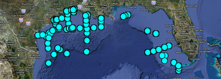
This data represents historical time series data in the Gulf of Mexico (18°-31°N, 80°-98°W) in comma separated value (CSV) files for each station. The time series data, collected between 1975 and 1993, includes ocean currents, temperature, salinity, and pressure measured typically at successive times, spaced at uniform time intervals. A .kmz file is available for Google Earth display, and here is an inventory of the stations. As time allows, we may add other data visualization tools for this data.
- Directory Listing of all Time Series files (Warning: long load times)
- All Time Series data zipped into one file
- Interact with Ocean Currents Google Map
 Offsite Link Notification