
Profiling floats report a number of times while on the surface in order to relay the full profile to a shore station. Each message is time stamped and may or may not have a position determination. All of the surface positions of the floats are included in the surface drift data files here. Each has a time attached, but if a position was not available, the position is assigned a value of 999 for both latitude and longitude. This will permit those who are interested in calculating the drift locations from the time information and the approximate location of the float. On other locations, the position may be known but the time is not. Again we have filled the time fields with 9999 for the year and 99 for the month and day.
Inventory records have not been constructed from these data because there has been no consistent quality control applied. Users will find unusual and wrong values in both profiles, locations and times. It was not possible to consistently edit out these values to produce inventory records that would be useful.
The profile files contain only those data for which there is at least one profile (temperature or salinity).
Some of the surface drift information provided here, may duplicate what has been compiled by the Float DAC. Users are cautioned to consider possible duplications if data from the Float DAC is combined with the data provided here. Since the data in this collection have undergone unknown QC procedures, users should find the data from the Float DAC to be of higher quality.
The formats of the profile and surface drift data files are different. The format of the profile data is identical to that used for UOT data while the format of the drift data is the same as used in Argo for the trajectory data. This latter format does not comply with the conventions agreed to for the other data on this WOCE collection.
The following table gives some basic information about the data available.
- To link to any documentation about the data file, click on the name.
- To link to the profile data files, click on the number of stations in the column for Profile Stations.
- To link to the surface drift data files, click on the number of stations in the column for Drift Stations. This contains all of the locations including those for the profiles.
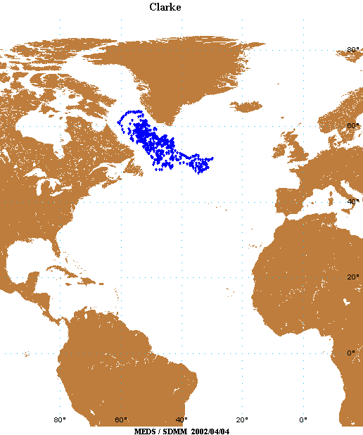
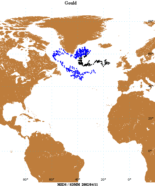
- To see a larger map click on the Location thumbnail map. The Location maps show locations of float profiles. Those with both temperature and salinity profiles are indicated in blue, and those with only temperature are in black.
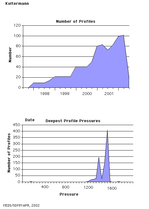
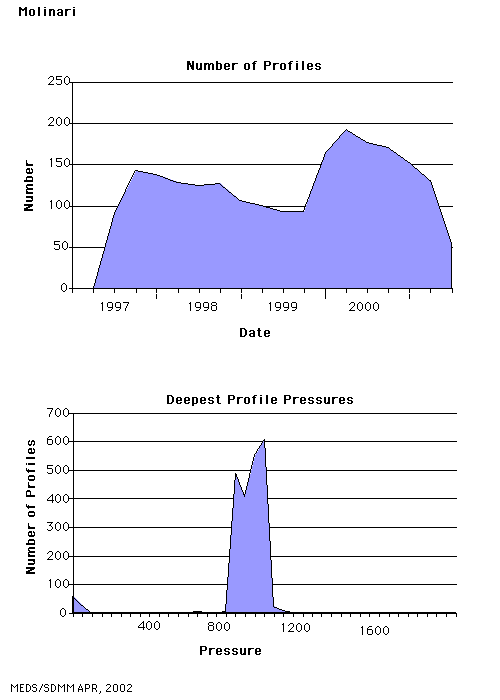
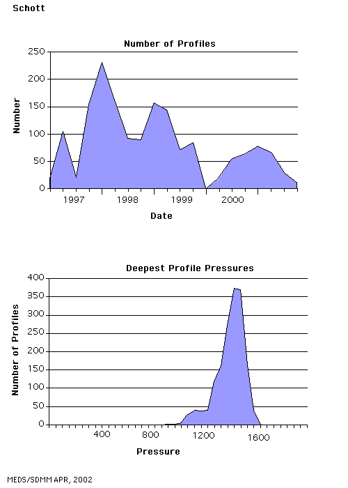
- To see the number of profile stations as a function of time, and the distribution of the deepest sampling depth for the profiles, click on the image under the column Statistics.
NOTE: The data presented in this collection have undergone only whatever data quality checking that the originator may have applied. It is safest to assume that no checks have been carried out when using the data.
| Source |
Date
Range |
Profile Stations |
Drift Stations |
Location |
Statistics |
| Clarke |
Nov, 1996
Nov, 1999 |
661 |
13,224 |
 |
 |
| Davis |
Nov, 1994
Jul, 2001 |
11,701 |
11,701 |
 |
 |
| Freeland |
Sep, 1995
Dec, 2001 |
923 |
12,866 |
 |
 |
| Gould |
Nov, 1996
Sep, 2001 |
532 |
8,496 |
 |
 |
| Koltermann |
Jul, 1997
Jan,2002 |
836 |
9,344 |
 |
 |
| Molinari |
Jul, 1997
Aug, 2001 |
2,178 |
22,656 |
 |
 |
| Owens |
Nov, 1994
Jan, 2002 |
11,797 |
35,274 |
 |
 |
| Riser |
Apr, 1997
Dec, 2001 |
7,515 |
25,042 |
 |
 |
| Schmitt |
Jul;, 1997
Aug, 2001 |
3,605 |
3,605 |
 |
 |
| Schott |
Mar, 1997
Nov, 2001 |
1,640 |
1,640 |
 |
 |
| Vertes |
Oct, 1997
Jan, 2002 |
2,531 |
2,531 |
 |
 |