Significant Habitats and Habitat Complexes
of the New York Bight Watershed
Table of Contents
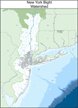
click image for title page
Geographic Boundaries and Area
Regionwide Threats and Conservation Considerations
Watershed or Ecosystem Approach
Geomorphic or Physiographic Provinces
REGIONAL SPECIES AND COMMUNITY CHARACTERIZATIONS
Federally Listed Endangered and Threatened Species
Species Groups of Special Interest
Marine Mammals and Sea Turtles
Rare Natural Communities and Habitat Types
HABITAT COMPLEXES BY PHYSIOGRAPHIC REGION
REGION
Zone or sub-region
ATLANTIC COASTAL PLAIN (Maps)
New Jersey Atlantic Coastal Watershed
New Jersey Barrier Beach/Backbarrier Lagoon System
4. Brigantine Bay and Marsh Complex
5. Mullica River - Great Bay Estuary
Long Island Atlantic Coastal Watershed
8. Long Island Pine Barrens - Peconic River Complex
Long Island Barrier Beach/Backbarrier Lagoon System
11. South Fork Atlantic Beaches
15. Hempstead Bays - South Oyster Bay Complex
NEW YORK - NEW JERSEY HARBOR URBAN CORE (Map)
New York - New Jersey Harbor Estuary (Summary Chapter)
16. Jamaica Bay and Breezy Point
17. Raritan Bay - Sandy Hook Bay Complex
East River/Western Long Island Sound
Hudson River Estuary
21. Lower Hudson River Estuary
(Mid-Hudson River Estuary and Upper Hudson River Estuary listed below under Appalachian Ridge and Valley)
PIEDMONT LOWLANDS (Newark Basin) (Map)
Traprock Ridges
Glacial Lake Basins
(Arthur Kill Complex and Hackensack Meadowlands listed above under New York - New Jersey Harbor)
NEW ENGLAND UPLANDS (Maps)
New York - New Jersey Highlands
25. New York - New Jersey Highlands
Taconic Highlands
26. Harlem Valley Calcareous Wetlands Complex
APPALACHIAN RIDGE AND VALLEY (Maps)
Wallkill/Hudson Valley
27. Dutchess County Wetlands Complex
29. Upper Wallkill River Valley
Ridge Systems
31. Shawangunk - Kittatinny Ridge
Hudson River Estuary
33. Upper Hudson River Estuary
(Lower Hudson River Estuary listed above under New York - New Jersey Harbor)
ALLEGHENY PLATEAU (Map)
Catskills
Helderberg Highlands
APPENDICES
List of Animal Species of Special Emphasis in the New York Bight Watershed study area (Note: may take several minutes to download.)
List of Plant Species of Special Emphasis in the New York Bight Watershed study area (Note: may take several minutes to download.)
Definitions of Ranks Used in List
Cross-Reference Table of Natural Communities
List of U.S. Fish and Wildlife Service and State Environmental Agency Offices
U.S. Fish and Wildlife Service
Southern New England - New York Bight Coastal Ecosystems Program
P.O. Box 307
Charlestown, Rhode Island 02813
(401) 364-9124
Joseph Dowhan, Project Leader
Thomas Halavik, Senior Biologist
Andrew Milliken, Senior Biologist
Andrew MacLachlan, Biologist/GIS Specialist
Marcianna Caplis, Outreach Specialist
Kelly Lima, GIS Technician
Andrew Zimba, Cartographic Technician