Surface Temperature and Salinity
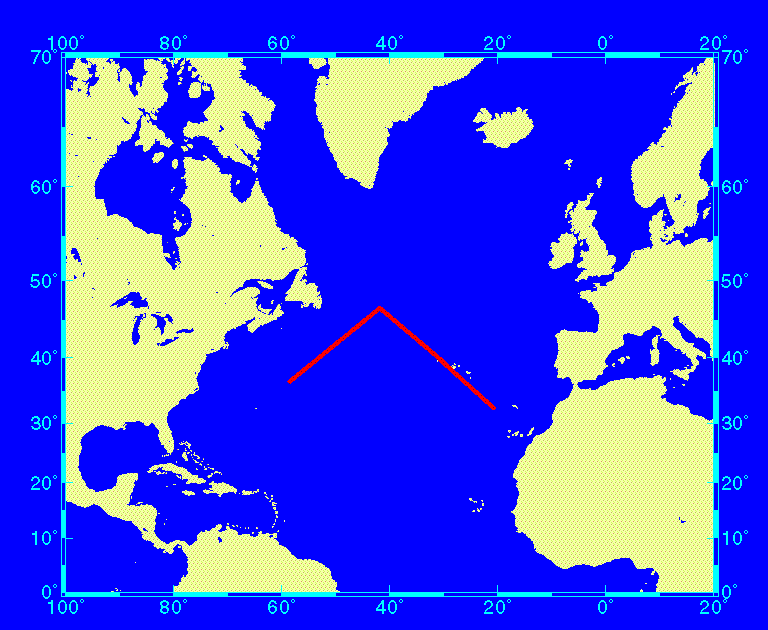
As said before, the cruise track of the R/V Meteor during the exercise (Fig. 1) was chosen in order to provide the largest possible range of surface temperatures and salinities in the whole area of the North Atlantic Ocean accessible during this rather short cruise. It was assumed that this track should likely provide more stable conditions in the eastern part as well as a highly variably situation at the northern turning point near the Flemish Cap off Newfoundland. This assumption was later verified to a full extent by the encountered ranges of surface temperature and salinity.
Fig. 6 shows the large observed ranges in surface temperature and salinity as measured during the course of the exercise: Surface seawater temperatures ranged from 6.2°C to 25.1°C while surface salinities covered a range from 32.6 to 37.0. This is equivalent to a span of 19°C in temperature as well as 4.4 in salinity. It should be pointed out that the observed temperature and salinity drop around 51° W was as large as 2.9°C/min and 0.4/min for salinity, which is equivalent to 4.2°C/km and 0.9/km, respectively. Such gradients can be regarded as extreme situations that represent a "worst case scenario" for any kind of intercomparison rather than a typical open ocean situation. Toward the eastern part of the cruise track, a more typical regime was found that represents the standard case for at-sea operation. In order to provide the hydrographic background for the fCO2 data, measurements of surface temperature and salinity are given as 1-min averages in daily figures (Fig. 7, Fig. 8, and Fig. 9) for the period June 8-16.