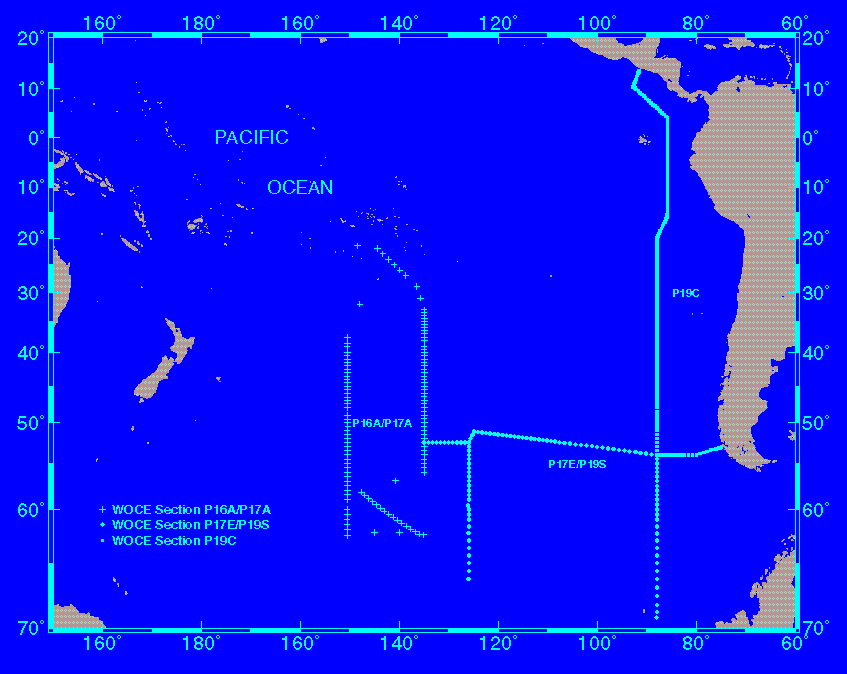
3.3 WOCE Section P19C
R/V Knorr departed Punta Arenas, Chile, for its twelfth leg of Cruise 138 on February 22, 1993. This was the seventh WOCE hydrographic leg on the R/V Knorr in the South Pacific since the beginning of 1992. WOCE Section P19C was supported by the National Science Foundation's Ocean Sciences Division. P19C was the fourth WOCE hydrographic leg on the R/V Knorr with basic technical support from SIO ODF. Because of the extensive use of the ship for this sort of work prior to the P19C leg, the expedition was fortunate in having very few problems with equipment. The weather in general was good, and the expedition encountered only two storms, which affected stations no. 257 and 274.
Stations were numbered consecutively from the beginning of the R/V Knorr work on WOCE Section P16A/P17A starting south of Tahiti in October 1992. The first station on P19C was numbered 234. On 20 days a separate Joint Global Ocean Flux Study (JGOFS) bio-optics station was made within several hours of noon. These stations extended to 200 m.
The original cruise plan was for sampling along 54°S westward until 88°W and then exclusively along 88°W until ~4°N, where the track jogged westward and then eastward into Central America (see Fig. 1). Because of clearance questions and also because of rethinking based on the topography between the Galapagos and South America, it was decided to bend the section northeastward to 85.8°W north of 20°S, thereby passing through the deeper part of the equatorial ocean east of the Galapagos. The last station, no. 422, was occupied on April 10, 1993, and on April 13 the R/V Knorr arrived in Panama City.
All 189 CTD/rosette stations were occupied close to the bottom.