Brief Cruise Summary
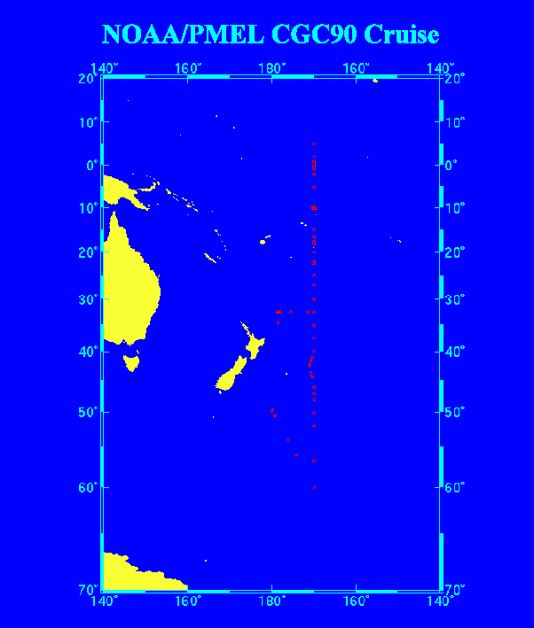
The cruise track for Leg 1 of CGC-90 started at 15o S/170o W and proceeded south along the meridional line; after reaching 60o S, it angled northwest, crossing the Western Boundary Current and ending in New Zealand. The cruise track for Leg 2 crossed the Kermadec Trench, included a reoccupation of selected stations between 30o S and 15o S on 170o W, and additional stations along the meridional line crossing the equator, to 5o N (see Fig. 1). Figure 2 shows the sampling depths at the 63 hydrographic stations occupied during the cruise.
Stations 2 through 7 were sampled using a 24-position rosette package equipped with 10-L Niskin® bottles and a Neil Brown (Mark III) CTD sampling system. While occupying Station 8, the CTD cable parted, and the equipment package was lost. Subsequently, the remaining stations (Stations 9 through 68) were sampled using a spare 12-position rosette with 10-L Niskin® bottles and Neil Brown (Mark III) CTD sampling system. Multiple casts were performed at these stations to ensure high density sample profiles. Occasionally while at the most extreme latitudes, weather deteriorated and prevented the occupation of some stations. Several stations sampled during Leg 1 were reoccupied on Leg 2 for data quality checks.
Two moorings were retrieved, and two deployed at the equator.