

formerly the National Oceanographic Data Center (NODC)... more on NCEI


 |
|
formerly the National Oceanographic Data Center (NODC)... more on NCEI |
|
NCEI is transitioning to a new website and paths to data resources will be changing. Please contact NCEI.Info@noaa.gov with any questions of issues. See the new website at www.ncei.noaa.gov.
| You are here: Home > Ocean Climate Laboratory > OCL Products > Seasonal Variability of Dynamic Height |
|
Seasonal Variability of Dynamic Height and its Fourier Analysis by Sydney Levitus, Grigory Isayev Monterey, and Timothy Boyer | |||||||||||||
|
| |||||||||||||
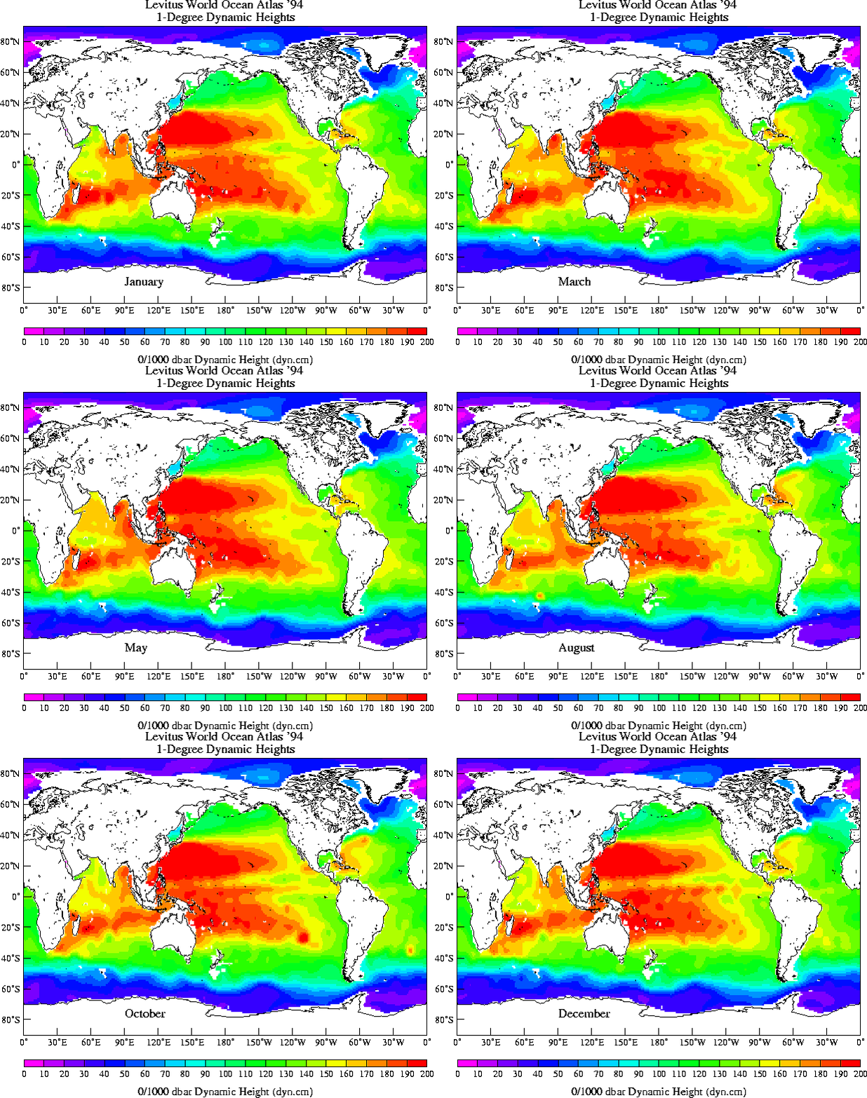
| These files contain climatological monthly mean dynamic height (dynamic-cm) of the sea surface relative to 1000 m depth level.
Dynamic heights are computed according to the formula from Levitus (1982) and updated using the UNESCO equation of state.
The units are dynamic centimeters. An atlas showing these fields, as well as deviations from the climatological annual means,
and results from their Fourier analyses, are available from the NNDC Online Store. | |||||||||||||
|
| |||||||||||||
| Download data (also, available the FORTRAN program and the co-ordinate system for reading the data) | |||||||||||||
| Monthly dynamic heights (0/1000 m) for the World ocean are in 12 direct access files on a 1*1 degree grid. The files are named dh.001,... dh.012.
|
|||||||||||||
|
Animation of monthly fields prepared by John Lillibridge (NODC/Laboratory for Satellite Altimetry) | |||||||||||||

| |||||||||||||
| Last modified: Thu, 23-Apr-2015 19:57 UTC | NCEI.info@noaa.gov | ||
|
Freedom of Information Act (FOIA)
USA.gov - The U.S. Government's Web Portal
|
|||