The BODC National Oceanographic Database (NODB) is a collection of entities known as series. Each series is a repeated set of measurements of one or more oceanographic parameters plus one or more of the independent variables time, latitude, longitude and depth. These data are delivered to the user as either simple ASCII files or as platform-independent binary files in QXF format (a BODC subset of NetCDF).
The database holds metadata for the series, including both fixed fields and plain-language documents. This is delivered to the user either as discrete XHTML files containing all the metadata for a series (Single-Series Reports) or as a condensed XHTML Combined Series Report.
The BODC metadata model includes three types of series aggregation entities:
The metadata for each of these aggregation entities is included in both types of report.
The BODC Single-Series Report contains the following sections:
The BODC Combined Series Report contains six sections.
This report contains the qualifying documentation and header information associated with the following data series extracted from the BODC database :
| Series Reference |
Data Type |
Latitude (Deg Min) |
Longitude (Deg Min) |
Start Date (yyyy-mm-dd) |
Sea Floor Depth (m) |
Min. Sensor Depth (m) |
Max. Sensor Depth (m) |
|---|---|---|---|---|---|---|---|
| 10589 | LA | 052°26.0'N | 003°26.0'E | 1978-02-08 | 31 | 17.5 | 17.5 |
| 10590 | LA | 052°22.0'N | 003° 3.0'E | 1978-02-04 | 35 | 14 | 14 |
| 10608 | LA | 052°22.0'N | 003° 3.0'E | 1978-02-04 | 35 | 29 | 29 |
| 10621 | LA | 052°22.0'N | 003° 3.0'E | 1978-02-07 | 35 | 14 | 14 |
| 10633 | LA | 052°22.0'N | 003° 3.0'E | 1978-02-07 | 35 | 29 | 29 |
| 10645 | LA | 052°18.0'N | 002°34.0'E | 1978-02-04 | 44 | 15 | 15 |
| 10657 | LA | 052°18.0'N | 002°34.0'E | 1978-02-04 | 44 | 38 | 38 |
| 10669 | LA | 052°13.0'N | 002°53.0'E | 1978-02-03 | 39 | 14 | 14 |
| 10670 | LA | 052°13.0'N | 002°53.0'E | 1978-02-03 | 39 | 33 | 33 |
| 10682 | LA | 052°12.0'N | 002°53.0'E | 1978-02-07 | 40 | 14 | 14 |
| 10694 | LA | 052°12.0'N | 002°53.0'E | 1978-02-07 | 40 | 34 | 34 |
| 10701 | LA | 052° 8.0'N | 003° 7.0'E | 1978-02-04 | 35 | 12 | 12 |
| 10713 | LA | 052° 4.0'N | 002°45.0'E | 1978-02-03 | 39 | 15 | 15 |
| 10725 | LA | 052° 4.0'N | 002°45.0'E | 1978-02-03 | 39 | 33 | 33 |
| 10737 | LA | 052° 3.0'N | 002°44.0'E | 1978-02-07 | 42 | 18 | 18 |
| 10749 | LA | 052° 3.0'N | 002°44.0'E | 1978-02-07 | 42 | 36 | 36 |
| 10750 | LA | 057°40.5'N | 001° 4.7'W | 1977-08-10 | 91 | 31 | 31 |
| 10762 | LA | 057°40.5'N | 001° 4.7'W | 1977-08-10 | 91 | 81 | 81 |
| 10774 | LA | 057°53.4'N | 000°42.7'W | 1977-08-10 | 90 | 24 | 24 |
| 10786 | LA | 057°53.4'N | 000°42.7'W | 1977-08-10 | 90 | 80 | 80 |
| 10798 | LA | 059°17.0'N | 001°41.2'W | 1977-08-11 | 75 | 26 | 26 |
| 10805 | LA | 059°17.0'N | 001°41.2'W | 1977-08-11 | 75 | 65 | 65 |
| 10817 | LA | 056° 5.0'N | 002° 8.0'W | 1977-08-14 | 60 | 24 | 24 |
| 10829 | LA | 056° 5.0'N | 002° 8.0'W | 1977-08-14 | 60 | 55 | 55 |
| 10830 | LA | 056° 0.0'N | 002°10.0'W | 1977-08-14 | 62 | 26 | 26 |
| 10842 | LA | 056° 0.0'N | 002°10.0'W | 1977-08-14 | 62 | 57 | 57 |
| 10854 | LA | 057°33.7'N | 001°18.6'W | 1976-03-02 | 88 | 26 | 26 |
| 10866 | LA | 057°33.7'N | 001°18.6'W | 1976-04-02 | 88 | 78 | 78 |
| 10878 | LA | 057°40.6'N | 001° 4.5'W | 1976-03-14 | 83 | 33 | 33 |
| 10909 | LA | 057°47.6'N | 000°53.2'W | 1976-03-02 | 91 | 31 | 31 |
| 10910 | LA | 057°47.6'N | 000°53.2'W | 1976-03-02 | 91 | 81 | 81 |
| 10922 | LA | 057°53.4'N | 000°42.7'W | 1976-03-02 | 93 | 33 | 33 |
| 10934 | LA | 057°53.4'N | 000°42.7'W | 1976-03-02 | 93 | 83 | 83 |
| 10958 | LA | 058° 1.1'N | 000°29.4'W | 1976-03-02 | 115 | 105 | 105 |
| 10971 | LA | 058°25.6'N | 001°20.8'E | 1976-03-13 | 136 | 36 | 36 |
| 10983 | LA | 058°25.6'N | 001°20.8'E | 1976-03-09 | 136 | 66 | 66 |
| 10995 | LA | 058°25.6'N | 001°20.8'E | 1976-03-09 | 136 | 126 | 126 |
| 11009 | LA | 058°25.8'N | 002° 6.1'E | 1976-03-09 | 84 | 29 | 29 |
| 11010 | LA | 058°25.8'N | 002° 6.1'E | 1976-03-09 | 84 | 59 | 59 |
| 11022 | LA | 058°25.8'N | 002° 6.1'E | 1976-03-09 | 84 | 74 | 74 |
| 11034 | LA | 058°25.6'N | 002°21.4'E | 1976-03-09 | 88 | 33 | 33 |
| 11046 | LA | 058°25.6'N | 002°21.4'E | 1976-03-09 | 88 | 78 | 78 |
| 11058 | LA | 056°10.6'N | 002°38.4'W | 1977-02-22 | 44 | 38 | 38 |
| 11071 | LA | 056°10.6'N | 002°38.4'W | 1977-02-22 | 44 | 11 | 11 |
| 11126 | LA | 056° 5.2'N | 002°53.9'W | 1977-02-22 | 37 | 13 | 13 |
| 11138 | LA | 056° 5.2'N | 002°53.9'W | 1977-02-22 | 37 | 31 | 31 |
| 11163 | LA | 060°24.7'N | 001°21.0'W | 1977-04-22 | 18 | 14 | 14 |
| 11175 | LA | 060°24.7'N | 001°21.0'W | 1977-04-22 | 18 | 2 | 2 |
| 11187 | LA | 056° 5.4'N | 002°53.1'W | 1977-05-17 | 40 | 34 | 34 |
| 11199 | LA | 056° 5.4'N | 002°53.1'W | 1977-05-17 | 40 | 18 | 18 |
| 11206 | LA | 060°26.4'N | 001°20.1'W | 1977-07-02 | 26 | 22 | 22 |
| 11218 | LA | 060°24.6'N | 001°20.9'W | 1977-07-02 | 33 | 29 | 29 |
| 11231 | LA | 060°24.6'N | 001°20.9'W | 1977-07-02 | 33 | 12 | 12 |
| 11243 | LA | 060°24.6'N | 001°20.9'W | 1977-07-02 | 33 | 3 | 3 |
| 11255 | LA | 056° 9.6'N | 002°38.8'W | 1977-08-27 | 44 | 39 | 39 |
| 11267 | LA | 056° 9.6'N | 002°38.8'W | 1977-08-27 | 44 | 15 | 15 |
| 11279 | LA | 056° 4.0'N | 002°53.7'W | 1977-08-27 | 24 | 21 | 21 |
| 11292 | LA | 056°29.0'N | 007°58.8'W | 1977-09-08 | 170 | 30 | 30 |
| 11311 | LA | 056°29.0'N | 007°58.8'W | 1977-09-08 | 170 | 120 | 120 |
| 11323 | LA | 055°29.8'N | 008° 0.7'W | 1977-09-09 | 73 | 63 | 63 |
| 11335 | LA | 055°29.8'N | 008° 0.7'W | 1977-09-09 | 73 | 32 | 32 |
| 11347 | LA | 056° 4.1'N | 002°53.7'W | 1977-10-19 | 26 | 15 | 15 |
| 11359 | LA | 056° 4.1'N | 002°53.7'W | 1977-10-19 | 26 | 23 | 23 |
| 11360 | LA | 059° 1.7'N | 008°32.0'W | 1978-04-08 | 1535 | 135 | 135 |
| 11372 | LA | 059° 1.7'N | 008°32.0'W | 1978-04-08 | 1535 | 535 | 535 |
| 11384 | LA | 059° 1.7'N | 008°32.0'W | 1978-04-08 | 1535 | 935 | 935 |
| 11396 | LA | 058°39.5'N | 005°16.4'W | 1978-08-24 | 79 | 29 | 29 |
| 11403 | LA | 058°41.2'N | 005°33.8'W | 1978-08-24 | 95 | 24 | 24 |
| 11415 | LA | 058°41.2'N | 005°33.8'W | 1978-08-24 | 95 | 84 | 84 |
| 11439 | LA | 058°49.4'N | 006°40.7'W | 1978-08-25 | 132 | 122 | 122 |
| 11440 | LA | 058°39.7'N | 005°15.8'W | 1978-04-07 | 84 | 34 | 34 |
| 11452 | LA | 058°39.7'N | 005°15.8'W | 1978-04-07 | 84 | 74 | 74 |
| 11464 | LA | 058°41.3'N | 005°33.8'W | 1978-04-07 | 100 | 29 | 29 |
| 11476 | LA | 058°41.3'N | 005°33.8'W | 1978-04-07 | 100 | 90 | 90 |
| 11488 | LA | 058°43.5'N | 005°52.9'W | 1978-04-07 | 111 | 31 | 31 |
| 11507 | LA | 058°43.5'N | 005°52.9'W | 1978-04-07 | 111 | 100 | 100 |
| 11519 | LA | 058°49.2'N | 006°39.0'W | 1978-04-07 | 131 | 30 | 30 |
| 11520 | LA | 058°55.5'N | 007°30.3'W | 1978-04-07 | 166 | 32 | 32 |
| 11532 | LA | 058°55.5'N | 007°30.3'W | 1978-04-07 | 166 | 156 | 156 |
| 11544 | LA | 060°30.1'N | 001°15.2'W | 1976-05-26 | 38 | 11 | 11 |
| 11556 | LA | 060°28.1'N | 001°18.9'W | 1976-05-26 | 33 | 17 | 17 |
| 11568 | LA | 060°28.1'N | 001°18.9'W | 1976-05-26 | 33 | 25 | 25 |
| 11581 | LA | 060°28.1'N | 001°18.9'W | 1976-06-12 | 33 | 25 | 25 |
| 11593 | LA | 060°28.1'N | 001°18.9'W | 1976-05-26 | 33 | 30 | 30 |
| 11600 | LA | 060°26.3'N | 001°20.1'W | 1976-05-27 | 28 | 12 | 12 |
| 11612 | LA | 060°26.3'N | 001°20.1'W | 1976-05-27 | 28 | 20 | 20 |
| 11624 | LA | 060°26.3'N | 001°20.1'W | 1976-05-27 | 28 | 25 | 25 |
| 11636 | LA | 060°29.5'N | 001°16.3'W | 1976-06-22 | 28 | 12 | 12 |
| 11648 | LA | 060°29.5'N | 001°16.3'W | 1976-06-22 | 28 | 25 | 25 |
| 11661 | LA | 060°29.4'N | 001°15.4'W | 1976-06-24 | 28 | 12 | 12 |
| 11673 | LA | 060°29.4'N | 001°15.4'W | 1976-06-24 | 28 | 25 | 25 |
| 11685 | LA | 056°25.0'N | 002°10.0'W | 1976-08-17 | 49 | 21 | 21 |
| 11697 | LA | 056°25.0'N | 002°10.0'W | 1976-08-17 | 49 | 44 | 44 |
| 11704 | LA | 056° 5.0'N | 002° 8.0'W | 1976-08-17 | 62 | 27 | 27 |
| 11716 | LA | 056° 5.0'N | 002° 8.0'W | 1976-08-17 | 62 | 58 | 58 |
| 11728 | LA | 056° 5.1'N | 002°50.0'W | 1976-08-17 | 44 | 28 | 28 |
| 11741 | LA | 056° 5.1'N | 002°50.0'W | 1976-08-17 | 44 | 40 | 40 |
| 11753 | LA | 056° 9.2'N | 002°50.0'W | 1976-08-17 | 37 | 14 | 14 |
| 11765 | LA | 056° 9.2'N | 002°50.0'W | 1976-08-17 | 37 | 33 | 33 |
| 11777 | LA | 057° 6.5'N | 001°23.4'W | 1968-10-21 | 104 | 47 | 47 |
| 20719 | LA | 057°56.2'N | 002°53.0'W | 1981-02-09 | 82 | 34 | 34 |
| 20720 | LA | 058°11.6'N | 003° 0.6'W | 1981-02-09 | 50 | 22 | 22 |
| 20732 | LA | 058°24.7'N | 001°36.9'W | 1981-02-10 | 113 | 35 | 35 |
| 20756 | LA | 058°11.7'N | 003° 0.5'W | 1981-04-28 | 49 | 43 | 43 |
| 20768 | LA | 057°56.3'N | 002°53.7'W | 1981-04-28 | 86 | 39 | 39 |
| 20781 | LA | 057°56.3'N | 002°53.7'W | 1981-04-28 | 86 | 80 | 80 |
| 20800 | LA | 058°25.1'N | 001°36.6'W | 1981-05-05 | 113 | 32 | 32 |
| 20824 | LA | 059°16.5'N | 001° 9.7'W | 1981-06-18 | 123 | 32 | 32 |
| 20836 | LA | 059°16.5'N | 001° 9.7'W | 1981-06-18 | 123 | 112 | 112 |
| 20848 | LA | 059°16.7'N | 001°41.2'W | 1981-06-18 | 81 | 34 | 34 |
| 20861 | LA | 059°16.7'N | 001°41.2'W | 1981-06-18 | 81 | 67 | 67 |
| 20873 | LA | 059°17.2'N | 002°10.1'W | 1981-06-18 | 89 | 29 | 29 |
| 20897 | LA | 058°24.9'N | 001°36.7'W | 1981-06-19 | 132 | 32 | 32 |
| 20904 | LA | 058°24.9'N | 001°36.7'W | 1981-06-19 | 132 | 126 | 126 |
| 20916 | LA | 057°56.2'N | 002°54.0'W | 1981-06-20 | 89 | 83 | 83 |
| 20928 | LA | 058°11.6'N | 003° 1.1'W | 1981-06-20 | 56 | 32 | 32 |
| 20941 | LA | 058°11.6'N | 003° 1.1'W | 1981-06-20 | 56 | 50 | 50 |
| 20953 | LA | 057°56.3'N | 002°53.7'W | 1981-08-18 | 89 | 36 | 36 |
| 20965 | LA | 057°56.3'N | 002°53.7'W | 1981-08-18 | 89 | 82 | 82 |
| 20977 | LA | 058°11.9'N | 003° 1.1'W | 1981-08-18 | 56 | 32 | 32 |
| 20989 | LA | 058°11.9'N | 003° 1.1'W | 1981-08-18 | 56 | 50 | 50 |
| 20990 | LA | 058°25.0'N | 001°36.5'W | 1981-08-19 | 135 | 32 | 32 |
| 21004 | LA | 058°25.0'N | 001°36.5'W | 1981-08-19 | 135 | 126 | 126 |
| 21016 | LA | 058°25.6'N | 002°21.4'E | 1976-03-25 | 88 | 33 | 33 |
| 21028 | LA | 058°25.6'N | 002°21.4'E | 1976-03-16 | 88 | 78 | 78 |
| 21053 | LA | 059°35.2'N | 007°15.0'W | 1979-05-22 | 1022 | 27 | 27 |
| 21065 | LA | 059°35.2'N | 007°15.0'W | 1979-05-22 | 1022 | 28 | 28 |
| 21077 | LA | 059°35.2'N | 007°11.6'W | 1979-05-22 | 1041 | 90 | 90 |
| 21089 | LA | 059°35.2'N | 007°15.0'W | 1979-05-22 | 1022 | 474 | 474 |
| 21090 | LA | 059°35.2'N | 007°11.6'W | 1979-05-22 | 1041 | 741 | 741 |
| 21108 | LA | 059°35.2'N | 007°15.0'W | 1979-05-22 | 1022 | 920 | 920 |
| 21121 | LA | 059°35.2'N | 007°11.6'W | 1979-05-22 | 1041 | 1032 | 1032 |
| 21133 | LA | 059°48.6'N | 009° 1.4'W | 1979-05-21 | 1370 | 53 | 53 |
| 21145 | LA | 059°48.6'N | 009° 1.4'W | 1979-05-21 | 1370 | 54 | 54 |
| 21157 | LA | 059°49.6'N | 008°59.3'W | 1979-05-21 | 1367 | 116 | 116 |
| 21169 | LA | 059°49.6'N | 008°59.3'W | 1979-05-21 | 1367 | 1117 | 1117 |
| 21170 | LA | 059°48.6'N | 009° 1.4'W | 1979-05-21 | 1370 | 1270 | 1270 |
| 21182 | LA | 059°49.6'N | 008°59.3'W | 1979-05-21 | 1367 | 1358 | 1358 |
| 21194 | LA | 059°35.1'N | 007°14.7'W | 1979-06-24 | 1019 | 29 | 29 |
| 21201 | LA | 059°35.1'N | 007°14.7'W | 1979-06-24 | 1019 | 69 | 69 |
| 21213 | LA | 059°35.1'N | 007°14.7'W | 1979-06-24 | 1019 | 470 | 470 |
| 21225 | LA | 059°35.1'N | 007°14.7'W | 1979-06-24 | 1019 | 716 | 716 |
| 21237 | LA | 059°35.1'N | 007°14.7'W | 1979-06-24 | 1019 | 917 | 917 |
| 21249 | LA | 059°35.1'N | 007°14.7'W | 1979-06-24 | 1019 | 1007 | 1007 |
| 21250 | LA | 059°49.3'N | 008°59.5'W | 1979-06-24 | 1361 | 46 | 46 |
| 21262 | LA | 059°48.7'N | 008°57.3'W | 1979-06-24 | 1360 | 114 | 114 |
| 21274 | LA | 059°48.7'N | 008°57.3'W | 1979-06-24 | 1360 | 115 | 115 |
| 21286 | LA | 059°49.3'N | 008°59.5'W | 1979-06-21 | 1361 | 511 | 511 |
| 21298 | LA | 059°48.7'N | 008°57.3'W | 1979-06-24 | 1360 | 1116 | 1116 |
| 21305 | LA | 059°49.3'N | 008°59.5'W | 1979-06-21 | 1361 | 1261 | 1261 |
| 21317 | LA | 059°48.7'N | 008°57.3'W | 1979-06-24 | 1360 | 1348 | 1348 |
| 21329 | LA | 059°49.8'N | 008°58.4'W | 1979-08-04 | 1359 | 45 | 45 |
| 21330 | LA | 059°49.8'N | 008°58.4'W | 1979-08-04 | 1359 | 709 | 709 |
| 21342 | LA | 059°49.8'N | 008°58.4'W | 1979-08-04 | 1359 | 1115 | 1115 |
| 21354 | LA | 059°49.8'N | 008°58.4'W | 1979-08-04 | 1359 | 1347 | 1347 |
| 21366 | LA | 051°30.2'N | 004°59.0'W | 1975-06-06 | 54 | 47 | 47 |
| 21378 | LA | 051°30.2'N | 004°59.0'W | 1975-06-06 | 54 | 21 | 21 |
| 21391 | LA | 051°19.8'N | 004°51.6'W | 1975-06-06 | 59 | 51 | 51 |
| 21409 | LA | 051°19.8'N | 004°51.6'W | 1975-06-06 | 59 | 36 | 36 |
| 21410 | LA | 051°19.8'N | 004°51.6'W | 1975-06-10 | 59 | 21 | 21 |
| 21422 | LA | 051° 4.6'N | 004°36.8'W | 1975-06-08 | 53 | 34 | 34 |
| 21434 | LA | 051° 4.6'N | 004°36.8'W | 1975-06-08 | 53 | 21 | 21 |
| 21446 | LA | 051°22.2'N | 004°27.8'W | 1975-06-12 | 47 | 40 | 40 |
| 21458 | LA | 051°22.2'N | 004°27.8'W | 1975-06-12 | 47 | 28 | 28 |
| 21471 | LA | 051°22.2'N | 004°27.8'W | 1975-06-12 | 47 | 17 | 17 |
| 21483 | LA | 051°13.5'N | 004°25.6'W | 1975-06-08 | 47 | 42 | 42 |
| 21495 | LA | 051°13.5'N | 004°25.6'W | 1975-06-08 | 47 | 17 | 17 |
| 21502 | LA | 051°27.3'N | 004° 0.4'W | 1975-06-17 | 32 | 25 | 25 |
| 21514 | LA | 051°27.3'N | 004° 0.4'W | 1975-06-17 | 32 | 16 | 16 |
| 21526 | LA | 051°28.7'N | 004°15.0'W | 1976-06-16 | 42 | 17 | 17 |
| 21538 | LA | 051°28.7'N | 004°15.0'W | 1976-06-16 | 42 | 37 | 37 |
| 21551 | LA | 051°22.3'N | 004°15.0'W | 1976-06-16 | 49 | 17 | 17 |
| 21563 | LA | 051°22.3'N | 004°15.0'W | 1976-06-16 | 49 | 44 | 44 |
| 21575 | LA | 051°16.2'N | 004°15.0'W | 1976-06-21 | 43 | 17 | 17 |
| 21587 | LA | 051°16.2'N | 004°15.0'W | 1976-06-21 | 43 | 38 | 38 |
| 21599 | LA | 050°50.2'N | 004°46.0'W | 1976-06-18 | 44 | 7 | 7 |
| 21606 | LA | 050°50.2'N | 004°46.0'W | 1976-06-18 | 44 | 22 | 22 |
| 21618 | LA | 050°56.3'N | 004°41.0'W | 1976-06-17 | 37 | 20 | 20 |
| 21631 | LA | 050°56.3'N | 004°41.0'W | 1976-06-17 | 37 | 30 | 30 |
| 21643 | LA | 051° 4.0'N | 004°38.2'W | 1976-06-22 | 53 | 16 | 16 |
| 21655 | LA | 051° 4.0'N | 004°38.2'W | 1976-06-22 | 53 | 31 | 31 |
| 21667 | LA | 051° 4.0'N | 004°38.2'W | 1976-06-22 | 53 | 46 | 46 |
| 21679 | LA | 051°14.0'N | 004°46.0'W | 1976-06-22 | 52 | 15 | 15 |
| 21680 | LA | 051°14.0'N | 004°46.0'W | 1976-06-22 | 52 | 30 | 30 |
| 21692 | LA | 051°14.0'N | 004°46.0'W | 1976-06-22 | 52 | 45 | 45 |
| 21711 | LA | 051°20.0'N | 004°51.5'W | 1976-06-24 | 61 | 19 | 19 |
| 21723 | LA | 051°20.0'N | 004°51.5'W | 1976-06-24 | 61 | 39 | 39 |
| 21735 | LA | 051°20.0'N | 004°51.5'W | 1976-06-24 | 61 | 54 | 54 |
| 21747 | LA | 051°26.4'N | 004°57.0'W | 1976-06-24 | 61 | 19 | 19 |
| 21759 | LA | 051°26.4'N | 004°57.0'W | 1976-06-24 | 61 | 54 | 54 |
| 21760 | LA | 051°26.4'N | 004°57.0'W | 1976-06-24 | 61 | 39 | 39 |
| 21772 | LA | 051°33.5'N | 005° 4.2'W | 1976-06-26 | 46 | 29 | 29 |
| 21784 | LA | 051°31.2'N | 004°32.0'W | 1976-06-26 | 33 | 16 | 16 |
| 21796 | LA | 051°31.2'N | 004°32.0'W | 1976-06-26 | 33 | 26 | 26 |
| 21803 | LA | 051°24.7'N | 003°49.0'W | 1976-08-11 | 24 | 19 | 19 |
| 21815 | LA | 051°24.7'N | 003°49.0'W | 1976-08-11 | 24 | 15 | 15 |
| 21827 | LA | 051°16.6'N | 003°49.5'W | 1976-08-11 | 31 | 19 | 19 |
| 21839 | LA | 051°16.6'N | 003°49.5'W | 1976-08-11 | 31 | 26 | 26 |
| 21840 | LA | 051°16.3'N | 004° 1.4'W | 1976-08-07 | 32 | 20 | 20 |
| 21852 | LA | 051°16.3'N | 004° 1.4'W | 1976-08-07 | 32 | 25 | 25 |
| 48170 | LA | 060°46.1'N | 003° 0.8'W | 1981-08-03 | 444 | 344 | 344 |
| 48182 | LA | 060°46.1'N | 003° 0.8'W | 1981-08-03 | 444 | 439 | 439 |
| 48194 | LA | 060°46.3'N | 003° 0.5'W | 1981-08-02 | 429 | 261 | 261 |
| 48201 | LA | 060°46.3'N | 003° 0.5'W | 1981-08-02 | 429 | 383 | 383 |
| 48213 | LA | 060°46.3'N | 003° 0.5'W | 1981-08-02 | 429 | 31 | 31 |
| 48225 | LA | 061°10.6'N | 001°49.1'W | 1982-03-19 | 400 | 30 | 30 |
| 48237 | LA | 061° 3.6'N | 001°49.4'W | 1982-03-19 | 213 | 30 | 30 |
| 48249 | LA | 061°10.6'N | 001°49.1'W | 1982-03-19 | 400 | 385 | 385 |
| 48250 | LA | 061° 3.6'N | 001°49.4'W | 1982-03-19 | 213 | 79 | 79 |
| 48262 | LA | 061°10.6'N | 001°49.1'W | 1982-03-19 | 400 | 272 | 272 |
| 48274 | LA | 061° 3.6'N | 001°49.4'W | 1982-03-31 | 213 | 30 | 30 |
| 48286 | LA | 061° 3.6'N | 001°49.4'W | 1982-03-31 | 213 | 79 | 79 |
| 48298 | LA | 061°10.6'N | 001°49.1'W | 1982-04-01 | 400 | 385 | 385 |
| 48305 | LA | 061°10.6'N | 001°49.1'W | 1982-04-01 | 400 | 272 | 272 |
| 48317 | LA | 060°46.4'N | 003° 1.8'W | 1981-05-22 | 443 | 153 | 153 |
| 48329 | LA | 060°46.4'N | 003° 1.8'W | 1981-05-22 | 443 | 275 | 275 |
| 48330 | LA | 060°46.2'N | 003° 2.1'W | 1981-04-25 | 449 | 219 | 219 |
| 48342 | LA | 060°46.1'N | 003° 2.2'W | 1981-04-17 | 449 | 444 | 444 |
| 48354 | LA | 060°46.4'N | 003° 1.8'W | 1981-05-22 | 443 | 397 | 397 |
| 48366 | LA | 060°46.2'N | 003° 2.1'W | 1981-04-25 | 449 | 403 | 403 |
| 48378 | LA | 060°46.5'N | 003° 1.7'W | 1981-05-03 | 449 | 403 | 403 |
| 48391 | LA | 060°46.2'N | 003° 2.1'W | 1981-04-25 | 449 | 444 | 444 |
| 48409 | LA | 060°46.5'N | 003° 1.7'W | 1981-05-03 | 449 | 444 | 444 |
| 48410 | LA | 049°26.4'N | 005°37.6'W | 1982-11-02 | 101 | 34.5 | 34.5 |
| 48422 | LA | 049°26.4'N | 005°37.6'W | 1982-11-02 | 101 | 96.5 | 96.5 |
| 48434 | LA | 049°26.4'N | 005°37.6'W | 1982-11-02 | 101 | 75.5 | 75.5 |
| 48446 | LA | 049°26.4'N | 005°37.6'W | 1982-11-02 | 101 | 18 | 18 |
| 48667 | LA | 053° 6.6'N | 002° 4.0'E | 1983-12-11 | 36 | 26 | 26 |
| 48679 | LA | 053° 6.6'N | 002° 4.0'E | 1983-12-11 | 36 | 33 | 33 |
| 48680 | LA | 053° 6.5'N | 002° 4.0'E | 1983-12-11 | 36 | 33 | 33 |
| 48692 | LA | 053° 6.5'N | 002° 4.0'E | 1983-12-11 | 36 | 26 | 26 |
| 48711 | LA | 053° 7.7'N | 002° 5.8'E | 1984-01-27 | 25 | 15 | 15 |
| 48723 | LA | 053° 7.7'N | 002° 5.8'E | 1984-01-27 | 25 | 22 | 22 |
| 48735 | LA | 053° 7.5'N | 002° 6.6'E | 1984-01-30 | 10 | 7 | 7 |
| 48747 | LA | 053° 6.6'N | 002° 4.0'E | 1983-12-11 | 36 | 26.5 | 26.5 |
| 48759 | LA | 052°24.9'N | 012°17.7'W | 1984-08-12 | 500 | 74 | 74 |
| 48760 | LA | 052°24.9'N | 012°17.7'W | 1984-08-12 | 500 | 300 | 300 |
| 48772 | LA | 052°24.9'N | 012°17.7'W | 1984-08-12 | 500 | 491 | 491 |
| 48784 | LA | 052°22.2'N | 012°10.9'W | 1984-08-12 | 500 | 74 | 74 |
| 48796 | LA | 052°22.2'N | 012°10.9'W | 1984-08-12 | 500 | 300 | 300 |
| 48803 | LA | 052°22.2'N | 012°10.9'W | 1984-08-12 | 500 | 491 | 491 |
| 48815 | LA | 052°18.1'N | 012°19.8'W | 1984-08-12 | 682 | 80 | 80 |
| 48827 | LA | 052°18.1'N | 012°19.8'W | 1984-08-12 | 682 | 306 | 306 |
| 48839 | LA | 052°18.1'N | 012°19.8'W | 1984-08-12 | 682 | 497 | 497 |
| 48840 | LA | 052°18.1'N | 012°19.8'W | 1984-08-12 | 682 | 673 | 673 |
| 48852 | LA | 053°37.0'N | 001°31.0'E | 1984-10-01 | 21 | 16 | 16 |
| 48864 | LA | 053°37.0'N | 001°31.0'E | 1984-10-01 | 21 | 10 | 10 |
| 48876 | LA | 053°20.0'N | 001°36.9'E | 1984-10-02 | 29.5 | 26.5 | 26.5 |
| 48888 | LA | 053°37.0'N | 001°31.0'E | 1984-10-01 | 21 | 5 | 5 |
| 48907 | LA | 053°37.0'N | 001°31.1'E | 1984-10-01 | 21 | 13 | 13 |
| 48919 | LA | 053°37.0'N | 001°31.1'E | 1984-10-01 | 21 | 18 | 18 |
| 48920 | LA | 053°14.0'N | 001°42.0'E | 1984-10-02 | 21 | 18 | 18 |
| 48932 | LA | 053°28.0'N | 001°34.9'E | 1984-10-01 | 23 | 20 | 20 |
| 48944 | LA | 053° 5.8'N | 001°36.6'E | 1984-10-02 | 31.5 | 28.5 | 28.5 |
| 48956 | LA | 052°37.6'N | 001°44.7'E | 1980-09-10 | 8 | 5 | 5 |
| 48981 | LA | 058°48.4'N | 003°27.5'W | 1981-05-15 | 88 | 85 | 85 |
| 48993 | LA | 058°54.2'N | 003°28.4'W | 1981-05-15 | 68 | 65 | 65 |
| 49007 | LA | 058°57.4'N | 003°23.6'W | 1981-05-16 | 60 | 57 | 57 |
| 49019 | LA | 058°27.0'N | 000°15.0'W | 1981-06-07 | 110 | 104 | 104 |
| 49020 | LA | 058°27.0'N | 000°15.0'W | 1981-06-07 | 110 | 104 | 104 |
| 49032 | LA | 058°49.7'N | 000°17.2'W | 1981-12-10 | 93 | 46 | 46 |
| 49044 | LA | 058°49.7'N | 000°17.2'W | 1981-12-10 | 93 | 46 | 46 |
| 49056 | LA | 058°49.7'N | 000°17.2'W | 1981-12-10 | 93 | 46 | 46 |
| 49068 | LA | 058°50.6'N | 000°17.5'W | 1981-11-19 | 103 | 88 | 88 |
| 49081 | LA | 058°48.5'N | 000°18.0'W | 1981-11-27 | 115 | 105 | 105 |
| 49093 | LA | 058°48.5'N | 000°18.0'W | 1981-11-27 | 115 | 112 | 112 |
| 49124 | LA | 058°48.5'N | 000°18.0'W | 1981-11-27 | 115 | 90 | 90 |
| 49136 | LA | 058°48.5'N | 000°18.0'W | 1981-11-27 | 115 | 45 | 45 |
| 49148 | LA | 058°48.5'N | 000°18.0'W | 1981-11-27 | 115 | 60 | 60 |
| 49161 | LA | 057°34.8'N | 001°45.8'W | 1982-08-27 | 31 | 2 | 2 |
| 49173 | LA | 057°33.4'N | 001°20.1'W | 1982-08-28 | 90 | 88 | 88 |
| 49185 | LA | 057°32.7'N | 001° 0.0'W | 1982-08-28 | 94 | 92 | 92 |
| 49197 | LA | 057°34.8'N | 001°47.4'W | 1982-08-27 | 20 | 5 | 5 |
| 49204 | LA | 057°34.6'N | 001°44.0'W | 1982-08-27 | 44 | 5 | 5 |
| 49216 | LA | 057°34.3'N | 001°40.0'W | 1982-08-30 | 59 | 57 | 57 |
| 49228 | LA | 057°33.3'N | 001°10.5'W | 1982-08-28 | 109 | 107 | 107 |
| 49241 | LA | 057°34.6'N | 001°44.0'W | 1982-08-27 | 44 | 42 | 42 |
| 49253 | LA | 057°34.8'N | 001°45.8'W | 1982-08-27 | 31 | 29 | 29 |
| 49265 | LA | 057°34.8'N | 001°47.4'W | 1982-08-27 | 20 | 18 | 18 |
| 49277 | LA | 056°38.8'N | 001°49.9'E | 1982-08-22 | 91 | 89 | 89 |
| 49289 | LA | 057°30.9'N | 000°24.6'W | 1982-08-20 | 105 | 103 | 103 |
| 49290 | LA | 057°28.9'N | 000°14.7'E | 1982-08-20 | 81 | 79 | 79 |
| 49308 | LA | 057° 9.0'N | 000°59.8'E | 1982-08-21 | 95 | 93 | 93 |
| 49321 | LA | 053°54.0'N | 003°44.5'W | 1982-10-30 | 30 | 3 | 3 |
| 49333 | LA | 053°54.0'N | 003°44.5'W | 1982-11-16 | 30 | 13 | 13 |
| 49345 | LA | 053°51.5'N | 003°37.0'W | 1982-10-30 | 30 | 10.5 | 10.5 |
| 49357 | LA | 053°51.5'N | 003°37.0'W | 1982-10-30 | 30 | 17.5 | 17.5 |
| 49369 | LA | 053°51.5'N | 003°37.0'W | 1982-10-30 | 30 | 27.5 | 27.5 |
| 49370 | LA | 057°42.7'N | 006°54.3'W | 1983-06-29 | 109 | 107 | 107 |
| 49382 | LA | 057°35.3'N | 006°43.6'W | 1983-06-29 | 165 | 163 | 163 |
| 49394 | LA | 054°30.0'N | 001°55.5'E | 1983-08-20 | 19 | 7.5 | 7.5 |
| 49401 | LA | 054°41.0'N | 001°29.4'E | 1983-08-20 | 25 | 10.5 | 10.5 |
| 49413 | LA | 054°17.5'N | 001°40.9'E | 1983-08-20 | 40 | 37 | 37 |
| 49425 | LA | 053°39.0'N | 001°24.6'E | 1983-08-19 | 21 | 18 | 18 |
| 49437 | LA | 053°18.0'N | 001°40.0'E | 1983-08-22 | 32 | 29 | 29 |
| 49449 | LA | 052°55.9'N | 001°27.9'E | 1983-08-19 | 17 | 14 | 14 |
| 49450 | LA | 054°41.0'N | 001°29.4'E | 1983-08-20 | 25 | 20.5 | 20.5 |
| 49462 | LA | 054°30.0'N | 001°55.5'E | 1983-08-20 | 19 | 14.5 | 14.5 |
| 49474 | LA | 054°35.1'N | 001°24.9'E | 1983-08-21 | 27 | 22.5 | 22.5 |
| 49486 | LA | 054°35.1'N | 001°24.9'E | 1983-08-21 | 27 | 9 | 9 |
| 427213 | LA | 055° 0.2'N | 001°14.2'W | 1990-01-18 | 55 | 15 | 15 |
| 427225 | LA | 055° 0.2'N | 001°14.2'W | 1990-01-18 | 55 | 51 | 51 |
| 427723 | LA | 054°41.4'N | 005°15.0'W | 1993-09-21 | 141 | 27 | 27 |
| 427735 | LA | 054°41.4'N | 005°15.0'W | 1993-09-21 | 141 | 79 | 79 |
| 427747 | LA | 054°41.4'N | 005°15.0'W | 1993-09-21 | 141 | 124 | 124 |
| 427759 | LA | 054°41.3'N | 005°14.7'W | 1993-10-28 | 140 | 25 | 25 |
| 427760 | LA | 054°41.3'N | 005°14.7'W | 1993-10-28 | 140 | 120 | 120 |
| 427772 | LA | 054°38.2'N | 005°22.2'W | 1993-09-21 | 104 | 18 | 18 |
| 427784 | LA | 054°38.2'N | 005°22.2'W | 1993-09-21 | 104 | 87 | 87 |
| 427796 | LA | 054°36.2'N | 005°28.0'W | 1993-09-21 | 44 | 25 | 25 |
| 427803 | LA | 054°36.0'N | 005°27.1'W | 1993-10-28 | 42 | 23 | 23 |
| 427815 | LA | 052°56.2'N | 000°16.3'E | 1993-08-11 | 18 | 12 | 12 |
| 427839 | LA | 052°56.2'N | 000°16.5'E | 1993-09-09 | 17 | 11 | 11 |
| 427852 | LA | 053° 2.7'N | 000°25.5'E | 1993-09-09 | 26 | 9 | 9 |
| 427864 | LA | 053° 2.7'N | 000°25.5'E | 1993-09-09 | 26 | 23 | 23 |
| 430085 | LA | 055°13.8'N | 005° 3.8'W | 1987-01-12 | 44 | 34 | 34 |
| 430097 | LA | 057°59.3'N | 001°19.1'W | 1988-09-18 | 92 | 30 | 30 |
| 430104 | LA | 057°59.3'N | 001°19.1'W | 1988-09-18 | 92 | 80 | 80 |
| 430116 | LA | 058° 8.9'N | 000°48.6'W | 1988-09-18 | 105 | 31 | 31 |
| 430128 | LA | 058° 8.9'N | 000°48.6'W | 1988-09-18 | 105 | 93 | 93 |
| 430141 | LA | 058°18.2'N | 000°24.1'W | 1988-09-18 | 130 | 32 | 32 |
| 430153 | LA | 058°32.2'N | 000° 5.9'E | 1988-09-19 | 142 | 30 | 30 |
| 430165 | LA | 058°32.2'N | 000° 5.9'E | 1988-09-19 | 142 | 130 | 130 |
| 430189 | LA | 055°60.0'N | 003°22.7'W | 1988-12-06 | 40 | 39 | 39 |
| 430190 | LA | 059° 5.9'N | 002° 8.1'E | 1987-09-16 | 115 | 35 | 35 |
| 430208 | LA | 055° 7.5'N | 005° 2.4'W | 1989-03-25 | 18 | 17 | 17 |
| 430221 | LA | 058°40.7'N | 008°16.5'W | 1989-06-23 | 509 | 60 | 60 |
| 430233 | LA | 058°40.7'N | 008°16.5'W | 1989-06-23 | 509 | 480 | 480 |
| 430245 | LA | 058°33.9'N | 008° 2.2'W | 1989-06-23 | 197 | 30 | 30 |
| 430257 | LA | 058°33.9'N | 008° 2.2'W | 1989-06-23 | 197 | 187 | 187 |
| 430269 | LA | 058°10.3'N | 007°52.5'W | 1989-06-24 | 101 | 36 | 36 |
| 430270 | LA | 058°10.3'N | 007°52.5'W | 1989-06-24 | 101 | 91 | 91 |
| 430282 | LA | 058°30.6'N | 005°31.1'W | 1989-06-25 | 114 | 29 | 29 |
| 430294 | LA | 058°30.6'N | 005°31.1'W | 1989-06-25 | 114 | 104 | 104 |
| 430301 | LA | 059° 9.6'N | 005°16.3'W | 1989-06-26 | 125 | 40 | 40 |
| 430313 | LA | 059° 9.6'N | 005°16.3'W | 1989-06-26 | 125 | 115 | 115 |
| 430337 | LA | 059° 9.2'N | 003°55.6'W | 1989-06-26 | 101 | 36 | 36 |
| 430349 | LA | 059° 9.2'N | 003°55.6'W | 1989-06-26 | 101 | 91 | 91 |
| 430350 | LA | 056°41.0'N | 005°38.6'W | 1989-07-08 | 65 | 6 | 6 |
| 430362 | LA | 056°41.0'N | 005°38.6'W | 1989-07-08 | 65 | 51 | 51 |
| 430386 | LA | 056° 0.4'N | 003°27.5'W | 1989-07-26 | 20 | 10 | 10 |
| 430398 | LA | 056° 0.4'N | 003°27.5'W | 1989-07-26 | 20 | 15 | 15 |
| 430405 | LA | 055°59.9'N | 003°22.8'W | 1989-09-12 | 33 | 13 | 13 |
| 430417 | LA | 055°59.9'N | 003°22.8'W | 1989-09-12 | 33 | 23 | 23 |
| 430430 | LA | 056° 0.4'N | 003°27.6'W | 1989-11-06 | 21 | 11 | 11 |
| 430442 | LA | 056° 0.4'N | 003°27.6'W | 1989-11-06 | 21 | 16 | 16 |
| 430454 | LA | 056° 0.0'N | 003°22.6'W | 1990-02-20 | 31 | 16 | 16 |
| 430466 | LA | 056° 0.0'N | 003°22.6'W | 1990-02-20 | 31 | 26 | 26 |
| 430478 | LA | 055° 7.4'N | 005° 2.4'W | 1990-06-01 | 18 | 17 | 17 |
| 430491 | LA | 059° 9.3'N | 003°56.3'W | 1990-04-25 | 100 | 32 | 32 |
| 430509 | LA | 059° 9.3'N | 003°56.3'W | 1990-04-25 | 100 | 90 | 90 |
| 430510 | LA | 060°53.0'N | 000°44.8'E | 1990-04-26 | 146 | 34 | 34 |
| 430522 | LA | 060°53.0'N | 000°44.8'E | 1990-04-26 | 146 | 136 | 136 |
| 430546 | LA | 060°53.2'N | 002°28.7'E | 1990-04-27 | 128 | 35 | 35 |
| 430558 | LA | 060°53.2'N | 002°28.7'E | 1990-04-27 | 128 | 118 | 118 |
| 430571 | LA | 058°21.0'N | 000°10.7'W | 1990-04-29 | 135 | 33 | 33 |
| 430583 | LA | 058°21.0'N | 000°10.7'W | 1990-04-29 | 135 | 125 | 125 |
| 430602 | LA | 056°41.0'N | 005°38.6'W | 1990-05-21 | 65 | 5 | 5 |
| 430614 | LA | 056°41.0'N | 005°38.6'W | 1990-05-21 | 65 | 55 | 55 |
| 430651 | LA | 056°26.9'N | 005°13.3'W | 1990-07-26 | 64 | 5 | 5 |
| 430663 | LA | 056°26.9'N | 005°13.3'W | 1990-07-26 | 64 | 54 | 54 |
| 430687 | LA | 056°27.0'N | 005°12.9'W | 1990-07-27 | 30 | 5 | 5 |
| 430699 | LA | 056°27.0'N | 005°12.9'W | 1990-07-27 | 30 | 10 | 10 |
| 430706 | LA | 056°52.0'N | 005°42.3'W | 1990-08-28 | 40 | 5 | 5 |
| 430718 | LA | 056°52.0'N | 005°42.3'W | 1990-08-28 | 40 | 31 | 31 |
| 430743 | LA | 056°52.6'N | 005°41.5'W | 1990-08-28 | 32 | 5 | 5 |
| 430755 | LA | 056°52.6'N | 005°41.5'W | 1990-08-28 | 32 | 10 | 10 |
| 430767 | LA | 056° 1.7'N | 005°35.1'W | 1991-01-29 | 18 | 5 | 5 |
| 430779 | LA | 056° 1.7'N | 005°35.1'W | 1991-01-29 | 18 | 10 | 10 |
| 430780 | LA | 055°26.0'N | 005°17.3'W | 1991-03-13 | 22 | 21 | 21 |
| 430792 | LA | 056°39.6'N | 005°59.8'W | 1991-04-30 | 60 | 19 | 19 |
| 430811 | LA | 056°39.6'N | 005°59.8'W | 1991-04-30 | 60 | 55 | 55 |
| 430823 | LA | 056°41.9'N | 005°46.1'W | 1991-05-01 | 70 | 3 | 3 |
| 430835 | LA | 056°41.9'N | 005°46.1'W | 1991-05-01 | 70 | 62 | 62 |
| 430859 | LA | 056°41.0'N | 005°39.3'W | 1991-05-02 | 58 | 5 | 5 |
| 430860 | LA | 056°41.0'N | 005°39.3'W | 1991-05-02 | 58 | 10 | 10 |
| 430872 | LA | 056°41.0'N | 005°39.3'W | 1991-05-02 | 58 | 48 | 48 |
| 430896 | LA | 055°26.0'N | 005°17.3'W | 1991-04-17 | 22 | 21 | 21 |
| 430903 | LA | 056°52.3'N | 005°41.1'W | 1991-08-11 | 37 | 1 | 1 |
| 430927 | LA | 056°28.1'N | 005°26.8'W | 1991-07-23 | 49 | 14 | 14 |
| 430939 | LA | 056°28.1'N | 005°26.8'W | 1991-07-23 | 49 | 45 | 45 |
| 430940 | LA | 056°27.6'N | 005°16.1'W | 1991-07-23 | 67 | 5 | 5 |
| 430952 | LA | 056°27.6'N | 005°16.1'W | 1991-07-23 | 67 | 62 | 62 |
| 430988 | LA | 056°28.1'N | 005° 9.7'W | 1991-07-24 | 141 | 5 | 5 |
| 431003 | LA | 056°28.1'N | 005° 9.7'W | 1991-07-24 | 141 | 22 | 22 |
| 431015 | LA | 056°28.1'N | 005° 9.7'W | 1991-07-24 | 141 | 127 | 127 |
| 431027 | LA | 057°41.0'N | 003°59.2'W | 1991-09-20 | 48 | 20 | 20 |
| 431039 | LA | 057°41.0'N | 003°59.2'W | 1991-09-20 | 48 | 47 | 47 |
| 431040 | LA | 059° 9.2'N | 003°56.2'W | 1991-09-26 | 97 | 28 | 28 |
| 431052 | LA | 059° 9.2'N | 003°56.2'W | 1991-09-26 | 97 | 86 | 86 |
| 431064 | LA | 060°30.3'N | 000°60.0'E | 1991-09-27 | 141 | 32 | 32 |
| 431076 | LA | 060°30.3'N | 000°60.0'E | 1991-09-27 | 141 | 130 | 130 |
| 431088 | LA | 060°30.0'N | 000° 0.3'W | 1991-09-27 | 116 | 34 | 34 |
| 431107 | LA | 060°30.0'N | 000° 0.3'W | 1991-09-27 | 116 | 105 | 105 |
| 431119 | LA | 060°30.0'N | 000°15.2'W | 1991-09-27 | 108 | 34 | 34 |
| 431120 | LA | 060°30.0'N | 000°15.2'W | 1991-09-27 | 108 | 97 | 97 |
| 431132 | LA | 060°30.0'N | 000°30.3'W | 1991-09-27 | 110 | 36 | 36 |
| 431144 | LA | 060°30.0'N | 000°30.3'W | 1991-09-27 | 110 | 99 | 99 |
| 431156 | LA | 060°30.0'N | 000°40.9'W | 1991-09-28 | 116 | 32 | 32 |
| 431168 | LA | 060°30.0'N | 000°40.9'W | 1991-09-28 | 116 | 105 | 105 |
| 580581 | LA | 053°15.8'N | 003° 1.5'E | 2000-05-20 | 34 | 15 | 15 |
| 580593 | LA | 053°15.8'N | 003° 1.5'E | 2000-05-20 | 34 | 31 | 31 |
| 580600 | LA | 053°15.7'N | 003° 1.5'E | 2000-06-27 | 35 | 15 | 15 |
| 580612 | LA | 053°15.7'N | 003° 1.5'E | 2000-06-27 | 35 | 31 | 31 |
| 580624 | LA | 056°14.7'N | 001°59.4'W | 2001-03-07 | 47 | 27 | 27 |
| 580636 | LA | 056°14.9'N | 001°15.2'W | 2001-03-08 | 62 | 27 | 27 |
| 580648 | LA | 056°14.9'N | 001°15.2'W | 2001-03-08 | 62 | 47 | 47 |
| 580661 | LA | 056°59.9'N | 001°44.8'W | 2001-03-15 | 77 | 22 | 22 |
| 580673 | LA | 056°59.9'N | 001°44.8'W | 2001-03-15 | 77 | 62 | 62 |
| 580685 | LA | 057°38.4'N | 005°56.5'W | 2001-04-05 | 105 | 30 | 30 |
| 580697 | LA | 057°38.4'N | 005°56.5'W | 2001-04-05 | 105 | 95 | 95 |
| 580704 | LA | 057°31.2'N | 005°39.8'W | 2001-04-05 | 28 | 3 | 3 |
| 580741 | LA | 056°59.8'N | 001°44.9'W | 2001-05-22 | 77 | 22 | 22 |
| 580753 | LA | 056°59.8'N | 001°44.9'W | 2001-05-22 | 77 | 62 | 62 |
| 580833 | LA | 056°15.0'N | 001°15.3'W | 2001-05-23 | 60 | 25 | 25 |
| 580845 | LA | 056°15.0'N | 001°15.3'W | 2001-05-23 | 60 | 45 | 45 |
| 580857 | LA | 056°14.8'N | 001°59.4'W | 2001-05-23 | 48 | 28 | 28 |
| 580869 | LA | 057°23.0'N | 005°37.4'W | 2001-08-22 | 29 | 4 | 4 |
| 580870 | LA | 057°23.0'N | 005°37.4'W | 2001-08-22 | 29 | 26 | 26 |
| 581492 | LA | 052°52.3'N | 001°38.2'E | 2001-04-07 | 29 | 19 | 19 |
| 581511 | LA | 052°54.4'N | 001°41.6'E | 2001-04-07 | 34 | 19 | 19 |
| 581523 | LA | 052°45.0'N | 001°43.0'E | 2001-04-08 | 24 | 14 | 14 |
| 581535 | LA | 052°43.5'N | 001°42.8'E | 2001-04-08 | 16 | 10 | 10 |
| 581547 | LA | 052°42.0'N | 001°44.3'E | 2001-04-08 | 12 | 8 | 8 |
| 591658 | LA | 055°30.1'N | 000°54.3'E | 1989-08-04 | 85 | 84.2 | 84.2 |
| 591671 | LA | 055°30.0'N | 000°54.3'E | 1989-07-01 | 85 | 84.2 | 84.2 |
| 591683 | LA | 055°30.2'N | 005°30.4'E | 1989-07-30 | 52 | 45 | 45 |
| 591695 | LA | 055°30.1'N | 005°30.3'E | 1989-06-30 | 52 | 45 | 45 |
| 591702 | LA | 055°29.9'N | 005°30.5'E | 1989-06-01 | 52 | 45 | 45 |
| 591714 | LA | 055°30.2'N | 005°28.0'E | 1989-05-03 | 52 | 45 | 45 |
| 591726 | LA | 055°29.9'N | 005°30.4'E | 1988-09-10 | 52 | 45 | 45 |
| 591738 | LA | 055°30.0'N | 005°30.6'E | 1989-08-29 | 52 | 45 | 45 |
| 591751 | LA | 054°19.8'N | 000°24.0'E | 1989-04-08 | 60 | 59.2 | 59.2 |
| 591763 | LA | 054°20.4'N | 000°23.8'E | 1989-08-05 | 60 | 59.2 | 59.2 |
| 591775 | LA | 054°20.4'N | 000°23.7'E | 1989-07-03 | 59 | 58.2 | 58.2 |
| 591787 | LA | 054°19.9'N | 000°24.2'E | 1989-05-06 | 60 | 59.2 | 59.2 |
| 591799 | LA | 054°20.4'N | 000°23.9'E | 1989-09-01 | 59 | 58.2 | 58.2 |
| 591806 | LA | 053°30.2'N | 003° 0.3'E | 1989-06-27 | 31 | 30.2 | 30.2 |
| 591818 | LA | 053°29.9'N | 003° 0.3'E | 1990-05-24 | 32 | 31.2 | 31.2 |
| 591831 | LA | 053°29.3'N | 002°59.3'E | 1989-04-30 | 31 | 30.2 | 30.2 |
| 591843 | LA | 053°29.7'N | 003° 0.6'E | 1989-08-26 | 31 | 30.2 | 30.2 |
| 591855 | LA | 052°41.2'N | 002°24.9'E | 1989-03-29 | 49 | 42 | 42 |
| 591867 | LA | 052°42.9'N | 002°25.3'E | 1988-08-04 | 49 | 42 | 42 |
| 591879 | LA | 052°41.1'N | 002°24.8'E | 1989-07-24 | 49 | 42 | 42 |
| 591880 | LA | 052°41.2'N | 002°25.7'E | 1988-12-01 | 49 | 42 | 42 |
| 591892 | LA | 052°40.8'N | 002°25.4'E | 1989-01-28 | 49 | 42 | 42 |
| 591911 | LA | 052°41.0'N | 002°24.6'E | 1989-06-24 | 49 | 42 | 42 |
| 591923 | LA | 052°41.0'N | 002°25.4'E | 1989-03-11 | 49 | 42 | 42 |
| 591935 | LA | 052°42.6'N | 002°25.7'E | 1988-09-15 | 49 | 42 | 42 |
| 591947 | LA | 052°41.0'N | 002°24.7'E | 1989-08-23 | 49 | 42 | 42 |
| 591959 | LA | 052°36.7'N | 003°45.2'E | 1988-08-05 | 30 | 23 | 23 |
| 591960 | LA | 052°37.0'N | 003°45.9'E | 1989-07-27 | 30 | 23 | 23 |
| 591972 | LA | 052°37.1'N | 003°45.5'E | 1989-01-07 | 30 | 23 | 23 |
| 591984 | LA | 052°36.9'N | 003°45.9'E | 1989-06-25 | 30 | 23 | 23 |
| 591996 | LA | 052°36.9'N | 003°46.1'E | 1989-05-29 | 30 | 23 | 23 |
| 592011 | LA | 052°37.0'N | 003°46.0'E | 1989-04-28 | 30 | 23 | 23 |
| 592023 | LA | 052°37.0'N | 003°45.9'E | 1988-11-02 | 30 | 23 | 23 |
| 592035 | LA | 052°36.9'N | 003°46.1'E | 1988-10-04 | 30 | 23 | 23 |
| 592047 | LA | 052°36.5'N | 003°45.2'E | 1988-09-06 | 30 | 23 | 23 |
| 592059 | LA | 052°36.9'N | 003°46.1'E | 1989-08-25 | 30 | 23 | 23 |
| 592060 | LA | 054°54.0'N | 001°11.7'E | 1989-07-11 | 46 | 25.5 | 25.5 |
| 592072 | LA | 053°59.9'N | 000° 9.4'E | 1989-07-09 | 45 | 35 | 35 |
| 592084 | LA | 053°59.9'N | 000° 9.4'E | 1989-07-09 | 45 | 25 | 25 |
| 592096 | LA | 053°59.9'N | 000° 9.4'E | 1989-07-09 | 45 | 15 | 15 |
| 592103 | LA | 054°34.9'N | 004°50.4'E | 1989-05-14 | 45 | 39 | 39 |
| 592115 | LA | 054°34.9'N | 004°50.4'E | 1989-05-14 | 45 | 34 | 34 |
| 592127 | LA | 054°34.9'N | 004°50.4'E | 1989-05-14 | 45 | 23.5 | 23.5 |
| 592139 | LA | 054°35.4'N | 004°49.2'E | 1989-09-07 | 45 | 40 | 40 |
| 592140 | LA | 054°35.4'N | 004°49.2'E | 1989-09-07 | 45 | 35 | 35 |
| 592152 | LA | 054°35.4'N | 004°49.2'E | 1989-09-07 | 45 | 15 | 15 |
| 592164 | LA | 054° 3.5'N | 000°17.4'E | 1989-07-09 | 56 | 46 | 46 |
| 592176 | LA | 052°39.2'N | 003°40.4'E | 1989-05-12 | 30 | 24 | 24 |
| 592188 | LA | 052°39.2'N | 003°40.4'E | 1989-05-12 | 30 | 21 | 21 |
| 592207 | LA | 052°40.2'N | 003°40.8'E | 1989-09-10 | 30 | 25 | 25 |
| 592219 | LA | 052°40.2'N | 003°40.8'E | 1989-09-10 | 30 | 20 | 20 |
| 592220 | LA | 052°40.2'N | 003°40.8'E | 1989-09-10 | 30 | 9 | 9 |
| 592232 | LA | 052°39.3'N | 003°40.3'E | 1989-02-21 | 30 | 18 | 18 |
| 592244 | LA | 052°39.5'N | 003°39.9'E | 1989-02-21 | 30 | 23 | 23 |
| 592521 | LA | 053°28.3'N | 003°35.9'W | 2001-09-02 | 24 | 11 | 11 |
| 592533 | LA | 053°28.3'N | 003°35.9'W | 2001-09-02 | 24 | 2 | 2 |
| 592545 | LA | 053°28.5'N | 003°39.5'W | 2001-09-03 | 31 | 30 | 30 |
| 592557 | LA | 053°28.5'N | 003°39.2'W | 2001-09-01 | 31 | 30 | 30 |
| 592569 | LA | 053°28.5'N | 003°39.2'W | 2001-09-10 | 31 | 30 | 30 |
| 592570 | LA | 053°28.3'N | 003°35.9'W | 2001-09-02 | 24 | 6 | 6 |
| 592766 | LA | 060°27.2'N | 004°22.5'W | 2000-05-16 | 797 | 112 | 777 |
| 592778 | LA | 060°27.5'N | 004°21.9'W | 2000-10-14 | 820 | 139 | 800 |
| 592791 | LA | 060°27.5'N | 004°22.0'W | 2001-05-16 | 822 | 86 | 797 |
| 592809 | LA | 060°27.1'N | 004°22.5'W | 2001-10-13 | 813 | 140 | 801 |
| 592810 | LA | 060°16.5'N | 004°20.0'W | 2001-10-13 | 447 | 279 | 435 |
| 592858 | LA | 060°20.7'N | 004° 8.4'W | 2000-12-23 | 411 | 48.5 | 369 |
| 592871 | LA | 060°20.5'N | 004°14.7'W | 2001-02-09 | 475 | 48.5 | 421 |
| 592883 | LA | 060°20.5'N | 004°14.7'W | 2001-05-22 | 475 | 48.5 | 421 |
| 592895 | LA | 060°20.1'N | 004° 2.0'W | 2001-07-20 | 360 | 48.5 | 317 |
| 592902 | LA | 060°20.1'N | 004° 2.0'W | 2001-11-01 | 360 | 48.5 | 317 |
| 593099 | LA | 052°14.9'N | 004° 3.9'E | 1990-09-23 | 21 | 1 | 1 |
| 593106 | LA | 052°10.1'N | 004°15.2'E | 1990-09-22 | 18 | 1 | 1 |
| 593118 | LA | 054°54.0'N | 001°11.7'E | 1989-07-11 | 46 | 15 | 15 |
| 593131 | LA | 054°35.4'N | 004°48.1'E | 1989-01-17 | 45 | 14 | 14 |
| 593143 | LA | 054°34.9'N | 004°51.3'E | 1989-01-17 | 45 | 10 | 10 |
| 593155 | LA | 054°35.4'N | 004°48.1'E | 1989-01-17 | 45 | 8 | 8 |
where Data Type
BODC Series References 0580581 0010589 0020719 0048170 0427213 0580593 0010590 0020720 0048182 0427225 0580600 0010608 0020732 0048194 0427723 0580612 0010621 0020756 0048201 0427735 0580624 0010633 0020768 0048213 0427747 0580636 0010645 0020781 0048225 0427759 0580648 0010657 0020800 0048237 0427760 0580661 0010669 0020824 0048249 0427772 0580673 0010670 0020836 0048250 0427784 0580685 0010682 0020848 0048262 0427796 0580697 0010694 0020861 0048274 0427803 0580704 0010701 0020873 0048286 0427815 0580741 0010713 0020897 0048298 0427839 0580753 0010725 0020904 0048305 0427852 0580833 0010737 0020916 0048317 0427864 0580845 0010749 0020928 0048329 0430085 0580857 0010750 0020941 0048330 0430097 0580869 0010762 0020953 0048342 0430104 0580870 0010774 0020965 0048354 0430116 0581492 0010786 0020977 0048366 0430128 0581511 0010798 0020989 0048378 0430141 0581523 0010805 0020990 0048391 0430153 0581535 0010817 0021004 0048409 0430165 0581547 0010829 0021016 0048410 0430189 0591658 0010830 0021028 0048422 0430190 0591671 0010842 0021053 0048434 0430208 0591683 0010854 0021065 0048446 0430221 0591695 0010866 0021077 0048667 0430233 0591702 0010878 0021089 0048679 0430245 0591714 0010909 0021090 0048680 0430257 0591726 0010910 0021108 0048692 0430269 0591738 0010922 0021121 0048711 0430270 0591751 0010934 0021133 0048723 0430282 0591763 0010958 0021145 0048735 0430294 0591775 0010971 0021157 0048747 0430301 0591787 0010983 0021169 0048759 0430313 0591799 0010995 0021170 0048760 0430337 0591806 0011009 0021182 0048772 0430349 0591818 0011010 0021194 0048784 0430350 0591831 0011022 0021201 0048796 0430362 0591843 0011034 0021213 0048803 0430386 0591855 0011046 0021225 0048815 0430398 0591867 0011058 0021237 0048827 0430405 0591879 0011071 0021249 0048839 0430417 0591880 0011126 0021250 0048840 0430430 0591892 0011138 0021262 0048852 0430442 0591911 0011163 0021274 0048864 0430454 0591923 0011175 0021286 0048876 0430466 0591935 0011187 0021298 0048888 0430478 0591947 0011199 0021305 0048907 0430491 0591959 0011206 0021317 0048919 0430509 0591960 0011218 0021329 0048920 0430510 0591972 0011231 0021330 0048932 0430522 0591984 0011243 0021342 0048944 0430546 0591996 0011255 0021354 0048956 0430558 0592011 0011267 0021366 0048981 0430571 0592023 0011279 0021378 0048993 0430583 0592035 0011292 0021391 0049007 0430602 0592047 0011311 0021409 0049019 0430614 0592059 0011323 0021410 0049020 0430651 0592060 0011335 0021422 0049032 0430663 0592072 0011347 0021434 0049044 0430687 0592084 0011359 0021446 0049056 0430699 0592096 0011360 0021458 0049068 0430706 0592103 0011372 0021471 0049081 0430718 0592115 0011384 0021483 0049093 0430743 0592127 0011396 0021495 0049124 0430755 0592139 0011403 0021502 0049136 0430767 0592140 0011415 0021514 0049148 0430779 0592152 0011439 0021526 0049161 0430780 0592164 0011440 0021538 0049173 0430792 0592176 0011452 0021551 0049185 0430811 0592188 0011464 0021563 0049197 0430823 0592207 0011476 0021575 0049204 0430835 0592219 0011488 0021587 0049216 0430859 0592220 0011507 0021599 0049228 0430860 0592232 0011519 0021606 0049241 0430872 0592244 0011520 0021618 0049253 0430896 0592521 0011532 0021631 0049265 0430903 0592533 0011544 0021643 0049277 0430927 0592545 0011556 0021655 0049289 0430939 0592557 0011568 0021667 0049290 0430940 0592569 0011581 0021679 0049308 0430952 0592570 0011593 0021680 0049321 0430988 0592766 0011600 0021692 0049333 0431003 0592778 0011612 0021711 0049345 0431015 0592791 0011624 0021723 0049357 0431027 0592809 0011636 0021735 0049369 0431039 0592810 0011648 0021747 0049370 0431040 0592858 0011661 0021759 0049382 0431052 0592871 0011673 0021760 0049394 0431064 0592883 0011685 0021772 0049401 0431076 0592895 0011697 0021784 0049413 0431088 0592902 0011704 0021796 0049425 0431107 0593099 0011716 0021803 0049437 0431119 0593106 0011728 0021815 0049449 0431120 0593118 0011741 0021827 0049450 0431132 0593131 0011753 0021839 0049462 0431144 0593143 0011765 0021840 0049474 0431156 0593155 0011777 0021852 0049486 0431168
| Data Category | Currents -subsurface Eulerian |
| Instrument Type | Paddle wheel current meter |
| Instrument Mounting | subsurface mooring |
| Originator | |
| Originating Laboratory | Centre for Environment, Fisheries and Aquaculture Science Lowestoft Laboratory |
| Processing Status | banked |
| Project | None |
| Originator's Identifier | 00G3-1M2590 |
| Start Time | 2000-05-20 12:05 |
| End Time | 2000-06-27 07:24 |
| Nominal Cycle Interval | 600.00 seconds |
| Latitude | 053°15.8'N |
| Longitude | 003° 1.5'E |
| Positional Uncertainty | Unspecified |
| Sensor Depth | 15.00 m |
| Sensor Depth Datum | Sea floor reference |
| Sensor Distribution | Fixed common depth |
| Sea Floor Depth | 34.00 m |
| Sea Floor Depth Datum | Instantaneous |
The following additional documents apply to this series :
Data Access Policy Document 200050
Narrative Document 6200 106651 49777
Data Activity Document : 106464
| Data Category | Currents -subsurface Eulerian |
| Instrument Type | Impeller current meter |
| Instrument Mounting | subsurface mooring |
| Originator | |
| Originating Laboratory | Ministry of Agriculture, Fisheries and Food Lowestoft Fisheries Laboratory (now Centre for Environment, Fisheries and Aquaculture Science Lowestoft Laboratory) |
| Processing Status | banked |
| Project | None |
| Originator's Identifier | D/554/T |
| Start Time | 1978-02-08 14:40 |
| End Time | 1978-02-15 15:28 |
| Nominal Cycle Interval | 600.00 seconds |
| Latitude | 052°26.0'N |
| Longitude | 003°26.0'E |
| Positional Uncertainty | 0.1 to 0.5 n.miles |
| Sensor Depth | 17.50 m |
| Sensor Depth Datum | Sea floor reference |
| Sensor Distribution | Fixed common depth |
| Sea Floor Depth | 31.00 m |
| Sea Floor Depth Datum | Chart reference |
The following additional documents apply to this series :
Data Access Policy Document 200050
Narrative Document 4869 4886 11967 4995 6200 4950
Data Activity Document : 5465
| Data Category | Currents -subsurface Eulerian |
| Instrument Type | Savonius rotor current meter |
| Instrument Mounting | subsurface mooring |
| Originator | |
| Originating Laboratory | Department of Agriculture and Fisheries for Scotland Aberdeen Marine Laboratory (now Marine Scotland Aberdeen Marine Laboratory) |
| Processing Status | banked |
| Project | None |
| Originator's Identifier | 201/1 |
| Start Time | 1981-02-09 17:00 |
| End Time | 1981-04-28 16:30 |
| Nominal Cycle Interval | 1800.00 seconds |
| Latitude | 057°56.2'N |
| Longitude | 002°53.0'W |
| Positional Uncertainty | 0.05 to 0.1 n.miles |
| Sensor Depth | 34.00 m |
| Sensor Depth Datum | Sea floor reference |
| Sensor Distribution | Fixed common depth |
| Sea Floor Depth | 82.00 m |
| Sea Floor Depth Datum | Instantaneous |
The following additional documents apply to this series :
Data Access Policy Document 200037
Narrative Document 4872 6200 18824 12811 17070 12808
| Data Category | Currents -subsurface Eulerian |
| Instrument Type | Impeller current meter |
| Instrument Mounting | subsurface mooring |
| Originator | |
| Originating Laboratory | British National Oil Corporation (now British Petroleum) |
| Processing Status | banked |
| Project | None |
| Originator's Identifier | 653/2/2120 |
| Start Time | 1981-08-03 13:50 |
| End Time | 1981-10-06 06:00 |
| Nominal Cycle Interval | 600.00 seconds |
| Latitude | 060°46.1'N |
| Longitude | 003° 0.8'W |
| Positional Uncertainty | 0.01 to 0.05 n.miles |
| Sensor Depth | 344.00 m |
| Sensor Depth Datum | Sea floor reference |
| Sensor Distribution | Fixed common depth |
| Sea Floor Depth | 444.00 m |
| Sea Floor Depth Datum | Unspecified |
The following additional documents apply to this series :
Data Access Policy Document 200037
Narrative Document 508 6200 40030 39858 19155
Data Activity Document : 63724
| Data Category | Currents -subsurface Eulerian |
| Instrument Type | Impeller current meter |
| Instrument Mounting | subsurface mooring |
| Originator | |
| Originating Laboratory | Ministry of Agriculture, Fisheries and Food Lowestoft Fisheries Laboratory (now Centre for Environment, Fisheries and Aquaculture Science Lowestoft Laboratory) |
| Processing Status | banked |
| Project | None |
| Originator's Identifier | 90D2-1T752 |
| Start Time | 1990-01-18 10:05 |
| End Time | 1990-02-17 06:45 |
| Nominal Cycle Interval | 600.00 seconds |
| Latitude | 055° 0.2'N |
| Longitude | 001°14.2'W |
| Positional Uncertainty | 0.05 to 0.1 n.miles |
| Sensor Depth | 15.00 m |
| Sensor Depth Datum | Sea floor reference |
| Sensor Distribution | Fixed common depth |
| Sea Floor Depth | 55.00 m |
| Sea Floor Depth Datum | Instantaneous |
The following additional documents apply to this series :
Data Access Policy Document 200050
Narrative Document 4855 4886 76495 6200 4995
Data Activity Document : 63724
| Data Category | Currents -subsurface Eulerian |
| Instrument Type | Paddle wheel current meter |
| Instrument Mounting | subsurface mooring |
| Originator | |
| Originating Laboratory | Centre for Environment, Fisheries and Aquaculture Science Lowestoft Laboratory |
| Processing Status | banked |
| Project | None |
| Originator's Identifier | 00G3-2B678 |
| Start Time | 2000-05-20 12:05 |
| End Time | 2000-06-27 07:25 |
| Nominal Cycle Interval | 600.00 seconds |
| Latitude | 053°15.8'N |
| Longitude | 003° 1.5'E |
| Positional Uncertainty | Unspecified |
| Sensor Depth | 31.00 m |
| Sensor Depth Datum | Sea floor reference |
| Sensor Distribution | Fixed common depth |
| Sea Floor Depth | 34.00 m |
| Sea Floor Depth Datum | Instantaneous |
The following additional documents apply to this series :
Data Access Policy Document 200050
Narrative Document 6200 106665 65611
Data Activity Document : 106464
| Data Category | Currents -subsurface Eulerian |
| Instrument Type | Impeller current meter |
| Instrument Mounting | subsurface mooring |
| Originator | |
| Originating Laboratory | Ministry of Agriculture, Fisheries and Food Lowestoft Fisheries Laboratory (now Centre for Environment, Fisheries and Aquaculture Science Lowestoft Laboratory) |
| Processing Status | banked |
| Project | None |
| Originator's Identifier | E1/554/T |
| Start Time | 1978-02-04 10:20 |
| End Time | 1978-02-07 12:50 |
| Nominal Cycle Interval | 600.00 seconds |
| Latitude | 052°22.0'N |
| Longitude | 003° 3.0'E |
| Positional Uncertainty | 0.1 to 0.5 n.miles |
| Sensor Depth | 14.00 m |
| Sensor Depth Datum | Sea floor reference |
| Sensor Distribution | Fixed common depth |
| Sea Floor Depth | 35.00 m |
| Sea Floor Depth Datum | Chart reference |
The following additional documents apply to this series :
Data Access Policy Document 200050
Narrative Document 4869 4886 11970 4995 6200 4950
Data Activity Document : 63724
| Data Category | Currents -subsurface Eulerian |
| Instrument Type | Savonius rotor current meter |
| Instrument Mounting | subsurface mooring |
| Originator | |
| Originating Laboratory | Department of Agriculture and Fisheries for Scotland Aberdeen Marine Laboratory (now Marine Scotland Aberdeen Marine Laboratory) |
| Processing Status | banked |
| Project | None |
| Originator's Identifier | 202/1 |
| Start Time | 1981-02-09 19:00 |
| End Time | 1981-04-28 10:30 |
| Nominal Cycle Interval | 1800.00 seconds |
| Latitude | 058°11.6'N |
| Longitude | 003° 0.6'W |
| Positional Uncertainty | 0.05 to 0.1 n.miles |
| Sensor Depth | 22.00 m |
| Sensor Depth Datum | Sea floor reference |
| Sensor Distribution | Fixed common depth |
| Sea Floor Depth | 50.00 m |
| Sea Floor Depth Datum | Instantaneous |
The following additional documents apply to this series :
Data Access Policy Document 200037
Narrative Document 4872 6200 18838 12811 17070 12808
| Data Category | Currents -subsurface Eulerian |
| Instrument Type | Impeller current meter |
| Instrument Mounting | subsurface mooring |
| Originator | |
| Originating Laboratory | British National Oil Corporation (now British Petroleum) |
| Processing Status | banked |
| Project | None |
| Originator's Identifier | 652/2/2121 |
| Start Time | 1981-08-03 13:50 |
| End Time | 1981-10-06 06:00 |
| Nominal Cycle Interval | 600.00 seconds |
| Latitude | 060°46.1'N |
| Longitude | 003° 0.8'W |
| Positional Uncertainty | 0.01 to 0.05 n.miles |
| Sensor Depth | 439.00 m |
| Sensor Depth Datum | Sea floor reference |
| Sensor Distribution | Fixed common depth |
| Sea Floor Depth | 444.00 m |
| Sea Floor Depth Datum | Unspecified |
The following additional documents apply to this series :
Data Access Policy Document 200037
Narrative Document 508 6200 40030 39858 19155
Data Activity Document : 63724
| Data Category | Currents -subsurface Eulerian |
| Instrument Type | Impeller current meter |
| Instrument Mounting | subsurface mooring |
| Originator | |
| Originating Laboratory | Ministry of Agriculture, Fisheries and Food Lowestoft Fisheries Laboratory (now Centre for Environment, Fisheries and Aquaculture Science Lowestoft Laboratory) |
| Processing Status | banked |
| Project | None |
| Originator's Identifier | 90D2-3B683 |
| Start Time | 1990-01-18 10:09 |
| End Time | 1990-02-17 06:49 |
| Nominal Cycle Interval | 600.00 seconds |
| Latitude | 055° 0.2'N |
| Longitude | 001°14.2'W |
| Positional Uncertainty | 0.05 to 0.1 n.miles |
| Sensor Depth | 51.00 m |
| Sensor Depth Datum | Sea floor reference |
| Sensor Distribution | Fixed common depth |
| Sea Floor Depth | 55.00 m |
| Sea Floor Depth Datum | Instantaneous |
The following additional documents apply to this series :
Data Access Policy Document 200050
Problem Report Document 76508
Narrative Document 4886 6200 4855 4995
Data Activity Document : 63724
| Data Category | Currents -subsurface Eulerian |
| Instrument Type | Paddle wheel current meter |
| Instrument Mounting | subsurface mooring |
| Originator | |
| Originating Laboratory | Centre for Environment, Fisheries and Aquaculture Science Lowestoft Laboratory |
| Processing Status | banked |
| Project | None |
| Originator's Identifier | 00G4-1T6530 |
| Start Time | 2000-06-27 09:15 |
| End Time | 2000-08-27 07:35 |
| Nominal Cycle Interval | 600.00 seconds |
| Latitude | 053°15.7'N |
| Longitude | 003° 1.5'E |
| Positional Uncertainty | Unspecified |
| Sensor Depth | 15.00 m |
| Sensor Depth Datum | Sea floor reference |
| Sensor Distribution | Fixed common depth |
| Sea Floor Depth | 35.00 m |
| Sea Floor Depth Datum | Instantaneous |
The following additional documents apply to this series :
Data Access Policy Document 200050
Narrative Document 6200 106679 49777
Data Activity Document : 106478
| Data Category | Currents -subsurface Eulerian |
| Instrument Type | Impeller current meter |
| Instrument Mounting | subsurface mooring |
| Originator | |
| Originating Laboratory | Ministry of Agriculture, Fisheries and Food Lowestoft Fisheries Laboratory (now Centre for Environment, Fisheries and Aquaculture Science Lowestoft Laboratory) |
| Processing Status | banked |
| Project | None |
| Originator's Identifier | E1/541/B |
| Start Time | 1978-02-04 10:36 |
| End Time | 1978-02-07 12:56 |
| Nominal Cycle Interval | 600.00 seconds |
| Latitude | 052°22.0'N |
| Longitude | 003° 3.0'E |
| Positional Uncertainty | 0.1 to 0.5 n.miles |
| Sensor Depth | 29.00 m |
| Sensor Depth Datum | Sea floor reference |
| Sensor Distribution | Fixed common depth |
| Sea Floor Depth | 35.00 m |
| Sea Floor Depth Datum | Chart reference |
The following additional documents apply to this series :
Data Access Policy Document 200050
Narrative Document 4869 4886 11984 4995 6200 4950
Data Activity Document : 63724
| Data Category | Currents -subsurface Eulerian |
| Instrument Type | Savonius rotor current meter |
| Instrument Mounting | subsurface mooring |
| Originator | |
| Originating Laboratory | Department of Agriculture and Fisheries for Scotland Aberdeen Marine Laboratory (now Marine Scotland Aberdeen Marine Laboratory) |
| Processing Status | banked |
| Project | None |
| Originator's Identifier | 203/1 |
| Start Time | 1981-02-10 14:00 |
| End Time | 1981-03-20 21:30 |
| Nominal Cycle Interval | 1800.00 seconds |
| Latitude | 058°24.7'N |
| Longitude | 001°36.9'W |
| Positional Uncertainty | 0.05 to 0.1 n.miles |
| Sensor Depth | 35.00 m |
| Sensor Depth Datum | Sea floor reference |
| Sensor Distribution | Fixed common depth |
| Sea Floor Depth | 113.00 m |
| Sea Floor Depth Datum | Instantaneous |
The following additional documents apply to this series :
Data Access Policy Document 200037
Narrative Document 4872 6200 19080 12811 18841 12808
| Data Category | Currents -subsurface Eulerian |
| Instrument Type | Impeller current meter |
| Instrument Mounting | subsurface mooring |
| Originator | |
| Originating Laboratory | British National Oil Corporation (now British Petroleum) |
| Processing Status | banked |
| Project | None |
| Originator's Identifier | 556/1/2122 |
| Start Time | 1981-08-02 13:45 |
| End Time | 1981-10-06 07:55 |
| Nominal Cycle Interval | 600.00 seconds |
| Latitude | 060°46.3'N |
| Longitude | 003° 0.5'W |
| Positional Uncertainty | 0.01 to 0.05 n.miles |
| Sensor Depth | 261.00 m |
| Sensor Depth Datum | Sea floor reference |
| Sensor Distribution | Fixed common depth |
| Sea Floor Depth | 429.00 m |
| Sea Floor Depth Datum | Unspecified |
The following additional documents apply to this series :
Data Access Policy Document 200037
Problem Report Document 39875
Narrative Document 6200 40030 508 19155
Data Activity Document : 63738
| Data Category | Currents -subsurface Eulerian |
| Instrument Type | Paddle wheel current meter |
| Instrument Mounting | subsurface mooring |
| Originator | |
| Originating Laboratory | Ministry of Agriculture, Fisheries and Food Lowestoft Fisheries Laboratory (now Centre for Environment, Fisheries and Aquaculture Science Lowestoft Laboratory) |
| Processing Status | banked |
| Project | None |
| Originator's Identifier | 93L1-1T608 |
| Start Time | 1993-09-21 18:35 |
| End Time | 1993-10-28 12:45 |
| Nominal Cycle Interval | 600.00 seconds |
| Latitude | 054°41.4'N |
| Longitude | 005°15.0'W |
| Positional Uncertainty | 0.05 to 0.1 n.miles |
| Sensor Depth | 27.00 m |
| Sensor Depth Datum | Sea floor reference |
| Sensor Distribution | Fixed common depth |
| Sea Floor Depth | 141.00 m |
| Sea Floor Depth Datum | Instantaneous |
The following additional documents apply to this series :
Data Access Policy Document 200050
Problem Report Document 76712
Narrative Document 4995 65611 4886 6200
Data Activity Document : 63738
| Data Category | Currents -subsurface Eulerian |
| Instrument Type | Paddle wheel current meter |
| Instrument Mounting | subsurface mooring |
| Originator | |
| Originating Laboratory | Centre for Environment, Fisheries and Aquaculture Science Lowestoft Laboratory |
| Processing Status | banked |
| Project | None |
| Originator's Identifier | 00G4-2B100 |
| Start Time | 2000-06-27 09:15 |
| End Time | 2000-08-27 07:36 |
| Nominal Cycle Interval | 600.00 seconds |
| Latitude | 053°15.7'N |
| Longitude | 003° 1.5'E |
| Positional Uncertainty | Unspecified |
| Sensor Depth | 31.00 m |
| Sensor Depth Datum | Sea floor reference |
| Sensor Distribution | Fixed common depth |
| Sea Floor Depth | 35.00 m |
| Sea Floor Depth Datum | Instantaneous |
The following additional documents apply to this series :
Data Access Policy Document 200050
Problem Report Document 106682
Data Activity Document : 106478
| Data Category | Currents -subsurface Eulerian |
| Instrument Type | Impeller current meter |
| Instrument Mounting | subsurface mooring |
| Originator | |
| Originating Laboratory | Ministry of Agriculture, Fisheries and Food Lowestoft Fisheries Laboratory (now Centre for Environment, Fisheries and Aquaculture Science Lowestoft Laboratory) |
| Processing Status | banked |
| Project | None |
| Originator's Identifier | E2/997/T |
| Start Time | 1978-02-07 14:31 |
| End Time | 1978-02-14 09:11 |
| Nominal Cycle Interval | 600.00 seconds |
| Latitude | 052°22.0'N |
| Longitude | 003° 3.0'E |
| Positional Uncertainty | 0.1 to 0.5 n.miles |
| Sensor Depth | 14.00 m |
| Sensor Depth Datum | Sea floor reference |
| Sensor Distribution | Fixed common depth |
| Sea Floor Depth | 35.00 m |
| Sea Floor Depth Datum | Chart reference |
The following additional documents apply to this series :
Data Access Policy Document 200050
Narrative Document 4869 4886 11998 4995 6200 4950
Data Activity Document : 63724
| Data Category | Currents -subsurface Eulerian |
| Instrument Type | Savonius rotor current meter |
| Instrument Mounting | subsurface mooring |
| Originator | |
| Originating Laboratory | Department of Agriculture and Fisheries for Scotland Aberdeen Marine Laboratory (now Marine Scotland Aberdeen Marine Laboratory) |
| Processing Status | banked |
| Project | None |
| Originator's Identifier | 204/2 |
| Start Time | 1981-04-28 13:45 |
| End Time | 1981-06-20 11:30 |
| Nominal Cycle Interval | 900.00 seconds |
| Latitude | 058°11.7'N |
| Longitude | 003° 0.5'W |
| Positional Uncertainty | 0.05 to 0.1 n.miles |
| Sensor Depth | 43.00 m |
| Sensor Depth Datum | Sea floor reference |
| Sensor Distribution | Fixed common depth |
| Sea Floor Depth | 49.00 m |
| Sea Floor Depth Datum | Instantaneous |
The following additional documents apply to this series :
Data Access Policy Document 200037
Narrative Document 4872 6200 12808 18855 13357 17070 12811
Data Activity Document : 63724
| Data Category | Currents -subsurface Eulerian |
| Instrument Type | Impeller current meter |
| Instrument Mounting | subsurface mooring |
| Originator | |
| Originating Laboratory | British National Oil Corporation (now British Petroleum) |
| Processing Status | banked |
| Project | None |
| Originator's Identifier | 469/1/2123 |
| Start Time | 1981-08-02 13:45 |
| End Time | 1981-10-06 07:55 |
| Nominal Cycle Interval | 600.00 seconds |
| Latitude | 060°46.3'N |
| Longitude | 003° 0.5'W |
| Positional Uncertainty | 0.01 to 0.05 n.miles |
| Sensor Depth | 383.00 m |
| Sensor Depth Datum | Sea floor reference |
| Sensor Distribution | Fixed common depth |
| Sea Floor Depth | 429.00 m |
| Sea Floor Depth Datum | Unspecified |
The following additional documents apply to this series :
Data Access Policy Document 200037
Problem Report Document 39875
Narrative Document 6200 40030 508 19155
Data Activity Document : 63738
| Data Category | Currents -subsurface Eulerian |
| Instrument Type | Impeller current meter |
| Instrument Mounting | subsurface mooring |
| Originator | |
| Originating Laboratory | Ministry of Agriculture, Fisheries and Food Lowestoft Fisheries Laboratory (now Centre for Environment, Fisheries and Aquaculture Science Lowestoft Laboratory) |
| Processing Status | banked |
| Project | None |
| Originator's Identifier | 93L1-2M360 |
| Start Time | 1993-09-21 18:45 |
| End Time | 1993-10-28 12:45 |
| Nominal Cycle Interval | 600.00 seconds |
| Latitude | 054°41.4'N |
| Longitude | 005°15.0'W |
| Positional Uncertainty | 0.05 to 0.1 n.miles |
| Sensor Depth | 79.00 m |
| Sensor Depth Datum | Sea floor reference |
| Sensor Distribution | Fixed common depth |
| Sea Floor Depth | 141.00 m |
| Sea Floor Depth Datum | Instantaneous |
The following additional documents apply to this series :
Data Access Policy Document 200050
Problem Report Document 76726
Narrative Document 4886 6200 4855 4995
Data Activity Document : 63738
| Data Category | Currents -subsurface Eulerian |
| Instrument Type | Paddle wheel current meter |
| Instrument Mounting | subsurface mooring |
| Originator | Dr Bill Turrell |
| Originating Laboratory | Fisheries Research Services Aberdeen Marine Laboratory (now Marine Scotland Aberdeen Marine Laboratory) |
| Processing Status | banked |
| Project | None |
| Originator's Identifier | 652/1 |
| Start Time | 2001-03-07 15:50 |
| End Time | 2001-05-23 14:10 |
| Nominal Cycle Interval | 1200.00 seconds |
| Latitude | 056°14.7'N |
| Longitude | 001°59.4'W |
| Positional Uncertainty | 0.05 to 0.1 n.miles |
| Sensor Depth | 27.00 m |
| Sensor Depth Datum | Sea floor reference |
| Sensor Distribution | Fixed common depth |
| Sea Floor Depth | 47.00 m |
| Sea Floor Depth Datum | Instantaneous |
The following additional documents apply to this series :
Data Access Policy Document 200018
Narrative Document 165861 165813
Cruise Summary Report Document FRV Clupea 0401C
Data Activity Document : 165643
| Data Category | Currents -subsurface Eulerian |
| Instrument Type | Impeller current meter |
| Instrument Mounting | subsurface mooring |
| Originator | |
| Originating Laboratory | Ministry of Agriculture, Fisheries and Food Lowestoft Fisheries Laboratory (now Centre for Environment, Fisheries and Aquaculture Science Lowestoft Laboratory) |
| Processing Status | banked |
| Project | None |
| Originator's Identifier | E2/053/B |
| Start Time | 1978-02-07 14:23 |
| End Time | 1978-02-12 12:23 |
| Nominal Cycle Interval | 600.00 seconds |
| Latitude | 052°22.0'N |
| Longitude | 003° 3.0'E |
| Positional Uncertainty | 0.1 to 0.5 n.miles |
| Sensor Depth | 29.00 m |
| Sensor Depth Datum | Sea floor reference |
| Sensor Distribution | Fixed common depth |
| Sea Floor Depth | 35.00 m |
| Sea Floor Depth Datum | Chart reference |
The following additional documents apply to this series :
Data Access Policy Document 200050
Narrative Document 4869 4886 12004 6200 6371 4995
Data Activity Document : 63724
| Data Category | Currents -subsurface Eulerian |
| Instrument Type | Savonius rotor current meter |
| Instrument Mounting | subsurface mooring |
| Originator | |
| Originating Laboratory | Department of Agriculture and Fisheries for Scotland Aberdeen Marine Laboratory (now Marine Scotland Aberdeen Marine Laboratory) |
| Processing Status | banked |
| Project | None |
| Originator's Identifier | 205/1 |
| Start Time | 1981-04-28 18:45 |
| End Time | 1981-06-20 06:45 |
| Nominal Cycle Interval | 900.00 seconds |
| Latitude | 057°56.3'N |
| Longitude | 002°53.7'W |
| Positional Uncertainty | 0.05 to 0.1 n.miles |
| Sensor Depth | 39.00 m |
| Sensor Depth Datum | Sea floor reference |
| Sensor Distribution | Fixed common depth |
| Sea Floor Depth | 86.00 m |
| Sea Floor Depth Datum | Instantaneous |
The following additional documents apply to this series :
Data Access Policy Document 200037
Narrative Document 4872 6200 18869 12811 17070 12808
Data Activity Document : 63724
| Data Category | Currents -subsurface Eulerian |
| Instrument Type | Savonius rotor current meter |
| Instrument Mounting | subsurface mooring |
| Originator | |
| Originating Laboratory | British National Oil Corporation (now British Petroleum) |
| Processing Status | banked |
| Project | None |
| Originator's Identifier | 2409/1/6040 |
| Start Time | 1981-08-02 13:40 |
| End Time | 1981-10-06 08:00 |
| Nominal Cycle Interval | 600.00 seconds |
| Latitude | 060°46.3'N |
| Longitude | 003° 0.5'W |
| Positional Uncertainty | 0.01 to 0.05 n.miles |
| Sensor Depth | 31.00 m |
| Sensor Depth Datum | Sea floor reference |
| Sensor Distribution | Fixed common depth |
| Sea Floor Depth | 429.00 m |
| Sea Floor Depth Datum | Unspecified |
The following additional documents apply to this series :
Data Access Policy Document 200037
Problem Report Document 39861
Narrative Document 6200 40030 4872 19155
Data Activity Document : 63738
| Data Category | Currents -subsurface Eulerian |
| Instrument Type | Impeller current meter |
| Instrument Mounting | subsurface mooring |
| Originator | |
| Originating Laboratory | Ministry of Agriculture, Fisheries and Food Lowestoft Fisheries Laboratory (now Centre for Environment, Fisheries and Aquaculture Science Lowestoft Laboratory) |
| Processing Status | banked |
| Project | None |
| Originator's Identifier | 93L1-3B512 |
| Start Time | 1993-09-21 18:35 |
| End Time | 1993-10-28 12:45 |
| Nominal Cycle Interval | 600.00 seconds |
| Latitude | 054°41.4'N |
| Longitude | 005°15.0'W |
| Positional Uncertainty | 0.05 to 0.1 n.miles |
| Sensor Depth | 124.00 m |
| Sensor Depth Datum | Sea floor reference |
| Sensor Distribution | Fixed common depth |
| Sea Floor Depth | 141.00 m |
| Sea Floor Depth Datum | Instantaneous |
The following additional documents apply to this series :
Data Access Policy Document 200050
Problem Report Document 76743
Narrative Document 4886 6200 4855 4995
Data Activity Document : 63738
| Data Category | Currents -subsurface Eulerian |
| Instrument Type | Paddle wheel current meter |
| Instrument Mounting | subsurface mooring |
| Originator | Dr Bill Turrell |
| Originating Laboratory | Fisheries Research Services Aberdeen Marine Laboratory (now Marine Scotland Aberdeen Marine Laboratory) |
| Processing Status | banked |
| Project | None |
| Originator's Identifier | 654/1 |
| Start Time | 2001-03-08 15:50 |
| End Time | 2001-05-23 10:30 |
| Nominal Cycle Interval | 1200.00 seconds |
| Latitude | 056°14.9'N |
| Longitude | 001°15.2'W |
| Positional Uncertainty | 0.05 to 0.1 n.miles |
| Sensor Depth | 27.00 m |
| Sensor Depth Datum | Sea floor reference |
| Sensor Distribution | Fixed common depth |
| Sea Floor Depth | 62.00 m |
| Sea Floor Depth Datum | Instantaneous |
The following additional documents apply to this series :
Data Access Policy Document 200018
Narrative Document 165861 165813
Cruise Summary Report Document FRV Clupea 0401C
Data Activity Document : 165657
| Data Category | Currents -subsurface Eulerian |
| Instrument Type | Impeller current meter |
| Instrument Mounting | subsurface mooring |
| Originator | |
| Originating Laboratory | Ministry of Agriculture, Fisheries and Food Lowestoft Fisheries Laboratory (now Centre for Environment, Fisheries and Aquaculture Science Lowestoft Laboratory) |
| Processing Status | banked |
| Project | None |
| Originator's Identifier | F/067/T |
| Start Time | 1978-02-04 07:44 |
| End Time | 1978-02-09 23:44 |
| Nominal Cycle Interval | 600.00 seconds |
| Latitude | 052°18.0'N |
| Longitude | 002°34.0'E |
| Positional Uncertainty | 0.1 to 0.5 n.miles |
| Sensor Depth | 15.00 m |
| Sensor Depth Datum | Sea floor reference |
| Sensor Distribution | Fixed common depth |
| Sea Floor Depth | 44.00 m |
| Sea Floor Depth Datum | Chart reference |
The following additional documents apply to this series :
Data Access Policy Document 200050
Narrative Document 4869 4886 12018 6200 6371 4995
Data Activity Document : 63724
| Data Category | Currents -subsurface Eulerian |
| Instrument Type | Savonius rotor current meter |
| Instrument Mounting | subsurface mooring |
| Originator | |
| Originating Laboratory | Department of Agriculture and Fisheries for Scotland Aberdeen Marine Laboratory (now Marine Scotland Aberdeen Marine Laboratory) |
| Processing Status | banked |
| Project | None |
| Originator's Identifier | 205/2 |
| Start Time | 1981-04-28 18:45 |
| End Time | 1981-06-20 06:45 |
| Nominal Cycle Interval | 900.00 seconds |
| Latitude | 057°56.3'N |
| Longitude | 002°53.7'W |
| Positional Uncertainty | 0.05 to 0.1 n.miles |
| Sensor Depth | 80.00 m |
| Sensor Depth Datum | Sea floor reference |
| Sensor Distribution | Fixed common depth |
| Sea Floor Depth | 86.00 m |
| Sea Floor Depth Datum | Instantaneous |
The following additional documents apply to this series :
Data Access Policy Document 200037
Narrative Document 4872 6200 18872 12811 17070 12808
Data Activity Document : 63724
| Data Category | Currents -subsurface Eulerian |
| Instrument Type | Impeller current meter |
| Instrument Mounting | subsurface mooring |
| Originator | |
| Originating Laboratory | British National Oil Corporation (now British Petroleum) |
| Processing Status | banked |
| Project | None |
| Originator's Identifier | 618/A1/2136 |
| Start Time | 1982-03-19 15:31 |
| End Time | 1982-03-24 12:01 |
| Nominal Cycle Interval | 600.00 seconds |
| Latitude | 061°10.6'N |
| Longitude | 001°49.1'W |
| Positional Uncertainty | 0.05 to 0.1 n.miles |
| Sensor Depth | 30.00 m |
| Sensor Depth Datum | Sea floor reference |
| Sensor Distribution | Fixed common depth |
| Sea Floor Depth | 400.00 m |
| Sea Floor Depth Datum | Unspecified |
The following additional documents apply to this series :
Data Access Policy Document 200037
Narrative Document 508 6200 40044 39749 19155
Data Activity Document : 63738
| Data Category | Currents -subsurface Eulerian |
| Instrument Type | Paddle wheel current meter |
| Instrument Mounting | subsurface mooring |
| Originator | |
| Originating Laboratory | Ministry of Agriculture, Fisheries and Food Lowestoft Fisheries Laboratory (now Centre for Environment, Fisheries and Aquaculture Science Lowestoft Laboratory) |
| Processing Status | banked |
| Project | None |
| Originator's Identifier | 93L2-1T608 |
| Start Time | 1993-10-28 15:54 |
| End Time | 1993-11-29 13:39 |
| Nominal Cycle Interval | 600.00 seconds |
| Latitude | 054°41.3'N |
| Longitude | 005°14.7'W |
| Positional Uncertainty | 0.05 to 0.1 n.miles |
| Sensor Depth | 25.00 m |
| Sensor Depth Datum | Sea floor reference |
| Sensor Distribution | Fixed common depth |
| Sea Floor Depth | 140.00 m |
| Sea Floor Depth Datum | Instantaneous |
The following additional documents apply to this series :
Data Access Policy Document 200050
Problem Report Document 76757
Narrative Document 4995 65611 4886 6200
Data Activity Document : 5543
| Data Category | Currents -subsurface Eulerian |
| Instrument Type | Paddle wheel current meter |
| Instrument Mounting | subsurface mooring |
| Originator | Dr Bill Turrell |
| Originating Laboratory | Fisheries Research Services Aberdeen Marine Laboratory (now Marine Scotland Aberdeen Marine Laboratory) |
| Processing Status | banked |
| Project | None |
| Originator's Identifier | 654/2 |
| Start Time | 2001-03-08 15:50 |
| End Time | 2001-05-23 10:30 |
| Nominal Cycle Interval | 1200.00 seconds |
| Latitude | 056°14.9'N |
| Longitude | 001°15.2'W |
| Positional Uncertainty | 0.05 to 0.1 n.miles |
| Sensor Depth | 47.00 m |
| Sensor Depth Datum | Sea floor reference |
| Sensor Distribution | Fixed common depth |
| Sea Floor Depth | 62.00 m |
| Sea Floor Depth Datum | Instantaneous |
The following additional documents apply to this series :
Data Access Policy Document 200018
Narrative Document 165861 165813
Cruise Summary Report Document FRV Clupea 0401C
Data Activity Document : 165657
| Data Category | Currents -subsurface Eulerian |
| Instrument Type | Impeller current meter |
| Instrument Mounting | subsurface mooring |
| Originator | |
| Originating Laboratory | Ministry of Agriculture, Fisheries and Food Lowestoft Fisheries Laboratory (now Centre for Environment, Fisheries and Aquaculture Science Lowestoft Laboratory) |
| Processing Status | banked |
| Project | None |
| Originator's Identifier | F/634/B |
| Start Time | 1978-02-04 07:54 |
| End Time | 1978-02-11 12:44 |
| Nominal Cycle Interval | 599.00 seconds |
| Latitude | 052°18.0'N |
| Longitude | 002°34.0'E |
| Positional Uncertainty | 0.1 to 0.5 n.miles |
| Sensor Depth | 38.00 m |
| Sensor Depth Datum | Sea floor reference |
| Sensor Distribution | Fixed common depth |
| Sea Floor Depth | 44.00 m |
| Sea Floor Depth Datum | Chart reference |
The following additional documents apply to this series :
Data Access Policy Document 200050
Problem Report Document 6153
Narrative Document 4886 4950 12021 6200 4869 4995
Data Activity Document : 63724
| Data Category | Currents -subsurface Eulerian |
| Instrument Type | Savonius rotor current meter |
| Instrument Mounting | subsurface mooring |
| Originator | |
| Originating Laboratory | Department of Agriculture and Fisheries for Scotland Aberdeen Marine Laboratory (now Marine Scotland Aberdeen Marine Laboratory) |
| Processing Status | banked |
| Project | None |
| Originator's Identifier | 207/1 |
| Start Time | 1981-05-05 19:45 |
| End Time | 1981-06-19 08:15 |
| Nominal Cycle Interval | 900.00 seconds |
| Latitude | 058°25.1'N |
| Longitude | 001°36.6'W |
| Positional Uncertainty | 0.05 to 0.1 n.miles |
| Sensor Depth | 32.00 m |
| Sensor Depth Datum | Sea floor reference |
| Sensor Distribution | Fixed common depth |
| Sea Floor Depth | 113.00 m |
| Sea Floor Depth Datum | Instantaneous |
The following additional documents apply to this series :
Data Access Policy Document 200037
Narrative Document 4872 6200 12808 18886 13357 17070 12811
| Data Category | Currents -subsurface Eulerian |
| Instrument Type | Impeller current meter |
| Instrument Mounting | subsurface mooring |
| Originator | |
| Originating Laboratory | British National Oil Corporation (now British Petroleum) |
| Processing Status | banked |
| Project | None |
| Originator's Identifier | 646/B1/2137 |
| Start Time | 1982-03-19 10:38 |
| End Time | 1982-03-31 15:08 |
| Nominal Cycle Interval | 600.00 seconds |
| Latitude | 061° 3.6'N |
| Longitude | 001°49.4'W |
| Positional Uncertainty | 0.05 to 0.1 n.miles |
| Sensor Depth | 30.00 m |
| Sensor Depth Datum | Sea floor reference |
| Sensor Distribution | Fixed common depth |
| Sea Floor Depth | 213.00 m |
| Sea Floor Depth Datum | Unspecified |
The following additional documents apply to this series :
Data Access Policy Document 200037
Narrative Document 508 6200 40044 39813 19155
Data Activity Document : 5574
| Data Category | Currents -subsurface Eulerian |
| Instrument Type | Paddle wheel current meter |
| Instrument Mounting | subsurface mooring |
| Originator | |
| Originating Laboratory | Ministry of Agriculture, Fisheries and Food Lowestoft Fisheries Laboratory (now Centre for Environment, Fisheries and Aquaculture Science Lowestoft Laboratory) |
| Processing Status | banked |
| Project | None |
| Originator's Identifier | 93L2-3B227 |
| Start Time | 1993-10-28 15:54 |
| End Time | 1993-11-03 15:05 |
| Nominal Cycle Interval | 600.00 seconds |
| Latitude | 054°41.3'N |
| Longitude | 005°14.7'W |
| Positional Uncertainty | 0.05 to 0.1 n.miles |
| Sensor Depth | 120.00 m |
| Sensor Depth Datum | Sea floor reference |
| Sensor Distribution | Fixed common depth |
| Sea Floor Depth | 140.00 m |
| Sea Floor Depth Datum | Instantaneous |
The following additional documents apply to this series :
Data Access Policy Document 200050
Problem Report Document 76760
Narrative Document 4995 65611 4886 6200
Data Activity Document : 5543
| Data Category | Currents -subsurface Eulerian |
| Instrument Type | Paddle wheel current meter |
| Instrument Mounting | subsurface mooring |
| Originator | Dr Bill Turrell |
| Originating Laboratory | Fisheries Research Services Aberdeen Marine Laboratory (now Marine Scotland Aberdeen Marine Laboratory) |
| Processing Status | banked |
| Project | None |
| Originator's Identifier | 656/1 |
| Start Time | 2001-03-15 13:50 |
| End Time | 2001-05-22 13:30 |
| Nominal Cycle Interval | 1200.00 seconds |
| Latitude | 056°59.9'N |
| Longitude | 001°44.8'W |
| Positional Uncertainty | 0.05 to 0.1 n.miles |
| Sensor Depth | 22.00 m |
| Sensor Depth Datum | Sea floor reference |
| Sensor Distribution | Fixed common depth |
| Sea Floor Depth | 77.00 m |
| Sea Floor Depth Datum | Instantaneous |
The following additional documents apply to this series :
Data Access Policy Document 200018
Narrative Document 165766 165861 165830
Cruise Summary Report Document FRV Clupea 0401C
Data Activity Document : 165660
| Data Category | Currents -subsurface Eulerian |
| Instrument Type | Impeller current meter |
| Instrument Mounting | subsurface mooring |
| Originator | |
| Originating Laboratory | Ministry of Agriculture, Fisheries and Food Lowestoft Fisheries Laboratory (now Centre for Environment, Fisheries and Aquaculture Science Lowestoft Laboratory) |
| Processing Status | banked |
| Project | None |
| Originator's Identifier | G1/431/T |
| Start Time | 1978-02-03 13:39 |
| End Time | 1978-02-07 10:49 |
| Nominal Cycle Interval | 600.00 seconds |
| Latitude | 052°13.0'N |
| Longitude | 002°53.0'E |
| Positional Uncertainty | 0.1 to 0.5 n.miles |
| Sensor Depth | 14.00 m |
| Sensor Depth Datum | Sea floor reference |
| Sensor Distribution | Fixed common depth |
| Sea Floor Depth | 39.00 m |
| Sea Floor Depth Datum | Chart reference |
The following additional documents apply to this series :
Data Access Policy Document 200050
Problem Report Document 6153
Narrative Document 4886 4950 12035 6200 4869 4995
Data Activity Document : 63724
| Data Category | Currents -subsurface Eulerian |
| Instrument Type | Savonius rotor current meter |
| Instrument Mounting | subsurface mooring |
| Originator | |
| Originating Laboratory | Department of Agriculture and Fisheries for Scotland Aberdeen Marine Laboratory (now Marine Scotland Aberdeen Marine Laboratory) |
| Processing Status | banked |
| Project | None |
| Originator's Identifier | 209/1 |
| Start Time | 1981-06-18 09:40 |
| End Time | 1981-07-05 18:10 |
| Nominal Cycle Interval | 600.00 seconds |
| Latitude | 059°16.5'N |
| Longitude | 001° 9.7'W |
| Positional Uncertainty | 0.05 to 0.1 n.miles |
| Sensor Depth | 32.00 m |
| Sensor Depth Datum | Sea floor reference |
| Sensor Distribution | Fixed common depth |
| Sea Floor Depth | 123.00 m |
| Sea Floor Depth Datum | Instantaneous |
The following additional documents apply to this series :
Data Access Policy Document 200037
Narrative Document 4872 6200 18902 12811 17070 12808
Data Activity Document : 63724
| Data Category | Currents -subsurface Eulerian |
| Instrument Type | Impeller current meter |
| Instrument Mounting | subsurface mooring |
| Originator | |
| Originating Laboratory | British National Oil Corporation (now British Petroleum) |
| Processing Status | banked |
| Project | None |
| Originator's Identifier | 650/A1/2138 |
| Start Time | 1982-03-19 15:50 |
| End Time | 1982-04-01 15:00 |
| Nominal Cycle Interval | 600.00 seconds |
| Latitude | 061°10.6'N |
| Longitude | 001°49.1'W |
| Positional Uncertainty | 0.05 to 0.1 n.miles |
| Sensor Depth | 385.00 m |
| Sensor Depth Datum | Sea floor reference |
| Sensor Distribution | Fixed common depth |
| Sea Floor Depth | 400.00 m |
| Sea Floor Depth Datum | Unspecified |
The following additional documents apply to this series :
Data Access Policy Document 200037
Narrative Document 508 6200 40044 39783 19155
Data Activity Document : 63738
| Data Category | Currents -subsurface Eulerian |
| Instrument Type | Paddle wheel current meter |
| Instrument Mounting | subsurface mooring |
| Originator | |
| Originating Laboratory | Ministry of Agriculture, Fisheries and Food Lowestoft Fisheries Laboratory (now Centre for Environment, Fisheries and Aquaculture Science Lowestoft Laboratory) |
| Processing Status | banked |
| Project | None |
| Originator's Identifier | 93M1-1T034 |
| Start Time | 1993-09-21 17:05 |
| End Time | 1993-10-28 09:55 |
| Nominal Cycle Interval | 600.00 seconds |
| Latitude | 054°38.2'N |
| Longitude | 005°22.2'W |
| Positional Uncertainty | 0.05 to 0.1 n.miles |
| Sensor Depth | 18.00 m |
| Sensor Depth Datum | Sea floor reference |
| Sensor Distribution | Fixed common depth |
| Sea Floor Depth | 104.00 m |
| Sea Floor Depth Datum | Instantaneous |
The following additional documents apply to this series :
Data Access Policy Document 200050
Narrative Document 4886 4995 76774 65611 6200
Data Activity Document : 63724
| Data Category | Currents -subsurface Eulerian |
| Instrument Type | Paddle wheel current meter |
| Instrument Mounting | subsurface mooring |
| Originator | Dr Bill Turrell |
| Originating Laboratory | Fisheries Research Services Aberdeen Marine Laboratory (now Marine Scotland Aberdeen Marine Laboratory) |
| Processing Status | banked |
| Project | None |
| Originator's Identifier | 656/2 |
| Start Time | 2001-03-15 13:50 |
| End Time | 2001-05-22 13:30 |
| Nominal Cycle Interval | 1200.00 seconds |
| Latitude | 056°59.9'N |
| Longitude | 001°44.8'W |
| Positional Uncertainty | 0.05 to 0.1 n.miles |
| Sensor Depth | 62.00 m |
| Sensor Depth Datum | Sea floor reference |
| Sensor Distribution | Fixed common depth |
| Sea Floor Depth | 77.00 m |
| Sea Floor Depth Datum | Instantaneous |
The following additional documents apply to this series :
Data Access Policy Document 200018
Narrative Document 165861 165813
Cruise Summary Report Document FRV Clupea 0401C
Data Activity Document : 165660
| Data Category | Currents -subsurface Eulerian |
| Instrument Type | Impeller current meter |
| Instrument Mounting | subsurface mooring |
| Originator | |
| Originating Laboratory | Ministry of Agriculture, Fisheries and Food Lowestoft Fisheries Laboratory (now Centre for Environment, Fisheries and Aquaculture Science Lowestoft Laboratory) |
| Processing Status | banked |
| Project | None |
| Originator's Identifier | G1/166/B |
| Start Time | 1978-02-03 13:50 |
| End Time | 1978-02-07 10:50 |
| Nominal Cycle Interval | 600.00 seconds |
| Latitude | 052°13.0'N |
| Longitude | 002°53.0'E |
| Positional Uncertainty | 0.1 to 0.5 n.miles |
| Sensor Depth | 33.00 m |
| Sensor Depth Datum | Sea floor reference |
| Sensor Distribution | Fixed common depth |
| Sea Floor Depth | 39.00 m |
| Sea Floor Depth Datum | Chart reference |
The following additional documents apply to this series :
Data Access Policy Document 200050
Narrative Document 4869 4886 12049 4995 6200 4950
Data Activity Document : 63724
| Data Category | Currents -subsurface Eulerian |
| Instrument Type | Savonius rotor current meter |
| Instrument Mounting | subsurface mooring |
| Originator | |
| Originating Laboratory | Department of Agriculture and Fisheries for Scotland Aberdeen Marine Laboratory (now Marine Scotland Aberdeen Marine Laboratory) |
| Processing Status | banked |
| Project | None |
| Originator's Identifier | 209/2 |
| Start Time | 1981-06-18 09:40 |
| End Time | 1981-07-05 18:10 |
| Nominal Cycle Interval | 600.00 seconds |
| Latitude | 059°16.5'N |
| Longitude | 001° 9.7'W |
| Positional Uncertainty | 0.05 to 0.1 n.miles |
| Sensor Depth | 112.00 m |
| Sensor Depth Datum | Sea floor reference |
| Sensor Distribution | Fixed common depth |
| Sea Floor Depth | 123.00 m |
| Sea Floor Depth Datum | Instantaneous |
The following additional documents apply to this series :
Data Access Policy Document 200037
Narrative Document 4872 6200 12808 18916 13343 17070 12811
Data Activity Document : 63724
| Data Category | Currents -subsurface Eulerian |
| Instrument Type | Impeller current meter |
| Instrument Mounting | subsurface mooring |
| Originator | |
| Originating Laboratory | British National Oil Corporation (now British Petroleum) |
| Processing Status | banked |
| Project | None |
| Originator's Identifier | 651/B1/2139 |
| Start Time | 1982-03-19 10:48 |
| End Time | 1982-03-31 15:08 |
| Nominal Cycle Interval | 600.00 seconds |
| Latitude | 061° 3.6'N |
| Longitude | 001°49.4'W |
| Positional Uncertainty | 0.05 to 0.1 n.miles |
| Sensor Depth | 79.00 m |
| Sensor Depth Datum | Sea floor reference |
| Sensor Distribution | Fixed common depth |
| Sea Floor Depth | 213.00 m |
| Sea Floor Depth Datum | Unspecified |
The following additional documents apply to this series :
Data Access Policy Document 200037
Narrative Document 508 6200 40044 40013 19155
Data Activity Document : 5574
| Data Category | Currents -subsurface Eulerian |
| Instrument Type | Impeller current meter |
| Instrument Mounting | subsurface mooring |
| Originator | |
| Originating Laboratory | Ministry of Agriculture, Fisheries and Food Lowestoft Fisheries Laboratory (now Centre for Environment, Fisheries and Aquaculture Science Lowestoft Laboratory) |
| Processing Status | banked |
| Project | None |
| Originator's Identifier | 93M1-2B749 |
| Start Time | 1993-09-21 17:15 |
| End Time | 1993-10-28 09:53 |
| Nominal Cycle Interval | 600.00 seconds |
| Latitude | 054°38.2'N |
| Longitude | 005°22.2'W |
| Positional Uncertainty | 0.05 to 0.1 n.miles |
| Sensor Depth | 87.00 m |
| Sensor Depth Datum | Sea floor reference |
| Sensor Distribution | Fixed common depth |
| Sea Floor Depth | 104.00 m |
| Sea Floor Depth Datum | Instantaneous |
The following additional documents apply to this series :
Data Access Policy Document 200050
Problem Report Document 76788
Narrative Document 4886 6200 4855 4995
Data Activity Document : 63724
| Data Category | Currents -subsurface Eulerian |
| Instrument Type | Paddle wheel current meter |
| Instrument Mounting | subsurface mooring |
| Originator | Dr Bill Turrell |
| Originating Laboratory | Fisheries Research Services Aberdeen Marine Laboratory (now Marine Scotland Aberdeen Marine Laboratory) |
| Processing Status | banked |
| Project | None |
| Originator's Identifier | 658/1 |
| Start Time | 2001-04-05 11:00 |
| End Time | 2001-07-17 14:30 |
| Nominal Cycle Interval | 1800.00 seconds |
| Latitude | 057°38.4'N |
| Longitude | 005°56.5'W |
| Positional Uncertainty | 0.05 to 0.1 n.miles |
| Sensor Depth | 30.00 m |
| Sensor Depth Datum | Sea floor reference |
| Sensor Distribution | Fixed common depth |
| Sea Floor Depth | 105.00 m |
| Sea Floor Depth Datum | Instantaneous |
The following additional documents apply to this series :
Data Access Policy Document 200018
Narrative Document 165861 165813
Cruise Summary Report Document FRV Clupea 0501C
Data Activity Document : 165674
| Data Category | Currents -subsurface Eulerian |
| Instrument Type | Impeller current meter |
| Instrument Mounting | subsurface mooring |
| Originator | |
| Originating Laboratory | Ministry of Agriculture, Fisheries and Food Lowestoft Fisheries Laboratory (now Centre for Environment, Fisheries and Aquaculture Science Lowestoft Laboratory) |
| Processing Status | banked |
| Project | None |
| Originator's Identifier | G2/992/T |
| Start Time | 1978-02-07 11:52 |
| End Time | 1978-02-15 09:13 |
| Nominal Cycle Interval | 600.00 seconds |
| Latitude | 052°12.0'N |
| Longitude | 002°53.0'E |
| Positional Uncertainty | 0.1 to 0.5 n.miles |
| Sensor Depth | 14.00 m |
| Sensor Depth Datum | Sea floor reference |
| Sensor Distribution | Fixed common depth |
| Sea Floor Depth | 40.00 m |
| Sea Floor Depth Datum | Chart reference |
The following additional documents apply to this series :
Data Access Policy Document 200050
Narrative Document 4869 4886 12052 4995 6200 4950
Data Activity Document : 63724
| Data Category | Currents -subsurface Eulerian |
| Instrument Type | Savonius rotor current meter |
| Instrument Mounting | subsurface mooring |
| Originator | |
| Originating Laboratory | Department of Agriculture and Fisheries for Scotland Aberdeen Marine Laboratory (now Marine Scotland Aberdeen Marine Laboratory) |
| Processing Status | banked |
| Project | None |
| Originator's Identifier | 210/1 |
| Start Time | 1981-06-18 13:40 |
| End Time | 1981-07-05 14:10 |
| Nominal Cycle Interval | 600.00 seconds |
| Latitude | 059°16.7'N |
| Longitude | 001°41.2'W |
| Positional Uncertainty | 0.05 to 0.1 n.miles |
| Sensor Depth | 34.00 m |
| Sensor Depth Datum | Sea floor reference |
| Sensor Distribution | Fixed common depth |
| Sea Floor Depth | 81.00 m |
| Sea Floor Depth Datum | Instantaneous |
The following additional documents apply to this series :
Data Access Policy Document 200037
Narrative Document 4872 6200 18933 12811 17070 12808
Data Activity Document : 63724
| Data Category | Currents -subsurface Eulerian |
| Instrument Type | Impeller current meter |
| Instrument Mounting | subsurface mooring |
| Originator | |
| Originating Laboratory | British National Oil Corporation (now British Petroleum) |
| Processing Status | banked |
| Project | None |
| Originator's Identifier | 680/A1/2141 |
| Start Time | 1982-03-19 15:40 |
| End Time | 1982-04-01 15:00 |
| Nominal Cycle Interval | 600.00 seconds |
| Latitude | 061°10.6'N |
| Longitude | 001°49.1'W |
| Positional Uncertainty | 0.05 to 0.1 n.miles |
| Sensor Depth | 272.00 m |
| Sensor Depth Datum | Sea floor reference |
| Sensor Distribution | Fixed common depth |
| Sea Floor Depth | 400.00 m |
| Sea Floor Depth Datum | Unspecified |
The following additional documents apply to this series :
Data Access Policy Document 200037
Problem Report Document 39752
Narrative Document 6200 40044 508 19155
Data Activity Document : 63738
| Data Category | Currents -subsurface Eulerian |
| Instrument Type | Impeller current meter |
| Instrument Mounting | subsurface mooring |
| Originator | |
| Originating Laboratory | Ministry of Agriculture, Fisheries and Food Lowestoft Fisheries Laboratory (now Centre for Environment, Fisheries and Aquaculture Science Lowestoft Laboratory) |
| Processing Status | banked |
| Project | None |
| Originator's Identifier | 93N1-1T683 |
| Start Time | 1993-09-21 15:35 |
| End Time | 1993-10-28 07:13 |
| Nominal Cycle Interval | 600.00 seconds |
| Latitude | 054°36.2'N |
| Longitude | 005°28.0'W |
| Positional Uncertainty | 0.05 to 0.1 n.miles |
| Sensor Depth | 25.00 m |
| Sensor Depth Datum | Sea floor reference |
| Sensor Distribution | Fixed common depth |
| Sea Floor Depth | 44.00 m |
| Sea Floor Depth Datum | Instantaneous |
The following additional documents apply to this series :
Data Access Policy Document 200050
Problem Report Document 76791
Narrative Document 4886 6200 4855 4995
| Data Category | Currents -subsurface Eulerian |
| Instrument Type | Paddle wheel current meter |
| Instrument Mounting | subsurface mooring |
| Originator | Dr Bill Turrell |
| Originating Laboratory | Fisheries Research Services Aberdeen Marine Laboratory (now Marine Scotland Aberdeen Marine Laboratory) |
| Processing Status | banked |
| Project | None |
| Originator's Identifier | 658/2 |
| Start Time | 2001-04-05 11:00 |
| End Time | 2001-07-17 14:30 |
| Nominal Cycle Interval | 1800.00 seconds |
| Latitude | 057°38.4'N |
| Longitude | 005°56.5'W |
| Positional Uncertainty | 0.05 to 0.1 n.miles |
| Sensor Depth | 95.00 m |
| Sensor Depth Datum | Sea floor reference |
| Sensor Distribution | Fixed common depth |
| Sea Floor Depth | 105.00 m |
| Sea Floor Depth Datum | Instantaneous |
The following additional documents apply to this series :
Data Access Policy Document 200018
Narrative Document 165813 200871 165861
Cruise Summary Report Document FRV Clupea 0501C
Data Activity Document : 165674
| Data Category | Currents -subsurface Eulerian |
| Instrument Type | Impeller current meter |
| Instrument Mounting | subsurface mooring |
| Originator | |
| Originating Laboratory | Ministry of Agriculture, Fisheries and Food Lowestoft Fisheries Laboratory (now Centre for Environment, Fisheries and Aquaculture Science Lowestoft Laboratory) |
| Processing Status | banked |
| Project | None |
| Originator's Identifier | G2/417/B |
| Start Time | 1978-02-07 11:54 |
| End Time | 1978-02-15 09:04 |
| Nominal Cycle Interval | 600.00 seconds |
| Latitude | 052°12.0'N |
| Longitude | 002°53.0'E |
| Positional Uncertainty | 0.1 to 0.5 n.miles |
| Sensor Depth | 34.00 m |
| Sensor Depth Datum | Sea floor reference |
| Sensor Distribution | Fixed common depth |
| Sea Floor Depth | 40.00 m |
| Sea Floor Depth Datum | Chart reference |
The following additional documents apply to this series :
Data Access Policy Document 200050
Narrative Document 4869 4886 12066 4995 6200 4950
Data Activity Document : 63724
| Data Category | Currents -subsurface Eulerian |
| Instrument Type | Savonius rotor current meter |
| Instrument Mounting | subsurface mooring |
| Originator | |
| Originating Laboratory | Department of Agriculture and Fisheries for Scotland Aberdeen Marine Laboratory (now Marine Scotland Aberdeen Marine Laboratory) |
| Processing Status | banked |
| Project | None |
| Originator's Identifier | 210/2 |
| Start Time | 1981-06-18 13:40 |
| End Time | 1981-07-05 14:10 |
| Nominal Cycle Interval | 600.00 seconds |
| Latitude | 059°16.7'N |
| Longitude | 001°41.2'W |
| Positional Uncertainty | 0.05 to 0.1 n.miles |
| Sensor Depth | 67.00 m |
| Sensor Depth Datum | Sea floor reference |
| Sensor Distribution | Fixed common depth |
| Sea Floor Depth | 81.00 m |
| Sea Floor Depth Datum | Instantaneous |
The following additional documents apply to this series :
Data Access Policy Document 200037
Narrative Document 4872 6200 12808 18947 13357 17070 12811
Data Activity Document : 63724
| Data Category | Currents -subsurface Eulerian |
| Instrument Type | Impeller current meter |
| Instrument Mounting | subsurface mooring |
| Originator | |
| Originating Laboratory | British National Oil Corporation (now British Petroleum) |
| Processing Status | banked |
| Project | None |
| Originator's Identifier | 654/B2/2142 |
| Start Time | 1982-03-31 19:45 |
| End Time | 1982-04-06 18:45 |
| Nominal Cycle Interval | 600.00 seconds |
| Latitude | 061° 3.6'N |
| Longitude | 001°49.4'W |
| Positional Uncertainty | 0.05 to 0.1 n.miles |
| Sensor Depth | 30.00 m |
| Sensor Depth Datum | Sea floor reference |
| Sensor Distribution | Fixed common depth |
| Sea Floor Depth | 213.00 m |
| Sea Floor Depth Datum | Unspecified |
The following additional documents apply to this series :
Data Access Policy Document 200037
Narrative Document 508 6200 40044 39827 19155
Data Activity Document : 5574
| Data Category | Currents -subsurface Eulerian |
| Instrument Type | Paddle wheel current meter |
| Instrument Mounting | subsurface mooring |
| Originator | |
| Originating Laboratory | Ministry of Agriculture, Fisheries and Food Lowestoft Fisheries Laboratory (now Centre for Environment, Fisheries and Aquaculture Science Lowestoft Laboratory) |
| Processing Status | banked |
| Project | None |
| Originator's Identifier | 93N2-1T239 |
| Start Time | 1993-10-28 09:15 |
| End Time | 1993-12-04 08:46 |
| Nominal Cycle Interval | 600.00 seconds |
| Latitude | 054°36.0'N |
| Longitude | 005°27.1'W |
| Positional Uncertainty | 0.05 to 0.1 n.miles |
| Sensor Depth | 23.00 m |
| Sensor Depth Datum | Sea floor reference |
| Sensor Distribution | Fixed common depth |
| Sea Floor Depth | 42.00 m |
| Sea Floor Depth Datum | Instantaneous |
The following additional documents apply to this series :
Data Access Policy Document 200050
Problem Report Document 76804
Narrative Document 4995 65611 4886 6200
| Data Category | Currents -subsurface Eulerian |
| Instrument Type | Acoustic current meter |
| Instrument Mounting | subsurface mooring |
| Originator | Dr Bill Turrell |
| Originating Laboratory | Fisheries Research Services Aberdeen Marine Laboratory (now Marine Scotland Aberdeen Marine Laboratory) |
| Processing Status | banked |
| Project | None |
| Originator's Identifier | 659/1 |
| Start Time | 2001-04-05 15:40 |
| End Time | 2001-07-18 08:00 |
| Nominal Cycle Interval | 1200.00 seconds |
| Latitude | 057°31.2'N |
| Longitude | 005°39.7'W |
| Positional Uncertainty | 0.05 to 0.1 n.miles |
| Sensor Depth | 3.00 m |
| Sensor Depth Datum | Sea floor reference |
| Sensor Distribution | Fixed common depth |
| Sea Floor Depth | 28.00 m |
| Sea Floor Depth Datum | Instantaneous |
The following additional documents apply to this series :
Data Access Policy Document 200018
Narrative Document 165858 200885 165861
Cruise Summary Report Document FRV Clupea 0501C
Data Activity Document : 165688
| Data Category | Currents -subsurface Eulerian |
| Instrument Type | Impeller current meter |
| Instrument Mounting | subsurface mooring |
| Originator | |
| Originating Laboratory | Ministry of Agriculture, Fisheries and Food Lowestoft Fisheries Laboratory (now Centre for Environment, Fisheries and Aquaculture Science Lowestoft Laboratory) |
| Processing Status | banked |
| Project | None |
| Originator's Identifier | H/062/T |
| Start Time | 1978-02-04 13:24 |
| End Time | 1978-02-11 16:22 |
| Nominal Cycle Interval | 600.00 seconds |
| Latitude | 052° 8.0'N |
| Longitude | 003° 7.0'E |
| Positional Uncertainty | 0.1 to 0.5 n.miles |
| Sensor Depth | 12.00 m |
| Sensor Depth Datum | Sea floor reference |
| Sensor Distribution | Fixed common depth |
| Sea Floor Depth | 35.00 m |
| Sea Floor Depth Datum | Chart reference |
The following additional documents apply to this series :
Data Access Policy Document 200050
Narrative Document 4869 4886 12083 4995 6200 4950
Data Activity Document : 5465
| Data Category | Currents -subsurface Eulerian |
| Instrument Type | Savonius rotor current meter |
| Instrument Mounting | subsurface mooring |
| Originator | |
| Originating Laboratory | Department of Agriculture and Fisheries for Scotland Aberdeen Marine Laboratory (now Marine Scotland Aberdeen Marine Laboratory) |
| Processing Status | banked |
| Project | None |
| Originator's Identifier | 211/1 |
| Start Time | 1981-06-18 15:40 |
| End Time | 1981-07-01 22:10 |
| Nominal Cycle Interval | 600.00 seconds |
| Latitude | 059°17.2'N |
| Longitude | 002°10.1'W |
| Positional Uncertainty | 0.05 to 0.1 n.miles |
| Sensor Depth | 29.00 m |
| Sensor Depth Datum | Sea floor reference |
| Sensor Distribution | Fixed common depth |
| Sea Floor Depth | 89.00 m |
| Sea Floor Depth Datum | Instantaneous |
The following additional documents apply to this series :
Data Access Policy Document 200037
Narrative Document 4872 6200 12808 12811 27684 17070 18950 23340 13357
Data Activity Document : 63724
| Data Category | Currents -subsurface Eulerian |
| Instrument Type | Impeller current meter |
| Instrument Mounting | subsurface mooring |
| Originator | |
| Originating Laboratory | British National Oil Corporation (now British Petroleum) |
| Processing Status | banked |
| Project | None |
| Originator's Identifier | 651/B2/2143 |
| Start Time | 1982-03-31 19:45 |
| End Time | 1982-04-06 18:55 |
| Nominal Cycle Interval | 600.00 seconds |
| Latitude | 061° 3.6'N |
| Longitude | 001°49.4'W |
| Positional Uncertainty | 0.05 to 0.1 n.miles |
| Sensor Depth | 79.00 m |
| Sensor Depth Datum | Sea floor reference |
| Sensor Distribution | Fixed common depth |
| Sea Floor Depth | 213.00 m |
| Sea Floor Depth Datum | Unspecified |
The following additional documents apply to this series :
Data Access Policy Document 200037
Narrative Document 508 6200 40044 39827 19155
Data Activity Document : 5574
| Data Category | Currents -subsurface Eulerian |
| Instrument Type | Paddle wheel current meter |
| Instrument Mounting | subsurface mooring |
| Originator | |
| Originating Laboratory | Ministry of Agriculture, Fisheries and Food Lowestoft Fisheries Laboratory (now Centre for Environment, Fisheries and Aquaculture Science Lowestoft Laboratory) |
| Processing Status | banked |
| Project | Joint Nutrient Study I (JoNuS) |
| Originator's Identifier | 93A1-1T608 |
| Start Time | 1993-08-11 16:55 |
| End Time | 1993-09-09 10:55 |
| Nominal Cycle Interval | 600.00 seconds |
| Latitude | 052°56.2'N |
| Longitude | 000°16.3'E |
| Positional Uncertainty | 0.05 to 0.1 n.miles |
| Sensor Depth | 12.00 m |
| Sensor Depth Datum | Sea floor reference |
| Sensor Distribution | Fixed common depth |
| Sea Floor Depth | 18.00 m |
| Sea Floor Depth Datum | Instantaneous |
The following additional documents apply to this series :
Data Access Policy Document 200050
Problem Report Document 76818
Narrative Document 4995 65611 4886 6200
Data Activity Document : 70574
Project Document : 151350
| Data Category | Currents -subsurface Eulerian |
| Instrument Type | Paddle wheel current meter |
| Instrument Mounting | subsurface mooring |
| Originator | Dr Bill Turrell |
| Originating Laboratory | Fisheries Research Services Aberdeen Marine Laboratory (now Marine Scotland Aberdeen Marine Laboratory) |
| Processing Status | banked |
| Project | None |
| Originator's Identifier | 665/1 |
| Start Time | 2001-05-22 14:40 |
| End Time | 2001-10-10 12:00 |
| Nominal Cycle Interval | 1200.00 seconds |
| Latitude | 056°59.8'N |
| Longitude | 001°44.9'W |
| Positional Uncertainty | 0.05 to 0.1 n.miles |
| Sensor Depth | 22.00 m |
| Sensor Depth Datum | Sea floor reference |
| Sensor Distribution | Fixed common depth |
| Sea Floor Depth | 77.00 m |
| Sea Floor Depth Datum | Instantaneous |
The following additional documents apply to this series :
Data Access Policy Document 200018
Narrative Document 165813 200901 165861
Cruise Summary Report Document FRV Clupea 0701C
Data Activity Document : 165718
| Data Category | Currents -subsurface Eulerian |
| Instrument Type | Impeller current meter |
| Instrument Mounting | subsurface mooring |
| Originator | |
| Originating Laboratory | Ministry of Agriculture, Fisheries and Food Lowestoft Fisheries Laboratory (now Centre for Environment, Fisheries and Aquaculture Science Lowestoft Laboratory) |
| Processing Status | banked |
| Project | None |
| Originator's Identifier | I1/278/T |
| Start Time | 1978-02-03 10:59 |
| End Time | 1978-02-07 08:29 |
| Nominal Cycle Interval | 601.00 seconds |
| Latitude | 052° 4.0'N |
| Longitude | 002°45.0'E |
| Positional Uncertainty | 0.1 to 0.5 n.miles |
| Sensor Depth | 15.00 m |
| Sensor Depth Datum | Sea floor reference |
| Sensor Distribution | Fixed common depth |
| Sea Floor Depth | 39.00 m |
| Sea Floor Depth Datum | Chart reference |
The following additional documents apply to this series :
Data Access Policy Document 200050
Narrative Document 4869 4886 12097 4995 6200 4950
Data Activity Document : 63724
| Data Category | Currents -subsurface Eulerian |
| Instrument Type | Savonius rotor current meter |
| Instrument Mounting | subsurface mooring |
| Originator | |
| Originating Laboratory | Department of Agriculture and Fisheries for Scotland Aberdeen Marine Laboratory (now Marine Scotland Aberdeen Marine Laboratory) |
| Processing Status | banked |
| Project | None |
| Originator's Identifier | 212/1 |
| Start Time | 1981-06-19 14:00 |
| End Time | 1981-08-19 07:00 |
| Nominal Cycle Interval | 1800.00 seconds |
| Latitude | 058°24.9'N |
| Longitude | 001°36.7'W |
| Positional Uncertainty | 0.05 to 0.1 n.miles |
| Sensor Depth | 32.00 m |
| Sensor Depth Datum | Sea floor reference |
| Sensor Distribution | Fixed common depth |
| Sea Floor Depth | 132.00 m |
| Sea Floor Depth Datum | Instantaneous |
The following additional documents apply to this series :
Data Access Policy Document 200037
Narrative Document 4872 6200 12808 18964 13357 17070 12811
Data Activity Document : 63724
| Data Category | Currents -subsurface Eulerian |
| Instrument Type | Impeller current meter |
| Instrument Mounting | subsurface mooring |
| Originator | |
| Originating Laboratory | British National Oil Corporation (now British Petroleum) |
| Processing Status | banked |
| Project | None |
| Originator's Identifier | 680/A2/2163 |
| Start Time | 1982-04-01 18:49 |
| End Time | 1982-06-22 17:59 |
| Nominal Cycle Interval | 600.00 seconds |
| Latitude | 061°10.6'N |
| Longitude | 001°49.1'W |
| Positional Uncertainty | 0.05 to 0.1 n.miles |
| Sensor Depth | 385.00 m |
| Sensor Depth Datum | Sea floor reference |
| Sensor Distribution | Fixed common depth |
| Sea Floor Depth | 400.00 m |
| Sea Floor Depth Datum | Unspecified |
The following additional documents apply to this series :
Data Access Policy Document 200037
Problem Report Document 40061 39830
Narrative Document 40044 6200 508 19155
Data Activity Document : 5604
| Data Category | Currents -subsurface Eulerian |
| Instrument Type | Paddle wheel current meter |
| Instrument Mounting | subsurface mooring |
| Originator | |
| Originating Laboratory | Ministry of Agriculture, Fisheries and Food Lowestoft Fisheries Laboratory (now Centre for Environment, Fisheries and Aquaculture Science Lowestoft Laboratory) |
| Processing Status | banked |
| Project | Joint Nutrient Study I (JoNuS) |
| Originator's Identifier | 93A2-1T186 |
| Start Time | 1993-09-09 14:35 |
| End Time | 1993-10-01 11:45 |
| Nominal Cycle Interval | 600.00 seconds |
| Latitude | 052°56.2'N |
| Longitude | 000°16.5'E |
| Positional Uncertainty | 0.05 to 0.1 n.miles |
| Sensor Depth | 11.00 m |
| Sensor Depth Datum | Sea floor reference |
| Sensor Distribution | Fixed common depth |
| Sea Floor Depth | 17.00 m |
| Sea Floor Depth Datum | Instantaneous |
The following additional documents apply to this series :
Data Access Policy Document 200050
Problem Report Document 76821
Narrative Document 4995 65611 4886 6200
Data Activity Document : 70574
Project Document : 151350
| Data Category | Currents -subsurface Eulerian |
| Instrument Type | Paddle wheel current meter |
| Instrument Mounting | subsurface mooring |
| Originator | Dr Bill Turrell |
| Originating Laboratory | Fisheries Research Services Aberdeen Marine Laboratory (now Marine Scotland Aberdeen Marine Laboratory) |
| Processing Status | banked |
| Project | None |
| Originator's Identifier | 665/2 |
| Start Time | 2001-05-22 14:40 |
| End Time | 2001-10-10 12:00 |
| Nominal Cycle Interval | 1200.00 seconds |
| Latitude | 056°59.8'N |
| Longitude | 001°44.9'W |
| Positional Uncertainty | 0.05 to 0.1 n.miles |
| Sensor Depth | 62.00 m |
| Sensor Depth Datum | Sea floor reference |
| Sensor Distribution | Fixed common depth |
| Sea Floor Depth | 77.00 m |
| Sea Floor Depth Datum | Instantaneous |
The following additional documents apply to this series :
Data Access Policy Document 200018
Narrative Document 165813 200915 165861
Cruise Summary Report Document FRV Clupea 0701C
Data Activity Document : 165718
| Data Category | Currents -subsurface Eulerian |
| Instrument Type | Impeller current meter |
| Instrument Mounting | subsurface mooring |
| Originator | |
| Originating Laboratory | Ministry of Agriculture, Fisheries and Food Lowestoft Fisheries Laboratory (now Centre for Environment, Fisheries and Aquaculture Science Lowestoft Laboratory) |
| Processing Status | banked |
| Project | None |
| Originator's Identifier | I1/295/B |
| Start Time | 1978-02-03 11:05 |
| End Time | 1978-02-07 08:35 |
| Nominal Cycle Interval | 600.00 seconds |
| Latitude | 052° 4.0'N |
| Longitude | 002°45.0'E |
| Positional Uncertainty | 0.1 to 0.5 n.miles |
| Sensor Depth | 33.00 m |
| Sensor Depth Datum | Sea floor reference |
| Sensor Distribution | Fixed common depth |
| Sea Floor Depth | 39.00 m |
| Sea Floor Depth Datum | Chart reference |
The following additional documents apply to this series :
Data Access Policy Document 200050
Narrative Document 4869 4886 12113 4995 6200 4950
Data Activity Document : 63724
| Data Category | Currents -subsurface Eulerian |
| Instrument Type | Savonius rotor current meter |
| Instrument Mounting | subsurface mooring |
| Originator | |
| Originating Laboratory | Department of Agriculture and Fisheries for Scotland Aberdeen Marine Laboratory (now Marine Scotland Aberdeen Marine Laboratory) |
| Processing Status | banked |
| Project | None |
| Originator's Identifier | 212/2 |
| Start Time | 1981-06-19 14:00 |
| End Time | 1981-08-19 07:00 |
| Nominal Cycle Interval | 1800.00 seconds |
| Latitude | 058°24.9'N |
| Longitude | 001°36.7'W |
| Positional Uncertainty | 0.05 to 0.1 n.miles |
| Sensor Depth | 126.00 m |
| Sensor Depth Datum | Sea floor reference |
| Sensor Distribution | Fixed common depth |
| Sea Floor Depth | 132.00 m |
| Sea Floor Depth Datum | Instantaneous |
The following additional documents apply to this series :
Data Access Policy Document 200037
Narrative Document 4872 6200 18978 12811 17070 12808
Data Activity Document : 63724
| Data Category | Currents -subsurface Eulerian |
| Instrument Type | Impeller current meter |
| Instrument Mounting | subsurface mooring |
| Originator | |
| Originating Laboratory | British National Oil Corporation (now British Petroleum) |
| Processing Status | banked |
| Project | None |
| Originator's Identifier | 650/A2/2162 |
| Start Time | 1982-04-01 18:59 |
| End Time | 1982-06-23 01:19 |
| Nominal Cycle Interval | 600.00 seconds |
| Latitude | 061°10.6'N |
| Longitude | 001°49.1'W |
| Positional Uncertainty | 0.05 to 0.1 n.miles |
| Sensor Depth | 272.00 m |
| Sensor Depth Datum | Sea floor reference |
| Sensor Distribution | Fixed common depth |
| Sea Floor Depth | 400.00 m |
| Sea Floor Depth Datum | Unspecified |
The following additional documents apply to this series :
Data Access Policy Document 200037
Problem Report Document 40075 39844
Narrative Document 40044 6200 508 19155
Data Activity Document : 5604
| Data Category | Currents -subsurface Eulerian |
| Instrument Type | Paddle wheel current meter |
| Instrument Mounting | subsurface mooring |
| Originator | |
| Originating Laboratory | Ministry of Agriculture, Fisheries and Food Lowestoft Fisheries Laboratory (now Centre for Environment, Fisheries and Aquaculture Science Lowestoft Laboratory) |
| Processing Status | banked |
| Project | Joint Nutrient Study I (JoNuS) |
| Originator's Identifier | 93B2-1T284 |
| Start Time | 1993-09-09 17:35 |
| End Time | 1993-10-02 12:34 |
| Nominal Cycle Interval | 600.00 seconds |
| Latitude | 053° 2.7'N |
| Longitude | 000°25.5'E |
| Positional Uncertainty | 0.05 to 0.1 n.miles |
| Sensor Depth | 9.00 m |
| Sensor Depth Datum | Sea floor reference |
| Sensor Distribution | Fixed common depth |
| Sea Floor Depth | 26.00 m |
| Sea Floor Depth Datum | Instantaneous |
The following additional documents apply to this series :
Data Access Policy Document 200050
Narrative Document 4886 4950 65611 6200 4995
Data Activity Document : 70588
Project Document : 151350
| Data Category | Currents -subsurface Eulerian |
| Instrument Type | Paddle wheel current meter |
| Instrument Mounting | subsurface mooring |
| Originator | Dr Bill Turrell |
| Originating Laboratory | Fisheries Research Services Aberdeen Marine Laboratory (now Marine Scotland Aberdeen Marine Laboratory) |
| Processing Status | banked |
| Project | None |
| Originator's Identifier | 667/1 |
| Start Time | 2001-05-23 11:40 |
| End Time | 2001-10-09 10:40 |
| Nominal Cycle Interval | 1200.00 seconds |
| Latitude | 056°15.0'N |
| Longitude | 001°15.3'W |
| Positional Uncertainty | 0.05 to 0.1 n.miles |
| Sensor Depth | 25.00 m |
| Sensor Depth Datum | Sea floor reference |
| Sensor Distribution | Fixed common depth |
| Sea Floor Depth | 60.00 m |
| Sea Floor Depth Datum | Instantaneous |
The following additional documents apply to this series :
Data Access Policy Document 200018
Narrative Document 165783 165861 165813
Cruise Summary Report Document FRV Clupea 0701C
Data Activity Document : 165735
| Data Category | Currents -subsurface Eulerian |
| Instrument Type | Impeller current meter |
| Instrument Mounting | subsurface mooring |
| Originator | |
| Originating Laboratory | Ministry of Agriculture, Fisheries and Food Lowestoft Fisheries Laboratory (now Centre for Environment, Fisheries and Aquaculture Science Lowestoft Laboratory) |
| Processing Status | banked |
| Project | None |
| Originator's Identifier | I2/545/T |
| Start Time | 1978-02-07 09:52 |
| End Time | 1978-02-11 14:42 |
| Nominal Cycle Interval | 600.00 seconds |
| Latitude | 052° 3.0'N |
| Longitude | 002°44.0'E |
| Positional Uncertainty | 0.1 to 0.5 n.miles |
| Sensor Depth | 18.00 m |
| Sensor Depth Datum | Sea floor reference |
| Sensor Distribution | Fixed common depth |
| Sea Floor Depth | 42.00 m |
| Sea Floor Depth Datum | Chart reference |
The following additional documents apply to this series :
Data Access Policy Document 200050
Narrative Document 4869 4886 12127 4995 6200 4950
Data Activity Document : 63724
| Data Category | Currents -subsurface Eulerian |
| Instrument Type | Savonius rotor current meter |
| Instrument Mounting | subsurface mooring |
| Originator | |
| Originating Laboratory | Department of Agriculture and Fisheries for Scotland Aberdeen Marine Laboratory (now Marine Scotland Aberdeen Marine Laboratory) |
| Processing Status | banked |
| Project | None |
| Originator's Identifier | 213/2 |
| Start Time | 1981-06-20 11:00 |
| End Time | 1981-07-29 18:00 |
| Nominal Cycle Interval | 1800.00 seconds |
| Latitude | 057°56.2'N |
| Longitude | 002°54.0'W |
| Positional Uncertainty | 0.05 to 0.1 n.miles |
| Sensor Depth | 83.00 m |
| Sensor Depth Datum | Sea floor reference |
| Sensor Distribution | Fixed common depth |
| Sea Floor Depth | 89.00 m |
| Sea Floor Depth Datum | Instantaneous |
The following additional documents apply to this series :
Data Access Policy Document 200037
Narrative Document 4872 6200 19094 12811 18981 12808
Data Activity Document : 5496
| Data Category | Currents -subsurface Eulerian |
| Instrument Type | Savonius rotor current meter |
| Instrument Mounting | subsurface mooring |
| Originator | |
| Originating Laboratory | British National Oil Corporation (now British Petroleum) |
| Processing Status | banked |
| Project | None |
| Originator's Identifier | 2405/1/24053 |
| Start Time | 1981-05-22 13:26 |
| End Time | 1981-07-30 07:06 |
| Nominal Cycle Interval | 600.00 seconds |
| Latitude | 060°46.4'N |
| Longitude | 003° 1.8'W |
| Positional Uncertainty | Unspecified |
| Sensor Depth | 153.00 m |
| Sensor Depth Datum | Sea floor reference |
| Sensor Distribution | Fixed common depth |
| Sea Floor Depth | 443.00 m |
| Sea Floor Depth Datum | Unspecified |
The following additional documents apply to this series :
Data Access Policy Document 200037
Problem Report Document 39892
Narrative Document 6200 39889 4872 19155
Data Activity Document : 63738
| Data Category | Currents -subsurface Eulerian |
| Instrument Type | Paddle wheel current meter |
| Instrument Mounting | subsurface mooring |
| Originator | |
| Originating Laboratory | Ministry of Agriculture, Fisheries and Food Lowestoft Fisheries Laboratory (now Centre for Environment, Fisheries and Aquaculture Science Lowestoft Laboratory) |
| Processing Status | banked |
| Project | Joint Nutrient Study I (JoNuS) |
| Originator's Identifier | 93B2-2M227 |
| Start Time | 1993-09-09 17:35 |
| End Time | 1993-09-18 20:25 |
| Nominal Cycle Interval | 600.00 seconds |
| Latitude | 053° 2.7'N |
| Longitude | 000°25.5'E |
| Positional Uncertainty | 0.05 to 0.1 n.miles |
| Sensor Depth | 23.00 m |
| Sensor Depth Datum | Sea floor reference |
| Sensor Distribution | Fixed common depth |
| Sea Floor Depth | 26.00 m |
| Sea Floor Depth Datum | Instantaneous |
The following additional documents apply to this series :
Data Access Policy Document 200050
Problem Report Document 76849
Narrative Document 4995 65611 4886 6200
Data Activity Document : 70588
Project Document : 151350
| Data Category | Currents -subsurface Eulerian |
| Instrument Type | Paddle wheel current meter |
| Instrument Mounting | subsurface mooring |
| Originator | Dr Bill Turrell |
| Originating Laboratory | Fisheries Research Services Aberdeen Marine Laboratory (now Marine Scotland Aberdeen Marine Laboratory) |
| Processing Status | banked |
| Project | None |
| Originator's Identifier | 667/2 |
| Start Time | 2001-05-23 11:40 |
| End Time | 2001-10-09 10:40 |
| Nominal Cycle Interval | 1200.00 seconds |
| Latitude | 056°15.0'N |
| Longitude | 001°15.3'W |
| Positional Uncertainty | 0.05 to 0.1 n.miles |
| Sensor Depth | 45.00 m |
| Sensor Depth Datum | Sea floor reference |
| Sensor Distribution | Fixed common depth |
| Sea Floor Depth | 60.00 m |
| Sea Floor Depth Datum | Instantaneous |
The following additional documents apply to this series :
Data Access Policy Document 200018
Narrative Document 165813 200994 165861
Cruise Summary Report Document FRV Clupea 0701C
Data Activity Document : 165735
| Data Category | Currents -subsurface Eulerian |
| Instrument Type | Impeller current meter |
| Instrument Mounting | subsurface mooring |
| Originator | |
| Originating Laboratory | Ministry of Agriculture, Fisheries and Food Lowestoft Fisheries Laboratory (now Centre for Environment, Fisheries and Aquaculture Science Lowestoft Laboratory) |
| Processing Status | banked |
| Project | None |
| Originator's Identifier | I2/498/B |
| Start Time | 1978-02-07 09:43 |
| End Time | 1978-02-11 14:33 |
| Nominal Cycle Interval | 600.00 seconds |
| Latitude | 052° 3.0'N |
| Longitude | 002°44.0'E |
| Positional Uncertainty | 0.1 to 0.5 n.miles |
| Sensor Depth | 36.00 m |
| Sensor Depth Datum | Sea floor reference |
| Sensor Distribution | Fixed common depth |
| Sea Floor Depth | 42.00 m |
| Sea Floor Depth Datum | Chart reference |
The following additional documents apply to this series :
Data Access Policy Document 200050
Narrative Document 4869 4886 12130 4995 6200 4950
Data Activity Document : 63724
| Data Category | Currents -subsurface Eulerian |
| Instrument Type | Savonius rotor current meter |
| Instrument Mounting | subsurface mooring |
| Originator | |
| Originating Laboratory | Department of Agriculture and Fisheries for Scotland Aberdeen Marine Laboratory (now Marine Scotland Aberdeen Marine Laboratory) |
| Processing Status | banked |
| Project | None |
| Originator's Identifier | 214/1 |
| Start Time | 1981-06-20 17:00 |
| End Time | 1981-08-18 11:30 |
| Nominal Cycle Interval | 1800.00 seconds |
| Latitude | 058°11.6'N |
| Longitude | 003° 1.1'W |
| Positional Uncertainty | 0.05 to 0.1 n.miles |
| Sensor Depth | 32.00 m |
| Sensor Depth Datum | Sea floor reference |
| Sensor Distribution | Fixed common depth |
| Sea Floor Depth | 56.00 m |
| Sea Floor Depth Datum | Instantaneous |
The following additional documents apply to this series :
Data Access Policy Document 200037
Problem Report Document 30544
Narrative Document 6200 12808 17070 18995 4872 12811
Data Activity Document : 63724
| Data Category | Currents -subsurface Eulerian |
| Instrument Type | Savonius rotor current meter |
| Instrument Mounting | subsurface mooring |
| Originator | |
| Originating Laboratory | British National Oil Corporation (now British Petroleum) |
| Processing Status | banked |
| Project | None |
| Originator's Identifier | 2408/1/24083 |
| Start Time | 1981-05-22 13:33 |
| End Time | 1981-07-23 13:53 |
| Nominal Cycle Interval | 600.00 seconds |
| Latitude | 060°46.4'N |
| Longitude | 003° 1.8'W |
| Positional Uncertainty | Unspecified |
| Sensor Depth | 275.00 m |
| Sensor Depth Datum | Sea floor reference |
| Sensor Distribution | Fixed common depth |
| Sea Floor Depth | 443.00 m |
| Sea Floor Depth Datum | Unspecified |
The following additional documents apply to this series :
Data Access Policy Document 200037
Problem Report Document 39967
Narrative Document 6200 39889 4872 19155
Data Activity Document : 63738
| Data Category | Currents -subsurface Eulerian |
| Instrument Type | Savonius rotor current meter |
| Instrument Mounting | subsurface mooring |
| Originator | |
| Originating Laboratory | Department of Agriculture and Fisheries for Scotland Aberdeen Marine Laboratory (now Marine Scotland Aberdeen Marine Laboratory) |
| Processing Status | banked |
| Project | None |
| Originator's Identifier | 270/2 |
| Start Time | 1987-01-12 14:00 |
| End Time | 1987-04-01 18:30 |
| Nominal Cycle Interval | 1800.00 seconds |
| Latitude | 055°13.8'N |
| Longitude | 005° 3.8'W |
| Positional Uncertainty | 0.05 to 0.1 n.miles |
| Sensor Depth | 34.00 m |
| Sensor Depth Datum | Sea floor reference |
| Sensor Distribution | Fixed common depth |
| Sea Floor Depth | 44.00 m |
| Sea Floor Depth Datum | Instantaneous |
The following additional documents apply to this series :
Data Access Policy Document 200037
Narrative Document 6200 12808 75700 49995 12811
Data Activity Document : 71340
| Data Category | Currents -subsurface Eulerian |
| Instrument Type | Paddle wheel current meter |
| Instrument Mounting | subsurface mooring |
| Originator | Dr Bill Turrell |
| Originating Laboratory | Fisheries Research Services Aberdeen Marine Laboratory (now Marine Scotland Aberdeen Marine Laboratory) |
| Processing Status | banked |
| Project | None |
| Originator's Identifier | 669/1 |
| Start Time | 2001-05-23 15:40 |
| End Time | 2001-10-09 16:20 |
| Nominal Cycle Interval | 1200.00 seconds |
| Latitude | 056°14.8'N |
| Longitude | 001°59.4'W |
| Positional Uncertainty | 0.05 to 0.1 n.miles |
| Sensor Depth | 28.00 m |
| Sensor Depth Datum | Sea floor reference |
| Sensor Distribution | Fixed common depth |
| Sea Floor Depth | 48.00 m |
| Sea Floor Depth Datum | Instantaneous |
The following additional documents apply to this series :
Data Access Policy Document 200018
Narrative Document 165797 165861 165813
Cruise Summary Report Document FRV Clupea 0701C
Data Activity Document : 165749
| Data Category | Currents -subsurface Eulerian |
| Instrument Type | Savonius rotor current meter |
| Instrument Mounting | subsurface mooring |
| Originator | |
| Originating Laboratory | Department of Agriculture and Fisheries for Scotland Aberdeen Marine Laboratory (now Marine Scotland Aberdeen Marine Laboratory) |
| Processing Status | banked |
| Project | None |
| Originator's Identifier | 163/1 |
| Start Time | 1977-08-10 19:30 |
| End Time | 1977-08-26 15:20 |
| Nominal Cycle Interval | 600.00 seconds |
| Latitude | 057°40.5'N |
| Longitude | 001° 4.7'W |
| Positional Uncertainty | 0.05 to 0.1 n.miles |
| Sensor Depth | 31.00 m |
| Sensor Depth Datum | Sea floor reference |
| Sensor Distribution | Fixed common depth |
| Sea Floor Depth | 91.00 m |
| Sea Floor Depth Datum | Instantaneous |
The following additional documents apply to this series :
Data Access Policy Document 200037
Narrative Document 4872 6200 15227 12811 12808
Data Activity Document : 63724
| Data Category | Currents -subsurface Eulerian |
| Instrument Type | Savonius rotor current meter |
| Instrument Mounting | subsurface mooring |
| Originator | |
| Originating Laboratory | Department of Agriculture and Fisheries for Scotland Aberdeen Marine Laboratory (now Marine Scotland Aberdeen Marine Laboratory) |
| Processing Status | banked |
| Project | None |
| Originator's Identifier | 214/2 |
| Start Time | 1981-06-20 17:00 |
| End Time | 1981-08-18 12:00 |
| Nominal Cycle Interval | 1800.00 seconds |
| Latitude | 058°11.6'N |
| Longitude | 003° 1.1'W |
| Positional Uncertainty | 0.05 to 0.1 n.miles |
| Sensor Depth | 50.00 m |
| Sensor Depth Datum | Sea floor reference |
| Sensor Distribution | Fixed common depth |
| Sea Floor Depth | 56.00 m |
| Sea Floor Depth Datum | Instantaneous |
The following additional documents apply to this series :
Data Access Policy Document 200037
Narrative Document 4872 6200 19001 12811 17070 12808
Data Activity Document : 63724
| Data Category | Currents -subsurface Eulerian |
| Instrument Type | Savonius rotor current meter |
| Instrument Mounting | subsurface mooring |
| Originator | |
| Originating Laboratory | British National Oil Corporation (now British Petroleum) |
| Processing Status | banked |
| Project | None |
| Originator's Identifier | 2409/1/24091 |
| Start Time | 1981-04-25 17:06 |
| End Time | 1981-05-03 14:56 |
| Nominal Cycle Interval | 600.00 seconds |
| Latitude | 060°46.2'N |
| Longitude | 003° 2.1'W |
| Positional Uncertainty | Unspecified |
| Sensor Depth | 219.00 m |
| Sensor Depth Datum | Sea floor reference |
| Sensor Distribution | Fixed common depth |
| Sea Floor Depth | 449.00 m |
| Sea Floor Depth Datum | Unspecified |
The following additional documents apply to this series :
Data Access Policy Document 200037
Problem Report Document 39905
Narrative Document 6200 39889 4872 19155
Data Activity Document : 63738
| Data Category | Currents -subsurface Eulerian |
| Instrument Type | Savonius rotor current meter |
| Instrument Mounting | subsurface mooring |
| Originator | |
| Originating Laboratory | Scottish Office Agriculture and Fisheries Department Aberdeen Marine Laboratory (now Marine Scotland Aberdeen Marine Laboratory) |
| Processing Status | banked |
| Project | ACE |
| Originator's Identifier | 303/1 |
| Start Time | 1988-09-18 10:00 |
| End Time | 1988-10-29 05:30 |
| Nominal Cycle Interval | 1800.00 seconds |
| Latitude | 057°59.3'N |
| Longitude | 001°19.1'W |
| Positional Uncertainty | 0.05 to 0.1 n.miles |
| Sensor Depth | 30.00 m |
| Sensor Depth Datum | Sea floor reference |
| Sensor Distribution | Fixed common depth |
| Sea Floor Depth | 92.00 m |
| Sea Floor Depth Datum | Instantaneous |
The following additional documents apply to this series :
Data Access Policy Document 200037
Narrative Document 6200 12808 75762 49995 75714 12811
Data Activity Document : 63724
Project Document : 53543
| Data Category | Currents -subsurface Eulerian |
| Instrument Type | Acoustic current meter |
| Instrument Mounting | subsurface mooring |
| Originator | Dr Bill Turrell |
| Originating Laboratory | Fisheries Research Services Aberdeen Marine Laboratory (now Marine Scotland Aberdeen Marine Laboratory) |
| Processing Status | banked |
| Project | None |
| Originator's Identifier | 670/1 |
| Start Time | 2001-08-22 10:40 |
| End Time | 2001-10-30 18:20 |
| Nominal Cycle Interval | 1200.00 seconds |
| Latitude | 057°23.0'N |
| Longitude | 005°37.4'W |
| Positional Uncertainty | 0.05 to 0.1 n.miles |
| Sensor Depth | 4.00 m |
| Sensor Depth Datum | Sea floor reference |
| Sensor Distribution | Fixed common depth |
| Sea Floor Depth | 29.00 m |
| Sea Floor Depth Datum | Instantaneous |
The following additional documents apply to this series :
Data Access Policy Document 200018
Narrative Document 165861 165858
Cruise Summary Report Document Unknown Loch Kishorn 2001
Data Activity Document : 201045
| Data Category | Currents -subsurface Eulerian |
| Instrument Type | Savonius rotor current meter |
| Instrument Mounting | subsurface mooring |
| Originator | |
| Originating Laboratory | Department of Agriculture and Fisheries for Scotland Aberdeen Marine Laboratory (now Marine Scotland Aberdeen Marine Laboratory) |
| Processing Status | banked |
| Project | None |
| Originator's Identifier | 163/2 |
| Start Time | 1977-08-10 19:30 |
| End Time | 1977-08-26 15:20 |
| Nominal Cycle Interval | 600.00 seconds |
| Latitude | 057°40.5'N |
| Longitude | 001° 4.7'W |
| Positional Uncertainty | 0.05 to 0.1 n.miles |
| Sensor Depth | 81.00 m |
| Sensor Depth Datum | Sea floor reference |
| Sensor Distribution | Fixed common depth |
| Sea Floor Depth | 91.00 m |
| Sea Floor Depth Datum | Instantaneous |
The following additional documents apply to this series :
Data Access Policy Document 200037
Narrative Document 4872 6200 15230 12811 12808
Data Activity Document : 63724
| Data Category | Currents -subsurface Eulerian |
| Instrument Type | Savonius rotor current meter |
| Instrument Mounting | subsurface mooring |
| Originator | |
| Originating Laboratory | Department of Agriculture and Fisheries for Scotland Aberdeen Marine Laboratory (now Marine Scotland Aberdeen Marine Laboratory) |
| Processing Status | banked |
| Project | None |
| Originator's Identifier | 215/1 |
| Start Time | 1981-08-18 09:00 |
| End Time | 1981-10-27 15:30 |
| Nominal Cycle Interval | 1800.00 seconds |
| Latitude | 057°56.3'N |
| Longitude | 002°53.7'W |
| Positional Uncertainty | 0.05 to 0.1 n.miles |
| Sensor Depth | 36.00 m |
| Sensor Depth Datum | Sea floor reference |
| Sensor Distribution | Fixed common depth |
| Sea Floor Depth | 89.00 m |
| Sea Floor Depth Datum | Instantaneous |
The following additional documents apply to this series :
Data Access Policy Document 200037
Narrative Document 4872 6200 19107 12811 19015 12808
Data Activity Document : 63724
| Data Category | Currents -subsurface Eulerian |
| Instrument Type | Savonius rotor current meter |
| Instrument Mounting | subsurface mooring |
| Originator | |
| Originating Laboratory | British National Oil Corporation (now British Petroleum) |
| Processing Status | banked |
| Project | None |
| Originator's Identifier | 2412/1/24120 |
| Start Time | 1981-04-17 16:40 |
| End Time | 1981-04-24 12:20 |
| Nominal Cycle Interval | 600.00 seconds |
| Latitude | 060°46.1'N |
| Longitude | 003° 2.2'W |
| Positional Uncertainty | Unspecified |
| Sensor Depth | 444.00 m |
| Sensor Depth Datum | Sea floor reference |
| Sensor Distribution | Fixed common depth |
| Sea Floor Depth | 449.00 m |
| Sea Floor Depth Datum | Unspecified |
The following additional documents apply to this series :
Data Access Policy Document 200037
Narrative Document 4872 6200 39936 39889 19155
| Data Category | Currents -subsurface Eulerian |
| Instrument Type | Savonius rotor current meter |
| Instrument Mounting | subsurface mooring |
| Originator | |
| Originating Laboratory | Scottish Office Agriculture and Fisheries Department Aberdeen Marine Laboratory (now Marine Scotland Aberdeen Marine Laboratory) |
| Processing Status | banked |
| Project | ACE |
| Originator's Identifier | 303/2 |
| Start Time | 1988-09-18 10:00 |
| End Time | 1988-10-22 07:00 |
| Nominal Cycle Interval | 1800.00 seconds |
| Latitude | 057°59.3'N |
| Longitude | 001°19.1'W |
| Positional Uncertainty | 0.05 to 0.1 n.miles |
| Sensor Depth | 80.00 m |
| Sensor Depth Datum | Sea floor reference |
| Sensor Distribution | Fixed common depth |
| Sea Floor Depth | 92.00 m |
| Sea Floor Depth Datum | Instantaneous |
The following additional documents apply to this series :
Data Access Policy Document 200037
Narrative Document 6200 12808 75776 49995 75728 12811
Data Activity Document : 63724
Project Document : 53543
| Data Category | Currents -subsurface Eulerian |
| Instrument Type | Acoustic current meter |
| Instrument Mounting | subsurface mooring |
| Originator | Dr Bill Turrell |
| Originating Laboratory | Fisheries Research Services Aberdeen Marine Laboratory (now Marine Scotland Aberdeen Marine Laboratory) |
| Processing Status | banked |
| Project | None |
| Originator's Identifier | 670/2 |
| Start Time | 2001-08-22 10:40 |
| End Time | 2001-10-22 00:20 |
| Nominal Cycle Interval | 1200.00 seconds |
| Latitude | 057°23.0'N |
| Longitude | 005°37.4'W |
| Positional Uncertainty | 0.05 to 0.1 n.miles |
| Sensor Depth | 26.00 m |
| Sensor Depth Datum | Sea floor reference |
| Sensor Distribution | Fixed common depth |
| Sea Floor Depth | 29.00 m |
| Sea Floor Depth Datum | Instantaneous |
The following additional documents apply to this series :
Data Access Policy Document 200018
Narrative Document 165861 165858
Cruise Summary Report Document Unknown Loch Kishorn 2001
Data Activity Document : 201045
| Data Category | Currents -subsurface Eulerian |
| Instrument Type | Savonius rotor current meter |
| Instrument Mounting | subsurface mooring |
| Originator | |
| Originating Laboratory | Department of Agriculture and Fisheries for Scotland Aberdeen Marine Laboratory (now Marine Scotland Aberdeen Marine Laboratory) |
| Processing Status | banked |
| Project | None |
| Originator's Identifier | 164/1 |
| Start Time | 1977-08-10 22:30 |
| End Time | 1977-08-26 12:20 |
| Nominal Cycle Interval | 600.00 seconds |
| Latitude | 057°53.4'N |
| Longitude | 000°42.7'W |
| Positional Uncertainty | 0.05 to 0.1 n.miles |
| Sensor Depth | 24.00 m |
| Sensor Depth Datum | Sea floor reference |
| Sensor Distribution | Fixed common depth |
| Sea Floor Depth | 90.00 m |
| Sea Floor Depth Datum | Instantaneous |
The following additional documents apply to this series :
Data Access Policy Document 200037
Narrative Document 4872 6200 15244 12811 12808
Data Activity Document : 63724
| Data Category | Currents -subsurface Eulerian |
| Instrument Type | Savonius rotor current meter |
| Instrument Mounting | subsurface mooring |
| Originator | |
| Originating Laboratory | Department of Agriculture and Fisheries for Scotland Aberdeen Marine Laboratory (now Marine Scotland Aberdeen Marine Laboratory) |
| Processing Status | banked |
| Project | None |
| Originator's Identifier | 215/2 |
| Start Time | 1981-08-18 09:00 |
| End Time | 1981-10-27 15:30 |
| Nominal Cycle Interval | 1800.00 seconds |
| Latitude | 057°56.3'N |
| Longitude | 002°53.7'W |
| Positional Uncertainty | 0.05 to 0.1 n.miles |
| Sensor Depth | 82.00 m |
| Sensor Depth Datum | Sea floor reference |
| Sensor Distribution | Fixed common depth |
| Sea Floor Depth | 89.00 m |
| Sea Floor Depth Datum | Instantaneous |
The following additional documents apply to this series :
Data Access Policy Document 200037
Narrative Document 4872 6200 19107 12811 19029 12808
Data Activity Document : 63724
| Data Category | Currents -subsurface Eulerian |
| Instrument Type | Savonius rotor current meter |
| Instrument Mounting | subsurface mooring |
| Originator | |
| Originating Laboratory | British National Oil Corporation (now British Petroleum) |
| Processing Status | banked |
| Project | None |
| Originator's Identifier | 2412/1/24123 |
| Start Time | 1981-05-22 13:30 |
| End Time | 1981-07-31 08:40 |
| Nominal Cycle Interval | 600.00 seconds |
| Latitude | 060°46.4'N |
| Longitude | 003° 1.8'W |
| Positional Uncertainty | Unspecified |
| Sensor Depth | 397.00 m |
| Sensor Depth Datum | Sea floor reference |
| Sensor Distribution | Fixed common depth |
| Sea Floor Depth | 443.00 m |
| Sea Floor Depth Datum | Unspecified |
The following additional documents apply to this series :
Data Access Policy Document 200037
Problem Report Document 40027
Narrative Document 6200 39889 4872 19155
Data Activity Document : 63738
| Data Category | Currents -subsurface Eulerian |
| Instrument Type | Savonius rotor current meter |
| Instrument Mounting | subsurface mooring |
| Originator | |
| Originating Laboratory | Scottish Office Agriculture and Fisheries Department Aberdeen Marine Laboratory (now Marine Scotland Aberdeen Marine Laboratory) |
| Processing Status | banked |
| Project | ACE |
| Originator's Identifier | 304/1 |
| Start Time | 1988-09-18 13:00 |
| End Time | 1989-01-19 13:00 |
| Nominal Cycle Interval | 1800.00 seconds |
| Latitude | 058° 8.9'N |
| Longitude | 000°48.6'W |
| Positional Uncertainty | 0.05 to 0.1 n.miles |
| Sensor Depth | 31.00 m |
| Sensor Depth Datum | Sea floor reference |
| Sensor Distribution | Fixed common depth |
| Sea Floor Depth | 105.00 m |
| Sea Floor Depth Datum | Instantaneous |
The following additional documents apply to this series :
Data Access Policy Document 200037
Narrative Document 6200 12808 72799 49995 12811
Data Activity Document : 63724
Project Document : 53543
| Data Category | Currents -subsurface Eulerian |
| Instrument Type | Impeller current meter |
| Instrument Mounting | subsurface mooring |
| Originator | |
| Originating Laboratory | Centre for Environment, Fisheries and Aquaculture Science Lowestoft Laboratory |
| Processing Status | banked |
| Project | None |
| Originator's Identifier | 01B1-1M6528 |
| Start Time | 2001-04-07 14:35 |
| End Time | 2001-04-23 16:24 |
| Nominal Cycle Interval | 600.00 seconds |
| Latitude | 052°52.3'N |
| Longitude | 001°38.2'E |
| Positional Uncertainty | Unspecified |
| Sensor Depth | 19.00 m |
| Sensor Depth Datum | Sea floor reference |
| Sensor Distribution | Fixed common depth |
| Sea Floor Depth | 29.00 m |
| Sea Floor Depth Datum | Instantaneous |
The following additional documents apply to this series :
Data Access Policy Document 200050
Narrative Document 6200 106307 49777
Data Activity Document : 106232
| Data Category | Currents -subsurface Eulerian |
| Instrument Type | Savonius rotor current meter |
| Instrument Mounting | subsurface mooring |
| Originator | |
| Originating Laboratory | Department of Agriculture and Fisheries for Scotland Aberdeen Marine Laboratory (now Marine Scotland Aberdeen Marine Laboratory) |
| Processing Status | banked |
| Project | None |
| Originator's Identifier | 164/2 |
| Start Time | 1977-08-10 22:30 |
| End Time | 1977-08-26 12:30 |
| Nominal Cycle Interval | 600.00 seconds |
| Latitude | 057°53.4'N |
| Longitude | 000°42.7'W |
| Positional Uncertainty | 0.05 to 0.1 n.miles |
| Sensor Depth | 80.00 m |
| Sensor Depth Datum | Sea floor reference |
| Sensor Distribution | Fixed common depth |
| Sea Floor Depth | 90.00 m |
| Sea Floor Depth Datum | Instantaneous |
The following additional documents apply to this series :
Data Access Policy Document 200037
Narrative Document 4872 6200 15258 12811 12808
Data Activity Document : 63724
| Data Category | Currents -subsurface Eulerian |
| Instrument Type | Savonius rotor current meter |
| Instrument Mounting | subsurface mooring |
| Originator | |
| Originating Laboratory | Department of Agriculture and Fisheries for Scotland Aberdeen Marine Laboratory (now Marine Scotland Aberdeen Marine Laboratory) |
| Processing Status | banked |
| Project | None |
| Originator's Identifier | 216/1 |
| Start Time | 1981-08-18 16:00 |
| End Time | 1981-11-14 12:30 |
| Nominal Cycle Interval | 1800.00 seconds |
| Latitude | 058°11.9'N |
| Longitude | 003° 1.1'W |
| Positional Uncertainty | 0.05 to 0.1 n.miles |
| Sensor Depth | 32.00 m |
| Sensor Depth Datum | Sea floor reference |
| Sensor Distribution | Fixed common depth |
| Sea Floor Depth | 56.00 m |
| Sea Floor Depth Datum | Instantaneous |
The following additional documents apply to this series :
Data Access Policy Document 200037
Problem Report Document 19110
Narrative Document 6200 12811 19032 4872 12808
Data Activity Document : 63724
| Data Category | Currents -subsurface Eulerian |
| Instrument Type | Savonius rotor current meter |
| Instrument Mounting | subsurface mooring |
| Originator | |
| Originating Laboratory | British National Oil Corporation (now British Petroleum) |
| Processing Status | banked |
| Project | None |
| Originator's Identifier | 2408/A24082 |
| Start Time | 1981-04-25 17:03 |
| End Time | 1981-05-03 15:03 |
| Nominal Cycle Interval | 600.00 seconds |
| Latitude | 060°46.2'N |
| Longitude | 003° 2.1'W |
| Positional Uncertainty | Unspecified |
| Sensor Depth | 403.00 m |
| Sensor Depth Datum | Sea floor reference |
| Sensor Distribution | Fixed common depth |
| Sea Floor Depth | 449.00 m |
| Sea Floor Depth Datum | Unspecified |
The following additional documents apply to this series :
Data Access Policy Document 200037
Problem Report Document 39919
Narrative Document 6200 39889 4872 19155
Data Activity Document : 63738
| Data Category | Currents -subsurface Eulerian |
| Instrument Type | Savonius rotor current meter |
| Instrument Mounting | subsurface mooring |
| Originator | |
| Originating Laboratory | Scottish Office Agriculture and Fisheries Department Aberdeen Marine Laboratory (now Marine Scotland Aberdeen Marine Laboratory) |
| Processing Status | banked |
| Project | ACE |
| Originator's Identifier | 304/2 |
| Start Time | 1988-09-18 13:00 |
| End Time | 1988-12-03 07:30 |
| Nominal Cycle Interval | 1800.00 seconds |
| Latitude | 058° 8.9'N |
| Longitude | 000°48.6'W |
| Positional Uncertainty | 0.05 to 0.1 n.miles |
| Sensor Depth | 93.00 m |
| Sensor Depth Datum | Sea floor reference |
| Sensor Distribution | Fixed common depth |
| Sea Floor Depth | 105.00 m |
| Sea Floor Depth Datum | Instantaneous |
The following additional documents apply to this series :
Data Access Policy Document 200037
Narrative Document 6200 12808 75793 49995 75731 12811
Data Activity Document : 63724
Project Document : 53543
| Data Category | Currents -subsurface Eulerian |
| Instrument Type | Impeller current meter |
| Instrument Mounting | subsurface mooring |
| Originator | |
| Originating Laboratory | Centre for Environment, Fisheries and Aquaculture Science Lowestoft Laboratory |
| Processing Status | banked |
| Project | None |
| Originator's Identifier | 01C1-1M2590 |
| Start Time | 2001-04-07 15:44 |
| End Time | 2001-04-23 17:34 |
| Nominal Cycle Interval | 600.00 seconds |
| Latitude | 052°54.4'N |
| Longitude | 001°41.6'E |
| Positional Uncertainty | Unspecified |
| Sensor Depth | 19.00 m |
| Sensor Depth Datum | Sea floor reference |
| Sensor Distribution | Fixed common depth |
| Sea Floor Depth | 34.00 m |
| Sea Floor Depth Datum | Instantaneous |
The following additional documents apply to this series :
Data Access Policy Document 200050
Narrative Document 6200 106310 49777
Data Activity Document : 106246
| Data Category | Currents -subsurface Eulerian |
| Instrument Type | Savonius rotor current meter |
| Instrument Mounting | subsurface mooring |
| Originator | |
| Originating Laboratory | Department of Agriculture and Fisheries for Scotland Aberdeen Marine Laboratory (now Marine Scotland Aberdeen Marine Laboratory) |
| Processing Status | banked |
| Project | None |
| Originator's Identifier | 165/1 |
| Start Time | 1977-08-11 14:30 |
| End Time | 1977-08-25 23:00 |
| Nominal Cycle Interval | 600.00 seconds |
| Latitude | 059°17.0'N |
| Longitude | 001°41.2'W |
| Positional Uncertainty | 0.05 to 0.1 n.miles |
| Sensor Depth | 26.00 m |
| Sensor Depth Datum | Sea floor reference |
| Sensor Distribution | Fixed common depth |
| Sea Floor Depth | 75.00 m |
| Sea Floor Depth Datum | Instantaneous |
The following additional documents apply to this series :
Data Access Policy Document 200037
Narrative Document 4872 6200 15261 12811 12808
Data Activity Document : 63724
| Data Category | Currents -subsurface Eulerian |
| Instrument Type | Savonius rotor current meter |
| Instrument Mounting | subsurface mooring |
| Originator | |
| Originating Laboratory | Department of Agriculture and Fisheries for Scotland Aberdeen Marine Laboratory (now Marine Scotland Aberdeen Marine Laboratory) |
| Processing Status | banked |
| Project | None |
| Originator's Identifier | 216/2 |
| Start Time | 1981-08-18 16:00 |
| End Time | 1981-11-14 12:30 |
| Nominal Cycle Interval | 1800.00 seconds |
| Latitude | 058°11.9'N |
| Longitude | 003° 1.1'W |
| Positional Uncertainty | 0.05 to 0.1 n.miles |
| Sensor Depth | 50.00 m |
| Sensor Depth Datum | Sea floor reference |
| Sensor Distribution | Fixed common depth |
| Sea Floor Depth | 56.00 m |
| Sea Floor Depth Datum | Instantaneous |
The following additional documents apply to this series :
Data Access Policy Document 200037
Problem Report Document 19124
Narrative Document 6200 12811 19046 4872 12808
Data Activity Document : 63724
| Data Category | Currents -subsurface Eulerian |
| Instrument Type | Savonius rotor current meter |
| Instrument Mounting | subsurface mooring |
| Originator | |
| Originating Laboratory | British National Oil Corporation (now British Petroleum) |
| Processing Status | banked |
| Project | None |
| Originator's Identifier | 2408/B24082 |
| Start Time | 1981-05-03 20:43 |
| End Time | 1981-05-21 09:53 |
| Nominal Cycle Interval | 600.00 seconds |
| Latitude | 060°46.5'N |
| Longitude | 003° 1.7'W |
| Positional Uncertainty | Unspecified |
| Sensor Depth | 403.00 m |
| Sensor Depth Datum | Sea floor reference |
| Sensor Distribution | Fixed common depth |
| Sea Floor Depth | 449.00 m |
| Sea Floor Depth Datum | Unspecified |
The following additional documents apply to this series :
Data Access Policy Document 200037
Narrative Document 4872 6200 39953 39889 19155
Data Activity Document : 5604
| Data Category | Currents -subsurface Eulerian |
| Instrument Type | Savonius rotor current meter |
| Instrument Mounting | subsurface mooring |
| Originator | |
| Originating Laboratory | Scottish Office Agriculture and Fisheries Department Aberdeen Marine Laboratory (now Marine Scotland Aberdeen Marine Laboratory) |
| Processing Status | banked |
| Project | ACE |
| Originator's Identifier | 305/1 |
| Start Time | 1988-09-18 16:00 |
| End Time | 1988-11-17 11:00 |
| Nominal Cycle Interval | 1800.00 seconds |
| Latitude | 058°18.2'N |
| Longitude | 000°24.1'W |
| Positional Uncertainty | 0.05 to 0.1 n.miles |
| Sensor Depth | 32.00 m |
| Sensor Depth Datum | Sea floor reference |
| Sensor Distribution | Fixed common depth |
| Sea Floor Depth | 130.00 m |
| Sea Floor Depth Datum | Instantaneous |
The following additional documents apply to this series :
Data Access Policy Document 200037
Narrative Document 6200 12808 75806 49995 12811
Data Activity Document : 75684
Project Document : 53543
| Data Category | Currents -subsurface Eulerian |
| Instrument Type | Impeller current meter |
| Instrument Mounting | subsurface mooring |
| Originator | |
| Originating Laboratory | Centre for Environment, Fisheries and Aquaculture Science Lowestoft Laboratory |
| Processing Status | banked |
| Project | None |
| Originator's Identifier | 01D1-1M2587 |
| Start Time | 2001-04-08 13:04 |
| End Time | 2001-04-24 15:34 |
| Nominal Cycle Interval | 600.00 seconds |
| Latitude | 052°45.0'N |
| Longitude | 001°43.0'E |
| Positional Uncertainty | Unspecified |
| Sensor Depth | 14.00 m |
| Sensor Depth Datum | Sea floor reference |
| Sensor Distribution | Fixed common depth |
| Sea Floor Depth | 24.00 m |
| Sea Floor Depth Datum | Instantaneous |
The following additional documents apply to this series :
Data Access Policy Document 200050
Problem Report Document 106324
Data Activity Document : 106263
| Data Category | Currents -subsurface Eulerian |
| Instrument Type | Savonius rotor current meter |
| Instrument Mounting | subsurface mooring |
| Originator | |
| Originating Laboratory | Department of Agriculture and Fisheries for Scotland Aberdeen Marine Laboratory (now Marine Scotland Aberdeen Marine Laboratory) |
| Processing Status | banked |
| Project | None |
| Originator's Identifier | 165/2 |
| Start Time | 1977-08-11 14:30 |
| End Time | 1977-08-25 23:20 |
| Nominal Cycle Interval | 600.00 seconds |
| Latitude | 059°17.0'N |
| Longitude | 001°41.2'W |
| Positional Uncertainty | 0.05 to 0.1 n.miles |
| Sensor Depth | 65.00 m |
| Sensor Depth Datum | Sea floor reference |
| Sensor Distribution | Fixed common depth |
| Sea Floor Depth | 75.00 m |
| Sea Floor Depth Datum | Instantaneous |
The following additional documents apply to this series :
Data Access Policy Document 200037
Narrative Document 4872 6200 15275 12811 12808
Data Activity Document : 63724
| Data Category | Currents -subsurface Eulerian |
| Instrument Type | Savonius rotor current meter |
| Instrument Mounting | subsurface mooring |
| Originator | |
| Originating Laboratory | Department of Agriculture and Fisheries for Scotland Aberdeen Marine Laboratory (now Marine Scotland Aberdeen Marine Laboratory) |
| Processing Status | banked |
| Project | None |
| Originator's Identifier | 217/1 |
| Start Time | 1981-08-19 11:00 |
| End Time | 1981-11-16 08:00 |
| Nominal Cycle Interval | 1800.00 seconds |
| Latitude | 058°25.0'N |
| Longitude | 001°36.5'W |
| Positional Uncertainty | 0.05 to 0.1 n.miles |
| Sensor Depth | 32.00 m |
| Sensor Depth Datum | Sea floor reference |
| Sensor Distribution | Fixed common depth |
| Sea Floor Depth | 135.00 m |
| Sea Floor Depth Datum | Instantaneous |
The following additional documents apply to this series :
Data Access Policy Document 200037
Narrative Document 4872 6200 19138 12811 19063 12808
Data Activity Document : 63724
| Data Category | Currents -subsurface Eulerian |
| Instrument Type | Savonius rotor current meter |
| Instrument Mounting | subsurface mooring |
| Originator | |
| Originating Laboratory | British National Oil Corporation (now British Petroleum) |
| Processing Status | banked |
| Project | None |
| Originator's Identifier | 2412/A24122 |
| Start Time | 1981-04-25 17:00 |
| End Time | 1981-05-03 15:00 |
| Nominal Cycle Interval | 600.00 seconds |
| Latitude | 060°46.2'N |
| Longitude | 003° 2.1'W |
| Positional Uncertainty | Unspecified |
| Sensor Depth | 444.00 m |
| Sensor Depth Datum | Sea floor reference |
| Sensor Distribution | Fixed common depth |
| Sea Floor Depth | 449.00 m |
| Sea Floor Depth Datum | Unspecified |
The following additional documents apply to this series :
Data Access Policy Document 200037
Problem Report Document 39919
Narrative Document 6200 39889 4872 19155
Data Activity Document : 63738
| Data Category | Currents -subsurface Eulerian |
| Instrument Type | Savonius rotor current meter |
| Instrument Mounting | subsurface mooring |
| Originator | |
| Originating Laboratory | Scottish Office Agriculture and Fisheries Department Aberdeen Marine Laboratory (now Marine Scotland Aberdeen Marine Laboratory) |
| Processing Status | banked |
| Project | ACE |
| Originator's Identifier | 306/1 |
| Start Time | 1988-09-19 10:00 |
| End Time | 1989-01-22 09:30 |
| Nominal Cycle Interval | 1800.00 seconds |
| Latitude | 058°32.2'N |
| Longitude | 000° 5.9'E |
| Positional Uncertainty | 0.05 to 0.1 n.miles |
| Sensor Depth | 30.00 m |
| Sensor Depth Datum | Sea floor reference |
| Sensor Distribution | Fixed common depth |
| Sea Floor Depth | 142.00 m |
| Sea Floor Depth Datum | Instantaneous |
The following additional documents apply to this series :
Data Access Policy Document 200037
Narrative Document 6200 12808 75823 49995 72877 12811
Data Activity Document : 70588
Project Document : 53543
| Data Category | Currents -subsurface Eulerian |
| Instrument Type | Impeller current meter |
| Instrument Mounting | subsurface mooring |
| Originator | |
| Originating Laboratory | Centre for Environment, Fisheries and Aquaculture Science Lowestoft Laboratory |
| Processing Status | banked |
| Project | None |
| Originator's Identifier | 01E1-1M2586 |
| Start Time | 2001-04-08 14:04 |
| End Time | 2001-04-24 13:35 |
| Nominal Cycle Interval | 600.00 seconds |
| Latitude | 052°43.5'N |
| Longitude | 001°42.8'E |
| Positional Uncertainty | Unspecified |
| Sensor Depth | 10.00 m |
| Sensor Depth Datum | Sea floor reference |
| Sensor Distribution | Fixed common depth |
| Sea Floor Depth | 16.00 m |
| Sea Floor Depth Datum | Instantaneous |
The following additional documents apply to this series :
Data Access Policy Document 200050
Narrative Document 6200 106341 49777
Data Activity Document : 106277
| Data Category | Currents -subsurface Eulerian |
| Instrument Type | Savonius rotor current meter |
| Instrument Mounting | subsurface mooring |
| Originator | |
| Originating Laboratory | Department of Agriculture and Fisheries for Scotland Aberdeen Marine Laboratory (now Marine Scotland Aberdeen Marine Laboratory) |
| Processing Status | banked |
| Project | None |
| Originator's Identifier | 166/1 |
| Start Time | 1977-08-14 15:30 |
| End Time | 1977-08-28 07:10 |
| Nominal Cycle Interval | 600.00 seconds |
| Latitude | 056° 5.0'N |
| Longitude | 002° 8.0'W |
| Positional Uncertainty | 0.05 to 0.1 n.miles |
| Sensor Depth | 24.00 m |
| Sensor Depth Datum | Sea floor reference |
| Sensor Distribution | Fixed common depth |
| Sea Floor Depth | 60.00 m |
| Sea Floor Depth Datum | Instantaneous |
The following additional documents apply to this series :
Data Access Policy Document 200037
Narrative Document 4872 6200 15289 12811 12808
Data Activity Document : 63724
| Data Category | Currents -subsurface Eulerian |
| Instrument Type | Savonius rotor current meter |
| Instrument Mounting | subsurface mooring |
| Originator | |
| Originating Laboratory | Department of Agriculture and Fisheries for Scotland Aberdeen Marine Laboratory (now Marine Scotland Aberdeen Marine Laboratory) |
| Processing Status | banked |
| Project | None |
| Originator's Identifier | 217/2 |
| Start Time | 1981-08-19 11:00 |
| End Time | 1981-11-16 13:00 |
| Nominal Cycle Interval | 1800.00 seconds |
| Latitude | 058°25.0'N |
| Longitude | 001°36.5'W |
| Positional Uncertainty | 0.05 to 0.1 n.miles |
| Sensor Depth | 126.00 m |
| Sensor Depth Datum | Sea floor reference |
| Sensor Distribution | Fixed common depth |
| Sea Floor Depth | 135.00 m |
| Sea Floor Depth Datum | Instantaneous |
The following additional documents apply to this series :
Data Access Policy Document 200037
Narrative Document 4872 6200 19141 12811 19077 12808
Data Activity Document : 63724
| Data Category | Currents -subsurface Eulerian |
| Instrument Type | Savonius rotor current meter |
| Instrument Mounting | subsurface mooring |
| Originator | |
| Originating Laboratory | British National Oil Corporation (now British Petroleum) |
| Processing Status | banked |
| Project | None |
| Originator's Identifier | 2412/B24122 |
| Start Time | 1981-05-03 20:40 |
| End Time | 1981-05-21 10:00 |
| Nominal Cycle Interval | 600.00 seconds |
| Latitude | 060°46.5'N |
| Longitude | 003° 1.7'W |
| Positional Uncertainty | Unspecified |
| Sensor Depth | 444.00 m |
| Sensor Depth Datum | Sea floor reference |
| Sensor Distribution | Fixed common depth |
| Sea Floor Depth | 449.00 m |
| Sea Floor Depth Datum | Unspecified |
The following additional documents apply to this series :
Data Access Policy Document 200037
Narrative Document 4872 6200 39953 39889 19155
Data Activity Document : 5604
| Data Category | Currents -subsurface Eulerian |
| Instrument Type | Savonius rotor current meter |
| Instrument Mounting | subsurface mooring |
| Originator | |
| Originating Laboratory | Scottish Office Agriculture and Fisheries Department Aberdeen Marine Laboratory (now Marine Scotland Aberdeen Marine Laboratory) |
| Processing Status | banked |
| Project | ACE |
| Originator's Identifier | 306/2 |
| Start Time | 1988-09-19 10:00 |
| End Time | 1989-01-22 09:30 |
| Nominal Cycle Interval | 1800.00 seconds |
| Latitude | 058°32.2'N |
| Longitude | 000° 5.9'E |
| Positional Uncertainty | 0.05 to 0.1 n.miles |
| Sensor Depth | 130.00 m |
| Sensor Depth Datum | Sea floor reference |
| Sensor Distribution | Fixed common depth |
| Sea Floor Depth | 142.00 m |
| Sea Floor Depth Datum | Instantaneous |
The following additional documents apply to this series :
Data Access Policy Document 200037
Narrative Document 6200 12808 75745 49995 12811
Data Activity Document : 70588
Project Document : 53543
| Data Category | Currents -subsurface Eulerian |
| Instrument Type | Impeller current meter |
| Instrument Mounting | subsurface mooring |
| Originator | |
| Originating Laboratory | Centre for Environment, Fisheries and Aquaculture Science Lowestoft Laboratory |
| Processing Status | banked |
| Project | None |
| Originator's Identifier | 01F1-1B6530 |
| Start Time | 2001-04-08 14:55 |
| End Time | 2001-04-24 12:05 |
| Nominal Cycle Interval | 600.00 seconds |
| Latitude | 052°42.0'N |
| Longitude | 001°44.3'E |
| Positional Uncertainty | Unspecified |
| Sensor Depth | 8.00 m |
| Sensor Depth Datum | Sea floor reference |
| Sensor Distribution | Fixed common depth |
| Sea Floor Depth | 12.00 m |
| Sea Floor Depth Datum | Instantaneous |
The following additional documents apply to this series :
Data Access Policy Document 200050
Narrative Document 6200 106355 49777
Data Activity Document : 106280
| Data Category | Currents -subsurface Eulerian |
| Instrument Type | Savonius rotor current meter |
| Instrument Mounting | subsurface mooring |
| Originator | |
| Originating Laboratory | Department of Agriculture and Fisheries for Scotland Aberdeen Marine Laboratory (now Marine Scotland Aberdeen Marine Laboratory) |
| Processing Status | banked |
| Project | None |
| Originator's Identifier | 166/2 |
| Start Time | 1977-08-14 15:30 |
| End Time | 1977-08-28 06:50 |
| Nominal Cycle Interval | 600.00 seconds |
| Latitude | 056° 5.0'N |
| Longitude | 002° 8.0'W |
| Positional Uncertainty | 0.05 to 0.1 n.miles |
| Sensor Depth | 55.00 m |
| Sensor Depth Datum | Sea floor reference |
| Sensor Distribution | Fixed common depth |
| Sea Floor Depth | 60.00 m |
| Sea Floor Depth Datum | Instantaneous |
The following additional documents apply to this series :
Data Access Policy Document 200037
Narrative Document 4872 6200 15292 12811 12808
Data Activity Document : 63724
| Data Category | Currents -subsurface Eulerian |
| Instrument Type | Savonius rotor current meter |
| Instrument Mounting | subsurface mooring |
| Originator | |
| Originating Laboratory | Department of Agriculture and Fisheries for Scotland Aberdeen Marine Laboratory (now Marine Scotland Aberdeen Marine Laboratory) |
| Processing Status | banked |
| Project | JONSDAP 1976 |
| Originator's Identifier | 146/1 |
| Start Time | 1976-03-25 22:10 |
| End Time | 1976-04-26 08:00 |
| Nominal Cycle Interval | 600.00 seconds |
| Latitude | 058°25.6'N |
| Longitude | 002°21.4'E |
| Positional Uncertainty | 0.05 to 0.1 n.miles |
| Sensor Depth | 33.00 m |
| Sensor Depth Datum | Sea floor reference |
| Sensor Distribution | Fixed common depth |
| Sea Floor Depth | 88.00 m |
| Sea Floor Depth Datum | Instantaneous |
The following additional documents apply to this series :
Data Access Policy Document 200037
Problem Report Document 6848
Narrative Document 6200 14123 12808 12811 4872
Data Activity Document : 63741
Project Document : 12764
| Data Category | Currents -subsurface Eulerian |
| Instrument Type | Impeller current meter |
| Instrument Mounting | subsurface mooring |
| Originator | |
| Originating Laboratory | Offshore Environmental Systems Ltd |
| Processing Status | banked |
| Project | None |
| Originator's Identifier | 646/1/PR2191 |
| Start Time | 1982-11-02 08:50 |
| End Time | 1982-11-28 08:10 |
| Nominal Cycle Interval | 600.00 seconds |
| Latitude | 049°26.4'N |
| Longitude | 005°37.6'W |
| Positional Uncertainty | 0.05 to 0.1 n.miles |
| Sensor Depth | 34.50 m |
| Sensor Depth Datum | Sea floor reference |
| Sensor Distribution | Fixed common depth |
| Sea Floor Depth | 101.00 m |
| Sea Floor Depth Datum | Chart reference |
The following additional documents apply to this series :
Data Access Policy Document 200037
Narrative Document 508 6200 48070 39984 19155
Data Activity Document : 63741
| Data Category | Currents -subsurface Eulerian |
| Instrument Type | Impeller current meter |
| Instrument Mounting | subsurface mooring |
| Originator | |
| Originating Laboratory | Scottish Office Agriculture and Fisheries Department Aberdeen Marine Laboratory (now Marine Scotland Aberdeen Marine Laboratory) |
| Processing Status | banked |
| Project | None |
| Originator's Identifier | 307/1 |
| Start Time | 1988-12-06 11:40 |
| End Time | 1989-01-14 12:50 |
| Nominal Cycle Interval | 600.00 seconds |
| Latitude | 055°60.0'N |
| Longitude | 003°22.7'W |
| Positional Uncertainty | 0.05 to 0.1 n.miles |
| Sensor Depth | 39.00 m |
| Sensor Depth Datum | Sea floor reference |
| Sensor Distribution | Fixed common depth |
| Sea Floor Depth | 40.00 m |
| Sea Floor Depth Datum | Instantaneous |
The following additional documents apply to this series :
Data Access Policy Document 200037
Problem Report Document 75837
Narrative Document 12808 50504 75759 6200 12811
| Data Category | Currents -subsurface Eulerian |
| Instrument Type | Paddle wheel current meter |
| Instrument Mounting | subsurface mooring |
| Originator | |
| Originating Laboratory | Proudman Oceanographic Laboratory (now National Oceanography Centre, Liverpool) |
| Processing Status | banked |
| Project | North Sea Project 1987-1992 |
| Originator's Identifier | AS9632.C57AC |
| Start Time | 1989-08-04 05:39 |
| End Time | 1989-08-09 00:39 |
| Nominal Cycle Interval | 600.00 seconds |
| Latitude | 055°30.1'N |
| Longitude | 000°54.3'E |
| Positional Uncertainty | 0.05 to 0.1 n.miles |
| Sensor Depth | 84.20 m |
| Sensor Depth Datum | Sea floor reference |
| Sensor Distribution | Fixed common depth |
| Sea Floor Depth | 85.00 m |
| Sea Floor Depth Datum | Instantaneous |
The following additional documents apply to this series :
Data Access Policy Document 200037
Narrative Document 6200 96223 65611 63428
Data Activity Document : 95630
Fixed Station Document : 92391
Project Document : 92700
| Data Category | Currents -subsurface Eulerian |
| Instrument Type | Savonius rotor current meter |
| Instrument Mounting | subsurface mooring |
| Originator | |
| Originating Laboratory | Department of Agriculture and Fisheries for Scotland Aberdeen Marine Laboratory (now Marine Scotland Aberdeen Marine Laboratory) |
| Processing Status | banked |
| Project | None |
| Originator's Identifier | 167/1 |
| Start Time | 1977-08-14 19:30 |
| End Time | 1977-08-28 08:20 |
| Nominal Cycle Interval | 600.00 seconds |
| Latitude | 056° 0.0'N |
| Longitude | 002°10.0'W |
| Positional Uncertainty | 0.05 to 0.1 n.miles |
| Sensor Depth | 26.00 m |
| Sensor Depth Datum | Sea floor reference |
| Sensor Distribution | Fixed common depth |
| Sea Floor Depth | 62.00 m |
| Sea Floor Depth Datum | Instantaneous |
The following additional documents apply to this series :
Data Access Policy Document 200037
Narrative Document 4872 6200 15305 12811 12808
Data Activity Document : 63724
| Data Category | Currents -subsurface Eulerian |
| Instrument Type | Savonius rotor current meter |
| Instrument Mounting | subsurface mooring |
| Originator | |
| Originating Laboratory | Department of Agriculture and Fisheries for Scotland Aberdeen Marine Laboratory (now Marine Scotland Aberdeen Marine Laboratory) |
| Processing Status | banked |
| Project | JONSDAP 1976 |
| Originator's Identifier | 146/3 |
| Start Time | 1976-03-16 17:30 |
| End Time | 1976-03-20 07:00 |
| Nominal Cycle Interval | 600.00 seconds |
| Latitude | 058°25.6'N |
| Longitude | 002°21.4'E |
| Positional Uncertainty | 0.05 to 0.1 n.miles |
| Sensor Depth | 78.00 m |
| Sensor Depth Datum | Sea floor reference |
| Sensor Distribution | Fixed common depth |
| Sea Floor Depth | 88.00 m |
| Sea Floor Depth Datum | Instantaneous |
The following additional documents apply to this series :
Data Access Policy Document 200037
Problem Report Document 17690
Narrative Document 6200 12811 14137 4872 12808
Data Activity Document : 63741
Project Document : 12764
| Data Category | Currents -subsurface Eulerian |
| Instrument Type | Impeller current meter |
| Instrument Mounting | subsurface mooring |
| Originator | |
| Originating Laboratory | Offshore Environmental Systems Ltd |
| Processing Status | banked |
| Project | None |
| Originator's Identifier | 654/1/PR2192 |
| Start Time | 1982-11-02 08:50 |
| End Time | 1982-11-28 08:10 |
| Nominal Cycle Interval | 600.00 seconds |
| Latitude | 049°26.4'N |
| Longitude | 005°37.6'W |
| Positional Uncertainty | 0.05 to 0.1 n.miles |
| Sensor Depth | 96.50 m |
| Sensor Depth Datum | Sea floor reference |
| Sensor Distribution | Fixed common depth |
| Sea Floor Depth | 101.00 m |
| Sea Floor Depth Datum | Chart reference |
The following additional documents apply to this series :
Data Access Policy Document 200037
Narrative Document 508 48070 19155 6200
Data Activity Document : 63741
| Data Category | Currents -subsurface Eulerian |
| Instrument Type | Savonius rotor current meter |
| Instrument Mounting | subsurface mooring |
| Originator | |
| Originating Laboratory | Department of Agriculture and Fisheries for Scotland Aberdeen Marine Laboratory (now Marine Scotland Aberdeen Marine Laboratory) |
| Processing Status | banked |
| Project | ACE |
| Originator's Identifier | 286/1 |
| Start Time | 1987-09-16 11:00 |
| End Time | 1988-01-19 10:30 |
| Nominal Cycle Interval | 1800.00 seconds |
| Latitude | 059° 5.9'N |
| Longitude | 002° 8.1'E |
| Positional Uncertainty | 0.1 to 0.5 n.miles |
| Sensor Depth | 35.00 m |
| Sensor Depth Datum | Sea floor reference |
| Sensor Distribution | Fixed common depth |
| Sea Floor Depth | 115.00 m |
| Sea Floor Depth Datum | Instantaneous |
The following additional documents apply to this series :
Data Access Policy Document 200037
Narrative Document 6200 12808 74655 49995 74471 12811
Project Document : 53543
| Data Category | Currents -subsurface Eulerian |
| Instrument Type | Paddle wheel current meter |
| Instrument Mounting | subsurface mooring |
| Originator | |
| Originating Laboratory | Proudman Oceanographic Laboratory (now National Oceanography Centre, Liverpool) |
| Processing Status | banked |
| Project | North Sea Project 1987-1992 |
| Originator's Identifier | AS9631.C55AC |
| Start Time | 1989-07-01 16:38 |
| End Time | 1989-08-04 04:08 |
| Nominal Cycle Interval | 600.00 seconds |
| Latitude | 055°30.0'N |
| Longitude | 000°54.3'E |
| Positional Uncertainty | 0.05 to 0.1 n.miles |
| Sensor Depth | 84.20 m |
| Sensor Depth Datum | Sea floor reference |
| Sensor Distribution | Fixed common depth |
| Sea Floor Depth | 85.00 m |
| Sea Floor Depth Datum | Instantaneous |
The following additional documents apply to this series :
Data Access Policy Document 200037
Narrative Document 6200 96237 65611 63428
Data Activity Document : 95627
Fixed Station Document : 92391
Project Document : 92700
| Data Category | Currents -subsurface Eulerian |
| Instrument Type | Savonius rotor current meter |
| Instrument Mounting | subsurface mooring |
| Originator | |
| Originating Laboratory | Department of Agriculture and Fisheries for Scotland Aberdeen Marine Laboratory (now Marine Scotland Aberdeen Marine Laboratory) |
| Processing Status | banked |
| Project | None |
| Originator's Identifier | 167/2 |
| Start Time | 1977-08-14 19:30 |
| End Time | 1977-08-28 08:10 |
| Nominal Cycle Interval | 600.00 seconds |
| Latitude | 056° 0.0'N |
| Longitude | 002°10.0'W |
| Positional Uncertainty | 0.05 to 0.1 n.miles |
| Sensor Depth | 57.00 m |
| Sensor Depth Datum | Sea floor reference |
| Sensor Distribution | Fixed common depth |
| Sea Floor Depth | 62.00 m |
| Sea Floor Depth Datum | Instantaneous |
The following additional documents apply to this series :
Data Access Policy Document 200037
Narrative Document 4872 6200 15319 12811 12808
Data Activity Document : 63724
| Data Category | Currents -subsurface Eulerian |
| Instrument Type | Savonius rotor current meter |
| Instrument Mounting | subsurface mooring |
| Originator | |
| Originating Laboratory | Offshore Environmental Systems Ltd |
| Processing Status | banked |
| Project | None |
| Originator's Identifier | 1(1)/OP3887 |
| Start Time | 1979-05-22 09:15 |
| End Time | 1979-05-25 15:40 |
| Nominal Cycle Interval | 30.00 seconds |
| Latitude | 059°35.2'N |
| Longitude | 007°15.0'W |
| Positional Uncertainty | 0.05 to 0.1 n.miles |
| Sensor Depth | 27.00 m |
| Sensor Depth Datum | Sea floor reference |
| Sensor Distribution | Fixed common depth |
| Sea Floor Depth | 1022.00 m |
| Sea Floor Depth Datum | Instantaneous |
The following additional documents apply to this series :
Data Access Policy Document 200037
Problem Report Document 20240
Narrative Document 6200 19155 20455 20441 4872 19250
Data Activity Document : 63741
| Data Category | Currents -subsurface Eulerian |
| Instrument Type | Impeller current meter |
| Instrument Mounting | subsurface mooring |
| Originator | |
| Originating Laboratory | Offshore Environmental Systems Ltd |
| Processing Status | banked |
| Project | None |
| Originator's Identifier | 650/1/PR2193 |
| Start Time | 1982-11-02 11:00 |
| End Time | 1982-11-28 08:10 |
| Nominal Cycle Interval | 600.00 seconds |
| Latitude | 049°26.4'N |
| Longitude | 005°37.6'W |
| Positional Uncertainty | 0.05 to 0.1 n.miles |
| Sensor Depth | 75.50 m |
| Sensor Depth Datum | Sea floor reference |
| Sensor Distribution | Fixed common depth |
| Sea Floor Depth | 101.00 m |
| Sea Floor Depth Datum | Chart reference |
The following additional documents apply to this series :
Data Access Policy Document 200037
Narrative Document 508 48070 19155 6200
Data Activity Document : 63741
| Data Category | Currents -subsurface Eulerian |
| Instrument Type | Impeller current meter |
| Instrument Mounting | subsurface mooring |
| Originator | |
| Originating Laboratory | Scottish Office Agriculture and Fisheries Department Aberdeen Marine Laboratory (now Marine Scotland Aberdeen Marine Laboratory) |
| Processing Status | banked |
| Project | None |
| Originator's Identifier | 308/1 |
| Start Time | 1989-03-25 12:40 |
| End Time | 1989-04-17 17:30 |
| Nominal Cycle Interval | 600.00 seconds |
| Latitude | 055° 7.5'N |
| Longitude | 005° 2.4'W |
| Positional Uncertainty | 0.1 to 0.5 n.miles |
| Sensor Depth | 17.00 m |
| Sensor Depth Datum | Sea floor reference |
| Sensor Distribution | Fixed common depth |
| Sea Floor Depth | 18.00 m |
| Sea Floor Depth Datum | Instantaneous |
The following additional documents apply to this series :
Data Access Policy Document 200037
Narrative Document 6200 12808 74485 50504 12811
| Data Category | Currents -subsurface Eulerian |
| Instrument Type | Paddle wheel current meter |
| Instrument Mounting | subsurface mooring |
| Originator | |
| Originating Laboratory | Proudman Oceanographic Laboratory (now National Oceanography Centre, Liverpool) |
| Processing Status | banked |
| Project | North Sea Project 1987-1992 |
| Originator's Identifier | AS9069.C57BC |
| Start Time | 1989-07-30 18:50 |
| End Time | 1989-08-29 16:40 |
| Nominal Cycle Interval | 600.00 seconds |
| Latitude | 055°30.2'N |
| Longitude | 005°30.4'E |
| Positional Uncertainty | 0.05 to 0.1 n.miles |
| Sensor Depth | 45.00 m |
| Sensor Depth Datum | Sea floor reference |
| Sensor Distribution | Fixed common depth |
| Sea Floor Depth | 52.00 m |
| Sea Floor Depth Datum | Instantaneous |
The following additional documents apply to this series :
Data Access Policy Document 200037
Problem Report Document 96410
Narrative Document 65611 6200 63428
Data Activity Document : 95689
Fixed Station Document : 96098
Project Document : 92700
| Data Category | Currents -subsurface Eulerian |
| Instrument Type | Savonius rotor current meter |
| Instrument Mounting | subsurface mooring |
| Originator | |
| Originating Laboratory | Department of Agriculture and Fisheries for Scotland Aberdeen Marine Laboratory (now Marine Scotland Aberdeen Marine Laboratory) |
| Processing Status | banked |
| Project | JONSDAP 1976 |
| Originator's Identifier | 139/1 |
| Start Time | 1976-03-02 08:30 |
| End Time | 1976-04-29 18:20 |
| Nominal Cycle Interval | 600.00 seconds |
| Latitude | 057°33.7'N |
| Longitude | 001°18.6'W |
| Positional Uncertainty | 0.05 to 0.1 n.miles |
| Sensor Depth | 26.00 m |
| Sensor Depth Datum | Sea floor reference |
| Sensor Distribution | Fixed common depth |
| Sea Floor Depth | 88.00 m |
| Sea Floor Depth Datum | Instantaneous |
The following additional documents apply to this series :
Data Access Policy Document 200037
Narrative Document 4872 6200 17070 12811 13932 12808
Data Activity Document : 63724
Project Document : 12764
| Data Category | Currents -subsurface Eulerian |
| Instrument Type | Savonius rotor current meter |
| Instrument Mounting | subsurface mooring |
| Originator | |
| Originating Laboratory | Offshore Environmental Systems Ltd |
| Processing Status | banked |
| Project | None |
| Originator's Identifier | 1(1)/OP5003 |
| Start Time | 1979-05-22 09:40 |
| End Time | 1979-06-12 16:30 |
| Nominal Cycle Interval | 600.00 seconds |
| Latitude | 059°35.2'N |
| Longitude | 007°15.0'W |
| Positional Uncertainty | 0.05 to 0.1 n.miles |
| Sensor Depth | 28.00 m |
| Sensor Depth Datum | Sea floor reference |
| Sensor Distribution | Fixed common depth |
| Sea Floor Depth | 1022.00 m |
| Sea Floor Depth Datum | Instantaneous |
The following additional documents apply to this series :
Data Access Policy Document 200037
Problem Report Document 21082 20254 20162
Narrative Document 20595 19202 19155 6200 19250
Data Activity Document : 63741
| Data Category | Currents -subsurface Eulerian |
| Instrument Type | Savonius rotor current meter |
| Instrument Mounting | subsurface mooring |
| Originator | |
| Originating Laboratory | Offshore Environmental Systems Ltd |
| Processing Status | banked |
| Project | None |
| Originator's Identifier | 46/1/PR5027 |
| Start Time | 1982-11-02 08:50 |
| End Time | 1982-11-28 08:10 |
| Nominal Cycle Interval | 600.00 seconds |
| Latitude | 049°26.4'N |
| Longitude | 005°37.6'W |
| Positional Uncertainty | 0.05 to 0.1 n.miles |
| Sensor Depth | 18.00 m |
| Sensor Depth Datum | Sea floor reference |
| Sensor Distribution | Fixed common depth |
| Sea Floor Depth | 101.00 m |
| Sea Floor Depth Datum | Chart reference |
The following additional documents apply to this series :
Data Access Policy Document 200037
Narrative Document 6200 48070 19202 19155
Data Activity Document : 63741
| Data Category | Currents -subsurface Eulerian |
| Instrument Type | Paddle wheel current meter |
| Instrument Mounting | subsurface mooring |
| Originator | |
| Originating Laboratory | Scottish Office Agriculture and Fisheries Department Aberdeen Marine Laboratory (now Marine Scotland Aberdeen Marine Laboratory) |
| Processing Status | banked |
| Project | None |
| Originator's Identifier | 310/1 |
| Start Time | 1989-06-23 14:00 |
| End Time | 1989-09-28 10:30 |
| Nominal Cycle Interval | 1800.00 seconds |
| Latitude | 058°40.7'N |
| Longitude | 008°16.5'W |
| Positional Uncertainty | 0.1 to 0.5 n.miles |
| Sensor Depth | 60.00 m |
| Sensor Depth Datum | Sea floor reference |
| Sensor Distribution | Fixed common depth |
| Sea Floor Depth | 509.00 m |
| Sea Floor Depth Datum | Instantaneous |
The following additional documents apply to this series :
Data Access Policy Document 200037
Narrative Document 6200 12808 74499 65611 12811
Data Activity Document : 63724
| Data Category | Currents -subsurface Eulerian |
| Instrument Type | Paddle wheel current meter |
| Instrument Mounting | subsurface mooring |
| Originator | |
| Originating Laboratory | Proudman Oceanographic Laboratory (now National Oceanography Centre, Liverpool) |
| Processing Status | banked |
| Project | North Sea Project 1987-1992 |
| Originator's Identifier | AS9419.C55BC |
| Start Time | 1989-06-30 13:10 |
| End Time | 1989-07-30 17:00 |
| Nominal Cycle Interval | 600.00 seconds |
| Latitude | 055°30.1'N |
| Longitude | 005°30.3'E |
| Positional Uncertainty | 0.05 to 0.1 n.miles |
| Sensor Depth | 45.00 m |
| Sensor Depth Datum | Sea floor reference |
| Sensor Distribution | Fixed common depth |
| Sea Floor Depth | 52.00 m |
| Sea Floor Depth Datum | Instantaneous |
The following additional documents apply to this series :
Data Access Policy Document 200037
Narrative Document 6200 96424 65611 63428
Data Activity Document : 95675
Fixed Station Document : 96098
Project Document : 92700
| Data Category | Currents -subsurface Eulerian |
| Instrument Type | Savonius rotor current meter |
| Instrument Mounting | subsurface mooring |
| Originator | |
| Originating Laboratory | Department of Agriculture and Fisheries for Scotland Aberdeen Marine Laboratory (now Marine Scotland Aberdeen Marine Laboratory) |
| Processing Status | banked |
| Project | JONSDAP 1976 |
| Originator's Identifier | 139/2 |
| Start Time | 1976-04-02 13:30 |
| End Time | 1976-04-29 19:00 |
| Nominal Cycle Interval | 600.00 seconds |
| Latitude | 057°33.7'N |
| Longitude | 001°18.6'W |
| Positional Uncertainty | 0.05 to 0.1 n.miles |
| Sensor Depth | 78.00 m |
| Sensor Depth Datum | Sea floor reference |
| Sensor Distribution | Fixed common depth |
| Sea Floor Depth | 88.00 m |
| Sea Floor Depth Datum | Instantaneous |
The following additional documents apply to this series :
Data Access Policy Document 200037
Narrative Document 4872 6200 17564 12811 13946 12808
Data Activity Document : 63724
Project Document : 12764
| Data Category | Currents -subsurface Eulerian |
| Instrument Type | Savonius rotor current meter |
| Instrument Mounting | subsurface mooring |
| Originator | |
| Originating Laboratory | Offshore Environmental Systems Ltd |
| Processing Status | banked |
| Project | None |
| Originator's Identifier | 2(1)/OP46 |
| Start Time | 1979-05-22 07:10 |
| End Time | 1979-06-20 19:10 |
| Nominal Cycle Interval | 600.00 seconds |
| Latitude | 059°35.2'N |
| Longitude | 007°11.6'W |
| Positional Uncertainty | 0.05 to 0.1 n.miles |
| Sensor Depth | 90.00 m |
| Sensor Depth Datum | Sea floor reference |
| Sensor Distribution | Fixed common depth |
| Sea Floor Depth | 1041.00 m |
| Sea Floor Depth Datum | Instantaneous |
The following additional documents apply to this series :
Data Access Policy Document 200037
Narrative Document 6200 19155 20720 19250 19202
Data Activity Document : 63738
| Data Category | Currents -subsurface Eulerian |
| Instrument Type | Impeller current meter |
| Instrument Mounting | subsurface mooring |
| Originator | |
| Originating Laboratory | Shell UK Exploration and Production Ltd. |
| Processing Status | banked |
| Project | None |
| Originator's Identifier | 672/F2/2231 |
| Start Time | 1983-12-11 13:40 |
| End Time | 1984-01-27 12:20 |
| Nominal Cycle Interval | 600.00 seconds |
| Latitude | 053° 6.6'N |
| Longitude | 002° 4.0'E |
| Positional Uncertainty | 0.01 to 0.05 n.miles |
| Sensor Depth | 26.00 m |
| Sensor Depth Datum | Sea floor reference |
| Sensor Distribution | Fixed common depth |
| Sea Floor Depth | 36.00 m |
| Sea Floor Depth Datum | Instantaneous |
The following additional documents apply to this series :
Data Access Policy Document 200037
Problem Report Document 47906
Narrative Document 6200 47770 508 19155
Data Activity Document : 63738
| Data Category | Currents -subsurface Eulerian |
| Instrument Type | Paddle wheel current meter |
| Instrument Mounting | subsurface mooring |
| Originator | |
| Originating Laboratory | Scottish Office Agriculture and Fisheries Department Aberdeen Marine Laboratory (now Marine Scotland Aberdeen Marine Laboratory) |
| Processing Status | banked |
| Project | None |
| Originator's Identifier | 310/2 |
| Start Time | 1989-06-23 14:00 |
| End Time | 1989-09-28 10:30 |
| Nominal Cycle Interval | 1800.00 seconds |
| Latitude | 058°40.7'N |
| Longitude | 008°16.5'W |
| Positional Uncertainty | 0.1 to 0.5 n.miles |
| Sensor Depth | 480.00 m |
| Sensor Depth Datum | Sea floor reference |
| Sensor Distribution | Fixed common depth |
| Sea Floor Depth | 509.00 m |
| Sea Floor Depth Datum | Instantaneous |
The following additional documents apply to this series :
Data Access Policy Document 200037
Narrative Document 6200 12808 74501 65611 12811
Data Activity Document : 63724
| Data Category | Currents -subsurface Eulerian |
| Instrument Type | Paddle wheel current meter |
| Instrument Mounting | subsurface mooring |
| Originator | |
| Originating Laboratory | Proudman Oceanographic Laboratory (now National Oceanography Centre, Liverpool) |
| Processing Status | banked |
| Project | North Sea Project 1987-1992 |
| Originator's Identifier | AS9069.C53BC |
| Start Time | 1989-06-01 18:20 |
| End Time | 1989-06-30 11:20 |
| Nominal Cycle Interval | 600.00 seconds |
| Latitude | 055°29.9'N |
| Longitude | 005°30.5'E |
| Positional Uncertainty | 0.05 to 0.1 n.miles |
| Sensor Depth | 45.00 m |
| Sensor Depth Datum | Sea floor reference |
| Sensor Distribution | Fixed common depth |
| Sea Floor Depth | 52.00 m |
| Sea Floor Depth Datum | Instantaneous |
The following additional documents apply to this series :
Data Access Policy Document 200037
Narrative Document 6200 65611 63428
Data Activity Document : 95661
Fixed Station Document : 96098
Project Document : 92700
| Data Category | Currents -subsurface Eulerian |
| Instrument Type | Savonius rotor current meter |
| Instrument Mounting | subsurface mooring |
| Originator | |
| Originating Laboratory | Department of Agriculture and Fisheries for Scotland Aberdeen Marine Laboratory (now Marine Scotland Aberdeen Marine Laboratory) |
| Processing Status | banked |
| Project | JONSDAP 1976 |
| Originator's Identifier | 140/1 |
| Start Time | 1976-03-14 02:30 |
| End Time | 1976-04-29 14:00 |
| Nominal Cycle Interval | 600.00 seconds |
| Latitude | 057°40.6'N |
| Longitude | 001° 4.5'W |
| Positional Uncertainty | 0.05 to 0.1 n.miles |
| Sensor Depth | 33.00 m |
| Sensor Depth Datum | Sea floor reference |
| Sensor Distribution | Fixed common depth |
| Sea Floor Depth | 83.00 m |
| Sea Floor Depth Datum | Instantaneous |
The following additional documents apply to this series :
Data Access Policy Document 200037
Problem Report Document 17578
Narrative Document 6200 12811 13963 4872 12808
Data Activity Document : 63724
Project Document : 12764
| Data Category | Currents -subsurface Eulerian |
| Instrument Type | Impeller current meter |
| Instrument Mounting | subsurface mooring |
| Originator | |
| Originating Laboratory | Offshore Environmental Systems Ltd |
| Processing Status | banked |
| Project | None |
| Originator's Identifier | 1(1)/OP2054 |
| Start Time | 1979-05-22 09:40 |
| End Time | 1979-06-20 15:25 |
| Nominal Cycle Interval | 300.00 seconds |
| Latitude | 059°35.2'N |
| Longitude | 007°15.0'W |
| Positional Uncertainty | 0.05 to 0.1 n.miles |
| Sensor Depth | 474.00 m |
| Sensor Depth Datum | Sea floor reference |
| Sensor Distribution | Fixed common depth |
| Sea Floor Depth | 1022.00 m |
| Sea Floor Depth Datum | Instantaneous |
The following additional documents apply to this series :
Data Access Policy Document 200037
Problem Report Document 21082
Narrative Document 6200 19250 20608 508 19155
Data Activity Document : 63741
| Data Category | Currents -subsurface Eulerian |
| Instrument Type | Impeller current meter |
| Instrument Mounting | subsurface mooring |
| Originator | |
| Originating Laboratory | Shell UK Exploration and Production Ltd. |
| Processing Status | banked |
| Project | None |
| Originator's Identifier | 618/F2/2232 |
| Start Time | 1983-12-11 13:40 |
| End Time | 1984-01-27 12:20 |
| Nominal Cycle Interval | 600.00 seconds |
| Latitude | 053° 6.6'N |
| Longitude | 002° 4.0'E |
| Positional Uncertainty | 0.01 to 0.05 n.miles |
| Sensor Depth | 33.00 m |
| Sensor Depth Datum | Sea floor reference |
| Sensor Distribution | Fixed common depth |
| Sea Floor Depth | 36.00 m |
| Sea Floor Depth Datum | Instantaneous |
The following additional documents apply to this series :
Data Access Policy Document 200037
Problem Report Document 47923
Narrative Document 6200 47770 508 19155
Data Activity Document : 63738
| Data Category | Currents -subsurface Eulerian |
| Instrument Type | Paddle wheel current meter |
| Instrument Mounting | subsurface mooring |
| Originator | |
| Originating Laboratory | Scottish Office Agriculture and Fisheries Department Aberdeen Marine Laboratory (now Marine Scotland Aberdeen Marine Laboratory) |
| Processing Status | banked |
| Project | None |
| Originator's Identifier | 311/1 |
| Start Time | 1989-06-23 18:00 |
| End Time | 1989-08-12 14:30 |
| Nominal Cycle Interval | 1800.00 seconds |
| Latitude | 058°33.9'N |
| Longitude | 008° 2.2'W |
| Positional Uncertainty | 0.1 to 0.5 n.miles |
| Sensor Depth | 30.00 m |
| Sensor Depth Datum | Sea floor reference |
| Sensor Distribution | Fixed common depth |
| Sea Floor Depth | 197.00 m |
| Sea Floor Depth Datum | Instantaneous |
The following additional documents apply to this series :
Data Access Policy Document 200037
Narrative Document 6200 12808 74669 65611 74515 12811
Data Activity Document : 63724
| Data Category | Currents -subsurface Eulerian |
| Instrument Type | Paddle wheel current meter |
| Instrument Mounting | subsurface mooring |
| Originator | |
| Originating Laboratory | Proudman Oceanographic Laboratory (now National Oceanography Centre, Liverpool) |
| Processing Status | banked |
| Project | North Sea Project 1987-1992 |
| Originator's Identifier | AS9069.C51BC |
| Start Time | 1989-05-03 23:00 |
| End Time | 1989-06-01 15:10 |
| Nominal Cycle Interval | 600.00 seconds |
| Latitude | 055°30.2'N |
| Longitude | 005°28.0'E |
| Positional Uncertainty | 0.05 to 0.1 n.miles |
| Sensor Depth | 45.00 m |
| Sensor Depth Datum | Sea floor reference |
| Sensor Distribution | Fixed common depth |
| Sea Floor Depth | 52.00 m |
| Sea Floor Depth Datum | Instantaneous |
The following additional documents apply to this series :
Data Access Policy Document 200037
Narrative Document 6200 65611 63428
Data Activity Document : 95658
Fixed Station Document : 96098
Project Document : 92700
| Data Category | Currents -subsurface Eulerian |
| Instrument Type | Savonius rotor current meter |
| Instrument Mounting | subsurface mooring |
| Originator | |
| Originating Laboratory | Department of Agriculture and Fisheries for Scotland Aberdeen Marine Laboratory (now Marine Scotland Aberdeen Marine Laboratory) |
| Processing Status | banked |
| Project | JONSDAP 1976 |
| Originator's Identifier | 141/1 |
| Start Time | 1976-03-02 18:30 |
| End Time | 1976-04-03 15:50 |
| Nominal Cycle Interval | 600.00 seconds |
| Latitude | 057°47.6'N |
| Longitude | 000°53.2'W |
| Positional Uncertainty | 0.05 to 0.1 n.miles |
| Sensor Depth | 31.00 m |
| Sensor Depth Datum | Sea floor reference |
| Sensor Distribution | Fixed common depth |
| Sea Floor Depth | 91.00 m |
| Sea Floor Depth Datum | Instantaneous |
The following additional documents apply to this series :
Data Access Policy Document 200037
Narrative Document 4872 6200 13980 12808 12811 6371
Data Activity Document : 63724
Project Document : 12764
| Data Category | Currents -subsurface Eulerian |
| Instrument Type | Impeller current meter |
| Instrument Mounting | subsurface mooring |
| Originator | |
| Originating Laboratory | Offshore Environmental Systems Ltd |
| Processing Status | banked |
| Project | None |
| Originator's Identifier | 2(1)/OP2051 |
| Start Time | 1979-05-22 06:30 |
| End Time | 1979-06-20 21:30 |
| Nominal Cycle Interval | 300.00 seconds |
| Latitude | 059°35.2'N |
| Longitude | 007°11.6'W |
| Positional Uncertainty | 0.05 to 0.1 n.miles |
| Sensor Depth | 741.00 m |
| Sensor Depth Datum | Sea floor reference |
| Sensor Distribution | Fixed common depth |
| Sea Floor Depth | 1041.00 m |
| Sea Floor Depth Datum | Instantaneous |
The following additional documents apply to this series :
Data Access Policy Document 200037
Narrative Document 508 6200 20611 19250 19155
Data Activity Document : 63738
| Data Category | Currents -subsurface Eulerian |
| Instrument Type | Impeller current meter |
| Instrument Mounting | subsurface mooring |
| Originator | |
| Originating Laboratory | Shell UK Exploration and Production Ltd. |
| Processing Status | banked |
| Project | None |
| Originator's Identifier | 653/F1/2233 |
| Start Time | 1983-12-11 12:40 |
| End Time | 1984-01-25 11:30 |
| Nominal Cycle Interval | 600.00 seconds |
| Latitude | 053° 6.5'N |
| Longitude | 002° 4.0'E |
| Positional Uncertainty | 0.01 to 0.05 n.miles |
| Sensor Depth | 33.00 m |
| Sensor Depth Datum | Sea floor reference |
| Sensor Distribution | Fixed common depth |
| Sea Floor Depth | 36.00 m |
| Sea Floor Depth Datum | Instantaneous |
The following additional documents apply to this series :
Data Access Policy Document 200037
Narrative Document 508 6200 47937 47770 19155
Data Activity Document : 63724
| Data Category | Currents -subsurface Eulerian |
| Instrument Type | Savonius rotor current meter |
| Instrument Mounting | subsurface mooring |
| Originator | |
| Originating Laboratory | Scottish Office Agriculture and Fisheries Department Aberdeen Marine Laboratory (now Marine Scotland Aberdeen Marine Laboratory) |
| Processing Status | banked |
| Project | None |
| Originator's Identifier | 311/2 |
| Start Time | 1989-06-23 18:00 |
| End Time | 1989-08-12 14:30 |
| Nominal Cycle Interval | 1800.00 seconds |
| Latitude | 058°33.9'N |
| Longitude | 008° 2.2'W |
| Positional Uncertainty | 0.1 to 0.5 n.miles |
| Sensor Depth | 187.00 m |
| Sensor Depth Datum | Sea floor reference |
| Sensor Distribution | Fixed common depth |
| Sea Floor Depth | 197.00 m |
| Sea Floor Depth Datum | Instantaneous |
The following additional documents apply to this series :
Data Access Policy Document 200037
Narrative Document 6200 12808 74669 49995 74529 12811
Data Activity Document : 63724
| Data Category | Currents -subsurface Eulerian |
| Instrument Type | Paddle wheel current meter |
| Instrument Mounting | subsurface mooring |
| Originator | |
| Originating Laboratory | Institute of Oceanographic Sciences Bidston Laboratory (now National Oceanography Centre, Liverpool) |
| Processing Status | banked |
| Project | North Sea Project 1987-1992 |
| Originator's Identifier | AS9069.C35BC |
| Start Time | 1988-09-10 00:20 |
| End Time | 1988-10-20 23:50 |
| Nominal Cycle Interval | 600.00 seconds |
| Latitude | 055°29.9'N |
| Longitude | 005°30.4'E |
| Positional Uncertainty | 0.05 to 0.1 n.miles |
| Sensor Depth | 45.00 m |
| Sensor Depth Datum | Sea floor reference |
| Sensor Distribution | Fixed common depth |
| Sea Floor Depth | 52.00 m |
| Sea Floor Depth Datum | Instantaneous |
The following additional documents apply to this series :
Data Access Policy Document 200037
Narrative Document 6200 65611 63428
Data Activity Document : 95644
Fixed Station Document : 96098
Project Document : 92700
| Data Category | Currents -subsurface Eulerian |
| Instrument Type | Impeller current meter |
| Instrument Mounting | subsurface mooring |
| Originator | |
| Originating Laboratory | Department of Agriculture and Fisheries for Scotland Aberdeen Marine Laboratory (now Marine Scotland Aberdeen Marine Laboratory) |
| Processing Status | banked |
| Project | JONSDAP 1976 |
| Originator's Identifier | 141/2 |
| Start Time | 1976-03-02 18:20 |
| End Time | 1976-04-13 06:00 |
| Nominal Cycle Interval | 600.00 seconds |
| Latitude | 057°47.6'N |
| Longitude | 000°53.2'W |
| Positional Uncertainty | 0.05 to 0.1 n.miles |
| Sensor Depth | 81.00 m |
| Sensor Depth Datum | Sea floor reference |
| Sensor Distribution | Fixed common depth |
| Sea Floor Depth | 91.00 m |
| Sea Floor Depth Datum | Instantaneous |
The following additional documents apply to this series :
Data Access Policy Document 200037
Problem Report Document 17581
Narrative Document 6200 12811 13994 4869 12808
Data Activity Document : 63724
Project Document : 12764
| Data Category | Currents -subsurface Eulerian |
| Instrument Type | Impeller current meter |
| Instrument Mounting | subsurface mooring |
| Originator | |
| Originating Laboratory | Offshore Environmental Systems Ltd |
| Processing Status | banked |
| Project | None |
| Originator's Identifier | 1(1)/OP2053 |
| Start Time | 1979-05-22 09:40 |
| End Time | 1979-06-11 18:40 |
| Nominal Cycle Interval | 300.00 seconds |
| Latitude | 059°35.2'N |
| Longitude | 007°15.0'W |
| Positional Uncertainty | 0.05 to 0.1 n.miles |
| Sensor Depth | 920.00 m |
| Sensor Depth Datum | Sea floor reference |
| Sensor Distribution | Fixed common depth |
| Sea Floor Depth | 1022.00 m |
| Sea Floor Depth Datum | Instantaneous |
The following additional documents apply to this series :
Data Access Policy Document 200037
Problem Report Document 21082 20145
Narrative Document 19155 20625 6200 508 19250
Data Activity Document : 63741
| Data Category | Currents -subsurface Eulerian |
| Instrument Type | Impeller current meter |
| Instrument Mounting | subsurface mooring |
| Originator | |
| Originating Laboratory | Shell UK Exploration and Production Ltd. |
| Processing Status | banked |
| Project | None |
| Originator's Identifier | 646/F1/2234 |
| Start Time | 1983-12-11 12:40 |
| End Time | 1984-01-25 11:30 |
| Nominal Cycle Interval | 600.00 seconds |
| Latitude | 053° 6.5'N |
| Longitude | 002° 4.0'E |
| Positional Uncertainty | 0.01 to 0.05 n.miles |
| Sensor Depth | 26.00 m |
| Sensor Depth Datum | Sea floor reference |
| Sensor Distribution | Fixed common depth |
| Sea Floor Depth | 36.00 m |
| Sea Floor Depth Datum | Instantaneous |
The following additional documents apply to this series :
Data Access Policy Document 200037
Narrative Document 508 6200 47985 47770 19155
Data Activity Document : 63724
| Data Category | Currents -subsurface Eulerian |
| Instrument Type | Paddle wheel current meter |
| Instrument Mounting | subsurface mooring |
| Originator | |
| Originating Laboratory | Scottish Office Agriculture and Fisheries Department Aberdeen Marine Laboratory (now Marine Scotland Aberdeen Marine Laboratory) |
| Processing Status | banked |
| Project | None |
| Originator's Identifier | 312/1 |
| Start Time | 1989-06-24 10:00 |
| End Time | 1989-09-27 14:30 |
| Nominal Cycle Interval | 1800.00 seconds |
| Latitude | 058°10.3'N |
| Longitude | 007°52.5'W |
| Positional Uncertainty | 0.1 to 0.5 n.miles |
| Sensor Depth | 36.00 m |
| Sensor Depth Datum | Sea floor reference |
| Sensor Distribution | Fixed common depth |
| Sea Floor Depth | 101.00 m |
| Sea Floor Depth Datum | Instantaneous |
The following additional documents apply to this series :
Data Access Policy Document 200037
Narrative Document 6200 12808 74532 65611 12811
Data Activity Document : 63724
| Data Category | Currents -subsurface Eulerian |
| Instrument Type | Paddle wheel current meter |
| Instrument Mounting | subsurface mooring |
| Originator | |
| Originating Laboratory | Proudman Oceanographic Laboratory (now National Oceanography Centre, Liverpool) |
| Processing Status | banked |
| Project | North Sea Project 1987-1992 |
| Originator's Identifier | AS9347.C59BC |
| Start Time | 1989-08-29 18:09 |
| End Time | 1989-09-28 06:19 |
| Nominal Cycle Interval | 600.00 seconds |
| Latitude | 055°30.0'N |
| Longitude | 005°30.6'E |
| Positional Uncertainty | 0.05 to 0.1 n.miles |
| Sensor Depth | 45.00 m |
| Sensor Depth Datum | Sea floor reference |
| Sensor Distribution | Fixed common depth |
| Sea Floor Depth | 52.00 m |
| Sea Floor Depth Datum | Instantaneous |
The following additional documents apply to this series :
Data Access Policy Document 200037
Narrative Document 6200 65611 63428
Data Activity Document : 95692
Fixed Station Document : 96098
Project Document : 92700
| Data Category | Currents -subsurface Eulerian |
| Instrument Type | Savonius rotor current meter |
| Instrument Mounting | subsurface mooring |
| Originator | |
| Originating Laboratory | Department of Agriculture and Fisheries for Scotland Aberdeen Marine Laboratory (now Marine Scotland Aberdeen Marine Laboratory) |
| Processing Status | banked |
| Project | JONSDAP 1976 |
| Originator's Identifier | 142/1 |
| Start Time | 1976-03-02 20:30 |
| End Time | 1976-04-28 18:20 |
| Nominal Cycle Interval | 600.00 seconds |
| Latitude | 057°53.4'N |
| Longitude | 000°42.7'W |
| Positional Uncertainty | 0.05 to 0.1 n.miles |
| Sensor Depth | 33.00 m |
| Sensor Depth Datum | Sea floor reference |
| Sensor Distribution | Fixed common depth |
| Sea Floor Depth | 93.00 m |
| Sea Floor Depth Datum | Instantaneous |
The following additional documents apply to this series :
Data Access Policy Document 200037
Narrative Document 4872 6200 17595 12811 14000 12808
Data Activity Document : 63724
Project Document : 12764
| Data Category | Currents -subsurface Eulerian |
| Instrument Type | Impeller current meter |
| Instrument Mounting | subsurface mooring |
| Originator | |
| Originating Laboratory | Offshore Environmental Systems Ltd |
| Processing Status | banked |
| Project | None |
| Originator's Identifier | 2(1)/OP2052 |
| Start Time | 1979-05-22 06:40 |
| End Time | 1979-06-20 21:20 |
| Nominal Cycle Interval | 300.00 seconds |
| Latitude | 059°35.2'N |
| Longitude | 007°11.6'W |
| Positional Uncertainty | 0.05 to 0.1 n.miles |
| Sensor Depth | 1032.00 m |
| Sensor Depth Datum | Sea floor reference |
| Sensor Distribution | Fixed common depth |
| Sea Floor Depth | 1041.00 m |
| Sea Floor Depth Datum | Instantaneous |
The following additional documents apply to this series :
Data Access Policy Document 200037
Narrative Document 508 6200 20734 19250 19155
Data Activity Document : 63738
| Data Category | Currents -subsurface Eulerian |
| Instrument Type | Impeller current meter |
| Instrument Mounting | subsurface mooring |
| Originator | |
| Originating Laboratory | Shell UK Exploration and Production Ltd. |
| Processing Status | banked |
| Project | None |
| Originator's Identifier | 653/G2/2237 |
| Start Time | 1984-01-27 17:25 |
| End Time | 1984-03-09 14:15 |
| Nominal Cycle Interval | 600.00 seconds |
| Latitude | 053° 7.7'N |
| Longitude | 002° 5.8'E |
| Positional Uncertainty | 0.01 to 0.05 n.miles |
| Sensor Depth | 15.00 m |
| Sensor Depth Datum | Sea floor reference |
| Sensor Distribution | Fixed common depth |
| Sea Floor Depth | 25.00 m |
| Sea Floor Depth Datum | Instantaneous |
The following additional documents apply to this series :
Data Access Policy Document 200037
Narrative Document 508 6200 47940 47770 19155
Data Activity Document : 63724
| Data Category | Currents -subsurface Eulerian |
| Instrument Type | Savonius rotor current meter |
| Instrument Mounting | subsurface mooring |
| Originator | |
| Originating Laboratory | Scottish Office Agriculture and Fisheries Department Aberdeen Marine Laboratory (now Marine Scotland Aberdeen Marine Laboratory) |
| Processing Status | banked |
| Project | None |
| Originator's Identifier | 312/2 |
| Start Time | 1989-06-24 10:00 |
| End Time | 1989-09-27 14:30 |
| Nominal Cycle Interval | 1800.00 seconds |
| Latitude | 058°10.3'N |
| Longitude | 007°52.5'W |
| Positional Uncertainty | 0.1 to 0.5 n.miles |
| Sensor Depth | 91.00 m |
| Sensor Depth Datum | Sea floor reference |
| Sensor Distribution | Fixed common depth |
| Sea Floor Depth | 101.00 m |
| Sea Floor Depth Datum | Instantaneous |
The following additional documents apply to this series :
Data Access Policy Document 200037
Narrative Document 6200 12808 74546 49995 12811
Data Activity Document : 63724
| Data Category | Currents -subsurface Eulerian |
| Instrument Type | Paddle wheel current meter |
| Instrument Mounting | subsurface mooring |
| Originator | |
| Originating Laboratory | Proudman Oceanographic Laboratory (now National Oceanography Centre, Liverpool) |
| Processing Status | banked |
| Project | North Sea Project 1987-1992 |
| Originator's Identifier | AS9632.C49CC |
| Start Time | 1989-04-08 09:40 |
| End Time | 1989-05-06 13:50 |
| Nominal Cycle Interval | 600.00 seconds |
| Latitude | 054°19.8'N |
| Longitude | 000°24.0'E |
| Positional Uncertainty | 0.05 to 0.1 n.miles |
| Sensor Depth | 59.20 m |
| Sensor Depth Datum | Sea floor reference |
| Sensor Distribution | Fixed common depth |
| Sea Floor Depth | 60.00 m |
| Sea Floor Depth Datum | Instantaneous |
The following additional documents apply to this series :
Data Access Policy Document 200037
Narrative Document 6200 65611 63428
Data Activity Document : 95705
Fixed Station Document : 92404
Project Document : 92700
| Data Category | Currents -subsurface Eulerian |
| Instrument Type | Impeller current meter |
| Instrument Mounting | subsurface mooring |
| Originator | |
| Originating Laboratory | Department of Agriculture and Fisheries for Scotland Aberdeen Marine Laboratory (now Marine Scotland Aberdeen Marine Laboratory) |
| Processing Status | banked |
| Project | JONSDAP 1976 |
| Originator's Identifier | 142/2 |
| Start Time | 1976-03-02 20:20 |
| End Time | 1976-04-09 07:30 |
| Nominal Cycle Interval | 600.00 seconds |
| Latitude | 057°53.4'N |
| Longitude | 000°42.7'W |
| Positional Uncertainty | 0.05 to 0.1 n.miles |
| Sensor Depth | 83.00 m |
| Sensor Depth Datum | Sea floor reference |
| Sensor Distribution | Fixed common depth |
| Sea Floor Depth | 93.00 m |
| Sea Floor Depth Datum | Instantaneous |
The following additional documents apply to this series :
Data Access Policy Document 200037
Problem Report Document 17608
Narrative Document 6200 12811 14014 4869 12808
Data Activity Document : 63724
Project Document : 12764
| Data Category | Currents -subsurface Eulerian |
| Instrument Type | Savonius rotor current meter |
| Instrument Mounting | subsurface mooring |
| Originator | |
| Originating Laboratory | Offshore Environmental Systems Ltd |
| Processing Status | banked |
| Project | None |
| Originator's Identifier | 3(1)/0P3884 |
| Start Time | 1979-05-21 15:10 |
| End Time | 1979-06-21 08:40 |
| Nominal Cycle Interval | 600.00 seconds |
| Latitude | 059°48.6'N |
| Longitude | 009° 1.4'W |
| Positional Uncertainty | 0.05 to 0.1 n.miles |
| Sensor Depth | 53.00 m |
| Sensor Depth Datum | Sea floor reference |
| Sensor Distribution | Fixed common depth |
| Sea Floor Depth | 1370.00 m |
| Sea Floor Depth Datum | Instantaneous |
The following additional documents apply to this series :
Data Access Policy Document 200037
Problem Report Document 20983 20469
Narrative Document 19155 19250 21048 20639 6200 4872 20455
Data Activity Document : 16474
| Data Category | Currents -subsurface Eulerian |
| Instrument Type | Impeller current meter |
| Instrument Mounting | subsurface mooring |
| Originator | |
| Originating Laboratory | Shell UK Exploration and Production Ltd. |
| Processing Status | banked |
| Project | None |
| Originator's Identifier | 646/G2/2238 |
| Start Time | 1984-01-27 17:25 |
| End Time | 1984-03-08 17:05 |
| Nominal Cycle Interval | 600.00 seconds |
| Latitude | 053° 7.7'N |
| Longitude | 002° 5.8'E |
| Positional Uncertainty | 0.01 to 0.05 n.miles |
| Sensor Depth | 22.00 m |
| Sensor Depth Datum | Sea floor reference |
| Sensor Distribution | Fixed common depth |
| Sea Floor Depth | 25.00 m |
| Sea Floor Depth Datum | Instantaneous |
The following additional documents apply to this series :
Data Access Policy Document 200037
Narrative Document 508 6200 47954 47770 19155
Data Activity Document : 63724
| Data Category | Currents -subsurface Eulerian |
| Instrument Type | Paddle wheel current meter |
| Instrument Mounting | subsurface mooring |
| Originator | |
| Originating Laboratory | Scottish Office Agriculture and Fisheries Department Aberdeen Marine Laboratory (now Marine Scotland Aberdeen Marine Laboratory) |
| Processing Status | banked |
| Project | None |
| Originator's Identifier | 313/1 |
| Start Time | 1989-06-25 13:00 |
| End Time | 1989-09-26 13:00 |
| Nominal Cycle Interval | 1800.00 seconds |
| Latitude | 058°30.6'N |
| Longitude | 005°31.1'W |
| Positional Uncertainty | 0.1 to 0.5 n.miles |
| Sensor Depth | 29.00 m |
| Sensor Depth Datum | Sea floor reference |
| Sensor Distribution | Fixed common depth |
| Sea Floor Depth | 114.00 m |
| Sea Floor Depth Datum | Instantaneous |
The following additional documents apply to this series :
Data Access Policy Document 200037
Narrative Document 6200 12808 74563 65611 12811
Data Activity Document : 63724
| Data Category | Currents -subsurface Eulerian |
| Instrument Type | Paddle wheel current meter |
| Instrument Mounting | subsurface mooring |
| Originator | |
| Originating Laboratory | Proudman Oceanographic Laboratory (now National Oceanography Centre, Liverpool) |
| Processing Status | banked |
| Project | North Sea Project 1987-1992 |
| Originator's Identifier | AS9631.C57CC |
| Start Time | 1989-08-05 06:50 |
| End Time | 1989-09-01 05:20 |
| Nominal Cycle Interval | 600.00 seconds |
| Latitude | 054°20.4'N |
| Longitude | 000°23.8'E |
| Positional Uncertainty | 0.05 to 0.1 n.miles |
| Sensor Depth | 59.20 m |
| Sensor Depth Datum | Sea floor reference |
| Sensor Distribution | Fixed common depth |
| Sea Floor Depth | 60.00 m |
| Sea Floor Depth Datum | Instantaneous |
The following additional documents apply to this series :
Data Access Policy Document 200037
Narrative Document 6200 96441 65611 63428
Data Activity Document : 95736
Fixed Station Document : 92404
Project Document : 92700
| Data Category | Currents -subsurface Eulerian |
| Instrument Type | Savonius rotor current meter |
| Instrument Mounting | subsurface mooring |
| Originator | |
| Originating Laboratory | Department of Agriculture and Fisheries for Scotland Aberdeen Marine Laboratory (now Marine Scotland Aberdeen Marine Laboratory) |
| Processing Status | banked |
| Project | JONSDAP 1976 |
| Originator's Identifier | 143/2 |
| Start Time | 1976-03-02 22:30 |
| End Time | 1976-04-28 16:20 |
| Nominal Cycle Interval | 600.00 seconds |
| Latitude | 058° 1.1'N |
| Longitude | 000°29.4'W |
| Positional Uncertainty | 0.05 to 0.1 n.miles |
| Sensor Depth | 105.00 m |
| Sensor Depth Datum | Sea floor reference |
| Sensor Distribution | Fixed common depth |
| Sea Floor Depth | 115.00 m |
| Sea Floor Depth Datum | Instantaneous |
The following additional documents apply to this series :
Data Access Policy Document 200037
Narrative Document 4872 6200 17070 12811 14031 12808
Data Activity Document : 63724
Project Document : 12764
| Data Category | Currents -subsurface Eulerian |
| Instrument Type | Savonius rotor current meter |
| Instrument Mounting | subsurface mooring |
| Originator | |
| Originating Laboratory | Offshore Environmental Systems Ltd |
| Processing Status | banked |
| Project | None |
| Originator's Identifier | 3(1)/OP36 |
| Start Time | 1979-05-21 15:10 |
| End Time | 1979-06-21 07:20 |
| Nominal Cycle Interval | 600.00 seconds |
| Latitude | 059°48.6'N |
| Longitude | 009° 1.4'W |
| Positional Uncertainty | 0.05 to 0.1 n.miles |
| Sensor Depth | 54.00 m |
| Sensor Depth Datum | Sea floor reference |
| Sensor Distribution | Fixed common depth |
| Sea Floor Depth | 1370.00 m |
| Sea Floor Depth Datum | Instantaneous |
The following additional documents apply to this series :
Data Access Policy Document 200037
Problem Report Document 20486
Narrative Document 19155 19202 21034 20642 6200 19250
Data Activity Document : 16474
| Data Category | Currents -subsurface Eulerian |
| Instrument Type | Savonius rotor current meter |
| Instrument Mounting | subsurface mooring |
| Originator | |
| Originating Laboratory | Shell UK Exploration and Production Ltd. |
| Processing Status | banked |
| Project | None |
| Originator's Identifier | 64/G1/5030 |
| Start Time | 1984-01-30 01:39 |
| End Time | 1984-03-03 06:19 |
| Nominal Cycle Interval | 600.00 seconds |
| Latitude | 053° 7.5'N |
| Longitude | 002° 6.6'E |
| Positional Uncertainty | 0.01 to 0.05 n.miles |
| Sensor Depth | 7.00 m |
| Sensor Depth Datum | Sea floor reference |
| Sensor Distribution | Fixed common depth |
| Sea Floor Depth | 10.00 m |
| Sea Floor Depth Datum | Instantaneous |
The following additional documents apply to this series :
Data Access Policy Document 200037
Problem Report Document 47968
Narrative Document 19155 47770 6200 19202
| Data Category | Currents -subsurface Eulerian |
| Instrument Type | Savonius rotor current meter |
| Instrument Mounting | subsurface mooring |
| Originator | |
| Originating Laboratory | Scottish Office Agriculture and Fisheries Department Aberdeen Marine Laboratory (now Marine Scotland Aberdeen Marine Laboratory) |
| Processing Status | banked |
| Project | None |
| Originator's Identifier | 313/2 |
| Start Time | 1989-06-25 13:00 |
| End Time | 1989-09-26 13:00 |
| Nominal Cycle Interval | 1800.00 seconds |
| Latitude | 058°30.6'N |
| Longitude | 005°31.1'W |
| Positional Uncertainty | 0.1 to 0.5 n.miles |
| Sensor Depth | 104.00 m |
| Sensor Depth Datum | Sea floor reference |
| Sensor Distribution | Fixed common depth |
| Sea Floor Depth | 114.00 m |
| Sea Floor Depth Datum | Instantaneous |
The following additional documents apply to this series :
Data Access Policy Document 200037
Narrative Document 6200 12808 74577 49995 12811
Data Activity Document : 63724
| Data Category | Currents -subsurface Eulerian |
| Instrument Type | Paddle wheel current meter |
| Instrument Mounting | subsurface mooring |
| Originator | |
| Originating Laboratory | Proudman Oceanographic Laboratory (now National Oceanography Centre, Liverpool) |
| Processing Status | banked |
| Project | North Sea Project 1987-1992 |
| Originator's Identifier | AS9633.C55CC |
| Start Time | 1989-07-03 05:47 |
| End Time | 1989-08-01 05:27 |
| Nominal Cycle Interval | 600.00 seconds |
| Latitude | 054°20.4'N |
| Longitude | 000°23.7'E |
| Positional Uncertainty | 0.05 to 0.1 n.miles |
| Sensor Depth | 58.20 m |
| Sensor Depth Datum | Sea floor reference |
| Sensor Distribution | Fixed common depth |
| Sea Floor Depth | 59.00 m |
| Sea Floor Depth Datum | Instantaneous |
The following additional documents apply to this series :
Data Access Policy Document 200037
Narrative Document 6200 65611 63428
Data Activity Document : 95722
Fixed Station Document : 92404
Project Document : 92700
| Data Category | Currents -subsurface Eulerian |
| Instrument Type | Savonius rotor current meter |
| Instrument Mounting | subsurface mooring |
| Originator | |
| Originating Laboratory | Department of Agriculture and Fisheries for Scotland Aberdeen Marine Laboratory (now Marine Scotland Aberdeen Marine Laboratory) |
| Processing Status | banked |
| Project | JONSDAP 1976 |
| Originator's Identifier | 144/1 |
| Start Time | 1976-03-13 23:30 |
| End Time | 1976-04-06 04:30 |
| Nominal Cycle Interval | 600.00 seconds |
| Latitude | 058°25.6'N |
| Longitude | 001°20.8'E |
| Positional Uncertainty | 0.05 to 0.1 n.miles |
| Sensor Depth | 36.00 m |
| Sensor Depth Datum | Sea floor reference |
| Sensor Distribution | Fixed common depth |
| Sea Floor Depth | 136.00 m |
| Sea Floor Depth Datum | Instantaneous |
The following additional documents apply to this series :
Data Access Policy Document 200037
Narrative Document 4872 6200 17611 12811 14045 12808
Data Activity Document : 63738
Project Document : 12764
| Data Category | Currents -subsurface Eulerian |
| Instrument Type | Savonius rotor current meter |
| Instrument Mounting | subsurface mooring |
| Originator | |
| Originating Laboratory | Offshore Environmental Systems Ltd |
| Processing Status | banked |
| Project | None |
| Originator's Identifier | 4(1)/OP37 |
| Start Time | 1979-05-21 08:00 |
| End Time | 1979-06-23 08:30 |
| Nominal Cycle Interval | 600.00 seconds |
| Latitude | 059°49.6'N |
| Longitude | 008°59.3'W |
| Positional Uncertainty | 0.05 to 0.1 n.miles |
| Sensor Depth | 116.00 m |
| Sensor Depth Datum | Sea floor reference |
| Sensor Distribution | Fixed common depth |
| Sea Floor Depth | 1367.00 m |
| Sea Floor Depth Datum | Instantaneous |
The following additional documents apply to this series :
Data Access Policy Document 200037
Narrative Document 6200 19155 20656 19250 19202
Data Activity Document : 63738
| Data Category | Currents -subsurface Eulerian |
| Instrument Type | Savonius rotor current meter |
| Instrument Mounting | subsurface mooring |
| Originator | |
| Originating Laboratory | Shell UK Exploration and Production Ltd. |
| Processing Status | banked |
| Project | None |
| Originator's Identifier | 6720/F2/6126 |
| Start Time | 1983-12-11 13:40 |
| End Time | 1984-01-27 12:20 |
| Nominal Cycle Interval | 600.00 seconds |
| Latitude | 053° 6.6'N |
| Longitude | 002° 4.0'E |
| Positional Uncertainty | 0.01 to 0.05 n.miles |
| Sensor Depth | 26.50 m |
| Sensor Depth Datum | Sea floor reference |
| Sensor Distribution | Fixed common depth |
| Sea Floor Depth | 36.00 m |
| Sea Floor Depth Datum | Instantaneous |
The following additional documents apply to this series :
Data Access Policy Document 200037
Problem Report Document 47971
Narrative Document 6200 47770 4872 19155
Data Activity Document : 63738
| Data Category | Currents -subsurface Eulerian |
| Instrument Type | Paddle wheel current meter |
| Instrument Mounting | subsurface mooring |
| Originator | |
| Originating Laboratory | Scottish Office Agriculture and Fisheries Department Aberdeen Marine Laboratory (now Marine Scotland Aberdeen Marine Laboratory) |
| Processing Status | banked |
| Project | None |
| Originator's Identifier | 314/1 |
| Start Time | 1989-06-26 10:00 |
| End Time | 1989-09-29 15:00 |
| Nominal Cycle Interval | 1800.00 seconds |
| Latitude | 059° 9.6'N |
| Longitude | 005°16.3'W |
| Positional Uncertainty | 0.1 to 0.5 n.miles |
| Sensor Depth | 40.00 m |
| Sensor Depth Datum | Sea floor reference |
| Sensor Distribution | Fixed common depth |
| Sea Floor Depth | 125.00 m |
| Sea Floor Depth Datum | Instantaneous |
The following additional documents apply to this series :
Data Access Policy Document 200037
Narrative Document 6200 12808 74580 65611 12811
Data Activity Document : 70588
| Data Category | Currents -subsurface Eulerian |
| Instrument Type | Paddle wheel current meter |
| Instrument Mounting | subsurface mooring |
| Originator | |
| Originating Laboratory | Proudman Oceanographic Laboratory (now National Oceanography Centre, Liverpool) |
| Processing Status | banked |
| Project | North Sea Project 1987-1992 |
| Originator's Identifier | AS9632.C51CC |
| Start Time | 1989-05-06 16:50 |
| End Time | 1989-06-04 04:40 |
| Nominal Cycle Interval | 600.00 seconds |
| Latitude | 054°19.9'N |
| Longitude | 000°24.2'E |
| Positional Uncertainty | 0.05 to 0.1 n.miles |
| Sensor Depth | 59.20 m |
| Sensor Depth Datum | Sea floor reference |
| Sensor Distribution | Fixed common depth |
| Sea Floor Depth | 60.00 m |
| Sea Floor Depth Datum | Instantaneous |
The following additional documents apply to this series :
Data Access Policy Document 200037
Narrative Document 6200 65611 63428
Data Activity Document : 95719
Fixed Station Document : 92404
Project Document : 92700
| Data Category | Currents -subsurface Eulerian |
| Instrument Type | Impeller current meter |
| Instrument Mounting | subsurface mooring |
| Originator | |
| Originating Laboratory | Department of Agriculture and Fisheries for Scotland Aberdeen Marine Laboratory (now Marine Scotland Aberdeen Marine Laboratory) |
| Processing Status | banked |
| Project | JONSDAP 1976 |
| Originator's Identifier | 144/2 |
| Start Time | 1976-03-09 10:20 |
| End Time | 1976-03-13 13:50 |
| Nominal Cycle Interval | 600.00 seconds |
| Latitude | 058°25.6'N |
| Longitude | 001°20.8'E |
| Positional Uncertainty | 0.05 to 0.1 n.miles |
| Sensor Depth | 66.00 m |
| Sensor Depth Datum | Sea floor reference |
| Sensor Distribution | Fixed common depth |
| Sea Floor Depth | 136.00 m |
| Sea Floor Depth Datum | Instantaneous |
The following additional documents apply to this series :
Data Access Policy Document 200037
Problem Report Document 17625
Narrative Document 6200 12811 14059 4869 12808
Data Activity Document : 63738
Project Document : 12764
| Data Category | Currents -subsurface Eulerian |
| Instrument Type | Impeller current meter |
| Instrument Mounting | subsurface mooring |
| Originator | |
| Originating Laboratory | Offshore Environmental Systems Ltd |
| Processing Status | banked |
| Project | None |
| Originator's Identifier | 4(1)/OP2049 |
| Start Time | 1979-05-21 08:00 |
| End Time | 1979-06-23 10:00 |
| Nominal Cycle Interval | 300.00 seconds |
| Latitude | 059°49.6'N |
| Longitude | 008°59.3'W |
| Positional Uncertainty | 0.05 to 0.1 n.miles |
| Sensor Depth | 1117.00 m |
| Sensor Depth Datum | Sea floor reference |
| Sensor Distribution | Fixed common depth |
| Sea Floor Depth | 1367.00 m |
| Sea Floor Depth Datum | Instantaneous |
The following additional documents apply to this series :
Data Access Policy Document 200037
Narrative Document 508 6200 20966 19250 20673 19155
Data Activity Document : 63738
| Data Category | Currents -subsurface Eulerian |
| Instrument Type | Savonius rotor current meter |
| Instrument Mounting | subsurface mooring |
| Originator | |
| Originating Laboratory | Britoil (now British Petroleum) |
| Processing Status | banked |
| Project | None |
| Originator's Identifier | 7765/1/6186 |
| Start Time | 1984-08-12 22:30 |
| End Time | 1984-10-08 09:00 |
| Nominal Cycle Interval | 900.00 seconds |
| Latitude | 052°24.9'N |
| Longitude | 012°17.7'W |
| Positional Uncertainty | 0.0 to 0.01 n.miles |
| Sensor Depth | 74.00 m |
| Sensor Depth Datum | Sea floor reference |
| Sensor Distribution | Fixed common depth |
| Sea Floor Depth | 500.00 m |
| Sea Floor Depth Datum | Unspecified Tidal Level |
The following additional documents apply to this series :
Data Access Policy Document 200037
Narrative Document 4872 6200 48005 47722 19155
Data Activity Document : 63738
| Data Category | Currents -subsurface Eulerian |
| Instrument Type | Savonius rotor current meter |
| Instrument Mounting | subsurface mooring |
| Originator | |
| Originating Laboratory | Scottish Office Agriculture and Fisheries Department Aberdeen Marine Laboratory (now Marine Scotland Aberdeen Marine Laboratory) |
| Processing Status | banked |
| Project | None |
| Originator's Identifier | 314/2 |
| Start Time | 1989-06-26 10:00 |
| End Time | 1989-09-29 15:00 |
| Nominal Cycle Interval | 1800.00 seconds |
| Latitude | 059° 9.6'N |
| Longitude | 005°16.3'W |
| Positional Uncertainty | 0.1 to 0.5 n.miles |
| Sensor Depth | 115.00 m |
| Sensor Depth Datum | Sea floor reference |
| Sensor Distribution | Fixed common depth |
| Sea Floor Depth | 125.00 m |
| Sea Floor Depth Datum | Instantaneous |
The following additional documents apply to this series :
Data Access Policy Document 200037
Narrative Document 6200 12808 74672 49995 74594 12811
Data Activity Document : 70588
| Data Category | Currents -subsurface Eulerian |
| Instrument Type | Paddle wheel current meter |
| Instrument Mounting | subsurface mooring |
| Originator | |
| Originating Laboratory | Proudman Oceanographic Laboratory (now National Oceanography Centre, Liverpool) |
| Processing Status | banked |
| Project | North Sea Project 1987-1992 |
| Originator's Identifier | AS9633.C59CC |
| Start Time | 1989-09-01 07:05 |
| End Time | 1989-09-30 15:55 |
| Nominal Cycle Interval | 600.00 seconds |
| Latitude | 054°20.4'N |
| Longitude | 000°23.9'E |
| Positional Uncertainty | 0.05 to 0.1 n.miles |
| Sensor Depth | 58.20 m |
| Sensor Depth Datum | Sea floor reference |
| Sensor Distribution | Fixed common depth |
| Sea Floor Depth | 59.00 m |
| Sea Floor Depth Datum | Instantaneous |
The following additional documents apply to this series :
Data Access Policy Document 200037
Narrative Document 6200 96438 65611 63428
Data Activity Document : 95753
Fixed Station Document : 92404
Project Document : 92700
| Data Category | Currents -subsurface Eulerian |
| Instrument Type | Savonius rotor current meter |
| Instrument Mounting | subsurface mooring |
| Originator | |
| Originating Laboratory | Department of Agriculture and Fisheries for Scotland Aberdeen Marine Laboratory (now Marine Scotland Aberdeen Marine Laboratory) |
| Processing Status | banked |
| Project | JONSDAP 1976 |
| Originator's Identifier | 144/3 |
| Start Time | 1976-03-09 10:30 |
| End Time | 1976-04-27 16:20 |
| Nominal Cycle Interval | 600.00 seconds |
| Latitude | 058°25.6'N |
| Longitude | 001°20.8'E |
| Positional Uncertainty | 0.05 to 0.1 n.miles |
| Sensor Depth | 126.00 m |
| Sensor Depth Datum | Sea floor reference |
| Sensor Distribution | Fixed common depth |
| Sea Floor Depth | 136.00 m |
| Sea Floor Depth Datum | Instantaneous |
The following additional documents apply to this series :
Data Access Policy Document 200037
Narrative Document 4872 6200 17639 12811 14062 12808
Data Activity Document : 63738
Project Document : 12764
| Data Category | Currents -subsurface Eulerian |
| Instrument Type | Impeller current meter |
| Instrument Mounting | subsurface mooring |
| Originator | |
| Originating Laboratory | Offshore Environmental Systems Ltd |
| Processing Status | banked |
| Project | None |
| Originator's Identifier | 3(1)/OP2050 |
| Start Time | 1979-05-21 15:10 |
| End Time | 1979-06-21 08:50 |
| Nominal Cycle Interval | 300.00 seconds |
| Latitude | 059°48.6'N |
| Longitude | 009° 1.4'W |
| Positional Uncertainty | 0.05 to 0.1 n.miles |
| Sensor Depth | 1270.00 m |
| Sensor Depth Datum | Sea floor reference |
| Sensor Distribution | Fixed common depth |
| Sea Floor Depth | 1370.00 m |
| Sea Floor Depth Datum | Instantaneous |
The following additional documents apply to this series :
Data Access Policy Document 200037
Problem Report Document 20997 20486
Narrative Document 19155 20687 6200 508 19250
Data Activity Document : 16474
| Data Category | Currents -subsurface Eulerian |
| Instrument Type | Savonius rotor current meter |
| Instrument Mounting | subsurface mooring |
| Originator | |
| Originating Laboratory | Britoil (now British Petroleum) |
| Processing Status | banked |
| Project | None |
| Originator's Identifier | 6061/1/6187 |
| Start Time | 1984-08-12 22:30 |
| End Time | 1984-08-13 03:30 |
| Nominal Cycle Interval | 900.00 seconds |
| Latitude | 052°24.9'N |
| Longitude | 012°17.7'W |
| Positional Uncertainty | 0.0 to 0.01 n.miles |
| Sensor Depth | 300.00 m |
| Sensor Depth Datum | Sea floor reference |
| Sensor Distribution | Fixed common depth |
| Sea Floor Depth | 500.00 m |
| Sea Floor Depth Datum | Unspecified Tidal Level |
The following additional documents apply to this series :
Data Access Policy Document 200037
Narrative Document 4872 6200 48019 47722 19155
Data Activity Document : 63738
| Data Category | Currents -subsurface Eulerian |
| Instrument Type | Savonius rotor current meter |
| Instrument Mounting | subsurface mooring |
| Originator | |
| Originating Laboratory | Scottish Office Agriculture and Fisheries Department Aberdeen Marine Laboratory (now Marine Scotland Aberdeen Marine Laboratory) |
| Processing Status | banked |
| Project | None |
| Originator's Identifier | 315/1 |
| Start Time | 1989-06-26 15:00 |
| End Time | 1989-09-20 09:00 |
| Nominal Cycle Interval | 1800.00 seconds |
| Latitude | 059° 9.2'N |
| Longitude | 003°55.6'W |
| Positional Uncertainty | 0.1 to 0.5 n.miles |
| Sensor Depth | 36.00 m |
| Sensor Depth Datum | Sea floor reference |
| Sensor Distribution | Fixed common depth |
| Sea Floor Depth | 101.00 m |
| Sea Floor Depth Datum | Instantaneous |
The following additional documents apply to this series :
Data Access Policy Document 200037
Narrative Document 6200 12808 74607 49995 12811
Data Activity Document : 63724
| Data Category | Currents -subsurface Eulerian |
| Instrument Type | Paddle wheel current meter |
| Instrument Mounting | subsurface mooring |
| Originator | |
| Originating Laboratory | Proudman Oceanographic Laboratory (now National Oceanography Centre, Liverpool) |
| Processing Status | banked |
| Project | North Sea Project 1987-1992 |
| Originator's Identifier | AS9632.C55DC |
| Start Time | 1989-06-27 10:00 |
| End Time | 1989-07-27 13:10 |
| Nominal Cycle Interval | 600.00 seconds |
| Latitude | 053°30.2'N |
| Longitude | 003° 0.3'E |
| Positional Uncertainty | 0.05 to 0.1 n.miles |
| Sensor Depth | 30.20 m |
| Sensor Depth Datum | Sea floor reference |
| Sensor Distribution | Fixed common depth |
| Sea Floor Depth | 31.00 m |
| Sea Floor Depth Datum | Instantaneous |
The following additional documents apply to this series :
Data Access Policy Document 200037
Narrative Document 6200 96240 65611 63428
Data Activity Document : 95798
Fixed Station Document : 92418
Project Document : 92700
| Data Category | Currents -subsurface Eulerian |
| Instrument Type | Savonius rotor current meter |
| Instrument Mounting | subsurface mooring |
| Originator | |
| Originating Laboratory | Department of Agriculture and Fisheries for Scotland Aberdeen Marine Laboratory (now Marine Scotland Aberdeen Marine Laboratory) |
| Processing Status | banked |
| Project | JONSDAP 1976 |
| Originator's Identifier | 145/1 |
| Start Time | 1976-03-09 13:30 |
| End Time | 1976-04-10 16:00 |
| Nominal Cycle Interval | 600.00 seconds |
| Latitude | 058°25.8'N |
| Longitude | 002° 6.1'E |
| Positional Uncertainty | 0.05 to 0.1 n.miles |
| Sensor Depth | 29.00 m |
| Sensor Depth Datum | Sea floor reference |
| Sensor Distribution | Fixed common depth |
| Sea Floor Depth | 84.00 m |
| Sea Floor Depth Datum | Instantaneous |
The following additional documents apply to this series :
Data Access Policy Document 200037
Narrative Document 4872 6200 17642 12811 14076 12808
Data Activity Document : 63738
Project Document : 12764
| Data Category | Currents -subsurface Eulerian |
| Instrument Type | Impeller current meter |
| Instrument Mounting | subsurface mooring |
| Originator | |
| Originating Laboratory | Offshore Environmental Systems Ltd |
| Processing Status | banked |
| Project | None |
| Originator's Identifier | 4(1)/OP2055 |
| Start Time | 1979-05-21 08:00 |
| End Time | 1979-06-23 10:20 |
| Nominal Cycle Interval | 300.00 seconds |
| Latitude | 059°49.6'N |
| Longitude | 008°59.3'W |
| Positional Uncertainty | 0.05 to 0.1 n.miles |
| Sensor Depth | 1358.00 m |
| Sensor Depth Datum | Sea floor reference |
| Sensor Distribution | Fixed common depth |
| Sea Floor Depth | 1367.00 m |
| Sea Floor Depth Datum | Instantaneous |
The following additional documents apply to this series :
Data Access Policy Document 200037
Problem Report Document 21003 21065 20237
Narrative Document 20717 19155 6200 508 19250
Data Activity Document : 63738
| Data Category | Currents -subsurface Eulerian |
| Instrument Type | Savonius rotor current meter |
| Instrument Mounting | subsurface mooring |
| Originator | |
| Originating Laboratory | Britoil (now British Petroleum) |
| Processing Status | banked |
| Project | None |
| Originator's Identifier | 7736/1/6188 |
| Start Time | 1984-08-12 22:30 |
| End Time | 1984-10-08 09:00 |
| Nominal Cycle Interval | 900.00 seconds |
| Latitude | 052°24.9'N |
| Longitude | 012°17.7'W |
| Positional Uncertainty | 0.0 to 0.01 n.miles |
| Sensor Depth | 491.00 m |
| Sensor Depth Datum | Sea floor reference |
| Sensor Distribution | Fixed common depth |
| Sea Floor Depth | 500.00 m |
| Sea Floor Depth Datum | Unspecified Tidal Level |
The following additional documents apply to this series :
Data Access Policy Document 200037
Narrative Document 4872 6200 48036 47722 19155
Data Activity Document : 63738
| Data Category | Currents -subsurface Eulerian |
| Instrument Type | Paddle wheel current meter |
| Instrument Mounting | subsurface mooring |
| Originator | |
| Originating Laboratory | Scottish Office Agriculture and Fisheries Department Aberdeen Marine Laboratory (now Marine Scotland Aberdeen Marine Laboratory) |
| Processing Status | banked |
| Project | None |
| Originator's Identifier | 315/2 |
| Start Time | 1989-06-26 15:00 |
| End Time | 1989-09-20 09:00 |
| Nominal Cycle Interval | 1800.00 seconds |
| Latitude | 059° 9.2'N |
| Longitude | 003°55.6'W |
| Positional Uncertainty | 0.1 to 0.5 n.miles |
| Sensor Depth | 91.00 m |
| Sensor Depth Datum | Sea floor reference |
| Sensor Distribution | Fixed common depth |
| Sea Floor Depth | 101.00 m |
| Sea Floor Depth Datum | Instantaneous |
The following additional documents apply to this series :
Data Access Policy Document 200037
Narrative Document 6200 12808 74610 65611 12811
Data Activity Document : 63724
| Data Category | Currents -subsurface Eulerian |
| Instrument Type | Paddle wheel current meter |
| Instrument Mounting | subsurface mooring |
| Originator | |
| Originating Laboratory | Proudman Oceanographic Laboratory (now National Oceanography Centre, Liverpool) |
| Processing Status | banked |
| Project | North Sea Project 1987-1992 |
| Originator's Identifier | AS9631.00432 |
| Start Time | 1990-05-24 06:30 |
| End Time | 1990-06-16 13:40 |
| Nominal Cycle Interval | 600.00 seconds |
| Latitude | 053°29.9'N |
| Longitude | 003° 0.3'E |
| Positional Uncertainty | 0.05 to 0.1 n.miles |
| Sensor Depth | 31.20 m |
| Sensor Depth Datum | Sea floor reference |
| Sensor Distribution | Fixed common depth |
| Sea Floor Depth | 32.00 m |
| Sea Floor Depth Datum | Instantaneous |
The following additional documents apply to this series :
Data Access Policy Document 200037
Narrative Document 6200 65611 63428
Data Activity Document : 95767
Fixed Station Document : 92418
Project Document : 92700
| Data Category | Currents -subsurface Eulerian |
| Instrument Type | Impeller current meter |
| Instrument Mounting | subsurface mooring |
| Originator | |
| Originating Laboratory | Department of Agriculture and Fisheries for Scotland Aberdeen Marine Laboratory (now Marine Scotland Aberdeen Marine Laboratory) |
| Processing Status | banked |
| Project | JONSDAP 1976 |
| Originator's Identifier | 145/2 |
| Start Time | 1976-03-09 13:20 |
| End Time | 1976-04-04 18:00 |
| Nominal Cycle Interval | 600.00 seconds |
| Latitude | 058°25.8'N |
| Longitude | 002° 6.1'E |
| Positional Uncertainty | 0.05 to 0.1 n.miles |
| Sensor Depth | 59.00 m |
| Sensor Depth Datum | Sea floor reference |
| Sensor Distribution | Fixed common depth |
| Sea Floor Depth | 84.00 m |
| Sea Floor Depth Datum | Instantaneous |
The following additional documents apply to this series :
Data Access Policy Document 200037
Problem Report Document 17656 17687
Narrative Document 12808 14093 6200 4869 12811
Data Activity Document : 63738
Project Document : 12764
| Data Category | Currents -subsurface Eulerian |
| Instrument Type | Savonius rotor current meter |
| Instrument Mounting | subsurface mooring |
| Originator | |
| Originating Laboratory | Offshore Environmental Systems Ltd |
| Processing Status | banked |
| Project | None |
| Originator's Identifier | 1-2/OP5005 |
| Start Time | 1979-06-24 15:10 |
| End Time | 1979-08-03 11:10 |
| Nominal Cycle Interval | 1800.00 seconds |
| Latitude | 059°35.1'N |
| Longitude | 007°14.7'W |
| Positional Uncertainty | 0.05 to 0.1 n.miles |
| Sensor Depth | 29.00 m |
| Sensor Depth Datum | Sea floor reference |
| Sensor Distribution | Fixed common depth |
| Sea Floor Depth | 1019.00 m |
| Sea Floor Depth Datum | Instantaneous |
The following additional documents apply to this series :
Data Access Policy Document 200037
Problem Report Document 21079
Narrative Document 19155 19250 20656 6200 19202
Data Activity Document : 63769
| Data Category | Currents -subsurface Eulerian |
| Instrument Type | Savonius rotor current meter |
| Instrument Mounting | subsurface mooring |
| Originator | |
| Originating Laboratory | Britoil (now British Petroleum) |
| Processing Status | banked |
| Project | None |
| Originator's Identifier | 7767/2/6189 |
| Start Time | 1984-08-12 19:30 |
| End Time | 1984-10-08 15:00 |
| Nominal Cycle Interval | 900.00 seconds |
| Latitude | 052°22.2'N |
| Longitude | 012°10.9'W |
| Positional Uncertainty | 0.0 to 0.01 n.miles |
| Sensor Depth | 74.00 m |
| Sensor Depth Datum | Sea floor reference |
| Sensor Distribution | Fixed common depth |
| Sea Floor Depth | 500.00 m |
| Sea Floor Depth Datum | Unspecified Tidal Level |
The following additional documents apply to this series :
Data Access Policy Document 200037
Narrative Document 4872 6200 48053 47722 19155
Data Activity Document : 63738
| Data Category | Currents -subsurface Eulerian |
| Instrument Type | Paddle wheel current meter |
| Instrument Mounting | subsurface mooring |
| Originator | |
| Originating Laboratory | Scottish Office Agriculture and Fisheries Department Aberdeen Marine Laboratory (now Marine Scotland Aberdeen Marine Laboratory) |
| Processing Status | banked |
| Project | None |
| Originator's Identifier | 316/1 |
| Start Time | 1989-07-08 14:40 |
| End Time | 1989-08-24 10:40 |
| Nominal Cycle Interval | 600.00 seconds |
| Latitude | 056°40.9'N |
| Longitude | 005°38.6'W |
| Positional Uncertainty | 0.1 to 0.5 n.miles |
| Sensor Depth | 6.00 m |
| Sensor Depth Datum | Sea floor reference |
| Sensor Distribution | Fixed common depth |
| Sea Floor Depth | 65.00 m |
| Sea Floor Depth Datum | Instantaneous |
The following additional documents apply to this series :
Data Access Policy Document 200037
Problem Report Document 74686
Narrative Document 12808 65611 71092 6200 12811
Data Activity Document : 63724
| Data Category | Currents -subsurface Eulerian |
| Instrument Type | Paddle wheel current meter |
| Instrument Mounting | subsurface mooring |
| Originator | |
| Originating Laboratory | Proudman Oceanographic Laboratory (now National Oceanography Centre, Liverpool) |
| Processing Status | banked |
| Project | North Sea Project 1987-1992 |
| Originator's Identifier | AS9633.C51DC |
| Start Time | 1989-04-30 18:40 |
| End Time | 1989-05-29 13:10 |
| Nominal Cycle Interval | 600.00 seconds |
| Latitude | 053°29.3'N |
| Longitude | 002°59.3'E |
| Positional Uncertainty | 0.05 to 0.1 n.miles |
| Sensor Depth | 30.20 m |
| Sensor Depth Datum | Sea floor reference |
| Sensor Distribution | Fixed common depth |
| Sea Floor Depth | 31.00 m |
| Sea Floor Depth Datum | Instantaneous |
The following additional documents apply to this series :
Data Access Policy Document 200037
Narrative Document 6200 65611 63428
Data Activity Document : 95770
Fixed Station Document : 92418
Project Document : 92700
| Data Category | Currents -subsurface Eulerian |
| Instrument Type | Savonius rotor current meter |
| Instrument Mounting | subsurface mooring |
| Originator | |
| Originating Laboratory | Department of Agriculture and Fisheries for Scotland Aberdeen Marine Laboratory (now Marine Scotland Aberdeen Marine Laboratory) |
| Processing Status | banked |
| Project | JONSDAP 1976 |
| Originator's Identifier | 145/3 |
| Start Time | 1976-03-09 13:30 |
| End Time | 1976-04-03 12:00 |
| Nominal Cycle Interval | 600.00 seconds |
| Latitude | 058°25.8'N |
| Longitude | 002° 6.1'E |
| Positional Uncertainty | 0.05 to 0.1 n.miles |
| Sensor Depth | 74.00 m |
| Sensor Depth Datum | Sea floor reference |
| Sensor Distribution | Fixed common depth |
| Sea Floor Depth | 84.00 m |
| Sea Floor Depth Datum | Instantaneous |
The following additional documents apply to this series :
Data Access Policy Document 200037
Problem Report Document 17673
Narrative Document 6200 12811 14106 4872 12808
Data Activity Document : 63738
Project Document : 12764
| Data Category | Currents -subsurface Eulerian |
| Instrument Type | Savonius rotor current meter |
| Instrument Mounting | subsurface mooring |
| Originator | |
| Originating Laboratory | Offshore Environmental Systems Ltd |
| Processing Status | banked |
| Project | None |
| Originator's Identifier | 1-2/OP6000 |
| Start Time | 1979-06-24 15:00 |
| End Time | 1979-08-03 11:40 |
| Nominal Cycle Interval | 600.00 seconds |
| Latitude | 059°35.1'N |
| Longitude | 007°14.7'W |
| Positional Uncertainty | 0.05 to 0.1 n.miles |
| Sensor Depth | 69.00 m |
| Sensor Depth Datum | Sea floor reference |
| Sensor Distribution | Fixed common depth |
| Sea Floor Depth | 1019.00 m |
| Sea Floor Depth Datum | Instantaneous |
The following additional documents apply to this series :
Data Access Policy Document 200037
Problem Report Document 20268 21109
Narrative Document 19155 20455 20639 6200 4872 19250
Data Activity Document : 63769
| Data Category | Currents -subsurface Eulerian |
| Instrument Type | Savonius rotor current meter |
| Instrument Mounting | subsurface mooring |
| Originator | |
| Originating Laboratory | Britoil (now British Petroleum) |
| Processing Status | banked |
| Project | None |
| Originator's Identifier | 7602/2/6190 |
| Start Time | 1984-08-12 19:30 |
| End Time | 1984-10-08 15:00 |
| Nominal Cycle Interval | 900.00 seconds |
| Latitude | 052°22.2'N |
| Longitude | 012°10.9'W |
| Positional Uncertainty | 0.0 to 0.01 n.miles |
| Sensor Depth | 300.00 m |
| Sensor Depth Datum | Sea floor reference |
| Sensor Distribution | Fixed common depth |
| Sea Floor Depth | 500.00 m |
| Sea Floor Depth Datum | Unspecified Tidal Level |
The following additional documents apply to this series :
Data Access Policy Document 200037
Narrative Document 4872 6200 48067 47722 19155
Data Activity Document : 63738
| Data Category | Currents -subsurface Eulerian |
| Instrument Type | Paddle wheel current meter |
| Instrument Mounting | subsurface mooring |
| Originator | |
| Originating Laboratory | Scottish Office Agriculture and Fisheries Department Aberdeen Marine Laboratory (now Marine Scotland Aberdeen Marine Laboratory) |
| Processing Status | banked |
| Project | None |
| Originator's Identifier | 316/2 |
| Start Time | 1989-07-08 14:40 |
| End Time | 1989-08-24 10:40 |
| Nominal Cycle Interval | 600.00 seconds |
| Latitude | 056°40.9'N |
| Longitude | 005°38.6'W |
| Positional Uncertainty | 0.1 to 0.5 n.miles |
| Sensor Depth | 51.00 m |
| Sensor Depth Datum | Sea floor reference |
| Sensor Distribution | Fixed common depth |
| Sea Floor Depth | 65.00 m |
| Sea Floor Depth Datum | Instantaneous |
The following additional documents apply to this series :
Data Access Policy Document 200037
Problem Report Document 74686
Narrative Document 12808 65611 74624 6200 12811
Data Activity Document : 63724
| Data Category | Currents -subsurface Eulerian |
| Instrument Type | Paddle wheel current meter |
| Instrument Mounting | subsurface mooring |
| Originator | |
| Originating Laboratory | Proudman Oceanographic Laboratory (now National Oceanography Centre, Liverpool) |
| Processing Status | banked |
| Project | North Sea Project 1987-1992 |
| Originator's Identifier | AS9632.C59DC |
| Start Time | 1989-08-26 10:20 |
| End Time | 1989-09-24 06:00 |
| Nominal Cycle Interval | 600.00 seconds |
| Latitude | 053°29.7'N |
| Longitude | 003° 0.6'E |
| Positional Uncertainty | 0.05 to 0.1 n.miles |
| Sensor Depth | 30.20 m |
| Sensor Depth Datum | Sea floor reference |
| Sensor Distribution | Fixed common depth |
| Sea Floor Depth | 31.00 m |
| Sea Floor Depth Datum | Instantaneous |
The following additional documents apply to this series :
Data Access Policy Document 200037
Narrative Document 6200 65611 63428
Data Activity Document : 95814
Fixed Station Document : 92418
Project Document : 92700
| Data Category | Currents -subsurface Eulerian |
| Instrument Type | Savonius rotor current meter |
| Instrument Mounting | subsurface mooring |
| Originator | |
| Originating Laboratory | Department of Agriculture and Fisheries for Scotland Aberdeen Marine Laboratory (now Marine Scotland Aberdeen Marine Laboratory) |
| Processing Status | banked |
| Project | JONSDAP 1976 |
| Originator's Identifier | 146/0 |
| Start Time | 1976-03-09 15:30 |
| End Time | 1976-03-15 18:20 |
| Nominal Cycle Interval | 600.00 seconds |
| Latitude | 058°25.6'N |
| Longitude | 002°21.4'E |
| Positional Uncertainty | 0.05 to 0.1 n.miles |
| Sensor Depth | 33.00 m |
| Sensor Depth Datum | Sea floor reference |
| Sensor Distribution | Fixed common depth |
| Sea Floor Depth | 88.00 m |
| Sea Floor Depth Datum | Instantaneous |
The following additional documents apply to this series :
Data Access Policy Document 200037
Problem Report Document 6848
Narrative Document 6200 14123 12808 12811 4872
Data Activity Document : 63741
Project Document : 12764
| Data Category | Currents -subsurface Eulerian |
| Instrument Type | Impeller current meter |
| Instrument Mounting | subsurface mooring |
| Originator | |
| Originating Laboratory | Offshore Environmental Systems Ltd |
| Processing Status | banked |
| Project | None |
| Originator's Identifier | 1-2/OP2059 |
| Start Time | 1979-06-24 15:02 |
| End Time | 1979-08-03 11:02 |
| Nominal Cycle Interval | 600.00 seconds |
| Latitude | 059°35.1'N |
| Longitude | 007°14.7'W |
| Positional Uncertainty | 0.05 to 0.1 n.miles |
| Sensor Depth | 470.00 m |
| Sensor Depth Datum | Sea floor reference |
| Sensor Distribution | Fixed common depth |
| Sea Floor Depth | 1019.00 m |
| Sea Floor Depth Datum | Instantaneous |
The following additional documents apply to this series :
Data Access Policy Document 200037
Problem Report Document 21079
Narrative Document 6200 19155 20690 20935 508 19250
Data Activity Document : 63769
| Data Category | Currents -subsurface Eulerian |
| Instrument Type | Savonius rotor current meter |
| Instrument Mounting | subsurface mooring |
| Originator | |
| Originating Laboratory | Britoil (now British Petroleum) |
| Processing Status | banked |
| Project | None |
| Originator's Identifier | 7766/2/6191 |
| Start Time | 1984-08-12 19:30 |
| End Time | 1984-10-08 15:00 |
| Nominal Cycle Interval | 900.00 seconds |
| Latitude | 052°22.2'N |
| Longitude | 012°10.9'W |
| Positional Uncertainty | 0.0 to 0.01 n.miles |
| Sensor Depth | 491.00 m |
| Sensor Depth Datum | Sea floor reference |
| Sensor Distribution | Fixed common depth |
| Sea Floor Depth | 500.00 m |
| Sea Floor Depth Datum | Unspecified Tidal Level |
The following additional documents apply to this series :
Data Access Policy Document 200037
Problem Report Document 88702
Narrative Document 6200 47722 48084 4872 19155
Data Activity Document : 63738
| Data Category | Currents -subsurface Eulerian |
| Instrument Type | Savonius rotor current meter |
| Instrument Mounting | subsurface mooring |
| Originator | |
| Originating Laboratory | Scottish Office Agriculture and Fisheries Department Aberdeen Marine Laboratory (now Marine Scotland Aberdeen Marine Laboratory) |
| Processing Status | banked |
| Project | None |
| Originator's Identifier | 318/1 |
| Start Time | 1989-07-26 14:40 |
| End Time | 1989-09-05 10:20 |
| Nominal Cycle Interval | 600.00 seconds |
| Latitude | 056° 0.4'N |
| Longitude | 003°27.5'W |
| Positional Uncertainty | 0.1 to 0.5 n.miles |
| Sensor Depth | 10.00 m |
| Sensor Depth Datum | Sea floor reference |
| Sensor Distribution | Fixed common depth |
| Sea Floor Depth | 20.00 m |
| Sea Floor Depth Datum | Instantaneous |
The following additional documents apply to this series :
Data Access Policy Document 200037
Narrative Document 6200 12808 72771 49995 12811
Data Activity Document : 63724
| Data Category | Currents -subsurface Eulerian |
| Instrument Type | Paddle wheel current meter |
| Instrument Mounting | subsurface mooring |
| Originator | |
| Originating Laboratory | Institute of Oceanographic Sciences Bidston Laboratory (now National Oceanography Centre, Liverpool) |
| Processing Status | banked |
| Project | North Sea Project 1987-1992 |
| Originator's Identifier | AS9579.C49EC |
| Start Time | 1989-03-29 20:59 |
| End Time | 1989-05-09 04:19 |
| Nominal Cycle Interval | 600.00 seconds |
| Latitude | 052°41.2'N |
| Longitude | 002°24.9'E |
| Positional Uncertainty | 0.05 to 0.1 n.miles |
| Sensor Depth | 42.00 m |
| Sensor Depth Datum | Sea floor reference |
| Sensor Distribution | Fixed common depth |
| Sea Floor Depth | 49.00 m |
| Sea Floor Depth Datum | Instantaneous |
The following additional documents apply to this series :
Data Access Policy Document 200037
Narrative Document 6200 65611 63428
Data Activity Document : 95862
Fixed Station Document : 96084
Project Document : 92700
| Data Category | Currents -subsurface Eulerian |
| Instrument Type | Savonius rotor current meter |
| Instrument Mounting | subsurface mooring |
| Originator | |
| Originating Laboratory | Department of Agriculture and Fisheries for Scotland Aberdeen Marine Laboratory (now Marine Scotland Aberdeen Marine Laboratory) |
| Processing Status | banked |
| Project | JONSDAP 1976 |
| Originator's Identifier | 146/2 |
| Start Time | 1976-03-09 15:30 |
| End Time | 1976-03-12 21:20 |
| Nominal Cycle Interval | 600.00 seconds |
| Latitude | 058°25.6'N |
| Longitude | 002°21.4'E |
| Positional Uncertainty | 0.05 to 0.1 n.miles |
| Sensor Depth | 78.00 m |
| Sensor Depth Datum | Sea floor reference |
| Sensor Distribution | Fixed common depth |
| Sea Floor Depth | 88.00 m |
| Sea Floor Depth Datum | Instantaneous |
The following additional documents apply to this series :
Data Access Policy Document 200037
Problem Report Document 17690
Narrative Document 6200 12811 14137 4872 12808
Data Activity Document : 63741
Project Document : 12764
| Data Category | Currents -subsurface Eulerian |
| Instrument Type | Impeller current meter |
| Instrument Mounting | subsurface mooring |
| Originator | |
| Originating Laboratory | Offshore Environmental Systems Ltd |
| Processing Status | banked |
| Project | None |
| Originator's Identifier | 1-2/OP2060 |
| Start Time | 1979-06-24 15:02 |
| End Time | 1979-08-03 11:02 |
| Nominal Cycle Interval | 600.00 seconds |
| Latitude | 059°35.1'N |
| Longitude | 007°14.7'W |
| Positional Uncertainty | 0.05 to 0.1 n.miles |
| Sensor Depth | 716.00 m |
| Sensor Depth Datum | Sea floor reference |
| Sensor Distribution | Fixed common depth |
| Sea Floor Depth | 1019.00 m |
| Sea Floor Depth Datum | Instantaneous |
The following additional documents apply to this series :
Data Access Policy Document 200037
Problem Report Document 21079
Narrative Document 6200 19155 20703 20949 508 19250
Data Activity Document : 63769
| Data Category | Currents -subsurface Eulerian |
| Instrument Type | Savonius rotor current meter |
| Instrument Mounting | subsurface mooring |
| Originator | |
| Originating Laboratory | Britoil (now British Petroleum) |
| Processing Status | banked |
| Project | None |
| Originator's Identifier | 6240/3/6192 |
| Start Time | 1984-08-12 16:00 |
| End Time | 1984-10-08 13:15 |
| Nominal Cycle Interval | 900.00 seconds |
| Latitude | 052°18.1'N |
| Longitude | 012°19.8'W |
| Positional Uncertainty | 0.0 to 0.01 n.miles |
| Sensor Depth | 80.00 m |
| Sensor Depth Datum | Sea floor reference |
| Sensor Distribution | Fixed common depth |
| Sea Floor Depth | 682.00 m |
| Sea Floor Depth Datum | Unspecified Tidal Level |
The following additional documents apply to this series :
Data Access Policy Document 200037
Problem Report Document 48098
Narrative Document 6200 47722 4872 19155
Data Activity Document : 63741
| Data Category | Currents -subsurface Eulerian |
| Instrument Type | Savonius rotor current meter |
| Instrument Mounting | subsurface mooring |
| Originator | |
| Originating Laboratory | Scottish Office Agriculture and Fisheries Department Aberdeen Marine Laboratory (now Marine Scotland Aberdeen Marine Laboratory) |
| Processing Status | banked |
| Project | None |
| Originator's Identifier | 318/2 |
| Start Time | 1989-07-26 14:40 |
| End Time | 1989-09-05 10:20 |
| Nominal Cycle Interval | 600.00 seconds |
| Latitude | 056° 0.4'N |
| Longitude | 003°27.5'W |
| Positional Uncertainty | 0.1 to 0.5 n.miles |
| Sensor Depth | 15.00 m |
| Sensor Depth Datum | Sea floor reference |
| Sensor Distribution | Fixed common depth |
| Sea Floor Depth | 20.00 m |
| Sea Floor Depth Datum | Instantaneous |
The following additional documents apply to this series :
Data Access Policy Document 200037
Narrative Document 6200 12808 73456 49995 12811
Data Activity Document : 63724
| Data Category | Currents -subsurface Eulerian |
| Instrument Type | Paddle wheel current meter |
| Instrument Mounting | subsurface mooring |
| Originator | |
| Originating Laboratory | Institute of Oceanographic Sciences Bidston Laboratory (now National Oceanography Centre, Liverpool) |
| Processing Status | banked |
| Project | North Sea Project 1987-1992 |
| Originator's Identifier | AS9353.C33EC |
| Start Time | 1988-08-04 23:00 |
| End Time | 1988-09-15 06:30 |
| Nominal Cycle Interval | 600.00 seconds |
| Latitude | 052°42.9'N |
| Longitude | 002°25.3'E |
| Positional Uncertainty | 0.05 to 0.1 n.miles |
| Sensor Depth | 42.00 m |
| Sensor Depth Datum | Sea floor reference |
| Sensor Distribution | Fixed common depth |
| Sea Floor Depth | 49.00 m |
| Sea Floor Depth Datum | Instantaneous |
The following additional documents apply to this series :
Data Access Policy Document 200037
Problem Report Document 96268
Narrative Document 65611 6200 63428
Data Activity Document : 95828
Fixed Station Document : 96084
Project Document : 92700
| Data Category | Currents -subsurface Eulerian |
| Instrument Type | Savonius rotor current meter |
| Instrument Mounting | subsurface mooring |
| Originator | |
| Originating Laboratory | Department of Agriculture and Fisheries for Scotland Aberdeen Marine Laboratory (now Marine Scotland Aberdeen Marine Laboratory) |
| Processing Status | banked |
| Project | None |
| Originator's Identifier | 156/2 |
| Start Time | 1977-02-22 10:30 |
| End Time | 1977-02-27 21:00 |
| Nominal Cycle Interval | 1800.00 seconds |
| Latitude | 056°10.6'N |
| Longitude | 002°38.4'W |
| Positional Uncertainty | 0.05 to 0.1 n.miles |
| Sensor Depth | 38.00 m |
| Sensor Depth Datum | Sea floor reference |
| Sensor Distribution | Fixed common depth |
| Sea Floor Depth | 44.00 m |
| Sea Floor Depth Datum | Instantaneous |
The following additional documents apply to this series :
Data Access Policy Document 200037
Problem Report Document 27111 30282
Narrative Document 12808 14154 6200 4872 12811
Data Activity Document : 63724
| Data Category | Currents -subsurface Eulerian |
| Instrument Type | Impeller current meter |
| Instrument Mounting | subsurface mooring |
| Originator | |
| Originating Laboratory | Offshore Environmental Systems Ltd |
| Processing Status | banked |
| Project | None |
| Originator's Identifier | 1-2/OP2061 |
| Start Time | 1979-06-24 15:02 |
| End Time | 1979-08-03 10:52 |
| Nominal Cycle Interval | 600.00 seconds |
| Latitude | 059°35.1'N |
| Longitude | 007°14.7'W |
| Positional Uncertainty | 0.05 to 0.1 n.miles |
| Sensor Depth | 917.00 m |
| Sensor Depth Datum | Sea floor reference |
| Sensor Distribution | Fixed common depth |
| Sea Floor Depth | 1019.00 m |
| Sea Floor Depth Datum | Instantaneous |
The following additional documents apply to this series :
Data Access Policy Document 200037
Problem Report Document 21079
Narrative Document 6200 19155 20717 20952 508 19250
Data Activity Document : 63769
| Data Category | Currents -subsurface Eulerian |
| Instrument Type | Savonius rotor current meter |
| Instrument Mounting | subsurface mooring |
| Originator | |
| Originating Laboratory | Britoil (now British Petroleum) |
| Processing Status | banked |
| Project | None |
| Originator's Identifier | 7599/3/6193 |
| Start Time | 1984-08-12 16:00 |
| End Time | 1984-10-08 13:15 |
| Nominal Cycle Interval | 900.00 seconds |
| Latitude | 052°18.1'N |
| Longitude | 012°19.8'W |
| Positional Uncertainty | 0.0 to 0.01 n.miles |
| Sensor Depth | 306.00 m |
| Sensor Depth Datum | Sea floor reference |
| Sensor Distribution | Fixed common depth |
| Sea Floor Depth | 682.00 m |
| Sea Floor Depth Datum | Unspecified Tidal Level |
The following additional documents apply to this series :
Data Access Policy Document 200037
Problem Report Document 48100
Narrative Document 6200 47722 4872 19155
Data Activity Document : 63741
| Data Category | Currents -subsurface Eulerian |
| Instrument Type | Savonius rotor current meter |
| Instrument Mounting | subsurface mooring |
| Originator | |
| Originating Laboratory | Scottish Office Agriculture and Fisheries Department Aberdeen Marine Laboratory (now Marine Scotland Aberdeen Marine Laboratory) |
| Processing Status | banked |
| Project | None |
| Originator's Identifier | 319/1 |
| Start Time | 1989-09-12 12:40 |
| End Time | 1989-10-24 10:30 |
| Nominal Cycle Interval | 600.00 seconds |
| Latitude | 055°59.9'N |
| Longitude | 003°22.8'W |
| Positional Uncertainty | 0.1 to 0.5 n.miles |
| Sensor Depth | 13.00 m |
| Sensor Depth Datum | Sea floor reference |
| Sensor Distribution | Fixed common depth |
| Sea Floor Depth | 33.00 m |
| Sea Floor Depth Datum | Instantaneous |
The following additional documents apply to this series :
Data Access Policy Document 200037
Narrative Document 6200 12808 74641 49995 12811
Data Activity Document : 63724
| Data Category | Currents -subsurface Eulerian |
| Instrument Type | Paddle wheel current meter |
| Instrument Mounting | subsurface mooring |
| Originator | |
| Originating Laboratory | Proudman Oceanographic Laboratory (now National Oceanography Centre, Liverpool) |
| Processing Status | banked |
| Project | North Sea Project 1987-1992 |
| Originator's Identifier | AS9579.C57EC |
| Start Time | 1989-07-24 20:50 |
| End Time | 1989-08-23 18:30 |
| Nominal Cycle Interval | 600.00 seconds |
| Latitude | 052°41.1'N |
| Longitude | 002°24.8'E |
| Positional Uncertainty | 0.05 to 0.1 n.miles |
| Sensor Depth | 42.00 m |
| Sensor Depth Datum | Sea floor reference |
| Sensor Distribution | Fixed common depth |
| Sea Floor Depth | 49.00 m |
| Sea Floor Depth Datum | Instantaneous |
The following additional documents apply to this series :
Data Access Policy Document 200037
Problem Report Document 121192
Narrative Document 63428 96271 6200 65611
Data Activity Document : 95893
Fixed Station Document : 96084
Project Document : 92700
| Data Category | Currents -subsurface Eulerian |
| Instrument Type | Savonius rotor current meter |
| Instrument Mounting | subsurface mooring |
| Originator | |
| Originating Laboratory | Department of Agriculture and Fisheries for Scotland Aberdeen Marine Laboratory (now Marine Scotland Aberdeen Marine Laboratory) |
| Processing Status | banked |
| Project | None |
| Originator's Identifier | 156/1 |
| Start Time | 1977-02-22 10:30 |
| End Time | 1977-04-01 06:30 |
| Nominal Cycle Interval | 1800.00 seconds |
| Latitude | 056°10.6'N |
| Longitude | 002°38.4'W |
| Positional Uncertainty | 0.05 to 0.1 n.miles |
| Sensor Depth | 11.00 m |
| Sensor Depth Datum | Sea floor reference |
| Sensor Distribution | Fixed common depth |
| Sea Floor Depth | 44.00 m |
| Sea Floor Depth Datum | Instantaneous |
The following additional documents apply to this series :
Data Access Policy Document 200037
Problem Report Document 30296 27111 30312
Narrative Document 14140 12808 6200 4872 12811
Data Activity Document : 63724
| Data Category | Currents -subsurface Eulerian |
| Instrument Type | Impeller current meter |
| Instrument Mounting | subsurface mooring |
| Originator | |
| Originating Laboratory | Offshore Environmental Systems Ltd |
| Processing Status | banked |
| Project | None |
| Originator's Identifier | 1-2/OP2062 |
| Start Time | 1979-06-24 15:10 |
| End Time | 1979-08-03 11:00 |
| Nominal Cycle Interval | 600.00 seconds |
| Latitude | 059°35.1'N |
| Longitude | 007°14.7'W |
| Positional Uncertainty | 0.05 to 0.1 n.miles |
| Sensor Depth | 1007.00 m |
| Sensor Depth Datum | Sea floor reference |
| Sensor Distribution | Fixed common depth |
| Sea Floor Depth | 1019.00 m |
| Sea Floor Depth Datum | Instantaneous |
The following additional documents apply to this series :
Data Access Policy Document 200037
Problem Report Document 21079
Narrative Document 6200 19155 21112 20673 508 19250
Data Activity Document : 63769
| Data Category | Currents -subsurface Eulerian |
| Instrument Type | Savonius rotor current meter |
| Instrument Mounting | subsurface mooring |
| Originator | |
| Originating Laboratory | Britoil (now British Petroleum) |
| Processing Status | banked |
| Project | None |
| Originator's Identifier | 7600/3/6194 |
| Start Time | 1984-08-12 16:00 |
| End Time | 1984-10-08 13:15 |
| Nominal Cycle Interval | 900.00 seconds |
| Latitude | 052°18.1'N |
| Longitude | 012°19.8'W |
| Positional Uncertainty | 0.0 to 0.01 n.miles |
| Sensor Depth | 497.00 m |
| Sensor Depth Datum | Sea floor reference |
| Sensor Distribution | Fixed common depth |
| Sea Floor Depth | 682.00 m |
| Sea Floor Depth Datum | Unspecified Tidal Level |
The following additional documents apply to this series :
Data Access Policy Document 200037
Problem Report Document 48114
Narrative Document 6200 47722 4872 19155
Data Activity Document : 63741
| Data Category | Currents -subsurface Eulerian |
| Instrument Type | Savonius rotor current meter |
| Instrument Mounting | subsurface mooring |
| Originator | |
| Originating Laboratory | Scottish Office Agriculture and Fisheries Department Aberdeen Marine Laboratory (now Marine Scotland Aberdeen Marine Laboratory) |
| Processing Status | banked |
| Project | None |
| Originator's Identifier | 319/2 |
| Start Time | 1989-09-12 12:40 |
| End Time | 1989-10-24 10:30 |
| Nominal Cycle Interval | 600.00 seconds |
| Latitude | 055°59.9'N |
| Longitude | 003°22.8'W |
| Positional Uncertainty | 0.1 to 0.5 n.miles |
| Sensor Depth | 23.00 m |
| Sensor Depth Datum | Sea floor reference |
| Sensor Distribution | Fixed common depth |
| Sea Floor Depth | 33.00 m |
| Sea Floor Depth Datum | Instantaneous |
The following additional documents apply to this series :
Data Access Policy Document 200037
Narrative Document 6200 12808 73456 49995 12811
Data Activity Document : 63724
| Data Category | Currents -subsurface Eulerian |
| Instrument Type | Paddle wheel current meter |
| Instrument Mounting | subsurface mooring |
| Originator | |
| Originating Laboratory | Institute of Oceanographic Sciences Bidston Laboratory (now National Oceanography Centre, Liverpool) |
| Processing Status | banked |
| Project | North Sea Project 1987-1992 |
| Originator's Identifier | AS9069.C41EC |
| Start Time | 1988-12-01 23:50 |
| End Time | 1988-12-30 20:50 |
| Nominal Cycle Interval | 600.00 seconds |
| Latitude | 052°41.2'N |
| Longitude | 002°25.7'E |
| Positional Uncertainty | 0.05 to 0.1 n.miles |
| Sensor Depth | 42.00 m |
| Sensor Depth Datum | Sea floor reference |
| Sensor Distribution | Fixed common depth |
| Sea Floor Depth | 49.00 m |
| Sea Floor Depth Datum | Instantaneous |
The following additional documents apply to this series :
Data Access Policy Document 200037
Problem Report Document 96285
Narrative Document 65611 6200 63428
Data Activity Document : 95845
Fixed Station Document : 96084
Project Document : 92700
| Data Category | Currents -subsurface Eulerian |
| Instrument Type | Savonius rotor current meter |
| Instrument Mounting | subsurface mooring |
| Originator | |
| Originating Laboratory | Department of Agriculture and Fisheries for Scotland Aberdeen Marine Laboratory (now Marine Scotland Aberdeen Marine Laboratory) |
| Processing Status | banked |
| Project | None |
| Originator's Identifier | 157/1 |
| Start Time | 1977-02-22 13:30 |
| End Time | 1977-02-23 23:30 |
| Nominal Cycle Interval | 1800.00 seconds |
| Latitude | 056° 5.2'N |
| Longitude | 002°53.9'W |
| Positional Uncertainty | 0.05 to 0.1 n.miles |
| Sensor Depth | 13.00 m |
| Sensor Depth Datum | Sea floor reference |
| Sensor Distribution | Fixed common depth |
| Sea Floor Depth | 37.00 m |
| Sea Floor Depth Datum | Instantaneous |
The following additional documents apply to this series :
Data Access Policy Document 200037
Problem Report Document 30326
Narrative Document 6200 12808 14168 27684 4872 12811
Data Activity Document : 63738
| Data Category | Currents -subsurface Eulerian |
| Instrument Type | Savonius rotor current meter |
| Instrument Mounting | subsurface mooring |
| Originator | |
| Originating Laboratory | Offshore Environmental Systems Ltd |
| Processing Status | banked |
| Project | None |
| Originator's Identifier | 3(2)/OP5006 |
| Start Time | 1979-06-24 21:00 |
| End Time | 1979-08-03 18:00 |
| Nominal Cycle Interval | 1800.00 seconds |
| Latitude | 059°49.3'N |
| Longitude | 008°59.5'W |
| Positional Uncertainty | 0.05 to 0.1 n.miles |
| Sensor Depth | 46.00 m |
| Sensor Depth Datum | Sea floor reference |
| Sensor Distribution | Fixed common depth |
| Sea Floor Depth | 1361.00 m |
| Sea Floor Depth Datum | Instantaneous |
The following additional documents apply to this series :
Data Access Policy Document 200037
Problem Report Document 20206 21188 21051 21191
Narrative Document 20642 19250 19202 19155 6200
Data Activity Document : 63738
| Data Category | Currents -subsurface Eulerian |
| Instrument Type | Savonius rotor current meter |
| Instrument Mounting | subsurface mooring |
| Originator | |
| Originating Laboratory | Britoil (now British Petroleum) |
| Processing Status | banked |
| Project | None |
| Originator's Identifier | 7601/3/6195 |
| Start Time | 1984-08-12 16:00 |
| End Time | 1984-10-08 13:15 |
| Nominal Cycle Interval | 900.00 seconds |
| Latitude | 052°18.1'N |
| Longitude | 012°19.8'W |
| Positional Uncertainty | 0.0 to 0.01 n.miles |
| Sensor Depth | 673.00 m |
| Sensor Depth Datum | Sea floor reference |
| Sensor Distribution | Fixed common depth |
| Sea Floor Depth | 682.00 m |
| Sea Floor Depth Datum | Unspecified Tidal Level |
The following additional documents apply to this series :
Data Access Policy Document 200037
Problem Report Document 48128
Narrative Document 6200 47722 4872 19155
Data Activity Document : 63741
| Data Category | Currents -subsurface Eulerian |
| Instrument Type | Savonius rotor current meter |
| Instrument Mounting | subsurface mooring |
| Originator | |
| Originating Laboratory | Scottish Office Agriculture and Fisheries Department Aberdeen Marine Laboratory (now Marine Scotland Aberdeen Marine Laboratory) |
| Processing Status | banked |
| Project | None |
| Originator's Identifier | 320/1 |
| Start Time | 1989-11-06 12:40 |
| End Time | 1989-11-17 15:10 |
| Nominal Cycle Interval | 600.00 seconds |
| Latitude | 056° 0.4'N |
| Longitude | 003°27.6'W |
| Positional Uncertainty | 0.1 to 0.5 n.miles |
| Sensor Depth | 11.00 m |
| Sensor Depth Datum | Sea floor reference |
| Sensor Distribution | Fixed common depth |
| Sea Floor Depth | 21.00 m |
| Sea Floor Depth Datum | Instantaneous |
The following additional documents apply to this series :
Data Access Policy Document 200037
Problem Report Document 74097
Narrative Document 12808 49995 74021 6200 12811
Data Activity Document : 63724
| Data Category | Currents -subsurface Eulerian |
| Instrument Type | Paddle wheel current meter |
| Instrument Mounting | subsurface mooring |
| Originator | |
| Originating Laboratory | Institute of Oceanographic Sciences Bidston Laboratory (now National Oceanography Centre, Liverpool) |
| Processing Status | banked |
| Project | North Sea Project 1987-1992 |
| Originator's Identifier | AS9069.C45EC |
| Start Time | 1989-01-28 22:00 |
| End Time | 1989-03-11 19:30 |
| Nominal Cycle Interval | 600.00 seconds |
| Latitude | 052°40.8'N |
| Longitude | 002°25.4'E |
| Positional Uncertainty | 0.05 to 0.1 n.miles |
| Sensor Depth | 42.00 m |
| Sensor Depth Datum | Sea floor reference |
| Sensor Distribution | Fixed common depth |
| Sea Floor Depth | 49.00 m |
| Sea Floor Depth Datum | Instantaneous |
The following additional documents apply to this series :
Data Access Policy Document 200037
Narrative Document 6200 96299 65611 63428
Data Activity Document : 96070
Fixed Station Document : 96084
Project Document : 92700
| Data Category | Currents -subsurface Eulerian |
| Instrument Type | Savonius rotor current meter |
| Instrument Mounting | subsurface mooring |
| Originator | |
| Originating Laboratory | Department of Agriculture and Fisheries for Scotland Aberdeen Marine Laboratory (now Marine Scotland Aberdeen Marine Laboratory) |
| Processing Status | banked |
| Project | None |
| Originator's Identifier | 157/2 |
| Start Time | 1977-02-22 13:30 |
| End Time | 1977-02-24 01:30 |
| Nominal Cycle Interval | 1800.00 seconds |
| Latitude | 056° 5.2'N |
| Longitude | 002°53.9'W |
| Positional Uncertainty | 0.05 to 0.1 n.miles |
| Sensor Depth | 31.00 m |
| Sensor Depth Datum | Sea floor reference |
| Sensor Distribution | Fixed common depth |
| Sea Floor Depth | 37.00 m |
| Sea Floor Depth Datum | Instantaneous |
The following additional documents apply to this series :
Data Access Policy Document 200037
Problem Report Document 30326
Narrative Document 6200 12808 30527 14171 27684 4872 12811
Data Activity Document : 63738
| Data Category | Currents -subsurface Eulerian |
| Instrument Type | Savonius rotor current meter |
| Instrument Mounting | subsurface mooring |
| Originator | |
| Originating Laboratory | Offshore Environmental Systems Ltd |
| Processing Status | banked |
| Project | None |
| Originator's Identifier | 4(2)/OP6001 |
| Start Time | 1979-06-24 07:10 |
| End Time | 1979-08-03 17:50 |
| Nominal Cycle Interval | 600.00 seconds |
| Latitude | 059°48.7'N |
| Longitude | 008°57.3'W |
| Positional Uncertainty | 0.05 to 0.1 n.miles |
| Sensor Depth | 114.00 m |
| Sensor Depth Datum | Sea floor reference |
| Sensor Distribution | Fixed common depth |
| Sea Floor Depth | 1360.00 m |
| Sea Floor Depth Datum | Instantaneous |
The following additional documents apply to this series :
Data Access Policy Document 200037
Problem Report Document 21051 20472
Narrative Document 19155 19250 21126 20455 21048 6200 4872 20441
Data Activity Document : 63741
| Data Category | Currents -subsurface Eulerian |
| Instrument Type | Savonius rotor current meter |
| Instrument Mounting | subsurface mooring |
| Originator | |
| Originating Laboratory | Shell UK Exploration and Production Ltd. |
| Processing Status | banked |
| Project | None |
| Originator's Identifier | 218/CM-A/005 |
| Start Time | 1984-10-01 11:10 |
| End Time | 1984-10-24 07:30 |
| Nominal Cycle Interval | 600.00 seconds |
| Latitude | 053°37.0'N |
| Longitude | 001°31.0'E |
| Positional Uncertainty | 0.01 to 0.05 n.miles |
| Sensor Depth | 16.00 m |
| Sensor Depth Datum | Sea floor reference |
| Sensor Distribution | Fixed common depth |
| Sea Floor Depth | 21.00 m |
| Sea Floor Depth Datum | Unspecified Tidal Level |
The following additional documents apply to this series :
Data Access Policy Document 200037
Narrative Document 6200 19155 48131 47800 19202
Data Activity Document : 19727
| Data Category | Currents -subsurface Eulerian |
| Instrument Type | Savonius rotor current meter |
| Instrument Mounting | subsurface mooring |
| Originator | |
| Originating Laboratory | Scottish Office Agriculture and Fisheries Department Aberdeen Marine Laboratory (now Marine Scotland Aberdeen Marine Laboratory) |
| Processing Status | banked |
| Project | None |
| Originator's Identifier | 320/2 |
| Start Time | 1989-11-06 12:40 |
| End Time | 1989-11-20 13:20 |
| Nominal Cycle Interval | 600.00 seconds |
| Latitude | 056° 0.4'N |
| Longitude | 003°27.6'W |
| Positional Uncertainty | 0.1 to 0.5 n.miles |
| Sensor Depth | 16.00 m |
| Sensor Depth Datum | Sea floor reference |
| Sensor Distribution | Fixed common depth |
| Sea Floor Depth | 21.00 m |
| Sea Floor Depth Datum | Instantaneous |
The following additional documents apply to this series :
Data Access Policy Document 200037
Problem Report Document 74097
Narrative Document 12808 74205 49995 6200 12811
Data Activity Document : 63724
| Data Category | Currents -subsurface Eulerian |
| Instrument Type | Paddle wheel current meter |
| Instrument Mounting | subsurface mooring |
| Originator | |
| Originating Laboratory | Proudman Oceanographic Laboratory (now National Oceanography Centre, Liverpool) |
| Processing Status | banked |
| Project | North Sea Project 1987-1992 |
| Originator's Identifier | AS9378.C55EC |
| Start Time | 1989-06-24 19:10 |
| End Time | 1989-07-24 19:10 |
| Nominal Cycle Interval | 600.00 seconds |
| Latitude | 052°41.0'N |
| Longitude | 002°24.6'E |
| Positional Uncertainty | 0.05 to 0.1 n.miles |
| Sensor Depth | 42.00 m |
| Sensor Depth Datum | Sea floor reference |
| Sensor Distribution | Fixed common depth |
| Sea Floor Depth | 49.00 m |
| Sea Floor Depth Datum | Instantaneous |
The following additional documents apply to this series :
Data Access Policy Document 200037
Problem Report Document 121189
Narrative Document 65611 6200 63428
Data Activity Document : 95876
Fixed Station Document : 96084
Project Document : 92700
| Data Category | Currents -subsurface Eulerian |
| Instrument Type | Savonius rotor current meter |
| Instrument Mounting | subsurface mooring |
| Originator | |
| Originating Laboratory | Department of Agriculture and Fisheries for Scotland Aberdeen Marine Laboratory (now Marine Scotland Aberdeen Marine Laboratory) |
| Processing Status | banked |
| Project | None |
| Originator's Identifier | 159/2 |
| Start Time | 1977-04-22 10:47 |
| End Time | 1977-04-28 07:17 |
| Nominal Cycle Interval | 300.00 seconds |
| Latitude | 060°24.7'N |
| Longitude | 001°21.0'W |
| Positional Uncertainty | 0.05 to 0.1 n.miles |
| Sensor Depth | 14.00 m |
| Sensor Depth Datum | Sea floor reference |
| Sensor Distribution | Fixed common depth |
| Sea Floor Depth | 18.00 m |
| Sea Floor Depth Datum | Instantaneous |
The following additional documents apply to this series :
Data Access Policy Document 200037
Problem Report Document 30497
Narrative Document 6200 12808 14199 17070 4872 12811
Data Activity Document : 63724
| Data Category | Currents -subsurface Eulerian |
| Instrument Type | Savonius rotor current meter |
| Instrument Mounting | subsurface mooring |
| Originator | |
| Originating Laboratory | Offshore Environmental Systems Ltd |
| Processing Status | banked |
| Project | None |
| Originator's Identifier | 4(2)/OP5007 |
| Start Time | 1979-06-24 07:02 |
| End Time | 1979-08-03 18:02 |
| Nominal Cycle Interval | 1800.00 seconds |
| Latitude | 059°48.7'N |
| Longitude | 008°57.3'W |
| Positional Uncertainty | 0.05 to 0.1 n.miles |
| Sensor Depth | 115.00 m |
| Sensor Depth Datum | Sea floor reference |
| Sensor Distribution | Fixed common depth |
| Sea Floor Depth | 1360.00 m |
| Sea Floor Depth Datum | Instantaneous |
The following additional documents apply to this series :
Data Access Policy Document 200037
Problem Report Document 20502 20918 21051
Narrative Document 19250 21034 20720 19202 19155 6200
Data Activity Document : 63741
| Data Category | Currents -subsurface Eulerian |
| Instrument Type | Savonius rotor current meter |
| Instrument Mounting | subsurface mooring |
| Originator | |
| Originating Laboratory | Shell UK Exploration and Production Ltd. |
| Processing Status | banked |
| Project | None |
| Originator's Identifier | 46/CM-A/5031 |
| Start Time | 1984-10-01 11:10 |
| End Time | 1984-10-24 07:10 |
| Nominal Cycle Interval | 1800.00 seconds |
| Latitude | 053°37.0'N |
| Longitude | 001°31.0'E |
| Positional Uncertainty | 0.01 to 0.05 n.miles |
| Sensor Depth | 10.00 m |
| Sensor Depth Datum | Sea floor reference |
| Sensor Distribution | Fixed common depth |
| Sea Floor Depth | 21.00 m |
| Sea Floor Depth Datum | Unspecified Tidal Level |
The following additional documents apply to this series :
Data Access Policy Document 200037
Narrative Document 6200 19155 48145 47800 19202
Data Activity Document : 19727
| Data Category | Currents -subsurface Eulerian |
| Instrument Type | Savonius rotor current meter |
| Instrument Mounting | subsurface mooring |
| Originator | |
| Originating Laboratory | Scottish Office Agriculture and Fisheries Department Aberdeen Marine Laboratory (now Marine Scotland Aberdeen Marine Laboratory) |
| Processing Status | banked |
| Project | None |
| Originator's Identifier | 321/1 |
| Start Time | 1990-02-20 12:45 |
| End Time | 1990-02-25 17:30 |
| Nominal Cycle Interval | 900.00 seconds |
| Latitude | 056° 0.0'N |
| Longitude | 003°22.6'W |
| Positional Uncertainty | 0.1 to 0.5 n.miles |
| Sensor Depth | 16.00 m |
| Sensor Depth Datum | Sea floor reference |
| Sensor Distribution | Fixed common depth |
| Sea Floor Depth | 31.00 m |
| Sea Floor Depth Datum | Instantaneous |
The following additional documents apply to this series :
Data Access Policy Document 200037
Narrative Document 6200 12808 74113 49995 74021 12811
Data Activity Document : 63724
| Data Category | Currents -subsurface Eulerian |
| Instrument Type | Paddle wheel current meter |
| Instrument Mounting | subsurface mooring |
| Originator | |
| Originating Laboratory | Institute of Oceanographic Sciences Bidston Laboratory (now National Oceanography Centre, Liverpool) |
| Processing Status | banked |
| Project | North Sea Project 1987-1992 |
| Originator's Identifier | AS9347.C47EC |
| Start Time | 1989-03-11 20:00 |
| End Time | 1989-03-29 18:50 |
| Nominal Cycle Interval | 600.00 seconds |
| Latitude | 052°41.0'N |
| Longitude | 002°25.4'E |
| Positional Uncertainty | 0.05 to 0.1 n.miles |
| Sensor Depth | 42.00 m |
| Sensor Depth Datum | Sea floor reference |
| Sensor Distribution | Fixed common depth |
| Sea Floor Depth | 49.00 m |
| Sea Floor Depth Datum | Instantaneous |
The following additional documents apply to this series :
Data Access Policy Document 200037
Narrative Document 6200 96301 65611 63428
Data Activity Document : 95859
Fixed Station Document : 96084
Project Document : 92700
| Data Category | Currents -subsurface Eulerian |
| Instrument Type | Savonius rotor current meter |
| Instrument Mounting | subsurface mooring |
| Originator | |
| Originating Laboratory | Department of Agriculture and Fisheries for Scotland Aberdeen Marine Laboratory (now Marine Scotland Aberdeen Marine Laboratory) |
| Processing Status | banked |
| Project | None |
| Originator's Identifier | 159/1 |
| Start Time | 1977-04-22 10:45 |
| End Time | 1977-04-28 07:15 |
| Nominal Cycle Interval | 300.00 seconds |
| Latitude | 060°24.7'N |
| Longitude | 001°21.0'W |
| Positional Uncertainty | 0.05 to 0.1 n.miles |
| Sensor Depth | 2.00 m |
| Sensor Depth Datum | Sea floor reference |
| Sensor Distribution | Fixed common depth |
| Sea Floor Depth | 18.00 m |
| Sea Floor Depth Datum | Instantaneous |
The following additional documents apply to this series :
Data Access Policy Document 200037
Narrative Document 4872 6200 17070 12811 14185 12808
Data Activity Document : 63724
| Data Category | Currents -subsurface Eulerian |
| Instrument Type | Impeller current meter |
| Instrument Mounting | subsurface mooring |
| Originator | |
| Originating Laboratory | Offshore Environmental Systems Ltd |
| Processing Status | banked |
| Project | None |
| Originator's Identifier | 3(2)/OP2063 |
| Start Time | 1979-06-21 21:00 |
| End Time | 1979-08-03 18:50 |
| Nominal Cycle Interval | 600.00 seconds |
| Latitude | 059°49.3'N |
| Longitude | 008°59.5'W |
| Positional Uncertainty | 0.05 to 0.1 n.miles |
| Sensor Depth | 511.00 m |
| Sensor Depth Datum | Sea floor reference |
| Sensor Distribution | Fixed common depth |
| Sea Floor Depth | 1361.00 m |
| Sea Floor Depth Datum | Instantaneous |
The following additional documents apply to this series :
Data Access Policy Document 200037
Problem Report Document 21051
Narrative Document 6200 19155 21143 20608 508 19250
Data Activity Document : 63738
| Data Category | Currents -subsurface Eulerian |
| Instrument Type | Savonius rotor current meter |
| Instrument Mounting | subsurface mooring |
| Originator | |
| Originating Laboratory | Shell UK Exploration and Production Ltd. |
| Processing Status | banked |
| Project | None |
| Originator's Identifier | 6308CM2/6199 |
| Start Time | 1984-10-02 06:50 |
| End Time | 1984-12-02 09:00 |
| Nominal Cycle Interval | 600.00 seconds |
| Latitude | 053°20.0'N |
| Longitude | 001°36.9'E |
| Positional Uncertainty | 0.01 to 0.05 n.miles |
| Sensor Depth | 26.50 m |
| Sensor Depth Datum | Sea floor reference |
| Sensor Distribution | Fixed common depth |
| Sea Floor Depth | 29.50 m |
| Sea Floor Depth Datum | Unspecified Tidal Level |
The following additional documents apply to this series :
Data Access Policy Document 200037
Narrative Document 4872 6200 48159 47800 19155
| Data Category | Currents -subsurface Eulerian |
| Instrument Type | Savonius rotor current meter |
| Instrument Mounting | subsurface mooring |
| Originator | |
| Originating Laboratory | Scottish Office Agriculture and Fisheries Department Aberdeen Marine Laboratory (now Marine Scotland Aberdeen Marine Laboratory) |
| Processing Status | banked |
| Project | None |
| Originator's Identifier | 321/2 |
| Start Time | 1990-02-20 12:45 |
| End Time | 1990-05-10 13:30 |
| Nominal Cycle Interval | 900.00 seconds |
| Latitude | 056° 0.0'N |
| Longitude | 003°22.6'W |
| Positional Uncertainty | 0.1 to 0.5 n.miles |
| Sensor Depth | 26.00 m |
| Sensor Depth Datum | Sea floor reference |
| Sensor Distribution | Fixed common depth |
| Sea Floor Depth | 31.00 m |
| Sea Floor Depth Datum | Instantaneous |
The following additional documents apply to this series :
Data Access Policy Document 200037
Problem Report Document 74127
Narrative Document 12808 74205 49995 6200 12811
Data Activity Document : 63724
| Data Category | Currents -subsurface Eulerian |
| Instrument Type | Paddle wheel current meter |
| Instrument Mounting | subsurface mooring |
| Originator | |
| Originating Laboratory | Institute of Oceanographic Sciences Bidston Laboratory (now National Oceanography Centre, Liverpool) |
| Processing Status | banked |
| Project | North Sea Project 1987-1992 |
| Originator's Identifier | AS9347.C35EC |
| Start Time | 1988-09-15 07:30 |
| End Time | 1988-10-02 07:00 |
| Nominal Cycle Interval | 600.00 seconds |
| Latitude | 052°42.6'N |
| Longitude | 002°25.7'E |
| Positional Uncertainty | 0.05 to 0.1 n.miles |
| Sensor Depth | 42.00 m |
| Sensor Depth Datum | Sea floor reference |
| Sensor Distribution | Fixed common depth |
| Sea Floor Depth | 49.00 m |
| Sea Floor Depth Datum | Instantaneous |
The following additional documents apply to this series :
Data Access Policy Document 200037
Narrative Document 6200 65611 63428
Data Activity Document : 95831
Fixed Station Document : 96084
Project Document : 92700
| Data Category | Currents -subsurface Eulerian |
| Instrument Type | Savonius rotor current meter |
| Instrument Mounting | subsurface mooring |
| Originator | |
| Originating Laboratory | Department of Agriculture and Fisheries for Scotland Aberdeen Marine Laboratory (now Marine Scotland Aberdeen Marine Laboratory) |
| Processing Status | banked |
| Project | None |
| Originator's Identifier | 160/2 |
| Start Time | 1977-05-17 11:30 |
| End Time | 1977-06-18 03:00 |
| Nominal Cycle Interval | 1800.00 seconds |
| Latitude | 056° 5.4'N |
| Longitude | 002°53.1'W |
| Positional Uncertainty | 0.05 to 0.1 n.miles |
| Sensor Depth | 34.00 m |
| Sensor Depth Datum | Sea floor reference |
| Sensor Distribution | Fixed common depth |
| Sea Floor Depth | 40.00 m |
| Sea Floor Depth Datum | Instantaneous |
The following additional documents apply to this series :
Data Access Policy Document 200037
Narrative Document 4872 6200 30357 12811 14215 12808
Data Activity Document : 63724
| Data Category | Currents -subsurface Eulerian |
| Instrument Type | Impeller current meter |
| Instrument Mounting | subsurface mooring |
| Originator | |
| Originating Laboratory | Offshore Environmental Systems Ltd |
| Processing Status | banked |
| Project | None |
| Originator's Identifier | 4(2)/OP2065 |
| Start Time | 1979-06-24 07:20 |
| End Time | 1979-08-03 13:40 |
| Nominal Cycle Interval | 600.00 seconds |
| Latitude | 059°48.7'N |
| Longitude | 008°57.3'W |
| Positional Uncertainty | 0.05 to 0.1 n.miles |
| Sensor Depth | 1116.00 m |
| Sensor Depth Datum | Sea floor reference |
| Sensor Distribution | Fixed common depth |
| Sea Floor Depth | 1360.00 m |
| Sea Floor Depth Datum | Instantaneous |
The following additional documents apply to this series :
Data Access Policy Document 200037
Problem Report Document 20502
Narrative Document 6200 19155 21157 20734 508 19250
Data Activity Document : 63741
| Data Category | Currents -subsurface Eulerian |
| Instrument Type | Savonius rotor current meter |
| Instrument Mounting | subsurface mooring |
| Originator | |
| Originating Laboratory | Shell UK Exploration and Production Ltd. |
| Processing Status | banked |
| Project | None |
| Originator's Identifier | 2408CMA/6200 |
| Start Time | 1984-10-01 11:10 |
| End Time | 1984-10-24 07:30 |
| Nominal Cycle Interval | 600.00 seconds |
| Latitude | 053°37.0'N |
| Longitude | 001°31.0'E |
| Positional Uncertainty | 0.01 to 0.05 n.miles |
| Sensor Depth | 5.00 m |
| Sensor Depth Datum | Sea floor reference |
| Sensor Distribution | Fixed common depth |
| Sea Floor Depth | 21.00 m |
| Sea Floor Depth Datum | Unspecified Tidal Level |
The following additional documents apply to this series :
Data Access Policy Document 200037
Narrative Document 4872 6200 48162 47800 19155
Data Activity Document : 19727
| Data Category | Currents -subsurface Eulerian |
| Instrument Type | Impeller current meter |
| Instrument Mounting | subsurface mooring |
| Originator | |
| Originating Laboratory | Scottish Office Agriculture and Fisheries Department Aberdeen Marine Laboratory (now Marine Scotland Aberdeen Marine Laboratory) |
| Processing Status | banked |
| Project | None |
| Originator's Identifier | 322/1 |
| Start Time | 1990-06-01 07:45 |
| End Time | 1990-07-10 14:00 |
| Nominal Cycle Interval | 900.00 seconds |
| Latitude | 055° 7.4'N |
| Longitude | 005° 2.4'W |
| Positional Uncertainty | 0.1 to 0.5 n.miles |
| Sensor Depth | 17.00 m |
| Sensor Depth Datum | Sea floor reference |
| Sensor Distribution | Fixed common depth |
| Sea Floor Depth | 18.00 m |
| Sea Floor Depth Datum | Instantaneous |
The following additional documents apply to this series :
Data Access Policy Document 200037
Problem Report Document 74130
Narrative Document 12808 50504 73797 6200 12811
| Data Category | Currents -subsurface Eulerian |
| Instrument Type | Paddle wheel current meter |
| Instrument Mounting | subsurface mooring |
| Originator | |
| Originating Laboratory | Proudman Oceanographic Laboratory (now National Oceanography Centre, Liverpool) |
| Processing Status | banked |
| Project | North Sea Project 1987-1992 |
| Originator's Identifier | AS9378.C59EC |
| Start Time | 1989-08-23 20:30 |
| End Time | 1989-08-31 02:10 |
| Nominal Cycle Interval | 600.00 seconds |
| Latitude | 052°41.0'N |
| Longitude | 002°24.7'E |
| Positional Uncertainty | 0.05 to 0.1 n.miles |
| Sensor Depth | 42.00 m |
| Sensor Depth Datum | Sea floor reference |
| Sensor Distribution | Fixed common depth |
| Sea Floor Depth | 49.00 m |
| Sea Floor Depth Datum | Instantaneous |
The following additional documents apply to this series :
Data Access Policy Document 200037
Narrative Document 6200 96315 65611 63428
Data Activity Document : 95906
Fixed Station Document : 96084
Project Document : 92700
| Data Category | Currents -subsurface Eulerian |
| Instrument Type | Savonius rotor current meter |
| Instrument Mounting | subsurface mooring |
| Originator | |
| Originating Laboratory | Department of Agriculture and Fisheries for Scotland Aberdeen Marine Laboratory (now Marine Scotland Aberdeen Marine Laboratory) |
| Processing Status | banked |
| Project | None |
| Originator's Identifier | 160/1 |
| Start Time | 1977-05-17 11:30 |
| End Time | 1977-08-16 12:30 |
| Nominal Cycle Interval | 1800.00 seconds |
| Latitude | 056° 5.4'N |
| Longitude | 002°53.1'W |
| Positional Uncertainty | 0.05 to 0.1 n.miles |
| Sensor Depth | 18.00 m |
| Sensor Depth Datum | Sea floor reference |
| Sensor Distribution | Fixed common depth |
| Sea Floor Depth | 40.00 m |
| Sea Floor Depth Datum | Instantaneous |
The following additional documents apply to this series :
Data Access Policy Document 200037
Narrative Document 4872 6200 12808 30530 14201 26669 30360 12811
Data Activity Document : 63724
| Data Category | Currents -subsurface Eulerian |
| Instrument Type | Impeller current meter |
| Instrument Mounting | subsurface mooring |
| Originator | |
| Originating Laboratory | Offshore Environmental Systems Ltd |
| Processing Status | banked |
| Project | None |
| Originator's Identifier | 3(2)/OP2064 |
| Start Time | 1979-06-21 20:53 |
| End Time | 1979-06-30 17:53 |
| Nominal Cycle Interval | 600.00 seconds |
| Latitude | 059°49.3'N |
| Longitude | 008°59.5'W |
| Positional Uncertainty | 0.05 to 0.1 n.miles |
| Sensor Depth | 1261.00 m |
| Sensor Depth Datum | Sea floor reference |
| Sensor Distribution | Fixed common depth |
| Sea Floor Depth | 1361.00 m |
| Sea Floor Depth Datum | Instantaneous |
The following additional documents apply to this series :
Data Access Policy Document 200037
Problem Report Document 21065
Narrative Document 6200 19155 20159 20625 20921 508 19250
Data Activity Document : 63738
| Data Category | Currents -subsurface Eulerian |
| Instrument Type | Savonius rotor current meter |
| Instrument Mounting | subsurface mooring |
| Originator | |
| Originating Laboratory | Shell UK Exploration and Production Ltd. |
| Processing Status | banked |
| Project | None |
| Originator's Identifier | 5746CMB/6201 |
| Start Time | 1984-10-01 13:30 |
| End Time | 1984-11-19 00:00 |
| Nominal Cycle Interval | 600.00 seconds |
| Latitude | 053°37.0'N |
| Longitude | 001°31.1'E |
| Positional Uncertainty | 0.01 to 0.05 n.miles |
| Sensor Depth | 13.00 m |
| Sensor Depth Datum | Sea floor reference |
| Sensor Distribution | Fixed common depth |
| Sea Floor Depth | 21.00 m |
| Sea Floor Depth Datum | Unspecified Tidal Level |
The following additional documents apply to this series :
Data Access Policy Document 200037
Narrative Document 4872 6200 48176 47800 19155
Data Activity Document : 5604
| Data Category | Currents -subsurface Eulerian |
| Instrument Type | Paddle wheel current meter |
| Instrument Mounting | subsurface mooring |
| Originator | |
| Originating Laboratory | Scottish Office Agriculture and Fisheries Department Aberdeen Marine Laboratory (now Marine Scotland Aberdeen Marine Laboratory) |
| Processing Status | banked |
| Project | None |
| Originator's Identifier | 323/1 |
| Start Time | 1990-04-25 09:00 |
| End Time | 1990-09-30 17:30 |
| Nominal Cycle Interval | 1800.00 seconds |
| Latitude | 059° 9.3'N |
| Longitude | 003°56.3'W |
| Positional Uncertainty | 0.1 to 0.5 n.miles |
| Sensor Depth | 32.00 m |
| Sensor Depth Datum | Sea floor reference |
| Sensor Distribution | Fixed common depth |
| Sea Floor Depth | 100.00 m |
| Sea Floor Depth Datum | Instantaneous |
The following additional documents apply to this series :
Data Access Policy Document 200037
Narrative Document 6200 12808 73919 65611 12811
Data Activity Document : 63724
| Data Category | Currents -subsurface Eulerian |
| Instrument Type | Paddle wheel current meter |
| Instrument Mounting | subsurface mooring |
| Originator | |
| Originating Laboratory | Institute of Oceanographic Sciences Bidston Laboratory (now National Oceanography Centre, Liverpool) |
| Processing Status | banked |
| Project | North Sea Project 1987-1992 |
| Originator's Identifier | AS9348.C33FC |
| Start Time | 1988-08-05 14:11 |
| End Time | 1988-09-06 04:31 |
| Nominal Cycle Interval | 600.00 seconds |
| Latitude | 052°36.7'N |
| Longitude | 003°45.2'E |
| Positional Uncertainty | 0.05 to 0.1 n.miles |
| Sensor Depth | 23.00 m |
| Sensor Depth Datum | Sea floor reference |
| Sensor Distribution | Fixed common depth |
| Sea Floor Depth | 30.00 m |
| Sea Floor Depth Datum | Instantaneous |
The following additional documents apply to this series :
Data Access Policy Document 200037
Problem Report Document 96329
Narrative Document 65611 6200 63428
Data Activity Document : 95937
Fixed Station Document : 96100
Project Document : 92700
| Data Category | Currents -subsurface Eulerian |
| Instrument Type | Savonius rotor current meter |
| Instrument Mounting | subsurface mooring |
| Originator | |
| Originating Laboratory | Department of Agriculture and Fisheries for Scotland Aberdeen Marine Laboratory (now Marine Scotland Aberdeen Marine Laboratory) |
| Processing Status | banked |
| Project | None |
| Originator's Identifier | 161/2 |
| Start Time | 1977-07-02 08:30 |
| End Time | 1977-09-04 10:00 |
| Nominal Cycle Interval | 900.00 seconds |
| Latitude | 060°26.4'N |
| Longitude | 001°20.1'W |
| Positional Uncertainty | 0.05 to 0.1 n.miles |
| Sensor Depth | 22.00 m |
| Sensor Depth Datum | Sea floor reference |
| Sensor Distribution | Fixed common depth |
| Sea Floor Depth | 26.00 m |
| Sea Floor Depth Datum | Instantaneous |
The following additional documents apply to this series :
Data Access Policy Document 200037
Narrative Document 4872 6200 30374 12811 14229 12808
Data Activity Document : 5560
| Data Category | Currents -subsurface Eulerian |
| Instrument Type | Impeller current meter |
| Instrument Mounting | subsurface mooring |
| Originator | |
| Originating Laboratory | Offshore Environmental Systems Ltd |
| Processing Status | banked |
| Project | None |
| Originator's Identifier | 4(2)/OP2066 |
| Start Time | 1979-06-24 07:22 |
| End Time | 1979-08-03 17:42 |
| Nominal Cycle Interval | 600.00 seconds |
| Latitude | 059°48.7'N |
| Longitude | 008°57.3'W |
| Positional Uncertainty | 0.05 to 0.1 n.miles |
| Sensor Depth | 1348.00 m |
| Sensor Depth Datum | Sea floor reference |
| Sensor Distribution | Fixed common depth |
| Sea Floor Depth | 1360.00 m |
| Sea Floor Depth Datum | Instantaneous |
The following additional documents apply to this series :
Data Access Policy Document 200037
Problem Report Document 20502
Narrative Document 6200 19155 20904 20611 508 19250
Data Activity Document : 63741
| Data Category | Currents -subsurface Eulerian |
| Instrument Type | Savonius rotor current meter |
| Instrument Mounting | subsurface mooring |
| Originator | |
| Originating Laboratory | Shell UK Exploration and Production Ltd. |
| Processing Status | banked |
| Project | None |
| Originator's Identifier | 7387CMB/6202 |
| Start Time | 1984-10-01 13:30 |
| End Time | 1984-12-01 11:20 |
| Nominal Cycle Interval | 600.00 seconds |
| Latitude | 053°37.0'N |
| Longitude | 001°31.1'E |
| Positional Uncertainty | 0.01 to 0.05 n.miles |
| Sensor Depth | 18.00 m |
| Sensor Depth Datum | Sea floor reference |
| Sensor Distribution | Fixed common depth |
| Sea Floor Depth | 21.00 m |
| Sea Floor Depth Datum | Unspecified Tidal Level |
The following additional documents apply to this series :
Data Access Policy Document 200037
Narrative Document 4872 6200 48193 47800 19155
Data Activity Document : 5604
| Data Category | Currents -subsurface Eulerian |
| Instrument Type | Paddle wheel current meter |
| Instrument Mounting | subsurface mooring |
| Originator | |
| Originating Laboratory | Scottish Office Agriculture and Fisheries Department Aberdeen Marine Laboratory (now Marine Scotland Aberdeen Marine Laboratory) |
| Processing Status | banked |
| Project | None |
| Originator's Identifier | 323/2 |
| Start Time | 1990-04-25 09:00 |
| End Time | 1990-09-30 17:30 |
| Nominal Cycle Interval | 1800.00 seconds |
| Latitude | 059° 9.3'N |
| Longitude | 003°56.3'W |
| Positional Uncertainty | 0.1 to 0.5 n.miles |
| Sensor Depth | 90.00 m |
| Sensor Depth Datum | Sea floor reference |
| Sensor Distribution | Fixed common depth |
| Sea Floor Depth | 100.00 m |
| Sea Floor Depth Datum | Instantaneous |
The following additional documents apply to this series :
Data Access Policy Document 200037
Narrative Document 6200 12808 73922 65611 12811
Data Activity Document : 63724
| Data Category | Currents -subsurface Eulerian |
| Instrument Type | Paddle wheel current meter |
| Instrument Mounting | subsurface mooring |
| Originator | |
| Originating Laboratory | Proudman Oceanographic Laboratory (now National Oceanography Centre, Liverpool) |
| Processing Status | banked |
| Project | North Sea Project 1987-1992 |
| Originator's Identifier | AS9352.C57FC |
| Start Time | 1989-07-27 05:10 |
| End Time | 1989-08-24 09:00 |
| Nominal Cycle Interval | 600.00 seconds |
| Latitude | 052°37.0'N |
| Longitude | 003°45.9'E |
| Positional Uncertainty | 0.05 to 0.1 n.miles |
| Sensor Depth | 23.00 m |
| Sensor Depth Datum | Sea floor reference |
| Sensor Distribution | Fixed common depth |
| Sea Floor Depth | 30.00 m |
| Sea Floor Depth Datum | Instantaneous |
The following additional documents apply to this series :
Data Access Policy Document 200037
Narrative Document 6200 96332 65611 63428
Data Activity Document : 96053
Fixed Station Document : 96100
Project Document : 92700
| Data Category | Currents -subsurface Eulerian |
| Instrument Type | Savonius rotor current meter |
| Instrument Mounting | subsurface mooring |
| Originator | |
| Originating Laboratory | Department of Agriculture and Fisheries for Scotland Aberdeen Marine Laboratory (now Marine Scotland Aberdeen Marine Laboratory) |
| Processing Status | banked |
| Project | None |
| Originator's Identifier | 162/3 |
| Start Time | 1977-07-02 09:30 |
| End Time | 1977-07-03 08:10 |
| Nominal Cycle Interval | 300.00 seconds |
| Latitude | 060°24.6'N |
| Longitude | 001°20.9'W |
| Positional Uncertainty | 0.05 to 0.1 n.miles |
| Sensor Depth | 29.00 m |
| Sensor Depth Datum | Sea floor reference |
| Sensor Distribution | Fixed common depth |
| Sea Floor Depth | 33.00 m |
| Sea Floor Depth Datum | Instantaneous |
The following additional documents apply to this series :
Data Access Policy Document 200037
Problem Report Document 30388
Narrative Document 6200 12808 14263 27684 4872 12811
Data Activity Document : 63738
| Data Category | Currents -subsurface Eulerian |
| Instrument Type | Savonius rotor current meter |
| Instrument Mounting | subsurface mooring |
| Originator | |
| Originating Laboratory | Offshore Environmental Systems Ltd |
| Processing Status | banked |
| Project | None |
| Originator's Identifier | 4(3)/OP6002 |
| Start Time | 1979-08-04 20:21 |
| End Time | 1979-09-06 09:31 |
| Nominal Cycle Interval | 600.00 seconds |
| Latitude | 059°49.8'N |
| Longitude | 008°58.4'W |
| Positional Uncertainty | 0.05 to 0.1 n.miles |
| Sensor Depth | 45.00 m |
| Sensor Depth Datum | Sea floor reference |
| Sensor Distribution | Fixed common depth |
| Sea Floor Depth | 1359.00 m |
| Sea Floor Depth Datum | Instantaneous |
The following additional documents apply to this series :
Data Access Policy Document 200037
Problem Report Document 21017
Narrative Document 6200 19155 20455 20639 20891 4872 19250
Data Activity Document : 19819
| Data Category | Currents -subsurface Eulerian |
| Instrument Type | Savonius rotor current meter |
| Instrument Mounting | subsurface mooring |
| Originator | |
| Originating Laboratory | Shell UK Exploration and Production Ltd. |
| Processing Status | banked |
| Project | None |
| Originator's Identifier | 7401CM3/6204 |
| Start Time | 1984-10-02 08:50 |
| End Time | 1984-11-22 00:00 |
| Nominal Cycle Interval | 600.00 seconds |
| Latitude | 053°14.0'N |
| Longitude | 001°42.0'E |
| Positional Uncertainty | 0.01 to 0.05 n.miles |
| Sensor Depth | 18.00 m |
| Sensor Depth Datum | Sea floor reference |
| Sensor Distribution | Fixed common depth |
| Sea Floor Depth | 21.00 m |
| Sea Floor Depth Datum | Unspecified Tidal Level |
The following additional documents apply to this series :
Data Access Policy Document 200037
Narrative Document 4872 6200 48206 47800 19155
| Data Category | Currents -subsurface Eulerian |
| Instrument Type | Paddle wheel current meter |
| Instrument Mounting | subsurface mooring |
| Originator | |
| Originating Laboratory | Scottish Office Agriculture and Fisheries Department Aberdeen Marine Laboratory (now Marine Scotland Aberdeen Marine Laboratory) |
| Processing Status | banked |
| Project | None |
| Originator's Identifier | 324/1 |
| Start Time | 1990-04-26 11:00 |
| End Time | 1990-09-28 07:30 |
| Nominal Cycle Interval | 1800.00 seconds |
| Latitude | 060°53.0'N |
| Longitude | 000°44.8'E |
| Positional Uncertainty | 0.1 to 0.5 n.miles |
| Sensor Depth | 34.00 m |
| Sensor Depth Datum | Sea floor reference |
| Sensor Distribution | Fixed common depth |
| Sea Floor Depth | 146.00 m |
| Sea Floor Depth Datum | Instantaneous |
The following additional documents apply to this series :
Data Access Policy Document 200037
Narrative Document 6200 12808 74219 65611 12811
Data Activity Document : 70588
| Data Category | Currents -subsurface Eulerian |
| Instrument Type | Paddle wheel current meter |
| Instrument Mounting | subsurface mooring |
| Originator | |
| Originating Laboratory | Institute of Oceanographic Sciences Bidston Laboratory (now National Oceanography Centre, Liverpool) |
| Processing Status | banked |
| Project | North Sea Project 1987-1992 |
| Originator's Identifier | AS9347.C43FC |
| Start Time | 1989-01-07 09:15 |
| End Time | 1989-01-16 22:55 |
| Nominal Cycle Interval | 600.00 seconds |
| Latitude | 052°37.1'N |
| Longitude | 003°45.5'E |
| Positional Uncertainty | 0.05 to 0.1 n.miles |
| Sensor Depth | 23.00 m |
| Sensor Depth Datum | Sea floor reference |
| Sensor Distribution | Fixed common depth |
| Sea Floor Depth | 30.00 m |
| Sea Floor Depth Datum | Instantaneous |
The following additional documents apply to this series :
Data Access Policy Document 200037
Narrative Document 6200 65611 63428
Data Activity Document : 96005
Fixed Station Document : 96100
Project Document : 92700
| Data Category | Currents -subsurface Eulerian |
| Instrument Type | Savonius rotor current meter |
| Instrument Mounting | subsurface mooring |
| Originator | |
| Originating Laboratory | Department of Agriculture and Fisheries for Scotland Aberdeen Marine Laboratory (now Marine Scotland Aberdeen Marine Laboratory) |
| Processing Status | banked |
| Project | None |
| Originator's Identifier | 162/2 |
| Start Time | 1977-07-02 09:30 |
| End Time | 1977-07-12 01:50 |
| Nominal Cycle Interval | 300.00 seconds |
| Latitude | 060°24.6'N |
| Longitude | 001°20.9'W |
| Positional Uncertainty | 0.05 to 0.1 n.miles |
| Sensor Depth | 12.00 m |
| Sensor Depth Datum | Sea floor reference |
| Sensor Distribution | Fixed common depth |
| Sea Floor Depth | 33.00 m |
| Sea Floor Depth Datum | Instantaneous |
The following additional documents apply to this series :
Data Access Policy Document 200037
Problem Report Document 30391
Narrative Document 6200 12811 14246 4872 12808
Data Activity Document : 63738
| Data Category | Currents -subsurface Eulerian |
| Instrument Type | Impeller current meter |
| Instrument Mounting | subsurface mooring |
| Originator | |
| Originating Laboratory | Offshore Environmental Systems Ltd |
| Processing Status | banked |
| Project | None |
| Originator's Identifier | 4(3)/OP2070 |
| Start Time | 1979-08-04 20:21 |
| End Time | 1979-09-06 09:51 |
| Nominal Cycle Interval | 600.00 seconds |
| Latitude | 059°49.8'N |
| Longitude | 008°58.4'W |
| Positional Uncertainty | 0.05 to 0.1 n.miles |
| Sensor Depth | 709.00 m |
| Sensor Depth Datum | Sea floor reference |
| Sensor Distribution | Fixed common depth |
| Sea Floor Depth | 1359.00 m |
| Sea Floor Depth Datum | Instantaneous |
The following additional documents apply to this series :
Data Access Policy Document 200037
Problem Report Document 21020
Narrative Document 6200 19155 21160 20690 508 19250
Data Activity Document : 19819
| Data Category | Currents -subsurface Eulerian |
| Instrument Type | Savonius rotor current meter |
| Instrument Mounting | subsurface mooring |
| Originator | |
| Originating Laboratory | Shell UK Exploration and Production Ltd. |
| Processing Status | banked |
| Project | None |
| Originator's Identifier | 6373CM1/6205 |
| Start Time | 1984-10-01 19:20 |
| End Time | 1984-10-03 12:50 |
| Nominal Cycle Interval | 600.00 seconds |
| Latitude | 053°28.0'N |
| Longitude | 001°34.9'E |
| Positional Uncertainty | 0.01 to 0.05 n.miles |
| Sensor Depth | 20.00 m |
| Sensor Depth Datum | Sea floor reference |
| Sensor Distribution | Fixed common depth |
| Sea Floor Depth | 23.00 m |
| Sea Floor Depth Datum | Unspecified Tidal Level |
The following additional documents apply to this series :
Data Access Policy Document 200037
Narrative Document 4872 6200 48223 47800 19155
| Data Category | Currents -subsurface Eulerian |
| Instrument Type | Paddle wheel current meter |
| Instrument Mounting | subsurface mooring |
| Originator | |
| Originating Laboratory | Scottish Office Agriculture and Fisheries Department Aberdeen Marine Laboratory (now Marine Scotland Aberdeen Marine Laboratory) |
| Processing Status | banked |
| Project | None |
| Originator's Identifier | 324/2 |
| Start Time | 1990-04-26 11:00 |
| End Time | 1990-09-28 07:30 |
| Nominal Cycle Interval | 1800.00 seconds |
| Latitude | 060°53.0'N |
| Longitude | 000°44.8'E |
| Positional Uncertainty | 0.1 to 0.5 n.miles |
| Sensor Depth | 136.00 m |
| Sensor Depth Datum | Sea floor reference |
| Sensor Distribution | Fixed common depth |
| Sea Floor Depth | 146.00 m |
| Sea Floor Depth Datum | Instantaneous |
The following additional documents apply to this series :
Data Access Policy Document 200037
Problem Report Document 74144
Narrative Document 12808 74222 65611 6200 12811
Data Activity Document : 70588
| Data Category | Currents -subsurface Eulerian |
| Instrument Type | Paddle wheel current meter |
| Instrument Mounting | subsurface mooring |
| Originator | |
| Originating Laboratory | Proudman Oceanographic Laboratory (now National Oceanography Centre, Liverpool) |
| Processing Status | banked |
| Project | North Sea Project 1987-1992 |
| Originator's Identifier | AS9352.C55FC |
| Start Time | 1989-06-25 09:10 |
| End Time | 1989-07-25 10:20 |
| Nominal Cycle Interval | 600.00 seconds |
| Latitude | 052°36.9'N |
| Longitude | 003°45.9'E |
| Positional Uncertainty | 0.05 to 0.1 n.miles |
| Sensor Depth | 23.00 m |
| Sensor Depth Datum | Sea floor reference |
| Sensor Distribution | Fixed common depth |
| Sea Floor Depth | 30.00 m |
| Sea Floor Depth Datum | Instantaneous |
The following additional documents apply to this series :
Data Access Policy Document 200037
Narrative Document 6200 65611 63428
Data Activity Document : 96036
Fixed Station Document : 96100
Project Document : 92700
| Data Category | Currents -subsurface Eulerian |
| Instrument Type | Savonius rotor current meter |
| Instrument Mounting | subsurface mooring |
| Originator | |
| Originating Laboratory | Department of Agriculture and Fisheries for Scotland Aberdeen Marine Laboratory (now Marine Scotland Aberdeen Marine Laboratory) |
| Processing Status | banked |
| Project | None |
| Originator's Identifier | 162/1 |
| Start Time | 1977-07-02 09:30 |
| End Time | 1977-07-10 13:35 |
| Nominal Cycle Interval | 300.00 seconds |
| Latitude | 060°24.6'N |
| Longitude | 001°20.9'W |
| Positional Uncertainty | 0.05 to 0.1 n.miles |
| Sensor Depth | 3.00 m |
| Sensor Depth Datum | Sea floor reference |
| Sensor Distribution | Fixed common depth |
| Sea Floor Depth | 33.00 m |
| Sea Floor Depth Datum | Instantaneous |
The following additional documents apply to this series :
Data Access Policy Document 200037
Problem Report Document 30418
Narrative Document 6200 12808 14232 27684 4872 12811
Data Activity Document : 63738
| Data Category | Currents -subsurface Eulerian |
| Instrument Type | Impeller current meter |
| Instrument Mounting | subsurface mooring |
| Originator | |
| Originating Laboratory | Offshore Environmental Systems Ltd |
| Processing Status | banked |
| Project | None |
| Originator's Identifier | 4(3)/OP2072 |
| Start Time | 1979-08-04 20:21 |
| End Time | 1979-09-06 09:51 |
| Nominal Cycle Interval | 600.00 seconds |
| Latitude | 059°49.8'N |
| Longitude | 008°58.4'W |
| Positional Uncertainty | 0.05 to 0.1 n.miles |
| Sensor Depth | 1115.00 m |
| Sensor Depth Datum | Sea floor reference |
| Sensor Distribution | Fixed common depth |
| Sea Floor Depth | 1359.00 m |
| Sea Floor Depth Datum | Instantaneous |
The following additional documents apply to this series :
Data Access Policy Document 200037
Problem Report Document 21020
Narrative Document 6200 19155 21174 20703 508 19250
Data Activity Document : 19819
| Data Category | Currents -subsurface Eulerian |
| Instrument Type | Savonius rotor current meter |
| Instrument Mounting | subsurface mooring |
| Originator | |
| Originating Laboratory | Shell UK Exploration and Production Ltd. |
| Processing Status | banked |
| Project | None |
| Originator's Identifier | 7389CM4/6203 |
| Start Time | 1984-10-02 10:40 |
| End Time | 1984-12-02 05:30 |
| Nominal Cycle Interval | 600.00 seconds |
| Latitude | 053° 5.8'N |
| Longitude | 001°36.6'E |
| Positional Uncertainty | 0.01 to 0.05 n.miles |
| Sensor Depth | 28.50 m |
| Sensor Depth Datum | Sea floor reference |
| Sensor Distribution | Fixed common depth |
| Sea Floor Depth | 31.50 m |
| Sea Floor Depth Datum | Unspecified Tidal Level |
The following additional documents apply to this series :
Data Access Policy Document 200037
Narrative Document 4872 6200 48237 47800 19155
| Data Category | Currents -subsurface Eulerian |
| Instrument Type | Paddle wheel current meter |
| Instrument Mounting | subsurface mooring |
| Originator | |
| Originating Laboratory | Scottish Office Agriculture and Fisheries Department Aberdeen Marine Laboratory (now Marine Scotland Aberdeen Marine Laboratory) |
| Processing Status | banked |
| Project | None |
| Originator's Identifier | 326/1 |
| Start Time | 1990-04-27 19:00 |
| End Time | 1990-06-30 20:00 |
| Nominal Cycle Interval | 1800.00 seconds |
| Latitude | 060°53.2'N |
| Longitude | 002°28.7'E |
| Positional Uncertainty | 0.1 to 0.5 n.miles |
| Sensor Depth | 35.00 m |
| Sensor Depth Datum | Sea floor reference |
| Sensor Distribution | Fixed common depth |
| Sea Floor Depth | 128.00 m |
| Sea Floor Depth Datum | Instantaneous |
The following additional documents apply to this series :
Data Access Policy Document 200037
Narrative Document 6200 12808 74236 65611 74158 12811
Data Activity Document : 63724
| Data Category | Currents -subsurface Eulerian |
| Instrument Type | Paddle wheel current meter |
| Instrument Mounting | subsurface mooring |
| Originator | |
| Originating Laboratory | Proudman Oceanographic Laboratory (now National Oceanography Centre, Liverpool) |
| Processing Status | banked |
| Project | North Sea Project 1987-1992 |
| Originator's Identifier | AS9347.C53FC |
| Start Time | 1989-05-29 05:10 |
| End Time | 1989-06-25 08:00 |
| Nominal Cycle Interval | 600.00 seconds |
| Latitude | 052°36.9'N |
| Longitude | 003°46.1'E |
| Positional Uncertainty | 0.05 to 0.1 n.miles |
| Sensor Depth | 23.00 m |
| Sensor Depth Datum | Sea floor reference |
| Sensor Distribution | Fixed common depth |
| Sea Floor Depth | 30.00 m |
| Sea Floor Depth Datum | Instantaneous |
The following additional documents apply to this series :
Data Access Policy Document 200037
Narrative Document 6200 65611 63428
Data Activity Document : 96022
Fixed Station Document : 96100
Project Document : 92700
| Data Category | Currents -subsurface Eulerian |
| Instrument Type | Savonius rotor current meter |
| Instrument Mounting | subsurface mooring |
| Originator | |
| Originating Laboratory | Department of Agriculture and Fisheries for Scotland Aberdeen Marine Laboratory (now Marine Scotland Aberdeen Marine Laboratory) |
| Processing Status | banked |
| Project | None |
| Originator's Identifier | 168/2 |
| Start Time | 1977-08-27 10:30 |
| End Time | 1977-09-27 08:40 |
| Nominal Cycle Interval | 600.00 seconds |
| Latitude | 056° 9.6'N |
| Longitude | 002°38.8'W |
| Positional Uncertainty | 0.05 to 0.1 n.miles |
| Sensor Depth | 39.00 m |
| Sensor Depth Datum | Sea floor reference |
| Sensor Distribution | Fixed common depth |
| Sea Floor Depth | 44.00 m |
| Sea Floor Depth Datum | Instantaneous |
The following additional documents apply to this series :
Data Access Policy Document 200037
Narrative Document 4872 6200 12808 30421 16658 26655 12811
Data Activity Document : 63724
| Data Category | Currents -subsurface Eulerian |
| Instrument Type | Impeller current meter |
| Instrument Mounting | subsurface mooring |
| Originator | |
| Originating Laboratory | Offshore Environmental Systems Ltd |
| Processing Status | banked |
| Project | None |
| Originator's Identifier | 4(3)/OP2071 |
| Start Time | 1979-08-04 20:21 |
| End Time | 1979-09-06 09:51 |
| Nominal Cycle Interval | 600.00 seconds |
| Latitude | 059°49.8'N |
| Longitude | 008°58.4'W |
| Positional Uncertainty | 0.05 to 0.1 n.miles |
| Sensor Depth | 1347.00 m |
| Sensor Depth Datum | Sea floor reference |
| Sensor Distribution | Fixed common depth |
| Sea Floor Depth | 1359.00 m |
| Sea Floor Depth Datum | Instantaneous |
The following additional documents apply to this series :
Data Access Policy Document 200037
Problem Report Document 21020 21065
Narrative Document 19155 20223 20687 6200 508 19250
Data Activity Document : 19819
| Data Category | Currents -subsurface Eulerian |
| Instrument Type | Impeller current meter |
| Instrument Mounting | subsurface mooring |
| Originator | |
| Originating Laboratory | Land & Marine Project Engineering Ltd |
| Processing Status | banked |
| Project | Great Yarmouth Outfall Survey 1980 |
| Originator's Identifier | 468 |
| Start Time | 1980-09-10 15:45 |
| End Time | 1980-10-05 06:30 |
| Nominal Cycle Interval | 900.00 seconds |
| Latitude | 052°37.6'N |
| Longitude | 001°44.7'E |
| Positional Uncertainty | 0.05 to 0.1 n.miles |
| Sensor Depth | 5.00 m |
| Sensor Depth Datum | Sea floor reference |
| Sensor Distribution | Fixed common depth |
| Sea Floor Depth | 8.00 m |
| Sea Floor Depth Datum | Instantaneous |
The following additional documents apply to this series :
Data Access Policy Document 200037
Problem Report Document 101184
Data Activity Document : 101432
Project Document : 101429
| Data Category | Currents -subsurface Eulerian |
| Instrument Type | Paddle wheel current meter |
| Instrument Mounting | subsurface mooring |
| Originator | |
| Originating Laboratory | Scottish Office Agriculture and Fisheries Department Aberdeen Marine Laboratory (now Marine Scotland Aberdeen Marine Laboratory) |
| Processing Status | banked |
| Project | None |
| Originator's Identifier | 326/2 |
| Start Time | 1990-04-27 19:00 |
| End Time | 1990-06-30 20:00 |
| Nominal Cycle Interval | 1800.00 seconds |
| Latitude | 060°53.2'N |
| Longitude | 002°28.7'E |
| Positional Uncertainty | 0.1 to 0.5 n.miles |
| Sensor Depth | 118.00 m |
| Sensor Depth Datum | Sea floor reference |
| Sensor Distribution | Fixed common depth |
| Sea Floor Depth | 128.00 m |
| Sea Floor Depth Datum | Instantaneous |
The following additional documents apply to this series :
Data Access Policy Document 200037
Narrative Document 6200 12808 74253 65611 74158 12811
Data Activity Document : 63724
| Data Category | Currents -subsurface Eulerian |
| Instrument Type | Paddle wheel current meter |
| Instrument Mounting | subsurface mooring |
| Originator | |
| Originating Laboratory | Proudman Oceanographic Laboratory (now National Oceanography Centre, Liverpool) |
| Processing Status | banked |
| Project | North Sea Project 1987-1992 |
| Originator's Identifier | AS9347.C51FC |
| Start Time | 1989-04-28 10:50 |
| End Time | 1989-05-27 05:10 |
| Nominal Cycle Interval | 600.00 seconds |
| Latitude | 052°37.0'N |
| Longitude | 003°46.0'E |
| Positional Uncertainty | 0.05 to 0.1 n.miles |
| Sensor Depth | 23.00 m |
| Sensor Depth Datum | Sea floor reference |
| Sensor Distribution | Fixed common depth |
| Sea Floor Depth | 30.00 m |
| Sea Floor Depth Datum | Instantaneous |
The following additional documents apply to this series :
Data Access Policy Document 200037
Problem Report Document 121175
Narrative Document 65611 6200 63428
Data Activity Document : 96019
Fixed Station Document : 96100
Project Document : 92700
| Data Category | Currents -subsurface Eulerian |
| Instrument Type | Savonius rotor current meter |
| Instrument Mounting | subsurface mooring |
| Originator | |
| Originating Laboratory | Department of Agriculture and Fisheries for Scotland Aberdeen Marine Laboratory (now Marine Scotland Aberdeen Marine Laboratory) |
| Processing Status | banked |
| Project | None |
| Originator's Identifier | 168/1 |
| Start Time | 1977-08-27 10:30 |
| End Time | 1977-09-27 08:40 |
| Nominal Cycle Interval | 600.00 seconds |
| Latitude | 056° 9.6'N |
| Longitude | 002°38.8'W |
| Positional Uncertainty | 0.05 to 0.1 n.miles |
| Sensor Depth | 15.00 m |
| Sensor Depth Datum | Sea floor reference |
| Sensor Distribution | Fixed common depth |
| Sea Floor Depth | 44.00 m |
| Sea Floor Depth Datum | Instantaneous |
The following additional documents apply to this series :
Data Access Policy Document 200037
Narrative Document 4872 6200 12808 30421 14277 26655 12811
Data Activity Document : 63724
| Data Category | Currents -subsurface Eulerian |
| Instrument Type | Impeller current meter |
| Instrument Mounting | subsurface mooring |
| Originator | |
| Originating Laboratory | Institute of Marine Environmental Research, Plymouth (now Plymouth Marine Laboratory) |
| Processing Status | banked |
| Project | None |
| Originator's Identifier | 1B/534 |
| Start Time | 1975-06-06 15:08 |
| End Time | 1975-07-12 06:18 |
| Nominal Cycle Interval | 600.00 seconds |
| Latitude | 051°30.2'N |
| Longitude | 004°59.0'W |
| Positional Uncertainty | 0.05 to 0.1 n.miles |
| Sensor Depth | 47.00 m |
| Sensor Depth Datum | Sea floor reference |
| Sensor Distribution | Fixed common depth |
| Sea Floor Depth | 54.00 m |
| Sea Floor Depth Datum | Mean sea level |
The following additional documents apply to this series :
Data Access Policy Document 200037
Narrative Document 6200
Data Activity Document : 83668
| Data Category | Currents -subsurface Eulerian |
| Instrument Type | Impeller current meter |
| Instrument Mounting | subsurface mooring |
| Originator | |
| Originating Laboratory | Offshore Environmental Systems Ltd |
| Processing Status | banked |
| Project | None |
| Originator's Identifier | 646/1/PR46 |
| Start Time | 1981-05-15 14:50 |
| End Time | 1981-05-25 12:30 |
| Nominal Cycle Interval | 600.00 seconds |
| Latitude | 058°48.4'N |
| Longitude | 003°27.5'W |
| Positional Uncertainty | 0.0 to 0.01 n.miles |
| Sensor Depth | 85.00 m |
| Sensor Depth Datum | Sea floor reference |
| Sensor Distribution | Fixed common depth |
| Sea Floor Depth | 88.00 m |
| Sea Floor Depth Datum | Chart reference |
The following additional documents apply to this series :
Data Access Policy Document 200037
Narrative Document 508 40664 19155 6200
| Data Category | Currents -subsurface Eulerian |
| Instrument Type | Paddle wheel current meter |
| Instrument Mounting | subsurface mooring |
| Originator | |
| Originating Laboratory | Scottish Office Agriculture and Fisheries Department Aberdeen Marine Laboratory (now Marine Scotland Aberdeen Marine Laboratory) |
| Processing Status | banked |
| Project | ACE |
| Originator's Identifier | 327/1 |
| Start Time | 1990-04-29 19:00 |
| End Time | 1990-10-02 09:00 |
| Nominal Cycle Interval | 1800.00 seconds |
| Latitude | 058°21.0'N |
| Longitude | 000°10.7'W |
| Positional Uncertainty | 0.1 to 0.5 n.miles |
| Sensor Depth | 33.00 m |
| Sensor Depth Datum | Sea floor reference |
| Sensor Distribution | Fixed common depth |
| Sea Floor Depth | 135.00 m |
| Sea Floor Depth Datum | Instantaneous |
The following additional documents apply to this series :
Data Access Policy Document 200037
Problem Report Document 74161
Narrative Document 12808 74267 65611 6200 12811
Data Activity Document : 70588
Project Document : 53543
| Data Category | Currents -subsurface Eulerian |
| Instrument Type | Paddle wheel current meter |
| Instrument Mounting | subsurface mooring |
| Originator | |
| Originating Laboratory | Institute of Oceanographic Sciences Bidston Laboratory (now National Oceanography Centre, Liverpool) |
| Processing Status | banked |
| Project | North Sea Project 1987-1992 |
| Originator's Identifier | AS9347.C39FC |
| Start Time | 1988-11-02 12:40 |
| End Time | 1988-12-02 08:50 |
| Nominal Cycle Interval | 600.00 seconds |
| Latitude | 052°37.0'N |
| Longitude | 003°45.9'E |
| Positional Uncertainty | 0.05 to 0.1 n.miles |
| Sensor Depth | 23.00 m |
| Sensor Depth Datum | Sea floor reference |
| Sensor Distribution | Fixed common depth |
| Sea Floor Depth | 30.00 m |
| Sea Floor Depth Datum | Instantaneous |
The following additional documents apply to this series :
Data Access Policy Document 200037
Narrative Document 6200 96346 65611 63428
Data Activity Document : 95985
Fixed Station Document : 96100
Project Document : 92700
| Data Category | Currents -subsurface Eulerian |
| Instrument Type | Savonius rotor current meter |
| Instrument Mounting | subsurface mooring |
| Originator | |
| Originating Laboratory | Department of Agriculture and Fisheries for Scotland Aberdeen Marine Laboratory (now Marine Scotland Aberdeen Marine Laboratory) |
| Processing Status | banked |
| Project | None |
| Originator's Identifier | 169/2 |
| Start Time | 1977-08-27 13:30 |
| End Time | 1977-10-19 08:50 |
| Nominal Cycle Interval | 600.00 seconds |
| Latitude | 056° 4.0'N |
| Longitude | 002°53.7'W |
| Positional Uncertainty | 0.05 to 0.1 n.miles |
| Sensor Depth | 21.00 m |
| Sensor Depth Datum | Sea floor reference |
| Sensor Distribution | Fixed common depth |
| Sea Floor Depth | 24.00 m |
| Sea Floor Depth Datum | Instantaneous |
The following additional documents apply to this series :
Data Access Policy Document 200037
Narrative Document 4872 6200 12808 26655 16675 17070 12811
Data Activity Document : 63724
| Data Category | Currents -subsurface Eulerian |
| Instrument Type | Impeller current meter |
| Instrument Mounting | subsurface mooring |
| Originator | |
| Originating Laboratory | Institute of Marine Environmental Research, Plymouth (now Plymouth Marine Laboratory) |
| Processing Status | banked |
| Project | None |
| Originator's Identifier | 1B/667 |
| Start Time | 1975-06-06 15:05 |
| End Time | 1975-07-12 06:31 |
| Nominal Cycle Interval | 598.80 seconds |
| Latitude | 051°30.2'N |
| Longitude | 004°59.0'W |
| Positional Uncertainty | 0.05 to 0.1 n.miles |
| Sensor Depth | 21.00 m |
| Sensor Depth Datum | Sea floor reference |
| Sensor Distribution | Fixed common depth |
| Sea Floor Depth | 54.00 m |
| Sea Floor Depth Datum | Mean sea level |
The following additional documents apply to this series :
Data Access Policy Document 200037
Narrative Document 6200
Data Activity Document : 83668
| Data Category | Currents -subsurface Eulerian |
| Instrument Type | Impeller current meter |
| Instrument Mounting | subsurface mooring |
| Originator | |
| Originating Laboratory | Offshore Environmental Systems Ltd |
| Processing Status | banked |
| Project | None |
| Originator's Identifier | 652/2/PR52 |
| Start Time | 1981-05-15 16:30 |
| End Time | 1981-05-25 13:30 |
| Nominal Cycle Interval | 600.00 seconds |
| Latitude | 058°54.2'N |
| Longitude | 003°28.4'W |
| Positional Uncertainty | 0.0 to 0.01 n.miles |
| Sensor Depth | 65.00 m |
| Sensor Depth Datum | Sea floor reference |
| Sensor Distribution | Fixed common depth |
| Sea Floor Depth | 68.00 m |
| Sea Floor Depth Datum | Chart reference |
The following additional documents apply to this series :
Data Access Policy Document 200037
Problem Report Document 40647
Narrative Document 6200 40664 508 19155
| Data Category | Currents -subsurface Eulerian |
| Instrument Type | Savonius rotor current meter |
| Instrument Mounting | subsurface mooring |
| Originator | |
| Originating Laboratory | Scottish Office Agriculture and Fisheries Department Aberdeen Marine Laboratory (now Marine Scotland Aberdeen Marine Laboratory) |
| Processing Status | banked |
| Project | ACE |
| Originator's Identifier | 327/2 |
| Start Time | 1990-04-29 19:00 |
| End Time | 1990-10-02 09:00 |
| Nominal Cycle Interval | 1800.00 seconds |
| Latitude | 058°21.0'N |
| Longitude | 000°10.7'W |
| Positional Uncertainty | 0.1 to 0.5 n.miles |
| Sensor Depth | 125.00 m |
| Sensor Depth Datum | Sea floor reference |
| Sensor Distribution | Fixed common depth |
| Sea Floor Depth | 135.00 m |
| Sea Floor Depth Datum | Instantaneous |
The following additional documents apply to this series :
Data Access Policy Document 200037
Problem Report Document 74175
Narrative Document 12808 49995 73534 6200 12811
Data Activity Document : 70588
Project Document : 53543
| Data Category | Currents -subsurface Eulerian |
| Instrument Type | Paddle wheel current meter |
| Instrument Mounting | subsurface mooring |
| Originator | |
| Originating Laboratory | Institute of Oceanographic Sciences Bidston Laboratory (now National Oceanography Centre, Liverpool) |
| Processing Status | banked |
| Project | North Sea Project 1987-1992 |
| Originator's Identifier | AS9348.C37FC |
| Start Time | 1988-10-04 21:00 |
| End Time | 1988-11-02 10:20 |
| Nominal Cycle Interval | 600.00 seconds |
| Latitude | 052°36.9'N |
| Longitude | 003°46.1'E |
| Positional Uncertainty | 0.05 to 0.1 n.miles |
| Sensor Depth | 23.00 m |
| Sensor Depth Datum | Sea floor reference |
| Sensor Distribution | Fixed common depth |
| Sea Floor Depth | 30.00 m |
| Sea Floor Depth Datum | Instantaneous |
The following additional documents apply to this series :
Data Access Policy Document 200037
Narrative Document 6200 96363 65611 63428
Data Activity Document : 95968
Fixed Station Document : 96100
Project Document : 92700
| Data Category | Currents -subsurface Eulerian |
| Instrument Type | Savonius rotor current meter |
| Instrument Mounting | subsurface mooring |
| Originator | |
| Originating Laboratory | Department of Agriculture and Fisheries for Scotland Aberdeen Marine Laboratory (now Marine Scotland Aberdeen Marine Laboratory) |
| Processing Status | banked |
| Project | None |
| Originator's Identifier | 170/1 |
| Start Time | 1977-09-08 19:30 |
| End Time | 1977-11-13 17:30 |
| Nominal Cycle Interval | 600.00 seconds |
| Latitude | 056°29.0'N |
| Longitude | 007°58.8'W |
| Positional Uncertainty | 0.05 to 0.1 n.miles |
| Sensor Depth | 30.00 m |
| Sensor Depth Datum | Sea floor reference |
| Sensor Distribution | Fixed common depth |
| Sea Floor Depth | 170.00 m |
| Sea Floor Depth Datum | Instantaneous |
The following additional documents apply to this series :
Data Access Policy Document 200037
Narrative Document 4872 6200 12808 30513 14280 30449 12811
Data Activity Document : 63724
| Data Category | Currents -subsurface Eulerian |
| Instrument Type | Impeller current meter |
| Instrument Mounting | subsurface mooring |
| Originator | |
| Originating Laboratory | Institute of Marine Environmental Research, Plymouth (now Plymouth Marine Laboratory) |
| Processing Status | banked |
| Project | None |
| Originator's Identifier | 2B/532 |
| Start Time | 1975-06-06 20:10 |
| End Time | 1975-06-19 22:40 |
| Nominal Cycle Interval | 600.00 seconds |
| Latitude | 051°19.8'N |
| Longitude | 004°51.6'W |
| Positional Uncertainty | 0.05 to 0.1 n.miles |
| Sensor Depth | 51.00 m |
| Sensor Depth Datum | Sea floor reference |
| Sensor Distribution | Fixed common depth |
| Sea Floor Depth | 59.00 m |
| Sea Floor Depth Datum | Mean sea level |
The following additional documents apply to this series :
Data Access Policy Document 200037
Narrative Document 6200
Data Activity Document : 83671
| Data Category | Currents -subsurface Eulerian |
| Instrument Type | Impeller current meter |
| Instrument Mounting | subsurface mooring |
| Originator | |
| Originating Laboratory | Offshore Environmental Systems Ltd |
| Processing Status | banked |
| Project | None |
| Originator's Identifier | 618/3/PR18 |
| Start Time | 1981-05-16 08:30 |
| End Time | 1981-05-25 14:10 |
| Nominal Cycle Interval | 600.00 seconds |
| Latitude | 058°57.4'N |
| Longitude | 003°23.6'W |
| Positional Uncertainty | 0.0 to 0.01 n.miles |
| Sensor Depth | 57.00 m |
| Sensor Depth Datum | Sea floor reference |
| Sensor Distribution | Fixed common depth |
| Sea Floor Depth | 60.00 m |
| Sea Floor Depth Datum | Chart reference |
The following additional documents apply to this series :
Data Access Policy Document 200037
Narrative Document 508 40664 19155 6200
| Data Category | Currents -subsurface Eulerian |
| Instrument Type | Savonius rotor current meter |
| Instrument Mounting | subsurface mooring |
| Originator | |
| Originating Laboratory | Scottish Office Agriculture and Fisheries Department Aberdeen Marine Laboratory (now Marine Scotland Aberdeen Marine Laboratory) |
| Processing Status | banked |
| Project | None |
| Originator's Identifier | 328/1 |
| Start Time | 1990-05-21 12:45 |
| End Time | 1990-07-25 13:30 |
| Nominal Cycle Interval | 900.00 seconds |
| Latitude | 056°40.9'N |
| Longitude | 005°38.6'W |
| Positional Uncertainty | 0.1 to 0.5 n.miles |
| Sensor Depth | 5.00 m |
| Sensor Depth Datum | Sea floor reference |
| Sensor Distribution | Fixed common depth |
| Sea Floor Depth | 65.00 m |
| Sea Floor Depth Datum | Instantaneous |
The following additional documents apply to this series :
Data Access Policy Document 200037
Narrative Document 6200 12808 74270 49995 12811
Data Activity Document : 73347
| Data Category | Currents -subsurface Eulerian |
| Instrument Type | Paddle wheel current meter |
| Instrument Mounting | subsurface mooring |
| Originator | |
| Originating Laboratory | Institute of Oceanographic Sciences Bidston Laboratory (now National Oceanography Centre, Liverpool) |
| Processing Status | banked |
| Project | North Sea Project 1987-1992 |
| Originator's Identifier | AS9348.C35FC |
| Start Time | 1988-09-06 06:27 |
| End Time | 1988-10-02 16:37 |
| Nominal Cycle Interval | 600.00 seconds |
| Latitude | 052°36.5'N |
| Longitude | 003°45.2'E |
| Positional Uncertainty | 0.05 to 0.1 n.miles |
| Sensor Depth | 23.00 m |
| Sensor Depth Datum | Sea floor reference |
| Sensor Distribution | Fixed common depth |
| Sea Floor Depth | 30.00 m |
| Sea Floor Depth Datum | Instantaneous |
The following additional documents apply to this series :
Data Access Policy Document 200037
Problem Report Document 96377
Narrative Document 65611 6200 63428
Data Activity Document : 95940
Fixed Station Document : 96100
Project Document : 92700
| Data Category | Currents -subsurface Eulerian |
| Instrument Type | Savonius rotor current meter |
| Instrument Mounting | subsurface mooring |
| Originator | |
| Originating Laboratory | Department of Agriculture and Fisheries for Scotland Aberdeen Marine Laboratory (now Marine Scotland Aberdeen Marine Laboratory) |
| Processing Status | banked |
| Project | None |
| Originator's Identifier | 170/2 |
| Start Time | 1977-09-08 19:30 |
| End Time | 1977-11-14 03:40 |
| Nominal Cycle Interval | 600.00 seconds |
| Latitude | 056°29.0'N |
| Longitude | 007°58.8'W |
| Positional Uncertainty | 0.05 to 0.1 n.miles |
| Sensor Depth | 120.00 m |
| Sensor Depth Datum | Sea floor reference |
| Sensor Distribution | Fixed common depth |
| Sea Floor Depth | 170.00 m |
| Sea Floor Depth Datum | Instantaneous |
The following additional documents apply to this series :
Data Access Policy Document 200037
Narrative Document 4872 6200 30449 12811 14294 12808
Data Activity Document : 63724
| Data Category | Currents -subsurface Eulerian |
| Instrument Type | Impeller current meter |
| Instrument Mounting | subsurface mooring |
| Originator | |
| Originating Laboratory | Institute of Marine Environmental Research, Plymouth (now Plymouth Marine Laboratory) |
| Processing Status | banked |
| Project | None |
| Originator's Identifier | 2B/557 |
| Start Time | 1975-06-06 18:30 |
| End Time | 1975-06-19 22:00 |
| Nominal Cycle Interval | 600.00 seconds |
| Latitude | 051°19.8'N |
| Longitude | 004°51.6'W |
| Positional Uncertainty | 0.05 to 0.1 n.miles |
| Sensor Depth | 36.00 m |
| Sensor Depth Datum | Sea floor reference |
| Sensor Distribution | Fixed common depth |
| Sea Floor Depth | 59.00 m |
| Sea Floor Depth Datum | Mean sea level |
The following additional documents apply to this series :
Data Access Policy Document 200037
Narrative Document 6200
Data Activity Document : 83671
| Data Category | Currents -subsurface Eulerian |
| Instrument Type | Savonius rotor current meter |
| Instrument Mounting | offshore structure |
| Originator | |
| Originating Laboratory | Offshore Environmental Systems Ltd |
| Processing Status | banked |
| Project | None |
| Originator's Identifier | 46/C-A/PR46 |
| Start Time | 1981-06-07 20:00 |
| End Time | 1981-06-18 23:20 |
| Nominal Cycle Interval | 600.00 seconds |
| Latitude | 058°27.0'N |
| Longitude | 000°15.0'W |
| Positional Uncertainty | Unspecified |
| Sensor Depth | 104.00 m |
| Sensor Depth Datum | Sea floor reference |
| Sensor Distribution | Fixed common depth |
| Sea Floor Depth | 110.00 m |
| Sea Floor Depth Datum | Chart reference |
The following additional documents apply to this series :
Data Access Policy Document 200037
Problem Report Document 40695
Narrative Document 19155 40711 6200 19202
Data Activity Document : 63802
| Data Category | Currents -subsurface Eulerian |
| Instrument Type | Savonius rotor current meter |
| Instrument Mounting | subsurface mooring |
| Originator | |
| Originating Laboratory | Scottish Office Agriculture and Fisheries Department Aberdeen Marine Laboratory (now Marine Scotland Aberdeen Marine Laboratory) |
| Processing Status | banked |
| Project | None |
| Originator's Identifier | 328/2 |
| Start Time | 1990-05-21 12:45 |
| End Time | 1990-07-25 13:30 |
| Nominal Cycle Interval | 900.00 seconds |
| Latitude | 056°40.9'N |
| Longitude | 005°38.6'W |
| Positional Uncertainty | 0.1 to 0.5 n.miles |
| Sensor Depth | 55.00 m |
| Sensor Depth Datum | Sea floor reference |
| Sensor Distribution | Fixed common depth |
| Sea Floor Depth | 65.00 m |
| Sea Floor Depth Datum | Instantaneous |
The following additional documents apply to this series :
Data Access Policy Document 200037
Narrative Document 6200 12808 74284 49995 12811
Data Activity Document : 73347
| Data Category | Currents -subsurface Eulerian |
| Instrument Type | Paddle wheel current meter |
| Instrument Mounting | subsurface mooring |
| Originator | |
| Originating Laboratory | Proudman Oceanographic Laboratory (now National Oceanography Centre, Liverpool) |
| Processing Status | banked |
| Project | North Sea Project 1987-1992 |
| Originator's Identifier | AS9419.C59FC |
| Start Time | 1989-08-25 23:45 |
| End Time | 1989-09-22 07:45 |
| Nominal Cycle Interval | 600.00 seconds |
| Latitude | 052°36.9'N |
| Longitude | 003°46.1'E |
| Positional Uncertainty | 0.05 to 0.1 n.miles |
| Sensor Depth | 23.00 m |
| Sensor Depth Datum | Sea floor reference |
| Sensor Distribution | Fixed common depth |
| Sea Floor Depth | 30.00 m |
| Sea Floor Depth Datum | Instantaneous |
The following additional documents apply to this series :
Data Access Policy Document 200037
Narrative Document 6200 65611 63428
Data Activity Document : 96067
Fixed Station Document : 96100
Project Document : 92700
| Data Category | Currents -subsurface Eulerian |
| Instrument Type | Savonius rotor current meter |
| Instrument Mounting | subsurface mooring |
| Originator | |
| Originating Laboratory | Department of Agriculture and Fisheries for Scotland Aberdeen Marine Laboratory (now Marine Scotland Aberdeen Marine Laboratory) |
| Processing Status | banked |
| Project | None |
| Originator's Identifier | 171/2 |
| Start Time | 1977-09-09 09:30 |
| End Time | 1977-10-30 23:20 |
| Nominal Cycle Interval | 600.00 seconds |
| Latitude | 055°29.8'N |
| Longitude | 008° 0.7'W |
| Positional Uncertainty | 0.05 to 0.1 n.miles |
| Sensor Depth | 63.00 m |
| Sensor Depth Datum | Sea floor reference |
| Sensor Distribution | Fixed common depth |
| Sea Floor Depth | 73.00 m |
| Sea Floor Depth Datum | Instantaneous |
The following additional documents apply to this series :
Data Access Policy Document 200037
Narrative Document 4872 6200 30466 12811 14310 12808
Data Activity Document : 63724
| Data Category | Currents -subsurface Eulerian |
| Instrument Type | Impeller current meter |
| Instrument Mounting | subsurface mooring |
| Originator | |
| Originating Laboratory | Institute of Marine Environmental Research, Plymouth (now Plymouth Marine Laboratory) |
| Processing Status | banked |
| Project | None |
| Originator's Identifier | 2B/680 |
| Start Time | 1975-06-10 12:38 |
| End Time | 1975-06-14 16:48 |
| Nominal Cycle Interval | 600.00 seconds |
| Latitude | 051°19.8'N |
| Longitude | 004°51.6'W |
| Positional Uncertainty | 0.05 to 0.1 n.miles |
| Sensor Depth | 21.00 m |
| Sensor Depth Datum | Sea floor reference |
| Sensor Distribution | Fixed common depth |
| Sea Floor Depth | 59.00 m |
| Sea Floor Depth Datum | Mean sea level |
The following additional documents apply to this series :
Data Access Policy Document 200037
Narrative Document 6200
Data Activity Document : 83671
| Data Category | Currents -subsurface Eulerian |
| Instrument Type | Savonius rotor current meter |
| Instrument Mounting | offshore structure |
| Originator | |
| Originating Laboratory | Offshore Environmental Systems Ltd |
| Processing Status | banked |
| Project | None |
| Originator's Identifier | 47/C-A/PR47 |
| Start Time | 1981-06-07 19:50 |
| End Time | 1981-06-18 23:00 |
| Nominal Cycle Interval | 600.00 seconds |
| Latitude | 058°27.0'N |
| Longitude | 000°15.0'W |
| Positional Uncertainty | Unspecified |
| Sensor Depth | 104.00 m |
| Sensor Depth Datum | Sea floor reference |
| Sensor Distribution | Fixed common depth |
| Sea Floor Depth | 110.00 m |
| Sea Floor Depth Datum | Chart reference |
The following additional documents apply to this series :
Data Access Policy Document 200037
Problem Report Document 40695
Narrative Document 19155 40711 6200 19202
Data Activity Document : 63802
| Data Category | Currents -subsurface Eulerian |
| Instrument Type | Savonius rotor current meter |
| Instrument Mounting | subsurface mooring |
| Originator | |
| Originating Laboratory | Scottish Office Agriculture and Fisheries Department Aberdeen Marine Laboratory (now Marine Scotland Aberdeen Marine Laboratory) |
| Processing Status | banked |
| Project | None |
| Originator's Identifier | 330/1 |
| Start Time | 1990-07-26 15:35 |
| End Time | 1990-08-02 15:25 |
| Nominal Cycle Interval | 300.00 seconds |
| Latitude | 056°26.9'N |
| Longitude | 005°13.3'W |
| Positional Uncertainty | 0.1 to 0.5 n.miles |
| Sensor Depth | 5.00 m |
| Sensor Depth Datum | Sea floor reference |
| Sensor Distribution | Fixed common depth |
| Sea Floor Depth | 64.00 m |
| Sea Floor Depth Datum | Instantaneous |
The following additional documents apply to this series :
Data Access Policy Document 200037
Problem Report Document 74189
Narrative Document 12808 74300 49995 6200 12811
Data Activity Document : 63724
| Data Category | Currents -subsurface Eulerian |
| Instrument Type | Paddle wheel current meter |
| Instrument Mounting | subsurface mooring |
| Originator | |
| Originating Laboratory | Proudman Oceanographic Laboratory (now National Oceanography Centre, Liverpool) |
| Processing Status | banked |
| Project | North Sea Project 1987-1992 |
| Originator's Identifier | AS9634.56386 |
| Start Time | 1989-07-11 05:40 |
| End Time | 1989-08-16 08:10 |
| Nominal Cycle Interval | 600.00 seconds |
| Latitude | 054°54.0'N |
| Longitude | 001°11.7'E |
| Positional Uncertainty | 0.05 to 0.1 n.miles |
| Sensor Depth | 25.50 m |
| Sensor Depth Datum | Sea floor reference |
| Sensor Distribution | Fixed common depth |
| Sea Floor Depth | 46.00 m |
| Sea Floor Depth Datum | Instantaneous |
The following additional documents apply to this series :
Data Access Policy Document 200037
Narrative Document 6200 65611 63428
Data Activity Document : 95613
Project Document : 92700 96455
| Data Category | Currents -subsurface Eulerian |
| Instrument Type | Savonius rotor current meter |
| Instrument Mounting | subsurface mooring |
| Originator | |
| Originating Laboratory | Department of Agriculture and Fisheries for Scotland Aberdeen Marine Laboratory (now Marine Scotland Aberdeen Marine Laboratory) |
| Processing Status | banked |
| Project | None |
| Originator's Identifier | 171/1 |
| Start Time | 1977-09-09 09:30 |
| End Time | 1977-11-04 13:40 |
| Nominal Cycle Interval | 600.00 seconds |
| Latitude | 055°29.8'N |
| Longitude | 008° 0.7'W |
| Positional Uncertainty | 0.05 to 0.1 n.miles |
| Sensor Depth | 32.00 m |
| Sensor Depth Datum | Sea floor reference |
| Sensor Distribution | Fixed common depth |
| Sea Floor Depth | 73.00 m |
| Sea Floor Depth Datum | Instantaneous |
The following additional documents apply to this series :
Data Access Policy Document 200037
Narrative Document 4872 6200 30483 12811 14307 12808
Data Activity Document : 63724
| Data Category | Currents -subsurface Eulerian |
| Instrument Type | Impeller current meter |
| Instrument Mounting | subsurface mooring |
| Originator | |
| Originating Laboratory | Institute of Marine Environmental Research, Plymouth (now Plymouth Marine Laboratory) |
| Processing Status | banked |
| Project | None |
| Originator's Identifier | 3B/663 |
| Start Time | 1975-06-08 13:30 |
| End Time | 1975-07-18 07:30 |
| Nominal Cycle Interval | 600.60 seconds |
| Latitude | 051° 4.6'N |
| Longitude | 004°36.8'W |
| Positional Uncertainty | 0.05 to 0.1 n.miles |
| Sensor Depth | 34.00 m |
| Sensor Depth Datum | Sea floor reference |
| Sensor Distribution | Fixed common depth |
| Sea Floor Depth | 53.00 m |
| Sea Floor Depth Datum | Mean sea level |
The following additional documents apply to this series :
Data Access Policy Document 200037
Narrative Document 6200
Data Activity Document : 83699
| Data Category | Currents -subsurface Eulerian |
| Instrument Type | Savonius rotor current meter |
| Instrument Mounting | offshore structure |
| Originator | |
| Originating Laboratory | Total Oil Marine Plc |
| Processing Status | banked |
| Project | None |
| Originator's Identifier | 46/MCP1/5021 |
| Start Time | 1981-12-10 08:25 |
| End Time | 1981-12-11 11:15 |
| Nominal Cycle Interval | 600.00 seconds |
| Latitude | 058°49.7'N |
| Longitude | 000°17.2'W |
| Positional Uncertainty | 0.01 to 0.05 n.miles |
| Sensor Depth | 46.00 m |
| Sensor Depth Datum | Sea floor reference |
| Sensor Distribution | Fixed common depth |
| Sea Floor Depth | 93.00 m |
| Sea Floor Depth Datum | Unspecified Tidal Level |
The following additional documents apply to this series :
Data Access Policy Document 200037
Narrative Document 6200 19155 40122 40092 19202
| Data Category | Currents -subsurface Eulerian |
| Instrument Type | Savonius rotor current meter |
| Instrument Mounting | subsurface mooring |
| Originator | |
| Originating Laboratory | Scottish Office Agriculture and Fisheries Department Aberdeen Marine Laboratory (now Marine Scotland Aberdeen Marine Laboratory) |
| Processing Status | banked |
| Project | None |
| Originator's Identifier | 330/2 |
| Start Time | 1990-07-26 15:35 |
| End Time | 1990-08-02 15:25 |
| Nominal Cycle Interval | 300.00 seconds |
| Latitude | 056°26.9'N |
| Longitude | 005°13.3'W |
| Positional Uncertainty | 0.1 to 0.5 n.miles |
| Sensor Depth | 54.00 m |
| Sensor Depth Datum | Sea floor reference |
| Sensor Distribution | Fixed common depth |
| Sea Floor Depth | 64.00 m |
| Sea Floor Depth Datum | Instantaneous |
The following additional documents apply to this series :
Data Access Policy Document 200037
Problem Report Document 74192
Narrative Document 12808 74314 49995 6200 12811
Data Activity Document : 63724
| Data Category | Currents -subsurface Eulerian |
| Instrument Type | Paddle wheel current meter |
| Instrument Mounting | subsurface mooring |
| Originator | |
| Originating Laboratory | Proudman Oceanographic Laboratory (now National Oceanography Centre, Liverpool) |
| Processing Status | banked |
| Project | North Sea Project 1987-1992 |
| Originator's Identifier | AS9652.56381 |
| Start Time | 1989-07-09 05:20 |
| End Time | 1989-08-17 08:00 |
| Nominal Cycle Interval | 600.00 seconds |
| Latitude | 053°59.9'N |
| Longitude | 000° 9.4'E |
| Positional Uncertainty | 0.05 to 0.1 n.miles |
| Sensor Depth | 35.00 m |
| Sensor Depth Datum | Sea floor reference |
| Sensor Distribution | Fixed common depth |
| Sea Floor Depth | 45.00 m |
| Sea Floor Depth Datum | Instantaneous |
The following additional documents apply to this series :
Data Access Policy Document 200037
Narrative Document 6200 65611 63428
Data Activity Document : 95583
Project Document : 92700 96455
| Data Category | Currents -subsurface Eulerian |
| Instrument Type | Savonius rotor current meter |
| Instrument Mounting | subsurface mooring |
| Originator | |
| Originating Laboratory | Department of Agriculture and Fisheries for Scotland Aberdeen Marine Laboratory (now Marine Scotland Aberdeen Marine Laboratory) |
| Processing Status | banked |
| Project | None |
| Originator's Identifier | 172/1 |
| Start Time | 1977-10-19 10:30 |
| End Time | 1977-12-01 09:15 |
| Nominal Cycle Interval | 900.00 seconds |
| Latitude | 056° 4.1'N |
| Longitude | 002°53.7'W |
| Positional Uncertainty | 0.05 to 0.1 n.miles |
| Sensor Depth | 15.00 m |
| Sensor Depth Datum | Sea floor reference |
| Sensor Distribution | Fixed common depth |
| Sea Floor Depth | 26.00 m |
| Sea Floor Depth Datum | Instantaneous |
The following additional documents apply to this series :
Data Access Policy Document 200037
Narrative Document 4872 6200 17070 12811 14324 12808
Data Activity Document : 63724
| Data Category | Currents -subsurface Eulerian |
| Instrument Type | Impeller current meter |
| Instrument Mounting | subsurface mooring |
| Originator | |
| Originating Laboratory | Institute of Marine Environmental Research, Plymouth (now Plymouth Marine Laboratory) |
| Processing Status | banked |
| Project | None |
| Originator's Identifier | 3B/559 |
| Start Time | 1975-06-08 13:09 |
| End Time | 1975-06-23 08:59 |
| Nominal Cycle Interval | 600.00 seconds |
| Latitude | 051° 4.6'N |
| Longitude | 004°36.8'W |
| Positional Uncertainty | 0.05 to 0.1 n.miles |
| Sensor Depth | 21.00 m |
| Sensor Depth Datum | Sea floor reference |
| Sensor Distribution | Fixed common depth |
| Sea Floor Depth | 53.00 m |
| Sea Floor Depth Datum | Mean sea level |
The following additional documents apply to this series :
Data Access Policy Document 200037
Narrative Document 6200
Data Activity Document : 83699
| Data Category | Currents -subsurface Eulerian |
| Instrument Type | Savonius rotor current meter |
| Instrument Mounting | offshore structure |
| Originator | |
| Originating Laboratory | Total Oil Marine Plc |
| Processing Status | banked |
| Project | None |
| Originator's Identifier | 47/MCP1/471 |
| Start Time | 1981-12-10 10:25 |
| End Time | 1981-12-10 22:45 |
| Nominal Cycle Interval | 600.00 seconds |
| Latitude | 058°49.7'N |
| Longitude | 000°17.2'W |
| Positional Uncertainty | 0.01 to 0.05 n.miles |
| Sensor Depth | 46.00 m |
| Sensor Depth Datum | Sea floor reference |
| Sensor Distribution | Fixed common depth |
| Sea Floor Depth | 93.00 m |
| Sea Floor Depth Datum | Unspecified Tidal Level |
The following additional documents apply to this series :
Data Access Policy Document 200037
Problem Report Document 41196
Narrative Document 19155 40089 40122 6200 19202
| Data Category | Currents -subsurface Eulerian |
| Instrument Type | Electromagnetic current meter |
| Instrument Mounting | subsurface mooring |
| Originator | |
| Originating Laboratory | Scottish Office Agriculture and Fisheries Department Aberdeen Marine Laboratory (now Marine Scotland Aberdeen Marine Laboratory) |
| Processing Status | banked |
| Project | None |
| Originator's Identifier | 332/1 |
| Start Time | 1990-07-27 10:35 |
| End Time | 1990-08-02 14:45 |
| Nominal Cycle Interval | 300.00 seconds |
| Latitude | 056°27.0'N |
| Longitude | 005°12.9'W |
| Positional Uncertainty | 0.1 to 0.5 n.miles |
| Sensor Depth | 5.00 m |
| Sensor Depth Datum | Sea floor reference |
| Sensor Distribution | Fixed common depth |
| Sea Floor Depth | 30.00 m |
| Sea Floor Depth Datum | Instantaneous |
The following additional documents apply to this series :
Data Access Policy Document 200037
Narrative Document 6200 12808 74328 40555 12811
Data Activity Document : 63724
| Data Category | Currents -subsurface Eulerian |
| Instrument Type | Paddle wheel current meter |
| Instrument Mounting | subsurface mooring |
| Originator | |
| Originating Laboratory | Proudman Oceanographic Laboratory (now National Oceanography Centre, Liverpool) |
| Processing Status | banked |
| Project | North Sea Project 1987-1992 |
| Originator's Identifier | AS9650.56381 |
| Start Time | 1989-07-09 05:20 |
| End Time | 1989-08-17 07:50 |
| Nominal Cycle Interval | 600.00 seconds |
| Latitude | 053°59.9'N |
| Longitude | 000° 9.4'E |
| Positional Uncertainty | 0.05 to 0.1 n.miles |
| Sensor Depth | 25.00 m |
| Sensor Depth Datum | Sea floor reference |
| Sensor Distribution | Fixed common depth |
| Sea Floor Depth | 45.00 m |
| Sea Floor Depth Datum | Instantaneous |
The following additional documents apply to this series :
Data Access Policy Document 200037
Narrative Document 6200 65611 63428
Data Activity Document : 95583
Project Document : 92700 96455
| Data Category | Currents -subsurface Eulerian |
| Instrument Type | Savonius rotor current meter |
| Instrument Mounting | subsurface mooring |
| Originator | |
| Originating Laboratory | Department of Agriculture and Fisheries for Scotland Aberdeen Marine Laboratory (now Marine Scotland Aberdeen Marine Laboratory) |
| Processing Status | banked |
| Project | None |
| Originator's Identifier | 172/2 |
| Start Time | 1977-10-19 10:30 |
| End Time | 1977-12-01 09:15 |
| Nominal Cycle Interval | 900.00 seconds |
| Latitude | 056° 4.1'N |
| Longitude | 002°53.7'W |
| Positional Uncertainty | 0.05 to 0.1 n.miles |
| Sensor Depth | 23.00 m |
| Sensor Depth Datum | Sea floor reference |
| Sensor Distribution | Fixed common depth |
| Sea Floor Depth | 26.00 m |
| Sea Floor Depth Datum | Instantaneous |
The following additional documents apply to this series :
Data Access Policy Document 200037
Narrative Document 4872 6200 17070 12811 14338 12808
Data Activity Document : 63724
| Data Category | Currents -subsurface Eulerian |
| Instrument Type | Impeller current meter |
| Instrument Mounting | subsurface mooring |
| Originator | |
| Originating Laboratory | Institute of Marine Environmental Research, Plymouth (now Plymouth Marine Laboratory) |
| Processing Status | banked |
| Project | None |
| Originator's Identifier | 5B/556 |
| Start Time | 1975-06-12 14:40 |
| End Time | 1975-06-14 09:10 |
| Nominal Cycle Interval | 600.00 seconds |
| Latitude | 051°22.2'N |
| Longitude | 004°27.8'W |
| Positional Uncertainty | 0.05 to 0.1 n.miles |
| Sensor Depth | 40.00 m |
| Sensor Depth Datum | Sea floor reference |
| Sensor Distribution | Fixed common depth |
| Sea Floor Depth | 47.00 m |
| Sea Floor Depth Datum | Mean sea level |
The following additional documents apply to this series :
Data Access Policy Document 200037
Narrative Document 6200
Data Activity Document : 83701
| Data Category | Currents -subsurface Eulerian |
| Instrument Type | Savonius rotor current meter |
| Instrument Mounting | offshore structure |
| Originator | |
| Originating Laboratory | Total Oil Marine Plc |
| Processing Status | banked |
| Project | None |
| Originator's Identifier | 47/MCP1/472 |
| Start Time | 1981-12-10 23:25 |
| End Time | 1981-12-11 10:55 |
| Nominal Cycle Interval | 600.00 seconds |
| Latitude | 058°49.7'N |
| Longitude | 000°17.2'W |
| Positional Uncertainty | 0.01 to 0.05 n.miles |
| Sensor Depth | 46.00 m |
| Sensor Depth Datum | Sea floor reference |
| Sensor Distribution | Fixed common depth |
| Sea Floor Depth | 93.00 m |
| Sea Floor Depth Datum | Unspecified Tidal Level |
The following additional documents apply to this series :
Data Access Policy Document 200037
Problem Report Document 41196
Narrative Document 19155 40105 40122 6200 19202
| Data Category | Currents -subsurface Eulerian |
| Instrument Type | Electromagnetic current meter |
| Instrument Mounting | subsurface mooring |
| Originator | |
| Originating Laboratory | Scottish Office Agriculture and Fisheries Department Aberdeen Marine Laboratory (now Marine Scotland Aberdeen Marine Laboratory) |
| Processing Status | banked |
| Project | None |
| Originator's Identifier | 332/2 |
| Start Time | 1990-07-27 10:35 |
| End Time | 1990-08-02 14:45 |
| Nominal Cycle Interval | 300.00 seconds |
| Latitude | 056°27.0'N |
| Longitude | 005°12.9'W |
| Positional Uncertainty | 0.1 to 0.5 n.miles |
| Sensor Depth | 10.00 m |
| Sensor Depth Datum | Sea floor reference |
| Sensor Distribution | Fixed common depth |
| Sea Floor Depth | 30.00 m |
| Sea Floor Depth Datum | Instantaneous |
The following additional documents apply to this series :
Data Access Policy Document 200037
Narrative Document 6200 12808 74331 40555 12811
Data Activity Document : 63724
| Data Category | Currents -subsurface Eulerian |
| Instrument Type | Paddle wheel current meter |
| Instrument Mounting | subsurface mooring |
| Originator | |
| Originating Laboratory | Proudman Oceanographic Laboratory (now National Oceanography Centre, Liverpool) |
| Processing Status | banked |
| Project | North Sea Project 1987-1992 |
| Originator's Identifier | AS9643.56381 |
| Start Time | 1989-07-09 05:20 |
| End Time | 1989-08-17 07:50 |
| Nominal Cycle Interval | 600.00 seconds |
| Latitude | 053°59.9'N |
| Longitude | 000° 9.4'E |
| Positional Uncertainty | 0.05 to 0.1 n.miles |
| Sensor Depth | 15.00 m |
| Sensor Depth Datum | Sea floor reference |
| Sensor Distribution | Fixed common depth |
| Sea Floor Depth | 45.00 m |
| Sea Floor Depth Datum | Instantaneous |
The following additional documents apply to this series :
Data Access Policy Document 200037
Problem Report Document 96380
Narrative Document 65611 6200 63428
Data Activity Document : 95583
Project Document : 92700 96455
| Data Category | Currents -subsurface Eulerian |
| Instrument Type | Savonius rotor current meter |
| Instrument Mounting | subsurface mooring |
| Originator | |
| Originating Laboratory | Department of Agriculture and Fisheries for Scotland Aberdeen Marine Laboratory (now Marine Scotland Aberdeen Marine Laboratory) |
| Processing Status | banked |
| Project | None |
| Originator's Identifier | 178/1 |
| Start Time | 1978-04-08 13:30 |
| End Time | 1978-08-25 08:30 |
| Nominal Cycle Interval | 1800.00 seconds |
| Latitude | 059° 1.7'N |
| Longitude | 008°32.0'W |
| Positional Uncertainty | 0.05 to 0.1 n.miles |
| Sensor Depth | 135.00 m |
| Sensor Depth Datum | Sea floor reference |
| Sensor Distribution | Fixed common depth |
| Sea Floor Depth | 1535.00 m |
| Sea Floor Depth Datum | Instantaneous |
The following additional documents apply to this series :
Data Access Policy Document 200037
Problem Report Document 26563
Narrative Document 6200 16396 17271 4872 12808
Data Activity Document : 63738
| Data Category | Currents -subsurface Eulerian |
| Instrument Type | Impeller current meter |
| Instrument Mounting | subsurface mooring |
| Originator | |
| Originating Laboratory | Institute of Marine Environmental Research, Plymouth (now Plymouth Marine Laboratory) |
| Processing Status | banked |
| Project | None |
| Originator's Identifier | 5B/629 |
| Start Time | 1975-06-12 14:39 |
| End Time | 1975-06-14 09:09 |
| Nominal Cycle Interval | 600.00 seconds |
| Latitude | 051°22.2'N |
| Longitude | 004°27.8'W |
| Positional Uncertainty | 0.05 to 0.1 n.miles |
| Sensor Depth | 28.00 m |
| Sensor Depth Datum | Sea floor reference |
| Sensor Distribution | Fixed common depth |
| Sea Floor Depth | 47.00 m |
| Sea Floor Depth Datum | Mean sea level |
The following additional documents apply to this series :
Data Access Policy Document 200037
Narrative Document 6200
Data Activity Document : 83701
| Data Category | Currents -subsurface Eulerian |
| Instrument Type | Impeller current meter |
| Instrument Mounting | subsurface mooring |
| Originator | |
| Originating Laboratory | Total Oil Marine Plc |
| Processing Status | banked |
| Project | None |
| Originator's Identifier | 652/1/2127 |
| Start Time | 1981-11-19 12:00 |
| End Time | 1982-01-08 10:50 |
| Nominal Cycle Interval | 600.00 seconds |
| Latitude | 058°50.6'N |
| Longitude | 000°17.5'W |
| Positional Uncertainty | 0.05 to 0.1 n.miles |
| Sensor Depth | 88.00 m |
| Sensor Depth Datum | Sea floor reference |
| Sensor Distribution | Fixed common depth |
| Sea Floor Depth | 103.00 m |
| Sea Floor Depth Datum | Unspecified Tidal Level |
The following additional documents apply to this series :
Data Access Policy Document 200037
Narrative Document 508 6200 40200 40119 19155
Data Activity Document : 63738
| Data Category | Currents -subsurface Eulerian |
| Instrument Type | Paddle wheel current meter |
| Instrument Mounting | subsurface mooring |
| Originator | |
| Originating Laboratory | Scottish Office Agriculture and Fisheries Department Aberdeen Marine Laboratory (now Marine Scotland Aberdeen Marine Laboratory) |
| Processing Status | banked |
| Project | None |
| Originator's Identifier | 333/1 |
| Start Time | 1990-08-28 11:35 |
| End Time | 1990-09-03 14:00 |
| Nominal Cycle Interval | 300.00 seconds |
| Latitude | 056°52.0'N |
| Longitude | 005°42.3'W |
| Positional Uncertainty | 0.1 to 0.5 n.miles |
| Sensor Depth | 5.00 m |
| Sensor Depth Datum | Sea floor reference |
| Sensor Distribution | Fixed common depth |
| Sea Floor Depth | 40.00 m |
| Sea Floor Depth Datum | Instantaneous |
The following additional documents apply to this series :
Data Access Policy Document 200037
Problem Report Document 74189
Narrative Document 12808 65611 73827 6200 12811
Data Activity Document : 63724
| Data Category | Currents -subsurface Eulerian |
| Instrument Type | Paddle wheel current meter |
| Instrument Mounting | subsurface mooring |
| Originator | |
| Originating Laboratory | Proudman Oceanographic Laboratory (now National Oceanography Centre, Liverpool) |
| Processing Status | banked |
| Project | NSP Resuspension Process Study |
| Originator's Identifier | AS9643.52352 |
| Start Time | 1989-05-14 10:24 |
| End Time | 1989-05-20 07:34 |
| Nominal Cycle Interval | 300.00 seconds |
| Latitude | 054°34.9'N |
| Longitude | 004°50.4'E |
| Positional Uncertainty | 0.05 to 0.1 n.miles |
| Sensor Depth | 39.00 m |
| Sensor Depth Datum | Sea floor reference |
| Sensor Distribution | Fixed common depth |
| Sea Floor Depth | 45.00 m |
| Sea Floor Depth Datum | Instantaneous |
The following additional documents apply to this series :
Data Access Policy Document 200037
Narrative Document 6200 65611 63428
Data Activity Document : 95535
Fixed Station Document : 92670
Project Document : 92700 96469
| Data Category | Currents -subsurface Eulerian |
| Instrument Type | Savonius rotor current meter |
| Instrument Mounting | subsurface mooring |
| Originator | |
| Originating Laboratory | Department of Agriculture and Fisheries for Scotland Aberdeen Marine Laboratory (now Marine Scotland Aberdeen Marine Laboratory) |
| Processing Status | banked |
| Project | None |
| Originator's Identifier | 178/2 |
| Start Time | 1978-04-08 13:30 |
| End Time | 1978-07-27 01:30 |
| Nominal Cycle Interval | 1800.00 seconds |
| Latitude | 059° 1.7'N |
| Longitude | 008°32.0'W |
| Positional Uncertainty | 0.05 to 0.1 n.miles |
| Sensor Depth | 535.00 m |
| Sensor Depth Datum | Sea floor reference |
| Sensor Distribution | Fixed common depth |
| Sea Floor Depth | 1535.00 m |
| Sea Floor Depth Datum | Instantaneous |
The following additional documents apply to this series :
Data Access Policy Document 200037
Narrative Document 4872 6200 26437 16409 17271 12808
Data Activity Document : 63738
| Data Category | Currents -subsurface Eulerian |
| Instrument Type | Impeller current meter |
| Instrument Mounting | subsurface mooring |
| Originator | |
| Originating Laboratory | Institute of Marine Environmental Research, Plymouth (now Plymouth Marine Laboratory) |
| Processing Status | banked |
| Project | None |
| Originator's Identifier | 5B/626 |
| Start Time | 1975-06-12 14:40 |
| End Time | 1975-06-14 09:20 |
| Nominal Cycle Interval | 600.00 seconds |
| Latitude | 051°22.2'N |
| Longitude | 004°27.8'W |
| Positional Uncertainty | 0.05 to 0.1 n.miles |
| Sensor Depth | 17.00 m |
| Sensor Depth Datum | Sea floor reference |
| Sensor Distribution | Fixed common depth |
| Sea Floor Depth | 47.00 m |
| Sea Floor Depth Datum | Mean sea level |
The following additional documents apply to this series :
Data Access Policy Document 200037
Narrative Document 6200
Data Activity Document : 83701
| Data Category | Currents -subsurface Eulerian |
| Instrument Type | Impeller current meter |
| Instrument Mounting | subsurface mooring |
| Originator | |
| Originating Laboratory | Total Oil Marine Plc |
| Processing Status | banked |
| Project | None |
| Originator's Identifier | 651/2/2128 |
| Start Time | 1981-11-27 00:50 |
| End Time | 1982-01-07 10:30 |
| Nominal Cycle Interval | 600.00 seconds |
| Latitude | 058°48.5'N |
| Longitude | 000°18.0'W |
| Positional Uncertainty | 0.05 to 0.1 n.miles |
| Sensor Depth | 105.00 m |
| Sensor Depth Datum | Sea floor reference |
| Sensor Distribution | Fixed common depth |
| Sea Floor Depth | 115.00 m |
| Sea Floor Depth Datum | Unspecified Tidal Level |
The following additional documents apply to this series :
Data Access Policy Document 200037
Narrative Document 508 40200 19155 6200
Data Activity Document : 63755
| Data Category | Currents -subsurface Eulerian |
| Instrument Type | Paddle wheel current meter |
| Instrument Mounting | subsurface mooring |
| Originator | |
| Originating Laboratory | Scottish Office Agriculture and Fisheries Department Aberdeen Marine Laboratory (now Marine Scotland Aberdeen Marine Laboratory) |
| Processing Status | banked |
| Project | None |
| Originator's Identifier | 333/2 |
| Start Time | 1990-08-28 11:35 |
| End Time | 1990-09-03 14:00 |
| Nominal Cycle Interval | 300.00 seconds |
| Latitude | 056°52.0'N |
| Longitude | 005°42.3'W |
| Positional Uncertainty | 0.1 to 0.5 n.miles |
| Sensor Depth | 31.00 m |
| Sensor Depth Datum | Sea floor reference |
| Sensor Distribution | Fixed common depth |
| Sea Floor Depth | 40.00 m |
| Sea Floor Depth Datum | Instantaneous |
The following additional documents apply to this series :
Data Access Policy Document 200037
Problem Report Document 74189
Narrative Document 12808 65611 73830 6200 12811
Data Activity Document : 63724
| Data Category | Currents -subsurface Eulerian |
| Instrument Type | Paddle wheel current meter |
| Instrument Mounting | subsurface mooring |
| Originator | |
| Originating Laboratory | Proudman Oceanographic Laboratory (now National Oceanography Centre, Liverpool) |
| Processing Status | banked |
| Project | NSP Resuspension Process Study |
| Originator's Identifier | AS9650.52352 |
| Start Time | 1989-05-14 10:25 |
| End Time | 1989-05-20 07:35 |
| Nominal Cycle Interval | 300.00 seconds |
| Latitude | 054°34.9'N |
| Longitude | 004°50.4'E |
| Positional Uncertainty | 0.05 to 0.1 n.miles |
| Sensor Depth | 34.00 m |
| Sensor Depth Datum | Sea floor reference |
| Sensor Distribution | Fixed common depth |
| Sea Floor Depth | 45.00 m |
| Sea Floor Depth Datum | Instantaneous |
The following additional documents apply to this series :
Data Access Policy Document 200037
Narrative Document 6200 65611 63428
Data Activity Document : 95535
Fixed Station Document : 92670
Project Document : 92700 96469
| Data Category | Currents -subsurface Eulerian |
| Instrument Type | Savonius rotor current meter |
| Instrument Mounting | subsurface mooring |
| Originator | |
| Originating Laboratory | Department of Agriculture and Fisheries for Scotland Aberdeen Marine Laboratory (now Marine Scotland Aberdeen Marine Laboratory) |
| Processing Status | banked |
| Project | None |
| Originator's Identifier | 178/3 |
| Start Time | 1978-04-08 13:30 |
| End Time | 1978-06-28 14:00 |
| Nominal Cycle Interval | 1800.00 seconds |
| Latitude | 059° 1.7'N |
| Longitude | 008°32.0'W |
| Positional Uncertainty | 0.05 to 0.1 n.miles |
| Sensor Depth | 935.00 m |
| Sensor Depth Datum | Sea floor reference |
| Sensor Distribution | Fixed common depth |
| Sea Floor Depth | 1535.00 m |
| Sea Floor Depth Datum | Instantaneous |
The following additional documents apply to this series :
Data Access Policy Document 200037
Narrative Document 4872 6200 26437 16412 17271 12808
Data Activity Document : 63738
| Data Category | Currents -subsurface Eulerian |
| Instrument Type | Impeller current meter |
| Instrument Mounting | subsurface mooring |
| Originator | |
| Originating Laboratory | Institute of Marine Environmental Research, Plymouth (now Plymouth Marine Laboratory) |
| Processing Status | banked |
| Project | None |
| Originator's Identifier | 6B/556 |
| Start Time | 1975-06-08 15:20 |
| End Time | 1975-06-10 17:40 |
| Nominal Cycle Interval | 600.00 seconds |
| Latitude | 051°13.5'N |
| Longitude | 004°25.6'W |
| Positional Uncertainty | 0.05 to 0.1 n.miles |
| Sensor Depth | 42.00 m |
| Sensor Depth Datum | Sea floor reference |
| Sensor Distribution | Fixed common depth |
| Sea Floor Depth | 47.00 m |
| Sea Floor Depth Datum | Mean sea level |
The following additional documents apply to this series :
Data Access Policy Document 200037
Narrative Document 6200
Data Activity Document : 83685
| Data Category | Currents -subsurface Eulerian |
| Instrument Type | Impeller current meter |
| Instrument Mounting | subsurface mooring |
| Originator | |
| Originating Laboratory | Total Oil Marine Plc |
| Processing Status | banked |
| Project | None |
| Originator's Identifier | 618/2/2129 |
| Start Time | 1981-11-27 00:50 |
| End Time | 1982-01-07 10:40 |
| Nominal Cycle Interval | 600.00 seconds |
| Latitude | 058°48.5'N |
| Longitude | 000°18.0'W |
| Positional Uncertainty | 0.05 to 0.1 n.miles |
| Sensor Depth | 112.00 m |
| Sensor Depth Datum | Sea floor reference |
| Sensor Distribution | Fixed common depth |
| Sea Floor Depth | 115.00 m |
| Sea Floor Depth Datum | Unspecified Tidal Level |
The following additional documents apply to this series :
Data Access Policy Document 200037
Narrative Document 508 40200 19155 6200
Data Activity Document : 63755
| Data Category | Currents -subsurface Eulerian |
| Instrument Type | Electromagnetic current meter |
| Instrument Mounting | subsurface mooring |
| Originator | |
| Originating Laboratory | Scottish Office Agriculture and Fisheries Department Aberdeen Marine Laboratory (now Marine Scotland Aberdeen Marine Laboratory) |
| Processing Status | banked |
| Project | None |
| Originator's Identifier | 335/1 |
| Start Time | 1990-08-28 10:35 |
| End Time | 1990-09-03 13:25 |
| Nominal Cycle Interval | 300.00 seconds |
| Latitude | 056°52.6'N |
| Longitude | 005°41.5'W |
| Positional Uncertainty | 0.1 to 0.5 n.miles |
| Sensor Depth | 5.00 m |
| Sensor Depth Datum | Sea floor reference |
| Sensor Distribution | Fixed common depth |
| Sea Floor Depth | 32.00 m |
| Sea Floor Depth Datum | Instantaneous |
The following additional documents apply to this series :
Data Access Policy Document 200037
Narrative Document 6200 12808 74328 40555 12811
Data Activity Document : 63724
| Data Category | Currents -subsurface Eulerian |
| Instrument Type | Paddle wheel current meter |
| Instrument Mounting | subsurface mooring |
| Originator | |
| Originating Laboratory | Proudman Oceanographic Laboratory (now National Oceanography Centre, Liverpool) |
| Processing Status | banked |
| Project | NSP Resuspension Process Study |
| Originator's Identifier | AS9634.52352 |
| Start Time | 1989-05-14 10:25 |
| End Time | 1989-05-20 07:35 |
| Nominal Cycle Interval | 300.00 seconds |
| Latitude | 054°34.9'N |
| Longitude | 004°50.4'E |
| Positional Uncertainty | 0.05 to 0.1 n.miles |
| Sensor Depth | 23.50 m |
| Sensor Depth Datum | Sea floor reference |
| Sensor Distribution | Fixed common depth |
| Sea Floor Depth | 45.00 m |
| Sea Floor Depth Datum | Instantaneous |
The following additional documents apply to this series :
Data Access Policy Document 200037
Narrative Document 6200 65611 63428
Data Activity Document : 95535
Fixed Station Document : 92670
Project Document : 92700 96469
| Data Category | Currents -subsurface Eulerian |
| Instrument Type | Savonius rotor current meter |
| Instrument Mounting | subsurface mooring |
| Originator | |
| Originating Laboratory | Department of Agriculture and Fisheries for Scotland Aberdeen Marine Laboratory (now Marine Scotland Aberdeen Marine Laboratory) |
| Processing Status | banked |
| Project | None |
| Originator's Identifier | 181/1 |
| Start Time | 1978-08-24 15:30 |
| End Time | 1978-08-29 06:40 |
| Nominal Cycle Interval | 600.00 seconds |
| Latitude | 058°39.5'N |
| Longitude | 005°16.4'W |
| Positional Uncertainty | 0.05 to 0.1 n.miles |
| Sensor Depth | 29.00 m |
| Sensor Depth Datum | Sea floor reference |
| Sensor Distribution | Fixed common depth |
| Sea Floor Depth | 79.00 m |
| Sea Floor Depth Datum | Instantaneous |
The following additional documents apply to this series :
Data Access Policy Document 200037
Problem Report Document 26580
Narrative Document 6200 12808 27684 16426 4872 12811
Data Activity Document : 5465
| Data Category | Currents -subsurface Eulerian |
| Instrument Type | Impeller current meter |
| Instrument Mounting | subsurface mooring |
| Originator | |
| Originating Laboratory | Institute of Marine Environmental Research, Plymouth (now Plymouth Marine Laboratory) |
| Processing Status | banked |
| Project | None |
| Originator's Identifier | 6B/626 |
| Start Time | 1975-06-08 15:20 |
| End Time | 1975-06-10 17:40 |
| Nominal Cycle Interval | 600.00 seconds |
| Latitude | 051°13.5'N |
| Longitude | 004°25.6'W |
| Positional Uncertainty | 0.05 to 0.1 n.miles |
| Sensor Depth | 17.00 m |
| Sensor Depth Datum | Sea floor reference |
| Sensor Distribution | Fixed common depth |
| Sea Floor Depth | 47.00 m |
| Sea Floor Depth Datum | Mean sea level |
The following additional documents apply to this series :
Data Access Policy Document 200037
Narrative Document 6200
Data Activity Document : 83685
| Data Category | Currents -subsurface Eulerian |
| Instrument Type | Impeller current meter |
| Instrument Mounting | subsurface mooring |
| Originator | |
| Originating Laboratory | Total Oil Marine Plc |
| Processing Status | banked |
| Project | None |
| Originator's Identifier | 650/2/2131 |
| Start Time | 1981-11-27 00:55 |
| End Time | 1982-01-07 10:35 |
| Nominal Cycle Interval | 600.00 seconds |
| Latitude | 058°48.5'N |
| Longitude | 000°18.0'W |
| Positional Uncertainty | 0.05 to 0.1 n.miles |
| Sensor Depth | 90.00 m |
| Sensor Depth Datum | Sea floor reference |
| Sensor Distribution | Fixed common depth |
| Sea Floor Depth | 115.00 m |
| Sea Floor Depth Datum | Unspecified Tidal Level |
The following additional documents apply to this series :
Data Access Policy Document 200037
Narrative Document 508 6200 41182 40200 19155
Data Activity Document : 63755
| Data Category | Currents -subsurface Eulerian |
| Instrument Type | Electromagnetic current meter |
| Instrument Mounting | subsurface mooring |
| Originator | |
| Originating Laboratory | Scottish Office Agriculture and Fisheries Department Aberdeen Marine Laboratory (now Marine Scotland Aberdeen Marine Laboratory) |
| Processing Status | banked |
| Project | None |
| Originator's Identifier | 335/2 |
| Start Time | 1990-08-28 10:35 |
| End Time | 1990-09-03 13:25 |
| Nominal Cycle Interval | 300.00 seconds |
| Latitude | 056°52.6'N |
| Longitude | 005°41.5'W |
| Positional Uncertainty | 0.1 to 0.5 n.miles |
| Sensor Depth | 10.00 m |
| Sensor Depth Datum | Sea floor reference |
| Sensor Distribution | Fixed common depth |
| Sea Floor Depth | 32.00 m |
| Sea Floor Depth Datum | Instantaneous |
The following additional documents apply to this series :
Data Access Policy Document 200037
Narrative Document 6200 12808 74331 40555 12811
Data Activity Document : 63724
| Data Category | Currents -subsurface Eulerian |
| Instrument Type | Paddle wheel current meter |
| Instrument Mounting | subsurface mooring |
| Originator | Mr Colin R Griffiths |
| Originating Laboratory | Dunstaffnage Marine Laboratory (now Scottish Association for Marine Science) |
| Processing Status | banked |
| Project | NSP Resuspension Process Study |
| Originator's Identifier | AS9652.60410 |
| Start Time | 1989-09-07 16:39 |
| End Time | 1989-09-17 09:19 |
| Nominal Cycle Interval | 600.00 seconds |
| Latitude | 054°35.4'N |
| Longitude | 004°49.2'E |
| Positional Uncertainty | 0.05 to 0.1 n.miles |
| Sensor Depth | 40.00 m |
| Sensor Depth Datum | Sea floor reference |
| Sensor Distribution | Fixed common depth |
| Sea Floor Depth | 45.00 m |
| Sea Floor Depth Datum | Instantaneous |
The following additional documents apply to this series :
Data Access Policy Document 200037
Narrative Document 6200 65611 63428
Data Activity Document : 95549
Fixed Station Document : 92670
Project Document : 92700 96469
| Data Category | Currents -subsurface Eulerian |
| Instrument Type | Savonius rotor current meter |
| Instrument Mounting | subsurface mooring |
| Originator | |
| Originating Laboratory | Department of Agriculture and Fisheries for Scotland Aberdeen Marine Laboratory (now Marine Scotland Aberdeen Marine Laboratory) |
| Processing Status | banked |
| Project | None |
| Originator's Identifier | 182/1 |
| Start Time | 1978-08-24 19:30 |
| End Time | 1978-09-10 18:20 |
| Nominal Cycle Interval | 600.00 seconds |
| Latitude | 058°41.2'N |
| Longitude | 005°33.8'W |
| Positional Uncertainty | 0.05 to 0.1 n.miles |
| Sensor Depth | 24.00 m |
| Sensor Depth Datum | Sea floor reference |
| Sensor Distribution | Fixed common depth |
| Sea Floor Depth | 95.00 m |
| Sea Floor Depth Datum | Instantaneous |
The following additional documents apply to this series :
Data Access Policy Document 200037
Problem Report Document 24073
Narrative Document 6200 12811 16443 4872 12808
Data Activity Document : 63724
| Data Category | Currents -subsurface Eulerian |
| Instrument Type | Impeller current meter |
| Instrument Mounting | subsurface mooring |
| Originator | |
| Originating Laboratory | Institute of Marine Environmental Research, Plymouth (now Plymouth Marine Laboratory) |
| Processing Status | banked |
| Project | None |
| Originator's Identifier | 7B/629 |
| Start Time | 1975-06-17 17:59 |
| End Time | 1975-06-18 18:59 |
| Nominal Cycle Interval | 600.00 seconds |
| Latitude | 051°27.3'N |
| Longitude | 004° 0.4'W |
| Positional Uncertainty | 0.05 to 0.1 n.miles |
| Sensor Depth | 25.00 m |
| Sensor Depth Datum | Sea floor reference |
| Sensor Distribution | Fixed common depth |
| Sea Floor Depth | 32.00 m |
| Sea Floor Depth Datum | Mean sea level |
The following additional documents apply to this series :
Data Access Policy Document 200037
Narrative Document 6200
Data Activity Document : 83715
| Data Category | Currents -subsurface Eulerian |
| Instrument Type | Savonius rotor current meter |
| Instrument Mounting | subsurface mooring |
| Originator | |
| Originating Laboratory | Total Oil Marine Plc |
| Processing Status | banked |
| Project | None |
| Originator's Identifier | 2678/2/6045 |
| Start Time | 1981-11-27 00:50 |
| End Time | 1982-01-07 10:30 |
| Nominal Cycle Interval | 600.00 seconds |
| Latitude | 058°48.5'N |
| Longitude | 000°18.0'W |
| Positional Uncertainty | 0.05 to 0.1 n.miles |
| Sensor Depth | 45.00 m |
| Sensor Depth Datum | Sea floor reference |
| Sensor Distribution | Fixed common depth |
| Sea Floor Depth | 115.00 m |
| Sea Floor Depth Datum | Unspecified Tidal Level |
The following additional documents apply to this series :
Data Access Policy Document 200037
Narrative Document 4872 6200 40200 40153 19155
Data Activity Document : 63755
| Data Category | Currents -subsurface Eulerian |
| Instrument Type | Electromagnetic current meter |
| Instrument Mounting | subsurface mooring |
| Originator | |
| Originating Laboratory | Scottish Office Agriculture and Fisheries Department Aberdeen Marine Laboratory (now Marine Scotland Aberdeen Marine Laboratory) |
| Processing Status | banked |
| Project | None |
| Originator's Identifier | 341/1 |
| Start Time | 1991-01-29 11:45 |
| End Time | 1991-02-14 10:15 |
| Nominal Cycle Interval | 1800.00 seconds |
| Latitude | 056° 1.7'N |
| Longitude | 005°35.1'W |
| Positional Uncertainty | 0.1 to 0.5 n.miles |
| Sensor Depth | 5.00 m |
| Sensor Depth Datum | Sea floor reference |
| Sensor Distribution | Fixed common depth |
| Sea Floor Depth | 18.00 m |
| Sea Floor Depth Datum | Instantaneous |
The following additional documents apply to this series :
Data Access Policy Document 200037
Narrative Document 6200 12808 73766 40555 12811
Data Activity Document : 70588
| Data Category | Currents -subsurface Eulerian |
| Instrument Type | Paddle wheel current meter |
| Instrument Mounting | subsurface mooring |
| Originator | Mr Colin R Griffiths |
| Originating Laboratory | Dunstaffnage Marine Laboratory (now Scottish Association for Marine Science) |
| Processing Status | banked |
| Project | NSP Resuspension Process Study |
| Originator's Identifier | AS9680.60410 |
| Start Time | 1989-09-07 16:39 |
| End Time | 1989-09-17 09:29 |
| Nominal Cycle Interval | 600.00 seconds |
| Latitude | 054°35.4'N |
| Longitude | 004°49.2'E |
| Positional Uncertainty | 0.05 to 0.1 n.miles |
| Sensor Depth | 35.00 m |
| Sensor Depth Datum | Sea floor reference |
| Sensor Distribution | Fixed common depth |
| Sea Floor Depth | 45.00 m |
| Sea Floor Depth Datum | Instantaneous |
The following additional documents apply to this series :
Data Access Policy Document 200037
Narrative Document 6200 65611 63428
Data Activity Document : 95549
Fixed Station Document : 92670
Project Document : 92700 96469
| Data Category | Currents -subsurface Eulerian |
| Instrument Type | Savonius rotor current meter |
| Instrument Mounting | subsurface mooring |
| Originator | |
| Originating Laboratory | Department of Agriculture and Fisheries for Scotland Aberdeen Marine Laboratory (now Marine Scotland Aberdeen Marine Laboratory) |
| Processing Status | banked |
| Project | None |
| Originator's Identifier | 182/2 |
| Start Time | 1978-08-24 19:30 |
| End Time | 1978-09-10 18:20 |
| Nominal Cycle Interval | 600.00 seconds |
| Latitude | 058°41.2'N |
| Longitude | 005°33.8'W |
| Positional Uncertainty | 0.05 to 0.1 n.miles |
| Sensor Depth | 84.00 m |
| Sensor Depth Datum | Sea floor reference |
| Sensor Distribution | Fixed common depth |
| Sea Floor Depth | 95.00 m |
| Sea Floor Depth Datum | Instantaneous |
The following additional documents apply to this series :
Data Access Policy Document 200037
Narrative Document 4872 6200 16457 12811 12808
Data Activity Document : 63724
| Data Category | Currents -subsurface Eulerian |
| Instrument Type | Impeller current meter |
| Instrument Mounting | subsurface mooring |
| Originator | |
| Originating Laboratory | Institute of Marine Environmental Research, Plymouth (now Plymouth Marine Laboratory) |
| Processing Status | banked |
| Project | None |
| Originator's Identifier | 7B/626 |
| Start Time | 1975-06-17 17:55 |
| End Time | 1975-06-18 18:55 |
| Nominal Cycle Interval | 600.00 seconds |
| Latitude | 051°27.3'N |
| Longitude | 004° 0.4'W |
| Positional Uncertainty | 0.05 to 0.1 n.miles |
| Sensor Depth | 16.00 m |
| Sensor Depth Datum | Sea floor reference |
| Sensor Distribution | Fixed common depth |
| Sea Floor Depth | 32.00 m |
| Sea Floor Depth Datum | Mean sea level |
The following additional documents apply to this series :
Data Access Policy Document 200037
Narrative Document 6200
Data Activity Document : 83715
| Data Category | Currents -subsurface Eulerian |
| Instrument Type | Savonius rotor current meter |
| Instrument Mounting | subsurface mooring |
| Originator | |
| Originating Laboratory | Total Oil Marine Plc |
| Processing Status | banked |
| Project | None |
| Originator's Identifier | 2672/2/6044 |
| Start Time | 1981-11-27 00:50 |
| End Time | 1982-01-07 10:30 |
| Nominal Cycle Interval | 600.00 seconds |
| Latitude | 058°48.5'N |
| Longitude | 000°18.0'W |
| Positional Uncertainty | 0.05 to 0.1 n.miles |
| Sensor Depth | 60.00 m |
| Sensor Depth Datum | Sea floor reference |
| Sensor Distribution | Fixed common depth |
| Sea Floor Depth | 115.00 m |
| Sea Floor Depth Datum | Unspecified Tidal Level |
The following additional documents apply to this series :
Data Access Policy Document 200037
Narrative Document 4872 6200 40200 40153 19155
Data Activity Document : 63755
| Data Category | Currents -subsurface Eulerian |
| Instrument Type | Electromagnetic current meter |
| Instrument Mounting | subsurface mooring |
| Originator | |
| Originating Laboratory | Scottish Office Agriculture and Fisheries Department Aberdeen Marine Laboratory (now Marine Scotland Aberdeen Marine Laboratory) |
| Processing Status | banked |
| Project | None |
| Originator's Identifier | 341/2 |
| Start Time | 1991-01-29 11:45 |
| End Time | 1991-02-14 10:15 |
| Nominal Cycle Interval | 1800.00 seconds |
| Latitude | 056° 1.7'N |
| Longitude | 005°35.1'W |
| Positional Uncertainty | 0.1 to 0.5 n.miles |
| Sensor Depth | 10.00 m |
| Sensor Depth Datum | Sea floor reference |
| Sensor Distribution | Fixed common depth |
| Sea Floor Depth | 18.00 m |
| Sea Floor Depth Datum | Instantaneous |
The following additional documents apply to this series :
Data Access Policy Document 200037
Narrative Document 6200 12808 73783 40555 12811
Data Activity Document : 70588
| Data Category | Currents -subsurface Eulerian |
| Instrument Type | Paddle wheel current meter |
| Instrument Mounting | subsurface mooring |
| Originator | Mr Colin R Griffiths |
| Originating Laboratory | Dunstaffnage Marine Laboratory (now Scottish Association for Marine Science) |
| Processing Status | banked |
| Project | NSP Resuspension Process Study |
| Originator's Identifier | AS9634.60410 |
| Start Time | 1989-09-07 16:40 |
| End Time | 1989-09-17 09:20 |
| Nominal Cycle Interval | 600.00 seconds |
| Latitude | 054°35.4'N |
| Longitude | 004°49.2'E |
| Positional Uncertainty | 0.05 to 0.1 n.miles |
| Sensor Depth | 15.00 m |
| Sensor Depth Datum | Sea floor reference |
| Sensor Distribution | Fixed common depth |
| Sea Floor Depth | 45.00 m |
| Sea Floor Depth Datum | Instantaneous |
The following additional documents apply to this series :
Data Access Policy Document 200037
Narrative Document 6200 65611 63428
Data Activity Document : 95549
Fixed Station Document : 92670
Project Document : 92700 96469
| Data Category | Currents -subsurface Eulerian |
| Instrument Type | Savonius rotor current meter |
| Instrument Mounting | subsurface mooring |
| Originator | |
| Originating Laboratory | Department of Agriculture and Fisheries for Scotland Aberdeen Marine Laboratory (now Marine Scotland Aberdeen Marine Laboratory) |
| Processing Status | banked |
| Project | None |
| Originator's Identifier | 183/2 |
| Start Time | 1978-08-25 01:30 |
| End Time | 1978-09-10 23:20 |
| Nominal Cycle Interval | 600.00 seconds |
| Latitude | 058°49.4'N |
| Longitude | 006°40.7'W |
| Positional Uncertainty | 0.05 to 0.1 n.miles |
| Sensor Depth | 122.00 m |
| Sensor Depth Datum | Sea floor reference |
| Sensor Distribution | Fixed common depth |
| Sea Floor Depth | 132.00 m |
| Sea Floor Depth Datum | Instantaneous |
The following additional documents apply to this series :
Data Access Policy Document 200037
Narrative Document 4872 6200 16041 12811 12808
Data Activity Document : 63724
| Data Category | Currents -subsurface Eulerian |
| Instrument Type | Impeller current meter |
| Instrument Mounting | subsurface mooring |
| Originator | |
| Originating Laboratory | Institute of Marine Environmental Research, Plymouth (now Plymouth Marine Laboratory) |
| Processing Status | banked |
| Project | None |
| Originator's Identifier | 1C/560 |
| Start Time | 1976-06-16 14:30 |
| End Time | 1976-07-23 12:10 |
| Nominal Cycle Interval | 600.00 seconds |
| Latitude | 051°28.7'N |
| Longitude | 004°15.0'W |
| Positional Uncertainty | 0.05 to 0.1 n.miles |
| Sensor Depth | 17.00 m |
| Sensor Depth Datum | Sea floor reference |
| Sensor Distribution | Fixed common depth |
| Sea Floor Depth | 42.00 m |
| Sea Floor Depth Datum | Mean sea level |
The following additional documents apply to this series :
Data Access Policy Document 200037
Narrative Document 6200
Data Activity Document : 83729
| Data Category | Currents -subsurface Eulerian |
| Instrument Type | Savonius rotor current meter |
| Instrument Mounting | subsurface mooring |
| Originator | |
| Originating Laboratory | Shell UK Exploration and Production Ltd. |
| Processing Status | banked |
| Project | None |
| Originator's Identifier | 2405IS2/6058 |
| Start Time | 1982-08-27 11:30 |
| End Time | 1982-09-15 11:30 |
| Nominal Cycle Interval | 600.00 seconds |
| Latitude | 057°34.8'N |
| Longitude | 001°45.8'W |
| Positional Uncertainty | 0.0 to 0.01 n.miles |
| Sensor Depth | 2.00 m |
| Sensor Depth Datum | Sea floor reference |
| Sensor Distribution | Fixed common depth |
| Sea Floor Depth | 31.00 m |
| Sea Floor Depth Datum | Chart reference |
The following additional documents apply to this series :
Data Access Policy Document 200037
Narrative Document 4872 6200 48315 47999 19155
Data Activity Document : 63724
| Data Category | Currents -subsurface Eulerian |
| Instrument Type | Impeller current meter |
| Instrument Mounting | subsurface mooring |
| Originator | |
| Originating Laboratory | Scottish Office Agriculture and Fisheries Department Aberdeen Marine Laboratory (now Marine Scotland Aberdeen Marine Laboratory) |
| Processing Status | banked |
| Project | None |
| Originator's Identifier | 358/1 |
| Start Time | 1991-03-13 15:40 |
| End Time | 1991-04-17 07:40 |
| Nominal Cycle Interval | 600.00 seconds |
| Latitude | 055°26.0'N |
| Longitude | 005°17.3'W |
| Positional Uncertainty | 0.1 to 0.5 n.miles |
| Sensor Depth | 21.00 m |
| Sensor Depth Datum | Sea floor reference |
| Sensor Distribution | Fixed common depth |
| Sea Floor Depth | 22.00 m |
| Sea Floor Depth Datum | Instantaneous |
The following additional documents apply to this series :
Data Access Policy Document 200037
Problem Report Document 73674
Narrative Document 12808 73797 50504 6200 12811
| Data Category | Currents -subsurface Eulerian |
| Instrument Type | Paddle wheel current meter |
| Instrument Mounting | subsurface mooring |
| Originator | |
| Originating Laboratory | Proudman Oceanographic Laboratory (now National Oceanography Centre, Liverpool) |
| Processing Status | banked |
| Project | North Sea Project 1987-1992 |
| Originator's Identifier | AS9680.56382 |
| Start Time | 1989-07-09 09:20 |
| End Time | 1989-08-17 09:50 |
| Nominal Cycle Interval | 600.00 seconds |
| Latitude | 054° 3.4'N |
| Longitude | 000°17.4'E |
| Positional Uncertainty | 0.05 to 0.1 n.miles |
| Sensor Depth | 46.00 m |
| Sensor Depth Datum | Sea floor reference |
| Sensor Distribution | Fixed common depth |
| Sea Floor Depth | 56.00 m |
| Sea Floor Depth Datum | Instantaneous |
The following additional documents apply to this series :
Data Access Policy Document 200037
Narrative Document 6200 65611 63428
Data Activity Document : 95597
Project Document : 92700 96455
| Data Category | Currents -subsurface Eulerian |
| Instrument Type | Savonius rotor current meter |
| Instrument Mounting | subsurface mooring |
| Originator | |
| Originating Laboratory | Department of Agriculture and Fisheries for Scotland Aberdeen Marine Laboratory (now Marine Scotland Aberdeen Marine Laboratory) |
| Processing Status | banked |
| Project | None |
| Originator's Identifier | 173/1 |
| Start Time | 1978-04-07 07:30 |
| End Time | 1978-04-21 10:10 |
| Nominal Cycle Interval | 600.00 seconds |
| Latitude | 058°39.7'N |
| Longitude | 005°15.8'W |
| Positional Uncertainty | 0.05 to 0.1 n.miles |
| Sensor Depth | 34.00 m |
| Sensor Depth Datum | Sea floor reference |
| Sensor Distribution | Fixed common depth |
| Sea Floor Depth | 84.00 m |
| Sea Floor Depth Datum | Instantaneous |
The following additional documents apply to this series :
Data Access Policy Document 200037
Problem Report Document 26594
Narrative Document 6200 12808 27684 16303 4872 12811
Data Activity Document : 63724
| Data Category | Currents -subsurface Eulerian |
| Instrument Type | Savonius rotor current meter |
| Instrument Mounting | subsurface mooring |
| Originator | |
| Originating Laboratory | Institute of Marine Environmental Research, Plymouth (now Plymouth Marine Laboratory) |
| Processing Status | banked |
| Project | None |
| Originator's Identifier | 1C/1880 |
| Start Time | 1976-06-16 13:50 |
| End Time | 1976-08-06 10:00 |
| Nominal Cycle Interval | 600.00 seconds |
| Latitude | 051°28.7'N |
| Longitude | 004°15.0'W |
| Positional Uncertainty | 0.05 to 0.1 n.miles |
| Sensor Depth | 37.00 m |
| Sensor Depth Datum | Sea floor reference |
| Sensor Distribution | Fixed common depth |
| Sea Floor Depth | 42.00 m |
| Sea Floor Depth Datum | Mean sea level |
The following additional documents apply to this series :
Data Access Policy Document 200037
Narrative Document 6200
Data Activity Document : 83729
| Data Category | Currents -subsurface Eulerian |
| Instrument Type | Savonius rotor current meter |
| Instrument Mounting | subsurface mooring |
| Originator | |
| Originating Laboratory | Shell UK Exploration and Production Ltd. |
| Processing Status | banked |
| Project | None |
| Originator's Identifier | 2408IS6/6059 |
| Start Time | 1982-08-28 11:10 |
| End Time | 1982-09-16 11:40 |
| Nominal Cycle Interval | 600.00 seconds |
| Latitude | 057°33.4'N |
| Longitude | 001°20.1'W |
| Positional Uncertainty | 0.0 to 0.01 n.miles |
| Sensor Depth | 88.00 m |
| Sensor Depth Datum | Sea floor reference |
| Sensor Distribution | Fixed common depth |
| Sea Floor Depth | 90.00 m |
| Sea Floor Depth Datum | Chart reference |
The following additional documents apply to this series :
Data Access Policy Document 200037
Narrative Document 4872 6200 48363 47999 19155
| Data Category | Currents -subsurface Eulerian |
| Instrument Type | Paddle wheel current meter |
| Instrument Mounting | subsurface mooring |
| Originator | |
| Originating Laboratory | Scottish Office Agriculture and Fisheries Department Aberdeen Marine Laboratory (now Marine Scotland Aberdeen Marine Laboratory) |
| Processing Status | banked |
| Project | None |
| Originator's Identifier | 364/1 |
| Start Time | 1991-04-30 12:40 |
| End Time | 1991-07-02 11:00 |
| Nominal Cycle Interval | 600.00 seconds |
| Latitude | 056°39.6'N |
| Longitude | 005°59.8'W |
| Positional Uncertainty | 0.1 to 0.5 n.miles |
| Sensor Depth | 19.00 m |
| Sensor Depth Datum | Sea floor reference |
| Sensor Distribution | Fixed common depth |
| Sea Floor Depth | 60.00 m |
| Sea Floor Depth Datum | Instantaneous |
The following additional documents apply to this series :
Data Access Policy Document 200037
Problem Report Document 73674
Narrative Document 12808 73813 65611 6200 12811
Data Activity Document : 70588
| Data Category | Currents -subsurface Eulerian |
| Instrument Type | Paddle wheel current meter |
| Instrument Mounting | subsurface mooring |
| Originator | Mr Colin R Griffiths |
| Originating Laboratory | Dunstaffnage Marine Laboratory (now Scottish Association for Marine Science) |
| Processing Status | banked |
| Project | NSP Resuspension Process Study |
| Originator's Identifier | AS9680.52351 |
| Start Time | 1989-05-12 17:15 |
| End Time | 1989-05-22 05:00 |
| Nominal Cycle Interval | 300.00 seconds |
| Latitude | 052°39.2'N |
| Longitude | 003°40.4'E |
| Positional Uncertainty | 0.05 to 0.1 n.miles |
| Sensor Depth | 24.00 m |
| Sensor Depth Datum | Sea floor reference |
| Sensor Distribution | Fixed common depth |
| Sea Floor Depth | 30.00 m |
| Sea Floor Depth Datum | Instantaneous |
The following additional documents apply to this series :
Data Access Policy Document 200037
Narrative Document 6200 65611 63428
Data Activity Document : 95552
Fixed Station Document : 92684
Project Document : 92700 96469
| Data Category | Currents -subsurface Eulerian |
| Instrument Type | Savonius rotor current meter |
| Instrument Mounting | subsurface mooring |
| Originator | |
| Originating Laboratory | Department of Agriculture and Fisheries for Scotland Aberdeen Marine Laboratory (now Marine Scotland Aberdeen Marine Laboratory) |
| Processing Status | banked |
| Project | None |
| Originator's Identifier | 173/2 |
| Start Time | 1978-04-07 07:30 |
| End Time | 1978-04-22 08:10 |
| Nominal Cycle Interval | 600.00 seconds |
| Latitude | 058°39.7'N |
| Longitude | 005°15.8'W |
| Positional Uncertainty | 0.05 to 0.1 n.miles |
| Sensor Depth | 74.00 m |
| Sensor Depth Datum | Sea floor reference |
| Sensor Distribution | Fixed common depth |
| Sea Floor Depth | 84.00 m |
| Sea Floor Depth Datum | Instantaneous |
The following additional documents apply to this series :
Data Access Policy Document 200037
Narrative Document 4872 6200 16317 12811 12808
Data Activity Document : 63724
| Data Category | Currents -subsurface Eulerian |
| Instrument Type | Impeller current meter |
| Instrument Mounting | subsurface mooring |
| Originator | |
| Originating Laboratory | Institute of Marine Environmental Research, Plymouth (now Plymouth Marine Laboratory) |
| Processing Status | banked |
| Project | None |
| Originator's Identifier | 2C/238 |
| Start Time | 1976-06-16 15:35 |
| End Time | 1976-08-02 19:15 |
| Nominal Cycle Interval | 600.00 seconds |
| Latitude | 051°22.3'N |
| Longitude | 004°15.0'W |
| Positional Uncertainty | 0.05 to 0.1 n.miles |
| Sensor Depth | 17.00 m |
| Sensor Depth Datum | Sea floor reference |
| Sensor Distribution | Fixed common depth |
| Sea Floor Depth | 49.00 m |
| Sea Floor Depth Datum | Mean sea level |
The following additional documents apply to this series :
Data Access Policy Document 200037
Narrative Document 6200
Data Activity Document : 83732
| Data Category | Currents -subsurface Eulerian |
| Instrument Type | Savonius rotor current meter |
| Instrument Mounting | subsurface mooring |
| Originator | |
| Originating Laboratory | Shell UK Exploration and Production Ltd. |
| Processing Status | banked |
| Project | None |
| Originator's Identifier | 2409IS8/6060 |
| Start Time | 1982-08-28 13:50 |
| End Time | 1982-09-16 09:50 |
| Nominal Cycle Interval | 600.00 seconds |
| Latitude | 057°32.7'N |
| Longitude | 001° 0.0'W |
| Positional Uncertainty | 0.0 to 0.01 n.miles |
| Sensor Depth | 92.00 m |
| Sensor Depth Datum | Sea floor reference |
| Sensor Distribution | Fixed common depth |
| Sea Floor Depth | 94.00 m |
| Sea Floor Depth Datum | Chart reference |
The following additional documents apply to this series :
Data Access Policy Document 200037
Narrative Document 4872 6200 48240 47999 19155
| Data Category | Currents -subsurface Eulerian |
| Instrument Type | Paddle wheel current meter |
| Instrument Mounting | subsurface mooring |
| Originator | |
| Originating Laboratory | Scottish Office Agriculture and Fisheries Department Aberdeen Marine Laboratory (now Marine Scotland Aberdeen Marine Laboratory) |
| Processing Status | banked |
| Project | None |
| Originator's Identifier | 364/2 |
| Start Time | 1991-04-30 12:40 |
| End Time | 1991-07-02 01:00 |
| Nominal Cycle Interval | 600.00 seconds |
| Latitude | 056°39.6'N |
| Longitude | 005°59.8'W |
| Positional Uncertainty | 0.1 to 0.5 n.miles |
| Sensor Depth | 55.00 m |
| Sensor Depth Datum | Sea floor reference |
| Sensor Distribution | Fixed common depth |
| Sea Floor Depth | 60.00 m |
| Sea Floor Depth Datum | Instantaneous |
The following additional documents apply to this series :
Data Access Policy Document 200037
Problem Report Document 73688
Narrative Document 12808 73827 65611 6200 12811
Data Activity Document : 70588
| Data Category | Currents -subsurface Eulerian |
| Instrument Type | Paddle wheel current meter |
| Instrument Mounting | subsurface mooring |
| Originator | Mr Colin R Griffiths |
| Originating Laboratory | Dunstaffnage Marine Laboratory (now Scottish Association for Marine Science) |
| Processing Status | banked |
| Project | NSP Resuspension Process Study |
| Originator's Identifier | AS9652.52351 |
| Start Time | 1989-05-12 17:15 |
| End Time | 1989-05-22 05:00 |
| Nominal Cycle Interval | 300.00 seconds |
| Latitude | 052°39.2'N |
| Longitude | 003°40.4'E |
| Positional Uncertainty | 0.05 to 0.1 n.miles |
| Sensor Depth | 21.00 m |
| Sensor Depth Datum | Sea floor reference |
| Sensor Distribution | Fixed common depth |
| Sea Floor Depth | 30.00 m |
| Sea Floor Depth Datum | Instantaneous |
The following additional documents apply to this series :
Data Access Policy Document 200037
Narrative Document 6200 65611 63428
Data Activity Document : 95552
Fixed Station Document : 92684
Project Document : 92700 96469
| Data Category | Currents -subsurface Eulerian |
| Instrument Type | Savonius rotor current meter |
| Instrument Mounting | subsurface mooring |
| Originator | |
| Originating Laboratory | Department of Agriculture and Fisheries for Scotland Aberdeen Marine Laboratory (now Marine Scotland Aberdeen Marine Laboratory) |
| Processing Status | banked |
| Project | None |
| Originator's Identifier | 174/1 |
| Start Time | 1978-04-07 10:30 |
| End Time | 1978-04-22 12:10 |
| Nominal Cycle Interval | 600.00 seconds |
| Latitude | 058°41.3'N |
| Longitude | 005°33.8'W |
| Positional Uncertainty | 0.05 to 0.1 n.miles |
| Sensor Depth | 29.00 m |
| Sensor Depth Datum | Sea floor reference |
| Sensor Distribution | Fixed common depth |
| Sea Floor Depth | 100.00 m |
| Sea Floor Depth Datum | Instantaneous |
The following additional documents apply to this series :
Data Access Policy Document 200037
Narrative Document 4872 6200 16320 12811 12808
Data Activity Document : 63724
| Data Category | Currents -subsurface Eulerian |
| Instrument Type | Savonius rotor current meter |
| Instrument Mounting | subsurface mooring |
| Originator | |
| Originating Laboratory | Institute of Marine Environmental Research, Plymouth (now Plymouth Marine Laboratory) |
| Processing Status | banked |
| Project | None |
| Originator's Identifier | 2C/1881 |
| Start Time | 1976-06-16 15:25 |
| End Time | 1976-08-06 08:35 |
| Nominal Cycle Interval | 600.00 seconds |
| Latitude | 051°22.3'N |
| Longitude | 004°15.0'W |
| Positional Uncertainty | 0.05 to 0.1 n.miles |
| Sensor Depth | 44.00 m |
| Sensor Depth Datum | Sea floor reference |
| Sensor Distribution | Fixed common depth |
| Sea Floor Depth | 49.00 m |
| Sea Floor Depth Datum | Mean sea level |
The following additional documents apply to this series :
Data Access Policy Document 200037
Narrative Document 6200
Data Activity Document : 83732
| Data Category | Currents -subsurface Eulerian |
| Instrument Type | Savonius rotor current meter |
| Instrument Mounting | subsurface mooring |
| Originator | |
| Originating Laboratory | Shell UK Exploration and Production Ltd. |
| Processing Status | banked |
| Project | None |
| Originator's Identifier | 2412IS1/6061 |
| Start Time | 1982-08-27 15:10 |
| End Time | 1982-09-15 12:00 |
| Nominal Cycle Interval | 600.00 seconds |
| Latitude | 057°34.8'N |
| Longitude | 001°47.4'W |
| Positional Uncertainty | 0.0 to 0.01 n.miles |
| Sensor Depth | 5.00 m |
| Sensor Depth Datum | Sea floor reference |
| Sensor Distribution | Fixed common depth |
| Sea Floor Depth | 20.00 m |
| Sea Floor Depth Datum | Chart reference |
The following additional documents apply to this series :
Data Access Policy Document 200037
Narrative Document 4872 6200 48315 47999 19155
Data Activity Document : 63724
| Data Category | Currents -subsurface Eulerian |
| Instrument Type | Paddle wheel current meter |
| Instrument Mounting | subsurface mooring |
| Originator | |
| Originating Laboratory | Scottish Office Agriculture and Fisheries Department Aberdeen Marine Laboratory (now Marine Scotland Aberdeen Marine Laboratory) |
| Processing Status | banked |
| Project | None |
| Originator's Identifier | 365/1 |
| Start Time | 1991-05-01 15:40 |
| End Time | 1991-06-29 05:30 |
| Nominal Cycle Interval | 600.00 seconds |
| Latitude | 056°41.9'N |
| Longitude | 005°46.1'W |
| Positional Uncertainty | 0.1 to 0.5 n.miles |
| Sensor Depth | 3.00 m |
| Sensor Depth Datum | Sea floor reference |
| Sensor Distribution | Fixed common depth |
| Sea Floor Depth | 70.00 m |
| Sea Floor Depth Datum | Instantaneous |
The following additional documents apply to this series :
Data Access Policy Document 200037
Narrative Document 6200 12808 73691 65611 71075 12811
Data Activity Document : 70588
| Data Category | Currents -subsurface Eulerian |
| Instrument Type | Paddle wheel current meter |
| Instrument Mounting | subsurface mooring |
| Originator | |
| Originating Laboratory | Proudman Oceanographic Laboratory (now National Oceanography Centre, Liverpool) |
| Processing Status | banked |
| Project | NSP Resuspension Process Study |
| Originator's Identifier | AS9650.60420 |
| Start Time | 1989-09-10 08:50 |
| End Time | 1989-09-15 13:20 |
| Nominal Cycle Interval | 600.00 seconds |
| Latitude | 052°40.2'N |
| Longitude | 003°40.8'E |
| Positional Uncertainty | 0.05 to 0.1 n.miles |
| Sensor Depth | 25.00 m |
| Sensor Depth Datum | Sea floor reference |
| Sensor Distribution | Fixed common depth |
| Sea Floor Depth | 30.00 m |
| Sea Floor Depth Datum | Instantaneous |
The following additional documents apply to this series :
Data Access Policy Document 200037
Narrative Document 6200 65611 63428
Data Activity Document : 95566
Fixed Station Document : 92684
Project Document : 92700 96469
| Data Category | Currents -subsurface Eulerian |
| Instrument Type | Savonius rotor current meter |
| Instrument Mounting | subsurface mooring |
| Originator | |
| Originating Laboratory | Department of Agriculture and Fisheries for Scotland Aberdeen Marine Laboratory (now Marine Scotland Aberdeen Marine Laboratory) |
| Processing Status | banked |
| Project | None |
| Originator's Identifier | 174/2 |
| Start Time | 1978-04-07 10:30 |
| End Time | 1978-04-22 12:10 |
| Nominal Cycle Interval | 600.00 seconds |
| Latitude | 058°41.3'N |
| Longitude | 005°33.8'W |
| Positional Uncertainty | 0.05 to 0.1 n.miles |
| Sensor Depth | 90.00 m |
| Sensor Depth Datum | Sea floor reference |
| Sensor Distribution | Fixed common depth |
| Sea Floor Depth | 100.00 m |
| Sea Floor Depth Datum | Instantaneous |
The following additional documents apply to this series :
Data Access Policy Document 200037
Narrative Document 4872 6200 16334 12811 12808
Data Activity Document : 63724
| Data Category | Currents -subsurface Eulerian |
| Instrument Type | Impeller current meter |
| Instrument Mounting | subsurface mooring |
| Originator | |
| Originating Laboratory | Institute of Marine Environmental Research, Plymouth (now Plymouth Marine Laboratory) |
| Processing Status | banked |
| Project | None |
| Originator's Identifier | 3C/237 |
| Start Time | 1976-06-21 15:35 |
| End Time | 1976-08-08 05:15 |
| Nominal Cycle Interval | 600.00 seconds |
| Latitude | 051°16.2'N |
| Longitude | 004°15.0'W |
| Positional Uncertainty | 0.05 to 0.1 n.miles |
| Sensor Depth | 17.00 m |
| Sensor Depth Datum | Sea floor reference |
| Sensor Distribution | Fixed common depth |
| Sea Floor Depth | 43.00 m |
| Sea Floor Depth Datum | Mean sea level |
The following additional documents apply to this series :
Data Access Policy Document 200037
Narrative Document 6200
Data Activity Document : 83746
| Data Category | Currents -subsurface Eulerian |
| Instrument Type | Savonius rotor current meter |
| Instrument Mounting | subsurface mooring |
| Originator | |
| Originating Laboratory | Shell UK Exploration and Production Ltd. |
| Processing Status | banked |
| Project | None |
| Originator's Identifier | 2671IS3/6062 |
| Start Time | 1982-08-27 13:20 |
| End Time | 1982-09-15 08:50 |
| Nominal Cycle Interval | 600.00 seconds |
| Latitude | 057°34.6'N |
| Longitude | 001°44.0'W |
| Positional Uncertainty | 0.0 to 0.01 n.miles |
| Sensor Depth | 5.00 m |
| Sensor Depth Datum | Sea floor reference |
| Sensor Distribution | Fixed common depth |
| Sea Floor Depth | 44.00 m |
| Sea Floor Depth Datum | Chart reference |
The following additional documents apply to this series :
Data Access Policy Document 200037
Problem Report Document 48329
Narrative Document 6200 47999 4872 19155
Data Activity Document : 63724
| Data Category | Currents -subsurface Eulerian |
| Instrument Type | Paddle wheel current meter |
| Instrument Mounting | subsurface mooring |
| Originator | |
| Originating Laboratory | Scottish Office Agriculture and Fisheries Department Aberdeen Marine Laboratory (now Marine Scotland Aberdeen Marine Laboratory) |
| Processing Status | banked |
| Project | None |
| Originator's Identifier | 365/2 |
| Start Time | 1991-05-01 15:40 |
| End Time | 1991-06-29 04:40 |
| Nominal Cycle Interval | 600.00 seconds |
| Latitude | 056°41.9'N |
| Longitude | 005°46.1'W |
| Positional Uncertainty | 0.1 to 0.5 n.miles |
| Sensor Depth | 62.00 m |
| Sensor Depth Datum | Sea floor reference |
| Sensor Distribution | Fixed common depth |
| Sea Floor Depth | 70.00 m |
| Sea Floor Depth Datum | Instantaneous |
The following additional documents apply to this series :
Data Access Policy Document 200037
Narrative Document 6200 12808 73830 65611 73691 12811
Data Activity Document : 70588
| Data Category | Currents -subsurface Eulerian |
| Instrument Type | Paddle wheel current meter |
| Instrument Mounting | subsurface mooring |
| Originator | |
| Originating Laboratory | Proudman Oceanographic Laboratory (now National Oceanography Centre, Liverpool) |
| Processing Status | banked |
| Project | NSP Resuspension Process Study |
| Originator's Identifier | AS9643.60420 |
| Start Time | 1989-09-10 08:50 |
| End Time | 1989-09-15 13:30 |
| Nominal Cycle Interval | 600.00 seconds |
| Latitude | 052°40.2'N |
| Longitude | 003°40.8'E |
| Positional Uncertainty | 0.05 to 0.1 n.miles |
| Sensor Depth | 20.00 m |
| Sensor Depth Datum | Sea floor reference |
| Sensor Distribution | Fixed common depth |
| Sea Floor Depth | 30.00 m |
| Sea Floor Depth Datum | Instantaneous |
The following additional documents apply to this series :
Data Access Policy Document 200037
Narrative Document 6200 65611 63428
Data Activity Document : 95566
Fixed Station Document : 92684
Project Document : 92700 96469
| Data Category | Currents -subsurface Eulerian |
| Instrument Type | Savonius rotor current meter |
| Instrument Mounting | subsurface mooring |
| Originator | |
| Originating Laboratory | Department of Agriculture and Fisheries for Scotland Aberdeen Marine Laboratory (now Marine Scotland Aberdeen Marine Laboratory) |
| Processing Status | banked |
| Project | None |
| Originator's Identifier | 175/1 |
| Start Time | 1978-04-07 13:30 |
| End Time | 1978-04-22 14:00 |
| Nominal Cycle Interval | 600.00 seconds |
| Latitude | 058°43.5'N |
| Longitude | 005°52.9'W |
| Positional Uncertainty | 0.05 to 0.1 n.miles |
| Sensor Depth | 31.00 m |
| Sensor Depth Datum | Sea floor reference |
| Sensor Distribution | Fixed common depth |
| Sea Floor Depth | 111.00 m |
| Sea Floor Depth Datum | Instantaneous |
The following additional documents apply to this series :
Data Access Policy Document 200037
Narrative Document 4872 6200 16348 12811 12808
Data Activity Document : 63724
| Data Category | Currents -subsurface Eulerian |
| Instrument Type | Savonius rotor current meter |
| Instrument Mounting | subsurface mooring |
| Originator | |
| Originating Laboratory | Institute of Marine Environmental Research, Plymouth (now Plymouth Marine Laboratory) |
| Processing Status | banked |
| Project | None |
| Originator's Identifier | 3C/1876 |
| Start Time | 1976-06-21 15:25 |
| End Time | 1976-08-08 05:35 |
| Nominal Cycle Interval | 600.00 seconds |
| Latitude | 051°16.2'N |
| Longitude | 004°15.0'W |
| Positional Uncertainty | 0.05 to 0.1 n.miles |
| Sensor Depth | 38.00 m |
| Sensor Depth Datum | Sea floor reference |
| Sensor Distribution | Fixed common depth |
| Sea Floor Depth | 43.00 m |
| Sea Floor Depth Datum | Mean sea level |
The following additional documents apply to this series :
Data Access Policy Document 200037
Narrative Document 6200
Data Activity Document : 83746
| Data Category | Currents -subsurface Eulerian |
| Instrument Type | Savonius rotor current meter |
| Instrument Mounting | subsurface mooring |
| Originator | |
| Originating Laboratory | Shell UK Exploration and Production Ltd. |
| Processing Status | banked |
| Project | None |
| Originator's Identifier | 2674IS4/6063 |
| Start Time | 1982-08-30 11:41 |
| End Time | 1982-09-15 13:51 |
| Nominal Cycle Interval | 600.00 seconds |
| Latitude | 057°34.3'N |
| Longitude | 001°40.0'W |
| Positional Uncertainty | 0.0 to 0.01 n.miles |
| Sensor Depth | 57.00 m |
| Sensor Depth Datum | Sea floor reference |
| Sensor Distribution | Fixed common depth |
| Sea Floor Depth | 59.00 m |
| Sea Floor Depth Datum | Chart reference |
The following additional documents apply to this series :
Data Access Policy Document 200037
Narrative Document 4872 6200 48363 47999 19155
| Data Category | Currents -subsurface Eulerian |
| Instrument Type | Paddle wheel current meter |
| Instrument Mounting | subsurface mooring |
| Originator | |
| Originating Laboratory | Scottish Office Agriculture and Fisheries Department Aberdeen Marine Laboratory (now Marine Scotland Aberdeen Marine Laboratory) |
| Processing Status | banked |
| Project | None |
| Originator's Identifier | 367/1 |
| Start Time | 1991-05-02 12:40 |
| End Time | 1991-07-04 09:00 |
| Nominal Cycle Interval | 600.00 seconds |
| Latitude | 056°41.0'N |
| Longitude | 005°39.3'W |
| Positional Uncertainty | 0.1 to 0.5 n.miles |
| Sensor Depth | 5.00 m |
| Sensor Depth Datum | Sea floor reference |
| Sensor Distribution | Fixed common depth |
| Sea Floor Depth | 58.00 m |
| Sea Floor Depth Datum | Instantaneous |
The following additional documents apply to this series :
Data Access Policy Document 200037
Problem Report Document 73674
Narrative Document 12808 73858 65611 6200 12811
Data Activity Document : 63738
| Data Category | Currents -subsurface Eulerian |
| Instrument Type | Paddle wheel current meter |
| Instrument Mounting | subsurface mooring |
| Originator | |
| Originating Laboratory | Proudman Oceanographic Laboratory (now National Oceanography Centre, Liverpool) |
| Processing Status | banked |
| Project | NSP Resuspension Process Study |
| Originator's Identifier | AS9631.60420 |
| Start Time | 1989-09-10 08:50 |
| End Time | 1989-09-15 13:30 |
| Nominal Cycle Interval | 600.00 seconds |
| Latitude | 052°40.2'N |
| Longitude | 003°40.8'E |
| Positional Uncertainty | 0.05 to 0.1 n.miles |
| Sensor Depth | 9.00 m |
| Sensor Depth Datum | Sea floor reference |
| Sensor Distribution | Fixed common depth |
| Sea Floor Depth | 30.00 m |
| Sea Floor Depth Datum | Instantaneous |
The following additional documents apply to this series :
Data Access Policy Document 200037
Narrative Document 6200 65611 63428
Data Activity Document : 95566
Fixed Station Document : 92684
Project Document : 92700 96469
| Data Category | Currents -subsurface Eulerian |
| Instrument Type | Savonius rotor current meter |
| Instrument Mounting | subsurface mooring |
| Originator | |
| Originating Laboratory | Department of Agriculture and Fisheries for Scotland Aberdeen Marine Laboratory (now Marine Scotland Aberdeen Marine Laboratory) |
| Processing Status | banked |
| Project | None |
| Originator's Identifier | 175/2 |
| Start Time | 1978-04-07 13:30 |
| End Time | 1978-04-22 14:00 |
| Nominal Cycle Interval | 600.00 seconds |
| Latitude | 058°43.5'N |
| Longitude | 005°52.9'W |
| Positional Uncertainty | 0.05 to 0.1 n.miles |
| Sensor Depth | 100.00 m |
| Sensor Depth Datum | Sea floor reference |
| Sensor Distribution | Fixed common depth |
| Sea Floor Depth | 111.00 m |
| Sea Floor Depth Datum | Instantaneous |
The following additional documents apply to this series :
Data Access Policy Document 200037
Narrative Document 4872 6200 16351 12811 12808
Data Activity Document : 63724
| Data Category | Currents -subsurface Eulerian |
| Instrument Type | Impeller current meter |
| Instrument Mounting | subsurface mooring |
| Originator | |
| Originating Laboratory | Institute of Marine Environmental Research, Plymouth (now Plymouth Marine Laboratory) |
| Processing Status | banked |
| Project | None |
| Originator's Identifier | 4C/669 |
| Start Time | 1976-06-18 05:15 |
| End Time | 1976-06-21 21:05 |
| Nominal Cycle Interval | 600.00 seconds |
| Latitude | 050°50.2'N |
| Longitude | 004°46.0'W |
| Positional Uncertainty | 0.05 to 0.1 n.miles |
| Sensor Depth | 7.00 m |
| Sensor Depth Datum | Sea floor reference |
| Sensor Distribution | Fixed common depth |
| Sea Floor Depth | 44.00 m |
| Sea Floor Depth Datum | Mean sea level |
The following additional documents apply to this series :
Data Access Policy Document 200037
Narrative Document 6200
Data Activity Document : 83763
| Data Category | Currents -subsurface Eulerian |
| Instrument Type | Savonius rotor current meter |
| Instrument Mounting | subsurface mooring |
| Originator | |
| Originating Laboratory | Shell UK Exploration and Production Ltd. |
| Processing Status | banked |
| Project | None |
| Originator's Identifier | 2678IS7/6064 |
| Start Time | 1982-08-28 12:35 |
| End Time | 1982-09-16 10:45 |
| Nominal Cycle Interval | 600.00 seconds |
| Latitude | 057°33.3'N |
| Longitude | 001°10.5'W |
| Positional Uncertainty | 0.0 to 0.01 n.miles |
| Sensor Depth | 107.00 m |
| Sensor Depth Datum | Sea floor reference |
| Sensor Distribution | Fixed common depth |
| Sea Floor Depth | 109.00 m |
| Sea Floor Depth Datum | Chart reference |
The following additional documents apply to this series :
Data Access Policy Document 200037
Narrative Document 4872 6200 48240 47999 19155
| Data Category | Currents -subsurface Eulerian |
| Instrument Type | Electromagnetic current meter |
| Instrument Mounting | subsurface mooring |
| Originator | |
| Originating Laboratory | Scottish Office Agriculture and Fisheries Department Aberdeen Marine Laboratory (now Marine Scotland Aberdeen Marine Laboratory) |
| Processing Status | banked |
| Project | None |
| Originator's Identifier | 367/2 |
| Start Time | 1991-05-02 12:45 |
| End Time | 1991-07-04 08:45 |
| Nominal Cycle Interval | 1800.00 seconds |
| Latitude | 056°41.0'N |
| Longitude | 005°39.3'W |
| Positional Uncertainty | 0.1 to 0.5 n.miles |
| Sensor Depth | 10.00 m |
| Sensor Depth Datum | Sea floor reference |
| Sensor Distribution | Fixed common depth |
| Sea Floor Depth | 58.00 m |
| Sea Floor Depth Datum | Instantaneous |
The following additional documents apply to this series :
Data Access Policy Document 200037
Narrative Document 6200 12808 73766 40555 12811
Data Activity Document : 63738
| Data Category | Currents -subsurface Eulerian |
| Instrument Type | Paddle wheel current meter |
| Instrument Mounting | subsurface mooring |
| Originator | |
| Originating Laboratory | Institute of Oceanographic Sciences Bidston Laboratory (now National Oceanography Centre, Liverpool) |
| Processing Status | banked |
| Project | North Sea Project 1987-1992 |
| Originator's Identifier | AS9574.C46X |
| Start Time | 1989-02-21 16:23 |
| End Time | 1989-02-24 14:54 |
| Nominal Cycle Interval | 60.00 seconds |
| Latitude | 052°39.3'N |
| Longitude | 003°40.3'E |
| Positional Uncertainty | 0.05 to 0.1 n.miles |
| Sensor Depth | 18.00 m |
| Sensor Depth Datum | Sea floor reference |
| Sensor Distribution | Fixed common depth |
| Sea Floor Depth | 30.00 m |
| Sea Floor Depth Datum | Instantaneous |
The following additional documents apply to this series :
Data Access Policy Document 200037
Problem Report Document 96394
Narrative Document 65611 6200 63428
Data Activity Document : 95518
Fixed Station Document : 94414
Project Document : 92700 96472
| Data Category | Currents -subsurface Eulerian |
| Instrument Type | Savonius rotor current meter |
| Instrument Mounting | subsurface mooring |
| Originator | |
| Originating Laboratory | Department of Agriculture and Fisheries for Scotland Aberdeen Marine Laboratory (now Marine Scotland Aberdeen Marine Laboratory) |
| Processing Status | banked |
| Project | None |
| Originator's Identifier | 176/1 |
| Start Time | 1978-04-07 16:30 |
| End Time | 1978-04-12 06:00 |
| Nominal Cycle Interval | 600.00 seconds |
| Latitude | 058°49.2'N |
| Longitude | 006°39.0'W |
| Positional Uncertainty | 0.05 to 0.1 n.miles |
| Sensor Depth | 30.00 m |
| Sensor Depth Datum | Sea floor reference |
| Sensor Distribution | Fixed common depth |
| Sea Floor Depth | 131.00 m |
| Sea Floor Depth Datum | Instantaneous |
The following additional documents apply to this series :
Data Access Policy Document 200037
Problem Report Document 26607 24087
Narrative Document 12808 27684 16365 6200 4872 12811
Data Activity Document : 5465
| Data Category | Currents -subsurface Eulerian |
| Instrument Type | Impeller current meter |
| Instrument Mounting | subsurface mooring |
| Originator | |
| Originating Laboratory | Institute of Marine Environmental Research, Plymouth (now Plymouth Marine Laboratory) |
| Processing Status | banked |
| Project | None |
| Originator's Identifier | 4C/680 |
| Start Time | 1976-06-18 05:15 |
| End Time | 1976-06-21 21:15 |
| Nominal Cycle Interval | 600.00 seconds |
| Latitude | 050°50.2'N |
| Longitude | 004°46.0'W |
| Positional Uncertainty | 0.05 to 0.1 n.miles |
| Sensor Depth | 22.00 m |
| Sensor Depth Datum | Sea floor reference |
| Sensor Distribution | Fixed common depth |
| Sea Floor Depth | 44.00 m |
| Sea Floor Depth Datum | Mean sea level |
The following additional documents apply to this series :
Data Access Policy Document 200037
Narrative Document 6200
Data Activity Document : 83763
| Data Category | Currents -subsurface Eulerian |
| Instrument Type | Impeller current meter |
| Instrument Mounting | subsurface mooring |
| Originator | |
| Originating Laboratory | Shell UK Exploration and Production Ltd. |
| Processing Status | banked |
| Project | None |
| Originator's Identifier | 646IS3/2172 |
| Start Time | 1982-08-27 13:20 |
| End Time | 1982-09-15 08:30 |
| Nominal Cycle Interval | 600.00 seconds |
| Latitude | 057°34.6'N |
| Longitude | 001°44.0'W |
| Positional Uncertainty | 0.0 to 0.01 n.miles |
| Sensor Depth | 42.00 m |
| Sensor Depth Datum | Sea floor reference |
| Sensor Distribution | Fixed common depth |
| Sea Floor Depth | 44.00 m |
| Sea Floor Depth Datum | Chart reference |
The following additional documents apply to this series :
Data Access Policy Document 200037
Problem Report Document 48254
Narrative Document 6200 47999 508 19155
Data Activity Document : 63724
| Data Category | Currents -subsurface Eulerian |
| Instrument Type | Electromagnetic current meter |
| Instrument Mounting | subsurface mooring |
| Originator | |
| Originating Laboratory | Scottish Office Agriculture and Fisheries Department Aberdeen Marine Laboratory (now Marine Scotland Aberdeen Marine Laboratory) |
| Processing Status | banked |
| Project | None |
| Originator's Identifier | 367/3 |
| Start Time | 1991-05-02 12:45 |
| End Time | 1991-07-04 08:45 |
| Nominal Cycle Interval | 1800.00 seconds |
| Latitude | 056°41.0'N |
| Longitude | 005°39.3'W |
| Positional Uncertainty | 0.1 to 0.5 n.miles |
| Sensor Depth | 48.00 m |
| Sensor Depth Datum | Sea floor reference |
| Sensor Distribution | Fixed common depth |
| Sea Floor Depth | 58.00 m |
| Sea Floor Depth Datum | Instantaneous |
The following additional documents apply to this series :
Data Access Policy Document 200037
Narrative Document 6200 12808 73783 40555 12811
Data Activity Document : 63738
| Data Category | Currents -subsurface Eulerian |
| Instrument Type | Paddle wheel current meter |
| Instrument Mounting | subsurface mooring |
| Originator | |
| Originating Laboratory | Institute of Oceanographic Sciences Bidston Laboratory (now National Oceanography Centre, Liverpool) |
| Processing Status | banked |
| Project | North Sea Project 1987-1992 |
| Originator's Identifier | AS9579.C46Y |
| Start Time | 1989-02-21 18:50 |
| End Time | 1989-02-24 14:22 |
| Nominal Cycle Interval | 60.00 seconds |
| Latitude | 052°39.5'N |
| Longitude | 003°39.9'E |
| Positional Uncertainty | 0.05 to 0.1 n.miles |
| Sensor Depth | 23.00 m |
| Sensor Depth Datum | Sea floor reference |
| Sensor Distribution | Fixed common depth |
| Sea Floor Depth | 30.00 m |
| Sea Floor Depth Datum | Instantaneous |
The following additional documents apply to this series :
Data Access Policy Document 200037
Problem Report Document 96407
Narrative Document 65611 6200 63428
Data Activity Document : 95521
Fixed Station Document : 94414
Project Document : 92700 96472
| Data Category | Currents -subsurface Eulerian |
| Instrument Type | Savonius rotor current meter |
| Instrument Mounting | subsurface mooring |
| Originator | |
| Originating Laboratory | Department of Agriculture and Fisheries for Scotland Aberdeen Marine Laboratory (now Marine Scotland Aberdeen Marine Laboratory) |
| Processing Status | banked |
| Project | None |
| Originator's Identifier | 177/1 |
| Start Time | 1978-04-07 22:30 |
| End Time | 1978-04-23 06:10 |
| Nominal Cycle Interval | 600.00 seconds |
| Latitude | 058°55.5'N |
| Longitude | 007°30.3'W |
| Positional Uncertainty | 0.05 to 0.1 n.miles |
| Sensor Depth | 32.00 m |
| Sensor Depth Datum | Sea floor reference |
| Sensor Distribution | Fixed common depth |
| Sea Floor Depth | 166.00 m |
| Sea Floor Depth Datum | Instantaneous |
The following additional documents apply to this series :
Data Access Policy Document 200037
Narrative Document 4872 6200 26610 12811 16379 12808
Data Activity Document : 63724
| Data Category | Currents -subsurface Eulerian |
| Instrument Type | Impeller current meter |
| Instrument Mounting | subsurface mooring |
| Originator | |
| Originating Laboratory | Institute of Marine Environmental Research, Plymouth (now Plymouth Marine Laboratory) |
| Processing Status | banked |
| Project | None |
| Originator's Identifier | 5C/244 |
| Start Time | 1976-06-17 21:45 |
| End Time | 1976-06-21 18:55 |
| Nominal Cycle Interval | 600.00 seconds |
| Latitude | 050°56.3'N |
| Longitude | 004°41.0'W |
| Positional Uncertainty | 0.05 to 0.1 n.miles |
| Sensor Depth | 20.00 m |
| Sensor Depth Datum | Sea floor reference |
| Sensor Distribution | Fixed common depth |
| Sea Floor Depth | 37.00 m |
| Sea Floor Depth Datum | Mean sea level |
The following additional documents apply to this series :
Data Access Policy Document 200037
Narrative Document 6200
Data Activity Document : 83777
| Data Category | Currents -subsurface Eulerian |
| Instrument Type | Impeller current meter |
| Instrument Mounting | subsurface mooring |
| Originator | |
| Originating Laboratory | Shell UK Exploration and Production Ltd. |
| Processing Status | banked |
| Project | None |
| Originator's Identifier | 650IS2/2173 |
| Start Time | 1982-08-27 11:50 |
| End Time | 1982-09-15 11:20 |
| Nominal Cycle Interval | 600.00 seconds |
| Latitude | 057°34.8'N |
| Longitude | 001°45.8'W |
| Positional Uncertainty | 0.0 to 0.01 n.miles |
| Sensor Depth | 29.00 m |
| Sensor Depth Datum | Sea floor reference |
| Sensor Distribution | Fixed common depth |
| Sea Floor Depth | 31.00 m |
| Sea Floor Depth Datum | Chart reference |
The following additional documents apply to this series :
Data Access Policy Document 200037
Problem Report Document 48268
Narrative Document 6200 47999 508 19155
Data Activity Document : 63724
| Data Category | Currents -subsurface Eulerian |
| Instrument Type | Impeller current meter |
| Instrument Mounting | subsurface mooring |
| Originator | |
| Originating Laboratory | Scottish Office Agriculture and Fisheries Department Aberdeen Marine Laboratory (now Marine Scotland Aberdeen Marine Laboratory) |
| Processing Status | banked |
| Project | None |
| Originator's Identifier | 379/1 |
| Start Time | 1991-04-17 07:40 |
| End Time | 1991-05-09 17:00 |
| Nominal Cycle Interval | 600.00 seconds |
| Latitude | 055°26.0'N |
| Longitude | 005°17.3'W |
| Positional Uncertainty | 0.1 to 0.5 n.miles |
| Sensor Depth | 21.00 m |
| Sensor Depth Datum | Sea floor reference |
| Sensor Distribution | Fixed common depth |
| Sea Floor Depth | 22.00 m |
| Sea Floor Depth Datum | Instantaneous |
The following additional documents apply to this series :
Data Access Policy Document 200037
Problem Report Document 73674
Narrative Document 12808 73861 50504 6200 12811
| Data Category | Currents -subsurface Eulerian |
| Instrument Type | Paddle wheel current meter |
| Instrument Mounting | subsurface mooring |
| Originator | |
| Originating Laboratory | Proudman Oceanographic Laboratory (now National Oceanography Centre, Liverpool) |
| Processing Status | banked |
| Project | Coastal Observatory |
| Originator's Identifier | as10528.843 |
| Start Time | 2001-09-02 14:00 |
| End Time | 2001-09-11 17:50 |
| Nominal Cycle Interval | 600.00 seconds |
| Latitude | 053°28.3'N |
| Longitude | 003°35.9'W |
| Positional Uncertainty | 0.05 to 0.1 n.miles |
| Sensor Depth | 11.00 m |
| Sensor Depth Datum | Sea floor reference |
| Sensor Distribution | Fixed common depth |
| Sea Floor Depth | 24.00 m |
| Sea Floor Depth Datum | Instantaneous |
The following additional documents apply to this series :
Data Access Policy Document 200018
Narrative Document 6200 95010 65720 65611
Data Activity Document : 94990
Fixed Station Document : 93897
Project Document : 93913
| Data Category | Currents -subsurface Eulerian |
| Instrument Type | Savonius rotor current meter |
| Instrument Mounting | subsurface mooring |
| Originator | |
| Originating Laboratory | Department of Agriculture and Fisheries for Scotland Aberdeen Marine Laboratory (now Marine Scotland Aberdeen Marine Laboratory) |
| Processing Status | banked |
| Project | None |
| Originator's Identifier | 177/2 |
| Start Time | 1978-04-07 22:30 |
| End Time | 1978-04-23 06:00 |
| Nominal Cycle Interval | 600.00 seconds |
| Latitude | 058°55.5'N |
| Longitude | 007°30.3'W |
| Positional Uncertainty | 0.05 to 0.1 n.miles |
| Sensor Depth | 156.00 m |
| Sensor Depth Datum | Sea floor reference |
| Sensor Distribution | Fixed common depth |
| Sea Floor Depth | 166.00 m |
| Sea Floor Depth Datum | Instantaneous |
The following additional documents apply to this series :
Data Access Policy Document 200037
Narrative Document 4872 6200 27530 12811 16382 12808
Data Activity Document : 63724
| Data Category | Currents -subsurface Eulerian |
| Instrument Type | Impeller current meter |
| Instrument Mounting | subsurface mooring |
| Originator | |
| Originating Laboratory | Institute of Marine Environmental Research, Plymouth (now Plymouth Marine Laboratory) |
| Processing Status | banked |
| Project | None |
| Originator's Identifier | 5C/573 |
| Start Time | 1976-06-17 21:55 |
| End Time | 1976-06-21 19:05 |
| Nominal Cycle Interval | 600.00 seconds |
| Latitude | 050°56.3'N |
| Longitude | 004°41.0'W |
| Positional Uncertainty | 0.05 to 0.1 n.miles |
| Sensor Depth | 30.00 m |
| Sensor Depth Datum | Sea floor reference |
| Sensor Distribution | Fixed common depth |
| Sea Floor Depth | 37.00 m |
| Sea Floor Depth Datum | Mean sea level |
The following additional documents apply to this series :
Data Access Policy Document 200037
Narrative Document 6200
Data Activity Document : 83777
| Data Category | Currents -subsurface Eulerian |
| Instrument Type | Impeller current meter |
| Instrument Mounting | subsurface mooring |
| Originator | |
| Originating Laboratory | Shell UK Exploration and Production Ltd. |
| Processing Status | banked |
| Project | None |
| Originator's Identifier | 654IS1/2174 |
| Start Time | 1982-08-27 16:20 |
| End Time | 1982-09-15 11:50 |
| Nominal Cycle Interval | 600.00 seconds |
| Latitude | 057°34.8'N |
| Longitude | 001°47.4'W |
| Positional Uncertainty | 0.0 to 0.01 n.miles |
| Sensor Depth | 18.00 m |
| Sensor Depth Datum | Sea floor reference |
| Sensor Distribution | Fixed common depth |
| Sea Floor Depth | 20.00 m |
| Sea Floor Depth Datum | Chart reference |
The following additional documents apply to this series :
Data Access Policy Document 200037
Narrative Document 508 6200 48240 47999 19155
Data Activity Document : 63724
| Data Category | Currents -subsurface Eulerian |
| Instrument Type | Electromagnetic current meter |
| Instrument Mounting | subsurface mooring |
| Originator | |
| Originating Laboratory | Scottish Office Agriculture and Fisheries Department Aberdeen Marine Laboratory (now Marine Scotland Aberdeen Marine Laboratory) |
| Processing Status | banked |
| Project | None |
| Originator's Identifier | 403/1 |
| Start Time | 1991-08-11 17:40 |
| End Time | 1991-08-15 12:50 |
| Nominal Cycle Interval | 600.00 seconds |
| Latitude | 056°52.3'N |
| Longitude | 005°41.1'W |
| Positional Uncertainty | 0.1 to 0.5 n.miles |
| Sensor Depth | 1.00 m |
| Sensor Depth Datum | Sea floor reference |
| Sensor Distribution | Fixed common depth |
| Sea Floor Depth | 37.00 m |
| Sea Floor Depth Datum | Instantaneous |
The following additional documents apply to this series :
Data Access Policy Document 200037
Narrative Document 6200 12808 73783 40555 12811
| Data Category | Currents -subsurface Eulerian |
| Instrument Type | Paddle wheel current meter |
| Instrument Mounting | subsurface mooring |
| Originator | |
| Originating Laboratory | Proudman Oceanographic Laboratory (now National Oceanography Centre, Liverpool) |
| Processing Status | banked |
| Project | Coastal Observatory |
| Originator's Identifier | as11814.843 |
| Start Time | 2001-09-02 13:55 |
| End Time | 2001-09-06 02:05 |
| Nominal Cycle Interval | 600.00 seconds |
| Latitude | 053°28.3'N |
| Longitude | 003°35.9'W |
| Positional Uncertainty | 0.05 to 0.1 n.miles |
| Sensor Depth | 2.00 m |
| Sensor Depth Datum | Sea floor reference |
| Sensor Distribution | Fixed common depth |
| Sea Floor Depth | 24.00 m |
| Sea Floor Depth Datum | Instantaneous |
The following additional documents apply to this series :
Data Access Policy Document 200018
Problem Report Document 95041
Narrative Document 65611 95150 66188 6200 65720
Data Activity Document : 94990
Fixed Station Document : 93897
Project Document : 93913
| Data Category | Currents -subsurface Eulerian |
| Instrument Type | Savonius rotor current meter |
| Instrument Mounting | subsurface mooring |
| Originator | |
| Originating Laboratory | Department of Agriculture and Fisheries for Scotland Aberdeen Marine Laboratory (now Marine Scotland Aberdeen Marine Laboratory) |
| Processing Status | banked |
| Project | None |
| Originator's Identifier | 147/1 |
| Start Time | 1976-05-26 16:30 |
| End Time | 1976-06-07 18:25 |
| Nominal Cycle Interval | 300.00 seconds |
| Latitude | 060°30.1'N |
| Longitude | 001°15.2'W |
| Positional Uncertainty | 0.05 to 0.1 n.miles |
| Sensor Depth | 11.00 m |
| Sensor Depth Datum | Sea floor reference |
| Sensor Distribution | Fixed common depth |
| Sea Floor Depth | 38.00 m |
| Sea Floor Depth Datum | Instantaneous |
The following additional documents apply to this series :
Data Access Policy Document 200037
Problem Report Document 24090
Narrative Document 6200 12808 27684 16116 4872 12811
Data Activity Document : 5465
| Data Category | Currents -subsurface Eulerian |
| Instrument Type | Impeller current meter |
| Instrument Mounting | subsurface mooring |
| Originator | |
| Originating Laboratory | Institute of Marine Environmental Research, Plymouth (now Plymouth Marine Laboratory) |
| Processing Status | banked |
| Project | None |
| Originator's Identifier | 6C/244 |
| Start Time | 1976-06-22 07:55 |
| End Time | 1976-06-23 16:35 |
| Nominal Cycle Interval | 600.00 seconds |
| Latitude | 051° 4.0'N |
| Longitude | 004°38.2'W |
| Positional Uncertainty | 0.05 to 0.1 n.miles |
| Sensor Depth | 16.00 m |
| Sensor Depth Datum | Sea floor reference |
| Sensor Distribution | Fixed common depth |
| Sea Floor Depth | 53.00 m |
| Sea Floor Depth Datum | Mean sea level |
The following additional documents apply to this series :
Data Access Policy Document 200037
Narrative Document 6200
Data Activity Document : 83780
| Data Category | Currents -subsurface Eulerian |
| Instrument Type | Impeller current meter |
| Instrument Mounting | subsurface mooring |
| Originator | |
| Originating Laboratory | Shell UK Exploration and Production Ltd. |
| Processing Status | banked |
| Project | None |
| Originator's Identifier | 646OS4/2168 |
| Start Time | 1982-08-22 00:00 |
| End Time | 1982-08-23 05:30 |
| Nominal Cycle Interval | 600.00 seconds |
| Latitude | 056°38.8'N |
| Longitude | 001°49.9'E |
| Positional Uncertainty | 0.05 to 0.1 n.miles |
| Sensor Depth | 89.00 m |
| Sensor Depth Datum | Sea floor reference |
| Sensor Distribution | Fixed common depth |
| Sea Floor Depth | 91.00 m |
| Sea Floor Depth Datum | Chart reference |
The following additional documents apply to this series :
Data Access Policy Document 200037
Narrative Document 508 6200 48301 48022 19155
| Data Category | Currents -subsurface Eulerian |
| Instrument Type | Paddle wheel current meter |
| Instrument Mounting | subsurface mooring |
| Originator | |
| Originating Laboratory | Scottish Office Agriculture and Fisheries Department Aberdeen Marine Laboratory (now Marine Scotland Aberdeen Marine Laboratory) |
| Processing Status | banked |
| Project | None |
| Originator's Identifier | 405/1 |
| Start Time | 1991-07-23 09:40 |
| End Time | 1991-09-04 09:00 |
| Nominal Cycle Interval | 600.00 seconds |
| Latitude | 056°28.1'N |
| Longitude | 005°26.8'W |
| Positional Uncertainty | 0.1 to 0.5 n.miles |
| Sensor Depth | 14.00 m |
| Sensor Depth Datum | Sea floor reference |
| Sensor Distribution | Fixed common depth |
| Sea Floor Depth | 49.00 m |
| Sea Floor Depth Datum | Instantaneous |
The following additional documents apply to this series :
Data Access Policy Document 200037
Problem Report Document 73718
Narrative Document 12808 73813 65611 6200 12811
Data Activity Document : 70588
| Data Category | Currents -subsurface Eulerian |
| Instrument Type | Paddle wheel current meter |
| Instrument Mounting | subsurface mooring |
| Originator | |
| Originating Laboratory | Proudman Oceanographic Laboratory (now National Oceanography Centre, Liverpool) |
| Processing Status | banked |
| Project | Coastal Observatory |
| Originator's Identifier | as11817.841 |
| Start Time | 2001-09-03 15:45 |
| End Time | 2001-09-11 17:05 |
| Nominal Cycle Interval | 600.00 seconds |
| Latitude | 053°28.5'N |
| Longitude | 003°39.5'W |
| Positional Uncertainty | 0.05 to 0.1 n.miles |
| Sensor Depth | 30.00 m |
| Sensor Depth Datum | Sea floor reference |
| Sensor Distribution | Fixed common depth |
| Sea Floor Depth | 31.00 m |
| Sea Floor Depth Datum | Instantaneous |
The following additional documents apply to this series :
Data Access Policy Document 200018
Narrative Document 63428 65611 95164 95150 66188
Data Activity Document : 94987
Fixed Station Document : 93897
Project Document : 93913
| Data Category | Currents -subsurface Eulerian |
| Instrument Type | Savonius rotor current meter |
| Instrument Mounting | subsurface mooring |
| Originator | |
| Originating Laboratory | Department of Agriculture and Fisheries for Scotland Aberdeen Marine Laboratory (now Marine Scotland Aberdeen Marine Laboratory) |
| Processing Status | banked |
| Project | None |
| Originator's Identifier | 148/1 |
| Start Time | 1976-05-26 18:30 |
| End Time | 1976-06-28 13:40 |
| Nominal Cycle Interval | 300.00 seconds |
| Latitude | 060°28.1'N |
| Longitude | 001°18.9'W |
| Positional Uncertainty | 0.05 to 0.1 n.miles |
| Sensor Depth | 17.00 m |
| Sensor Depth Datum | Sea floor reference |
| Sensor Distribution | Fixed common depth |
| Sea Floor Depth | 33.00 m |
| Sea Floor Depth Datum | Instantaneous |
The following additional documents apply to this series :
Data Access Policy Document 200037
Narrative Document 4872 6200 16133 12811 12808
Data Activity Document : 63741
| Data Category | Currents -subsurface Eulerian |
| Instrument Type | Impeller current meter |
| Instrument Mounting | subsurface mooring |
| Originator | |
| Originating Laboratory | Institute of Marine Environmental Research, Plymouth (now Plymouth Marine Laboratory) |
| Processing Status | banked |
| Project | None |
| Originator's Identifier | 6C/669 |
| Start Time | 1976-06-22 08:05 |
| End Time | 1976-06-23 16:45 |
| Nominal Cycle Interval | 600.00 seconds |
| Latitude | 051° 4.0'N |
| Longitude | 004°38.2'W |
| Positional Uncertainty | 0.05 to 0.1 n.miles |
| Sensor Depth | 31.00 m |
| Sensor Depth Datum | Sea floor reference |
| Sensor Distribution | Fixed common depth |
| Sea Floor Depth | 53.00 m |
| Sea Floor Depth Datum | Mean sea level |
The following additional documents apply to this series :
Data Access Policy Document 200037
Narrative Document 6200
Data Activity Document : 83780
| Data Category | Currents -subsurface Eulerian |
| Instrument Type | Impeller current meter |
| Instrument Mounting | subsurface mooring |
| Originator | |
| Originating Laboratory | Shell UK Exploration and Production Ltd. |
| Processing Status | banked |
| Project | None |
| Originator's Identifier | 650OS1/2169 |
| Start Time | 1982-08-20 07:10 |
| End Time | 1982-08-24 10:30 |
| Nominal Cycle Interval | 600.00 seconds |
| Latitude | 057°30.9'N |
| Longitude | 000°24.6'W |
| Positional Uncertainty | 0.05 to 0.1 n.miles |
| Sensor Depth | 103.00 m |
| Sensor Depth Datum | Sea floor reference |
| Sensor Distribution | Fixed common depth |
| Sea Floor Depth | 105.00 m |
| Sea Floor Depth Datum | Chart reference |
The following additional documents apply to this series :
Data Access Policy Document 200037
Narrative Document 508 6200 48271 48022 19155
| Data Category | Currents -subsurface Eulerian |
| Instrument Type | Paddle wheel current meter |
| Instrument Mounting | subsurface mooring |
| Originator | |
| Originating Laboratory | Scottish Office Agriculture and Fisheries Department Aberdeen Marine Laboratory (now Marine Scotland Aberdeen Marine Laboratory) |
| Processing Status | banked |
| Project | None |
| Originator's Identifier | 405/2 |
| Start Time | 1991-07-23 09:40 |
| End Time | 1991-09-04 09:10 |
| Nominal Cycle Interval | 600.00 seconds |
| Latitude | 056°28.1'N |
| Longitude | 005°26.8'W |
| Positional Uncertainty | 0.1 to 0.5 n.miles |
| Sensor Depth | 45.00 m |
| Sensor Depth Datum | Sea floor reference |
| Sensor Distribution | Fixed common depth |
| Sea Floor Depth | 49.00 m |
| Sea Floor Depth Datum | Instantaneous |
The following additional documents apply to this series :
Data Access Policy Document 200037
Problem Report Document 73674
Narrative Document 12808 73830 65611 6200 12811
Data Activity Document : 70588
| Data Category | Currents -subsurface Eulerian |
| Instrument Type | Paddle wheel current meter |
| Instrument Mounting | subsurface mooring |
| Originator | |
| Originating Laboratory | Proudman Oceanographic Laboratory (now National Oceanography Centre, Liverpool) |
| Processing Status | banked |
| Project | Coastal Observatory |
| Originator's Identifier | as11818.838 |
| Start Time | 2001-09-01 16:09 |
| End Time | 2001-09-06 13:09 |
| Nominal Cycle Interval | 600.00 seconds |
| Latitude | 053°28.5'N |
| Longitude | 003°39.2'W |
| Positional Uncertainty | 0.05 to 0.1 n.miles |
| Sensor Depth | 30.00 m |
| Sensor Depth Datum | Sea floor reference |
| Sensor Distribution | Fixed common depth |
| Sea Floor Depth | 31.00 m |
| Sea Floor Depth Datum | Instantaneous |
The following additional documents apply to this series :
Data Access Policy Document 200018
Narrative Document 63428 65611 95164 95150 66188
Data Activity Document : 93804
Fixed Station Document : 93897
Project Document : 93913
| Data Category | Currents -subsurface Eulerian |
| Instrument Type | Savonius rotor current meter |
| Instrument Mounting | subsurface mooring |
| Originator | |
| Originating Laboratory | Department of Agriculture and Fisheries for Scotland Aberdeen Marine Laboratory (now Marine Scotland Aberdeen Marine Laboratory) |
| Processing Status | banked |
| Project | None |
| Originator's Identifier | 148/2 |
| Start Time | 1976-05-26 18:30 |
| End Time | 1976-06-05 08:25 |
| Nominal Cycle Interval | 300.00 seconds |
| Latitude | 060°28.1'N |
| Longitude | 001°18.9'W |
| Positional Uncertainty | 0.05 to 0.1 n.miles |
| Sensor Depth | 25.00 m |
| Sensor Depth Datum | Sea floor reference |
| Sensor Distribution | Fixed common depth |
| Sea Floor Depth | 33.00 m |
| Sea Floor Depth Datum | Instantaneous |
The following additional documents apply to this series :
Data Access Policy Document 200037
Problem Report Document 27483
Narrative Document 6200 12811 16147 4872 12808
Data Activity Document : 63741
| Data Category | Currents -subsurface Eulerian |
| Instrument Type | Impeller current meter |
| Instrument Mounting | subsurface mooring |
| Originator | |
| Originating Laboratory | Institute of Marine Environmental Research, Plymouth (now Plymouth Marine Laboratory) |
| Processing Status | banked |
| Project | None |
| Originator's Identifier | 6C/663 |
| Start Time | 1976-06-22 08:35 |
| End Time | 1976-06-23 16:45 |
| Nominal Cycle Interval | 600.00 seconds |
| Latitude | 051° 4.0'N |
| Longitude | 004°38.2'W |
| Positional Uncertainty | 0.05 to 0.1 n.miles |
| Sensor Depth | 46.00 m |
| Sensor Depth Datum | Sea floor reference |
| Sensor Distribution | Fixed common depth |
| Sea Floor Depth | 53.00 m |
| Sea Floor Depth Datum | Mean sea level |
The following additional documents apply to this series :
Data Access Policy Document 200037
Narrative Document 6200
Data Activity Document : 83780
| Data Category | Currents -subsurface Eulerian |
| Instrument Type | Impeller current meter |
| Instrument Mounting | subsurface mooring |
| Originator | |
| Originating Laboratory | Shell UK Exploration and Production Ltd. |
| Processing Status | banked |
| Project | None |
| Originator's Identifier | 651OS2/2170 |
| Start Time | 1982-08-20 11:00 |
| End Time | 1982-08-23 17:00 |
| Nominal Cycle Interval | 600.00 seconds |
| Latitude | 057°28.9'N |
| Longitude | 000°14.7'E |
| Positional Uncertainty | 0.05 to 0.1 n.miles |
| Sensor Depth | 79.00 m |
| Sensor Depth Datum | Sea floor reference |
| Sensor Distribution | Fixed common depth |
| Sea Floor Depth | 81.00 m |
| Sea Floor Depth Datum | Chart reference |
The following additional documents apply to this series :
Data Access Policy Document 200037
Narrative Document 508 6200 48285 48022 19155
| Data Category | Currents -subsurface Eulerian |
| Instrument Type | Paddle wheel current meter |
| Instrument Mounting | subsurface mooring |
| Originator | |
| Originating Laboratory | Scottish Office Agriculture and Fisheries Department Aberdeen Marine Laboratory (now Marine Scotland Aberdeen Marine Laboratory) |
| Processing Status | banked |
| Project | None |
| Originator's Identifier | 406/1 |
| Start Time | 1991-07-23 13:40 |
| End Time | 1991-09-05 07:50 |
| Nominal Cycle Interval | 600.00 seconds |
| Latitude | 056°27.6'N |
| Longitude | 005°16.1'W |
| Positional Uncertainty | 0.1 to 0.5 n.miles |
| Sensor Depth | 5.00 m |
| Sensor Depth Datum | Sea floor reference |
| Sensor Distribution | Fixed common depth |
| Sea Floor Depth | 67.00 m |
| Sea Floor Depth Datum | Instantaneous |
The following additional documents apply to this series :
Data Access Policy Document 200037
Problem Report Document 73674
Narrative Document 12808 73889 65611 6200 12811
Data Activity Document : 70588
| Data Category | Currents -subsurface Eulerian |
| Instrument Type | Paddle wheel current meter |
| Instrument Mounting | subsurface mooring |
| Originator | |
| Originating Laboratory | Proudman Oceanographic Laboratory (now National Oceanography Centre, Liverpool) |
| Processing Status | banked |
| Project | Coastal Observatory |
| Originator's Identifier | as11818.845 |
| Start Time | 2001-09-10 19:44 |
| End Time | 2001-09-23 19:24 |
| Nominal Cycle Interval | 600.00 seconds |
| Latitude | 053°28.5'N |
| Longitude | 003°39.2'W |
| Positional Uncertainty | 0.05 to 0.1 n.miles |
| Sensor Depth | 30.00 m |
| Sensor Depth Datum | Sea floor reference |
| Sensor Distribution | Fixed common depth |
| Sea Floor Depth | 31.00 m |
| Sea Floor Depth Datum | Instantaneous |
The following additional documents apply to this series :
Data Access Policy Document 200018
Narrative Document 63428 65611 95164 95150 66188
Data Activity Document : 93883
Fixed Station Document : 93897
Project Document : 93913
| Data Category | Currents -subsurface Eulerian |
| Instrument Type | Savonius rotor current meter |
| Instrument Mounting | subsurface mooring |
| Originator | |
| Originating Laboratory | Department of Agriculture and Fisheries for Scotland Aberdeen Marine Laboratory (now Marine Scotland Aberdeen Marine Laboratory) |
| Processing Status | banked |
| Project | None |
| Originator's Identifier | 148/3 |
| Start Time | 1976-06-12 04:30 |
| End Time | 1976-06-28 13:40 |
| Nominal Cycle Interval | 300.00 seconds |
| Latitude | 060°28.1'N |
| Longitude | 001°18.9'W |
| Positional Uncertainty | 0.05 to 0.1 n.miles |
| Sensor Depth | 25.00 m |
| Sensor Depth Datum | Sea floor reference |
| Sensor Distribution | Fixed common depth |
| Sea Floor Depth | 33.00 m |
| Sea Floor Depth Datum | Instantaneous |
The following additional documents apply to this series :
Data Access Policy Document 200037
Problem Report Document 27483
Narrative Document 6200 12811 16147 4872 12808
Data Activity Document : 63741
| Data Category | Currents -subsurface Eulerian |
| Instrument Type | Impeller current meter |
| Instrument Mounting | subsurface mooring |
| Originator | |
| Originating Laboratory | Institute of Marine Environmental Research, Plymouth (now Plymouth Marine Laboratory) |
| Processing Status | banked |
| Project | None |
| Originator's Identifier | 7C/573 |
| Start Time | 1976-06-22 09:55 |
| End Time | 1976-06-23 19:05 |
| Nominal Cycle Interval | 600.00 seconds |
| Latitude | 051°14.0'N |
| Longitude | 004°46.0'W |
| Positional Uncertainty | 0.05 to 0.1 n.miles |
| Sensor Depth | 15.00 m |
| Sensor Depth Datum | Sea floor reference |
| Sensor Distribution | Fixed common depth |
| Sea Floor Depth | 52.00 m |
| Sea Floor Depth Datum | Mean sea level |
The following additional documents apply to this series :
Data Access Policy Document 200037
Narrative Document 6200
Data Activity Document : 83794
| Data Category | Currents -subsurface Eulerian |
| Instrument Type | Impeller current meter |
| Instrument Mounting | subsurface mooring |
| Originator | |
| Originating Laboratory | Shell UK Exploration and Production Ltd. |
| Processing Status | banked |
| Project | None |
| Originator's Identifier | 654OS3/2171 |
| Start Time | 1982-08-21 17:40 |
| End Time | 1982-08-23 11:20 |
| Nominal Cycle Interval | 600.00 seconds |
| Latitude | 057° 9.0'N |
| Longitude | 000°59.8'E |
| Positional Uncertainty | 0.05 to 0.1 n.miles |
| Sensor Depth | 93.00 m |
| Sensor Depth Datum | Sea floor reference |
| Sensor Distribution | Fixed common depth |
| Sea Floor Depth | 95.00 m |
| Sea Floor Depth Datum | Chart reference |
The following additional documents apply to this series :
Data Access Policy Document 200037
Narrative Document 508 6200 48299 48022 19155
| Data Category | Currents -subsurface Eulerian |
| Instrument Type | Paddle wheel current meter |
| Instrument Mounting | subsurface mooring |
| Originator | |
| Originating Laboratory | Scottish Office Agriculture and Fisheries Department Aberdeen Marine Laboratory (now Marine Scotland Aberdeen Marine Laboratory) |
| Processing Status | banked |
| Project | None |
| Originator's Identifier | 406/2 |
| Start Time | 1991-07-23 13:40 |
| End Time | 1991-09-05 07:50 |
| Nominal Cycle Interval | 600.00 seconds |
| Latitude | 056°27.6'N |
| Longitude | 005°16.1'W |
| Positional Uncertainty | 0.1 to 0.5 n.miles |
| Sensor Depth | 62.00 m |
| Sensor Depth Datum | Sea floor reference |
| Sensor Distribution | Fixed common depth |
| Sea Floor Depth | 67.00 m |
| Sea Floor Depth Datum | Instantaneous |
The following additional documents apply to this series :
Data Access Policy Document 200037
Problem Report Document 73674
Narrative Document 12808 73892 65611 6200 12811
Data Activity Document : 70588
| Data Category | Currents -subsurface Eulerian |
| Instrument Type | Paddle wheel current meter |
| Instrument Mounting | subsurface mooring |
| Originator | |
| Originating Laboratory | Proudman Oceanographic Laboratory (now National Oceanography Centre, Liverpool) |
| Processing Status | banked |
| Project | Coastal Observatory |
| Originator's Identifier | as12173.843 |
| Start Time | 2001-09-02 14:00 |
| End Time | 2001-09-11 17:50 |
| Nominal Cycle Interval | 600.00 seconds |
| Latitude | 053°28.3'N |
| Longitude | 003°35.9'W |
| Positional Uncertainty | 0.05 to 0.1 n.miles |
| Sensor Depth | 6.00 m |
| Sensor Depth Datum | Sea floor reference |
| Sensor Distribution | Fixed common depth |
| Sea Floor Depth | 24.00 m |
| Sea Floor Depth Datum | Instantaneous |
The following additional documents apply to this series :
Data Access Policy Document 200018
Narrative Document 6200 95069 65720 65611
Data Activity Document : 94990
Fixed Station Document : 93897
Project Document : 93913
| Data Category | Currents -subsurface Eulerian |
| Instrument Type | Impeller current meter |
| Instrument Mounting | subsurface mooring |
| Originator | |
| Originating Laboratory | Department of Agriculture and Fisheries for Scotland Aberdeen Marine Laboratory (now Marine Scotland Aberdeen Marine Laboratory) |
| Processing Status | banked |
| Project | None |
| Originator's Identifier | 148/4 |
| Start Time | 1976-05-26 18:20 |
| End Time | 1976-06-28 13:30 |
| Nominal Cycle Interval | 300.00 seconds |
| Latitude | 060°28.1'N |
| Longitude | 001°18.9'W |
| Positional Uncertainty | 0.05 to 0.1 n.miles |
| Sensor Depth | 30.00 m |
| Sensor Depth Datum | Sea floor reference |
| Sensor Distribution | Fixed common depth |
| Sea Floor Depth | 33.00 m |
| Sea Floor Depth Datum | Instantaneous |
The following additional documents apply to this series :
Data Access Policy Document 200037
Narrative Document 4869 6200 16150 12811 12808
Data Activity Document : 63741
| Data Category | Currents -subsurface Eulerian |
| Instrument Type | Impeller current meter |
| Instrument Mounting | subsurface mooring |
| Originator | |
| Originating Laboratory | Institute of Marine Environmental Research, Plymouth (now Plymouth Marine Laboratory) |
| Processing Status | banked |
| Project | None |
| Originator's Identifier | 7C/626 |
| Start Time | 1976-06-22 09:55 |
| End Time | 1976-06-23 19:05 |
| Nominal Cycle Interval | 600.00 seconds |
| Latitude | 051°14.0'N |
| Longitude | 004°46.0'W |
| Positional Uncertainty | 0.05 to 0.1 n.miles |
| Sensor Depth | 30.00 m |
| Sensor Depth Datum | Sea floor reference |
| Sensor Distribution | Fixed common depth |
| Sea Floor Depth | 52.00 m |
| Sea Floor Depth Datum | Mean sea level |
The following additional documents apply to this series :
Data Access Policy Document 200037
Narrative Document 6200
Data Activity Document : 83794
| Data Category | Currents -subsurface Eulerian |
| Instrument Type | Savonius rotor current meter |
| Instrument Mounting | subsurface mooring |
| Originator | |
| Originating Laboratory | Offshore Environmental Systems Ltd |
| Processing Status | banked |
| Project | None |
| Originator's Identifier | 6307/2/6073 |
| Start Time | 1982-10-30 15:14 |
| End Time | 1982-12-03 08:14 |
| Nominal Cycle Interval | 600.00 seconds |
| Latitude | 053°54.0'N |
| Longitude | 003°44.5'W |
| Positional Uncertainty | 0.05 to 0.1 n.miles |
| Sensor Depth | 3.00 m |
| Sensor Depth Datum | Sea floor reference |
| Sensor Distribution | Fixed common depth |
| Sea Floor Depth | 30.00 m |
| Sea Floor Depth Datum | Chart reference |
The following additional documents apply to this series :
Data Access Policy Document 200037
Narrative Document 4872 6200 40446 40371 40432 19155
Data Activity Document : 63724
| Data Category | Currents -subsurface Eulerian |
| Instrument Type | Paddle wheel current meter |
| Instrument Mounting | subsurface mooring |
| Originator | |
| Originating Laboratory | Scottish Office Agriculture and Fisheries Department Aberdeen Marine Laboratory (now Marine Scotland Aberdeen Marine Laboratory) |
| Processing Status | banked |
| Project | None |
| Originator's Identifier | 410/1 |
| Start Time | 1991-07-24 10:40 |
| End Time | 1991-09-05 09:30 |
| Nominal Cycle Interval | 600.00 seconds |
| Latitude | 056°28.1'N |
| Longitude | 005° 9.7'W |
| Positional Uncertainty | 0.1 to 0.5 n.miles |
| Sensor Depth | 5.00 m |
| Sensor Depth Datum | Sea floor reference |
| Sensor Distribution | Fixed common depth |
| Sea Floor Depth | 141.00 m |
| Sea Floor Depth Datum | Instantaneous |
The following additional documents apply to this series :
Data Access Policy Document 200037
Problem Report Document 73674
Narrative Document 12808 73858 65611 6200 12811
Data Activity Document : 63738
| Data Category | Currents -subsurface Eulerian |
| Instrument Type | Acoustic doppler current profiler |
| Instrument Mounting | subsurface mooring |
| Originator | |
| Originating Laboratory | Fisheries Research Services Aberdeen Marine Laboratory (now Marine Scotland Aberdeen Marine Laboratory) |
| Processing Status | banked |
| Project | MAIA |
| Originator's Identifier | NWSD0005 |
| Start Time | 2000-05-16 10:20 |
| End Time | 2000-10-09 08:20 |
| Nominal Cycle Interval | 1200.00 seconds |
| Latitude | 060°27.2'N |
| Longitude | 004°22.5'W |
| Positional Uncertainty | 0.05 to 0.1 n.miles |
| Sensor Depth | 112.00 to 777.00 m |
| Sensor Depth Datum | Sea floor reference |
| Sensor Distribution | Sensor fixed, measurements made at fixed depths |
| Sea Floor Depth | 797.00 m |
| Sea Floor Depth Datum | Instantaneous |
The following additional documents apply to this series :
Data Access Policy Document 200018
Narrative Document 68541 63428
Data Activity Document : 95086
Fixed Station Document : 95072
Project Document : 85725 105670
| Data Category | Currents -subsurface Eulerian |
| Instrument Type | Savonius rotor current meter |
| Instrument Mounting | subsurface mooring |
| Originator | |
| Originating Laboratory | Department of Agriculture and Fisheries for Scotland Aberdeen Marine Laboratory (now Marine Scotland Aberdeen Marine Laboratory) |
| Processing Status | banked |
| Project | None |
| Originator's Identifier | 149/1 |
| Start Time | 1976-05-27 09:30 |
| End Time | 1976-06-22 08:25 |
| Nominal Cycle Interval | 300.00 seconds |
| Latitude | 060°26.3'N |
| Longitude | 001°20.1'W |
| Positional Uncertainty | 0.05 to 0.1 n.miles |
| Sensor Depth | 12.00 m |
| Sensor Depth Datum | Sea floor reference |
| Sensor Distribution | Fixed common depth |
| Sea Floor Depth | 28.00 m |
| Sea Floor Depth Datum | Instantaneous |
The following additional documents apply to this series :
Data Access Policy Document 200037
Narrative Document 4872 6200 16164 12811 12808
Data Activity Document : 63738
| Data Category | Currents -subsurface Eulerian |
| Instrument Type | Impeller current meter |
| Instrument Mounting | subsurface mooring |
| Originator | |
| Originating Laboratory | Institute of Marine Environmental Research, Plymouth (now Plymouth Marine Laboratory) |
| Processing Status | banked |
| Project | None |
| Originator's Identifier | 7C/680 |
| Start Time | 1976-06-22 10:05 |
| End Time | 1976-06-23 19:05 |
| Nominal Cycle Interval | 600.00 seconds |
| Latitude | 051°14.0'N |
| Longitude | 004°46.0'W |
| Positional Uncertainty | 0.05 to 0.1 n.miles |
| Sensor Depth | 45.00 m |
| Sensor Depth Datum | Sea floor reference |
| Sensor Distribution | Fixed common depth |
| Sea Floor Depth | 52.00 m |
| Sea Floor Depth Datum | Mean sea level |
The following additional documents apply to this series :
Data Access Policy Document 200037
Narrative Document 6200
Data Activity Document : 83794
| Data Category | Currents -subsurface Eulerian |
| Instrument Type | Savonius rotor current meter |
| Instrument Mounting | subsurface mooring |
| Originator | |
| Originating Laboratory | Offshore Environmental Systems Ltd |
| Processing Status | banked |
| Project | None |
| Originator's Identifier | 2408/2/6074 |
| Start Time | 1982-11-16 07:45 |
| End Time | 1982-12-03 08:15 |
| Nominal Cycle Interval | 600.00 seconds |
| Latitude | 053°54.0'N |
| Longitude | 003°44.5'W |
| Positional Uncertainty | 0.05 to 0.1 n.miles |
| Sensor Depth | 13.00 m |
| Sensor Depth Datum | Sea floor reference |
| Sensor Distribution | Fixed common depth |
| Sea Floor Depth | 30.00 m |
| Sea Floor Depth Datum | Chart reference |
The following additional documents apply to this series :
Data Access Policy Document 200037
Problem Report Document 40340
Narrative Document 6200 40446 40371 4872 19155
Data Activity Document : 63724
| Data Category | Currents -subsurface Eulerian |
| Instrument Type | Paddle wheel current meter |
| Instrument Mounting | subsurface mooring |
| Originator | |
| Originating Laboratory | Scottish Office Agriculture and Fisheries Department Aberdeen Marine Laboratory (now Marine Scotland Aberdeen Marine Laboratory) |
| Processing Status | banked |
| Project | None |
| Originator's Identifier | 410/2 |
| Start Time | 1991-07-24 10:40 |
| End Time | 1991-09-05 09:30 |
| Nominal Cycle Interval | 600.00 seconds |
| Latitude | 056°28.1'N |
| Longitude | 005° 9.7'W |
| Positional Uncertainty | 0.1 to 0.5 n.miles |
| Sensor Depth | 22.00 m |
| Sensor Depth Datum | Sea floor reference |
| Sensor Distribution | Fixed common depth |
| Sea Floor Depth | 141.00 m |
| Sea Floor Depth Datum | Instantaneous |
The following additional documents apply to this series :
Data Access Policy Document 200037
Problem Report Document 73674
Narrative Document 12808 73827 65611 6200 12811
Data Activity Document : 63738
| Data Category | Currents -subsurface Eulerian |
| Instrument Type | Acoustic doppler current profiler |
| Instrument Mounting | subsurface mooring |
| Originator | |
| Originating Laboratory | Fisheries Research Services Aberdeen Marine Laboratory (now Marine Scotland Aberdeen Marine Laboratory) |
| Processing Status | banked |
| Project | MAIA |
| Originator's Identifier | NWSD0010 |
| Start Time | 2000-10-14 09:00 |
| End Time | 2001-05-06 19:00 |
| Nominal Cycle Interval | 1200.00 seconds |
| Latitude | 060°27.5'N |
| Longitude | 004°21.9'W |
| Positional Uncertainty | 0.05 to 0.1 n.miles |
| Sensor Depth | 139.00 to 800.00 m |
| Sensor Depth Datum | Sea floor reference |
| Sensor Distribution | Sensor fixed, measurements made at fixed depths |
| Sea Floor Depth | 820.00 m |
| Sea Floor Depth Datum | Instantaneous |
The following additional documents apply to this series :
Data Access Policy Document 200018
Narrative Document 68541 63428
Data Activity Document : 95102
Fixed Station Document : 95072
Project Document : 85725 105670
| Data Category | Currents -subsurface Eulerian |
| Instrument Type | Savonius rotor current meter |
| Instrument Mounting | subsurface mooring |
| Originator | |
| Originating Laboratory | Department of Agriculture and Fisheries for Scotland Aberdeen Marine Laboratory (now Marine Scotland Aberdeen Marine Laboratory) |
| Processing Status | banked |
| Project | None |
| Originator's Identifier | 149/2 |
| Start Time | 1976-05-27 09:35 |
| End Time | 1976-06-22 08:25 |
| Nominal Cycle Interval | 600.00 seconds |
| Latitude | 060°26.3'N |
| Longitude | 001°20.1'W |
| Positional Uncertainty | 0.05 to 0.1 n.miles |
| Sensor Depth | 20.00 m |
| Sensor Depth Datum | Sea floor reference |
| Sensor Distribution | Fixed common depth |
| Sea Floor Depth | 28.00 m |
| Sea Floor Depth Datum | Instantaneous |
The following additional documents apply to this series :
Data Access Policy Document 200037
Narrative Document 4872 6200 27527 12811 16195 12808
Data Activity Document : 63738
| Data Category | Currents -subsurface Eulerian |
| Instrument Type | Impeller current meter |
| Instrument Mounting | subsurface mooring |
| Originator | |
| Originating Laboratory | Institute of Marine Environmental Research, Plymouth (now Plymouth Marine Laboratory) |
| Processing Status | banked |
| Project | None |
| Originator's Identifier | 8C/663 |
| Start Time | 1976-06-24 09:35 |
| End Time | 1976-06-26 06:15 |
| Nominal Cycle Interval | 600.00 seconds |
| Latitude | 051°20.0'N |
| Longitude | 004°51.5'W |
| Positional Uncertainty | 0.05 to 0.1 n.miles |
| Sensor Depth | 19.00 m |
| Sensor Depth Datum | Sea floor reference |
| Sensor Distribution | Fixed common depth |
| Sea Floor Depth | 61.00 m |
| Sea Floor Depth Datum | Mean sea level |
The following additional documents apply to this series :
Data Access Policy Document 200037
Narrative Document 6200
Data Activity Document : 83807
| Data Category | Currents -subsurface Eulerian |
| Instrument Type | Savonius rotor current meter |
| Instrument Mounting | subsurface mooring |
| Originator | |
| Originating Laboratory | Offshore Environmental Systems Ltd |
| Processing Status | banked |
| Project | None |
| Originator's Identifier | 2674/1/7086 |
| Start Time | 1982-10-30 13:27 |
| End Time | 1983-01-22 07:37 |
| Nominal Cycle Interval | 600.00 seconds |
| Latitude | 053°51.5'N |
| Longitude | 003°37.0'W |
| Positional Uncertainty | 0.05 to 0.1 n.miles |
| Sensor Depth | 10.50 m |
| Sensor Depth Datum | Sea floor reference |
| Sensor Distribution | Fixed common depth |
| Sea Floor Depth | 30.00 m |
| Sea Floor Depth Datum | Chart reference |
The following additional documents apply to this series :
Data Access Policy Document 200037
Problem Report Document 40429
Narrative Document 6200 40446 40385 4872 19155
Data Activity Document : 40415
| Data Category | Currents -subsurface Eulerian |
| Instrument Type | Electromagnetic current meter |
| Instrument Mounting | subsurface mooring |
| Originator | |
| Originating Laboratory | Scottish Office Agriculture and Fisheries Department Aberdeen Marine Laboratory (now Marine Scotland Aberdeen Marine Laboratory) |
| Processing Status | banked |
| Project | None |
| Originator's Identifier | 410/3 |
| Start Time | 1991-07-24 10:45 |
| End Time | 1991-09-05 09:15 |
| Nominal Cycle Interval | 1800.00 seconds |
| Latitude | 056°28.1'N |
| Longitude | 005° 9.7'W |
| Positional Uncertainty | 0.1 to 0.5 n.miles |
| Sensor Depth | 127.00 m |
| Sensor Depth Datum | Sea floor reference |
| Sensor Distribution | Fixed common depth |
| Sea Floor Depth | 141.00 m |
| Sea Floor Depth Datum | Instantaneous |
The following additional documents apply to this series :
Data Access Policy Document 200037
Narrative Document 6200 12808 73766 40555 12811
Data Activity Document : 63738
| Data Category | Currents -subsurface Eulerian |
| Instrument Type | Acoustic doppler current profiler |
| Instrument Mounting | subsurface mooring |
| Originator | |
| Originating Laboratory | Fisheries Research Services Aberdeen Marine Laboratory (now Marine Scotland Aberdeen Marine Laboratory) |
| Processing Status | banked |
| Project | MAIA |
| Originator's Identifier | NWSD0105 |
| Start Time | 2001-05-16 18:20 |
| End Time | 2001-08-28 05:20 |
| Nominal Cycle Interval | 1200.00 seconds |
| Latitude | 060°27.5'N |
| Longitude | 004°22.0'W |
| Positional Uncertainty | 0.05 to 0.1 n.miles |
| Sensor Depth | 86.00 to 797.00 m |
| Sensor Depth Datum | Sea floor reference |
| Sensor Distribution | Sensor fixed, measurements made at fixed depths |
| Sea Floor Depth | 822.00 m |
| Sea Floor Depth Datum | Instantaneous |
The following additional documents apply to this series :
Data Access Policy Document 200018
Narrative Document 68541 63428
Data Activity Document : 95116
Fixed Station Document : 95072
Project Document : 85725 105670
| Data Category | Currents -subsurface Eulerian |
| Instrument Type | Impeller current meter |
| Instrument Mounting | subsurface mooring |
| Originator | |
| Originating Laboratory | Department of Agriculture and Fisheries for Scotland Aberdeen Marine Laboratory (now Marine Scotland Aberdeen Marine Laboratory) |
| Processing Status | banked |
| Project | None |
| Originator's Identifier | 149/3 |
| Start Time | 1976-05-27 09:20 |
| End Time | 1976-06-22 06:55 |
| Nominal Cycle Interval | 300.00 seconds |
| Latitude | 060°26.3'N |
| Longitude | 001°20.1'W |
| Positional Uncertainty | 0.05 to 0.1 n.miles |
| Sensor Depth | 25.00 m |
| Sensor Depth Datum | Sea floor reference |
| Sensor Distribution | Fixed common depth |
| Sea Floor Depth | 28.00 m |
| Sea Floor Depth Datum | Instantaneous |
The following additional documents apply to this series :
Data Access Policy Document 200037
Narrative Document 4869 6200 16181 12811 12808
Data Activity Document : 63738
| Data Category | Currents -subsurface Eulerian |
| Instrument Type | Impeller current meter |
| Instrument Mounting | subsurface mooring |
| Originator | |
| Originating Laboratory | Institute of Marine Environmental Research, Plymouth (now Plymouth Marine Laboratory) |
| Processing Status | banked |
| Project | None |
| Originator's Identifier | 8C/573 |
| Start Time | 1976-06-24 03:35 |
| End Time | 1976-06-26 06:05 |
| Nominal Cycle Interval | 600.00 seconds |
| Latitude | 051°20.0'N |
| Longitude | 004°51.5'W |
| Positional Uncertainty | 0.05 to 0.1 n.miles |
| Sensor Depth | 39.00 m |
| Sensor Depth Datum | Sea floor reference |
| Sensor Distribution | Fixed common depth |
| Sea Floor Depth | 61.00 m |
| Sea Floor Depth Datum | Mean sea level |
The following additional documents apply to this series :
Data Access Policy Document 200037
Narrative Document 6200
Data Activity Document : 83807
| Data Category | Currents -subsurface Eulerian |
| Instrument Type | Savonius rotor current meter |
| Instrument Mounting | subsurface mooring |
| Originator | |
| Originating Laboratory | Offshore Environmental Systems Ltd |
| Processing Status | banked |
| Project | None |
| Originator's Identifier | 2409/1/7185 |
| Start Time | 1982-10-30 13:18 |
| End Time | 1983-01-22 07:58 |
| Nominal Cycle Interval | 600.00 seconds |
| Latitude | 053°51.5'N |
| Longitude | 003°37.0'W |
| Positional Uncertainty | 0.05 to 0.1 n.miles |
| Sensor Depth | 17.50 m |
| Sensor Depth Datum | Sea floor reference |
| Sensor Distribution | Fixed common depth |
| Sea Floor Depth | 30.00 m |
| Sea Floor Depth Datum | Chart reference |
The following additional documents apply to this series :
Data Access Policy Document 200037
Problem Report Document 40480
Narrative Document 6200 40385 40446 4872 19155
Data Activity Document : 40415
| Data Category | Currents -subsurface Eulerian |
| Instrument Type | Savonius rotor current meter |
| Instrument Mounting | subsurface mooring |
| Originator | |
| Originating Laboratory | Scottish Office Agriculture and Fisheries Department Aberdeen Marine Laboratory (now Marine Scotland Aberdeen Marine Laboratory) |
| Processing Status | banked |
| Project | None |
| Originator's Identifier | 422/1 |
| Start Time | 1991-09-20 14:40 |
| End Time | 1991-10-30 10:40 |
| Nominal Cycle Interval | 600.00 seconds |
| Latitude | 057°41.0'N |
| Longitude | 003°59.2'W |
| Positional Uncertainty | 0.1 to 0.5 n.miles |
| Sensor Depth | 20.00 m |
| Sensor Depth Datum | Sea floor reference |
| Sensor Distribution | Fixed common depth |
| Sea Floor Depth | 48.00 m |
| Sea Floor Depth Datum | Instantaneous |
The following additional documents apply to this series :
Data Access Policy Document 200037
Problem Report Document 73721
Narrative Document 12808 73905 49995 6200 12811
Data Activity Document : 70588
| Data Category | Currents -subsurface Eulerian |
| Instrument Type | Acoustic doppler current profiler |
| Instrument Mounting | subsurface mooring |
| Originator | |
| Originating Laboratory | Fisheries Research Services Aberdeen Marine Laboratory (now Marine Scotland Aberdeen Marine Laboratory) |
| Processing Status | banked |
| Project | MAIA |
| Originator's Identifier | NWSD0110 |
| Start Time | 2001-10-13 09:00 |
| End Time | 2002-05-17 09:20 |
| Nominal Cycle Interval | 1200.00 seconds |
| Latitude | 060°27.1'N |
| Longitude | 004°22.5'W |
| Positional Uncertainty | 0.05 to 0.1 n.miles |
| Sensor Depth | 140.00 to 801.00 m |
| Sensor Depth Datum | Sea floor reference |
| Sensor Distribution | Sensor fixed, measurements made at fixed depths |
| Sea Floor Depth | 813.00 m |
| Sea Floor Depth Datum | Instantaneous |
The following additional documents apply to this series :
Data Access Policy Document 200018
Narrative Document 68541 63428
Data Activity Document : 95133
Fixed Station Document : 95072
Project Document : 85725 105670
| Data Category | Currents -subsurface Eulerian |
| Instrument Type | Savonius rotor current meter |
| Instrument Mounting | subsurface mooring |
| Originator | |
| Originating Laboratory | Department of Agriculture and Fisheries for Scotland Aberdeen Marine Laboratory (now Marine Scotland Aberdeen Marine Laboratory) |
| Processing Status | banked |
| Project | None |
| Originator's Identifier | 150/1 |
| Start Time | 1976-06-22 14:40 |
| End Time | 1976-06-24 12:00 |
| Nominal Cycle Interval | 600.00 seconds |
| Latitude | 060°29.5'N |
| Longitude | 001°16.3'W |
| Positional Uncertainty | 0.05 to 0.1 n.miles |
| Sensor Depth | 12.00 m |
| Sensor Depth Datum | Sea floor reference |
| Sensor Distribution | Fixed common depth |
| Sea Floor Depth | 28.00 m |
| Sea Floor Depth Datum | Instantaneous |
The following additional documents apply to this series :
Data Access Policy Document 200037
Narrative Document 4872 6200 27527 12811 16195 12808
Data Activity Document : 63724
| Data Category | Currents -subsurface Eulerian |
| Instrument Type | Impeller current meter |
| Instrument Mounting | subsurface mooring |
| Originator | |
| Originating Laboratory | Institute of Marine Environmental Research, Plymouth (now Plymouth Marine Laboratory) |
| Processing Status | banked |
| Project | None |
| Originator's Identifier | 8C/626 |
| Start Time | 1976-06-24 03:25 |
| End Time | 1976-06-26 06:05 |
| Nominal Cycle Interval | 600.00 seconds |
| Latitude | 051°20.0'N |
| Longitude | 004°51.5'W |
| Positional Uncertainty | 0.05 to 0.1 n.miles |
| Sensor Depth | 54.00 m |
| Sensor Depth Datum | Sea floor reference |
| Sensor Distribution | Fixed common depth |
| Sea Floor Depth | 61.00 m |
| Sea Floor Depth Datum | Mean sea level |
The following additional documents apply to this series :
Data Access Policy Document 200037
Narrative Document 6200
Data Activity Document : 83807
| Data Category | Currents -subsurface Eulerian |
| Instrument Type | Savonius rotor current meter |
| Instrument Mounting | subsurface mooring |
| Originator | |
| Originating Laboratory | Offshore Environmental Systems Ltd |
| Processing Status | banked |
| Project | None |
| Originator's Identifier | 6308/1/7288 |
| Start Time | 1982-10-30 13:16 |
| End Time | 1983-01-22 08:06 |
| Nominal Cycle Interval | 600.00 seconds |
| Latitude | 053°51.5'N |
| Longitude | 003°37.0'W |
| Positional Uncertainty | 0.05 to 0.1 n.miles |
| Sensor Depth | 27.50 m |
| Sensor Depth Datum | Sea floor reference |
| Sensor Distribution | Fixed common depth |
| Sea Floor Depth | 30.00 m |
| Sea Floor Depth Datum | Chart reference |
The following additional documents apply to this series :
Data Access Policy Document 200037
Narrative Document 4872 6200 40463 40385 40446 19155
Data Activity Document : 40415
| Data Category | Currents -subsurface Eulerian |
| Instrument Type | Impeller current meter |
| Instrument Mounting | subsurface mooring |
| Originator | |
| Originating Laboratory | Scottish Office Agriculture and Fisheries Department Aberdeen Marine Laboratory (now Marine Scotland Aberdeen Marine Laboratory) |
| Processing Status | banked |
| Project | None |
| Originator's Identifier | 422/2 |
| Start Time | 1991-09-20 14:40 |
| End Time | 1991-10-30 10:40 |
| Nominal Cycle Interval | 600.00 seconds |
| Latitude | 057°41.0'N |
| Longitude | 003°59.2'W |
| Positional Uncertainty | 0.1 to 0.5 n.miles |
| Sensor Depth | 47.00 m |
| Sensor Depth Datum | Sea floor reference |
| Sensor Distribution | Fixed common depth |
| Sea Floor Depth | 48.00 m |
| Sea Floor Depth Datum | Instantaneous |
The following additional documents apply to this series :
Data Access Policy Document 200037
Problem Report Document 73721
Narrative Document 12808 73797 50504 6200 12811
Data Activity Document : 70588
| Data Category | Currents -subsurface Eulerian |
| Instrument Type | Acoustic doppler current profiler |
| Instrument Mounting | subsurface mooring |
| Originator | |
| Originating Laboratory | Fisheries Research Services Aberdeen Marine Laboratory (now Marine Scotland Aberdeen Marine Laboratory) |
| Processing Status | banked |
| Project | MAIA |
| Originator's Identifier | NWSE0110 |
| Start Time | 2001-10-13 11:30 |
| End Time | 2001-12-30 17:00 |
| Nominal Cycle Interval | 900.00 seconds |
| Latitude | 060°16.5'N |
| Longitude | 004°20.0'W |
| Positional Uncertainty | 0.05 to 0.1 n.miles |
| Sensor Depth | 279.00 to 435.00 m |
| Sensor Depth Datum | Sea floor reference |
| Sensor Distribution | Sensor fixed, measurements made at fixed depths |
| Sea Floor Depth | 447.00 m |
| Sea Floor Depth Datum | Instantaneous |
The following additional documents apply to this series :
Data Access Policy Document 200018
Narrative Document 68541 63428
Data Activity Document : 95147
Fixed Station Document : 95225
Project Document : 85725 105670
| Data Category | Currents -subsurface Eulerian |
| Instrument Type | Savonius rotor current meter |
| Instrument Mounting | subsurface mooring |
| Originator | |
| Originating Laboratory | Department of Agriculture and Fisheries for Scotland Aberdeen Marine Laboratory (now Marine Scotland Aberdeen Marine Laboratory) |
| Processing Status | banked |
| Project | None |
| Originator's Identifier | 150/2 |
| Start Time | 1976-06-22 14:55 |
| End Time | 1976-06-24 12:35 |
| Nominal Cycle Interval | 300.00 seconds |
| Latitude | 060°29.5'N |
| Longitude | 001°16.3'W |
| Positional Uncertainty | 0.05 to 0.1 n.miles |
| Sensor Depth | 25.00 m |
| Sensor Depth Datum | Sea floor reference |
| Sensor Distribution | Fixed common depth |
| Sea Floor Depth | 28.00 m |
| Sea Floor Depth Datum | Instantaneous |
The following additional documents apply to this series :
Data Access Policy Document 200037
Narrative Document 4872 6200 16164 12811 12808
Data Activity Document : 63724
| Data Category | Currents -subsurface Eulerian |
| Instrument Type | Impeller current meter |
| Instrument Mounting | subsurface mooring |
| Originator | |
| Originating Laboratory | Institute of Marine Environmental Research, Plymouth (now Plymouth Marine Laboratory) |
| Processing Status | banked |
| Project | None |
| Originator's Identifier | 9C/244 |
| Start Time | 1976-06-24 05:05 |
| End Time | 1976-06-26 07:45 |
| Nominal Cycle Interval | 600.00 seconds |
| Latitude | 051°26.4'N |
| Longitude | 004°57.0'W |
| Positional Uncertainty | 0.05 to 0.1 n.miles |
| Sensor Depth | 19.00 m |
| Sensor Depth Datum | Sea floor reference |
| Sensor Distribution | Fixed common depth |
| Sea Floor Depth | 61.00 m |
| Sea Floor Depth Datum | Mean sea level |
The following additional documents apply to this series :
Data Access Policy Document 200037
Narrative Document 6200
Data Activity Document : 83810
| Data Category | Currents -subsurface Eulerian |
| Instrument Type | Impeller current meter |
| Instrument Mounting | subsurface mooring |
| Originator | |
| Originating Laboratory | North of Scotland Hydro-Electric Board |
| Processing Status | banked |
| Project | None |
| Originator's Identifier | 618/1/PR2219 |
| Start Time | 1983-06-29 14:30 |
| End Time | 1983-08-01 06:50 |
| Nominal Cycle Interval | 600.00 seconds |
| Latitude | 057°42.7'N |
| Longitude | 006°54.3'W |
| Positional Uncertainty | 0.05 to 0.1 n.miles |
| Sensor Depth | 107.00 m |
| Sensor Depth Datum | Sea floor reference |
| Sensor Distribution | Fixed common depth |
| Sea Floor Depth | 109.00 m |
| Sea Floor Depth Datum | Unspecified |
The following additional documents apply to this series :
Data Access Policy Document 200018
Narrative Document 508 6200 40681 40633 19155
| Data Category | Currents -subsurface Eulerian |
| Instrument Type | Paddle wheel current meter |
| Instrument Mounting | subsurface mooring |
| Originator | |
| Originating Laboratory | Scottish Office Agriculture and Fisheries Department Aberdeen Marine Laboratory (now Marine Scotland Aberdeen Marine Laboratory) |
| Processing Status | banked |
| Project | None |
| Originator's Identifier | 423/1 |
| Start Time | 1991-09-26 08:40 |
| End Time | 1991-10-23 07:40 |
| Nominal Cycle Interval | 600.00 seconds |
| Latitude | 059° 9.2'N |
| Longitude | 003°56.2'W |
| Positional Uncertainty | 0.1 to 0.5 n.miles |
| Sensor Depth | 28.00 m |
| Sensor Depth Datum | Sea floor reference |
| Sensor Distribution | Fixed common depth |
| Sea Floor Depth | 97.00 m |
| Sea Floor Depth Datum | Instantaneous |
The following additional documents apply to this series :
Data Access Policy Document 200037
Narrative Document 6200 12808 73919 65611 12811
Data Activity Document : 70588
| Data Category | Currents -subsurface Eulerian |
| Instrument Type | Acoustic doppler current profiler |
| Instrument Mounting | offshore structure |
| Originator | Dr Colin Grant |
| Originating Laboratory | British Petroleum |
| Processing Status | banked |
| Project | MAIA |
| Originator's Identifier | 1TOLDEC_JAN |
| Start Time | 2000-12-23 05:50 |
| End Time | 2001-01-30 04:20 |
| Nominal Cycle Interval | 600.00 seconds |
| Latitude | 060°20.7'N |
| Longitude | 004° 8.4'W |
| Positional Uncertainty | 0.05 to 0.1 n.miles |
| Sensor Depth | 48.50 to 369.00 m |
| Sensor Depth Datum | Mean sea level |
| Sensor Distribution | Sensor fixed, measurements made at fixed depths |
| Sea Floor Depth | 411.00 m |
| Sea Floor Depth Datum | Instantaneous |
The following additional documents apply to this series :
Data Access Policy Document 200018
Narrative Document 63428 95211 68541
Data Activity Document : 95242
Fixed Station Document : 95225
Project Document : 85725 105670
| Data Category | Currents -subsurface Eulerian |
| Instrument Type | Savonius rotor current meter |
| Instrument Mounting | subsurface mooring |
| Originator | |
| Originating Laboratory | Department of Agriculture and Fisheries for Scotland Aberdeen Marine Laboratory (now Marine Scotland Aberdeen Marine Laboratory) |
| Processing Status | banked |
| Project | None |
| Originator's Identifier | 151/1 |
| Start Time | 1976-06-24 14:30 |
| End Time | 1976-06-28 13:05 |
| Nominal Cycle Interval | 300.00 seconds |
| Latitude | 060°29.4'N |
| Longitude | 001°15.4'W |
| Positional Uncertainty | 0.05 to 0.1 n.miles |
| Sensor Depth | 12.00 m |
| Sensor Depth Datum | Sea floor reference |
| Sensor Distribution | Fixed common depth |
| Sea Floor Depth | 28.00 m |
| Sea Floor Depth Datum | Instantaneous |
The following additional documents apply to this series :
Data Access Policy Document 200037
Narrative Document 4872 6200 16208 12811 12808
Data Activity Document : 63724
| Data Category | Currents -subsurface Eulerian |
| Instrument Type | Impeller current meter |
| Instrument Mounting | subsurface mooring |
| Originator | |
| Originating Laboratory | Institute of Marine Environmental Research, Plymouth (now Plymouth Marine Laboratory) |
| Processing Status | banked |
| Project | None |
| Originator's Identifier | 9C/669 |
| Start Time | 1976-06-24 05:05 |
| End Time | 1976-06-26 07:55 |
| Nominal Cycle Interval | 600.00 seconds |
| Latitude | 051°26.4'N |
| Longitude | 004°57.0'W |
| Positional Uncertainty | 0.05 to 0.1 n.miles |
| Sensor Depth | 54.00 m |
| Sensor Depth Datum | Sea floor reference |
| Sensor Distribution | Fixed common depth |
| Sea Floor Depth | 61.00 m |
| Sea Floor Depth Datum | Mean sea level |
The following additional documents apply to this series :
Data Access Policy Document 200037
Narrative Document 6200
Data Activity Document : 83810
| Data Category | Currents -subsurface Eulerian |
| Instrument Type | Impeller current meter |
| Instrument Mounting | subsurface mooring |
| Originator | |
| Originating Laboratory | North of Scotland Hydro-Electric Board |
| Processing Status | banked |
| Project | None |
| Originator's Identifier | 672/3/PR2220 |
| Start Time | 1983-06-29 18:09 |
| End Time | 1983-08-13 13:49 |
| Nominal Cycle Interval | 600.00 seconds |
| Latitude | 057°35.3'N |
| Longitude | 006°43.6'W |
| Positional Uncertainty | 0.05 to 0.1 n.miles |
| Sensor Depth | 163.00 m |
| Sensor Depth Datum | Sea floor reference |
| Sensor Distribution | Fixed common depth |
| Sea Floor Depth | 165.00 m |
| Sea Floor Depth Datum | Unspecified |
The following additional documents apply to this series :
Data Access Policy Document 200018
Narrative Document 508 6200 40650 40633 19155
| Data Category | Currents -subsurface Eulerian |
| Instrument Type | Paddle wheel current meter |
| Instrument Mounting | subsurface mooring |
| Originator | |
| Originating Laboratory | Scottish Office Agriculture and Fisheries Department Aberdeen Marine Laboratory (now Marine Scotland Aberdeen Marine Laboratory) |
| Processing Status | banked |
| Project | None |
| Originator's Identifier | 423/2 |
| Start Time | 1991-09-26 08:40 |
| End Time | 1991-10-23 07:40 |
| Nominal Cycle Interval | 600.00 seconds |
| Latitude | 059° 9.2'N |
| Longitude | 003°56.2'W |
| Positional Uncertainty | 0.1 to 0.5 n.miles |
| Sensor Depth | 86.00 m |
| Sensor Depth Datum | Sea floor reference |
| Sensor Distribution | Fixed common depth |
| Sea Floor Depth | 97.00 m |
| Sea Floor Depth Datum | Instantaneous |
The following additional documents apply to this series :
Data Access Policy Document 200037
Narrative Document 6200 12808 73922 65611 12811
Data Activity Document : 70588
| Data Category | Currents -subsurface Eulerian |
| Instrument Type | Acoustic doppler current profiler |
| Instrument Mounting | offshore structure |
| Originator | Dr Colin Grant |
| Originating Laboratory | British Petroleum |
| Processing Status | banked |
| Project | MAIA |
| Originator's Identifier | 2TOLFEB_MAY |
| Start Time | 2001-02-09 14:30 |
| End Time | 2001-05-22 07:00 |
| Nominal Cycle Interval | 600.00 seconds |
| Latitude | 060°20.5'N |
| Longitude | 004°14.7'W |
| Positional Uncertainty | 0.05 to 0.1 n.miles |
| Sensor Depth | 48.50 to 421.00 m |
| Sensor Depth Datum | Mean sea level |
| Sensor Distribution | Sensor fixed, measurements made at fixed depths |
| Sea Floor Depth | 475.00 m |
| Sea Floor Depth Datum | Instantaneous |
The following additional documents apply to this series :
Data Access Policy Document 200018
Narrative Document 63428 95211 68541
Data Activity Document : 95273
Fixed Station Document : 95225
Project Document : 85725 105670
| Data Category | Currents -subsurface Eulerian |
| Instrument Type | Savonius rotor current meter |
| Instrument Mounting | subsurface mooring |
| Originator | |
| Originating Laboratory | Department of Agriculture and Fisheries for Scotland Aberdeen Marine Laboratory (now Marine Scotland Aberdeen Marine Laboratory) |
| Processing Status | banked |
| Project | None |
| Originator's Identifier | 151/2 |
| Start Time | 1976-06-24 14:30 |
| End Time | 1976-06-28 13:05 |
| Nominal Cycle Interval | 300.00 seconds |
| Latitude | 060°29.4'N |
| Longitude | 001°15.4'W |
| Positional Uncertainty | 0.05 to 0.1 n.miles |
| Sensor Depth | 25.00 m |
| Sensor Depth Datum | Sea floor reference |
| Sensor Distribution | Fixed common depth |
| Sea Floor Depth | 28.00 m |
| Sea Floor Depth Datum | Instantaneous |
The following additional documents apply to this series :
Data Access Policy Document 200037
Narrative Document 4872 6200 16164 12811 12808
Data Activity Document : 63724
| Data Category | Currents -subsurface Eulerian |
| Instrument Type | Impeller current meter |
| Instrument Mounting | subsurface mooring |
| Originator | |
| Originating Laboratory | Institute of Marine Environmental Research, Plymouth (now Plymouth Marine Laboratory) |
| Processing Status | banked |
| Project | None |
| Originator's Identifier | 9C/680 |
| Start Time | 1976-06-24 04:55 |
| End Time | 1976-06-26 07:35 |
| Nominal Cycle Interval | 600.00 seconds |
| Latitude | 051°26.4'N |
| Longitude | 004°57.0'W |
| Positional Uncertainty | 0.05 to 0.1 n.miles |
| Sensor Depth | 39.00 m |
| Sensor Depth Datum | Sea floor reference |
| Sensor Distribution | Fixed common depth |
| Sea Floor Depth | 61.00 m |
| Sea Floor Depth Datum | Mean sea level |
The following additional documents apply to this series :
Data Access Policy Document 200037
Narrative Document 6200
Data Activity Document : 83810
| Data Category | Currents -subsurface Eulerian |
| Instrument Type | Savonius rotor current meter |
| Instrument Mounting | subsurface mooring |
| Originator | |
| Originating Laboratory | Hamilton Brothers Oil and Gas Limited |
| Processing Status | banked |
| Project | None |
| Originator's Identifier | 46/B/5028 |
| Start Time | 1983-08-20 08:50 |
| End Time | 1983-09-24 05:10 |
| Nominal Cycle Interval | 600.00 seconds |
| Latitude | 054°30.0'N |
| Longitude | 001°55.5'E |
| Positional Uncertainty | 0.05 to 0.1 n.miles |
| Sensor Depth | 7.50 m |
| Sensor Depth Datum | Sea floor reference |
| Sensor Distribution | Fixed common depth |
| Sea Floor Depth | 19.00 m |
| Sea Floor Depth Datum | Chart reference |
The following additional documents apply to this series :
Data Access Policy Document 200018
Narrative Document 6200 19155 40569 40401 19202
Data Activity Document : 63724
| Data Category | Currents -subsurface Eulerian |
| Instrument Type | Paddle wheel current meter |
| Instrument Mounting | subsurface mooring |
| Originator | |
| Originating Laboratory | Scottish Office Agriculture and Fisheries Department Aberdeen Marine Laboratory (now Marine Scotland Aberdeen Marine Laboratory) |
| Processing Status | banked |
| Project | None |
| Originator's Identifier | 424/1 |
| Start Time | 1991-09-27 09:40 |
| End Time | 1991-10-27 07:40 |
| Nominal Cycle Interval | 600.00 seconds |
| Latitude | 060°30.3'N |
| Longitude | 000°60.0'E |
| Positional Uncertainty | 0.1 to 0.5 n.miles |
| Sensor Depth | 32.00 m |
| Sensor Depth Datum | Sea floor reference |
| Sensor Distribution | Fixed common depth |
| Sea Floor Depth | 141.00 m |
| Sea Floor Depth Datum | Instantaneous |
The following additional documents apply to this series :
Data Access Policy Document 200037
Narrative Document 6200 12808 73487 65611 12811
Data Activity Document : 70588
| Data Category | Currents -subsurface Eulerian |
| Instrument Type | Acoustic doppler current profiler |
| Instrument Mounting | offshore structure |
| Originator | Dr Colin Grant |
| Originating Laboratory | British Petroleum |
| Processing Status | banked |
| Project | MAIA |
| Originator's Identifier | 3TOLMAY_JUL |
| Start Time | 2001-05-22 14:50 |
| End Time | 2001-07-14 00:30 |
| Nominal Cycle Interval | 600.00 seconds |
| Latitude | 060°20.5'N |
| Longitude | 004°14.7'W |
| Positional Uncertainty | 0.05 to 0.1 n.miles |
| Sensor Depth | 48.50 to 421.00 m |
| Sensor Depth Datum | Mean sea level |
| Sensor Distribution | Sensor fixed, measurements made at fixed depths |
| Sea Floor Depth | 475.00 m |
| Sea Floor Depth Datum | Instantaneous |
The following additional documents apply to this series :
Data Access Policy Document 200018
Narrative Document 63428 95211 68541
Data Activity Document : 95273
Fixed Station Document : 95225
Project Document : 85725 105670
| Data Category | Currents -subsurface Eulerian |
| Instrument Type | Savonius rotor current meter |
| Instrument Mounting | subsurface mooring |
| Originator | |
| Originating Laboratory | Department of Agriculture and Fisheries for Scotland Aberdeen Marine Laboratory (now Marine Scotland Aberdeen Marine Laboratory) |
| Processing Status | banked |
| Project | None |
| Originator's Identifier | 152/1 |
| Start Time | 1976-08-17 08:30 |
| End Time | 1976-09-02 14:30 |
| Nominal Cycle Interval | 600.00 seconds |
| Latitude | 056°25.0'N |
| Longitude | 002°10.0'W |
| Positional Uncertainty | 0.05 to 0.1 n.miles |
| Sensor Depth | 21.00 m |
| Sensor Depth Datum | Sea floor reference |
| Sensor Distribution | Fixed common depth |
| Sea Floor Depth | 49.00 m |
| Sea Floor Depth Datum | Instantaneous |
The following additional documents apply to this series :
Data Access Policy Document 200037
Narrative Document 4872 6200 27248 12811 16211 12808
Data Activity Document : 63724
| Data Category | Currents -subsurface Eulerian |
| Instrument Type | Impeller current meter |
| Instrument Mounting | subsurface mooring |
| Originator | |
| Originating Laboratory | Institute of Marine Environmental Research, Plymouth (now Plymouth Marine Laboratory) |
| Processing Status | banked |
| Project | None |
| Originator's Identifier | 10C/573 |
| Start Time | 1976-06-26 10:55 |
| End Time | 1976-06-28 12:05 |
| Nominal Cycle Interval | 600.00 seconds |
| Latitude | 051°33.5'N |
| Longitude | 005° 4.2'W |
| Positional Uncertainty | 0.05 to 0.1 n.miles |
| Sensor Depth | 29.00 m |
| Sensor Depth Datum | Sea floor reference |
| Sensor Distribution | Fixed common depth |
| Sea Floor Depth | 46.00 m |
| Sea Floor Depth Datum | Mean sea level |
The following additional documents apply to this series :
Data Access Policy Document 200037
Narrative Document 6200
| Data Category | Currents -subsurface Eulerian |
| Instrument Type | Savonius rotor current meter |
| Instrument Mounting | subsurface mooring |
| Originator | |
| Originating Laboratory | Hamilton Brothers Oil and Gas Limited |
| Processing Status | banked |
| Project | None |
| Originator's Identifier | 47/A/5029 |
| Start Time | 1983-08-20 12:50 |
| End Time | 1983-09-24 08:30 |
| Nominal Cycle Interval | 600.00 seconds |
| Latitude | 054°41.0'N |
| Longitude | 001°29.4'E |
| Positional Uncertainty | 0.05 to 0.1 n.miles |
| Sensor Depth | 10.50 m |
| Sensor Depth Datum | Sea floor reference |
| Sensor Distribution | Fixed common depth |
| Sea Floor Depth | 25.00 m |
| Sea Floor Depth Datum | Chart reference |
The following additional documents apply to this series :
Data Access Policy Document 200018
Narrative Document 6200 19155 40616 40401 40569 19202
Data Activity Document : 63724
| Data Category | Currents -subsurface Eulerian |
| Instrument Type | Paddle wheel current meter |
| Instrument Mounting | subsurface mooring |
| Originator | |
| Originating Laboratory | Scottish Office Agriculture and Fisheries Department Aberdeen Marine Laboratory (now Marine Scotland Aberdeen Marine Laboratory) |
| Processing Status | banked |
| Project | None |
| Originator's Identifier | 424/2 |
| Start Time | 1991-09-27 09:40 |
| End Time | 1991-10-27 07:40 |
| Nominal Cycle Interval | 600.00 seconds |
| Latitude | 060°30.3'N |
| Longitude | 000°60.0'E |
| Positional Uncertainty | 0.1 to 0.5 n.miles |
| Sensor Depth | 130.00 m |
| Sensor Depth Datum | Sea floor reference |
| Sensor Distribution | Fixed common depth |
| Sea Floor Depth | 141.00 m |
| Sea Floor Depth Datum | Instantaneous |
The following additional documents apply to this series :
Data Access Policy Document 200037
Problem Report Document 73721
Narrative Document 12808 73936 65611 6200 12811
Data Activity Document : 70588
| Data Category | Currents -subsurface Eulerian |
| Instrument Type | Acoustic doppler current profiler |
| Instrument Mounting | offshore structure |
| Originator | Dr Colin Grant |
| Originating Laboratory | British Petroleum |
| Processing Status | banked |
| Project | MAIA |
| Originator's Identifier | 4TOLJUL_OCT |
| Start Time | 2001-07-20 02:20 |
| End Time | 2001-10-31 23:50 |
| Nominal Cycle Interval | 600.00 seconds |
| Latitude | 060°20.1'N |
| Longitude | 004° 2.0'W |
| Positional Uncertainty | 0.05 to 0.1 n.miles |
| Sensor Depth | 48.50 to 317.00 m |
| Sensor Depth Datum | Mean sea level |
| Sensor Distribution | Sensor fixed, measurements made at fixed depths |
| Sea Floor Depth | 360.00 m |
| Sea Floor Depth Datum | Instantaneous |
The following additional documents apply to this series :
Data Access Policy Document 200018
Narrative Document 63428 95211 68541
Data Activity Document : 95239
Fixed Station Document : 95225
Project Document : 85725 105670
| Data Category | Currents -subsurface Eulerian |
| Instrument Type | Savonius rotor current meter |
| Instrument Mounting | subsurface mooring |
| Originator | |
| Originating Laboratory | Department of Agriculture and Fisheries for Scotland Aberdeen Marine Laboratory (now Marine Scotland Aberdeen Marine Laboratory) |
| Processing Status | banked |
| Project | None |
| Originator's Identifier | 152/2 |
| Start Time | 1976-08-17 08:30 |
| End Time | 1976-09-02 14:40 |
| Nominal Cycle Interval | 600.00 seconds |
| Latitude | 056°25.0'N |
| Longitude | 002°10.0'W |
| Positional Uncertainty | 0.05 to 0.1 n.miles |
| Sensor Depth | 44.00 m |
| Sensor Depth Datum | Sea floor reference |
| Sensor Distribution | Fixed common depth |
| Sea Floor Depth | 49.00 m |
| Sea Floor Depth Datum | Instantaneous |
The following additional documents apply to this series :
Data Access Policy Document 200037
Narrative Document 4872 6200 16225 12811 12808
Data Activity Document : 63724
| Data Category | Currents -subsurface Eulerian |
| Instrument Type | Impeller current meter |
| Instrument Mounting | subsurface mooring |
| Originator | |
| Originating Laboratory | Institute of Marine Environmental Research, Plymouth (now Plymouth Marine Laboratory) |
| Processing Status | banked |
| Project | None |
| Originator's Identifier | 11C/244 |
| Start Time | 1976-06-26 14:25 |
| End Time | 1976-06-28 16:25 |
| Nominal Cycle Interval | 600.00 seconds |
| Latitude | 051°31.2'N |
| Longitude | 004°32.0'W |
| Positional Uncertainty | 0.05 to 0.1 n.miles |
| Sensor Depth | 16.00 m |
| Sensor Depth Datum | Sea floor reference |
| Sensor Distribution | Fixed common depth |
| Sea Floor Depth | 33.00 m |
| Sea Floor Depth Datum | Mean sea level |
The following additional documents apply to this series :
Data Access Policy Document 200037
Narrative Document 6200
Data Activity Document : 83824
| Data Category | Currents -subsurface Eulerian |
| Instrument Type | Savonius rotor current meter |
| Instrument Mounting | subsurface mooring |
| Originator | |
| Originating Laboratory | Hamilton Brothers Oil and Gas Limited |
| Processing Status | banked |
| Project | None |
| Originator's Identifier | 2409/1/6113 |
| Start Time | 1983-08-20 17:10 |
| End Time | 1983-09-25 12:00 |
| Nominal Cycle Interval | 600.00 seconds |
| Latitude | 054°17.5'N |
| Longitude | 001°40.9'E |
| Positional Uncertainty | 0.05 to 0.1 n.miles |
| Sensor Depth | 37.00 m |
| Sensor Depth Datum | Sea floor reference |
| Sensor Distribution | Fixed common depth |
| Sea Floor Depth | 40.00 m |
| Sea Floor Depth Datum | Chart reference |
The following additional documents apply to this series :
Data Access Policy Document 200018
Narrative Document 4872 6200 40572 40401 19155
| Data Category | Currents -subsurface Eulerian |
| Instrument Type | Paddle wheel current meter |
| Instrument Mounting | subsurface mooring |
| Originator | |
| Originating Laboratory | Scottish Office Agriculture and Fisheries Department Aberdeen Marine Laboratory (now Marine Scotland Aberdeen Marine Laboratory) |
| Processing Status | banked |
| Project | None |
| Originator's Identifier | 425/1 |
| Start Time | 1991-09-27 13:40 |
| End Time | 1991-10-27 11:30 |
| Nominal Cycle Interval | 600.00 seconds |
| Latitude | 060°30.0'N |
| Longitude | 000° 0.3'W |
| Positional Uncertainty | 0.1 to 0.5 n.miles |
| Sensor Depth | 34.00 m |
| Sensor Depth Datum | Sea floor reference |
| Sensor Distribution | Fixed common depth |
| Sea Floor Depth | 116.00 m |
| Sea Floor Depth Datum | Instantaneous |
The following additional documents apply to this series :
Data Access Policy Document 200037
Narrative Document 6200 12808 73953 65611 12811
Data Activity Document : 70588
| Data Category | Currents -subsurface Eulerian |
| Instrument Type | Acoustic doppler current profiler |
| Instrument Mounting | offshore structure |
| Originator | Dr Colin Grant |
| Originating Laboratory | British Petroleum |
| Processing Status | banked |
| Project | MAIA |
| Originator's Identifier | 5TOLNOV_JAN |
| Start Time | 2001-11-01 00:00 |
| End Time | 2002-01-31 23:50 |
| Nominal Cycle Interval | 600.00 seconds |
| Latitude | 060°20.1'N |
| Longitude | 004° 2.0'W |
| Positional Uncertainty | 0.05 to 0.1 n.miles |
| Sensor Depth | 48.50 to 317.00 m |
| Sensor Depth Datum | Mean sea level |
| Sensor Distribution | Sensor fixed, measurements made at fixed depths |
| Sea Floor Depth | 360.00 m |
| Sea Floor Depth Datum | Instantaneous |
The following additional documents apply to this series :
Data Access Policy Document 200018
Narrative Document 63428 95211 68541
Data Activity Document : 95239
Fixed Station Document : 95225
Project Document : 85725 105670
| Data Category | Currents -subsurface Eulerian |
| Instrument Type | Savonius rotor current meter |
| Instrument Mounting | subsurface mooring |
| Originator | |
| Originating Laboratory | Department of Agriculture and Fisheries for Scotland Aberdeen Marine Laboratory (now Marine Scotland Aberdeen Marine Laboratory) |
| Processing Status | banked |
| Project | None |
| Originator's Identifier | 153/1 |
| Start Time | 1976-08-17 11:30 |
| End Time | 1976-08-20 03:30 |
| Nominal Cycle Interval | 600.00 seconds |
| Latitude | 056° 5.0'N |
| Longitude | 002° 8.0'W |
| Positional Uncertainty | 0.05 to 0.1 n.miles |
| Sensor Depth | 27.00 m |
| Sensor Depth Datum | Sea floor reference |
| Sensor Distribution | Fixed common depth |
| Sea Floor Depth | 62.00 m |
| Sea Floor Depth Datum | Instantaneous |
The following additional documents apply to this series :
Data Access Policy Document 200037
Narrative Document 4872 6200 12808 27684 16239 23340 27248 12811
Data Activity Document : 63724
| Data Category | Currents -subsurface Eulerian |
| Instrument Type | Impeller current meter |
| Instrument Mounting | subsurface mooring |
| Originator | |
| Originating Laboratory | Institute of Marine Environmental Research, Plymouth (now Plymouth Marine Laboratory) |
| Processing Status | banked |
| Project | None |
| Originator's Identifier | 11C/669 |
| Start Time | 1976-06-26 14:25 |
| End Time | 1976-06-28 16:15 |
| Nominal Cycle Interval | 600.00 seconds |
| Latitude | 051°31.2'N |
| Longitude | 004°32.0'W |
| Positional Uncertainty | 0.05 to 0.1 n.miles |
| Sensor Depth | 26.00 m |
| Sensor Depth Datum | Sea floor reference |
| Sensor Distribution | Fixed common depth |
| Sea Floor Depth | 33.00 m |
| Sea Floor Depth Datum | Mean sea level |
The following additional documents apply to this series :
Data Access Policy Document 200037
Narrative Document 6200
Data Activity Document : 83824
| Data Category | Currents -subsurface Eulerian |
| Instrument Type | Savonius rotor current meter |
| Instrument Mounting | subsurface mooring |
| Originator | |
| Originating Laboratory | Hamilton Brothers Oil and Gas Limited |
| Processing Status | banked |
| Project | None |
| Originator's Identifier | 5746/3/6114 |
| Start Time | 1983-08-19 17:20 |
| End Time | 1983-09-26 05:50 |
| Nominal Cycle Interval | 600.00 seconds |
| Latitude | 053°39.0'N |
| Longitude | 001°24.6'E |
| Positional Uncertainty | 0.05 to 0.1 n.miles |
| Sensor Depth | 18.00 m |
| Sensor Depth Datum | Sea floor reference |
| Sensor Distribution | Fixed common depth |
| Sea Floor Depth | 21.00 m |
| Sea Floor Depth Datum | Chart reference |
The following additional documents apply to this series :
Data Access Policy Document 200018
Narrative Document 4872 6200 40572 40401 19155
| Data Category | Currents -subsurface Eulerian |
| Instrument Type | Paddle wheel current meter |
| Instrument Mounting | subsurface mooring |
| Originator | |
| Originating Laboratory | Scottish Office Agriculture and Fisheries Department Aberdeen Marine Laboratory (now Marine Scotland Aberdeen Marine Laboratory) |
| Processing Status | banked |
| Project | None |
| Originator's Identifier | 425/2 |
| Start Time | 1991-09-27 13:40 |
| End Time | 1991-10-27 11:30 |
| Nominal Cycle Interval | 600.00 seconds |
| Latitude | 060°30.0'N |
| Longitude | 000° 0.3'W |
| Positional Uncertainty | 0.1 to 0.5 n.miles |
| Sensor Depth | 105.00 m |
| Sensor Depth Datum | Sea floor reference |
| Sensor Distribution | Fixed common depth |
| Sea Floor Depth | 116.00 m |
| Sea Floor Depth Datum | Instantaneous |
The following additional documents apply to this series :
Data Access Policy Document 200037
Problem Report Document 73721
Narrative Document 12808 73967 65611 6200 12811
Data Activity Document : 70588
| Data Category | Currents -subsurface Eulerian |
| Instrument Type | Electromagnetic current meter |
| Instrument Mounting | subsurface mooring |
| Originator | |
| Originating Laboratory | Proudman Oceanographic Laboratory (now National Oceanography Centre, Liverpool) |
| Processing Status | banked |
| Project | North Sea Project 1987-1992 |
| Originator's Identifier | S41264.00445 |
| Start Time | 1990-09-23 14:33 |
| End Time | 1990-10-07 04:25 |
| Nominal Cycle Interval | 120.00 seconds |
| Latitude | 052°14.9'N |
| Longitude | 004° 3.9'E |
| Positional Uncertainty | 0.05 to 0.1 n.miles |
| Sensor Depth | 1.00 m |
| Sensor Depth Datum | Sea floor reference |
| Sensor Distribution | Fixed common depth |
| Sea Floor Depth | 21.00 m |
| Sea Floor Depth Datum | Instantaneous |
The following additional documents apply to this series :
Data Access Policy Document 200037
Narrative Document 6200 63428 40555
Data Activity Document : 92095
Fixed Station Document : 92667
Project Document : 92700
| Data Category | Currents -subsurface Eulerian |
| Instrument Type | Savonius rotor current meter |
| Instrument Mounting | subsurface mooring |
| Originator | |
| Originating Laboratory | Department of Agriculture and Fisheries for Scotland Aberdeen Marine Laboratory (now Marine Scotland Aberdeen Marine Laboratory) |
| Processing Status | banked |
| Project | None |
| Originator's Identifier | 153/2 |
| Start Time | 1976-08-17 11:30 |
| End Time | 1976-09-02 11:20 |
| Nominal Cycle Interval | 600.00 seconds |
| Latitude | 056° 5.0'N |
| Longitude | 002° 8.0'W |
| Positional Uncertainty | 0.05 to 0.1 n.miles |
| Sensor Depth | 58.00 m |
| Sensor Depth Datum | Sea floor reference |
| Sensor Distribution | Fixed common depth |
| Sea Floor Depth | 62.00 m |
| Sea Floor Depth Datum | Instantaneous |
The following additional documents apply to this series :
Data Access Policy Document 200037
Narrative Document 4872 6200 16242 12811 12808
Data Activity Document : 63724
| Data Category | Currents -subsurface Eulerian |
| Instrument Type | Impeller current meter |
| Instrument Mounting | subsurface mooring |
| Originator | |
| Originating Laboratory | Institute of Marine Environmental Research, Plymouth (now Plymouth Marine Laboratory) |
| Processing Status | banked |
| Project | None |
| Originator's Identifier | 14C/626 |
| Start Time | 1976-08-11 16:35 |
| End Time | 1976-08-14 10:15 |
| Nominal Cycle Interval | 600.00 seconds |
| Latitude | 051°24.7'N |
| Longitude | 003°49.0'W |
| Positional Uncertainty | 0.05 to 0.1 n.miles |
| Sensor Depth | 19.00 m |
| Sensor Depth Datum | Sea floor reference |
| Sensor Distribution | Fixed common depth |
| Sea Floor Depth | 24.00 m |
| Sea Floor Depth Datum | Mean sea level |
The following additional documents apply to this series :
Data Access Policy Document 200037
Narrative Document 6200
Data Activity Document : 83838
| Data Category | Currents -subsurface Eulerian |
| Instrument Type | Savonius rotor current meter |
| Instrument Mounting | subsurface mooring |
| Originator | |
| Originating Laboratory | Hamilton Brothers Oil and Gas Limited |
| Processing Status | banked |
| Project | None |
| Originator's Identifier | 5720/4A/6115 |
| Start Time | 1983-08-22 17:30 |
| End Time | 1983-09-23 09:30 |
| Nominal Cycle Interval | 600.00 seconds |
| Latitude | 053°18.0'N |
| Longitude | 001°40.0'E |
| Positional Uncertainty | 0.05 to 0.1 n.miles |
| Sensor Depth | 29.00 m |
| Sensor Depth Datum | Sea floor reference |
| Sensor Distribution | Fixed common depth |
| Sea Floor Depth | 32.00 m |
| Sea Floor Depth Datum | Chart reference |
The following additional documents apply to this series :
Data Access Policy Document 200018
Problem Report Document 40602
Narrative Document 6200 40401 40572 4872 19155
| Data Category | Currents -subsurface Eulerian |
| Instrument Type | Savonius rotor current meter |
| Instrument Mounting | subsurface mooring |
| Originator | |
| Originating Laboratory | Scottish Office Agriculture and Fisheries Department Aberdeen Marine Laboratory (now Marine Scotland Aberdeen Marine Laboratory) |
| Processing Status | banked |
| Project | None |
| Originator's Identifier | 426/1 |
| Start Time | 1991-09-27 15:40 |
| End Time | 1991-10-04 16:40 |
| Nominal Cycle Interval | 600.00 seconds |
| Latitude | 060°30.0'N |
| Longitude | 000°15.2'W |
| Positional Uncertainty | 0.1 to 0.5 n.miles |
| Sensor Depth | 34.00 m |
| Sensor Depth Datum | Sea floor reference |
| Sensor Distribution | Fixed common depth |
| Sea Floor Depth | 108.00 m |
| Sea Floor Depth Datum | Instantaneous |
The following additional documents apply to this series :
Data Access Policy Document 200037
Narrative Document 6200 12808 73970 49995 73752 12811
Data Activity Document : 70588
| Data Category | Currents -subsurface Eulerian |
| Instrument Type | Electromagnetic current meter |
| Instrument Mounting | subsurface mooring |
| Originator | |
| Originating Laboratory | Proudman Oceanographic Laboratory (now National Oceanography Centre, Liverpool) |
| Processing Status | banked |
| Project | North Sea Project 1987-1992 |
| Originator's Identifier | S41263.00448 |
| Start Time | 1990-09-22 19:01 |
| End Time | 1990-10-06 10:15 |
| Nominal Cycle Interval | 120.00 seconds |
| Latitude | 052°10.1'N |
| Longitude | 004°15.2'E |
| Positional Uncertainty | 0.05 to 0.1 n.miles |
| Sensor Depth | 1.00 m |
| Sensor Depth Datum | Sea floor reference |
| Sensor Distribution | Fixed common depth |
| Sea Floor Depth | 18.00 m |
| Sea Floor Depth Datum | Instantaneous |
The following additional documents apply to this series :
Data Access Policy Document 200037
Narrative Document 6200 63428 40555
Data Activity Document : 92265
Fixed Station Document : 92667
Project Document : 92700
| Data Category | Currents -subsurface Eulerian |
| Instrument Type | Savonius rotor current meter |
| Instrument Mounting | subsurface mooring |
| Originator | |
| Originating Laboratory | Department of Agriculture and Fisheries for Scotland Aberdeen Marine Laboratory (now Marine Scotland Aberdeen Marine Laboratory) |
| Processing Status | banked |
| Project | None |
| Originator's Identifier | 154/1 |
| Start Time | 1976-08-17 14:30 |
| End Time | 1976-09-02 07:20 |
| Nominal Cycle Interval | 600.00 seconds |
| Latitude | 056° 5.1'N |
| Longitude | 002°50.0'W |
| Positional Uncertainty | 0.05 to 0.1 n.miles |
| Sensor Depth | 28.00 m |
| Sensor Depth Datum | Sea floor reference |
| Sensor Distribution | Fixed common depth |
| Sea Floor Depth | 44.00 m |
| Sea Floor Depth Datum | Instantaneous |
The following additional documents apply to this series :
Data Access Policy Document 200037
Narrative Document 4872 6200 27248 12811 16256 12808
Data Activity Document : 63724
| Data Category | Currents -subsurface Eulerian |
| Instrument Type | Impeller current meter |
| Instrument Mounting | subsurface mooring |
| Originator | |
| Originating Laboratory | Institute of Marine Environmental Research, Plymouth (now Plymouth Marine Laboratory) |
| Processing Status | banked |
| Project | None |
| Originator's Identifier | 14C/594 |
| Start Time | 1976-08-11 16:35 |
| End Time | 1976-08-14 10:15 |
| Nominal Cycle Interval | 600.00 seconds |
| Latitude | 051°24.7'N |
| Longitude | 003°49.0'W |
| Positional Uncertainty | 0.05 to 0.1 n.miles |
| Sensor Depth | 15.00 m |
| Sensor Depth Datum | Sea floor reference |
| Sensor Distribution | Fixed common depth |
| Sea Floor Depth | 24.00 m |
| Sea Floor Depth Datum | Mean sea level |
The following additional documents apply to this series :
Data Access Policy Document 200037
Narrative Document 6200
Data Activity Document : 83838
| Data Category | Currents -subsurface Eulerian |
| Instrument Type | Savonius rotor current meter |
| Instrument Mounting | subsurface mooring |
| Originator | |
| Originating Laboratory | Hamilton Brothers Oil and Gas Limited |
| Processing Status | banked |
| Project | None |
| Originator's Identifier | 2674/5/6116 |
| Start Time | 1983-08-19 09:50 |
| End Time | 1983-09-23 06:00 |
| Nominal Cycle Interval | 600.00 seconds |
| Latitude | 052°55.9'N |
| Longitude | 001°27.9'E |
| Positional Uncertainty | 0.05 to 0.1 n.miles |
| Sensor Depth | 14.00 m |
| Sensor Depth Datum | Sea floor reference |
| Sensor Distribution | Fixed common depth |
| Sea Floor Depth | 17.00 m |
| Sea Floor Depth Datum | Chart reference |
The following additional documents apply to this series :
Data Access Policy Document 200018
Problem Report Document 40586
Narrative Document 6200 40401 4872 19155
| Data Category | Currents -subsurface Eulerian |
| Instrument Type | Savonius rotor current meter |
| Instrument Mounting | subsurface mooring |
| Originator | |
| Originating Laboratory | Scottish Office Agriculture and Fisheries Department Aberdeen Marine Laboratory (now Marine Scotland Aberdeen Marine Laboratory) |
| Processing Status | banked |
| Project | None |
| Originator's Identifier | 426/2 |
| Start Time | 1991-09-27 15:40 |
| End Time | 1991-10-27 13:50 |
| Nominal Cycle Interval | 600.00 seconds |
| Latitude | 060°30.0'N |
| Longitude | 000°15.2'W |
| Positional Uncertainty | 0.1 to 0.5 n.miles |
| Sensor Depth | 97.00 m |
| Sensor Depth Datum | Sea floor reference |
| Sensor Distribution | Fixed common depth |
| Sea Floor Depth | 108.00 m |
| Sea Floor Depth Datum | Instantaneous |
The following additional documents apply to this series :
Data Access Policy Document 200037
Problem Report Document 73721
Narrative Document 12808 73984 49995 6200 12811
Data Activity Document : 70588
| Data Category | Currents -subsurface Eulerian |
| Instrument Type | Electromagnetic current meter |
| Instrument Mounting | subsurface mooring |
| Originator | |
| Originating Laboratory | Proudman Oceanographic Laboratory (now National Oceanography Centre, Liverpool) |
| Processing Status | banked |
| Project | North Sea Project 1987-1992 |
| Originator's Identifier | S41195.56386 |
| Start Time | 1989-07-11 05:40 |
| End Time | 1989-08-16 08:13 |
| Nominal Cycle Interval | 0.00 |
| Latitude | 054°54.0'N |
| Longitude | 001°11.7'E |
| Positional Uncertainty | 0.05 to 0.1 n.miles |
| Sensor Depth | 15.00 m |
| Sensor Depth Datum | Sea floor reference |
| Sensor Distribution | Fixed common depth |
| Sea Floor Depth | 46.00 m |
| Sea Floor Depth Datum | Instantaneous |
The following additional documents apply to this series :
Data Access Policy Document 200037
Narrative Document 6200 96502 63428 40555
Data Activity Document : 95613
Project Document : 92700 96455
| Data Category | Currents -subsurface Eulerian |
| Instrument Type | Impeller current meter |
| Instrument Mounting | subsurface mooring |
| Originator | |
| Originating Laboratory | Department of Agriculture and Fisheries for Scotland Aberdeen Marine Laboratory (now Marine Scotland Aberdeen Marine Laboratory) |
| Processing Status | banked |
| Project | None |
| Originator's Identifier | 154/2 |
| Start Time | 1976-08-17 14:20 |
| End Time | 1976-08-19 09:20 |
| Nominal Cycle Interval | 600.00 seconds |
| Latitude | 056° 5.1'N |
| Longitude | 002°50.0'W |
| Positional Uncertainty | 0.05 to 0.1 n.miles |
| Sensor Depth | 40.00 m |
| Sensor Depth Datum | Sea floor reference |
| Sensor Distribution | Fixed common depth |
| Sea Floor Depth | 44.00 m |
| Sea Floor Depth Datum | Instantaneous |
The following additional documents apply to this series :
Data Access Policy Document 200037
Narrative Document 4869 6200 12808 27684 16273 23340 12811
Data Activity Document : 63724
| Data Category | Currents -subsurface Eulerian |
| Instrument Type | Impeller current meter |
| Instrument Mounting | subsurface mooring |
| Originator | |
| Originating Laboratory | Institute of Marine Environmental Research, Plymouth (now Plymouth Marine Laboratory) |
| Processing Status | banked |
| Project | None |
| Originator's Identifier | 15C/534 |
| Start Time | 1976-08-11 14:25 |
| End Time | 1976-08-14 08:15 |
| Nominal Cycle Interval | 600.00 seconds |
| Latitude | 051°16.6'N |
| Longitude | 003°49.5'W |
| Positional Uncertainty | 0.05 to 0.1 n.miles |
| Sensor Depth | 19.00 m |
| Sensor Depth Datum | Sea floor reference |
| Sensor Distribution | Fixed common depth |
| Sea Floor Depth | 31.00 m |
| Sea Floor Depth Datum | Mean sea level |
The following additional documents apply to this series :
Data Access Policy Document 200037
Narrative Document 6200
Data Activity Document : 83841
| Data Category | Currents -subsurface Eulerian |
| Instrument Type | Savonius rotor current meter |
| Instrument Mounting | subsurface mooring |
| Originator | |
| Originating Laboratory | Hamilton Brothers Oil and Gas Limited |
| Processing Status | banked |
| Project | None |
| Originator's Identifier | 2408/A/6117 |
| Start Time | 1983-08-20 13:10 |
| End Time | 1983-09-24 08:30 |
| Nominal Cycle Interval | 600.00 seconds |
| Latitude | 054°41.0'N |
| Longitude | 001°29.4'E |
| Positional Uncertainty | 0.05 to 0.1 n.miles |
| Sensor Depth | 20.50 m |
| Sensor Depth Datum | Sea floor reference |
| Sensor Distribution | Fixed common depth |
| Sea Floor Depth | 25.00 m |
| Sea Floor Depth Datum | Chart reference |
The following additional documents apply to this series :
Data Access Policy Document 200018
Problem Report Document 40541
Narrative Document 6200 40616 40401 4872 19155
Data Activity Document : 63724
| Data Category | Currents -subsurface Eulerian |
| Instrument Type | Savonius rotor current meter |
| Instrument Mounting | subsurface mooring |
| Originator | |
| Originating Laboratory | Scottish Office Agriculture and Fisheries Department Aberdeen Marine Laboratory (now Marine Scotland Aberdeen Marine Laboratory) |
| Processing Status | banked |
| Project | None |
| Originator's Identifier | 427/1 |
| Start Time | 1991-09-27 16:40 |
| End Time | 1991-10-13 00:20 |
| Nominal Cycle Interval | 600.00 seconds |
| Latitude | 060°30.0'N |
| Longitude | 000°30.3'W |
| Positional Uncertainty | 0.1 to 0.5 n.miles |
| Sensor Depth | 36.00 m |
| Sensor Depth Datum | Sea floor reference |
| Sensor Distribution | Fixed common depth |
| Sea Floor Depth | 110.00 m |
| Sea Floor Depth Datum | Instantaneous |
The following additional documents apply to this series :
Data Access Policy Document 200037
Problem Report Document 73735
Narrative Document 12808 49995 73534 6200 12811
Data Activity Document : 70588
| Data Category | Currents -subsurface Eulerian |
| Instrument Type | Electromagnetic current meter |
| Instrument Mounting | subsurface mooring |
| Originator | |
| Originating Laboratory | Institute of Oceanographic Sciences Bidston Laboratory (now National Oceanography Centre, Liverpool) |
| Processing Status | banked |
| Project | NSP Resuspension Process Study |
| Originator's Identifier | S40714.44320 |
| Start Time | 1989-01-17 15:40 |
| End Time | 1989-01-22 09:42 |
| Nominal Cycle Interval | 0.00 |
| Latitude | 054°35.4'N |
| Longitude | 004°48.1'E |
| Positional Uncertainty | 0.05 to 0.1 n.miles |
| Sensor Depth | 14.00 m |
| Sensor Depth Datum | Sea floor reference |
| Sensor Distribution | Fixed common depth |
| Sea Floor Depth | 45.00 m |
| Sea Floor Depth Datum | Instantaneous |
The following additional documents apply to this series :
Data Access Policy Document 200037
Narrative Document 6200 63428 40555
Data Activity Document : 96533
Fixed Station Document : 92670
Project Document : 92700 96469
| Data Category | Currents -subsurface Eulerian |
| Instrument Type | Savonius rotor current meter |
| Instrument Mounting | subsurface mooring |
| Originator | |
| Originating Laboratory | Department of Agriculture and Fisheries for Scotland Aberdeen Marine Laboratory (now Marine Scotland Aberdeen Marine Laboratory) |
| Processing Status | banked |
| Project | None |
| Originator's Identifier | 155/1 |
| Start Time | 1976-08-17 15:30 |
| End Time | 1976-09-02 05:40 |
| Nominal Cycle Interval | 600.00 seconds |
| Latitude | 056° 9.2'N |
| Longitude | 002°50.0'W |
| Positional Uncertainty | 0.05 to 0.1 n.miles |
| Sensor Depth | 14.00 m |
| Sensor Depth Datum | Sea floor reference |
| Sensor Distribution | Fixed common depth |
| Sea Floor Depth | 37.00 m |
| Sea Floor Depth Datum | Instantaneous |
The following additional documents apply to this series :
Data Access Policy Document 200037
Narrative Document 4872 6200 27248 12811 16287 12808
Data Activity Document : 63724
| Data Category | Currents -subsurface Eulerian |
| Instrument Type | Impeller current meter |
| Instrument Mounting | subsurface mooring |
| Originator | |
| Originating Laboratory | Institute of Marine Environmental Research, Plymouth (now Plymouth Marine Laboratory) |
| Processing Status | banked |
| Project | None |
| Originator's Identifier | 15C/532 |
| Start Time | 1976-08-11 14:25 |
| End Time | 1976-08-14 08:15 |
| Nominal Cycle Interval | 600.00 seconds |
| Latitude | 051°16.6'N |
| Longitude | 003°49.5'W |
| Positional Uncertainty | 0.05 to 0.1 n.miles |
| Sensor Depth | 26.00 m |
| Sensor Depth Datum | Sea floor reference |
| Sensor Distribution | Fixed common depth |
| Sea Floor Depth | 31.00 m |
| Sea Floor Depth Datum | Mean sea level |
The following additional documents apply to this series :
Data Access Policy Document 200037
Narrative Document 6200
Data Activity Document : 83841
| Data Category | Currents -subsurface Eulerian |
| Instrument Type | Savonius rotor current meter |
| Instrument Mounting | subsurface mooring |
| Originator | |
| Originating Laboratory | Hamilton Brothers Oil and Gas Limited |
| Processing Status | banked |
| Project | None |
| Originator's Identifier | 6308/B/6118 |
| Start Time | 1983-08-20 08:50 |
| End Time | 1983-09-24 06:00 |
| Nominal Cycle Interval | 600.00 seconds |
| Latitude | 054°30.0'N |
| Longitude | 001°55.5'E |
| Positional Uncertainty | 0.05 to 0.1 n.miles |
| Sensor Depth | 14.50 m |
| Sensor Depth Datum | Sea floor reference |
| Sensor Distribution | Fixed common depth |
| Sea Floor Depth | 19.00 m |
| Sea Floor Depth Datum | Chart reference |
The following additional documents apply to this series :
Data Access Policy Document 200018
Problem Report Document 40541
Narrative Document 6200 40401 4872 19155
Data Activity Document : 63724
| Data Category | Currents -subsurface Eulerian |
| Instrument Type | Savonius rotor current meter |
| Instrument Mounting | subsurface mooring |
| Originator | |
| Originating Laboratory | Scottish Office Agriculture and Fisheries Department Aberdeen Marine Laboratory (now Marine Scotland Aberdeen Marine Laboratory) |
| Processing Status | banked |
| Project | None |
| Originator's Identifier | 427/2 |
| Start Time | 1991-09-27 16:40 |
| End Time | 1991-09-30 21:30 |
| Nominal Cycle Interval | 600.00 seconds |
| Latitude | 060°30.0'N |
| Longitude | 000°30.3'W |
| Positional Uncertainty | 0.1 to 0.5 n.miles |
| Sensor Depth | 99.00 m |
| Sensor Depth Datum | Sea floor reference |
| Sensor Distribution | Fixed common depth |
| Sea Floor Depth | 110.00 m |
| Sea Floor Depth Datum | Instantaneous |
The following additional documents apply to this series :
Data Access Policy Document 200037
Narrative Document 6200 12808 73998 49995 73749 12811
Data Activity Document : 70588
| Data Category | Currents -subsurface Eulerian |
| Instrument Type | Electromagnetic current meter |
| Instrument Mounting | subsurface mooring |
| Originator | |
| Originating Laboratory | Institute of Oceanographic Sciences Bidston Laboratory (now National Oceanography Centre, Liverpool) |
| Processing Status | banked |
| Project | NSP Resuspension Process Study |
| Originator's Identifier | S41195.44321 |
| Start Time | 1989-01-17 12:20 |
| End Time | 1989-01-22 10:50 |
| Nominal Cycle Interval | 600.00 seconds |
| Latitude | 054°34.9'N |
| Longitude | 004°51.3'E |
| Positional Uncertainty | 0.05 to 0.1 n.miles |
| Sensor Depth | 10.00 m |
| Sensor Depth Datum | Sea floor reference |
| Sensor Distribution | Fixed common depth |
| Sea Floor Depth | 45.00 m |
| Sea Floor Depth Datum | Instantaneous |
The following additional documents apply to this series :
Data Access Policy Document 200037
Narrative Document 6200 63428 40555
Data Activity Document : 96547
Fixed Station Document : 92670
Project Document : 92700 96469
| Data Category | Currents -subsurface Eulerian |
| Instrument Type | Impeller current meter |
| Instrument Mounting | subsurface mooring |
| Originator | |
| Originating Laboratory | Department of Agriculture and Fisheries for Scotland Aberdeen Marine Laboratory (now Marine Scotland Aberdeen Marine Laboratory) |
| Processing Status | banked |
| Project | None |
| Originator's Identifier | 155/2 |
| Start Time | 1976-08-17 15:20 |
| End Time | 1976-09-02 05:40 |
| Nominal Cycle Interval | 600.00 seconds |
| Latitude | 056° 9.2'N |
| Longitude | 002°50.0'W |
| Positional Uncertainty | 0.05 to 0.1 n.miles |
| Sensor Depth | 33.00 m |
| Sensor Depth Datum | Sea floor reference |
| Sensor Distribution | Fixed common depth |
| Sea Floor Depth | 37.00 m |
| Sea Floor Depth Datum | Instantaneous |
The following additional documents apply to this series :
Data Access Policy Document 200037
Narrative Document 4869 6200 16290 12811 12808
Data Activity Document : 63724
| Data Category | Currents -subsurface Eulerian |
| Instrument Type | Impeller current meter |
| Instrument Mounting | subsurface mooring |
| Originator | |
| Originating Laboratory | Institute of Marine Environmental Research, Plymouth (now Plymouth Marine Laboratory) |
| Processing Status | banked |
| Project | None |
| Originator's Identifier | 17C/532 |
| Start Time | 1976-08-07 20:25 |
| End Time | 1976-08-11 13:05 |
| Nominal Cycle Interval | 600.00 seconds |
| Latitude | 051°16.3'N |
| Longitude | 004° 1.4'W |
| Positional Uncertainty | 0.05 to 0.1 n.miles |
| Sensor Depth | 20.00 m |
| Sensor Depth Datum | Sea floor reference |
| Sensor Distribution | Fixed common depth |
| Sea Floor Depth | 32.00 m |
| Sea Floor Depth Datum | Mean sea level |
The following additional documents apply to this series :
Data Access Policy Document 200037
Narrative Document 6200
Data Activity Document : 83855
| Data Category | Currents -subsurface Eulerian |
| Instrument Type | Savonius rotor current meter |
| Instrument Mounting | subsurface mooring |
| Originator | |
| Originating Laboratory | Hamilton Brothers Oil and Gas Limited |
| Processing Status | banked |
| Project | None |
| Originator's Identifier | 6720/C/6119 |
| Start Time | 1983-08-21 10:20 |
| End Time | 1983-09-24 10:30 |
| Nominal Cycle Interval | 600.00 seconds |
| Latitude | 054°35.1'N |
| Longitude | 001°24.9'E |
| Positional Uncertainty | 0.05 to 0.1 n.miles |
| Sensor Depth | 22.50 m |
| Sensor Depth Datum | Sea floor reference |
| Sensor Distribution | Fixed common depth |
| Sea Floor Depth | 27.00 m |
| Sea Floor Depth Datum | Chart reference |
The following additional documents apply to this series :
Data Access Policy Document 200018
Problem Report Document 40541
Narrative Document 6200 40401 4872 19155
Data Activity Document : 63724
| Data Category | Currents -subsurface Eulerian |
| Instrument Type | Savonius rotor current meter |
| Instrument Mounting | subsurface mooring |
| Originator | |
| Originating Laboratory | Scottish Office Agriculture and Fisheries Department Aberdeen Marine Laboratory (now Marine Scotland Aberdeen Marine Laboratory) |
| Processing Status | banked |
| Project | None |
| Originator's Identifier | 428/1 |
| Start Time | 1991-09-28 09:40 |
| End Time | 1991-10-06 23:20 |
| Nominal Cycle Interval | 600.00 seconds |
| Latitude | 060°30.0'N |
| Longitude | 000°40.9'W |
| Positional Uncertainty | 0.1 to 0.5 n.miles |
| Sensor Depth | 32.00 m |
| Sensor Depth Datum | Sea floor reference |
| Sensor Distribution | Fixed common depth |
| Sea Floor Depth | 116.00 m |
| Sea Floor Depth Datum | Instantaneous |
The following additional documents apply to this series :
Data Access Policy Document 200037
Narrative Document 6200 12808 74004 49995 73752 12811
Data Activity Document : 70588
| Data Category | Currents -subsurface Eulerian |
| Instrument Type | Electromagnetic current meter |
| Instrument Mounting | subsurface mooring |
| Originator | |
| Originating Laboratory | Institute of Oceanographic Sciences Bidston Laboratory (now National Oceanography Centre, Liverpool) |
| Processing Status | banked |
| Project | NSP Resuspension Process Study |
| Originator's Identifier | S40716.44320 |
| Start Time | 1989-01-17 15:40 |
| End Time | 1989-01-22 09:43 |
| Nominal Cycle Interval | 0.00 |
| Latitude | 054°35.4'N |
| Longitude | 004°48.1'E |
| Positional Uncertainty | 0.05 to 0.1 n.miles |
| Sensor Depth | 8.00 m |
| Sensor Depth Datum | Sea floor reference |
| Sensor Distribution | Fixed common depth |
| Sea Floor Depth | 45.00 m |
| Sea Floor Depth Datum | Instantaneous |
The following additional documents apply to this series :
Data Access Policy Document 200037
Narrative Document 6200 63428 40555
Data Activity Document : 96533
Fixed Station Document : 92670
Project Document : 92700 96469
| Data Category | Currents -subsurface Eulerian |
| Instrument Type | Impeller current meter |
| Instrument Mounting | subsurface mooring |
| Originator | |
| Originating Laboratory | Department of Agriculture and Fisheries for Scotland Aberdeen Marine Laboratory (now Marine Scotland Aberdeen Marine Laboratory) |
| Processing Status | banked |
| Project | None |
| Originator's Identifier | 022(1) |
| Start Time | 1968-10-21 15:30 |
| End Time | 1968-11-06 04:30 |
| Nominal Cycle Interval | 3600.00 seconds |
| Latitude | 057° 6.5'N |
| Longitude | 001°23.4'W |
| Positional Uncertainty | 0.05 to 0.1 n.miles |
| Sensor Depth | 47.00 m |
| Sensor Depth Datum | Sea floor reference |
| Sensor Distribution | Fixed common depth |
| Sea Floor Depth | 104.00 m |
| Sea Floor Depth Datum | Instantaneous |
The following additional documents apply to this series :
Data Access Policy Document 200037
Narrative Document 4869 6200 17100 12811 15367 12808
| Data Category | Currents -subsurface Eulerian |
| Instrument Type | Impeller current meter |
| Instrument Mounting | subsurface mooring |
| Originator | |
| Originating Laboratory | Institute of Marine Environmental Research, Plymouth (now Plymouth Marine Laboratory) |
| Processing Status | banked |
| Project | None |
| Originator's Identifier | 17C/543 |
| Start Time | 1976-08-07 20:15 |
| End Time | 1976-08-11 12:55 |
| Nominal Cycle Interval | 600.00 seconds |
| Latitude | 051°16.3'N |
| Longitude | 004° 1.4'W |
| Positional Uncertainty | 0.05 to 0.1 n.miles |
| Sensor Depth | 25.00 m |
| Sensor Depth Datum | Sea floor reference |
| Sensor Distribution | Fixed common depth |
| Sea Floor Depth | 32.00 m |
| Sea Floor Depth Datum | Mean sea level |
The following additional documents apply to this series :
Data Access Policy Document 200037
Narrative Document 6200
Data Activity Document : 83855
| Data Category | Currents -subsurface Eulerian |
| Instrument Type | Electromagnetic current meter |
| Instrument Mounting | subsurface mooring |
| Originator | |
| Originating Laboratory | Hamilton Brothers Oil and Gas Limited |
| Processing Status | banked |
| Project | None |
| Originator's Identifier | 1185/C/B001 |
| Start Time | 1983-08-21 10:10 |
| End Time | 1983-09-24 10:30 |
| Nominal Cycle Interval | 600.00 seconds |
| Latitude | 054°35.1'N |
| Longitude | 001°24.9'E |
| Positional Uncertainty | 0.05 to 0.1 n.miles |
| Sensor Depth | 9.00 m |
| Sensor Depth Datum | Sea floor reference |
| Sensor Distribution | Fixed common depth |
| Sea Floor Depth | 27.00 m |
| Sea Floor Depth Datum | Chart reference |
The following additional documents apply to this series :
Data Access Policy Document 200018
Narrative Document 6200 19155 41165 41148 40401
Data Activity Document : 63724
| Data Category | Currents -subsurface Eulerian |
| Instrument Type | Savonius rotor current meter |
| Instrument Mounting | subsurface mooring |
| Originator | |
| Originating Laboratory | Scottish Office Agriculture and Fisheries Department Aberdeen Marine Laboratory (now Marine Scotland Aberdeen Marine Laboratory) |
| Processing Status | banked |
| Project | None |
| Originator's Identifier | 428/2 |
| Start Time | 1991-09-28 09:40 |
| End Time | 1991-10-28 11:30 |
| Nominal Cycle Interval | 600.00 seconds |
| Latitude | 060°30.0'N |
| Longitude | 000°40.9'W |
| Positional Uncertainty | 0.1 to 0.5 n.miles |
| Sensor Depth | 105.00 m |
| Sensor Depth Datum | Sea floor reference |
| Sensor Distribution | Fixed common depth |
| Sea Floor Depth | 116.00 m |
| Sea Floor Depth Datum | Instantaneous |
The following additional documents apply to this series :
Data Access Policy Document 200037
Problem Report Document 73674
Narrative Document 12808 74018 49995 6200 12811
Data Activity Document : 70588
200018 Public domain data
200037 Academic domain data
200050 Centre for Environment, Fisheries and Aquaculture Science (Cefas) data access conditions
6153 Problem Report
6848 Problem Report
17578 Problem Report
17581 Problem Report
17608 Problem Report
17625 Problem Report
17656 Problem Report
17673 Problem Report
17687 Problem Report
17690 Problem Report
19110 Problem Report
19124 Problem Report
20145 Problem Report
20162 Problem Report
20206 Problem Report
20237 Problem Report
20240 Problem Report
20254 Problem Report
20268 Problem Report
20469 Problem Report
20472 Problem Report
20486 Problem Report
20502 Problem Report
20918 Problem Report
20983 Problem Report
20997 Problem Report
21003 Problem Report
21017 Problem Report
21020 Problem Report
21051 Problem Report
21065 Problem Report
21079 Problem Report
21082 Problem Report
21109 Problem Report
21188 Problem Report
21191 Problem Report
24073 Problem Report
24087 Problem Report
24090 Problem Report
26563 Problem Report
26580 Problem Report
26594 Problem Report
26607 Problem Report
27111 Problem Report
27483 Problem Report
30282 Problem Report
30296 Problem Report
30312 Problem Report
30326 Problem Report
30388 Problem Report
30391 Problem Report
30418 Problem Report
30497 Problem Report
30544 Problem Report
39752 Problem Report
39830 Problem Report
39844 Problem Report
39861 Problem Report
39875 Problem Report
39892 Problem Report
39905 Problem Report
39919 Problem Report
39967 Problem Report
40027 Problem Report
40061 Problem Report
40075 Problem Report
40340 Problem Report
40429 Problem Report
40480 Problem Report
40541 Problem Report
40586 Problem Report
40602 Problem Report
40647 Problem Report
40695 Problem Report
41196 Problem Report
47906 Problem Report
47923 Problem Report
47968 Problem Report
47971 Problem Report
48098 Problem Report
48100 Problem Report
48114 Problem Report
48128 Problem Report
48254 Problem Report
48268 Problem Report
48329 Problem Report
73674 Problem Report
73688 Problem Report
73718 Problem Report
73721 Problem Report
73735 Problem Report
74097 Problem Report
74127 Problem Report
74130 Problem Report
74144 Problem Report
74161 Problem Report
74175 Problem Report
74189 Problem Report
74192 Problem Report
74686 Problem Report
75837 Problem Report
76508 Problem Report
76712 Problem Report
76726 Problem Report
76743 Problem Report
76757 Problem Report
76760 Problem Report
76788 Problem Report
76791 Problem Report
76804 Problem Report
76818 Problem Report
76821 Problem Report
76849 Problem Report
88702 Problem Report
95041 Problem report
96268 Problem report
96285 Problem report
96329 Problem report
96377 Problem report
96380 Problem report
96394 Problem report
96407 Problem report
96410 Problem report
101184 Problem report
106324 Problem report
106682 Problem report
121175 Problem Report
121189 Problem Report
121192 Problem Report
508 NBA Recording Current Meter Model DNC2/DNC2B
4855 Plessey Recording Current Meter Model 9021
4869 Plessey Recording Current Meter Model M021
4872 Aanderaa Recording Current Meter Model 4/5
4886 MAFF CMD Calibration, Processing and Validation Procedures
4950 Data Quality Statement
4995 MAFF Current Meter Procedures Summary
6200 BODC Current Meter Screening
6371 Additional Information
11967 Data Processing Notes
11970 Data Processing Notes
11984 Data Processing Notes
11998 Data Processing Notes
12004 Data Processing Notes
12018 Data Processing Notes
12021 Data Processing Notes
12035 Data Processing Notes
12049 Data Processing Notes
12052 Data Processing Notes
12066 Data Processing Notes
12083 Data Processing Notes
12097 Data Processing Notes
12113 Data Processing Notes
12127 Data Processing Notes
12130 Data Processing Notes
12808 FRS, Aberdeen Current Meter Data Procedures
12811 FRS Standard Procedures for Current Meter Data
13343 Data Quality Report
13357 Data Quality Report
13932 Data Processing Notes
13946 Data Processing Notes
13963 Data Processing Notes
13980 Data Processing Notes
13994 Data Processing Notes
14000 Data Processing Notes
14014 Data Processing Notes
14031 Data Processing Notes
14045 Data Processing Notes
14059 Data Processing Notes
14062 Data Processing Notes
14076 Data Processing Notes
14093 Data Processing Notes
14106 Data Processing Notes
14123 Data Processing Notes
14137 Data Processing Notes
14140 Data Processing Notes
14154 Data Processing Notes
14168 Data Processing Notes
14171 Data Processing Notes
14185 Data Processing Notes
14199 Data Processing Notes
14201 Data Processing Notes
14215 Data Processing Notes
14229 Data Processing Notes
14232 Data Processing Notes
14246 Data Processing Notes
14263 Data Processing Notes
14277 Data Processing Notes
14280 Data Processing Notes
14294 Data Processing Notes
14307 Data Processing Notes
14310 Data Processing Notes
14324 Data Processing Notes
14338 Data Processing Notes
15227 Data Processing Notes
15230 Data Processing Notes
15244 Data Processing Notes
15258 Data Processing Notes
15261 Data Processing Notes
15275 Data Processing Notes
15289 Data Processing Notes
15292 Data Processing Notes
15305 Data Processing Notes
15319 Data Processing Notes
15367 Data Processing Notes
16041 Data Processing Notes
16116 Data Processing Notes
16133 Data Processing Notes
16147 Data Processing Notes
16150 Data Processing Notes
16164 Data Processing Notes
16181 Data Processing Notes
16195 Data Processing Notes
16208 Data Processing Notes
16211 Data Processing Notes
16225 Data Processing Notes
16239 Data Processing Notes
16242 Data Processing Notes
16256 Data Processing Notes
16273 Data Processing Notes
16287 Data Processing Notes
16290 Data Processing Notes
16303 Data Processing Notes
16317 Data Processing Notes
16320 Data Processing Notes
16334 Data Processing Notes
16348 Data Processing Notes
16351 Data Processing Notes
16365 Data Processing Notes
16379 Data Processing Notes
16382 Data Processing Notes
16396 Data Processing Notes
16409 Data Processing Notes
16412 Data Processing Notes
16426 Data Processing Notes
16443 Data Processing Notes
16457 Data Processing Notes
16658 Data Processing Notes
16675 Data Processing Notes
17070 Data Quality Report
17100 Data Processing Notes
17271 Summary of FRS (formerly DAFS) Standard Procedures for CMD
17564 Data Quality Report
17595 Data Quality Report
17611 Data Quality Report
17639 Data Quality Report
17642 Additional Information
18824 Data Processing Notes
18838 Data Processing Notes
18841 Data Processing Notes
18855 Data Processing Notes
18869 Data Processing Notes
18872 Data Processing Notes
18886 Data Processing Notes
18902 Data Processing Notes
18916 Data Processing Notes
18933 Data Processing Notes
18947 Data Processing Notes
18950 Data Processing Notes
18964 Data Processing Notes
18978 Data Processing Notes
18981 Data Processing Notes
18995 Data Processing Notes
19001 Data Processing Notes
19015 Data Processing Notes
19029 Data Processing Notes
19032 Data Processing Notes
19046 Data Processing Notes
19063 Data Processing Notes
19077 Data Processing Notes
19080 Additional Information
19094 Additional Information
19107 Additional Information
19138 Additional Information
19141 Additional Information
19155 OES Farnham Current Meter Data Procedures
19202 Suber Self Recording Vector Averaging Current Meter SLS21
19250 OES Farnham Current Meter Procedures (Shell data)
20159 Additional Information
20223 Additional Information
20441 Data Processing Notes
20455 Data Processing Notes
20595 Data Processing Notes
20608 Data Processing Notes
20611 Data Processing Notes
20625 Data Processing Notes
20639 Data Processing Notes
20642 Data Processing Notes
20656 Data Processing Notes
20673 Data Processing Notes
20687 Data Processing Notes
20690 Data Processing Notes
20703 Data Processing Notes
20717 Data Processing Notes
20720 Data Processing Notes
20734 Data Processing Notes
20891 Additional Information
20904 Additional Information
20921 Additional Information
20935 Additional Information
20949 Additional Information
20952 Additional Information
20966 Additional Information
21034 Data Quality Report
21048 Data Quality Report
21112 Additional Information
21126 Additional Information
21143 Additional Information
21157 Additional Information
21160 Additional Information
21174 Additional Information
23340 Additional Information
26437 Additional Information
26610 Data Quality Report
26655 Data Quality Report
26669 Data Quality Report
27248 Data Processing Notes
27527 Data Processing Notes
27530 Data Quality Report
27684 Data Quality Report
30357 Additional Information
30360 Additional Information
30374 Additional Information
30421 Additional Information
30449 Additional Information
30466 Additional Information
30483 Additional Information
30513 Data Quality Report
30527 Additional Data
30530 Data Quality Report
39749 Additional information
39783 Additional information
39813 Additional information
39827 Additional information
39858 Data Processing Notes
39889 OES Farnham Current Meter Data Procedures (Shell/CF1)
39936 Data Processing Notes
39953 Data Processing Notes
39984 Data Processing Notes
40013 Data Processing Notes
40030 OES Farnham Current Meter Data Procedures (Shell/CF1)
40044 OES Farnham Current Meter Data Procedures (Shell/CF1)
40089 Mooring Information
40092 Mooring Information
40105 Mooring Information
40119 Mooring Information
40122 OES Farnham Current Meter Data Procedures (Total Oil Marine)
40153 Data Processing Notes
40200 OES Farnham Current Meter Data Procedures (Total Oil Marine)
40371 Data Processing Notes
40385 Data Processing Notes
40401 OES Farnham Current Meter Data Procedures (Hamilton Oil)
40432 Additional information
40446 OES Farnham Current Meter Data Procedures (British Gas)
40463 Additional information
40555 InterOcean Spherical Solid State Sensor Current Meter S4/S4D
40569 Data Processing Notes
40572 Additional Information
40616 Additional Information
40633 OES Farnham Current Meter Data Procedures (NSHEB)
40650 Data quality report
40664 OES Farnham Current Meter Data Procedures (NSHEB)
40681 Additional information
40711 OES Farnham Current Meter Data Procedures (Occidental Petroleum)
41148 Neil Brown Acoustic Current Meter 2
41165 Additional information
41182 Data Originator's Note
47722 IHD/OES Procedures for Current Meter Data (Britoil)
47770 OES Farnham Procedures for Current Meter Data (Shell)
47800 OES Farnham Procedures for Current Meter Data (Shell)
47937 Data Processing Notes
47940 Additional information
47954 Additional information
47985 Data Processing Notes
47999 OES Farnham Current Meter Procedures (Shell UK)
48005 Data Processing Notes
48019 Data Processing Notes
48022 OES Farnham Current Meter Procedures (Shell UK)
48036 Data Processing Notes
48053 Data Processing Notes
48067 Data Processing Notes
48070 OES Farnham Current Meter Procedures (Murphy Petroleum)
48084 Data Processing Notes
48131 Additional information
48145 Additional information
48159 Data Processing Notes
48162 Additional information
48176 Additional information
48193 Data Processing Notes
48206 Additional information
48223 Additional information
48237 Data Processing Notes
48240 Data Processing Notes
48271 Data Processing Notes
48285 Additional information
48299 Additional information
48301 Additional information
48315 Data Processing Notes
48363 Data Processing Notes
49777 Valeport Recording Current Meter Model 308
49995 Aanderaa Recording Current Meter Model 4S
50504 NBA Recording Current Meter Model DNC-2M
63428 General Data Screening carried out by BODC
65611 Aanderaa Recording Current Meter Model 7/8
65720 Aanderaa Current Meter Data Processing
66188 SeaTech 25cm Transmissometer
68541 RDI Acoustic Doppler Current Profiler
71075 Data Processing Notes
71092 Data Processing Notes
72771 Data Processing Notes
72799 Data Processing Notes
72877 Data Processing Notes
73456 Data Processing Notes
73487 Data Processing Notes
73534 Additional Information
73691 Additional information
73749 Additional information
73752 Additional information
73766 Data Processing Notes
73783 Data Processing Notes
73797 Data Processing Notes
73813 Data Processing Notes
73827 Data Processing Notes
73830 Data Processing Notes
73858 Data Processing Notes
73861 Data Processing Notes
73889 Data Processing Notes
73892 Data Processing Notes
73905 Data Processing Notes
73919 Data Processing Notes
73922 Data Processing Notes
73936 Data Processing Notes
73953 Data Processing Notes
73967 Data Processing Notes
73970 Data Processing Notes
73984 Data Processing Notes
73998 Data Processing Notes
74004 Data Processing Notes
74018 Data Processing Notes
74021 Data Processing Notes
74113 Additional information
74158 Additional information
74205 Data Processing Notes
74219 Data Processing Notes
74222 Data Processing Notes
74236 Data Processing Notes
74253 Data Processing Notes
74267 Data Processing Notes
74270 Data Processing Notes
74284 Data Processing Notes
74300 Data Processing Notes
74314 Data Processing Notes
74328 Data Processing Notes
74331 Data Processing Notes
74471 Data Processing Notes
74485 Data Processing Notes
74499 Data Processing Notes
74501 Data Processing Notes
74515 Data Processing Notes
74529 Data Processing Notes
74532 Data Processing Notes
74546 Data Processing Notes
74563 Data Processing Notes
74577 Data Processing Notes
74580 Data Processing Notes
74594 Data Processing Notes
74607 Data Processing Notes
74610 Data Processing Notes
74624 Data Processing Notes
74641 Data Processing Notes
74655 Additional information
74669 Additional information
74672 Additional information
75700 Data Processing Notes
75714 Data Processing Notes
75728 Data Processing Notes
75731 Data Processing Notes
75745 Data Processing Notes
75759 Data Processing Notes
75762 Additional information
75776 Additional information
75793 Additional information
75806 Data Processing Notes
75823 Additional information
76495 Additional information
76774 Data quality report
95010 Data Quality Notes
95069 Data Quality Notes
95150 Transmissometer data processing
95164 Data Quality Notes
95211 Processing Notes
96223 Data Quality Report: Series 591658
96237 Data Quality Report: Series 591671
96240 Data Quality Report: Series 591806
96271 Data Quality Report: Series 591879
96299 Data Quality Report: Series 591892
96301 Data Quality Report: Series 591923
96315 Data Quality Report: Series 591947
96332 Data Quality Report: Series 591960
96346 Data Quality Report: Series 592023
96363 Data Quality Report: Series 592035
96424 Data Quality Report: Series 591695
96438 Data Quality Report: Series 591799
96441 Data Quality Report: Series 591763
96502 Data Quality Report: Series 593118
106307 Data Quality Report: Series 581492
106310 Data Quality Report: Series 581511
106341 Data Quality Report: Series 581535
106355 Data Quality Report: Series 581547
106651 Data Quality Report: Series 580581
106665 Data Quality Report: Series 580593
106679 Data Quality Report: Series 580600
165766 Data quality
165783 Data quality
165797 Data quality
165813 BODC processing
165830 BODC processing
165858 BODC processing
165861 Originator's data processing
200871 Data quality
200885 Data quality
200901 Data quality
200915 Data quality
200994 Data quality
5465 Mooring Description
5496 Mooring Description
5543 Mooring Description
5560 Mooring Description
5574 Mooring Description
5604 Mooring Description
16474 Mooring Information
19727 Mooring Information
19819 Mooring Information
40415 Mooring Information
63724 Mooring Information
63738 Mooring Information
63741 Mooring Information
63755 Mooring Information
63769 Mooring Information
63802 Mooring Information
70574 Mooring Information
70588 Mooring Information
71340 Mooring Information
73347 Mooring Information
75684 Mooring Description
83668 Plymouth Marine Laboratory (formerly IMER) Rig#1B
83671 Plymouth Marine Laboratory (formerly IMER) Rig#2B
83685 Plymouth Marine Laboratory (formerly IMER) Rig#6B
83699 Plymouth Marine Laboratory (formerly IMER) Rig#3B
83701 Plymouth Marine Laboratory (formerly IMER) Rig#5B
83715 Plymouth Marine Laboratory (formerly IMER) Rig#7B
83729 Plymouth Marine Laboratory (formerly IMER) Rig#1C
83732 Plymouth Marine Laboratory (formerly IMER) Rig#2C
83746 Plymouth Marine Laboratory (formerly IMER) Rig#3C
83763 Plymouth Marine Laboratory (formerly IMER) Rig#4C
83777 Plymouth Marine Laboratory (formerly IMER) Rig#5C
83780 Plymouth Marine Laboratory (formerly IMER) Rig#6C
83794 Plymouth Marine Laboratory (formerly IMER) Rig#7C
83807 Plymouth Marine Laboratory (formerly IMER) Rig#8C
83810 Plymouth Marine Laboratory (formerly IMER) Rig#9C
83824 Plymouth Marine Laboratory (formerly IMER) Rig#11C
83838 Plymouth Marine Laboratory (formerly IMER) Rig#14C
83841 Plymouth Marine Laboratory (formerly IMER) Rig#15C
83855 Plymouth Marine Laboratory (formerly IMER) Rig#17C
92095 North Sea Project Data Activity: POLRIG#00445
92265 North Sea Project Data Activity: POLRIG#D00448
93804 Proudman Oceanographic Laboratory Rig#838
93883 Proudman Oceanographic Laboratory Rig#845
94987 Proudman Oceanographic Laboratory Rig#841
94990 Proudman Oceanographic Laboratory Rig#843
95086 MAIA Mooring NWSD0005
95102 MAIA Mooring NWSD0010
95116 MAIA Mooring NWSD0105
95133 MAIA Mooring NWSD0110
95147 MAIA Mooring NWSE0110
95239 SCHIEHALLION CENTRAL 204/20
95242 SCHIEHALLION CLAW 204/20-P
95273 FOINAVEN DC-2 204/19
95518 North Sea Project POLRIG#CH46X
95521 North Sea Project POLRIG#CH46Y
95535 North Sea Project POLRIG#52352
95549 North Sea Project POLRIG#60410
95552 North Sea Project POLRIG#52351
95566 North Sea Project POLRIG#60420
95583 North Sea Project POLRIG#56381
95597 North Sea Project POLRIG#56382
95613 North Sea Project POLRIG#56386
95627 North Sea Project POLRIG#C55AC
95630 North Sea Project POLRIG#C57AC
95644 North Sea Project POLRIG#C35BC
95658 North Sea Project POLRIG#C51BC
95661 North Sea Project POLRIG#C53BC
95675 North Sea Project POLRIG#C55BC
95689 North Sea Project POLRIG#C57BC
95692 North Sea Project POLRIG#C59BC
95705 North Sea Project POLRIG#C49CC
95719 North Sea Project POLRIG#C51CC
95722 North Sea Project POLRIG#C55CC
95736 North Sea Project POLRIG#C57CC
95753 North Sea Project POLRIG#C59CC
95767 North Sea Project POLRIG#00432
95770 North Sea Project POLRIG#C51DC
95798 North Sea Project POLRIG#C55DC
95814 North Sea Project POLRIG#C59DC
95828 North Sea Project POLRIG#C33EC
95831 North Sea Project POLRIG#C35EC
95845 North Sea Project POLRIG#C41EC
95859 North Sea Project POLRIG#C47EC
95862 North Sea Project POLRIG#C49EC
95876 North Sea Project POLRIG#C55EC
95893 North Sea Project POLRIG#C57EC
95906 North Sea Project POLRIG#C59EC
95937 North Sea Project POLRIG#C33FC
95940 North Sea Project POLRIG#C35FC
95968 North Sea Project POLRIG#C37FC
95985 North Sea Project POLRIG#C39FC
96005 North Sea Project POLRIG#C43FC
96019 North Sea Project POLRIG#C51FC
96022 North Sea Project POLRIG#C53FC
96036 North Sea Project POLRIG#C55FC
96053 North Sea Project POLRIG#C57FC
96067 North Sea Project POLRIG#C59FC
96070 North Sea Project POLRIG#C45EC
96533 North Sea Project POLRIG#44320
96547 North Sea Project POLRIG#44321
101432 RIG#RN-BEACH-700
106232 CEFAS Norfolk Coast Mooring 01B1 (2001)
106246 CEFAS Norfolk Coast Mooring 01C1 (2001)
106263 CEFAS Norfolk Coast Mooring 01D1 (2001)
106277 CEFAS Norfolk Coast Mooring 01E1 (2001)
106280 CEFAS Norfolk Coast Mooring 01F1 (2001)
106464 CEFAS Sean Gas Field Mooring 00G3 (2000)
106478 CEFAS Sean Gas Field Mooring 00G4 (2000)
165643 FRS moored Aanderaa recording current meter (RCM7) from Wee Bankie
165657 FRS moored Aanderaa recording current meter (RCM7) from Wee Bankie
165660 FRS moored Aanderaa recording current meter (RCM7) from Stonehaven
165674 FRS moored Aanderaa recording current meter (RCM7) from off Loch Torridon
165688 FRS moored SonTek Argonaut MD current meter from off Loch Torridon
165718 FRS moored Aanderaa recording current meter (RCM7) from Stonehaven
165735 FRS moored Aanderaa recording current meter (RCM7) from Wee Bankie
165749 FRS moored Aanderaa recording current meter (RCM7) from Wee Bankie
201045 FRS moored SonTek Argonaut MD current meter from Loch Kishorn
92391 North Sea Project Survey Mooring Site A and CTD Site CS
92404 North Sea Project Survey Mooring Site C and CTD Site DM
92418 North Sea Project Survey Mooring Site D and CTD Site BB
92667 Fixed Station: North Sea Project Rhine Outflow Study Site
92670 Fixed Station: North Sea Project Resuspension Experiment Northern Site
92684 North Sea Project Resuspension Experiment Southern Site
93897 Coastal Observatory Site LB2
94414 NSP Sandwave Process Studies Moorings
95072 MAIA Mooring NWSD
95225 MAIA Mooring NWSE
96084 North Sea Project Survey Mooring Site E and CTD Site AB
96098 North Sea Project Survey Mooring Site B and CTD Site CK
96100 North Sea Project Survey Mooring Site F and CTD Site AE
12764 1976 Joint North Sea Data Acquisition Project (JONSDAP 76)
53543 Autumn Circulation Experiment (ACE)
85725 Monitoring the Atlantic Inflow toward the Arctic (MAIA)
92700 North Sea Project
93913 Proudman Oceanographic Laboratory Coastal Observatory
96455 North Sea Project Frontal Process Study
96469 North Sea Project Resuspension Process Study
96472 North Sea Project Sandwaves and Sandbanks Process Study
101429 Great Yarmouth Outfall Survey 1980
105670 Climate Variability and Predictability (CLIVAR)
151350 Joint Nutrient Study I (JoNuS)
Applies to BODC Series Ref. Nos : 49370, 592902, 49394, 49401, 49413, 49425, 49437, 49449, 49450, 49462, 49474, 49486, 580624, 580636, 580648, 580661, 580673, 580685, 580697, 580704, 580741, 580753, 580833, 580845, 580857, 580869, 580870, 592521, 592533, 592545, 592557, 592569, 592570, 592766, 592778, 592791, 592809, 592810, 592858, 592871, 592883, 592895, 49382
These data have no specific confidentiality restrictions for users. However, users must acknowledge data sources as it is not ethical to publish data without proper attribution. Any publication or other output resulting from usage of the data should include an acknowledgment.
The recommended acknowledgment is
"This study uses data from the data source/organisation/programme, provided by the British Oceanographic Data Centre and funded by the funding body."
Applies to BODC Series Ref. Nos : 10750, 10762, 10774, 10786, 10798, 10805, 10817, 10829, 10830, 10842, 10854, 10866, 10878, 10909, 10910, 10922, 10934, 10958, 10971, 10983, 10995, 11009, 11010, 11022, 11034, 11046, 11058, 11071, 11126, 11138, 11163, 11175, 11187, 11199, 11206, 11218, 11231, 11243, 11255, 11267, 11279, 11292, 11311, 11323, 11335, 11347, 11359, 11360, 11372, 11384, 11396, 11403, 11415, 11439, 11440, 11452, 11464, 11476, 11488, 11507, 11519, 11520, 11532, 11544, 11556, 11568, 11581, 11593, 11600, 11612, 11624, 11636, 11648, 11661, 11673, 11685, 11697, 11704, 11716, 11728, 11741, 11753, 11765, 11777, 20719, 20720, 20732, 20756, 20768, 20781, 20800, 20824, 20836, 20848, 20861, 20873, 20897, 20904, 20916, 20928, 20941, 20953, 20965, 20977, 20989, 20990, 21004, 21016, 21028, 21053, 21065, 21077, 21089, 21090, 21108, 21121, 21133, 21145, 21157, 21169, 21170, 21182, 21194, 21201, 21213, 21225, 21237, 21249, 21250, 21262, 21274, 21286, 21298, 21305, 21317, 21329, 21330, 21342, 21354, 21366, 21378, 21391, 21409, 21410, 21422, 21434, 21446, 21458, 21471, 21483, 21495, 21502, 21514, 21526, 21538, 21551, 21563, 21575, 21587, 21599, 21606, 21618, 21631, 21643, 21655, 21667, 21679, 21680, 21692, 21711, 21723, 21735, 21747, 21759, 21760, 21772, 21784, 21796, 21803, 21815, 21827, 21839, 21840, 21852, 48170, 48182, 48194, 48201, 48213, 48225, 48237, 48249, 48250, 48262, 48274, 48286, 48298, 48305, 48317, 48329, 48330, 48342, 48354, 48366, 48378, 48391, 48409, 48410, 48422, 48434, 48446, 48667, 48679, 48680, 48692, 48711, 48723, 48735, 48747, 48759, 48760, 48772, 48784, 48796, 48803, 48815, 48827, 48839, 48840, 48852, 48864, 48876, 48888, 48907, 48919, 48920, 48932, 48944, 48956, 48981, 48993, 49007, 49019, 49020, 49032, 49044, 49056, 49068, 49081, 49093, 49124, 49136, 49148, 49161, 49173, 49185, 49197, 49204, 49216, 49228, 49241, 49253, 49265, 49277, 49289, 49290, 49308, 49321, 49333, 49345, 49357, 49369, 430085, 430097, 430104, 430116, 430128, 430141, 430153, 430165, 430189, 430190, 430208, 430221, 430233, 430245, 430257, 430269, 430270, 430282, 430294, 430301, 430313, 430337, 430349, 430350, 430362, 430386, 430398, 430405, 430417, 430430, 430442, 430454, 430466, 430478, 430491, 430509, 430510, 430522, 430546, 430558, 430571, 430583, 430602, 430614, 430651, 430663, 430687, 430699, 430706, 430718, 430743, 430755, 430767, 430779, 430780, 430792, 430811, 430823, 430835, 430859, 430860, 430872, 430896, 430903, 430927, 430939, 430940, 430952, 430988, 431003, 431015, 431027, 431039, 431040, 431052, 431064, 431076, 431088, 431107, 431119, 431120, 431132, 431144, 431156, 431168, 591658, 591671, 591683, 591695, 591702, 591714, 591726, 591738, 591751, 591763, 591775, 591787, 591799, 591806, 591818, 591831, 591843, 591855, 591867, 591879, 591880, 591892, 591911, 591923, 591935, 591947, 591959, 591960, 591972, 591984, 591996, 592011, 592023, 592035, 592047, 592059, 592060, 592072, 592084, 592096, 592103, 592115, 592127, 592139, 592140, 592152, 592164, 592176, 592188, 592207, 592219, 592220, 592232, 592244, 593099, 593106, 593118, 593131, 593143, 593155
These data have no specific confidentiality restrictions for academic users. However, users must acknowledge data sources as it is not ethical to publish data without proper attribution. Any publication or other output resulting from usage of the data should include an acknowledgment.
The recommended acknowledgment is:
"This study uses data from data source/organisation/programme, provided by the British Oceanographic Data Centre and funded by the funding body."
Applies to BODC Series Ref. Nos : 10589, 581547, 10608, 10621, 10633, 10645, 10657, 10669, 10670, 10682, 10694, 10701, 10713, 10725, 10737, 10749, 427213, 427225, 427723, 427735, 427747, 427759, 427760, 427772, 427784, 427796, 427803, 427815, 427839, 427852, 427864, 580581, 580593, 580600, 580612, 581492, 581511, 581523, 581535, 10590
The Centre for Environment, Fisheries and Aquaculture Science (Cefas) is an Executive Agency of the Department of Environment, Food and Rural Affairs (Defra), formerly the Ministry of Agriculture, Fisheries and Food (MAFF). It was also known previously as the Directorate of Fisheries Research (DFR). This data policy refers to data collected by the organisation under all titles.
Applies to BODC Series Ref. Nos : 10657, 10669
BODC express concern about data at the start of the series which appear to be spurious. The data have been flagged but they could throw doubt on the timing (eg start time).
Applies to BODC Series Ref. Nos : 11034, 21016
Record split into two parts (Originator's reference 146/0 and 146/1, BODC series ref. 11034 and 21016) due to meter stopping on 15 March 1976 for about ten days.
Start time for part 2, ref. 21016, could be imprecise. It was estimated by comparing the series with data returned from meters recording simultaneously at neighbouring sites i.e. 58°25.83'N 2°06.08'E and 58°25.63'N 01°20.79'E, BODC series ref. 11009 and 10971 respectively.
Observed interference with rig at about 2030h on 27 April 1976 by a Russian cargo ship/ trawler. On recovery the tape was found to have expired.
Time series analysis produced tidal functions consistent with existing knowledge, 18 data cycles having been added to achieve this (see flagged data).
Applies to BODC Series Ref. Nos : 10878
The time/date for the start of the series (0230h, 14 March 76) is later than that for meter deployment (i.e. 2 March 76) since the meter stopped for 9 days after deployment. Thereafter every second reading of raw data was invalid due to a fault on the speed channel. Values, obtained by interpolation, have been substituted for the invalid data.
Applies to BODC Series Ref. Nos : 10910
Bad translation. Values obtained by interpolation have been substituted for missing readings. Series truncated on 13 April when translation became so poor it was impossible to interpolate. Temperature data series truncated prematurely on 10 March. BODC noted that the direction record has a notable dead space gap between 351° and 356°.
Applies to BODC Series Ref. Nos : 10934
Bad translation of second half of series. Values, obtained by interpolation, have been substituted for missing/poor data cycles. Series truncated prematurely when interpolation became impossible. BODC noted that the direction record has a notable dead space gap between 351° and 357°.
Applies to BODC Series Ref. Nos : 10983
Series truncated due to speed channel triggering faults. No time check possible, hence no check on the interval between data cycles.
Applies to BODC Series Ref. Nos : 11010
DAFS comments. Poor translation, much of the series had to be manually input. Original data found to be 45min/day fast. The data were run through a special computer program to reduce the series to the correct length. Reservations still held.
BODC comments: Series truncated prematurely. The factor applied to correct for the timing error indicates that the data have been corrected for a 36min/day error. Comparison of the time series plot (by overlaying) with those for the data returned from the top and bottom meters on the rig suggest:
Applies to BODC Series Ref. Nos : 11022
Series truncated as speed channel broke down. Values, obtained by interpolation, have been substituted for unreadable data, which occurred within the last two thousand data cycles, due to bad translation.
Applies to BODC Series Ref. Nos : 11010
Timing suspect and possibly missing data in mid series.
Applies to BODC Series Ref. Nos : 11046, 21028
Record split into two parts (Originator's reference 146/2 and 146/3, BODC series ref. 11046 and 21028) due to meter stopping on 12 March 1976 for about four days. Start time for part 2, ref. 21028, could be imprecise. It was estimated by comparing the series with data returned from meters recording simultaneously at neighbouring sites.
Series finally truncated on 20 March due to faulty triggering. No timing check possible hence no check on interval between data cycles.
Applies to BODC Series Ref. Nos : 20977
Speed sensor partly seized due to fouling. Question mark - mooring moved:- The mooring position 58° 11.9min N 03° 01.1min W was that logged at deployment but on recovery the mooring position was 0.25 miles south east of the former position.
Applies to BODC Series Ref. Nos : 20989
Question mark - mooring moved:- The mooring position 58° 11.9min N 03° 01.1min W was that logged at deployment but on recovery the mooring position was 0.25 miles south east of the former position.
Applies to BODC Series Ref. Nos : 21108
Series truncated due to apparent locking of impeller.
Applies to BODC Series Ref. Nos : 21065
Temperature values recorded here seem low (by upwards of 3°C) for the time of year and depth of meter.
Applies to BODC Series Ref. Nos : 21250
Although data were collected for the duration of the deployment period they must be treated as suspect. The clearest indication of malfunction of this instrument is shown in the current velocity scatter plot where the northing values are grouped in bands. However the maxima, when compared with other meters, appear to be of a similar magnitude.
Applies to BODC Series Ref. Nos : 21182
The magnetic tape was installed so that the oxide layer was reversed while passing over the recording head. The data were retrieved electronically and appears to have been recorded satisfactorally; several data dropouts were replaced by interpolated values.
Applies to BODC Series Ref. Nos : 21053
The meter was erroneously set to record with sampling interval of 30 seconds, hence the available tape was filled within 3 days of deployment. The pressure record shows that the rig suffered from knockdown from 22 to 25 May by 8.5m at most. The pressure record was limited to this period.
Applies to BODC Series Ref. Nos : 21065
Series truncated due to fault in last section of internal memory. Some hardware fault as yet unexplained caused a reversal of recorded directions, apparent from comparison with adjacent meters. A second analysis made recovery of the data possible.
Applies to BODC Series Ref. Nos : 21201
The impeller was seen to be missing on recovery of the instrument and as speed counts for all records were zero, it was inferred that the impeller was lost soon after deployment. The direction, temperature and pressure channels recorded normally for the duration. The pressure record shows that the rig suffered from knockdown from 26 to 28 June and 8 to 15 July (at most 11m knockdown). O.E.S. state that the periods of greatest knockdown occur during spring tides.
Applies to BODC Series Ref. Nos : 21133
The pressure record shows that the rig suffered from knockdown from 23 to 25 May and 7 to 8 June in both cases up to 65m knockdown and from 28 to 29 May and 6 June (at most 15m).
Applies to BODC Series Ref. Nos : 21262
The pressure record shows that the rig suffered from knockdown from 25 to 28 June and 10 to 13 July (at most 15m knockdown) and from 21 to 27 July (at most 25m).
Applies to BODC Series Ref. Nos : 21145, 21170
The pressure record returned from the top meter on the rig (BODC series ref. 21133) shows that the rig suffered from knockdown from 23 to 25 May and 7 to 8 June in both cases up to 65m knockdown and from 28 to 29 May and 6 June (at most 15m).
Applies to BODC Series Ref. Nos : 21274, 21298, 21317
The pressure record returned from the top meter on the rig (BODC series ref. 21262) shows that the rig suffered from knockdown from 25 to 28 June and 10 to 13 July (at most 15m knockdown) and from 21 to 27 July (at most 25m).
Applies to BODC Series Ref. Nos : 21274
Inconsistencies in timing information may call into question the start time for the data series and the time values associated with the data cycles. Information sheets supplied to BODC with the data files gave meter switch on time 0530h 24 June 1979, start time for the data series 0702h 24 June, end time for the data series 1800h 3 August. The meter was set for 30 minute sampling.
Applies to BODC Series Ref. Nos : 21133
Information sheets supplied to BODC with the data files gave meter switch on time (ie first data cycle recorded) 0900h 21 May 1979, meter switch off time (ie last data cycle recorded) 1319h 21 June 1979.
Note that switch on/off times are logged to the nearest minute from a field engineer's watch (not necessarily checked against a standard reference time). Hence the above timing discrepancy may be due to errors in either the engineer's watch, the meter clock or information transcription.
Applies to BODC Series Ref. Nos : 21170
Information sheets supplied to BODC with the data files gave meter switch on time (ie first data cycle recorded) 1220h 21 May 1979, meter switch off time (ie last data cycle recorded) 1308h 21 June 1979.
Note that switch on/off times are logged to the nearest minute from a field engineer's watch (not necessarily checked against a standard reference time). Hence the above timing discrepancy may be due to errors in either the engineer's watch, the meter clock or information transcription.
Applies to BODC Series Ref. Nos : 21182
Information sheets supplied to BODC with the data files gave meter switch on time (ie first data cycle recorded) 0510h 21 May 1979, meter switch off time (ie last data cycle recorded) 0916h 24 June 1979.
Note that switch on/off times are logged to the nearest minute from a field engineer's watch (not necessarily checked against a standard reference time). Hence the above timing discrepancy may be due to errors in either the engineer's watch, the meter clock or information transcription.
Applies to BODC Series Ref. Nos : 21329
The pressure record shows that the rig suffered from knockdown from 4 to 15 August (at most 12m).
Applies to BODC Series Ref. Nos : 21330, 21342, 21354
The pressure record returned from the top meter on the rig (BODC series ref. 21329) shows that the rig suffered from knockdown from 4 to 15 August (at most 12m).
Applies to BODC Series Ref. Nos : 21250, 21262, 21274, 21286
At sites 3(2) (BODC data activity ref. 16705) and 4(2) (BODC data activity ref. 16713) (ie this site and an adjacent site) meters deployed for the period June to July at depths 46m, 511m and 114m, 115m returned currents which differed from those returned from the bottom meters (1116m and 1261m respectively) at the sites and from other meters deployed throughout the depth in May/June and August/September in the immediate vicinity. They differed in that the orientations of the major axis of the current ellipse (as seen from the current velocity scatter plot) were displaced by 90°. Note 3(2) and 4(2) are OES station references.
Applies to BODC Series Ref. Nos : 21182, 21305, 21354
Currents returned from this, the bottom meter on the rig, are larger than those returned from the meter above.
Applies to BODC Series Ref. Nos : 21194, 21213, 21225, 21237, 21249
The pressure record returned from the second to top meter on the rig (BODC series ref. 21201) shows that the rig suffered from knockdown from 26 to 28 June and 8 to 15 July (at most 11m knockdown). O.E.S. state that the periods of greatest knockdown occur during spring tides.
Applies to BODC Series Ref. Nos : 21065, 21089, 21108
The pressure record returned from the top meter on the rig (BODC series ref. 21053) shows that the rig suffered from knockdown from 22 to 25 May by at most 8.5m. The pressure record was limited to this period.
Applies to BODC Series Ref. Nos : 21201
Information sheets supplied to BODC with the data files gave meter switch on time (ie first data cycle recorded) 1340h 21 June 1979, meter switch off time (ie last data cycle recorded) 1331h 3 August 1979.
Note that switch on/off times are logged to the nearest minute from a field engineer's watch (not necessarily checked against a standard reference time). Hence the above timing discrepancy may be due to errors in either the engineer's watch, the meter clock or information transcription.
Applies to BODC Series Ref. Nos : 21250
Comparison (by overlaying) of the time series plots for this series and those from the middle and bottom meters on this rig leads BODC to question whether the start date for this series should be 21 June 1979.
Applies to BODC Series Ref. Nos : 21250
Current velocity scatter plot shows northings in bands hence data suspect.
Applies to BODC Series Ref. Nos : 11403
BODC note that inspection of the time series plot of the data suggests that the meter is malfunctioning up to data cycle 1125, causing spikes in the speed record.
Applies to BODC Series Ref. Nos : 11519
BODC note that more than 1 per cent of the direction record contains spikes.
Applies to BODC Series Ref. Nos : 11544
Series truncated; data of dubious value, since meter entangled in marker rope.
Applies to BODC Series Ref. Nos : 11360
Series truncated, the data does not span the period for which the meter was deployed.
Applies to BODC Series Ref. Nos : 11396
Meter broke from mooring 3 September 1978. Series truncated prior to this.
Applies to BODC Series Ref. Nos : 11440
Series truncated. On recovery the meter was found to be sampling continuously (i.e. it was not awaiting the nominal interval).
Applies to BODC Series Ref. Nos : 11519
Series truncated. Meter broke adrift 12 April.
Applies to BODC Series Ref. Nos : 11058, 11071
No timing check possible hence no check on interval between data cycles. Nominal 30 minute interval used.
Applies to BODC Series Ref. Nos : 11568, 11581
Record split into two parts (Originator's reference 148/2, 148/3; BODC series ref. 11568, 11581. Speed and direction stick on zero for about 90 per cent of part one and for about 75 per cent of part two. Part one data ends on 5 June and part 2 starts on 12 June.
No good data were returned in the interim period.
Applies to BODC Series Ref. Nos : 11058
Series truncated; the mooring had been dragged off position and both the clock and the magnetic tape were faulty.
Applies to BODC Series Ref. Nos : 11071
Series spans 37 days 20 hours, but contains four gaps each of an order of 1.5 days.
Applies to BODC Series Ref. Nos : 11071
Series truncated; the mooring had been dragged off position and the meter was not recording on recovery.
There are four gaps in the data series as follows:
Because of these gaps in the series, the data processing laboratory, DAFS, Aberdeen, processed the series in 5 parts and referred to the parts as:
This rig, numbered 156, held two meters; this top meter referred to as 156/1 (i.e. the complete series with 5 parts), and a meter at 38m depth referred to as 156/2.
Applies to BODC Series Ref. Nos : 11126, 11138
Series truncated; sub-surface buoy sank.
Applies to BODC Series Ref. Nos : 11218
Series truncated; tape drive became faulty. On recovery there was mud on the meter which might have resulted from the meter becoming entangled with the anchor during recovery, or else the meter might have been lying on the sea bed.
BODC note: the instrument was working close to its threshold value and recording speeds less than 12cm/s. There are many zero values in both the speed and direction records where the speed value was too low to be measured and the direction has been set to zero.
Applies to BODC Series Ref. Nos : 11231
The processing laboratory, DAFS Aberdeeen, note that 70 cycles of data have been added in the vicinity of data cycle 1160.
BODC note that the instrument was working close to its threshold value and recording speeds less than 10cm/s. There are many zero values in both the speed and direction records where the speed value was too low to be measured and the direction has been set to zero.
Applies to BODC Series Ref. Nos : 11243
Series truncated; clock became faulty.
Applies to BODC Series Ref. Nos : 11163
BODC note that the instrument was working close to its threshold value and reading speeds less than 18cm/s; in the main the speeds were less than 10cm/s. There are many zero values in both the speed and direction records where the speed value was too low to be measured and the direction has been set to zero.
Applies to BODC Series Ref. Nos : 20928
BODC note that the orientation of the current ellipse (approximately 55° east of north) may be suspect since it differs from the orientation indicated from other data recorded at this site. See, for example, data recorded on the bottom meter of this same rig (BODC series ref 20941, meter depth 50m) and data recorded February to April 1981 at 22m and August to November 1981 at 32m (BODC series ref 20720 and 20977 respectively); these ellipses all have an orientation of approximately 25°.
Note that the maximum and minimum values of direction in the series are 330.1 and 22.8° respectively which suggests a gap in the direction measurement. However, the current velocity scatter plot shows that the gap in this sector and in the opposite sector 150 to 200° constitutes measurements below the instrument threshold of 2.5cm/s and so these gaps in the direction values are not a serious problem.
Applies to BODC Series Ref. Nos : 48262
Magnetic variation assumed 11°W.
No speed values returned for 4 days from 22 March.
BODC note that the sequential data cycle numbers on the source tape had a jump of one data cycle in their sequence after data cycle 678. It is not known whether this indicates that one cycle of parameters is missing. The directional data after the 28 March 1982 contains many sequences of repeated data values in consecutive data cycles.
Also note that the format of the originator's reference, when quoted by BODC, is not as normally used for data processed by OES; it is meter serial number / station name or mooring number / preparatory file reference number.
Applies to BODC Series Ref. Nos : 48298
Magnetic variation assumed 11°W.
On recovery of the mooring, the sub- surface float and the top current meter were found to be missing.
Series truncated because the data does not span the period for which the meter was deployed. No speed data returned after 1419h 11 Apr 1982 i.e. data cycle 1414. No direction data returned after 1109h 2 May 1982 i.e. data cycle 4419.
Note: the format of the originator's reference, when quoted by BODC, is not as normally used for data processed by OES; it is meter serial number / station name or mooring number / preparatory file reference number.
Applies to BODC Series Ref. Nos : 48305
Magnetic variation assumed 11°W.
On recovery of the mooring, the sub- surface float and the top current meter were found to be missing.
Series truncated; the data does not span the period for which the meter was deployed. No speed or direction data returned after 1049h 2 May 1982 i.e. data cycle 4416.
Note that the format of the originator's reference, when quoted by BODC, is not as normally used for data processed by OES; it is meter serial number / station name or mooring number / preparatory file reference number.
Applies to BODC Series Ref. Nos : 48213
Magnetic variation assumed 11°W.
Directions recorded from 1 to 6 October 1981 are very noisy.
The pressure record shows that the rig suffered knockdown on occasions throughout the deployment, the maximum being of an order of 30m.
Note that the format of the originator's reference, when quoted by BODC, is not as normally used for data processed by OES; it is meter serial number / station name or mooring number / preparatory file reference number.
Applies to BODC Series Ref. Nos : 48194, 48201
Magnetic variation assumed 11°W.
The pressure record returned by the top meter at depth 31m on this rig (BODC series ref. 48213) shows that the rig suffered knockdown on occasions throughout the deployment. The maximum experienced by the top meter was of an order of 30m.
Note: the format of the originator's reference, when quoted by BODC, is not as normally used for data processed by OES; it is meter serial number / station name or mooring number / preparatory file reference number.
Applies to BODC Series Ref. Nos : 48317
Magnetic variation assumed 11°W.
Meter also returned real time data from 29 May to 10 July 1981 using telemetry on board drillship located at 60°45.17'N 03°03.51'W. OES, the data processor, noted that this data recording suffered from loss of signal whilst real time data were being transmitted. Data gaps have been replaced by interpolated values and flagged accordingly.
The pressure record shows that the rig suffered knockdown on occasions throughout the deployment; the maximum being of an order of 50m.
Note that the format of the originator's reference, when quoted by BODC, is not as normally used for data processed by OES; it is meter serial number / station name or mooring number / preparatory file reference number.
Applies to BODC Series Ref. Nos : 48330
Magnetic variation assumed 11°W.
The pressure record shows that the rig suffered knockdown on occasions throughout the deployment, the maximum being of an order of 30m.
Note that the format of the originator's reference, when quoted by BODC, is not as normally used for data processed by OES; it is meter serial number / station name or mooring number / preparatory file reference number.
Applies to BODC Series Ref. Nos : 48366, 48391
Magnetic variation assumed 11°W.
The pressure record returned by the top meter at depth 219m on this rig (BODC series ref. 48330) shows that the rig suffered knockdown on occasions throughout the deployment. The maximum experienced by the top meter was of an order of 30m.
Note: the format of the originator's reference, when quoted by BODC, is not as normally used for data processed by OES; it is meter serial number / preparatory file reference number.
Applies to BODC Series Ref. Nos : 48329
Magnetic variation assumed 11°W.
Meter also returned real time data from 29 May to 10 July 1981 using telemetry on board drillship located at 60°45.17'N 03°03.51'W.
The pressure record returned by the top meter at depth 153m on this rig (BODC series ref. 48317) shows that the rig suffered knockdown on occasions throughout the deployment. The maximum experienced by the top meter was of an order of 50m.
Note: the format of the originator's reference, when quoted by BODC, is not as normally used for data processed by OES; it is meter serial number / station name or mooring number / preparatory file reference number.
Applies to BODC Series Ref. Nos : 48354
Magnetic variation assumed 11°W.
Meter also returned real time data from 29 May to 10 July 1981 using telemetry on board drillship located at 60°45.17'N 03°03.51'W. OES, the data processor, noted that this data recording suffered from loss of signal whilst real time data were being transmitted. Data gaps have been replaced by interpolated values and flagged accordingly.
The pressure record returned by the top meter at depth 153m on this rig (BODC series ref. 48317) shows that the rig suffered knockdown on occasions throughout the deployment. The maximum experienced by the top meter was of an order of 50m.
Note that the format of the originator's reference, when quoted by BODC, is not as normally used for data processed by OES; it is meter serial number / station name or mooring number / preparatory file reference number.
Applies to BODC Series Ref. Nos : 48298
Series contains 82 days of temperature data and 30 days of direction data, but only 9 days of both speed and direction data.
Applies to BODC Series Ref. Nos : 48305
Series contains 82 days of temperature data, but only 30 days of speed and direction data.
Applies to BODC Series Ref. Nos : 49333
OES, the data processor, comment that
The general trends in the data do, however, agree with those obtained from other meters deployed simultaneously at this and an adjacent site, see for example BODC series ref 49321 and 49345.
BODC note that conflicting information on meter height given by source laboratory. Meter height given as 16m and 17m.
Applies to BODC Series Ref. Nos : 49345
OES, the data processor, notes that wave corruption of the data caused by gale conditions is evident at various times - 19 and 20 December for instance.
Applies to BODC Series Ref. Nos : 49357
OES, the data processing laboratory, state that the data are suspect.
BODC note that comparison, by overlaying, of the time series plot of the data with data returned from other meters on this rig (BODC series ref 49345, 49369) shows that speed data after 1030h 6 December are suspect. Their values are low and the characteristic tidal envelope to the record is distorted.
Applies to BODC Series Ref. Nos : 49450, 49462, 49474
OES, the data processor, note that caution is required in the interpretation of this near sea bed data.
Direct comparison between the upper, vector averaging current meters (VACM) and lower recording current meters (RCM4) on the moorings (BODC data activity ref. 23347, 23355, 23416) deployed simultaneously in this area show that the VACM averages out any wave induced mooring motions and wave orbital velocities but the RCM4 is affected by wave motion and has a tendency to over-read by 10 to 15 cm/s at both low and high current speeds.
OES also note that small amounts of marine growth on the meter on recovery. Only the conductivity sensor was affected adversely.
Applies to BODC Series Ref. Nos : 49449
BODC note that from 5 to 11 September, speeds hesitating on the threshold value for over an hour may be questionable.
Applies to BODC Series Ref. Nos : 49437
BODC note that from 13 to 23 September, speeds hesitating on the threshold value for over an hour may be questionable.
Applies to BODC Series Ref. Nos : 48993
OES, the data processor, note that on recovery, an impeller blade was found to be missing from the current meter. Normally the expected effects of this would be to increase the threshold velocity of the meter, but there is no evidence of this in the data. Furthermore, the data series compares favourably with the series recorded simultaneously at a similar location nearby (see BODC Series Ref. 49007). Thus, it would seem that either the data have been relatively unaffected, or the damage to the impeller occurred during recovery. Nevertheless, an element of caution should be exercised in viewing the data from this current meter.
Applies to BODC Series Ref. Nos : 49019, 49020
OES, the data processor, note that two Suber vector averaging current meters were deployed within the structure of the Claymore-Alpha platform. One meter (BODC series ref. 49019) was deployed immediately above the other (BODC series ref. 49020).
The current speeds recorded by the two meters are in close agreement with one another but there is a systematic difference between the directions they recorded. Of the two, the directions recorded by meter MSR 49019 are most likely to be correct. The discrepancy is probably due to a distortion of the Earth's magnetic field caused by the structure of the platform.
The data quality is good but the actual speeds and directions recorded are undoubtedly affected by the structure of the platform.
Occidental personnel on board Claymore-Alpha determined the method of deployment and the location of the instruments; there was no practical alternative to the method employed.
Applies to BODC Series Ref. Nos : 49044, 49056
OES, the data processor, note that data are considered to be questionable. The directions measured by the current meter were at variance with the ambient current directions - approximately at right angles at maximum speeds (see BODC series ref. 49068 to 49148).
Applies to BODC Series Ref. Nos : 48667
Magnetic variation assumed 6° W. Series contains 47 days (see below) of current direction data but only 21 days of current speed data. On recovery, the current meter impeller was fouled with fishing twine and unable to move freely. The damage to the instruments occurred between 1 and 4 January 1984. The cause of the damage is unknown but may have resulted from either the severe weather conditions or unintentional interference (e.g. due to fishing activity). Evidence for the latter was indicated by the position of the spar buoy which, on recovery was found to have moved some 500 metres from its original location. This should be borne in mind when using any direction data recorded after 1 January 1984. Speed data recorded after 1950h 1 January 1984 frequently stick on zero and should be regarded as suspect.
Note: The format of the originator's reference, when quoted by BODC, is not as normally used for data processed by OES; it is meter serial number / station name and mooring number / preparatory file reference number.
Applies to BODC Series Ref. Nos : 48679
Magnetic variation assumed 6° W. Series contains 47 days of current direction data but only 23 days of current speed data. On recovery, the current meter impeller was found to be missing. Inspection of the time series plots of the speed data shows that the impeller was fouled for a period of about 24 hours on 24-25 December 1983.
Comparison of the data with that from the meter at the same depth on the adjacent mooring 57 meters away (BODC series ref. 48680) suggests that the data from 26 December to 4 January are valid. The damage to the instruments occurred between 1 and 4 January 1984.
The cause of the damage is unknown but may have resulted from either the severe weather conditions or unintentional interference (e.g. due to fishing activity). Evidence for the latter was indicated by the position of the spar buoy which, on recovery, was found to have moved some 500 metres from its original location. This should be borne in mind when using any direction data recorded after 1 January 1984.
Note: The format of the originator's reference, when quoted by BODC, is not as normally used for data processed by OES; it is meter serial number / station name and mooring number / preparatory file reference number.
Applies to BODC Series Ref. Nos : 48735
Magnetic variation assumed 6° W. Meter malfunctioned at the start of the deployment, hence the series starts late. Also, the series was truncated: the current meter, together with the upper section of the mooring, broke adrift from its anchor weight. It was recovered by a merchant vessel two days later on 5 March approximately 11 km SE of the station.
OES point out that inspection of the data suggests that data after 19-20 February may not be valid due to an apparent fault which developed in the current meter. BODC stress that the last 11 days of data are questionable i.e. onwards from data cycle 3523. OES note that calibration of this SUBER instrument did not conform with the manufacturer's specifications; the instrument had been damaged during transit from the manufacturer. Data validation for this series included a harmonic analysis of the northerly and easterly velocity components for 17 tidal constituents.
Note the format of the originator's reference, when quoted by BODC, is not as normally used for data processed by OES; it is meter serial number / station name / preparatory file reference number.
Applies to BODC Series Ref. Nos : 48747
Magnetic variation assumed 6° W.
BODC note that there is no speed data and direction data should be treated with caution as they were not validated by OES and are probably uncalibrated. They are about 190° out on other direction data returned from this site at depth 26m (eg BODC series reference 48667).
OES note that the pressure data suggest that the knockdown (i.e. vertical displacement) of the mooring/instruments at this depth did not exceed 1.5m.
Data returned from the other meters on this rig (BODC series ref. 48667 and 48680) show the rig to have suffered damage between 1 and 4 January 1984. The cause of the damage is unknown but may have resulted from either the severe weather conditions or unintentional interference (e.g. due to fishing activity). Evidence for the latter was indicated by the position of the spar buoy which, on recovery, was found to have moved some 500 metres from its original location. This should be borne in mind when using any direction data recorded after 1 January 1984.
Temperature data shows repetition of consecutive data values for adjacent data cycles and directional data does not match well with other instruments on the same mooring. No project information
Note that the format of the originator's reference, when quoted by BODC, is not as normally used for data processed by OES. It is "meter serial number / station name and mooring number / preparatory file reference number".
Applies to BODC Series Ref. Nos : 48815
Magnetic variation assumed 10° W.
Pressure data recorded on this meter show that the rig settled some 5.5m, to the meter depth logged, over the first 9 data cycles i.e. 2 hours 15 minutes.
Conductivity is noisy.
There are some repetitive values in consecutive data cycles in the speed data, particularly 1.10 cm/s.
This Aanderaa meter was fitted with the new surfzone rotor which was designed to reduce the wave motion effect suffered by the savonius type rotors originally used.
Sea floor depth relative to LAT (i.e. chart datum) given as 682m based on an echo sounder record corrected for predicted tidal height. Sea floor depth was also given as 685m (depth datum unspecified). This is presumed to be an instantaneous sea surface measurement.
The format of the originator's reference, when quoted by BODC, is not as normally used for data processed by OES. It is meter serial number / mooring number / OES preparatory file reference number.
Applies to BODC Series Ref. Nos : 48827
Magnetic variation assumed 10° W.
Pressure data recorded on the top meter on this rig (BODC series ref. 48815) show that the rig settled some 5.5m, to the meter depth logged, over the first 9 data cycles i.e. 2 hours 15 minutes.
Sea floor depth relative to LAT (i.e. chart datum) given as 682m based on an echo sounder record corrected for predicted tidal height. Sea floor depth was also given as 685m (depth datum unspecified). This is presumed to be an instantaneous sea surface measurement.
Temperature and conductivity data were recorded but these have not been received by BODC.
The format of the originator's reference, when quoted by BODC, is not as normally used for data processed by OES. It is meter serial number / mooring number / OES preparatory file reference number.
Applies to BODC Series Ref. Nos : 48839
Magnetic variation assumed 10° W.
Pressure data recorded on the top meter on this rig (BODC series ref. 48815) show that the rig settled some 5.5m, to the meter depth logged, over the first 9 data cycles i.e. 2 hours 15 minutes.
Firstly note that the sea floor depth relative to LAT (i.e. chart datum) given as 682m: echo sounder record corrected for predicted tidal height. Also, sea floor depth given as 685m: depth datum unspecified, instantaneous sea surface presumed. Also note that the temperature and conductivity data were recorded but these have not been received by BODC.
Finally note that the format of the originator's reference, when quoted by BODC, is not as normally used for data processed by OES; it is meter serial number / mooring number / OES preparatory file reference number.
Applies to BODC Series Ref. Nos : 48840
Magnetic variation assumed 10° W.
Pressure data recorded on the top meter on this rig (BODC series ref. 48815) show that the rig settled some 5.5m, to the meter depth logged, over the first 9 data cycles i.e. 2 hours 15 minutes.
Sea floor depth relative to LAT (i.e. chart datum) given as 682m based on an echo sounder record corrected for predicted tidal height. Sea floor depth was also given as 685m (depth datum unspecified). This is presumed to be an instantaneous sea surface measurement.
Temperature and conductivity data were recorded but these have not been received by BODC.
The format of the originator's reference, when quoted by BODC, is not as normally used for data processed by OES. It is meter serial number / mooring number / OES preparatory file reference number.
Applies to BODC Series Ref. Nos : 49241
Magnetic variation assumed 9° W. Data validation for this series included a harmonic analysis of the northerly end easterly velocity components for 17 tidal constituents. OES, the data processor, note: Meter stopped recording speeds for periods on 5 Sep and 6 Sep and from 0800h 12 Sep to 0710h 14 Sep. This was presumed to have been caused by marine growth on the impeller.
BODC note that one cycle of parameter values may be missing from the series at data cycle 912 and again at data cycle 972. This was suggested by steps in the sequential data cycle numbers on the source tape.
Also, note that the format of the originator's reference, when quoted by BODC, is not as normally used for data processed by OES; it is meter serial number / station name or mooring number / preparatory file reference number.
Applies to BODC Series Ref. Nos : 49253
Magnetic variation assumed 9° W. Data validation for this series included a harmonic analysis of the northerly end easterly velocity components for 17 tidal constituents. OES, the data processor, note: Good speed data returned until 0640h 1 September 1982. On recovering the meter, the impeller was found to be fouled with marine growth; subsequent analysis showed this affected the speed data return from 1 September, and by 3 September there is no useable speed data. BODC note that temperatures recorded after 3 September are also suspect.
Note that the format of the originator's reference, when quoted by BODC, is not as normally used for data processed by OES; it is meter serial number / station name or mooring number / preparatory file reference number.
Applies to BODC Series Ref. Nos : 49204
Magnetic variation assumed 9° W. Data validation for this series included a harmonic analysis of the northerly end easterly velocity components for 17 tidal constituents.
BODC note that the pressure record serves as an indicator of mooring performance but does not conform to the meter deployment depth logged. The record shows that on occasions between 2 and 9 September 1982 the rig suffered knockdown of at most 9m. Also, the current velocity scatter plot shows evidence of a dead space gap in the direction readings; this is not thought to be a serious problem.
Note: the format of the originator's reference, when quoted by BODC, is not as normally used for data processed by OES; it is meter serial number / station name or mooring number / preparatory file reference number.
Applies to BODC Series Ref. Nos : 430780, 430792, 430859, 430896, 430939, 430940, 430952, 430988, 431003, 431168
A hole was present in the centre of the scatter plot due to the current meter intermittently sticking. These zero values were flagged suspect.
Applies to BODC Series Ref. Nos : 430811
The record is 10 hours short due to battery failure. Also the current meter intermittently stuck at zero.
Applies to BODC Series Ref. Nos : 430927
Due to a meter malfunction no speed or direction was recorded, only temperature.
Applies to BODC Series Ref. Nos : 431027, 431039, 431076, 431107, 431120
A few zero values of current speed and direction were flagged suspect.
Applies to BODC Series Ref. Nos : 431132
The record is 15 days short due to meter malfunction.
Applies to BODC Series Ref. Nos : 430430, 430442
The record was cut short as the mooring was interfered with and the translation was bad.
Applies to BODC Series Ref. Nos : 430466
The current series is quite noisy and contains intermittent periods where the current meter became stuck. In the scatter plot a hole is present in the centre.
Applies to BODC Series Ref. Nos : 430478
The current series is noisy and the values of current are low. The tidal signal is not prominent.
Applies to BODC Series Ref. Nos : 430522
The current meter became stuck frequently, especially between mid July and the end of the series.
Applies to BODC Series Ref. Nos : 430571
On recovery the meter was found to be heavily fouled by hydroids. The record terminated after 104 days.
Applies to BODC Series Ref. Nos : 430583
The vane was fouled on deployment resulting in no current record.
Applies to BODC Series Ref. Nos : 430651, 430706, 430718
A few short periods where the current meter became stuck are present.
Applies to BODC Series Ref. Nos : 430663
The majority of the current record is suspect, containing mainly zero values.
Applies to BODC Series Ref. Nos : 430350, 430362
On occasions, the current speed and direction are suspect due to the rotor sticking.
Applies to BODC Series Ref. Nos : 430189
DAFS state: Excessive friction on bearing spindle leading to compass jamming at low speeds (<10cm/s).
Applies to BODC Series Ref. Nos : 427225
Meter returned to lab from N.Shields. No final signal time, therefore no timing error check possible.
Applies to BODC Series Ref. Nos : 427723
MAFF state that the recovery position, and pressure sensor fitted to the top meter on the rig, suggest that the rig was dragged for about 40 minutes over approximately half a mile on 14 October 1993.
Recovery position: 54°40.91'N 5°16.08'W.
Time of position change: 12:30 14/10/1993.
Recorded speeds 'smoothed' at this time.
Conductivity derived using manufacturer's calibration data, divided by 42.914 to give conductivity ratio, and salinity calculated using PSS78 algorithm. No independent salinity data available to corroborate the salinity estimates or to derive a calibration for the meter conductivity sensor.
Applies to BODC Series Ref. Nos : 427735
MAFF state that the recovery position, and pressure sensor fitted to the top meter on the rig, suggest that the rig was dragged for about 40 minutes over approximately half a mile on 14 October 1993.
Recovery position: 54°40.91'N 5°16.08'W.
Time of position change: 12:30 14/10/1993.
Recorded speeds 'smoothed' at this time.
Applies to BODC Series Ref. Nos : 427747
MAFF state that the recovery position, and pressure sensor fitted to the top meter on the rig, suggest that the rig was dragged for about 40 minutes over approximately half a mile on 14 October 1993.
Recovery position: 54°40.91'N 5°16.08'W.
Time of position change: 12:30 14/10/1993.
Recorded values 'smoothed' at this time.
The temperatures are too low by approximately 0.5°C when compared with CTD profiles from the vicinity of the mooring and the temperatures recoreded by the meter at this position during the subsequent follow-on deployment.
Applies to BODC Series Ref. Nos : 427759
MAFF state that the rig was trawled and relaid immediately, after 6 days, on 3/11/93. Recovery position was 54°42.75'N 5°17.29'W.
The meter and SSB broke adrift from remainder of mooring on 29/11/93 and was recoverd undamaged from Portpatrick. The series is terminated when meter goes adrift.
Conductivity derived using manufacturer's calibration data, divided by 42.914 to give conductivity ratio, and salinity calculated using PSS78 algorithm. No independent salinity data were available to corroborate the salinity estimates or to derive a calibration for the meter conductivity sensor.
Applies to BODC Series Ref. Nos : 427760
MAFF state that the rig was trawled up after 6 days, and relaid immediately. However, all data following redeployment were unreliable, so this is a very short time series.
Applies to BODC Series Ref. Nos : 427784
MAFF state that the rotor was weeded but free on recovery. However, weeding appears to have occurred from 0925 hr 15/10/1993 when first threshold speed recorded (record number 3410). Although all tidal speeds may be reduced, the effect of the weed is most noticable at minimum speeds when the threshold values are recorded; note the 'shoulders' which exist in the v-component time series.
Applies to BODC Series Ref. Nos : 427796
MAFF state that the record should be used with caution since flow is far from rectilinear. A large westerly residual results which appears suspect. However, the sames applies to the series from the follow-on deployment, and RCM7 meter. The non-rectilinear flow may be real.
Speeds at threshold from recording period (starting 25/09/93 9.00) to recording period (ending 26/09/93 4.40). ie. mid point times 0905 25/09/1993 to 0435 26/09/1993 (records 538 to 655 respectively). Also from recording period (starting 17/10/93 1.40) to end of record. ie. mid point times 0145 17/10/1993 to 0713 28/10/1993 (records 3662 to 5279).
Some doubt surrounds the thermistor values,which appear to be about 0.8°C too high when compared with CTD profiles from the vicinity and the temperatures recorded at the start of the second deployment: 12.7°C at end of first deployment,11.9°C at start of second.
Applies to BODC Series Ref. Nos : 427803
MAFF state that some light fouling of meter noted when meter recovered but no apparent malfunction.
As with the series from the first deployment at this location, the flow is not entirely rectilinear. This results in a marked westerly residual flow.
Applies to BODC Series Ref. Nos : 427815
Conductivity was derived from manufacturer's conductivity calibration figures; no samples collected at deployment or recovery to check accuracy of this sensor.
Applies to BODC Series Ref. Nos : 427839
MAFF state that sub surface buoy at surface on recovery. This may have influenced measured speeds.
Applies to BODC Series Ref. Nos : 427864
Temperature sensor was faulty at start of record and also very erratic at end, particularly as compared to that on the other instrument on the mooring (427842). Temperature is null for cycles 1 to 100 and 1211 to 1314.
Applies to BODC Series Ref. Nos : 48803
On retrieval, the mooring was found to have suffered damage (large wire abrasions) caused by fishing activity past the site. The current meter exterior had been damaged by a trawl warp and the rotor knocked off.
The speed data ends after 16 days at data cycle 1538 i.e. 1945h 28th August 1984.
Applies to BODC Series Ref. Nos : 592533
The instrument that recorded this series may have suffered an impact during its deployment. The pressure signal was in phase with the other instruments mounted on the rig, until approximately 01:00 03/09/2001, when there was a sharp deviation in the record. After this, the pressure and temperature signals were out of phase with the other instruments. All data logged after this time should be used with caution.
The pressure sensor was not properly calibrated and was intended to serve only as an indication of rig movement or disturbance.
Beam attenuation values are probably higher than they should be. The CTD transmissometer record, against which these data were calibrated, was processed using manufacturer's air and blocked path values that date to 1998. It is likely that degradation of the optical window has occurred, which would increase attenuation of the beam.
Applies to BODC Series Ref. Nos : 591867
The contributor comments that a comparison between this instrument (A9353) and the S4 (S1115) current meter deployed, 28 m above, on the same mooring suggests that A9353 may not be accurately recording current speed. A large percentage of the A9353 recorded speeds were greater than those speeds recorded by the S4 (S1115).
The pressure sensor indicates mooring instability between 27 August and 02 September, and 11 to 14 September 1988.
The conductivity record from 17.00 hours 09 September to 23.20 hours 11 September 1988 has been flagged as suspect.
Applies to BODC Series Ref. Nos : 591880
Good current speed and direction data recorded until 25 December 1988 (23:50 hours) when meter failed.
Applies to BODC Series Ref. Nos : 591959
The contributor comments that a comparison between this instrument (A9348) and the S4 (S1117) current meter deployed, 5 m above, on the same mooring suggests that A9348 North and East components of speed are larger than expected.
A visual examination of the Salinity record suggests that the conductivity cell was fouled from the beginning of September 1988 to the end of the record (6 September 1988). Comparison between these data and the data recorded during the subsequent deployment support this.
Applies to BODC Series Ref. Nos : 592047
The contributor comments that a comparison between this instrument (A9348) and the S4 (S1121) current meter deployed, 5 m above, on the same mooring suggests that A9348 North and East components of speed are larger than expected.
The Salinity record calculated from the conductivity increases by approximately 0.2 PSU between the end of this deployment and the start of the subsequent deployment. There is a gap of two days between recovery and deployment so this is possible but unlikely.
The pressure sensor indicates mooring instability on 13th September and on 23rd - 24th September 1988.
Applies to BODC Series Ref. Nos : 592096
A visual inspection of the scatter plot indicates a narrow arc at approximately 355° where direction data have not been recorded.
Applies to BODC Series Ref. Nos : 592232
The visual inspection of the scatter plot indicates a problem with the current direction which appears to be recording in 1° intervals. A visual inspection of the time series show that current speed data are noisy.
Applies to BODC Series Ref. Nos : 592244
The visual inspection of the scatter plot indicates a problem with the current direction which appears to be recording in 1° intervals. A visual inspection of the time series show that current speed data are noisy.
Applies to BODC Series Ref. Nos : 591683
Several sections of the current speed record have been marked as suspect as there is strong evidence of meter fouling.
Applies to BODC Series Ref. Nos : 48956
A visual inspection of the scatter plot indicates a problem with the current direction which appears to be recording in 3° intervals.
Applies to BODC Series Ref. Nos : 581523
Speeds failed throughout this record.
The pressure sensor shows the meter to be on the seabed throughout, therefore there is no useable data.
Applies to BODC Series Ref. Nos : 580612
****CAUTION****
Meter completely fouled with weed on recovery. Speeds appear to fail from reading 6012 onwards and gradually deteriorate due to weed. Comparison plots with upper meter as speed ratio, show speed failure begins after 41 days 18 hr. i.e. Good speed series 0915 27/06/2000 to 08/08/200 only.
Temperature record is good throughout.
Applies to BODC Series Ref. Nos : 592011
The current speed and direction data marked suspect from 9 May 1989 until the end of the deployment. The rotor was fouled by fishing line.
Applies to BODC Series Ref. Nos : 591911
The the majority of the data, including current speed and direction, are marked suspect from 27 June 1989 until the end of the deployment. Good data are available for temperature only.
Applies to BODC Series Ref. Nos : 591879
The current speed and direction data marked suspect from 15 August 1989 until the end of the deployment.
Applies to BODC Series Ref. Nos : 21089, 21090, 21108, 21121, 21169, 21170, 21182, 21213, 21225, 21237, 21249, 21286, 21298, 21305, 21317, 21330, 21342, 21354, 48170, 48182, 48194, 48201, 48225, 48237, 48249, 48250, 48262, 48274, 48286, 48298, 48305, 48410, 48422, 48434, 48667, 48679, 48680, 48692, 48711, 48723, 48956, 48981, 48993, 49007, 49068, 49081, 49093, 49124, 49241, 49253, 49265, 49277, 49289, 49290, 49308, 49370, 49382
Manufacturer's specifications: Meter (overall length 120cm or DNC2B 135cm, frontal section diameter 18cm, rear section diameter without fins 10.4cm, with fins fitted 73cm) is designed for depths down to 600m (2500m optional). It incorporates a spindle which is shackled into the mooring line. The meter is attached to the spindle through a gimbal mounting which permits a maximum 23.5deg deviation of the spindle from the vertical, the meter still remaining horizontal.
Meter comprises:-
Balanced impeller magnetically coupled to an electronic counter reed switch to give average velocity over an interrogation period, starting velocity less than 5cm/s (typically 3cm/s), system calibrations are provided up to 250cm/s (500cm/s optional) with an accuracy of 2 per cent; the readings are scaled for optimum resolution, the impeller count is reset to zero after each interrogation.
Stabilising tail plane.
Digital magnetic compass with 7 bit optical encoded disc, direction being recorded at instant of sampling only, range 0 to 360deg with 3deg accuracy and resolution; the allowable tilt for the compass i.e. the maximum deviation of the meter from the horizontal at which the compass still registers correctly, is 30deg in both pitch and roll axes.
Solid state crystal clock, timing accuracy 2sec/day over a temperature range of 0 - 20degC.
Thermistor, temperature sensor (optional), range 5 to 25degC, accuracy 0.25degC, resolution 0.25 per cent.
Pressure transducer (optional), range 0 to 100, 200, 500, or 1000psi, accuracy 1 per cent of range, resolution 0.25 per cent.
Inductive cell conductivity sensor (optional), range 0 to 85mmho/cm, accuracy 4 per cent, resolution 0.33mmho/cm.
Associated electronics.
Data are recorded in 8 bit binary words on magnetic tape, DNC2 uses 7 to 12 bit words. Interrogation rate adjustable in increments of 15sec, from 15sec to a maximum of 31min 45sec. Sample duration equals nominal interval between data cycles. Sample recording order: meter serial number, sample count (DNC2), speed, direction, and for DNC2B: sensor 1, sensor 2, sample count.
Manufacturer's calibration formulae:
speed = 0.978 + 32.1 * B * (M/T) cm/s
direction = 360 * N/128 deg magnetic
where B is the number of impeller revolutions per count, M is the binary equivalent of the count over the sampling interval T(sec) and N is the binary equivalent of the direction reading.
Note: Data collecting laboratories may calibrate their own meters and so not use the manufacturer's calibration equations.
Applies to BODC Series Ref. Nos : 427213, 427225, 427735, 427747, 427784, 427796
Manufacturer's specifications: Meter (case diameter 14cm, impeller assembly width 20cm, fin height 61cm, instrument and fin length 132cm, overall including suspension frame: height 244cm - length 193cm) is designed for operating depths down to 2000m (6000m optional) in temperatures from -5° to 40°C.
The meter is suspended from its mooring line by an asymmetrical A frame. The frame may be clipped directly on to the mooring line so rendering it independent of mooring line inclinations. Alternatively it may be spliced into gaps in the mooring line with the vertical part of the frame acting as tension bar. In this latter case the allowable deviation from the vertical for the line such that the meter will still be horizontal is 30°, beyond this the fin fouls the wire. The meter is pivoted from a fork bracket on its horizontal centre line, a pendulum weight keeps it horizontal with no current flow.
Meter comprises:-
Axial flow impeller which rotates clockwise with forward currents and counterclockwise with reverse currents; to compensate for small oscillations (e.g. those from wave action) a counter magnetically coupled to the impeller records net current speed over the sample period by accumulating counts for forward and deducting counts for reverse currents - starting speed 1.5cm/s, speed range 2.5 to 500cm/s, accuracy greater of 2cm/s or 2 per cent.
Tail vane, with horizontal stabiliser fins which aligns instrument with current flow, minimum velocity for response 3cm/s.
Magnetic compass read at the instant of measurement by photovoltaic sensors giving full 360° range - direction recorded with 3° accuracy (1.5° claimed by MAFF, Lowestoft) and 1.4° resolution. Allowable tilt for the compass i.e. the maximum deviation of the meter from the horizontal at which the compass still registers correctly is 4° plus or minus 1° (if gimballed 40° but note suspension tilt above) in both pitch and roll axes.
Solid state crystal clock, accuracy better than 2sec/day, timing interval programmable from 0.5 to 75 minutes.
Optional platinum resistance temperature sensor - range -2 to 35°C, accuracy to 0.1°C, 99 per cent response time 15sec.
Optional pressure sensor i.e. solid state silicon strain gauge transducer with temperature compensation, accuracy 0.5 per cent of full scale, response time 10msec, standard ranges from 0 to 300, 500, 1000, 3000 or 9000psi.
Optional conductivity sensor and sample counter.
Associated electronics.
Data is recorded in 10 bit binary words on magnetic tape with resolution 0.1 per cent. Sample recording order: meter reference number, direction, speed, temperature, sample count, conductivity, pressure.
Manufacturer's calibration formulae:
speed = 1.2 + 31.6 * (M/60) cm/s,
direction = 360 * N/1023 ° magnetic,
where
M, N are the binary equivalents of the speed (impeller revolutions/ minute) and direction measurements.
Note:
Data collecting laboratories may calibrate their own meters and so not use the manufacturer's calibration equations.
Applies to BODC Series Ref. Nos : 10589, 10590, 10608, 10621, 10633, 10645, 10657, 10669, 10670, 10682, 10694, 10701, 10713, 10725, 10737, 10749, 10910, 10934, 10983, 11010, 11593, 11624, 11741, 11765, 11777
Manufacturer's specifications: Meter (case: diameter 12.7cm, length 61cm; instrument + fin: height 61cm, length 91.5cm; overall including suspension frame: height 244cm, length 152cm) is designed for depths down to 1000m, or maximum pressure 10.15MN/m2 in temperatures from -4 to 35°C. The meter is attached to a mooring cable from an A frame, it is pivoted from a fork bracket on its horizontal centre line, a pendulum weight keeps the meter horizontal with no current flow.
Meter comprises:
Axial flow impeller driving a potentiometer, the change in resistance ratio between 2 consecutive readings giving the average velocity over an interrogation period - starting speed* 2cm/s, speed range 5 to 250cm/s, accuracy greater of 3cm/s or 3 per cent.
Vanes with horizontal stabiliser fins to align instrument with current flow.
Magnetic compass with floating contact which clamps on to potentiometer element at instant of measurement only - direction recorded with 0.35° resolution* and 2° accuracy, the allowable tilt for the compass (i.e. the maximum deviation of the meter from the horizontal at which the compass still registers to within 5°) is 15° in both pitch and roll axes.
Solid state crystal timer - accuracy 2 sec/day (pre 1972 battery driven clock - accuracy better than 10sec/day).
External sensor for measuring pressure or temperature (all sensors are variable resistance transducers).
Associated electronics.
Data is recorded in 10 bit binary words on magnetic tape with accuracy 0.3 per cent. Interrogation rate 5, 10, 15 or 60min. Sample recording order: meter reference number, external sensor, direction, speed.
Manufacturer's calibration formulae:
speed = 0.884 + 345.3 * (M/T) cm/s
direction = 0.346N + 5 degrees magnetic
where:
M, N are the binary equivalents of the speed and direction measurements, and T (sec) is the sampling interval.
Note:
Data collecting laboratories may calibrate their own meters and so not use the manufacturer's calibration equations.
* Technical data supplied by MAFF, Fisheries Laboratory, Lowestoft.
Applies to BODC Series Ref. Nos : 10750, 10762, 10774, 10786, 10798, 10805, 10817, 10829, 10830, 10842, 10854, 10866, 10878, 10909, 10922, 10958, 10971, 10995, 11009, 11022, 11034, 11046, 11058, 11071, 11126, 11138, 11163, 11175, 11187, 11199, 11206, 11218, 11231, 11243, 11255, 11267, 11279, 11292, 11311, 11323, 11335, 11347, 11359, 11360, 11372, 11384, 11396, 11403, 11415, 11439, 11440, 11452, 11464, 11476, 11488, 11507, 11519, 11520, 11532, 11544, 11556, 11568, 11581, 11600, 11612, 11636, 11648, 11661, 11673, 11685, 11697, 11704, 11716, 11728, 11753, 20719, 20720, 20732, 20756, 20768, 20781, 20800, 20824, 20836, 20848, 20861, 20873, 20897, 20904, 20916, 20928, 20941, 20953, 20965, 20977, 20989, 20990, 21004, 21016, 21028, 21053, 21133, 21201, 21262, 21329, 48213, 48317, 48329, 48330, 48342, 48354, 48366, 48378, 48391, 48409, 48747, 48759, 48760, 48772, 48784, 48796, 48803, 48815, 48827, 48839, 48840, 48876, 48888, 48907, 48919, 48920, 48932, 48944, 49136, 49148, 49161, 49173, 49185, 49197, 49204, 49216, 49228, 49321, 49333, 49345, 49357, 49369, 49413, 49425, 49437, 49449, 49450, 49462, 49474
Manufacturer's specifications: Meter (recording unit: height 51cm, diameter 12.8cm, vane size 37x100cm; overall: length 137cm, height 75cm) is designed for depths down to 2000m (6000m RCM model 5). It incorporates a spindle which is shackled into the mooring line. The meter is attached to the spindle through a gimbal mounting which permits a maximum 27° deviation of the spindle from the vertical, the meter still remaining horizontal.
Meter comprises :-
Savonius rotor magnetically coupled to an electronic counter - the number of revolutions during the sampling interval giving the average current speed over the interval - starting speed 2cm/s (users find 1.5 to 3cm/s), range 2.5 to 250cm/s, accuracy greater of 1cm/s or 2 per cent.
Vane, which aligns instrument with current flow, has a balance weight ensuring static balance and tail fins to ensure dynamic balance in flows up to 250cm/s.
Magnetic compass (needle is clamped to potentiometer ring at instant of sampling only) - direction recorded with 0.35° resolution, 5° accuracy (1.5° claimed by MAFF, Lowestoft) for speeds 5 to 100cm/s, 7.5° accuracy for remaining speeds within 2.5 to 200cm/s range, maximum compass tilt (i.e. maximum deviation of the meter from the horizontal at which the meter still registers correctly) is 12° in both pitch and roll axes.
Quartz clock, accuracy better than 2sec/day within temperature range 0 to 20°C.
Thermistor (temperature sensor), standard range -2.46 to 21.48°C (max on high range 36.04°C), accuracy 0.15°C, resolution 0.1 per cent of range, 63 per cent response time 12sec.
Inductive cell conductivity sensor (optional), range 0 to 70mmho/cm standard resolution 0.1 per cent of range.
Bourdon tube pressure sensor (optional) driving a potentiometer - range 0 to 100, 200, 500, 1000 or (RCM4 to 3000psi), (RCM5 to 5000, or 8000psi), lowest calibrated pressure 14.24psi, accuracy 1 per cent of range, resolution 0.1 per cent of range.
Self balancing potentiometer which converts the output from each sensor into a 10 bit binary number for storage on magnetic tape.
Associated electronics.
Sample duration equals nominal interval between data cycles pre-chosen as 0.5, 1, 2, 5, 10, 15, 20, 30, 60 or 180 minutes. Sample recording order: meter reference number, temperature, (conductivity, pressure if installed), current direction, speed.
Manufacturer's calibration formulae:
Meters (manufactured prior to October 1974) with analogue measurement of speed, i.e. the Savonius rotor drives a potentiometer via a magnetically coupled follower and gearbox (6000 : 1 gear ratio):
speed = 1.5 + 246 * (M/T) cm/s (1)
meters with digital measurement of speed i.e. utilizing an electronic reed switch to count the total number of rotor revolutions during the sampling interval:
speed = 1.5 + 42 * B * (M/T) cm/s (2)
all meters:
direction = 1.5 + 0.349N ° magnetic (3)
where
B is the number of rotor revolutions per count, M (bits) binary is the count over the sampling interval T (sec) and N (bits) binary is the direction reading.
Note:
Data collecting laboratories may calibrate their own meters and so not use the manufacturer's calibration equations.
Applies to BODC Series Ref. Nos : 10589, 10590, 10608, 10621, 10633, 10645, 10657, 10669, 10670, 10682, 10694, 10701, 10713, 10725, 10737, 10749, 427213, 427225, 427723, 427735, 427747, 427759, 427760, 427772, 427784, 427796, 427803, 427815, 427839, 427852, 427864
Each meter is calibrated against the manufacturer's formulae. The procedures for speed and direction calibration were revised in January 1984. Prior to January 1984, speed calibrations were periodically checked in a towing tank to ensure the manufacturer's formula holds, and samples of new batches of rotors were checked in a flume. Direction calibrations were performed, up to 1975 before use and thereafter before and after use, on a programmed rotating table in an area free from magnetic interference. Four sets of readings were made at 10° intervals - accurate to ± 1° - and three sets at 30° intervals, obtained with the meter moving alternately clockwise and anticlockwise. A calibration curve was fitted through the mean values of the readings at each interval. A table of corrections to the manufacturer's formula for each meter reading was obtained.
From January 1984 onwards, the meter compass is calibrated twice before each deployment, and to avoid systematic error each calibration uses a different cradle on the calibration table. (For Aanderaa meters, the setting of the optional sensor - channel 4 - has been found to affect compass values (Keenan 1976) hence one calibration is performed with the channel 4 sensor set to give 1023 bits and the other with it set to 0 bits.) Readings are made at 10° intervals and the rotor is made to spin throughout the calibration. The two calibrations are plotted and a smooth curve is drawn between them. This curve is read at 20° intervals and represents the meter calibration. A check on the rotor threshold is made prior to deployment.
Temperature and pressure calibrations are performed before and from 1975 also after use. Thermistors are calibrated separately in a stirred water bath, with the thermistor in place in the instrument; a second order polynomial is fitted to the results. Pressure checks are made in a pressure vessel using precision gauges which have been calibrated against a dead weight tester and a first order polynomial is fitted to the results. From January 1984 calibrations are made directly using a dead weight tester. Changes in atmospheric pressure are assumed to be insignificant and are not allowed for.
Note 1:
Where pressure measurements are converted to depth (metres of water) a sigma T of 26.2 has been assumed.
Note 2:
MAFF (November 1979) express doubt about the reliability of the pressure transducers fitted, mainly to Plessey M021 meters, as they tended to leak.
Direction = 360 * N/1020 degrees magnetic
Direction = 5.0 + 0.346N + C degrees magnetic.
where:
N(bits) binary is the direction reading
C is the calibration correction in degrees
As stated above MAFF use the manufacturer's calibration formula for speed. For these formulae see BODC documentation on instrumentation, but note that for data collected before January 1984 using Plessey meters, if the count M(bits) binary, over the sampling interval T(sec), equals zero, speeds are set to zero and the manufacturer's calibration equations are bypassed.
Data recorded on magnetic tape are translated into computer compatible format on paper/magnetic tape. Records of direction are calibrated and corrected for magnetic variation which is obtained from Admiralty Charts covering the year and area of the data collection. Impeller rotations for the sampling interval are converted to speed using the manufacturer's calibration formula. The time assigned to the parameters is the middle of the period over which the impeller count was taken.
The first record of a series contains average speed in cm/sec over the sampling interval SI terminating at time ST + SI/2 (where ST is start time i.e. time of first cycle in data series) and direction in degrees true, this being the mean of the directions measured at ST-SI/2 and at ST + SI/2. The time given to both records is start time ST. The N th record contains the mean of directions recorded at time ST + (N-3/2)SI and ST + (N-1/2)SI and the average speed measured from ST + (N-3/2)SI to ST + (N-1/2)SI i.e. over the interval terminating at ST + (N-1/2)SI. The time for the Nth record is given as ST + (N-1)SI.
Where vector, rather than scalar, measurement of current is used speed and direction are derived from vectors accumulated over the sampling interval and the time allocated to these parameters is that of the middle of the sampling interval. When temperature or pressure is measured these data are calibrated and, as with direction measurement, the mean of the parameter value at the start and end of the sampling period is taken; the time for these records being allocated in the same manner as for direction.
Data errors which may result from shortcomings in the measuring system e.g. dead space if potentiometer sensors are used, are detected and replaced. Changes of direction which exceed 45° when the speed is greater than 21cm/s are smoothed. Compass data are smoothed by linear interpolation over a maximum of 5 readings only, while speed data are smoothed using second difference techniques over a maximum of 25 readings. The smoothing routines are used for data sampled at 10 minute intervals, they are not used for hourly sampled data.
All parameters are visually inspected to remove errors due to meter or program malfunction as seen when parameter characteristics vary from those expected. Data replaced by interpolated values may be reinstated where the irregularity was not felt to be attributable to meter or program malfunction (e.g perhaps due to weather).
Elimination of instances where a meter fired twice instead of once or where it missed a reading or group marker rely on visual detection and correction. Generally interpolated values will not exceed a maximum of 6 hours of consecutive data. Obvious spurious data are removed from the beginning and end of the data series. The timing discrepancy is calculated. This is the difference between the actual elapsed time for the deployment (i.e. the data series) and the apparent time deduced from the number of samples recorded and the nominal sample interval to which the meter was set. The apparent time is adjusted for the timing discrepancy and the actual sample interval is calculated based on the assumption that the rate of sampling was constant throughout the record. When a meter stops before recovery no timing discrepancy checks are possible and the nominal sample intervals cannot be corrected or confirmed. It should be noted that the sample interval is only determined to the nearest 0.001 minutes before the time values of each data cycle are calculated.
After editing data sampled at 10 minute intervals, north and east components of velocity are used to calculate hourly, 12h 25min and 24h 50min (i.e. tidal) mean values of speed and direction. Then the following data presentations are inspected to detect any obvious fault in the distribution:
Note 1:
The data processing details described apply regardless of the type of meter used.
Note 2:
For MAFF current meter data, the format of the originator's reference when quoted by BODC will be, pre 1987 data: station name/ meter reference number/ position on rig; 1987 onwards: record identifier (i.e. station name - position on rig) followed by meter reference number.
Keenan, P.V. 1976.
Sources of compass error within the Aanderaa R.C.M., Bedford Institute of Oceanography, Canada, Report Series BI-R-76-2.
Applies to BODC Series Ref. Nos : 10589, 10590, 10608, 10621, 10657, 10669, 10670, 10682, 10694, 10701, 10713, 10725, 10737, 10749, 427852
MAFF data validation procedures revealed no obvious faults hence MAFF state good series.
Applies to BODC Series Ref. Nos : 10589, 10590, 10608, 10621, 10633, 10645, 10657, 10669, 10670, 10682, 10694, 10701, 10713, 10725, 10737, 10749, 427213, 427225, 427723, 427735, 427747, 427759, 427760, 427772, 427784, 427796, 427803, 427815, 427839, 427852, 427864
Each meter is calibrated against the manufacturer's formulae for all parameters, except speed, before and (from 1975) after use. Speed calibrations are periodically checked in a towing tank to ensure the manufacturer's formula holds, and samples of new batches of rotors are checked in a flume.
U-shaped mooring, i.e. pellet float to pellet line to sub-surface buoy to meter mooring line (with either in-line or A frame mounting of meters) to anchor weight to ground line to anchor weight to marker buoy tow line to surface marker buoy. The mooring is deployed in the order given and recovered in reverse order. Normally lengths of main wires are: buoy tow 2D, ground rope 2.2D, meter rope (excluding sub-surface buoy bridles and anchor bridles) D-13m where D is depth of water; the mooring site being chosen by echo sounding such that the sub-surface buoy is close to 10m below the surface. The site is positioned to the nearest minute of latitude and longitude using Decca main chain.
Speed is averaged instrumentally over the cycle interval (nominally 10 minutes) and the time is assigned at the middle of this sampling period. Direction is taken as the mean of spot measurements at the beginning and end of the speed sampling. Direction is corrected for magnetic variation. Where measured, pressure is converted to metres of water assuming a sigma-T of 26.2; it is not corrected for atmospheric pressure. Sea floor depths, for meters deployed prior to 1975, are taken directly from Admiralty charts employing a chart datum of mean low water springs. Sea floor depths, for meters deployed from 1975 onwards, are relative to the instantaneous sea surface, i.e. obtained from echo soundings at the time of rig deployment, Carter's corrections being applied where necessary.
Applies to BODC Series Ref. Nos : 10589, 10590, 10608, 10621, 10633, 10645, 10657, 10669, 10670, 10682, 10694, 10701, 10713, 10725, 10737, 10749, 10750, 10762, 10774, 10786, 10798, 10805, 10817, 10829, 10830, 10842, 10854, 10866, 10878, 10909, 10910, 10922, 10934, 10958, 10971, 10983, 10995, 11009, 11010, 11022, 11034, 11046, 11058, 11071, 11126, 11138, 11163, 11175, 11187, 11199, 11206, 11218, 11231, 11243, 11255, 11267, 11279, 11292, 11311, 11323, 11335, 11347, 11359, 11360, 11372, 11384, 11396, 11403, 11415, 11439, 11440, 11452, 11464, 11476, 11488, 11507, 11519, 11520, 11532, 11544, 11556, 11568, 11581, 11593, 11600, 11612, 11624, 11636, 11648, 11661, 11673, 11685, 11697, 11704, 11716, 11728, 11741, 11753, 11765, 11777, 20719, 20720, 20732, 20756, 20768, 20781, 20800, 20824, 20836, 20848, 20861, 20873, 20897, 20904, 20916, 20928, 20941, 20953, 20965, 20977, 20989, 20990, 21004, 21016, 21028, 21053, 21065, 21077, 21089, 21090, 21108, 21121, 21133, 21145, 21157, 21169, 21170, 21182, 21194, 21201, 21213, 21225, 21237, 21249, 21250, 21262, 21274, 21286, 21298, 21305, 21317, 21329, 21330, 21342, 21354, 21366, 21378, 21391, 21409, 21410, 21422, 21434, 21446, 21458, 21471, 21483, 21495, 21502, 21514, 21526, 21538, 21551, 21563, 21575, 21587, 21599, 21606, 21618, 21631, 21643, 21655, 21667, 21679, 21680, 21692, 21711, 21723, 21735, 21747, 21759, 21760, 21772, 21784, 21796, 21803, 21815, 21827, 21839, 21840, 21852, 48170, 48182, 48194, 48201, 48213, 48225, 48237, 48249, 48250, 48262, 48274, 48286, 48298, 48305, 48317, 48329, 48330, 48342, 48354, 48366, 48378, 48391, 48409, 48410, 48422, 48434, 48446, 48667, 48679, 48680, 48692, 48711, 48723, 48735, 48747, 48759, 48760, 48772, 48784, 48796, 48803, 48815, 48827, 48839, 48840, 48852, 48864, 48876, 48888, 48907, 48919, 48920, 48932, 48944, 48956, 48981, 48993, 49007, 49019, 49020, 49032, 49044, 49056, 49068, 49081, 49093, 49124, 49136, 49148, 49161, 49173, 49185, 49197, 49204, 49216, 49228, 49241, 49253, 49265, 49277, 49289, 49290, 49308, 49321, 49333, 49345, 49357, 49369, 49370, 49382, 49394, 49401, 49413, 49425, 49437, 49449, 49450, 49462, 49474, 49486, 427213, 427225, 427723, 427735, 427747, 427759, 427760, 427772, 427784, 427796, 427803, 427815, 427839, 427852, 427864, 430085, 430097, 430104, 430116, 430128, 430141, 430153, 430165, 430189, 430190, 430208, 430221, 430233, 430245, 430257, 430269, 430270, 430282, 430294, 430301, 430313, 430337, 430349, 430350, 430362, 430386, 430398, 430405, 430417, 430430, 430442, 430454, 430466, 430478, 430491, 430509, 430510, 430522, 430546, 430558, 430571, 430583, 430602, 430614, 430651, 430663, 430687, 430699, 430706, 430718, 430743, 430755, 430767, 430779, 430780, 430792, 430811, 430823, 430835, 430859, 430860, 430872, 430896, 430903, 430927, 430939, 430940, 430952, 430988, 431003, 431015, 431027, 431039, 431040, 431052, 431064, 431076, 431088, 431107, 431119, 431120, 431132, 431144, 431156, 431168, 580581, 580593, 580600, 580612, 581492, 581511, 581523, 581535, 581547, 591658, 591671, 591683, 591695, 591702, 591714, 591726, 591738, 591751, 591763, 591775, 591787, 591799, 591806, 591818, 591831, 591843, 591855, 591867, 591879, 591880, 591892, 591911, 591923, 591935, 591947, 591959, 591960, 591972, 591984, 591996, 592011, 592023, 592035, 592047, 592059, 592060, 592072, 592084, 592096, 592103, 592115, 592127, 592139, 592140, 592152, 592164, 592176, 592188, 592207, 592219, 592220, 592232, 592244, 592521, 592533, 592570, 593099, 593106, 593118, 593131, 593143, 593155
BODC screen both the series header qualifying information and the parameter values in the data cycles themselves.
Header information is inspected for:
Documents are written by BODC highlighting irregularities which cannot be resolved.
Data cycles are inspected using time series plots of all parameters. Currents are additionally inspected using vector scatter plots and time series plots of North and East velocity components. These presentations undergo intrinsic and extrinsic screening to detect infeasible values within the data cycles themselves and inconsistencies as seen when comparing characteristics of adjacent data sets displaced with respect to depth, position or time. Values suspected of being of non- oceanographic origin may be tagged with the BODC flag denoting suspect value.
The following types of irregularity, each relying on visual detection in the time series plot, are amongst those which may be flagged as suspect:
If a large percentage of the data is affected by irregularities, deemed abnormal, then instead of flagging the individual suspect values, a caution may be documented. Likewise documents will highlight irregularities seen in the current vector scatter plots such as incongruous centre holes, evidence of mooring 'knock-down', abnormal asymmetry in tidally dominated records or gaps as when a range of speeds or directions go unregistered due to meter malfunction.
The term 'knock-down' refers to the situation when the 'drag' exerted on a mooring at high current speeds may cause instruments to tilt beyond the angle at which they are intended to operate. At this point the efficiency of the current sensors to accurately record the flow is reduced.
Inconsistencies between the characteristics of the data set and those of its neighbours are sought, and where necessary, documented. This covers inconsistencies in the following:
This intrinsic and extrinsic screening of the parameter values seeks to confirm the qualifying information and the source laboratory's comments on the series. In screening and collating information, every care is taken to ensure that errors of BODC making are not introduced.
Applies to BODC Series Ref. Nos : 10633, 10645, 10909
Series truncated, meter malfunction.
Applies to BODC Series Ref. Nos : 10589
Magnetic variation assumed 5.3° W.
Clock gained 1 minute over 7 days 0 hours 49 minutes; the cycle interval and time values have been corrected.
Applies to BODC Series Ref. Nos : 10590
Magnetic variation assumed 5.3° W.
Clock gained 0 minutes over 3 days 2 hours 30 minutes.
Applies to BODC Series Ref. Nos : 10608
Magnetic variation assumed 5.3° W.
Clock gained 0 minutes over 3 days 2 hours 20 minutes.
Applies to BODC Series Ref. Nos : 10621
Magnetic variation assumed 5.3° W.
Clock gained 0 minutes over 6 days 18 hours 40 minutes.
Applies to BODC Series Ref. Nos : 10633
Magnetic variation assumed 5.3° W.
Clock gained 0 minutes over 4 days 22 hours 0 minutes.
Applies to BODC Series Ref. Nos : 10645
Magnetic variation assumed 5.3° W.
Clock gained 0 minutes over 5 days 16 hours 0 minutes.
Applies to BODC Series Ref. Nos : 10657
Magnetic variation assumed 5.3° W.
Clock gained 20 minutes over 7 days 4 hours 50 minutes; the cycle interval and time values have been corrected.
Applies to BODC Series Ref. Nos : 10669
Magnetic variation assumed 5.3° W.
Clock gained 0 minutes over 3 days 21 hours 10 minutes.
Applies to BODC Series Ref. Nos : 10670
Magnetic variation assumed 5.3° W.
Clock gained 0 minutes over 3 days 21 hours 0 minutes.
Applies to BODC Series Ref. Nos : 10682
Magnetic variation assumed 5.3° W.
Clock lost 1 minute over 7 days 21 hours 21 minutes; the cycle interval and time values have been corrected.
Applies to BODC Series Ref. Nos : 10694
Magnetic variation assumed 5.3° W.
Clock gained 0 minutes over 7 days 21 hours 10 minutes.
Applies to BODC Series Ref. Nos : 10701
Magnetic variation assumed 5.3° W.
Clock gained 1 minute over 7 days 2 hours 59 minutes; the cycle interval and time values have been corrected.
Applies to BODC Series Ref. Nos : 10713
Magnetic variation assumed 5.3° W.
Clock lost 10 minutes over 3 days 21 hours 30 minutes; the cycle interval and time values have been corrected.
Applies to BODC Series Ref. Nos : 10725
Magnetic variation assumed 5.3° W.
Clock gained 0 minutes over 3 days 21 hours 30 minutes.
Applies to BODC Series Ref. Nos : 10737
Magnetic variation assumed 5.3° W.
Clock gained 0 minutes over 4 days 4 hours 50 minutes.
Applies to BODC Series Ref. Nos : 10749
Magnetic variation assumed 5.3° W.
Clock gained 0 minutes over 4 days 4 hours 50 minutes.
Applies to BODC Series Ref. Nos : 10750, 10762, 10774, 10786, 10798, 10805, 10817, 10829, 10830, 10842, 10854, 10866, 10878, 10909, 10910, 10922, 10934, 10958, 10971, 10983, 10995, 11009, 11010, 11022, 11034, 11046, 11058, 11071, 11126, 11138, 11163, 11175, 11187, 11199, 11206, 11218, 11231, 11243, 11255, 11267, 11279, 11292, 11311, 11323, 11335, 11347, 11359, 11360, 11372, 11384, 11396, 11403, 11415, 11439, 11440, 11452, 11464, 11476, 11488, 11507, 11519, 11520, 11532, 11544, 11556, 11568, 11581, 11593, 11600, 11612, 11624, 11636, 11648, 11661, 11673, 11685, 11697, 11704, 11716, 11728, 11741, 11753, 11765, 11777, 20719, 20720, 20732, 20756, 20768, 20781, 20800, 20824, 20836, 20848, 20861, 20873, 20897, 20904, 20916, 20928, 20941, 20953, 20965, 20977, 20989, 20990, 21004, 21016, 21028, 430085, 430097, 430104, 430116, 430128, 430141, 430153, 430165, 430189, 430190, 430208, 430221, 430233, 430245, 430257, 430269, 430270, 430282, 430294, 430301, 430313, 430337, 430349, 430350, 430362, 430386, 430398, 430405, 430417, 430430, 430442, 430454, 430466, 430478, 430491, 430509, 430510, 430522, 430546, 430558, 430571, 430583, 430602, 430614, 430651, 430663, 430687, 430699, 430706, 430718, 430743, 430755, 430767, 430779, 430780, 430792, 430811, 430823, 430835, 430859, 430860, 430872, 430896, 430903, 430927, 430939, 430940, 430952, 430988, 431003, 431015, 431027, 431039, 431040, 431052, 431064, 431076, 431088, 431107, 431119, 431120, 431132, 431144, 431156, 431168
The calibration formulae used by FRS for speed are as follows:
The manufacturer's equations are used i.e.
speed = 0.6882 + 4.118 * (M/T) cm/s - for meters with analogue measurement of speed, used prior to August 1971,
speed = 1.5 + 4.118 * (M/T) cm/s - for meters with analogue measurement, used after August 1971,
speed = 1.5 + 0.7 * B * (M/T) cm/s - for meters with digital/electronic measurement of speed.
The manufacturer's equations are used i.e.
speed = 1.1 + 0.2906 * (M/T) cm/s - for meters with digital/ electronic measurement of speed.
For these the speeds have been calibrated in a towing tank by FRS:
speed = 5.761 * (M/T) cm/s.
In the above equations M is the speed count accrued over the sampling interval T(min) and for Aanderaa meters, B is the number of rotor revolutions per count. Note that if M equals zero, speeds are set to zero and the Aanderaa manufacturer's equations are bypassed.
The calibration formulae used by FRS for direction are:
direction = 0.346N + 5 + C ° magnetic - for meters used prior to 1975,
direction = 0.352N + C ° magnetic - for meters used from 1975 onwards.
direction = a + bN + cN^2 + dN^3 + C ° magnetic
The manufacturer's equation is used i.e.
direction = 0.346N + 5 + C ° magnetic.
where N is the direction reading and C is the calibration correction in degrees.
When meters are submitted to the manufacturer for maintenance or repair they undergo in situ checks by the manufacturer on the compass calibration. The calibration is checked by manually rotating the meter on a fixed compass table. Readings are taken every 15 degrees through 360 degrees in both clockwise and anticlockwise directions. A calibration curve is fitted through the mean values of the readings at each interval. The curve is read at 20 degree intervals and a table of corrections to the manufacturer's formula for each meter reading is obtained.
Prior to 1994 FRS used only the model 4 Aanderaa recording current meter, thereafter the model 7 Aanderaa recording current meter has been used. Model 4 records on magnetic tape and model 7 records on a Data Storage Unit. Tail fins are not fitted to the vanes as they are susceptible to becoming snagged on the mooring wires during deployment. The meters are fitted with the standard range thermistor and with the electronic rotor counter/reed switch assembly in the speed measurement circuit; meters manufactured before the introduction of the reed switch in 1974 have subsequently been converted from analogue to reed switch measurement. Comments given with each data series identify instances of analogue measurement prior to meter conversion.
Data recorded on magnetic tape or a Data Storage Unit (DSU) are translated directly into computer compatible format on disk. The data are inspected for errors caused by instrument malfunction, tape translation faults or DSU malfunction. Such errors, provided they do not cover lengthy time periods, are replaced by manually interpolated data. Generally, interpolated data will not exceed a maximum of 6 hours of consecutive readings. The number of data cycles recorded is compared with the number expected; if there is more than one data cycle difference between the two, the timing discrepancy is calculated. This is the difference between the actual elapsed time for the deployment (i.e. the data series) and the apparent time deduced from the number of samples recorded and the nominal sample interval to which the meter was set. The apparent time is adjusted for the timing discrepancy and the actual sample interval is calculated based on the assumption that the rate of sampling was constant throughout the record. Here it is important to note that
Data recorded during deployment and recovery are discarded. Records of direction are calibrated and corrected for magnetic variation which is obtained from Admiralty charts covering the year and area of the data collection. Rotor revolutions over the sampling interval are converted to speed using the calibration formula. The time assigned to the parameters is the end of the period over which the rotor count was taken. The first record of a series contains integrated speed in cm/sec over the sampling interval SI terminating at time ST (where ST is the start time i.e. the time of the first cycle in the data series) and direction in DEGREES TRUE, measured at ST. The n th record contains the direction recorded at time ST + (n-1)SI and the average speed measured from ST + (n-2)SI to ST + (n-1)SI i.e. over the interval terminating at ST + (n-1)SI. The time for the n th record is given as ST + (n-1)SI. When temperature is measured these data are calibrated and the time for these records is the same as for the speed and direction measurement. After calibration, values of speed and direction are obtained at time values incremented by the nominal (as opposed to the actual) sample interval by linear interpolation applied to northings and eastings.
From the north and east components of velocity, hourly mean and 25 hourly mean values are computed for speed and direction. Graphs of hourly mean speed, direction and north and east velocity components for unfiltered and filtered (Godin filter) data are then produced, along with speed/direction distribution diagrams and feather diagrams. Data, free from outstanding irregularities, which produce well behaved periodograms and tidal functions consistent with existing knowledge, are classed as good data by FRS.
Note : For FRS current meter data the format of the originator's reference when quoted by BODC will be mooring number/position on mooring string.
Applies to BODC Series Ref. Nos : 10750, 10762, 10774, 10786, 10798, 10805, 10817, 10829, 10830, 10842, 10854, 10866, 10878, 10909, 10910, 10922, 10934, 10958, 10971, 10983, 10995, 11009, 11010, 11022, 11034, 11046, 11058, 11071, 11126, 11138, 11163, 11175, 11187, 11199, 11206, 11218, 11231, 11243, 11255, 11267, 11279, 11292, 11311, 11323, 11335, 11347, 11359, 11396, 11403, 11415, 11439, 11440, 11452, 11464, 11476, 11488, 11507, 11519, 11520, 11532, 11544, 11556, 11568, 11581, 11593, 11600, 11612, 11624, 11636, 11648, 11661, 11673, 11685, 11697, 11704, 11716, 11728, 11741, 11753, 11765, 11777, 20719, 20720, 20732, 20756, 20768, 20781, 20800, 20824, 20836, 20848, 20861, 20873, 20897, 20904, 20916, 20928, 20941, 20953, 20965, 20977, 20989, 20990, 21004, 21016, 21028, 430085, 430097, 430104, 430116, 430128, 430141, 430153, 430165, 430189, 430190, 430208, 430221, 430233, 430245, 430257, 430269, 430270, 430282, 430294, 430301, 430313, 430337, 430349, 430350, 430362, 430386, 430398, 430405, 430417, 430430, 430442, 430454, 430466, 430478, 430491, 430509, 430510, 430522, 430546, 430558, 430571, 430583, 430602, 430614, 430651, 430663, 430687, 430699, 430706, 430718, 430743, 430755, 430767, 430779, 430780, 430792, 430811, 430823, 430835, 430859, 430860, 430872, 430896, 430903, 430927, 430939, 430940, 430952, 430988, 431003, 431015, 431027, 431039, 431040, 431052, 431064, 431076, 431088, 431107, 431119, 431120, 431132, 431144, 431156, 431168
Meters are periodically submitted to the manufacturer or supplier (WS Ocean Systems) for in situ direction calibrations. The calibration formulae used are given in the BODC document: DAFS, Aberdeen, current meter data calibration, processing and validation.
U-shaped mooring, i.e. pellet float to pellet line to sub-surface buoy to meter mooring line, with in line mounting of meters and back-up buoyancy, to anchor weight to ground line to anchor weight to marker buoy line to surface spar marker buoy. The mooring is deployed in the order given above and recovered in reverse order. Normally the lengths of the main wires are:- marker buoy wire 1.5D, ground wire from 1.5D up to 2D and instrument wire D-30m where D is the depth of the water at the mooring site which is chosen by echo sounding such that the sub- surface buoy is close to 30m below the surface, except in sheltered land- locked areas where a depth close to the surface may be chosen. The site prior to 1994 is positioned using Decca main chain which gives a relative accuracy of at least 0.1nm over most of the area investigated. More recently a site is positioned using Global Position Satellite GPS.
Speed is integrated over the sampling interval.
Direction and, where measured, temperature are taken as spot measurements at the end of the sampling interval. Direction is corrected for magnetic variation.
Parameter values i.e. speed, direction and temperature, are given at times incremented by the Nominal Sample interval. The time assigned to each parameter is that of the end of the sampling interval. Where timing errors occurred, the whole series has been digitally stretched or shrunk to attain the nominal series length.
Applies to BODC Series Ref. Nos : 20836
The current velocity scatter plot indicates that directions 350° and 170° (approximately) are preferentially selected. This is not thought to be a serious problem. The preference for 350° is probably due to the dead space in the direction measurement.
Applies to BODC Series Ref. Nos : 20756, 20800, 20861, 20873, 20897
The current velocity scatter plot indicates that a direction of approximately 350° is preferentially selected. This is probably a result of the dead space in the direction measurement and is not thought to be a serious problem.
Applies to BODC Series Ref. Nos : 10854
Magnetic variation assumed 8° W.
Current meter serial number 907.
Date of compass calibration 20 February 1976.
Applies to BODC Series Ref. Nos : 10866
Magnetic variation assumed 8° W.
Current meter serial number 908.
Date of compass calibration 19 February 1976.
Applies to BODC Series Ref. Nos : 10878
Magnetic variation assumed 8° W.
Current meter serial number 553.
Date of compass calibration 27 February 1976.
Applies to BODC Series Ref. Nos : 10909
Magnetic variation assumed 8° W.
Current meter serial number 381.
Date of compass calibration 24 February 1976.
Applies to BODC Series Ref. Nos : 10910
Magnetic variation assumed 8° W.
Current meter serial number 601.
Directions calibrated using manufacturer's standard equation without calibration corrections.
Applies to BODC Series Ref. Nos : 10922
Magnetic variation assumed 8° W.
Current meter serial number 1289.
Date of compass calibration 12 February 1976.
Applies to BODC Series Ref. Nos : 10934
Magnetic variation assumed 8° W.
Current meter serial number 665.
Directions calibrated using manufacturer's standard equation without calibration corrections.
Applies to BODC Series Ref. Nos : 10958
Magnetic variation assumed 8° W.
Current meter serial number 906.
Date of compass calibration 19 February 1976.
Applies to BODC Series Ref. Nos : 10971
Magnetic variation assumed 7° W.
Current meter serial number 1293.
Date of compass calibration 13 February 1976.
Applies to BODC Series Ref. Nos : 10983
Magnetic variation assumed 7° W.
Current meter serial number 541.
Directions calibrated using manufacturer's standard equation without calibration corrections.
Applies to BODC Series Ref. Nos : 10995
Magnetic variation assumed 7° W.
Current meter serial number 1290.
Date of compass calibration 09 February 1976.
Applies to BODC Series Ref. Nos : 11009
Magnetic variation assumed 7° W.
Current meter serial number 1292.
Date of compass calibration 13 February 1976.
Applies to BODC Series Ref. Nos : 11010
Magnetic variation assumed 7° W.
Current meter serial number 548.
Directions calibrated using manufacturer's standard equation without calibration corrections.
Applies to BODC Series Ref. Nos : 11022
Magnetic variation assumed 7° W.
Current meter serial number 1916.
Date of compass calibration 24 November 1976.
Applies to BODC Series Ref. Nos : 11034, 21016
Magnetic variation assumed 7° W.
Current meter serial number 1291.
Date of compass calibration 13 February 1976.
Applies to BODC Series Ref. Nos : 11046, 21028
Magnetic variation assumed 7° W.
Current meter serial number 1915.
Date of compass calibration 24 February 1976.
Applies to BODC Series Ref. Nos : 11071
Magnetic variation assumed 10° W.
Current meter serial number 2596.
Date of compass calibration 22 November 1976.
Applies to BODC Series Ref. Nos : 11058
Magnetic variation assumed 10° W.
Current meter serial number 2597.
Date of compass calibration 22 November 1976.
Applies to BODC Series Ref. Nos : 11126
Magnetic variation assumed 10° W.
Current meter serial number 2131.
Date of compass calibration 6 December 1976.
Applies to BODC Series Ref. Nos : 11138
Magnetic variation assumed 10° W.
Current meter serial number 2595.
Date of compass calibration 6 December 1976.
Applies to BODC Series Ref. Nos : 11175
Magnetic variation assumed 8° W.
Current meter serial number 1292.
Date of compass calibration 23 February 1977.
Applies to BODC Series Ref. Nos : 11163
Magnetic variation assumed 8° W.
Current meter serial number 1915.
Date of compass calibration 23 February 1977.
Applies to BODC Series Ref. Nos : 11199
Magnetic variation assumed 10° W.
Current meter serial number 907.
Date of compass calibration 20 February 1976.
Applies to BODC Series Ref. Nos : 11187
Magnetic variation assumed 10° W.
Current meter serial number 1915.
Date of compass calibration 23 February 1977.
Applies to BODC Series Ref. Nos : 11206
Magnetic variation assumed 8° W.
Current meter serial number 1918.
Date of compass calibration 23 February 1977.
Applies to BODC Series Ref. Nos : 11243
Magnetic variation assumed 8° W.
Current meter serial number 381.
Date of compass calibration 23 February 1977.
Applies to BODC Series Ref. Nos : 11231
Magnetic variation assumed 8° W.
Current meter serial number 554.
Date of compass calibration 23 February 1977.
Applies to BODC Series Ref. Nos : 11218
Magnetic variation assumed 8° W.
Current meter serial number 909.
Date of compass calibration 6 December 1976.
Applies to BODC Series Ref. Nos : 11267
Magnetic variation assumed 10° W.
Current meter serial number 2131.
Date of compass calibration 7 December 1976.
Applies to BODC Series Ref. Nos : 11292
Magnetic variation assumed 11° W.
Current meter serial number 553.
Date of compass calibration 7 December 1976.
Applies to BODC Series Ref. Nos : 11311
Magnetic variation assumed 11° W.
Current meter serial number 554.
Date of compass calibration 23 February 1977.
Applies to BODC Series Ref. Nos : 11335
Magnetic variation assumed 11° W.
Current meter serial number 1291.
Date of compass calibration 11 November 1976.
Applies to BODC Series Ref. Nos : 11323
Magnetic variation assumed 11° W.
Current meter serial number 1914.
Directions calibrated using manufacturer's standard equation without calibration corrections.
Applies to BODC Series Ref. Nos : 11347
Magnetic variation assumed 9.5° W.
Current meter serial number 908.
Date of compass calibration 7 December 1976.
Applies to BODC Series Ref. Nos : 11359
Magnetic variation assumed 9.5° W.
Current meter serial number 1290.
Date of compass calibration 9 February 1976.
Applies to BODC Series Ref. Nos : 10750
Magnetic variation assumed 7.3° W.
Current meter serial number 553.
Date of compass calibration 07 December 1976.
Applies to BODC Series Ref. Nos : 10762
Magnetic variation assumed 7.3° W.
Current meter serial number 1291.
Date of compass calibration 11 November 1976.
Applies to BODC Series Ref. Nos : 10774
Magnetic variation assumed 7.3° W.
Current meter serial number 906.
Date of compass calibration 23 November 1976.
Applies to BODC Series Ref. Nos : 10786
Magnetic variation assumed 7.3° W.
Current meter serial number 1914.
Directions calibrated using manufacturer's standard equation without calibration corrections.
Applies to BODC Series Ref. Nos : 10798
Magnetic variation assumed 9° W.
Current meter serial number 1292.
Date of compass calibration 23 February 1977.
Applies to BODC Series Ref. Nos : 10805
Magnetic variation assumed 9° W.
Current meter serial number 1916.
Date of compass calibration 25 November 1976.
Applies to BODC Series Ref. Nos : 10817
Magnetic variation assumed 3° W. Admiralty Chart No. 2339 (Published 1966) shows this to be low by 6° W.
Current meter serial number 554.
Date of compass calibration 23 February 1977.
Applies to BODC Series Ref. Nos : 10829
Magnetic variation assumed 3° W. Admiralty Chart No. 2339 (Published 1966) shows this to be low by 6° W.
Current meter serial number 2132.
Date of compass calibration 30 January 1977.
Applies to BODC Series Ref. Nos : 10830
Magnetic variation assumed 3° W. Admiralty Chart No. 2339 (Published 1966) shows this to be low by 6° W.
Current meter serial number 381.
Date of compass calibration 23 February 1977.
Applies to BODC Series Ref. Nos : 10842
Magnetic variation assumed 3° W. Admiralty Chart No. 2339 (Published 1966) shows this to be low by 6° W.
Current meter serial number 1293.
Date of compass calibration 19 July 1976.
Applies to BODC Series Ref. Nos : 11777
Magnetic variation assumed 10.0° W.
Current meter serial number 269.
Directions calibrated using manufacturer's standard equation without calibration corrections.
Applies to BODC Series Ref. Nos : 11439
Magnetic variation assumed 12.0° W.
Current meter serial number 1293.
Date of compass calibration 18 July 1976.
Applies to BODC Series Ref. Nos : 11544
Magnetic variation assumed 9.0° W.
Current meter serial number 908.
Date of compass calibration 19 February 1976.
Applies to BODC Series Ref. Nos : 11556
Magnetic variation assumed 9.0° W.
Current meter serial number 907.
Date of compass calibration 19 February 1976.
Applies to BODC Series Ref. Nos : 11568, 11581
Magnetic variation assumed 9.0° W.
Current meter serial number 554.
Date of compass calibration 20 February 1976.
Applies to BODC Series Ref. Nos : 11593
Magnetic variation assumed 9.0° W.
Current meter serial number 665.
Directions calibrated using manufacturer's standard equation without calibration corrections.
Applies to BODC Series Ref. Nos : 11600, 11648, 11673
Magnetic variation assumed 9.0° W.
Current meter serial number 1289.
Date of compass calibration 13 February 1976.
Applies to BODC Series Ref. Nos : 11624
Magnetic variation assumed 9.0° W.
Current meter serial number 550.
Directions calibrated using manufacturer's standard equation without calibration corrections.
Applies to BODC Series Ref. Nos : 11612, 11636
Magnetic variation assumed 9.0° W.
Current meter serial number 381.
Date of compass calibration 24 February 1976.
Applies to BODC Series Ref. Nos : 11661
Magnetic variation assumed 9.0° W.
Current meter serial number 906.
Date of compass calibration 19 February 1976.
Applies to BODC Series Ref. Nos : 11685
Magnetic variation assumed 7.0° W.
Current meter serial number 2131.
Directions calibrated using manufacturer's standard equation without calibration corrections.
Applies to BODC Series Ref. Nos : 11697
Magnetic variation assumed 7.0° W.
Current meter serial number 906.
Date of compass calibration 19 February 1976.
Applies to BODC Series Ref. Nos : 11704
Magnetic variation assumed 7.0° W.
Current meter serial number 909.
Directions calibrated using manufacturer's standard equation without calibration corrections.
Applies to BODC Series Ref. Nos : 11716
Magnetic variation assumed 7.0° W.
Current meter serial number 1289.
Date of compass calibration 13 February 1976.
Applies to BODC Series Ref. Nos : 11728
Magnetic variation assumed 7.0° W.
Current meter serial number 1914.
Directions calibrated using manufacturer's standard equation without calibration corrections.
Applies to BODC Series Ref. Nos : 11741
Magnetic variation assumed 7.0° W.
Current meter serial number 665.
Directions calibrated using manufacturer's standard equation without calibration corrections.
Applies to BODC Series Ref. Nos : 11753
Magnetic variation assumed 7.0° W.
Current meter serial number 2132.
Directions calibrated using manufacturer's standard equation without calibration corrections.
Applies to BODC Series Ref. Nos : 11765
Magnetic variation assumed 7.0° W.
Current meter serial number 601.
Directions calibrated using manufacturer's standard equation without calibration corrections.
Applies to BODC Series Ref. Nos : 11440
Magnetic variation assumed 12.0° W.
Current meter serial number 381.
Date of compass calibration 23 February 1977.
Applies to BODC Series Ref. Nos : 11452
Magnetic variation assumed 12.0° W.
Current meter serial number 1289.
Date of compass calibration 23 February 1977.
Applies to BODC Series Ref. Nos : 11464
Magnetic variation assumed 12.0° W.
Current meter serial number 554.
Date of compass calibration 23 February 1977.
Applies to BODC Series Ref. Nos : 11476
Magnetic variation assumed 12.0° W.
Current meter serial number 908.
Date of compass calibration 07 December 1976.
Applies to BODC Series Ref. Nos : 11488
Magnetic variation assumed 12.0° W.
Current meter serial number 1293.
Date of compass calibration 20 July 1976.
Applies to BODC Series Ref. Nos : 11507
Magnetic variation assumed 12.0° W.
Current meter serial number 1292.
Date of compass calibration 23 February 1977.
Applies to BODC Series Ref. Nos : 11519
Magnetic variation assumed 12.0° W.
Current meter serial number 1916.
Date of compass calibration 24 November 1976.
Applies to BODC Series Ref. Nos : 11520
Magnetic variation assumed 12.0° W.
Current meter serial number 1291.
Date of compass calibration 10 November 1976.
Applies to BODC Series Ref. Nos : 11532
Magnetic variation assumed 12.0° W.
Current meter serial number 1290.
Date of compass calibration 19 February 1976.
Applies to BODC Series Ref. Nos : 11360
Magnetic variation assumed 12.0° W.
Current meter serial number 3542.
Date of compass calibration 20 March 1978.
Applies to BODC Series Ref. Nos : 11372
Magnetic variation assumed 12.0° W.
Current meter serial number 553.
Date of compass calibration 07 December 1976.
Applies to BODC Series Ref. Nos : 11384
Magnetic variation assumed 12.0° W.
Current meter serial number 2595.
Date of compass calibration 12 November 1976.
Applies to BODC Series Ref. Nos : 11396
Magnetic variation assumed 11.0° W.
Current meter serial number 554.
Date of compass calibration 27 February 1977.
Applies to BODC Series Ref. Nos : 11403
Magnetic variation assumed 11.0° W.
Current meter serial number 1916.
Date of compass calibration 24 November 1976.
Applies to BODC Series Ref. Nos : 11415
Magnetic variation assumed 11.0° W.
Current meter serial number 2132.
Date of compass calibration 06 December 1976.
Applies to BODC Series Ref. Nos : 11255
Magnetic variation assumed 10° W.
Current meter serial number 2595.
Date of compass calibration 12 November 1976.
Applies to BODC Series Ref. Nos : 11279
Magnetic variation assumed 10° W.
Current meter serial number 2597.
Date of compass calibration 12 November 1976.
Applies to BODC Series Ref. Nos : 10854, 10958, 11163, 11175, 11279, 11347, 11359, 20719, 20720, 20756, 20768, 20781, 20800, 20824, 20836, 20848, 20861, 20873, 20897, 20904, 20928, 20941
DAFS data validation procedures revealed no obvious faults hence DAFS state good series.
Applies to BODC Series Ref. Nos : 11777
It should be noted that times assigned to the parameters in this series do not conform to the normal procedures of the data processing laboratory, DAFS Aberdeen. In this series, the hourly values have been reduced from data sampled at 10 minute intervals by averaging north and east components of the current at 5 minutes, 15 minutes and 25 minutes before and 5 minutes, 15 minutes and 25 minutes after the time allocated to the hourly value.
The north and east components at a time T are derived from the integrated speed over the period T - 5 minutes to T + 5 minutes and the direction at T + 5 minutes.
Where recorded, temperature values have been reduced by averaging the 10 minute values recorded 20 minutes before through to 30 minutes after the time allocated.
Applies to BODC Series Ref. Nos : 11360, 11372, 11384
Meters are periodically submitted to the manufacturer or supplier (WS Ocean Systems) for in situ direction calibrations. The calibration formulae used are given in the BODC document: DAFS, Aberdeen, current meter data calibration, processing and validation.
I shaped mooring i.e. sub- surface buoy to meter mooring line, with in-line mounting of meters and back-up buoyancy, to acoustic release, to anchor weight. The site prior to 1994 is positioned using Decca main chain which gives a relative accuracy of at least 0.1nm over most of the area investigated. More recently a site is positioned using Global Position Satellite GPS. Sea floor depths are taken from the echo sounder on board ship.
Speed is integrated over the sampling interval. Direction and, where measured, temperature are taken as spot measurements at the end of the sampling interval. Direction is corrected for magnetic variation.
Parameter values i.e. speed, direction and temperature, are given at times incremented by the Nominal Sample interval. The time assigned to each parameter is that of the end of the sampling interval. Where timing errors occurred, the whole series has been digitally stretched or shrunk to attain the nominal series length.
Applies to BODC Series Ref. Nos : 10866
A meter fault corrupted the data for a period of time after the meter was deployed. These contaminated data have been jettisoned. The time/date for the start of the series is therefore considerably later than for meter deployment.
Applies to BODC Series Ref. Nos : 10922
There were 13 hours of data missing at 1300h on 27 March 76 and 3.5 hours at 0830h on 29 March 76. These gaps have been filled with interpolated values.
Applies to BODC Series Ref. Nos : 10971
A fault with the rotor counter corrupted the data for a time after the meter was deployed. These contaminated data have been jettisoned. The time/date for the start of the series is therefore considerably later than that for meter deployment. Also the series was truncated prematurely since the tape became entangled.
Applies to BODC Series Ref. Nos : 10995
Four hours of replacement values have been added in the period 22 to 25 March 76. The temperature record truncated prematurely at data cycle 5429. BODC note that spikes affect more than 1 per cent of the speed and direction record after data cycle 6100.
Applies to BODC Series Ref. Nos : 11009
Data cycles 2803 to 2825 have been used to replace the original data which were recorded between data cycles 3103 and 3125 since these suffered a bad translation. The series was truncated when the data became unprocessable.
Applies to BODC Series Ref. Nos : 20719
Magnetic variation assumed 9.0° W.
Current meter serial number 5301.
Date of compass calibration 21 October 1980.
Applies to BODC Series Ref. Nos : 20720
Magnetic variation assumed 9.0° W.
Current meter serial number 5222.
Date of compass calibration 21 October 1980.
Applies to BODC Series Ref. Nos : 20732
Magnetic variation assumed 9.0° W.
Current meter serial number 5223.
Date of compass calibration 21 October 1980.
Applies to BODC Series Ref. Nos : 20756
Magnetic variation assumed 9.0° W.
Current meter serial number 909.
Date of compass calibration 07 December 1976.
This meter underwent a compass calibration in 1982 but there was no significant difference from the 1976 calibration used here.
Applies to BODC Series Ref. Nos : 20768
Magnetic variation assumed 9.0° W.
Current meter serial number 553.
Date of compass calibration 07 December 1976.
Applies to BODC Series Ref. Nos : 20781
Magnetic variation assumed 9.0° W.
Current meter serial number 1291.
Date of compass calibration 30 October 1978.
Applies to BODC Series Ref. Nos : 20800
Magnetic variation assumed 9.0° W.
Current meter serial number 165.
Date of compass calibration 03 August 1977.
Applies to BODC Series Ref. Nos : 20824
Magnetic variation assumed 9.0° W.
Current meter serial number 1916.
Date of compass calibration 25 November 1976.
Applies to BODC Series Ref. Nos : 20836
Magnetic variation assumed 9.0° W.
Current meter serial number 3849.
Date of compass calibration 26 July 1978.
Applies to BODC Series Ref. Nos : 20848
Magnetic variation assumed 9.0° W.
Current meter serial number 1915.
Date of compass calibration 23 February 1977.
Applies to BODC Series Ref. Nos : 20861
Magnetic variation assumed 9.0° W.
Current meter serial number 3542.
Date of compass calibration 20 March 1978.
Applies to BODC Series Ref. Nos : 20873
Magnetic variation assumed 9.0° W.
Current meter serial number 907.
Date of compass calibration 30 October 1978.
Applies to BODC Series Ref. Nos : 20897
Magnetic variation assumed 9.0° W.
Current meter serial number 3851.
Date of compass calibration 26 July 1978.
Applies to BODC Series Ref. Nos : 20904
Magnetic variation assumed 9.0° W.
Current meter serial number 5301.
Date of compass calibration 21 October 1980.
Applies to BODC Series Ref. Nos : 20916
Magnetic variation assumed 9.0° W.
Current meter serial number 2597.
Date of compass calibration 21 November 1976.
Applies to BODC Series Ref. Nos : 20928
Magnetic variation assumed 9.0° W.
Current meter serial number 1292.
Date of compass calibration 23 February 1977.
Applies to BODC Series Ref. Nos : 20941
Magnetic variation assumed 9.0° W.
Current meter serial number 2595.
Date of compass calibration 17 September 1980.
Applies to BODC Series Ref. Nos : 20953
Magnetic variation assumed 9.0° W.
Current meter serial number 165.
Date of compass calibration 03 August 1977.
Applies to BODC Series Ref. Nos : 20965
Magnetic variation assumed 9.0° W.
Current meter serial number 1293.
Date of compass calibration 07 July 1981.
Applies to BODC Series Ref. Nos : 20977
Magnetic variation assumed 9.0° W.
Current meter serial number 2132.
Date of compass calibration 14 July 1981.
Applies to BODC Series Ref. Nos : 20989
Magnetic variation assumed 9.0° W.
Current meter serial number 5800.
Date of compass calibration 18 June 1981.
Applies to BODC Series Ref. Nos : 20990
Magnetic variation assumed 9.0° W.
Current meter serial number 5801.
Date of compass calibration 18 June 1981.
Applies to BODC Series Ref. Nos : 21004
Magnetic variation assumed 9.0° W.
Current meter serial number 5802.
Date of compass calibration 18 June 1981.
Applies to BODC Series Ref. Nos : 20732
Series truncated, meter broke adrift.
Applies to BODC Series Ref. Nos : 20916
Series truncated. Mooring fouled by a fishing boat.
Applies to BODC Series Ref. Nos : 20953, 20965
Series truncated. Mooring recovered by a fishing boat.
Applies to BODC Series Ref. Nos : 20990
On recovery the surface buoy was missing. The first attempt to grapnel the rig broke this meter clear (the other meter on the rig was recovered on the sixth attempt, some 5 hours later).
Applies to BODC Series Ref. Nos : 21004
On recovery the surface buoy was missing. This meter was recovered on the sixth attempt to grapnel the rig (the other meter on the rig was recovered on the first attempt, some 5 hours earlier).
Applies to BODC Series Ref. Nos : 21053, 21065, 21077, 21089, 21090, 21108, 21121, 21133, 21145, 21157, 21169, 21170, 21182, 21194, 21201, 21213, 21225, 21237, 21249, 21250, 21262, 21274, 21286, 21298, 21305, 21317, 21329, 21330, 21342, 21354, 48170, 48182, 48194, 48201, 48213, 48225, 48237, 48249, 48250, 48262, 48274, 48286, 48298, 48305, 48317, 48329, 48330, 48342, 48354, 48366, 48378, 48391, 48409, 48410, 48422, 48434, 48446, 48667, 48679, 48680, 48692, 48711, 48723, 48735, 48747, 48759, 48760, 48772, 48784, 48796, 48803, 48815, 48827, 48839, 48840, 48852, 48864, 48876, 48888, 48907, 48919, 48920, 48932, 48944, 48981, 48993, 49007, 49019, 49020, 49032, 49044, 49056, 49068, 49081, 49093, 49124, 49136, 49148, 49161, 49173, 49185, 49197, 49204, 49216, 49228, 49241, 49253, 49265, 49277, 49289, 49290, 49308, 49321, 49333, 49345, 49357, 49369, 49370, 49382, 49394, 49401, 49413, 49425, 49437, 49449, 49450, 49462, 49474, 49486
Deviations of the compass from the manufacturer's calibration formula are checked annually to ensure that they lie within the manufacturer's specification, but the compass corrections noted are not applied in calibrating the directions. The annual compass check is carried out at 10° intervals through 360° and at 1° intervals through the dead space.
Commencing in May 1982, on servicing meters after use, a check limited to cardinal points is also carried out. If a compass is found not to be to specification, this is acknowledged in the comments given with the data series returned. Temperature calibrations are spot checked annually against the manufacturer's formula. Meter clocks are checked annually to ensure that timing accuracies agree with the manufacturer's specification.
Data recorded on magnetic tape are translated directly into computer compatible format on paper/magnetic tape. Data recorded during deployment and recovery are discarded.
The manufacturer's calibration formulae, given in the BODC document on instrumentation, are applied to all parameters measured. Records of direction are calibrated and corrected for magnetic variation which is obtained from the Admiralty Chart covering the year and area of the data collection. Impeller rotations/rotor revolutions over the sampling interval are converted to speed using the calibration equations.
The time assigned to parameters is the end of the period over which the impeller/rotor count was taken. The first record of a series contains integrated speed in cm/sec over the samplng interval SI terminating at time ST (where ST is the start time i.e. the time of the first cycle in the data series) and direction in DEGREES TRUE, measured at ST. The n th record contains the direction recorded at time ST + (n-1)SI and the average speed measured from ST + (n-2)SI to ST + (n-1)SI, i.e. over the interval terminating at ST + (n-1)SI. The time for the n th record is given as ST + (n-1)SI. Where vector, rather than scalar, measurement of currents is used speed and direction are derived from vectors accumulated over the sampling interval and the time allocated to these parameters is the end of the sampling interval.
When temperature, conductivity or pressure is measured these data are calibrated and the time for these records is the same as for the speed and direction measurement. The sample interval is not corrected for clock error, the nominal value to which the meter was set is assumed. The clock error accrued over the deployment period is not ascertained. However, the number of data cycles returned is compared with the number expected for the period of operation, nominal sampling assumed, and any discrepancy noted is given in the documentation accompanying each series. When a meter stops before recovery no such checks are possible.
Time series plots of the data are inspected for errors caused by instrument malfunction or tape translation faults. Such errors, provided they do not cover lengthy time periods, are replaced by manually interpolated data. Generally, interpolated data will not exceed a maximum of one hour of consecutive readings and the data cycles containing replacement values are flagged. Since the flag does not identify which parameter(s) in the data cycle was replaced, all the parameters have been flagged. After editing the data, the following data presentations are inspected:
Plots of current speed and direction, north and east components of velocity and where measured, temperature, conductivity and pressure, against time.
The plot of percentage exceedance, compiled by sorting all data points into order of speed values and representing them as a percentage exceedance of the whole data series.
Progressive vector plots of the recorded current and the tidal residual current, the data being filtered by applying a running average over 24.8 hours of data (two tidal cycles) to remove most of the tidal signal. Also residuals computed 12.4 hours out of phase are inspected.
The double histogram of speed vs direction giving percentage distribution.
The current velocity scatter plot.
Data free from outstanding irregularities are now classed as good data by OES.
The data processing details described apply regardless of the type of meter used.
For current meter data processed by OES, the format of the originator's reference when quoted by BODC will be station name (deployment number) / preparatory file reference number; the first digit of the reference number corresponds to meter type and is coded: 2, NBA; 5, Suber; 6, Aanderaa.
Applies to BODC Series Ref. Nos : 21065, 21077, 21145, 21157, 21194, 21250, 21274, 48446, 48735, 48852, 48864, 49019, 49020, 49032, 49044, 49056, 49394, 49401
Manufacturer's specifications: Meter (diameter 15cm; length of electronics housing 55cm; length overall, rotor + vane + housing, 86cm) is designed for depths down to 1000m (standard bronze construction) or down to 3000m or 6000m (titanium version). The meter, protected by rubber fenders, is shackled directly, i.e. without gimballing, into the mooring cable. The Suber SLS11 and SLS21 current meters differ only in the microprocessor system used for storing data.
Meter comprises:-
Savonius rotor, starting speed 2.5cm/s, speed range 0 to 320cm/s, accuracy 2 per cent, linearity 2cm/s; the rotor, mounted on tungsten carbide bearings, is magnetically coupled to a reed switch assembly such that each revolution, or part revolution, of the rotor causes the reed switch to close and represents the passage of a known length of water whose direction will be registered. The number of reed switch operations per revolution is equal to the number of magnets fitted in the rotor i.e. 1, 2 or 4.
Vane, mounted on tungsten carbide bearings, which aligns with current flow; the angle of the vane relative to magnetic north is computed by comparing an encoder which is magnetically coupled to the vane with an independent compass encoder.
Magnetic compass range 0 to 360°, accuracy 4°, resolution 1 bit in 256; the allowable tilt for the compass (i.e. the maximum deviation of the meter from the vertical at which the compass still registers correctly) is 20° in both pitch and roll axes.
Solid state crystal clock, accuracy 2sec/day, no temperature compensation.
Optional thermistor, temperature sensor (copper probe), range -5 to 35°C, accuracy 0.1°C standard, 0.05°C special.
Optional pressure sensor (strain gauge), range 0 to 250, 500, 1000, or special version to 3000 or 6000m, accuracy (standard) 0.7 per cent of range selected, special 0.2 per cent.
Mini computer, digital encoders and solid state memory recording.
Knowing that a fixed length of water is flowing in a certain direction a vector is determined. The sine and cosine of the current angle against North is then computed and stored in a register.
This sequence is repeated continuously for a period of ten minutes after which time the sum of the sines and cosines are logged representing the x and y co-ordinates of the accumulated vectors over a ten minute period. Sample recording order: meter reference number, vector co-ordinates x, y, temperature, sample count, pressure.
Manufacturer's calibration formulae applies a multiplicative factor of 1/ (B x 257) to the vector co-ordinates to obtain the northings and eastings (relative to magnetic north) in cm/s. Here B is the number of magnets in the rotor.
Note:
Data collecting laboratories may calibrate their own meters and so not use the manufacturer's calibration equations.
Applies to BODC Series Ref. Nos : 21053, 21065, 21077, 21089, 21090, 21108, 21121, 21133, 21145, 21157, 21169, 21170, 21182, 21194, 21201, 21213, 21225, 21237, 21249, 21250, 21262, 21274, 21286, 21298, 21305, 21317, 21329, 21330, 21342, 21354
Data collected/processed by Offshore Environmental Systems Ltd. (OES), Farnham on behalf of CF1.
The manufacturer's calibration formulae are used for all parameters. Meters undergo, annually, a spot check on temperatures and a compass check to ensure that deviations from the manufacturer's calibration formulae lie within the manufacturer's specification. Also, post May 1982, a cardinal point compass check is carried out on servicing after use.
Corrections for compass deviation are not applied to direction measurements.
I shaped mooring i.e. trawl floats (optional) to sub- surface buoy to meter mooring line, with in-line mounting of meters, to acoustic release, to anchor weight. The site is chosen by echo sounding such that the sub-surface buoy is from 20m to 30m below the surface. The site is positioned using Decca main chain which gives a relative accuracy of at least 0.1nm over most of the area investigated.
Speed is integrated over the sampling interval. Direction and, where measured, temperature, conductivity or pressure are taken as spot measurements at the end of the sampling interval. Direction is corrected for magnetic variation. Pressure is not corrected for atmospheric variations. Parameter values i.e. speed, direction etc. are given at times incremented by the Nominal Sample interval. The time assigned to each parameter is that of the end of the sampling interval; time values are not corrected for clock error should this occur. Sea floor depths are relative to the instantaneous sea surface i.e. obtained from corrected echo soundings at the time of rig deployment.
Applies to BODC Series Ref. Nos : 21305
The impeller was assumed to have jammed at about data cycle 1300 as zero speeds were given after that time. Series truncated.
Applies to BODC Series Ref. Nos : 21354
The magnetic tape was found to have a flaw on it, in that the oxide coating was partly scratched throughout and this was responsible for approximately 250 dropouts in the data. All data were subsequently retrieved by increasing the reading head sensitivity.
Applies to BODC Series Ref. Nos : 21053, 21262
Magnetic variation assumed 14.0° W.
Current meter serial number 3887.
Applies to BODC Series Ref. Nos : 21053, 21133, 21201, 21262, 21329
Pressure measurements were converted to metres of water assuming a sigma T of zero.
Applies to BODC Series Ref. Nos : 21065
Magnetic variation assumed 14.0° W.
Current meter serial number 45.
Applies to BODC Series Ref. Nos : 21089, 21286
Magnetic variation assumed 14.0° W.
Current meter serial number 650.
Applies to BODC Series Ref. Nos : 21090, 21317
Magnetic variation assumed 14.0° W.
Current meter serial number 651.
Applies to BODC Series Ref. Nos : 21108, 21305
Magnetic variation assumed 14.0° W.
Current meter serial number 648.
Applies to BODC Series Ref. Nos : 21133, 21201, 21329
Magnetic variation assumed 14.0° W.
Current meter serial number 3884.
Applies to BODC Series Ref. Nos : 21145, 21250
Magnetic variation assumed 14.0° W.
Current meter serial number 36.
Applies to BODC Series Ref. Nos : 21157, 21194
Magnetic variation assumed 14.0° W.
Current meter serial number 37.
Applies to BODC Series Ref. Nos : 21169, 21249
Magnetic variation assumed 14.0° W.
Current meter serial number 652.
Applies to BODC Series Ref. Nos : 21170, 21354
Magnetic variation assumed 14.0° W.
Current meter serial number 653.
Applies to BODC Series Ref. Nos : 21213, 21330
Magnetic variation assumed 14.0° W.
Current meter serial number 646.
Applies to BODC Series Ref. Nos : 21225, 21342
Magnetic variation assumed 14.0° W.
Current meter serial number 654.
Applies to BODC Series Ref. Nos : 21182, 21237
Magnetic variation assumed 14.0° W.
Current meter serial number 649.
Applies to BODC Series Ref. Nos : 21077, 21274
Magnetic variation assumed 14.0° W.
Current meter serial number 46.
Applies to BODC Series Ref. Nos : 21121, 21298
Magnetic variation assumed 14.0° W.
Current meter serial number 647.
Applies to BODC Series Ref. Nos : 21329
Inconsistencies in timing information may call into question the start time for the data series and the time values assocciated with the data cycles. Information sheets supplied to BODC with the data files gave, meter switch on time 1525h 4 August 1979, start time for the data series 2021h 4 August, meter switch off time (i.e. the time for the last data cycle recorded) 1748h 6 September 1979. The meter was set for 10 minute sampling.
There were another three meters on the mooring line and for each of these the data file information sheets gave meter switch on time 1741h 4 August, start time for the data series 2021h 4 August.
Note that switch on/off times are logged to the nearest minute from a field engineer's watch (not necessarily checked against a standard reference time), hence timing discrepancies may be due to errors in either i) the engineer's watch ii) the meter clock iii) information transcription.
Applies to BODC Series Ref. Nos : 21317
Inconsistencies in timing information may call into question the start time for the data series and the time values associated with the data cycles. Information sheets supplied to BODC with the data files gave meter switch on time 0500h 24 June 1979, start time for the data series 0722h 24 June, meter switch off time (i.e. the time for the last data cycle recorded) 0849h 5 August. The meter was set for 10 minute sampling.
Note that switch on/off times are logged to the nearest minute from a field engineer's watch (not necessarily checked against a standard reference time), hence timing discrepancies may be due to errors in either i) the engineer's watch ii) the meter clock iii) information transcription.
Applies to BODC Series Ref. Nos : 21305
Inconsistencies in timing information may call into question the start time for the data series and the time values associated with the data cycles.
Information sheets supplied to BODC with the data files gave meter switch on time 1710h 21 June 1979, start time for the data series 2053h 21 June, end time for the data series 1750h 30 June, meter switch off time (i.e. the time for the last data cycle recorded 0752h 4 August. The meter was set for 10 minute sampling.
Note that switch on/off times are logged to the nearest minute from a field engineer's watch (not necessarily checked against a standard reference time) hence timing discrepancies may be due to errors in either the engineer's watch, the meter clock or information transcription.
Applies to BODC Series Ref. Nos : 21213
Inconsistencies in timing information may call into question the start time for the data series and the time values associated with the data cycles. Information sheets supplied to BODC with the data files gave meter switch on time 1240h 24 June 1979, start time for the data series 1502h 24 June, end time for the data series 1102h 3 August, meter switch off time (i.e. time for the last data cycle recorded) 1408h 3 August. The meter was set for 10 minute sampling.
Note that switch on/off times are logged to the nearest minute from a field engineer's watch (not necessarily checked against a standard reference time), hence timing discrepancies may be due to errors in either the engineer's watch the meter clock or information transcription.
Note also that the data file information sheets gave meter switch on 1240h 24 June for a total of four meters on the rig of which three had start time given as 1502h 24 June.
Applies to BODC Series Ref. Nos : 21225
Inconsistencies in timing information may call into question the start time for the data series and the time values associated with the data cycles. Information sheets supplied to BODC with the data files gave meter switch on time 1240h 24 June 1979, start time for the data series 1502h 24 June, end time for the data series 1102h 3 August, meter switch off time (i.e. time for the last data cycle recorded) 1502h 3 August. The meter was set for 10 minute sampling.
Note also that the data file information sheets gave meter switch on 1240h 24 June for a total of four meters on the rig of which three had start time given as 1502h 24 June.
Applies to BODC Series Ref. Nos : 21237
Inconsistencies in timing information may call into question the start time for the data series and the time values associated with the data cycles. Information sheets supplied to BODC with the data files gave meter switch on time 1240h 24 June 1979, start time for the data series 1502h 24 June; end time for the data series 1050h 3 August, meter switch off time (i.e. time for the last data cycle recorded) 1550h 3 August. The meter was set for 10 minute sampling.
Note also that the data file information sheets gave meter switch on 1240h 24 June for a total of four meters on the rig of which three had start time given as 1502h 24 June.
Applies to BODC Series Ref. Nos : 21169
Information sheets supplied to BODC with the data files gave meter switch on time (ie first data cycle recorded) 0510h 21 May 1979, meter switch off time (ie last data cycle recorded) 0824h 24 June 1979.
Note that switch on/off times are logged to the nearest minute from a field engineer's watch (not necessarily checked against a standard reference time). Hence the above timing discrepancy may be due to errors in either the engineer's watch, the meter clock or information transcription.
Applies to BODC Series Ref. Nos : 21145, 21274
Currents here are of magnitude approximately 5/6ths of those returned from the Aanderaa meter 1m above this Suber VACM on the mooring line.
Applies to BODC Series Ref. Nos : 21133, 21262
Currents here are of magnitude approximately 6/5ths of those returned from the Suber VACM 1m below this Aanderaa meter on the mooring line.
Applies to BODC Series Ref. Nos : 21249
Information sheets supplied to BODC with the data files gave:
Note that switch on/off times are logged to the nearest minute from a field engineer's watch (not necessarily checked against a standard reference time). Hence the above timing discrepancy may be due to errors in either the engineer's watch, the meter clock or information transcription.
Applies to BODC Series Ref. Nos : 21262
Information sheets supplied to BODC with the data files gave:
Note that switch on/off times are logged to the nearest minute from a field engineer's watch (not necessarily checked against a standard reference time). Hence the above timing discrepancy may be due to errors in either the engineer's watch, the meter clock or information transcription.
Applies to BODC Series Ref. Nos : 21286
Information sheets supplied to BODC with the data files gave:
Note that switch on/off times are logged to the nearest minute from a field engineer's watch (not necessarily checked against a standard reference time). Hence the above timing discrepancy may be due to errors in either the engineer's watch, the meter clock or information transcription.
Applies to BODC Series Ref. Nos : 21298
Information sheets supplied to BODC with the data files gave:
Note that switch on/off times are logged to the nearest minute from a field engineer's watch (not necessarily checked against a standard reference time). Hence the above timing discrepancy may be due to errors in the engineer's watch, the meter clock or information transcription.
Applies to BODC Series Ref. Nos : 21330
Information sheets supplied to BODC with the data files gave:
Note that switch on/off times are logged to the nearest minute from a field engineer's watch (not necessarily checked against a standard reference time). Hence the above timing discrepancy may be due to errors in the engineer's watch, the meter clock or information transcription.
Applies to BODC Series Ref. Nos : 21342
Information sheets supplied to BODC with the data files gave:
Note that switch on/off times are logged to the nearest minute from a field engineer's watch (not necessarily checked against a standard reference time). Hence the above timing discrepancy may be due to errors in the engineer's watch, the meter clock or information transcription.
Applies to BODC Series Ref. Nos : 11704, 11741, 20873
BODC note that the number of data cycles in the series is significantly less than the number expected for the coverage of the actual elapsed time from the deployment to the recovery of the mooring. This indicates that the series has been prematurely truncated.
Applies to BODC Series Ref. Nos : 11372, 11384
Series truncated, battery failure.
Applies to BODC Series Ref. Nos : 11520
Meter was stopping and starting throughout the record. The missing data cycles have been added during data processing.
Applies to BODC Series Ref. Nos : 11255, 11267, 11279
Temperature values recorded here seem high (by an order of 2° C) for the time of year and the depth of the meter. Reference Tomczak, G. and Goedecke, E. 1964, Die Thermische Schichtung der Nordsee. Dt. Hydrogr Z. 8, Heft 4.
Applies to BODC Series Ref. Nos : 11199
Temperature values recorded here seem high (by an order of 3 °C) for the time of year and the depth of the meter. Reference Tomczak, G. and Goedecke, E. 1964, Die Thermische Schichtung der Nordsee. Dt. Hydrogr Z. 8, Heft 4.
Applies to BODC Series Ref. Nos : 11685, 11704, 11728, 11753
The calibration equation used here for direction was:
direction = 0.346N + 5 + C °magnetic
where:
N is the direction reading
C is the calibration correction in degrees
This was because the meter had not been upgraded to require the equation stated in the data processing laboratory's (DAFS, Aberdeen) procedures for calibrating Aanderaa meters used after 1975.
Applies to BODC Series Ref. Nos : 11612, 11636
Meter set to sample at 5 minute intervals.
After calibrating the data, every second data cycle was suppressed and the data cycle interval changed to 10 minute.
Applies to BODC Series Ref. Nos : 11532
The orientation block on the current meter was mounted 180° out of line. The data have been corrected for this by adjusting the additive constant in the calibration equation.
Applies to BODC Series Ref. Nos : 11126, 11138, 11218, 11243, 11396, 11440, 11519, 11544, 11704, 11741, 20873
The data processing laboratory, DAFS Aberdeen, indicated that where the premature truncation of a record resulted in a series of significantly less than 28 days then it was probable that the timing could not be checked. Hence the interval between data cycles would not have been checked; the nominal value would be assumed.
Applies to BODC Series Ref. Nos : 11187
Series truncated; battery failure.
Applies to BODC Series Ref. Nos : 11199
Speed and direction data series truncated; speed faults occurred due to meter becoming fouled with mussels.
Applies to BODC Series Ref. Nos : 11206
Series truncated; mooring damaged.
Applies to BODC Series Ref. Nos : 11255, 11267
Series truncated; rig and meters sank to the sea bed.
Applies to BODC Series Ref. Nos : 11292, 11311
This series does not span the period for which the meter was deployed since the magnetic tape expired before the meter was recovered.
Applies to BODC Series Ref. Nos : 11323
The magnetic tape expired before the meter was recovered. The series was truncated since the data showed evidence of meter fouling.
Applies to BODC Series Ref. Nos : 11335
Series truncated; meter not functioning on recovery.
Applies to BODC Series Ref. Nos : 11292
BODC note that at the end of the series, directions stick on 348.88° for 30 values flagged suspect. These directions will be seen as a line or spike on certain presentations of the data e.g. on current velocity scatter plots.
Applies to BODC Series Ref. Nos : 11138
This meter also returned 28 days of temperature data; for these see BODC series ref. 11151; originator's ref. 157/3.
Applies to BODC Series Ref. Nos : 11199
Series contains 91 days 1 hour of temperature data, but only 51 days 18 hours of current speed and direction data.
Applies to BODC Series Ref. Nos : 48225
Magnetic variation assumed 11° W.
Series truncated; the data does not span the period for which the meter was deployed.
Note: the format of the originator's reference, when quoted by BODC, is not as normally used for data processed by OES; it is meter serial number / station name or mooring number / preparatory file reference number.
Applies to BODC Series Ref. Nos : 48249
Magnetic variation assumed 11°W.
BODC note that the sequential data cycle numbers on the source tape had a jump of one data cycle in their sequence after data cycle 996. It is not known whether this indicates that one cycle of parameters is missing.
Also note that the format of the originator's reference, when quoted by BODC, is not as normally used for data processed by OES; it is meter serial number / station name or mooring number / preparatory file reference number.
Applies to BODC Series Ref. Nos : 48237
Magnetic variation assumed 11°W.
BODC note: the sequential data cycle numbers on the source tape had a jump of one data cycle in their sequence after data cycle 1607. It is not known whether this indicates that one cycle of parameters is missing.
Also note that the format of the originator's reference, when quoted by BODC, is not as normally used for data processed by OES; it is meter serial number / station name or mooring number / preparatory file reference number.
Applies to BODC Series Ref. Nos : 48274, 48286
Magnetic variation assumed 11°W.
The sub-surface float and upper (BODC Series Ref. 48274) and mid depth (BODC Series Ref. 48286) current meters were found drifting and recovered 11km north east of the deployed position approximately 6 days after mooring deployment. Evidence suggesting that the mooring was trawled by a fishing vessel is corroborated by the retrieval of the bottom meter from a French fisherman.
Note that the format of the originator's reference, when quoted by BODC, is not as normally used for data processed by OES; it is meter serial number / station name or mooring number / preparatory file reference number.
Applies to BODC Series Ref. Nos : 48170, 48182
Magnetic variation assumed 11° W.
The format of the originator's reference, when quoted by BODC, is not as normally used for data processed by OES. It is meter serial number / station name or mooring number / preparatory file reference number.
Applies to BODC Series Ref. Nos : 48317, 48329, 48330, 48342, 48354, 48366, 48378, 48391, 48409
Data collected/processed by Offshore Environmental Systems Ltd., OES, Farnham, on behalf of CF1.
The manufacturer's calibration formulae are used for all parameters. Meters undergo, annually, a spot check on temperatures and a compass check to ensure that deviations from the manufacturer's calibration formulae lie within the manufacturer's specification. Corrections for compass deviation are not applied to direction measurements.
I-shaped mooring, i.e. surface buoy with radio transmitter to hydrophone assembly to trawl floats to sub-surface buoy to meter mooring line, with in-line mounting of meters, to acoustic release, to anchor weight. Real time data (transmitted by an Aanderaa acoustic transponder fitted to the current meter) are telemetered to the survey vessel nearby and at the same time data are stored on magnetic tape within the current meter.
Speed is integrated over the sampling interval. Direction and, where measured, temperature, conductivity or pressure are taken as spot measurements at the end of the sampling interval. Direction is corrected for magnetic variation. Pressure is not corrected for atmospheric variations. Parameter values i.e. speed, direction etc, are given at times incremented by the Nominal Sample interval. The time assigned to each parameter is that of the end of the sampling interval; time values are not corrected for clock error should this occur.
Applies to BODC Series Ref. Nos : 48342
Magnetic variation assumed 11° W.
The format of the originator's reference, when quoted by BODC, is not as normally used for data processed by OES. It is meter serial number / station name or mooring number / preparatory file reference number.
Applies to BODC Series Ref. Nos : 48378, 48409
Magnetic variation assumed 11° W.
The format of the originator's reference, when quoted by BODC, is not as normally used for data processed by OES. It is meter serial number / preparatory file reference number.
Applies to BODC Series Ref. Nos : 48410
The direction data are noisy throughout the series, unlike the other current meter data returned from this mooring (see BODC series ref. 48446, 48434, 48422).
Applies to BODC Series Ref. Nos : 48250
Magnetic variation assumed 11° W.
The format of the originator's reference, when quoted by BODC, is not as normally used for data processed by OES. It is meter serial number / station name or mooring number / preparatory file reference number.
Applies to BODC Series Ref. Nos : 48170, 48182, 48194, 48201, 48213
Data collected/processed by Offshore Environmental Services Ltd., OES, Farnham, on behalf of CF1.
The manufacturer's calibration formulae are used for all parameters. Meters undergo, annually, a spot check on temperatures and a compass check to ensure that deviations from the manufacturer's calibration formulae lie within the manufacturer's specification. Corrections for compass deviation are not applied to direction measurements.
I-shaped mooring, i.e. trawl floats to sub-surface buoy to meter mooring line, with in-line mounting of meters, to acoustic release, to anchor weight. The site is chosen by echo sounding and positioned using Decca Main Chain (Scottish 6c) to an accuracy of 50m over the area investigated.
Speed is integrated over the sampling interval. Direction and, where measured, temperature, conductivity or pressure are taken as spot measurements at the end of the sampling interval. Direction is corrected for magnetic variation. Pressure is not corrected for atmospheric variations. Parameter values i.e. speed, direction etc, are given at times incremented by the Nominal Sample interval. The time assigned to each parameter is that of the end of the sampling interval; time values are not corrected for clock error should this occur.
Applies to BODC Series Ref. Nos : 48225, 48237, 48249, 48250, 48262, 48274, 48286, 48298, 48305
Data collected/processed by Offshore Environmental Systems Ltd., OES, Farnham, on behalf of CF1.
The manufacturer's calibration formulae are used for all parameters. Meters undergo, annually, a spot check on temperatures and a compass check to ensure that deviations from the manufacturer's calibration formulae lie within the manufacturer's specification. Corrections for compass deviation are not applied to direction measurements.
I-shaped mooring, i.e. sub-surface buoy to meter mooring line, with in-line mounting of meters, to acoustic release, to anchor weight. The site is chosen by echo sounding and positioned using Decca Pulse 8 and Decca Main Chain to an accuracy of 0.02nm to 0.1nm over most of the area investigated.
Speed is integrated over the sampling interval. Direction and, where measured, temperature, are taken as spot measurements at the end of the sampling interval. Direction is corrected for magnetic variation. Parameter values i.e. speed, direction etc, are given at times incremented by the Nominal Sample interval. The time assigned to each parameter is that of the end of the sampling interval; time values are not corrected for clock error should this occur. The sea floor depth datum is unknown.
Applies to BODC Series Ref. Nos : 49044
Station name given as MCP-01-Liferaft 4 and as MCP-01-LR 4 and as MCP1. This mooring string was located off Liferaft 4 of the MCP-01 Platform i.e. off the forward (i.e. northern) edge of the platform close to the starboard edge.
The latitude and longitude of the centre of the platform has been used to denote the position of the mooring string hence the current meter position is accurate to 0.05nm. (The centre of the platform itself is positioned using the platform navigation system, accurate to 0.005nm).
Applies to BODC Series Ref. Nos : 49032
Station name given as MCP-01-Liferaft 3 and as MCP-01-LR 3 and as MCP1. This mooring string was located off Liferaft 3 of the MCP-01 Platform i.e. off the port edge of the platform close to the forward (i.e. northern) edge.
The latitude and longitude of the centre of the platform has been used to denote the position of the mooring string hence the current meter position is accurate to 0.05nm. (The centre of the platform itself is positioned using the platform navigation system, accurate to 0.005nm).
Applies to BODC Series Ref. Nos : 49056
Station name given as MCP-01-Liferaft 1 and as MCP-01-LR 1 and as MCP1. This mooring string was located off Liferaft 1 of the MCP-01 Platform i.e. threequarters of the way along the starboard edge of the platform away from the forward edge.
The latitude and longitude of the centre of the platform has been used to denote the position of the mooring string hence the current meter position is accurate to 0.05nm. (The centre of the platform itself is positioned using the platform navigation system, accurate to 0.005nm).
Applies to BODC Series Ref. Nos : 49068
This mooring is located just to the north of the MCP-01 platform; bearing to the platform 160° T 9.7 cables.
Applies to BODC Series Ref. Nos : 49032, 49044, 49056
Data collected/processed by Offshore Environmental Systems Ltd., OES, Farnham, on behalf of Total Oil Marine Ltd., Aberdeen.
The manufacturer's calibration formulae are used for all parameters. Meters undergo, annually, a spot check on temperatures and a compass check to ensure that deviations from the manufacturer's calibration formulae lie within the manufacturer's specification. A cardinal point compass check is carried out on servicing after use. It is not known whether corrections for compass deviation were applied to direction measurements.
I-shaped mooring, i.e. rope from "MCP01" Platform to trawl floats to sub-surface buoy to meter mooring line, with in-line mounting of meter, to acoustic release, to anchor weight.
Speed and direction are derived from vectors accumulated over the sampling interval. Temperature is taken as a spot measurement at the end of the sampling interval. Direction is corrected for magnetic variation (9° W assumed). Parameter values, i.e. speed, direction, etc, are given at times incremented by the Nominal Sample interval. The time assigned to each parameter is that of the end of the sampling interval; time values are not corrected for clock error should this occur. Sea floor depths are relative to Lowest Astronomical Tide. Note the format of the originator's reference, when quoted by BODC, is not as normally used for data processed by OES; it is meter serial number / station name / preparatory file reference number.
Applies to BODC Series Ref. Nos : 49136, 49148
BODC note that he current velocity scatter plot of the data exhibits a dead space gap in the data at 351°. This is of no cause for concern.
Applies to BODC Series Ref. Nos : 49068, 49081, 49093, 49124, 49136, 49148
Data collected/processed by Offshore Environmental Systems Ltd., OES, Farnham, on behalf of Total Oil Marine Ltd., Aberdeen.
The manufacturer's calibration formulae are used for all parameters. Meters undergo, annually, a spot check on temperatures and a compass check to ensure that deviations from the manufacturer's calibration formulae lie within the manufacturer's specification. A cardinal point compass check is carried out on servicing after use. It is not known whether corrections for compass deviation were applied to direction measurements.
I-shaped mooring, i.e. trawl floats to trawl line to sub- surface buoy to meter mooring line, with in-line mounting of meters, to acoustic release, to anchor weight. The site is chosen by echo sounding and positioned using Decca main chain to an accuracy of 0.1nm.
Speed is integrated over the sampling interval. Direction and, where measured, temperature, conductivity or pressure are taken as spot measurements at the end of the sampling interval. Direction is corrected for magnetic variation (9° W assumed). Pressure is not corrected for atmospheric variations. Parameter values, i.e. speed, direction, etc, are given at times incremented by the Nominal Sample interval. The time assigned to each parameter is that of the end of the sampling interval; time values are not corrected for clock error should this occur. Sea floor depths are relative to Lowest Astronomical Tide.
Note the format of the originator's reference, when quoted by BODC, is not as normally used for data processed by OES; it is meter serial number / station name / preparatory file reference number.
Applies to BODC Series Ref. Nos : 49321, 49333
Station name known as Tow Route String (mooring 2). Data validation for the series included a harmonic analysis of the northerly and easterly velocity component for 17 tidal constituents.
The format of the originator's reference, when quoted by BODC, is not as normally used for data processed by OES. It is meter serial number / station name or mooring number / preparatory file reference number.
Applies to BODC Series Ref. Nos : 49345, 49357, 49369
Station name known as CPPI String (mooring 1).
Data for the period of the service visit inspection from 1047h to 1207h 6 December have been interpolated.
Data validation for the series included a harmonic analysis of the northerly and easterly velocity component for 17 tidal constituents.
The format of the originator's reference, when quoted by BODC, is not as normally used for data processed by OES. It is meter serial number / station name or mooring number / preparatory file reference number.
Applies to BODC Series Ref. Nos : 49394, 49401, 49413, 49425, 49437, 49449, 49450, 49462, 49474, 49486
Data collected/processed by Offshore Environmental Systems Ltd., OES, Farnham, on behalf of Hamilton Brothers Oil and Gas Ltd., London.
The manufacturer's calibration formulae are used for all parameters. Corrections for compass deviation based on instrument calibrations carried out at OES prior to deployment are applied to direction measurements. (This is a divergence from the normal OES processing procedure described by BODC.) Velocity threshold checks were made before and after meter use. Temperature calibrations derived in Feb 1983 were applied. Checks on conductivity cells were made by comparison with water samples taken during deployment/recovery and subsequently analysed at IOS using a precision salinometer. Timing checks were made on the meters to ensure the accuracy of the record times.
U-shaped mooring, i.e. pellet float to pellet line to sub- surface buoy to meter mooring line, with in line mounting of meter(s) to acoustic release to anchor weight to ground line to anchor weight to marker buoy line to surface marker/location and recovery buoy. The site is chosen by echo sounding and positioned using Racal Decca Pulse 8 and Main Chain to an accuracy of 0.02nm to 0.1nm over most of the area investigated.
Speed is integrated over the sampling interval. Direction and, where measured, temperature or conductivity, are taken as spot measurements at the end of the sampling interval. (Note exceptions to the above for BODC series reference 49394, 49401 and 49486, where speed and direction are derived from vectors accumulated over the sampling interval.) Direction is corrected for magnetic variation, 6° W assumed. Parameter values, i.e. speed, direction, etc, are given at times incremented by the Nominal Sample interval. The time assigned to each parameter is that of the end of the sampling interval; time values are not corrected for clock error should this occur. Sea floor depths are relative to chart datum (i.e. LAT). Data validation included a harmonic analysis of the northerly and easterly velocity components for 17 tidal constituents.
The format of the originator's reference, when quoted by BODC, is not as normally used for data processed by OES. It is meter serial number / station name or mooring number / preparatory file reference number.
Applies to BODC Series Ref. Nos : 49321
Series truncated as mooring fouled. Varying information on meter height (i.e. 26.5m and 27m) given by source laboratory; the difference is not attributable to rounding.
Applies to BODC Series Ref. Nos : 49321, 49333, 49345, 49357, 49369
Data collected/processed by Offshore Environmental Systems Ltd., OES, Farnham, on behalf of British Gas Corporation Ltd., London.
The manufacturer's calibration formulae are used for all parameters. Corrections for compass deviation, based on instrument calibrations carried out at OES, are applied to direction measurements. (This is a divergence from the normal OES processing procedures described by BODC.)
U-shaped mooring, i.e. sub-surface buoy to meter mooring line, with in line mounting of meters to acoustic release to anchor weight to ground line to anchor weight to marker buoy line to surface marker/location and recovery buoys. The site is chosen by echo sounding and positioned using Racal-Decca main chain to an accuracy of 0.1nm.
Speed is integrated over the sampling interval. Direction and, where measured, temperature, conductivity or pressure, are taken as spot measurements at the end of the sampling interval. Direction is corrected for magnetic variation (9° W assumed). Pressure is not corrected for atmospheric variation. Parameter values, i.e. speed, direction, etc, are given at times incremented by the Nominal Sample interval. The time assigned to each parameter is that of the end of the sampling interval; time values are not corrected for clock error should this occur. The sea floor depths are relative to chart datum.
Applies to BODC Series Ref. Nos : 49369
Conflicting information on meter height given by the source laboratory. Meter height given as 2.5m above sea bed but 4.5m quoted in places, 2.5m is preferred as it occurs on the mooring diagram.
Applies to BODC Series Ref. Nos : 430687, 430699, 430743, 430755, 430767, 430779, 430860, 430872, 430903, 431015, 593099, 593106, 593118, 593131, 593143, 593155
Manufacturer's specification: Meter (sphere, diameter 25cm) is designed for depths down to 1000m (S4 standard: glass-filled cycloaliphalic epoxy construction with grooved surface for hydrodynamic stability) or down to 6000m (S4D, deep: annealed borosilicate glass version with smooth surface). The meter is shackled directly into the mooring cable by means of an axial titanium load bearing shaft.
Meter comprises:-
Electromagnetic, 2 axis current speed sensor, range 0 to 350cm/s (standard) 0 to 50 and 0 to 100cm/s (optional), resolution 0.2cm/s (standard) 0.03cm/s (0 to 50 range) 0.06cm/s (0 to 100 range), accuracy 2 per cent reading +/- 1cm/s. The sensor responds to the component of flow normal to its vertical axis.
Flux-gate magnetometer compass for heading information used to reference the current direction to magnetic north, compass range 360°, resolution 0.5°, accuracy 2°, tilt +/- 25° for specified accuracy.
Temperature stable quartz oscillator clock, accuracy 12 minutes/year.
Optional automatic tilt compensation i.e. the allowable tilt of the meter from the vertical at which the vertical cosine response is fully corrected, angle range +/- 45°, resolution 0.6°, accuracy (speed correction) 1 per cent (angle output) 0.25°.
Optional semiconductor (thermistor or platinum) temperature sensor, range -5 to +45 °C, resolution 0.05 °C, accuracy 0.2 °C, response time at 63 per cent 1 min (1.5 sec thermistor or 60msec platinum).
Optional conductive conductivity sensor, range 5 to 70mS/cm, resolution 0.1mS/cm, accuracy 0.2mS/cm (optional inductive sensor, range 1 to 70mS/cm).
Optional semiconductor strain gauge pressure sensor, range 0 to 1000dBar (70M option), resolution 1dBar (4mm with 70M option), accuracy 0.25 per cent fs.
Recorder, CMOS static RAM microprocessor, 64KByte (128K or 256KByte optional) performs vector averaging, burst sampling and adaptive sampling.
The S4 is a self-contained current measuring sensor enclosing all necessary solid state electronics for acquiring, processing and outputting data. Data retrieval is accomplished through a serial port without opening the instrument.
The spherical shape of the S4 is a contributing factor in the rejection of the vertical components of water movement and there are no protruding parts or sensor support structures to interfere with the water flow.
The S4 measures the magnitude and direction of the horizontal current motion of the water. Water flows through the electromagnetic field created by the instrument, thereby producing a voltage which is proportional to the magnitude of the water velocity past the sensor. This voltage is then sensed by two pairs of titanium electrodes located symmetrically on the equator of the spherical housing which forms the sensor.
Applies to BODC Series Ref. Nos : 49394, 49401
OES, the data processor, note that small amounts of marine growth on the meter on recovery. However, this did not affect its performance.
Applies to BODC Series Ref. Nos : 49413, 49425, 49437
OES, the data processor note that small amounts of marine growth on the meter on recovery; only conductivity sensor was adversely affected.
Applies to BODC Series Ref. Nos : 49401, 49450
Temperature values recorded here prior to 5 September seem high (by an order of 2°C) for the time of year and the depth of the meter. Reference Tomczak, G. and Geodecke, E. 1964, Die Thermische Schichtung der Nordsee. Dt. Hydrogr. Z. 8, Heft 4.
Applies to BODC Series Ref. Nos : 49370, 49382
Data collected/processed by Offshore Environmental Systems Ltd., OES, Farnham, on behalf of the North of Scotland Hydro-Electric Board,Edinburgh.
The manufacturer's calibration formulae are used for all parameters. Corrections for compass deviation based on instrument calibration are applied to direction measurements. (This is a divergence from the normal OES processing procedure described by BODC.)
I-shaped mooring, i.e. trawl float to recovery line to sub-surface buoy to meter mooring line, with in-line mounting of meter, to acoustic release, to anchor weight. The site is chosen by echo sounding and positioned using Racal-Decca main chain to an accuracy of 0.1nm over most of the area investigated.
Speed is integrated over the sampling interval. Direction is taken as a spot measurement at the end of the sampling interval. Direction is corrected for magnetic variation. (Data validation included harmonic analysis of northerly and easterly velocity components for 17 tidal constituents.) Parameter values, i.e. speed and direction, are given at times incremented by the Nominal Sample interval. The time assigned to each parameter is that of the end of the sampling interval; time values are not corrected for clock error should this occur. The sea floor depth datum is unknown.
Applies to BODC Series Ref. Nos : 49382
Magnetic Variation assumed 6°W. Admiralty chart number 2339 (published 1966) shows this to be low by some 5°.
BODC note that the sequential data cycle numbers on the source tape had a jump of one data cycle in their sequence after data cycle 6137. It is not known whether this indicates that one cycle of parameters is missing.
Also note that the format of the originator's reference, when quoted by BODC, is not as normally used for data processed by OES; it is meter serial number / station name or mooring number / preparatory file reference number.
Applies to BODC Series Ref. Nos : 48981, 48993, 49007
Data collected/processed by Offshore Environmental Systems Ltd., OES, Farnham, on behalf of the North of Scotland Hydro-Electric Board, Edinburgh.
The manufacturer's calibration formulae are used for all parameters. Corrections for compass deviation based on instrument calibration are applied to direction measurements. (This is a divergence from the normal OES processing procedure described by BODC.)
I-shaped mooring, i.e. trawl float to recovery line to sub-surface buoy to meter mooring line, with in-line mounting of meter, to acoustic release, to anchor weight. The site is chosen by echo sounding and positioned using Racal-Decca Trisponder position fixing system to an accuracy of 4 to 12m over most of the area investigated.
Speed is integrated over the sampling interval. Direction is taken as a spot measurement at the end of the sampling interval. Direction is corrected for magnetic variation, 9° W assumed. (Data validation included harmonic analysis of northerly and easterly velocity components for 17 tidal constituents.) Parameter values, i.e. speed and direction, are given at times incremented by the Nominal Sample interval. The time assigned to each parameter is that of the end of the sampling interval; time values are not corrected for clock error should this occur. Sea floor depths, estimated from Admiralty Chart 2179, are approximate.
The format of the originator's reference, when quoted by BODC, is not as normally used for data processed by OES. It is meter serial number / station name or mooring number / preparatory file reference number.
Applies to BODC Series Ref. Nos : 49370
Magnetic variation assumed 6°W. Admiralty chart number 2339 (published 1966) shows this to be low by some 5°.
Note that the format of the originator's reference, when quoted by BODC, is not as normally used for data processed by OES; it is meter serial number / station name or mooring number / preparatory file reference number.
Applies to BODC Series Ref. Nos : 49019, 49020
Data collected/processed by Offshore Environmental Systems Ltd., OES, Farnham, on behalf of Occidental Petroleum (Caledonia) Ltd., Aberdeen.
The manufacturer's calibration formulae are used for all parameters. Meters undergo, annually, a spot check on temperatures and a compass check to ensure that deviations from the manufacturer's calibration formulae lie within the manufacturer's specification. Corrections for compass deviation are not applied to direction measurements.
Meter mooring line, with in-line mounting of meters suspended off the Claymore-Alpha Platform.
Speed and direction are derived from vectors accumulated over the sampling interval and temperature is taken as a spot measurement at the end of the sampling interval. Direction is corrected for magnetic variation, 8° W assumed. Parameter values, i.e. speed, direction, etc, are given at times incremented by the Nominal Sample interval. The time assigned to each parameter is that of the end of the sampling interval; time values are not corrected for clock error should this occur. Sea floor depths are relative to chart datum.
The format of the originator's reference, when quoted by BODC, is not as normally used for data processed by OES. It is meter serial number / station name / preparatory file reference number.
Applies to BODC Series Ref. Nos : 49486
Descriptive documentation is not yet available for this instrument.
Applies to BODC Series Ref. Nos : 49486
OES, the data processor, noted that there were small amounts of marine growth on the meter on recovery, but that the data were not affected adversely.
BODC note that conflicting information was given by the source laboratory on the meter height (18m and as 13m given). The former is the more likely to be correct as the intention was to position the meter close to mid depth (8m below the surface).
Applies to BODC Series Ref. Nos : 49124
OES, the data processor, noted that on recovery the meter had lost a blade from its impellor. When this impellor blade was lost is unknown, and no indication is evident from the data. The manufacturers of the current meter state that the lack of one impellor blade should make no appreciable difference to the recorded current speeds, except possibly by increasing the threshold speed to some extent. Thus, although a certain degree of caution should be taken in viewing the results of this current meter, the data appeared to be of acceptable quality.
Applies to BODC Series Ref. Nos : 48759, 48760, 48772, 48784, 48796, 48803, 48815, 48827, 48839, 48840
Data collected by Irish Hydrodata Ltd., Ballygarvan, Co. Cork and processed by Offshore Environmental Systems Ltd. (OES), Farnham, on behalf of Britoil PLC, Aberdeen.
The manufacturer's calibration formulae are used for all parameters. Meters undergo, annually, a spot check on temperatures and a compass check to ensure that deviations from the manufacturer's calibration formulae lie within the manufacturer's specification. Corrections for compass deviation are not applied to direction measurements.
I-shaped mooring, i.e. sub-surface buoy (depth 70m below the surface) to meter mooring line, with in-line mounting of meters, to acoustic release, to anchor weight. The site is positioned using the Sea Surveys Limited west coast Hyper-Fix chain and relocated using the Decca Navigator Irish Chain (7D) to an accuracy of about 25m over most of the area investigated.
Speed is integrated over the sampling interval. Direction and, where measured, temperature, conductivity or pressure are taken as spot measurements at the end of the sampling interval. Direction is corrected for magnetic variation. Pressure is not corrected for atmospheric variations. Parameter values i.e. speed, direction etc, are given at times incremented by the Nominal Sample interval. The time assigned to each parameter is that of the end of the sampling interval; time values are not corrected for clock error should this occur. Sea floor depths are relative to LAT i.e. chart datum obtained from echosounder records corrected for predicted tidal heights.
Applies to BODC Series Ref. Nos : 48667, 48679, 48680, 48692, 48711, 48723, 48735, 48747
Data collected/processed by Offshore Environmental Systems Ltd., OES, Farnham, on behalf of Shell UK Exploration and Production Ltd., London.
The manufacturer's calibration formulae are used for all parameters. Meters undergo, annually, a spot check on temperatures and a compass check to ensure that deviations from the manufacturer's calibration formulae lie within the manufacturer's specification. A cardinal point compass check is carried out on servicing before and after use. Corrections for compass deviation are applied to direction measurements. (This is a divergence from the normal OES processing procedure described by BODC.)
I-shaped mooring, i.e. sub-surface buoy to meter mooring line, with in-line mounting of meters, to acoustic release, to anchor weight. The site is chosen by echo sounding and positioned using Decca Pulse 8 to an accuracy of 0.02nm over most of the area investigated.
Speed is integrated over the sampling interval. Direction and, where measured, temperature, conductivity or pressure are taken as spot measurements at the end of the sampling interval. Direction is corrected for magnetic variation. Pressure is not corrected for atmospheric variations. Parameter values i.e. speed, direction etc, are given at times incremented by the Nominal Sample interval. The time assigned to each parameter is that of the end of the sampling interval; time values are not corrected for clock error should this occur. Sea floor depths are relative to the instantaneous sea surface i.e. obtained from corrected echo soundings at the time of rig deployment.
Applies to BODC Series Ref. Nos : 48852, 48864, 48876, 48888, 48907, 48919, 48920, 48932, 48944
Data collected/processed by Offshore Environmental Systems Ltd., OES, Farnham, on behalf of Shell UK Exploration and Production Ltd., London.
The manufacturer's calibration formulae are used for all parameters. Meters undergo, annually, a spot check on temperatures and a compass check to ensure that deviations from the manufacturer's calibration formulae lie within the manufacturer's specification. A cardinal point compass check is carried out on servicing before and after use. Corrections for compass deviation are applied to direction measurements. (This is a divergence from the normal OES processing procedure described by BODC.)
I-shaped mooring, i.e. sub-surface buoy to meter mooring line, with in-line mounting of meters, to acoustic release, to anchor weight. The site is chosen by echo sounding and positioned using Decca Pulse 8 to an accuracy of 0.02nm over most of the area investigated.
Speed is integrated over the sampling interval. Direction and, where measured, temperature, conductivity or pressure are taken as spot measurements at the end of the sampling interval. Direction is corrected for magnetic variation. Pressure is not corrected for atmospheric variations. Parameter values, i.e. speed, direction, etc, are given at times incremented by the Nominal Sample interval. The time assigned to each parameter is that of the end of the sampling interval; time values are not corrected for clock error should this occur. Sea floor depths are approximate and given relative to LAT i.e. derived from echo sounder readings and tidal reduction.
Applies to BODC Series Ref. Nos : 48680
Magnetic variation assumed 6° W.
OES data validation procedures revealed no obvious faults hence OES state good series. Data validation for this series included a harmonic analysis of the northerly and easterly velocity components for 17 tidal constituents.
Note: The format of the originator's reference, when quoted by BODC, is not as normally used for data processed by OES; it is meter serial number / station name and mooring number / preparatory file reference number.
Applies to BODC Series Ref. Nos : 48711
Magnetic variation assumed 6° W.
OES note:
A spar buoy deployed at this site for protective purposes was recovered on 8 March and, as a result, the current meters on this present rig sustained some damage and the series has been truncated. For data prior to 8 March, OES data validation procedures revealed no obvious faults hence OES state good series. Data validation for this series included a harmonic analysis of the northerly and easterly velocity components for 17 tidal constituents.
Note:
The format of the originator's reference, when quoted by BODC, is not as normally used for data processed by OES; it is meter serial number / station name / preparatory file reference number.
Applies to BODC Series Ref. Nos : 48723
Magnetic variation assumed 6° W.
OES note that this series was truncated: a spar buoy deployed at this site for protective purposes was recovered on 8 March and, as a result, the current meters on this present rig sustained some damage and the series has been truncated. For data prior to 8 March, OES data validation procedures revealed no obvious faults hence OES state good series. Data validation for this series included a harmonic analysis of the northerly and easterly velocity components for 17 tidal constituents.
Note:
The format of the originator's reference, when quoted by BODC, is not as normally used for data processed by OES; it is meter serial number / station name / preparatory file reference number.
Applies to BODC Series Ref. Nos : 48692
Magnetic variation assumed 6° W.
OES data validation procedures revealed no obvious faults hence OES state good series. Data validation for this series included a harmonic analysis of the northerly and easterly velocity components for 17 tidal constituents.
Note: The format of the originator's reference, when quoted by BODC, is not as normally used for data processed by OES; it is meter serial number / station name and mooring number / preparatory file reference number.
Applies to BODC Series Ref. Nos : 49161, 49173, 49185, 49197, 49204, 49216, 49228, 49241, 49253, 49265
Data collected/processed by Offshore Environmental Systems Ltd., OES, Farnham, on behalf of Shell UK Exploration and Production Ltd., London.
The manufacturer's calibration formulae are used for all parameters. Meters undergo, annually, a spot check on temperatures and a compass check to ensure that deviations from the manufacturer's calibration formulae lie within the manufacturer's specification. A cardinal point compass check is carried out on servicing before and after use. Corrections for compass deviation are applied to direction measurements. (This is a divergence from the normal OES processing procedure described by BODC.)
I-shaped mooring, i.e. sub-surface buoy to meter mooring line, with in-line mounting of meters, to acoustic release, to anchor weight. The site is chosen by echo sounding and positioned using Decca 540 Trisponder to an accuracy of 4 to 12m over most of the area investigated.
Speed is integrated over the sampling interval. Direction and, where measured, temperature, conductivity or pressure are taken as spot measurements at the end of the sampling interval. Direction is corrected for magnetic variation. Pressure is not corrected for atmospheric variations. Parameter values, i.e. speed, direction, etc, are given at times incremented by the Nominal Sample interval. The time assigned to each parameter is that of the end of the sampling interval; time values are not corrected for clock error should this occur. Sea floor depths are relative to chart datum.
Applies to BODC Series Ref. Nos : 48759
Magnetic variation assumed 10° W.
This Aanderaa meter was fitted with the new surfzone rotor which was designed to reduce the wave motion effect suffered by the savonius type rotors originally used.
Note 1: Sea floor depth relative to LAT (i.e. chart datum) given as 500m: echo sounder record corrected for predicted tidal height. Also, sea floor depth given as 502m: depth datum unspecified, instantaneous sea surface presumed.
Note 2: The meter reference number recorded on the data tape, which should be a near constant value, varied wildly in the latter half of the series. This is not thought to be a serious problem.
Note 3: Temperature data were also recorded but these have not been received by BODC.
Note 4: The format of the originator's reference, when quoted by BODC, is not as normally used for data processed by OES; it is meter serial number / mooring number / OES preparatory file reference number.
Applies to BODC Series Ref. Nos : 48760
Magnetic variation assumed 10° W.
Series truncated; faulty battery.
Note 1: Sea floor depth relative to LAT (i.e. chart datum) given as 500m: echo sounder record corrected for predicted tidal height. Also, sea floor depth given as 502m: depth datum unspecified, instantaneous sea surface presumed.
Note 2: Temperature data were also recorded but these have not been received by BODC.
Note 3: The format of the originator's reference, when quoted by BODC, is not as normally used for data processed by OES; it is meter serial number / mooring number / OES preparatory file reference number.
Applies to BODC Series Ref. Nos : 49277, 49289, 49290, 49308
Data collected/processed by Offshore Environmental Systems Ltd., OES, Farnham, on behalf of Shell UK Exploration and Production Ltd., London.
The manufacturer's calibration formulae are used for all parameters. Meters undergo, annually, a spot check on temperatures and a compass check to ensure that deviations from the manufacturer's calibration formulae lie within the manufacturer's specification. A cardinal point compass check is carried out on servicing before and after use. Corrections for compass deviation are applied to direction measurements. (This is a divergence from the normal OES processing procedure described by BODC.)
I-shaped mooring, i.e. sub-surface buoy to meter mooring line, with in-line mounting of meters, to acoustic release, to anchor weight. The site is chosen by echo sounding and positioned using both Decca Pulse 8 and Decca main chain to an accuracy of 0.03 to 0.1nm over most of the area investigated.
Speed is integrated over the sampling interval. Direction and, where measured, temperature, conductivity or pressure are taken as spot measurements at the end of the sampling interval. Direction is corrected for magnetic variation. Pressure is not corrected for atmospheric variations. Parameter values, i.e. speed, direction, etc, are given at times incremented by the Nominal Sample interval. The time assigned to each parameter is that of the end of the sampling interval; time values are not corrected for clock error should this occur. Sea floor depths are relative to chart datum.
Applies to BODC Series Ref. Nos : 48772
Magnetic variation assumed 10° W.
Note 1: Sea floor depth relative to LAT (i.e. chart datum) given as 500m: echo sounder record corrected for predicted tidal height. Also, sea floor depth given as 502m: depth datum unspecified, instantaneous sea surface presumed.
Note 2: Temperature, conductivity and pressure data were also recorded but these have not been received by BODC.
Note 3: The format of the originator's reference, when quoted by BODC, is not as normally used for data processed by OES; it is meter serial number / mooring number / OES preparatory file reference number.
Applies to BODC Series Ref. Nos : 48784
Magnetic variation assumed 10° W.
This Aanderaa meter was fitted with the new surfzone rotor which was designed to reduce the wave motion effect suffered by the savonius type rotors originally used. On retrieval, the mooring was found to have suffered damage (large wire abrasions) caused by fishing activity past the site.
Note 1: Sea floor depth relative to LAT (i.e. chart datum) given as 500m: echo sounder record corrected for predicted tidal height. Also, sea floor depth given as 503m: depth datum unspecified, instantaneous sea surface presumed.
Note 2: Temperature data were also recorded but these have not been received by BODC.
Note 3: The format of the originator's reference, when quoted by BODC, is not as normally used for data processed by OES; it is meter serial number / mooring number / OES preparatory file reference number.
Applies to BODC Series Ref. Nos : 48796
Magnetic variation assumed 10° W.
On retrieval, the mooring was found to have suffered damage (large wire abrasions) caused by fishing activity past the site; the current meter exterior had been damaged by a trawl warp.
Note 1: Sea floor depth relative to LAT (i.e. chart datum) given as 500m: echo sounder record corrected for predicted tidal height. Also, sea floor depth given as 503m: depth datum unspecified, instantaneous sea surface presumed.
Note 2: Temperature data were also recorded but these have not been received by BODC.
Note 3: The format of the originator's reference, when quoted by BODC, is not as normally used for data processed by OES; it is meter serial number / mooring number / OES preparatory file reference number.
Applies to BODC Series Ref. Nos : 48410, 48422, 48434, 48446
Data collected/processed by Offshore Environmental Systems Ltd., OES, Farnham, on behalf of Murphy Petroleum Ltd., London.
The manufacturer's calibration formulae are used for all parameters. Meters undergo, annually, a spot check on temperatures and a compass check to ensure that deviations from the manufacturer's calibration formulae lie within the manufacturer's specification. A cardinal point compass check is carried out on servicing before and after use. Corrections for compass deviation are not applied to direction measurements.
I-shaped mooring, i.e. sub-surface buoy to meter mooring line, with in-line mounting to meters, to acoustic release, to anchor weight. The site is chosen by echo sounding and positioned using Decca main chain to an accuracy of at least 0.1nm.
Speed is integrated over the sampling interval. Direction and, where measured, temperature, are taken as spot measurements at the end of the sampling interval. (Note an exception to the above for BODC series reference 48446, where speed and direction are derived from vectors accumulated over the sampling interval.). Direction is corrected for magnetic variation (8° W assumed).
Parameter values, i.e. speed, direction, etc, are given at times incremented by the Nominal Sample interval. The time assigned to each parameter is that of the end of the sampling interval; time values are not corrected for clock error should this occur. Sea floor depths are relative to chart datum.
Note: the format of the originator's reference, when quoted by BODC, is not as normally used for data processed by OES; it is meter serial number / station name or mooring number / preparatory file reference number.
Applies to BODC Series Ref. Nos : 48803
Magnetic variation assumed 10° W.
Note 1: Sea floor depth relative to LAT (i.e. chart datum) given as 500m: echo sounder record corrected for predicted tidal height. Also, sea floor depth given as 503m: depth datum unspecified, instantaneous sea surface presumed.
Note 2: Temperature data were also recorded but these have not been received by BODC.
Note 3: The format of the originator's reference, when quoted by BODC, is not as normally used for data processed by OES; it is meter serial number / mooring number / OES preparatory file reference number.
Applies to BODC Series Ref. Nos : 48852
Magnetic variation assumed 6° W.
Series truncated; the data series does not span the period for which the meter/mooring was deployed.
The meter in use was a Suber SLS21.
Data validation for this series included a harmonic analysis of the northerly and easterly velocity components for 17 tidal constituents.
Note:
The format of the originator's reference when quoted by BODC, is not as normally used for data processed by OES; it is meter serial number / station name or mooring number / preparatory file reference number.
Applies to BODC Series Ref. Nos : 48864
Magnetic variation assumed 6° W.
Series truncated; the data series does not span the period for which the meter/mooring was deployed. Meter sampled for 10 minutes in every 30 minutes. Data validation for this series included a harmonic analysis of the northerly and easterly velocity components for 17 tidal constituents.
Note:
The format of the originator's reference when quoted by BODC, is not as normally used for data processed by OES; it is meter serial number / station name or mooring number / preparatory file reference number.
Applies to BODC Series Ref. Nos : 48876
Magnetic variation assumed 6° W.
Data validation for this series included a harmonic analysis of the northerly and easterly velocity components for 17 tidal constituents.
Note: the format of the originator's reference when quoted by BODC, is not as normally used for data processed by OES; it is meter serial number / station name or mooring number / preparatory file reference number.
Applies to BODC Series Ref. Nos : 48888
Magnetic variation assumed 6° W.
Series truncated; the data series does not span the period for which the meter/mooring was deployed. Data validation for this series included a harmonic analysis of the northerly and easterly velocity components for 17 tidal constituents.
Note:
The format of the originator's reference when quoted by BODC, is not as normally used for data processed by OES; it is meter serial number / station name or mooring number / preparatory file reference number.
Applies to BODC Series Ref. Nos : 48907
Magnetic variation assumed 6° W.
Series truncated; the data series does not span the period for which the meter/mooring was deployed. Data validation for this series included a harmonic analysis of the northerly and easterly velocity components for 17 tidal constituents.
Note:
The format of the originator's reference when quoted by BODC, is not as normally used for data processed by OES; it is meter serial number / station name or mooring number / preparatory file reference number.
Applies to BODC Series Ref. Nos : 48919
Magnetic variation assumed 6° W.
Data validation for this series included a harmonic analysis of the northerly and easterly velocity components for 17 tidal constituents.
Note: the format of the originator's reference when quoted by BODC, is not as normally used for data processed by OES; it is meter serial number / station name or mooring number / preparatory file reference number.
Applies to BODC Series Ref. Nos : 48920
Magnetic variation assumed 6° W.
Series truncated; the data series does not span the period for which the meter/mooring was deployed. Data validation for this series included a harmonic analysis of the northerly and easterly velocity components for 17 tidal constituents.
Note:
The format of the originator's reference when quoted by BODC, is not as normally used for data processed by OES; it is meter serial number / station name or mooring number / preparatory file reference number.
Applies to BODC Series Ref. Nos : 48932
Magnetic variation assumed 6° W.
Series truncated; the data series does not span the period for which the meter/mooring was deployed.
Note:
The format of the originator's reference when quoted by BODC, is not as normally used for data processed by OES; it is meter serial number / station name or mooring number / preparatory file reference number.
Applies to BODC Series Ref. Nos : 48944
Magnetic variation assumed 6° W.
Data validation for this series included a harmonic analysis of the northerly and easterly velocity components for 17 tidal constituents.
Note: the format of the originator's reference when quoted by BODC, is not as normally used for data processed by OES; it is meter serial number / station name or mooring number / preparatory file reference number.
Applies to BODC Series Ref. Nos : 49185, 49228, 49265
Magnetic variation assumed 9° W.
Data validation for this series included a harmonic analysis of the northerly end easterly velocity components for 17 tidal constituents.
Note: the format of the originator's reference, when quoted by BODC, is not as normally used for data processed by OES; it is meter serial number / station name or mooring number / preparatory file reference number.
Applies to BODC Series Ref. Nos : 49289
Magnetic variation assumed 9° W.
Note: the format of the originator's reference, when quoted by BODC, is not as normally used for data processed by OES; it is meter serial number / station name or mooring number / preparatory file reference number.
Applies to BODC Series Ref. Nos : 49290
Magnetic variation assumed 9° W. Admiralty chart number 2339 (published 1966) shows this to be high by some 2°.
BODC note that one cycle of parameter values may be missing from the series at data cycle 360. This was suggested by a step in the sequential data cycle numbers on the source tape.
Note: the format of the originator's reference, when quoted by BODC, is not as normally used for data processed by OES; it is meter serial number / station name or mooring number / preparatory file reference number.
Applies to BODC Series Ref. Nos : 49308
Magnetic variation assumed 9° W. Admiralty chart number 2339 (published 1966) shows this to be high by some 2.3°.
Note: the format of the originator's reference, when quoted by BODC, is not as normally used for data processed by OES; it is meter serial number / station name or mooring number / preparatory file reference number.
Applies to BODC Series Ref. Nos : 49277
Magnetic variation assumed 9° W. Admiralty chart number 2339 (published 1966) shows this to be high by some 3°.
Note: the format of the originator's reference, when quoted by BODC, is not as normally used for data processed by OES; it is meter serial number / station name or mooring number / preparatory file reference number.
Applies to BODC Series Ref. Nos : 49161, 49197
Magnetic variation assumed 9° W.
Data validation for this series included a harmonic analysis of the northerly end easterly velocity components for 17 tidal constituents.
BODC note: The pressure record serves as an indicator of mooring performance but does not conform to the meter deployment depth logged. Also, the current velocity scatter plot shows evidence of a dead space gap in the direction readings; this is not thought to be a serious problem.
Note: the format of the originator's reference, when quoted by BODC, is not as normally used for data processed by OES; it is meter serial number / station name or mooring number / preparatory file reference number.
Applies to BODC Series Ref. Nos : 49173, 49216
Magnetic variation assumed 9° W.
Data validation for this series included a harmonic analysis of the northerly end easterly velocity components for 17 tidal constituents.
BODC noted that the current velocity scatter plot shows evidence of a dead space gap in the direction readings. This is not thought to be a serious problem.
The format of the originator's reference, when quoted by BODC, is not as normally used for data processed by OES. It is meter serial number / station name or mooring number / preparatory file reference number.
Applies to BODC Series Ref. Nos : 580581, 580600, 581492, 581511, 581523, 581535, 581547
The Model 308 is a direct or self recording instrument measuring current Speed and Direction as standard with optional Conductivity, Temperature and Depth Sensors. An internal battery (7 x 1.5V "C" cells) and memory (maximum 1 Mbyte) allows self recording for over one year at ten minute recording intervals. Sampling setup and data display are achieved either with Valeport's DatalogTM windows based software or through the optional Model 8008 control display unit.
| Depth Rating | 2000 m |
|---|---|
| Materials | Titanium and Acetal |
| Body diameter | 76 mm |
| Overall length | 1000 mm ( 1080 mm with CTD) |
| Weight in air | 13.5 kg |
| Weight in water | 9.5 kg |
| Suspension | Integral pitch/roll/yaw/swivel with maximum pitch/roll angle of 25° |
Salinity, Speed of sound and Density are derived from the Conductivity, Temperature and Pressure readings using industry standard equations.
| Type | Range | Accuracy | Resolution | |
|---|---|---|---|---|
| Speed | Impeller (0.27m pitch x 125 mm Ø) | 0.03 to 5.0 m/s | 0.03 - 0.07 m/s ± 0.004 m/s | 0.001 m/s |
| 0.07 - 0.1 m/s ± 0.003 m/s | ||||
| 0.1 - 0.15 m/s ± 0.002 m/s | ||||
| 0.15 - 5.0 m/s < 1.5% of reading | ||||
| Direction | Flux gate compass (± 25° gimbal) | 0 - 360° | ± 0.25° | 0.25° |
| Temperature | PRT | -5 to 35 °C | ± 0.02 °C | 0.002 °C |
| Thermistor | -5 to 35 °C | ± 0.1 °C | 0.002 °C | |
| Conductivity | Inductive coils | 0.1 to 60 mS/cm | ± 0.05 mS/cm | 0.003 mS/cm |
| Pressure | Strain gauge | 100, 200, 500 or 1000 dBar | ± 0.5% FS | 0.005% FS |
| Strain gauge | 100, 200, 500 or 1000 dBar | ± 0.1% FS | 0.005% FS |
The vector average is based on a 5 second period during which impeller counts are measured and a single compass reading is made. An average period can be any multiple of 5 seconds up to a maximum of 30 minutes. For the optional parameters, the sample is taken at the end of the sample period and averaged over the averaging period.
Applies to BODC Series Ref. Nos : 430085, 430097, 430104, 430116, 430128, 430141, 430153, 430165, 430190, 430257, 430270, 430294, 430313, 430337, 430386, 430398, 430405, 430417, 430430, 430442, 430454, 430466, 430583, 430602, 430614, 430651, 430663, 431027, 431119, 431120, 431132, 431144, 431156, 431168
Manufacturer's specifications: Meter (recording unit: height 51cm, diameter 12.8cm, vane size 37x100cm; overall: length 137cm, height 75cm) is designed for depths down to 2000m (6000m RCM model 5). It incorporates a spindle which is shackled into the mooring line. The meter is attached to the spindle through a gimbal mounting which permits a maximum 27° deviation of the spindle from the vertical, the meter still remaining horizontal.
Meter comprises:
Savonius rotor magnetically coupled to an electronic counter - the number of revolutions during the sampling interval giving the average current speed over the interval - starting speed 2cm/s (users find 1.5 to 3cm/s), range 2.5 to 250cm/s, accuracy greater of 1cm/s or 2 per cent.
Vane, which aligns instrument with current flow, has a balance weight ensuring static balance and tail fins to ensure dynamic balance in flows up to 250cm/s.
Magnetic compass (needle is clamped to potentiometer ring at instant of sampling only) - direction recorded with 0.35° resolution, 5° accuracy (1.5deg claimed by MAFF, Lowestoft) for speeds 5 to 100cm/s, 7.5° accuracy for remaining speeds within 2.5 to 200cm/s range, maximum compass tilt (i.e. maximum deviation of the meter from the horizontal at which the meter still registers correctly) is 12° in both pitch and roll axes.
Quartz clock, accuracy better than 2sec/day within temperature range 0 to 20°C.
Thermistor (temperature sensor), standard range -2.46 to 21.48°C (max on high range 36.04°C), accuracy 0.15°C, resolution 0.1 per cent of range, 63 per cent response time 12sec.
Inductive cell conductivity sensor (optional), range 0 to 70mmho/cm standard resolution 0.1 per cent of range.
Bourdon tube pressure sensor (optional) driving a potentiometer - range 0 to 100, 200, 500, 1000 or (RCM4 to 3000psi), (RCM5 to 5000, or 8000psi), lowest calibrated pressure 14.24psi, accuracy 1 per cent of range, resolution 0.1 per cent of range.
Self balancing potentiometer which converts the output from each sensor into a 10 bit binary number for storage on magnetic tape.
Associated electronics.
Sample duration equals nominal interval between data cycles pre-chosen as 0.5, 1, 2, 5, 10, 15, 20, 30, 60 or 180 minutes. Sample recording order: meter reference number, temperature, (conductivity, pressure if installed), current direction, speed.
Manufacturer's calibration formulae:
Meters (manufactured prior to October 1974) with analogue measurement of speed, i.e. the Savonius rotor drives a potentiometer via a magnetically coupled follower and gearbox (6000 : 1 gear ratio):
speed = 1.5 + 246 * (M/T) cm/s (1)
meters with digital measurement of speed i.e. utilizing an electronic reed switch to count the total number of rotor revolutions during the sampling interval:
speed = 1.5 + 42 * B * (M/T) cm/s (2)
all meters:
direction = 1.5 + 0.349N deg magnetic (3)
where
B is the number of rotor revolutions per count, M (bits) binary is the count over the sampling interval T (sec) and N (bits) binary is the direction reading.
Note:
Data collecting laboratories may calibrate their own meters and so not use the manufacturer's calibration equations.
Applies to BODC Series Ref. Nos : 430189, 430208, 430478, 430780, 430896, 431039
Manufacturer's specifications: Meter (overall length 136cm, frontal section diameter 18cm, rear section diameter without fins 10.4cm, with fins fitted 73cm) is designed for depths down to 3000m (6000m optional). It incorporates a spindle which is shackled into the mooring line. The meter is attached to the spindle through a gimbal mounting which permits a maximum 23.5° deviation of the spindle from the vertical, the meter still remaining horizontal.
Meter comprises:
Balanced impeller magnetically coupled to an electronic counter reed switch to give average velocity over an interrogation period, starting velocity less than 5cm/s (typically 3cm/s), system calibrations are provided up to 500cm/s with an accuracy of +/-1cm/s or 2 per cent whichever is greater, the readings are scaled for optimum resolution, 1 bit equal to 15cm water run, the impeller count is reset to zero after each interrogation.
Stabilising tail plane.
Digital magnetic compass with 8 bit optical encoded disc, direction being recorded at instant of sampling only, range 0 to 360° with 5° accuracy and 1.4° resolution; the allowable tilt for the compass i.e. the maximum deviation of the meter from the horizontal at which the compass still registers correctly, is 30° in both pitch and roll axes. The computer average value is recorded in addition to the instantaneous direction. This facility is switch selectable.
Solid state crystal clock, timing accuracy 2sec/day over a temperature range of 0 to 20°C.
Thermistor, temperature sensor mounted on nose cone, range -8.75 to 47.5°C, accuracy 0.2°C, resolution 0.01°C.
Piezo resistive pressure transducer (optional), range various options, accuracy +/-0.5per cent, resolution 0.25 per cent FSD.
Inductive cell conductivity sensor (optional), range 0 to 100mmho/cm, accuracy +/-2mmho/cm over range 3 to 85mmho/cm, resolution 12bits.
Associated electronics.
Data are recorded in 8 bit binary words on data cassette tapes.
Interrogation rate adjustable in increments of 15sec, from 15sec to a maximum of 31min 45sec. Sample duration equals nominal interval between data cycles. Sample recording order (no. of bits): meter serial number (8), sample count(16), interrogation interval (8), speed (16), average direction (8), direction (8), depth - if fitted (12), temperature (12), conductivity -if fitted (12), battery voltage (8), record mark (8).
Manufacturer's calibration formulae:
speed = 0.978 + 34.564 * B * M / (2*T) cm/s,
direction = 360 * N/128 deg magnetic,
where
B is the number of impeller revolutions per count, M is the binary equivalent of the count over the sampling interval T(sec) and N is the binary equivalent of the direction reading.
Note:
Data collecting laboratories may calibrate their own meters and so not use the manufacturer's calibration equations.
Applies to BODC Series Ref. Nos : 591658, 591671, 591683, 591695, 591702, 591714, 591726, 591738, 591751, 591763, 591775, 591787, 591799, 591806, 591818, 591831, 591843, 591855, 591867, 591879, 591880, 591892, 591911, 591923, 591935, 591947, 591959, 591960, 591972, 591984, 591996, 592011, 592023, 592035, 592047, 592059, 592060, 592072, 592084, 592096, 592103, 592115, 592127, 592139, 592140, 592152, 592164, 592176, 592188, 592207, 592219, 592220, 592232, 592244, 592545, 592557, 592569, 592766, 592778, 592791, 592809, 592810, 592858, 592871, 592883, 592895, 592902, 593099, 593106, 593118, 593131, 593143, 593155
BODC screen both the series header qualifying information and the parameter values in the data cycles themselves.
Header information is inspected for:
Documents are written by BODC highlighting irregularities which cannot be resolved.
Data cycles are inspected using time or depth series plots of all parameters. Currents are additionally inspected using vector scatter plots and time series plots of North and East velocity components. These presentations undergo intrinsic and extrinsic screening to detect infeasible values within the data cycles themselves and inconsistencies as seen when comparing characteristics of adjacent data sets displaced with respect to depth, position or time. Values suspected of being of non-oceanographic origin may be tagged with the BODC flag denoting suspect value; the data values will not be altered.
The following types of irregularity, each relying on visual detection in the plot, are amongst those which may be flagged as suspect:
If a large percentage of the data is affected by irregularities then a Problem Report will be written rather than flagging the individual suspect values. Problem Reports are also used to highlight irregularities seen in the graphical data presentations.
Inconsistencies between the characteristics of the data set and those of its neighbours are sought and, where necessary, documented. This covers inconsistencies such as the following:
This intrinsic and extrinsic screening of the parameter values seeks to confirm the qualifying information and the source laboratory's comments on the series. In screening and collating information, every care is taken to ensure that errors of BODC making are not introduced.
Applies to BODC Series Ref. Nos : 427723, 427759, 427760, 427772, 427803, 427815, 427839, 427852, 427864, 430221, 430233, 430245, 430269, 430282, 430301, 430349, 430350, 430362, 430491, 430509, 430510, 430522, 430546, 430558, 430571, 430706, 430718, 430792, 430811, 430823, 430835, 430859, 430927, 430939, 430940, 430952, 430988, 431003, 431040, 431052, 431064, 431076, 431088, 431107, 580593, 580612, 591658, 591671, 591683, 591695, 591702, 591714, 591726, 591738, 591751, 591763, 591775, 591787, 591799, 591806, 591818, 591831, 591843, 591855, 591867, 591879, 591880, 591892, 591911, 591923, 591935, 591947, 591959, 591960, 591972, 591984, 591996, 592011, 592023, 592035, 592047, 592059, 592060, 592072, 592084, 592096, 592103, 592115, 592127, 592139, 592140, 592152, 592164, 592176, 592188, 592207, 592219, 592220, 592232, 592244, 592521, 592533, 592545, 592557, 592569, 592570
Manufacturer's specifications: recording unit height 49.5cm (RCM8 52.0cm), diameter 12.8cm, vane size 48.5x50.0cm. Meter is designed for depths down to 2000m (RCM8 6000m). It incorporates a spindle which is shackled to the mooring line. The meter is attached to the spindle through a gimbal mounting which permits a maximum 27° deviation of the spindle from the vertical, the meter still remaining horizontal.
Meter comprises :
Paddle wheel rotor magnetically coupled to an electronic counter
Vane, which aligns instrument with current flow, has a balance weight ensuring static balance and tail fins to ensure dynamic balance in flows up to 250cm/s.
Magnetic compass (needle is clamped to potentiometer ring) - direction recorded with 0.35° resolution, 5° accuracy for speeds 5 to 100cm/s, 7.5° accuracy for remaining speeds within 2.5 to 200cm/s range.
Quartz clock, accuracy better than 2 sec/day within temperature range 0 to 20°C.
Thermistor (temperature sensor), standard range -2.46 to 21.48°C (max on high range 36.04°C), accuracy 0.05°C, resolution 0.1 per cent of range, 63 per cent response time 12sec.
Inductive cell conductivity sensor (optional), range 0 to 70mmho/cm standard resolution 0.1 per cent of range.
Silicon piezoresistive bridge, standard range 0 to 3000 psi (RCM8 to 9000 psi), resolution 0.1% of range.
Self balancing potentiometer which converts the output from each sensor into a 10 bit binary number for storage on magnetic tape.
Associated electronics.
A built-in clock triggers the instrument at preset intervals and up to six channels are sampled in sequence. Channel 1 is a fixed reference reading for control purposes and data identification. Channels 2, 3 and 4 represent measurement of temperature, conductivity and pressure. Channels 5 and 6 represent the VECTOR AVERAGED current speed and direction since the previous triggering of the instrument. The number of rotor revolutions and the direction is sampled every 12 seconds and broken into North and East components. Successive components are added and recorded as speed and direction. For recording intervals longer than 10 minutes, speed and direction are sampled 1/50th of recording interval.
It has become common practice in some laboratories to deploy these meters as temperature and conductivity loggers without current measuring capabilities.
The following link will provide the manufacturer specifications:
Manufacturer specificationsApplies to BODC Series Ref. Nos : 592521, 592533, 592570
The following procedures are carried out before the data were supplied to BODC.
Data were downloaded from the instrument logger, and factory calibrations were applied to the current speed channel, and the pressure, conductivity and temperature channels when fitted. Where available, laboratory calibrations of the current direction channels were used; factory formulae were used in their absence. Where no form factor was known for the conductivity sensor, a value of 2.8 was used.
Please note (concerns vector averaged current data): The current data are averaged by the logger over the sampling interval, whereas the pressure, temperature and conductivity data are single point measurements taken at the end of the interval. The data originator has moved the time stamps to the mid-point of the vector averaging sampling interval for all channels without interpolation.
Where pressure sensors were fitted: the data record was compared with the pressure computed from the water depth on deployment and rig geometry. The time series was visually screened for evidence of rig movement (e.g. trawling) and excessive leaning (perhaps due to strong currents).
Where temperature sensors were fitted: the data record was compared with calibrated CTD data taken in the vicinity and checked for agreement within a few tenths of a degree Celsius. Obvious spikes were flagged. Periods of excessively noisy data were noted.
Where conductivity sensors were fitted: salinity (PSS-78) was computed from in-situ temperature and conductivity and a nominal pressure computed from the water depth on deployment and rig geometry. Obvious spikes were flagged.
Applies to BODC Series Ref. Nos : 592533, 592545, 592557, 592569
The transmissometer is designed to accurately measure the the amount of light transmitted by a modulated Light Emitting Diode (LED) through a fixed-length (25 cm in the case of this instrument) in-situ water column to a synchronous detector.
The instrument can be interfaced to Aanderaa RCM7 current meters. This is achieved by fitting the transmissometer in a slot cut into a customized RCM4-type vane.
A red LED (660 nm) is used for general applications looking at water column sediment load. However, green or blue LEDs can be fitted for specilised optics applications. The light source used is identified by the BODC parameter code.
Applies to BODC Series Ref. Nos : 592766, 592778, 592791, 592809, 592810, 592858, 592871, 592883, 592895, 592902
Acoustic Doppler Current Profilers (ADCPs) use sound waves to determine vertical profiles of currents, and may be deployed fixed to the sea floor, attached to a surface buoy, mounted on the hull of a ship, towed behind a ship or lowered on a cable.
ADCPs transmit sound bursts into the water. Particles carried by the water currents scatter the sound back to the transducer. As echoes return from further ranges from the sensor, the instrument assigns different water depths to the returning signals. Motion of the scattering particles relative to the sound source causes a change in the frequency of the sound (known as Doppler shift). The ADCP measures this change to produce vertical profiles of water velocity at up to 128 depths throughout the water column.
Specifications:
number of depth cells 1 to 128;
size of depth cells 0.12 to 32.00 metres;
velocity range +/- 10 m/s.
Applies to BODC Series Ref. Nos : 430823
Magnetic variation assumed 9° W.
Current meter serial number 7596.
Applies to BODC Series Ref. Nos : 430350
Magnetic variation assumed 9° W.
Current meter serial number 9542.
Applies to BODC Series Ref. Nos : 430386
Magnetic variation assumed 8° W.
Current meter serial number 165. DAFS data validation procedures revealed no obvious fault hence DAFS state good series.
Applies to BODC Series Ref. Nos : 430116
Magnetic variation assumed 8° W.
Current meter serial number 3851. DAFS data validation procedures revealed no obvious fault hence DAFS state good series.
Applies to BODC Series Ref. Nos : 430153
Magnetic variation assumed 8° W.
Current meter serial number 7596.
Applies to BODC Series Ref. Nos : 430398, 430417
Magnetic variation assumed 8° W.
Current meter serial number 1292. DAFS data validation procedures revealed no obvious fault hence DAFS state good series.
Applies to BODC Series Ref. Nos : 431064
Magnetic variation assumed 7° W.
Current meter serial number 909. DAFS data validation procedures revealed no obvious fault hence DAFS state good series.
Applies to BODC Series Ref. Nos : 430583, 431132
Magnetic variation assumed 7° W.
Current meter serial number 5800.
Applies to BODC Series Ref. Nos : 430823, 430835
The record is 4 days short due to battery failure.
Applies to BODC Series Ref. Nos : 431144
The record is 28 days short due to meter malfunction.
Applies to BODC Series Ref. Nos : 431119, 431156
The record is 22 days short due to meter malfunction.
Applies to BODC Series Ref. Nos : 430767, 430860, 431015
Magnetic variation assumed 9° W.
Interocean S4 current meter serial number 942. DAFS data validation procedures revealed no obvious fault hence DAFS state good series.
The instrument was set to record between 40 and 50 minutes past the hour and 10 and 20 minutes past the hour, thus the hourly mean would be centred on 0. This method was employed to save battery power allowing the instruments to be deployed longer.
Applies to BODC Series Ref. Nos : 430779, 430872, 430903
Magnetic variation assumed 9° W.
Interocean S4 current meter serial number 943. DAFS data validation procedures revealed no obvious fault hence DAFS state good series.
The instrument was set to record between 40 and 50 minutes past the hour and 10 and 20 minutes past the hour, thus the hourly mean would be centred on 0. This method was employed to save battery power allowing the instruments to be deployed longer.
Applies to BODC Series Ref. Nos : 430478, 430780, 431039
Magnetic variation assumed 9° W.
Current meter serial number 93.
Applies to BODC Series Ref. Nos : 430792, 430927
Magnetic variation assumed 9° W.
Current meter serial number 9039.
Applies to BODC Series Ref. Nos : 430706, 430811, 431003
Magnetic variation assumed 9° W.
Current meter serial number 909.
Applies to BODC Series Ref. Nos : 430718, 430835, 430939
Magnetic variation assumed 9° W.
Current meter serial number 9947.
Applies to BODC Series Ref. Nos : 430859, 430988
Magnetic variation assumed 9° W.
Current meter serial number 9048.
Applies to BODC Series Ref. Nos : 430896
Magnetic variation assumed 9° W.
Current meter serial number 92.
Applies to BODC Series Ref. Nos : 430940
Magnetic variation assumed 9° W.
Current meter serial number 7596.
Applies to BODC Series Ref. Nos : 430952
Magnetic variation assumed 9° W.
Current meter serial number 5801.
Applies to BODC Series Ref. Nos : 431027
Magnetic variation assumed 9° W.
Current meter serial number 2132.
Applies to BODC Series Ref. Nos : 430491, 431040
Magnetic variation assumed 9° W.
Current meter serial number 9542. DAFS data validation procedures revealed no obvious fault hence DAFS state good series.
Applies to BODC Series Ref. Nos : 430509, 431052
Magnetic variation assumed 9° W.
Current meter serial number 9543. DAFS data validation procedures revealed no obvious fault hence DAFS state good series.
Applies to BODC Series Ref. Nos : 431076
Magnetic variation assumed 7° W.
Current meter serial number 9039.
Applies to BODC Series Ref. Nos : 431088
Magnetic variation assumed 7° W.
Current meter serial number 9946. DAFS data validation procedures revealed no obvious fault hence DAFS state good series.
Applies to BODC Series Ref. Nos : 431107
Magnetic variation assumed 7° W.
Current meter serial number 9947.
Applies to BODC Series Ref. Nos : 431119
Magnetic variation assumed 7° W.
Current meter serial number 8047.
Applies to BODC Series Ref. Nos : 431120
Magnetic variation assumed 7° W.
Current meter serial number 8592.
Applies to BODC Series Ref. Nos : 431144
Magnetic variation assumed 7° W.
Current meter serial number 5802.
Applies to BODC Series Ref. Nos : 431156
Magnetic variation assumed 7° W.
Current meter serial number 554.
Applies to BODC Series Ref. Nos : 431168
Magnetic variation assumed 7° W.
Current meter serial number 1292.
Applies to BODC Series Ref. Nos : 430430, 430454
Magnetic variation assumed 8° W.
Current meter serial number 165.
Applies to BODC Series Ref. Nos : 430454
The record terminated after 5 days due to a faulty encoder.
Applies to BODC Series Ref. Nos : 430546, 430558
The mooring was hit and recovered by a Faroese trawler.
Applies to BODC Series Ref. Nos : 430442, 430466
Magnetic variation assumed 8° W.
Current meter serial number 1292.
Applies to BODC Series Ref. Nos : 430510
Magnetic variation assumed 7° W.
Current meter serial number 9093. DAFS data validation procedures revealed no obvious faults hence DAFS state good series.
Applies to BODC Series Ref. Nos : 430522
Magnetic variation assumed 7° W.
Current meter serial number 9048.
Applies to BODC Series Ref. Nos : 430546
Magnetic variation assumed 6° W.
Current meter serial number 909.
Applies to BODC Series Ref. Nos : 430558
Magnetic variation assumed 6° W.
Current meter serial number 5801.
Applies to BODC Series Ref. Nos : 430571
Magnetic variation assumed 7° W.
Current meter serial number 7596.
Applies to BODC Series Ref. Nos : 430602
Magnetic variation assumed 9° W.
Current meter serial number 8047. DAFS data validation procedures revealed no obvious faults hence DAFS state good series.
Applies to BODC Series Ref. Nos : 430614
Magnetic variation assumed 9° W.
Current meter serial number 8592. DAFS data validation procedures revealed no obvious faults hence DAFS state good series.
Applies to BODC Series Ref. Nos : 430651
Magnetic variation assumed 9° W.
Current meter serial number 5802.
Applies to BODC Series Ref. Nos : 430663
Magnetic variation assumed 9° W.
Current meter serial number 8592.
Applies to BODC Series Ref. Nos : 430687, 430743
Magnetic variation assumed 9° W.
Current meter serial number 492. DAFS data validation procedures revealed no obvious faults hence DAFS state good series.
Applies to BODC Series Ref. Nos : 430699, 430755
Magnetic variation assumed 9° W.
Current meter serial number 493. DAFS data validation procedures revealed no obvious faults hence DAFS state good series.
Applies to BODC Series Ref. Nos : 430190
Magnetic variation assumed 7° W.
Current meter serial number 2597.
Applies to BODC Series Ref. Nos : 430208
Magnetic variation assumed 9° W.
Current meter serial number 92. DAFS data validation procedures revealed no obvious fault hence DAFS state good series.
Applies to BODC Series Ref. Nos : 430221
Magnetic variation assumed 12° W.
Current meter serial number 7578. DAFS data validation procedures revealed no obvious fault hence DAFS state good series.
Applies to BODC Series Ref. Nos : 430233
Magnetic variation assumed 12° W.
Current meter serial number 7579. DAFS data validation procedures revealed no obvious fault hence DAFS state good series.
Applies to BODC Series Ref. Nos : 430245
Magnetic variation assumed 12° W.
Current meter serial number 9048.
Applies to BODC Series Ref. Nos : 430257
Magnetic variation assumed 12° W.
Current meter serial number 554.
Applies to BODC Series Ref. Nos : 430269
Magnetic variation assumed 11° W.
Current meter serial number 9039. DAFS data validation procedures revealed no obvious fault hence DAFS state good series.
Applies to BODC Series Ref. Nos : 430270
Magnetic variation assumed 11° W.
Current meter serial number 553. DAFS data validation procedures revealed no obvious fault hence DAFS state good series.
Applies to BODC Series Ref. Nos : 430282
Magnetic variation assumed 10° W.
Current meter serial number 5801. DAFS data validation procedures revealed no obvious fault hence DAFS state good series.
Applies to BODC Series Ref. Nos : 430294
Magnetic variation assumed 10° W.
Current meter serial number 3543. DAFS data validation procedures revealed no obvious fault hence DAFS state good series.
Applies to BODC Series Ref. Nos : 430301
Magnetic variation assumed 10° W.
Current meter serial number 7596. DAFS data validation procedures revealed no obvious fault hence DAFS state good series.
Applies to BODC Series Ref. Nos : 430313
Magnetic variation assumed 10° W.
Current meter serial number 5802.
Applies to BODC Series Ref. Nos : 430337
Magnetic variation assumed 9° W.
Current meter serial number 5800. DAFS data validation procedures revealed no obvious fault hence DAFS state good series.
Applies to BODC Series Ref. Nos : 430349
Magnetic variation assumed 9° W.
Current meter serial number 909. DAFS data validation procedures revealed no obvious fault hence DAFS state good series.
Applies to BODC Series Ref. Nos : 430362
Magnetic variation assumed 9° W.
Current meter serial number 9543.
Applies to BODC Series Ref. Nos : 430405
Magnetic variation assumed 8° W.
Current meter serial number 165. DAFS data validation procedures revealed no obvious fault hence DAFS state good series.
Applies to BODC Series Ref. Nos : 430190
The mooring was recovered by a fishing boat in September 89.
Applies to BODC Series Ref. Nos : 430245, 430257
Series truncated. Recovered by fishing boat.
Applies to BODC Series Ref. Nos : 430313
The current record was cut short due to fouling.
Applies to BODC Series Ref. Nos : 430085
Magnetic variation assumed 10° W.
Current meter serial number 5301. Recovered by a fishing boat 2 years later.
Applies to BODC Series Ref. Nos : 430097
Magnetic variation assumed 8° W.
Current meter serial number 7578.
Applies to BODC Series Ref. Nos : 430104
Magnetic variation assumed 8° W.
Current meter serial number 7579.
Applies to BODC Series Ref. Nos : 430128
Magnetic variation assumed 8° W.
Current meter serial number 4857.
Applies to BODC Series Ref. Nos : 430165
Magnetic variation assumed 8° W.
Current meter serial number 8047. DAFS data validation procedures revealed no obvious fault hence DAFS state good series.
Applies to BODC Series Ref. Nos : 430189
Magnetic variation assumed 8° W.
Current meter serial number 92.
Applies to BODC Series Ref. Nos : 430097
The record was cut short by 82 days due to battery failure.
Applies to BODC Series Ref. Nos : 430104
The record was cut short by 89 days due to battery failure.
Applies to BODC Series Ref. Nos : 430128
The record was cut short by 47 days due to battery failure.
Applies to BODC Series Ref. Nos : 430141
Magnetic variation assumed 8° W.
Current meter serial number 165. Recovered by fishing boat on position. No surface buoy.
Applies to BODC Series Ref. Nos : 430153
Current record cut short by 44 days due to fouling of rotor.
Applies to BODC Series Ref. Nos : 427213
This meter was collected from N.Shields fisheries office on 16 March during cruise Corystes 4/1990. It had been handed in by a fishing skipper some two weeks' earlier.
The record suggests that mooring was trawled through am 17 February. Data seems fine until then.
Applies to BODC Series Ref. Nos : 427772
MAFF state that no direction calibration available for this meter, therefore record processed with compass corrections set to zero.
Pressure set to 20.0db for salinity calculation and conductivity ratio calculated by dividing measured conductivity by 42.914.
The temperature estimates appear to be too low by about 0.7°C when compared with CTD profiles collected during the cruise. This results in suspect salinity estimates also, for water sample salinity estimates from the area are near 33.85; if the temperatures used to calculate salinity are too low by 0.7°C then the salinity will be too high by 0.7, which is approximately what the salinity series here appears to be.
Applies to BODC Series Ref. Nos : 592521
The pressure sensor was not properly calibrated and was intended only to serve as an indication of rig movement or disturbance.
Applies to BODC Series Ref. Nos : 592570
The salinity record appears too high, as it is approximately 0.25 units greater than the record from a near-bed instrument on the same rig. Both records were also compared with two CTD casts that took place at the mooring site, and it was found that there was closer agreement with the near-bed instrument and CTD salinity, than with this series and CTD salinity.
The pressure sensor was not properly calibrated and was intended only to serve as an indication of rig movement or disturbance.
Applies to BODC Series Ref. Nos : 592533, 592545, 592557, 592569
The transmissometer was calibrated against the CTD transmissometer. It was strapped to the CTD and held at a specified depth for approximately 10 minutes during the calibration cast. Mean counts logged by the moored transmissometer and mean beam attenuation measured by the CTD transmissometer were used to calculate the reference counts value, using the equation:
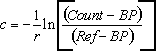
where
| c | = | mean beam attenuation (m-1) from the CTD transmissometer at calibration depth |
| r | = | transmissometer pathlength (m) |
| Count | = | mean count logged at calibration depth |
| BP | = | blocked path counts |
| Ref | = | reference counts |
Once calculated, Ref was substituted into the equation, allowing c to be calculated for the transmissometer time series.
Calibration details are shown in the table below. Please note, no blocked path readings were available, so they were assumed to be zero.
| Series ID |
POL Rig |
Cruise | CTD Cast |
Ref (counts) |
BP (counts) |
r (m) |
|---|---|---|---|---|---|---|
| 592557 | 838 | PD05_01 | C01 | 1121.52 | 0 | 0.25 |
| 592569 | 845 | PD05_01 | C01 | 1121.52 | 0 | 0.25 |
| 592545 | 841 | PD05_01 | C07 | 820.65 | 0 | 0.25 |
| 592533 | 843 | PD05_01 | C02 | 918.32 | 0 | 0.25 |
Applies to BODC Series Ref. Nos : 592545, 592557, 592569
Beam attenuation values are probably higher than they should be. The CTD transmissometer record, against which these data were calibrated, was processed using manufacturer's air and blocked path values that date to 1998. It is likely that degradation of the optical window has occurred, which would increase attenuation of the beam.
The pressure sensor was not properly calibrated. It was intended only to serve as an indication of rig movement or disturbance.
Applies to BODC Series Ref. Nos : 592858, 592871, 592883, 592895, 592902
The data were recorded using a NarrowBand 75 kHz ADCP mounted on an oil platform facing downward. The data have been splined onto a regular time base.
As the instrument depth was not supplied it has been set to 1.5 times the bin length above the shallowest bin.
The data have also been visually inspected by BODC.
Applies to BODC Series Ref. Nos : 591658
Good record. Temperature agrees well with previous deployment. Salinity recordings start approximately 0.2 PSU lower than the end of the previous deployment, these have not been flagged
Applies to BODC Series Ref. Nos : 591671
The temperature record has 'flat spots' with constant readings, from 01 July to 15 July. The tidal signal reappears in the data after 15 July and the record looks good. The salinity record has similar 'flat spots' up to 15 July. These data have not been marked as suspect.
Applies to BODC Series Ref. Nos : 591806
Conductivity records flagged as suspect from 19 July 1980.
Applies to BODC Series Ref. Nos : 591879
A comparison between these conductivity data and the conductivity data recorded in the subsequent deployment, indicates a downward trend in the conductivity record, probably due to fouling.
Applies to BODC Series Ref. Nos : 591892
The pressure sensor indicates mooring instability from 06:00 14 February to 13:20 14 February 1989. The current speed and direction have been marked as suspect.
Applies to BODC Series Ref. Nos : 591923
A block of 14 data cycles on the 20 March 1989 have been marked as suspect for all channels, with the exception of temperature.
Applies to BODC Series Ref. Nos : 591947
The pressure sensor indicates mooring instability from 23 September 1988 to 02 October 1988 (end of the deployment).
Applies to BODC Series Ref. Nos : 591960
The pressure sensor indicates mooring instability on 30 July - 02 August 1989.
Applies to BODC Series Ref. Nos : 592023
The pressure sensor indicates mooring instability on 16 November 1988 when the value suddenly decreases by 2.5m.
Applies to BODC Series Ref. Nos : 592035
The Salinity record calculated from the conductivity increases by approximately 0.2 PSU between the end of the previous deployment and the start of the this deployment. There is a gap of two days between recovery and deployment so this is possible but unlikely.
The pressure sensor indicates mooring instability on 7 - 8 October and 28 - 29 October 1988.
Applies to BODC Series Ref. Nos : 591695
The visual inspection of the scatter plot indicates the meter was 'sticking' causing erroneous direction readings. Numerous direction 'spikes' have been marked as suspect.
Applies to BODC Series Ref. Nos : 591799
Conductivity records from 29 August suggest fouling.
Applies to BODC Series Ref. Nos : 591763
Conductivity records from 31 August suggest fouling.
Applies to BODC Series Ref. Nos : 593118
The initial visual inspection of the scatter plot indicated some irregularities, however a comparison between these data and the data recorded by a Aanderaa current meter (incorporating a temperature sensor) deployed some 29 m below on the same mooring showed evidence of frontal movement, which may explain these irregularities.
Applies to BODC Series Ref. Nos : 581492
Appears to be a good record.
The following corrections were applied to the instrument sensors:
These corrections were obtained by comparing meter records with corrected CTD pressure and temperature estimates when the instrument was attached to the CTD rosette and lowered with the CTD during cruise Cirolana 4/97.
This correction was obtained by comparing derived salinity, after temperature was corrected, with water samples collected whilst the meter was attached to the Nisken bottle rosette during Cirolana cruise 4/97.
Applies to BODC Series Ref. Nos : 581511
Appears to be a good record, except pressure sensor shows 3 occasions where meter seems to have been displaced downwards by 4 metres.
Instrument main spindle bent on recovery. Evidence of abrasion on instrument side.
The following corrections were applied to the instrument sensors:
These corrections were obtained by comparing meter records with corrected CTD pressure and temperature estimates when the instrument was attached to the CTD rosette and lowered with the CTD during cruise Corystes 7/00.
This correction was obtained by comparing derived salinity, after temperature was corrected, with water samples collected whilst the meter was attached to the Nisken bottle rosette during Corystes 7/00.
Applies to BODC Series Ref. Nos : 581535
Appears to be a good record.
The following corrections were applied to the instrument sensors:
These corrections were obtained by comparing meter records with corrected CTD pressure and temperature estimates when the instrument was attached to the CTD rosette and lowered with the CTD during cruise Corystes 7/00.
This correction was obtained by comparing derived salinity, after temperature was corrected, with water samples collected whilst the meter was attached to the Nisken bottle rosette during Corystes 7/00.
Applies to BODC Series Ref. Nos : 581547
Appears to be a good record
The following corrections were applied to the instrument sensors:
These corrections were obtained by comparing meter records with corrected CTD pressure and temperature estimates when the instrument was attached to the CTD rosette and lowered with the CTD during cruise Corystes 7/98.
This correction was obtained by comparing derived salinity, after temperature was corrected, with water samples collected whilst the meter was attached to the Nisken bottle rosette during Corystes 7/98.
Applies to BODC Series Ref. Nos : 580581
Appears to be a good series. Pressure, temperature and conductivity/salinity sensors calibrated during cruise Corystes 7/2000 when meter attached to niskin rosette whilst CTD profile being obtained. Recorded pressure and temperature compared with corrected CTD estimates and derived salinity, after P and T corrected, compared with salinity of water samples whose salinity measured by bench salinometer. The following corrections were applied to the instrument sensors:
The temperature and salinity estimates at start of series are in good agreement with a CTD profile (Corystes 7/00 stn 48) obtained shortly after mooring deployed. However, there are fears that biological fouling may have compromised the second half of the salinity record. The estimates of 33.5 near the end of the series are unrealistically low and at odds with the salinity of a near-surface sample (34.24) collected when mooring recovered.
Applies to BODC Series Ref. Nos : 580593
Appears to be a good series. Thermistor estimates as meter-bits pending calibration of sensor.
Applies to BODC Series Ref. Nos : 580600
Appears good record, except tidal analysis and u/v plot shows a small event disrupted record from reading 4640 to 4680 (1425h to 2105h 29/07/2000). Not apparent in series from 00F4-1, was rotor temporarily fouled? The following corrections were applied to the instrument sensors:
These corrections were obtained by comparing meter records with corrected CTD pressure and temperature estimates when the instrument was attached to the CTD rosette and lowered with the CTD during cruise Corystes 7/98.
This correction was obtained by comparing derived salinity, after pressure and temperature corrected, with water samples collected whilst the meter was attached to the Nisken bottle rosette during Corystes cruise 7/98.
A near-surface (4m depth) water sample collected when mooring deployed had a salinity of 34.24, approx 0.2 > estimates at start of this series. Note that start of salinity series is larger than that at end of 00G3-1 which was flagged as being suspect. This (00G4-1) salinity series is also suspect, decreasing to 31.7 on 2nd August. Biological fouling is thought to be compromising the salinity series and it is suggested that salinity estimates are unreliable after 8th July.
Applies to BODC Series Ref. Nos : 580661
The temperature channel becomes very noisy near the end of the deployment. Temperature data after approximately 12:00 on the 13th May 2001 should be treated with caution.
Applies to BODC Series Ref. Nos : 580833
At approximately 01:00 on the 29th May 2001 the data from temperature channel show an initial sharp increase followed by very spikey data until the end of the dataset. The salinity channel also shows large small scale variability during deployment. These data should be treated with caution.
The current speed and direction data do not cover the duration of the deployment. The data end at approximately 00:30 on the 10th Septhamber 2001.
Applies to BODC Series Ref. Nos : 580857
At approximately 21:30 on the 28th May 2001 the data from temperature channel shows an initial sharp increase followed by very spikey data until the end of the dataset.
The salinity data begins to tail off around the 10th August 2001. There is then a slight recovery before a sharp decrease form the 11th September until the end of the dataset. This data should be used with caution.
Applies to BODC Series Ref. Nos : 580624, 580636, 580648, 580673, 580685, 580697, 580741, 580753, 580833, 580845, 580857
The data were provided to BODC in ascii format and were transferred to qxf format by BODC produced Matlab transfer 136. The full dataset was made up from two files. One file contained velocity vectors in both the North/South direction and the East/West direction and temperature readings. The second file contained Salinity readings. The transfer converted the velocities to current speed and direction.
There were no headings included in the files to point to which channel refered to which variable. The files had suffixes of t or s to denote whether the last column was for temperature or salinity. The temperature file contained the current vectors. The vectors were resolved during transfer so no user activity is required for this conversion. The variables were then mapped to the appropriate BODC parameter code which can be seen below:
| Variable | Units | BODC parameter code | Units | Comments |
|---|---|---|---|---|
| Current speed | n/a | LCSAEL01 | cms-1 | Speed generated from appropriate given vectors |
| Current Direction | n/a | LCDAEL01 | cms-1 | Speed generated from appropriate given vectors |
| Temperature | deg C | TEMPPR01 | deg C | - |
| Salinity | - | PSALPR01 | - | - |
Following the transfer the data was screened using the BODC in-house visualisation software, EDSERPLO. Any suspect data points were flagged with the appropriate BODC flag code.
Applies to BODC Series Ref. Nos : 580661
The data were provided to BODC in ascii format and were transferred to qxf format by BODC produced Matlab transfer 136. The full dataset was made up from two files. One file contained Temperature readings and the other file contained Salinity readings.
There were no headings included in the files to point to which channel refered to which variable. The files had suffixes of t or s to denote whether the last column was for temperature or salinity. The variables were then mapped to the appropriate BODC parameter code which can be seen below:
| Variable | Units | BODC parameter code | Units | Comments |
|---|---|---|---|---|
| Temperature | deg C | TEMPPR01 | deg C | - |
| Salinity | - | PSALPR01 | - | - |
Following the transfer the data was screened using the BODC in-house visualisation software, EDSERPLO. Any suspect data points were flagged with the appropriate BODC flag code.
Applies to BODC Series Ref. Nos : 580704, 580869, 580870
The data were provided to BODC in ascii format and were transferred to qxf format by BODC produced Matlab transfer 136. The full dataset was made up of velocity vectors in both the North/South direction and the East/West direction and temperature readings. The transfer converted the velocities to current speed and direction.
The vectors were resolved during transfer so no user activity is required for this conversion. The variables were then mapped to the appropriate BODC parameter code which can be seen below:
| Variable | Units | BODC parameter code | Units | Comments |
|---|---|---|---|---|
| Current speed | n/a | LCSAEL01 | cms-1 | Speed generated from appropriate given vectors |
| Current Direction | n/a | LCDAEL01 | cms-1 | Speed generated from appropriate given vectors |
| Temperature | deg C | TEMPPR01 | deg C | - |
Following the transfer the data was screened using the BODC in-house visualisation software, EDSERPLO. Any suspect data points were flagged with the appropriate BODC flag code.
Applies to BODC Series Ref. Nos : 580624, 580636, 580648, 580661, 580673, 580685, 580697, 580704, 580741, 580753, 580833, 580845, 580857, 580869, 580870
The data from the Vemco Miniloggers were merged to form "pseudo" thermistor chain records prior to being supplied to BODC.
FRS applied the standard manufaturers' calibrations to all data, and produced ascii files for submission to BODC.
Applies to BODC Series Ref. Nos : 580697
The temperature channel becomes noiser throught this dataset and there is a gradual increase in values from start to finish. This data should be used with caution.
Applies to BODC Series Ref. Nos : 580704
The temperature channel is noisy throught the dataset and there is a gradual increase in values from start to finish. This data should be used with caution.
Applies to BODC Series Ref. Nos : 580741
The temperature channel is noisy throught the dataset and there is a gradual increase in values from start to finish. Although the data levels out after the 8th of September the temperature values look too high for the time of year and location. This data should be used with caution.
The current speed and direction channels are not present for the duration of the deployment. Data is not recorded from the 3rd of August. The data that is recorded is useable
There is a large spike in the salinty data at the beginning of September. The data appears to recover after this but it rapidly tails off from this point until the end of the dataset. Data after September should be used with caution.
Applies to BODC Series Ref. Nos : 580753
The temperature channel is noisy throught the dataset and there is a sharp increase in values from start to finish.
The salinity data is noisy throughout and trails off from July 11th 2001 to the end of the data.
Applies to BODC Series Ref. Nos : 580845
The temperature channel is noisy throught the dataset and there is a sharp increase in values from start to finish. The salinity data trails off badly towards the end of the data. This data should be treated with caution.
The current speed and direction channel data does not cover the duration of the deployment and ends earlier at approximately 00:00 on the 12th August 2001.
Applies to BODC Series Ref. Nos : 10589, 10701, 11396, 11519, 11544
| Start Date | 1978-02-08 |
|---|---|
| End Date | 1978-02-15 |
| Organisation Undertaking Activity | Ministry of Agriculture, Fisheries and Food Lowestoft Fisheries Laboratory (now Centre for Environment, Fisheries and Aquaculture Science Lowestoft Laboratory) |
| Country of Organisation | United Kingdom |
| Originator's Data Activity Identifier | SD |
| Platform Category | subsurface mooring |
|---|
The mooring held two meters. The bottom meter returned no data.
Applies to BODC Series Ref. Nos : 20916
| Start Date | 1981-06-20 |
|---|---|
| End Date | 1981-08-03 |
| Organisation Undertaking Activity | Department of Agriculture and Fisheries for Scotland Aberdeen Marine Laboratory (now Marine Scotland Aberdeen Marine Laboratory) |
| Country of Organisation | United Kingdom |
| Originator's Data Activity Identifier | R213 |
| Platform Category | subsurface mooring |
|---|
The mooring held two meters. The top meter was lost.
Applies to BODC Series Ref. Nos : 427759, 427760
| Start Date | 1993-10-28 |
|---|---|
| End Date | 1993-11-29 |
| Organisation Undertaking Activity | Ministry of Agriculture, Fisheries and Food Lowestoft Fisheries Laboratory (now Centre for Environment, Fisheries and Aquaculture Science Lowestoft Laboratory) |
| Country of Organisation | United Kingdom |
| Originator's Data Activity Identifier | S93L2 |
| Platform Category | subsurface mooring |
|---|
The mooring held three meters. The middle meter returned no data.
Applies to BODC Series Ref. Nos : 11206
| Start Date | 1977-07-02 |
|---|---|
| End Date | 1977-11-03 |
| Organisation Undertaking Activity | Department of Agriculture and Fisheries for Scotland Aberdeen Marine Laboratory (now Marine Scotland Aberdeen Marine Laboratory) |
| Country of Organisation | United Kingdom |
| Originator's Data Activity Identifier | R161 |
| Platform Category | subsurface mooring |
|---|
The mooring held two meters. The top meter returned no data.
Applies to BODC Series Ref. Nos : 48237, 48250, 48274, 48286
| Start Date | 1982-03-19 |
|---|---|
| End Date | 1982-03-31 |
| Organisation Undertaking Activity | Offshore Environmental Systems Ltd |
| Country of Organisation | United Kingdom |
| Originator's Data Activity Identifier | RB1 |
| Platform Category | subsurface mooring |
|---|
The mooring held three meters. The bottom meter returned no data.
Applies to BODC Series Ref. Nos : 48298, 48305, 48378, 48409, 48907, 48919
| Start Date | 1982-04-01 |
|---|---|
| End Date | 1982-07-24 |
| Organisation Undertaking Activity | Offshore Environmental Systems Ltd |
| Country of Organisation | United Kingdom |
| Originator's Data Activity Identifier | RA2 |
| Platform Category | subsurface mooring |
|---|
The mooring held three meters. The top meter returned no data.
Applies to BODC Series Ref. Nos : 21133, 21145, 21170
| Start Date | 1979-05-21 |
|---|---|
| End Date | 1979-06-21 |
| Organisation Undertaking Activity | Offshore Environmental Systems Ltd |
| Country of Organisation | United Kingdom |
| Originator's Data Activity Identifier | R3(1) |
| Platform Category | subsurface mooring |
|---|
The mooring held 4 meters. The lower middle meter returned no data.
Applies to BODC Series Ref. Nos : 48852, 48864, 48888
| Start Date | 1984-10-01 |
|---|---|
| End Date | 1984-12-01 |
| Organisation Undertaking Activity | Offshore Environmental Systems Ltd |
| Country of Organisation | United Kingdom |
| Originator's Data Activity Identifier | RCM-A |
| Platform Category | subsurface mooring |
|---|
The mooring held 4 meters. The top meter returned no data.
Applies to BODC Series Ref. Nos : 21329, 21330, 21342, 21354
| Start Date | 1979-08-04 |
|---|---|
| End Date | 1979-09-06 |
| Organisation Undertaking Activity | Offshore Environmental Systems Ltd |
| Country of Organisation | United Kingdom |
| Originator's Data Activity Identifier | R4(3) |
| Platform Category | subsurface mooring |
|---|
The mooring held 5 meters. The second meter from the top returned no data.
Applies to BODC Series Ref. Nos : 49345, 49357, 49369
| Start Date | 1982-10-30 |
|---|---|
| End Date | 1983-01-22 |
| Organisation Undertaking Activity | Offshore Environmental Systems Ltd |
| Country of Organisation | United Kingdom |
| Originator's Data Activity Identifier | R1 |
| Platform Category | subsurface mooring |
|---|
Mooring held 3 current meters and one offshore pressure recorder.
Data from the latter are not held by BODC.
Applies to BODC Series Ref. Nos : 10590, 10608, 10621, 10633, 10645, 10657, 10669, 10670, 10682, 10694, 10713, 10725, 10737, 10749, 10750, 10762, 10774, 10786, 10798, 10805, 10817, 10829, 10830, 10842, 10854, 10866, 10878, 10909, 10910, 10922, 10934, 10958, 11058, 11071, 11163, 11175, 11187, 11199, 11255, 11267, 11279, 11292, 11311, 11323, 11335, 11347, 11359, 11403, 11415, 11439, 11440, 11452, 11464, 11476, 11488, 11507, 11520, 11532, 11636, 11648, 11661, 11673, 11685, 11697, 11704, 11716, 11728, 11741, 11753, 11765, 20756, 20768, 20781, 20824, 20836, 20848, 20861, 20873, 20897, 20904, 20928, 20941, 20953, 20965, 20977, 20989, 20990, 21004, 48170, 48182, 48680, 48692, 48711, 48723, 49161, 49197, 49204, 49241, 49253, 49265, 49321, 49333, 49394, 49401, 49450, 49462, 49474, 49486, 427213, 427225, 427772, 427784, 430097, 430104, 430116, 430128, 430221, 430233, 430245, 430257, 430269, 430270, 430282, 430294, 430337, 430349, 430350, 430362, 430386, 430398, 430405, 430417, 430430, 430442, 430454, 430466, 430491, 430509, 430546, 430558, 430651, 430663, 430687, 430699, 430706, 430718, 430743, 430755
| Start Date | 1978-02-04 |
|---|---|
| End Date | 1978-02-07 |
| Organisation Undertaking Activity | Ministry of Agriculture, Fisheries and Food Lowestoft Fisheries Laboratory (now Centre for Environment, Fisheries and Aquaculture Science Lowestoft Laboratory) |
| Country of Organisation | United Kingdom |
| Originator's Data Activity Identifier | SE1 |
| Platform Category | subsurface mooring |
|---|
Mooring held 2 meters.
Applies to BODC Series Ref. Nos : 10971, 10983, 10995, 11009, 11010, 11022, 11126, 11138, 11218, 11231, 11243, 11360, 11372, 11384, 11600, 11612, 11624, 21077, 21090, 21121, 21157, 21169, 21182, 21250, 21286, 21305, 48194, 48201, 48213, 48225, 48249, 48262, 48317, 48329, 48330, 48354, 48366, 48391, 48667, 48679, 48747, 48759, 48760, 48772, 48784, 48796, 48803, 49068, 427723, 427735, 427747, 430859, 430860, 430872, 430988, 431003, 431015
| Start Date | 1976-03-09 |
|---|---|
| End Date | 1976-04-27 |
| Organisation Undertaking Activity | Department of Agriculture and Fisheries for Scotland Aberdeen Marine Laboratory (now Marine Scotland Aberdeen Marine Laboratory) |
| Country of Organisation | United Kingdom |
| Originator's Data Activity Identifier | PJONSDAP/S51 |
| Platform Category | subsurface mooring |
|---|
Mooring held 2 current meters and one bottom pressure recorder.
Applies to BODC Series Ref. Nos : 11034, 11046, 11556, 11568, 11581, 11593, 21016, 21028, 21053, 21065, 21089, 21108, 21262, 21274, 21298, 21317, 48410, 48422, 48434, 48446, 48815, 48827, 48839, 48840
| Start Date | 1976-03-09 |
|---|---|
| End Date | 1976-04-27 |
| Organisation Undertaking Activity | Department of Agriculture and Fisheries for Scotland Aberdeen Marine Laboratory (now Marine Scotland Aberdeen Marine Laboratory) |
| Country of Organisation | United Kingdom |
| Originator's Data Activity Identifier | PJONSDP/S521 |
| Platform Category | subsurface mooring |
|---|
Mooring held 4 meters.
Applies to BODC Series Ref. Nos : 49081, 49093, 49124, 49136, 49148
| Start Date | 1981-11-27 |
|---|---|
| End Date | 1982-01-07 |
| Organisation Undertaking Activity | Offshore Environmental Systems Ltd |
| Country of Organisation | United Kingdom |
| Originator's Data Activity Identifier | R2 |
| Platform Category | subsurface mooring |
|---|
Mooring held 5 meters.
Applies to BODC Series Ref. Nos : 21194, 21201, 21213, 21225, 21237, 21249
| Start Date | 1979-06-24 |
|---|---|
| End Date | 1979-08-03 |
| Organisation Undertaking Activity | Offshore Environmental Systems Ltd |
| Country of Organisation | United Kingdom |
| Originator's Data Activity Identifier | R1-2(2) |
| Platform Category | subsurface mooring |
|---|
Mooring held 6 meters.
Applies to BODC Series Ref. Nos : 49019, 49020
| Start Date | 1981-06-07 |
|---|---|
| End Date | 1981-06-18 |
| Organisation Undertaking Activity | Offshore Environmental Systems Ltd |
| Country of Organisation | United Kingdom |
| Originator's Data Activity Identifier | RCLAYMORE-AL |
| Platform Category | offshore structure |
|---|
Two current meters were deployed from the rig.
Applies to BODC Series Ref. Nos : 427815, 427839
| Start Date | 1993-08-11 |
|---|---|
| End Date | 1993-09-09 |
| Organisation Undertaking Activity | Ministry of Agriculture, Fisheries and Food Lowestoft Fisheries Laboratory (now Centre for Environment, Fisheries and Aquaculture Science Lowestoft Laboratory) |
| Country of Organisation | United Kingdom |
| Originator's Data Activity Identifier | S93A1 |
| Platform Category | subsurface mooring |
|---|
Mooring held 1 current meter and 1 water level recorder.
Applies to BODC Series Ref. Nos : 427852, 427864, 430153, 430165, 430301, 430313, 430510, 430522, 430571, 430583, 430767, 430779, 430792, 430811, 430823, 430835, 430927, 430939, 430940, 430952, 431027, 431039, 431040, 431052, 431064, 431076, 431088, 431107, 431119, 431120, 431132, 431144, 431156, 431168
| Start Date | 1993-09-09 |
|---|---|
| End Date | 1993-10-02 |
| Organisation Undertaking Activity | Ministry of Agriculture, Fisheries and Food Lowestoft Fisheries Laboratory (now Centre for Environment, Fisheries and Aquaculture Science Lowestoft Laboratory) |
| Country of Organisation | United Kingdom |
| Originator's Data Activity Identifier | S93B2 |
| Platform Category | subsurface mooring |
|---|
Mooring held 2 current meters and 1 water level recorder.
Applies to BODC Series Ref. Nos : 430085
| Start Date | 1987-01-12 |
|---|---|
| End Date | 1987-04-01 |
| Organisation Undertaking Activity | Department of Agriculture and Fisheries for Scotland Aberdeen Marine Laboratory (now Marine Scotland Aberdeen Marine Laboratory) |
| Country of Organisation | United Kingdom |
| Originator's Data Activity Identifier | R270 |
| Platform Category | subsurface mooring |
|---|
Mooring held 2 current meters. The top meter returned no data.
Applies to BODC Series Ref. Nos : 430602, 430614
| Start Date | 1990-05-21 |
|---|---|
| End Date | 1990-07-25 |
| Organisation Undertaking Activity | Scottish Office Agriculture and Fisheries Department Aberdeen Marine Laboratory (now Marine Scotland Aberdeen Marine Laboratory) |
| Country of Organisation | United Kingdom |
| Originator's Data Activity Identifier | R328 |
| Platform Category | subsurface mooring |
|---|
Mooring held 2 current meters and 1 thermistor chain.
Applies to BODC Series Ref. Nos : 430141
| Start Date | 1988-09-18 |
|---|---|
| End Date | 1988-11-17 |
| Organisation Undertaking Activity | Scottish Office Agriculture and Fisheries Department Aberdeen Marine Laboratory (now Marine Scotland Aberdeen Marine Laboratory) |
| Country of Organisation | United Kingdom |
| Originator's Data Activity Identifier | R305 |
| Platform Category | subsurface mooring |
|---|
Mooring held 2 meters, the bottom returned no data.
Applies to BODC Series Ref. Nos : 21366, 21378
| Start Date | 1975-06-06 |
|---|---|
| End Date | 1975-07-12 |
| Organisation Undertaking Activity | Institute of Marine Environmental Research, Plymouth (now Plymouth Marine Laboratory) |
| Country of Organisation | United Kingdom |
| Originator's Data Activity Identifier | IMER#1B |
| Platform Category | subsurface mooring |
|---|
| Position | 51° 30.2' N, 04° 59.0' W |
|---|---|
| Period | 06 June - 12 July 1975 |
| Depth | Instrument |
|---|---|
| 21m | Current meter (#667) |
| 47m | Current meter (#534) |
Applies to BODC Series Ref. Nos : 21391, 21409, 21410
| Start Date | 1975-06-06 |
|---|---|
| End Date | 1975-06-19 |
| Organisation Undertaking Activity | Institute of Marine Environmental Research, Plymouth (now Plymouth Marine Laboratory) |
| Country of Organisation | United Kingdom |
| Originator's Data Activity Identifier | IMER#2B |
| Platform Category | subsurface mooring |
|---|
| Position | 51° 19.9' N, 04° 51.6' W |
|---|---|
| Period | 06 - 19 June 1975 |
| Depth | Instrument |
|---|---|
| 21m | Current meter (#680) |
| 36m | Current meter (#557) |
| 51m | Current meter (#532) |
Applies to BODC Series Ref. Nos : 21483, 21495
| Start Date | 1975-06-08 |
|---|---|
| End Date | 1975-06-10 |
| Organisation Undertaking Activity | Institute of Marine Environmental Research, Plymouth (now Plymouth Marine Laboratory) |
| Country of Organisation | United Kingdom |
| Originator's Data Activity Identifier | IMER#6B |
| Platform Category | subsurface mooring |
|---|
| Position | 51° 13.5' N, 04° 25.6' W |
|---|---|
| Period | 08 - 10 Jun 1975 |
| Depth | Instrument |
|---|---|
| 17m | Current meter (#626) |
| 42m | Current meter (#556) |
Applies to BODC Series Ref. Nos : 21422, 21434
| Start Date | 1975-06-08 |
|---|---|
| End Date | 1975-07-18 |
| Organisation Undertaking Activity | Institute of Marine Environmental Research, Plymouth (now Plymouth Marine Laboratory) |
| Country of Organisation | United Kingdom |
| Originator's Data Activity Identifier | IMER#3B |
| Platform Category | subsurface mooring |
|---|
| Position | 51° 04.6' N, 04° 36.8' W |
|---|---|
| Period | 08 June - 18 July 1975 |
| Depth | Instrument |
|---|---|
| 21m | Current meter (#559) |
| 34m | Current meter (#663) |
Applies to BODC Series Ref. Nos : 21446, 21458, 21471
| Start Date | 1975-06-12 |
|---|---|
| End Date | 1975-06-14 |
| Organisation Undertaking Activity | Institute of Marine Environmental Research, Plymouth (now Plymouth Marine Laboratory) |
| Country of Organisation | United Kingdom |
| Originator's Data Activity Identifier | IMER#5B |
| Platform Category | subsurface mooring |
|---|
| Position | 51° 22.2' N, 04° 27.8' W |
|---|---|
| Period | 12 - 14 June 1975 |
| Depth | Instrument |
|---|---|
| 17m | Current meter (#626) |
| 28m | Current meter (#629) |
| 40m | Current meter (#556) |
Applies to BODC Series Ref. Nos : 21502, 21514
| Start Date | 1975-06-17 |
|---|---|
| End Date | 1975-06-18 |
| Organisation Undertaking Activity | Institute of Marine Environmental Research, Plymouth (now Plymouth Marine Laboratory) |
| Country of Organisation | United Kingdom |
| Originator's Data Activity Identifier | IMER#7B |
| Platform Category | subsurface mooring |
|---|
| Position | 51° 27.3' N, 04° 00.4' W |
|---|---|
| Period | 17 - 18 June 1975 |
| Depth | Instrument |
|---|---|
| 16m | Current meter (#626) |
| 25m | Current meter (#629) |
Applies to BODC Series Ref. Nos : 21526, 21538
| Start Date | 1976-06-16 |
|---|---|
| End Date | 1976-08-06 |
| Organisation Undertaking Activity | Institute of Marine Environmental Research, Plymouth (now Plymouth Marine Laboratory) |
| Country of Organisation | United Kingdom |
| Originator's Data Activity Identifier | IMER#1C |
| Platform Category | subsurface mooring |
|---|
| Position | 51° 28.7' N, 04° 15.0' W |
|---|---|
| Period | 16 June - 06 August 1976 |
| Depth | Instrument |
|---|---|
| 17m | Current meter (#560) |
| 37m | Current meter (#1880) |
Applies to BODC Series Ref. Nos : 21551, 21563
| Start Date | 1976-06-16 |
|---|---|
| End Date | 1976-08-06 |
| Organisation Undertaking Activity | Institute of Marine Environmental Research, Plymouth (now Plymouth Marine Laboratory) |
| Country of Organisation | United Kingdom |
| Originator's Data Activity Identifier | IMER#2C |
| Platform Category | subsurface mooring |
|---|
| Position | 51° 22.3' N, 04° 41.0' W |
|---|---|
| Period | 16 June - 06 August 1976 |
| Depth | Instrument |
|---|---|
| 17m | Current meter (#238) |
| 44m | Current meter (#1881) |
Applies to BODC Series Ref. Nos : 21575, 21587
| Start Date | 1976-06-21 |
|---|---|
| End Date | 1976-08-08 |
| Organisation Undertaking Activity | Institute of Marine Environmental Research, Plymouth (now Plymouth Marine Laboratory) |
| Country of Organisation | United Kingdom |
| Originator's Data Activity Identifier | IMER#3C |
| Platform Category | subsurface mooring |
|---|
| Position | 51° 16.2' N, 04° 15.0' W |
|---|---|
| Period | 21 June - 08 August 1976 |
| Depth | Instrument |
|---|---|
| 17m | Current meter (#237) |
| 38m | Current meter (#1876) |
Applies to BODC Series Ref. Nos : 21599, 21606
| Start Date | 1976-06-18 |
|---|---|
| End Date | 1976-06-21 |
| Organisation Undertaking Activity | Institute of Marine Environmental Research, Plymouth (now Plymouth Marine Laboratory) |
| Country of Organisation | United Kingdom |
| Originator's Data Activity Identifier | IMER#4C |
| Platform Category | subsurface mooring |
|---|
| Position | 50° 50.2' N, 04° 46.0' W |
|---|---|
| Period | 18 - 21 June 1976 |
| Depth | Instrument |
|---|---|
| 7m | Current meter (#669) |
| 22m | Current meter (#680) |
Applies to BODC Series Ref. Nos : 21618, 21631
| Start Date | 1976-06-17 |
|---|---|
| End Date | 1976-06-21 |
| Organisation Undertaking Activity | Institute of Marine Environmental Research, Plymouth (now Plymouth Marine Laboratory) |
| Country of Organisation | United Kingdom |
| Originator's Data Activity Identifier | IMER#5C |
| Platform Category | subsurface mooring |
|---|
| Position | 50° 36.3' N, 04° 41.0' W |
|---|---|
| Period | 17 -21 June 1976 |
| Depth | Instrument |
|---|---|
| 20m | Current meter (#244) |
| 30m | Current meter (#573) |
Applies to BODC Series Ref. Nos : 21643, 21655, 21667
| Start Date | 1976-06-22 |
|---|---|
| End Date | 1976-06-23 |
| Organisation Undertaking Activity | Institute of Marine Environmental Research, Plymouth (now Plymouth Marine Laboratory) |
| Country of Organisation | United Kingdom |
| Originator's Data Activity Identifier | IMER#6C |
| Platform Category | subsurface mooring |
|---|
| Position | 51° 04.0' N, 04° 38.2' W |
|---|---|
| Period | 22 - 23 June 1976 |
| Depth | Instrument |
|---|---|
| 16m | Current meter (#244) |
| 31m | Current meter (#669) |
| 46m | Current meter (#663) |
Applies to BODC Series Ref. Nos : 21679, 21680, 21692
| Start Date | 1976-06-22 |
|---|---|
| End Date | 1976-06-23 |
| Organisation Undertaking Activity | Institute of Marine Environmental Research, Plymouth (now Plymouth Marine Laboratory) |
| Country of Organisation | United Kingdom |
| Originator's Data Activity Identifier | IMER#7C |
| Platform Category | subsurface mooring |
|---|
| Position | 51° 14.0' N, 04° 46.0' W |
|---|---|
| Period | 22 - 23 June 1976 |
| Depth | Instrument |
|---|---|
| 15m | Current meter (#573) |
| 30m | Current meter (#626) |
| 45m | Current meter (#680) |
Applies to BODC Series Ref. Nos : 21711, 21723, 21735
| Start Date | 1976-06-24 |
|---|---|
| End Date | 1976-06-26 |
| Organisation Undertaking Activity | Institute of Marine Environmental Research, Plymouth (now Plymouth Marine Laboratory) |
| Country of Organisation | United Kingdom |
| Originator's Data Activity Identifier | IMER#8C |
| Platform Category | subsurface mooring |
|---|
| Position | 51° 20.0' N, 04° 51.5' W |
|---|---|
| Period | 24 - 26 June 1976 |
| Depth | Instrument |
|---|---|
| 19m | Current meter (#663) |
| 39m | Current meter (#573) |
| 54m | Current meter (#626) |
Applies to BODC Series Ref. Nos : 21747, 21759, 21760
| Start Date | 1976-06-24 |
|---|---|
| End Date | 1976-06-26 |
| Organisation Undertaking Activity | Institute of Marine Environmental Research, Plymouth (now Plymouth Marine Laboratory) |
| Country of Organisation | United Kingdom |
| Originator's Data Activity Identifier | IMER#9C |
| Platform Category | subsurface mooring |
|---|
| Position | 51° 26.4' N, 04° 57.0' W |
|---|---|
| Period | 24 - 26 June 1976 |
| Depth | Instrument |
|---|---|
| 19m | Current meter (#224) |
| 39m | Current meter (#680) |
| 54m | Current meter (#669) |
Applies to BODC Series Ref. Nos : 21784, 21796
| Start Date | 1976-06-26 |
|---|---|
| End Date | 1976-06-28 |
| Organisation Undertaking Activity | Institute of Marine Environmental Research, Plymouth (now Plymouth Marine Laboratory) |
| Country of Organisation | United Kingdom |
| Originator's Data Activity Identifier | IMER#11C |
| Platform Category | subsurface mooring |
|---|
| Position | 51° 31.2' N, 04° 32.0' W |
|---|---|
| Period | 26 - 28 June 1976 |
| Depth | Instrument |
|---|---|
| 16m | Current meter (#244) |
| 26m | Current meter (#669) |
Applies to BODC Series Ref. Nos : 21803, 21815
| Start Date | 1976-08-11 |
|---|---|
| End Date | 1976-08-14 |
| Organisation Undertaking Activity | Institute of Marine Environmental Research, Plymouth (now Plymouth Marine Laboratory) |
| Country of Organisation | United Kingdom |
| Originator's Data Activity Identifier | IMER#14C |
| Platform Category | subsurface mooring |
|---|
| Position | 51° 24.7' N, 03° 49.0' W |
|---|---|
| Period | 11 - 14 August 1976 |
| Depth | Instrument |
|---|---|
| 15m | Current meter (#594) |
| 19m | Current meter (#626) |
Applies to BODC Series Ref. Nos : 21827, 21839
| Start Date | 1976-08-11 |
|---|---|
| End Date | 1976-08-14 |
| Organisation Undertaking Activity | Institute of Marine Environmental Research, Plymouth (now Plymouth Marine Laboratory) |
| Country of Organisation | United Kingdom |
| Originator's Data Activity Identifier | IMER#15C |
| Platform Category | subsurface mooring |
|---|
| Position | 51° 16.6' N, 03° 49.5' W |
|---|---|
| Period | 11 - 14 August 1976 |
| Depth | Instrument |
|---|---|
| 19m | Current meter (#534) |
| 26m | Current meter (#532) |
Applies to BODC Series Ref. Nos : 21840, 21852
| Start Date | 1976-08-07 |
|---|---|
| End Date | 1976-08-11 |
| Organisation Undertaking Activity | Institute of Marine Environmental Research, Plymouth (now Plymouth Marine Laboratory) |
| Country of Organisation | United Kingdom |
| Originator's Data Activity Identifier | IMER#17C |
| Platform Category | subsurface mooring |
|---|
| Position | 51° 16.3' N, 04° 01.4' W |
|---|---|
| Period | 07 - 11 August 1976 |
| Depth | Instrument |
|---|---|
| 20m | Current meter (#532) |
| 25m | Current meter (#543) |
Applies to BODC Series Ref. Nos : 593099
| Start Date | 1990-09-23 |
|---|---|
| End Date | 1990-10-17 |
| Organisation Undertaking Activity | Proudman Oceanographic Laboratory (now National Oceanography Centre, Liverpool) |
| Country of Organisation | United Kingdom |
| Originator's Data Activity Identifier | 00445 |
| Platform Category | subsurface mooring |
|---|
This rig (also known as C72AB) was deployed as part of the NERC North Sea Project Process Study in the Rhine outflow region, at Site B near the Dutch coast.
| Rig position | 52 ° 14.89N 04 ° 03.91E |
|---|---|
| Water depth | 21m |
The mooring was U-shaped, with a surface toroid buoy at one end and a subsurface float at the other end. One InterOcean S4 and three Aanderaa RCM current meters were included in the line with the sub-surface float. A transmissometer and an Aanderaa RCM (measuring temperature and salinity only) were attached just beneath the surface toroid buoy.
| Instrument | Meter height | Parameters measured |
|---|---|---|
| RCM 3308 | 3m | Temperature, salinity, current direction and speed |
| RCM 9634 | 7m | Temperature, current direction and speed |
| RCM 9680 | 11m | Temperature, current direction and speed |
| RCM 5228 | 20m | Temperature and salinity |
| TR 0004 | 20m | Beam attenuation |
| S4 1264 | 20m | Current direction and speed |
Applies to BODC Series Ref. Nos : 593106
| Start Date | 1990-09-22 |
|---|---|
| End Date | 1990-10-16 |
| Organisation Undertaking Activity | Proudman Oceanographic Laboratory (now National Oceanography Centre, Liverpool) |
| Country of Organisation | United Kingdom |
| Originator's Data Activity Identifier | D00448 |
| Platform Category | subsurface mooring |
|---|
This rig (also known as C72AD) was deployed as part of the NERC North Sea Project Process Study in the Rhine outflow region, at Site D near the Dutch coast.
| Rig position | 52 ° 10.12N 04 ° 15.19E |
|---|---|
| Water depth | 18m |
The mooring was U-shaped, with a surface toroid buoy at one end and a subsurface float at the other end. One InterOcean S4 and three Aanderaa RCM current meters were included in the line with the sub-surface float. A transmissometer and an Aanderaa RCM (measuring temperature and salinity only) were attached just beneath the surface toroid buoy.
| Instrument | Meter height | Parameters measured |
|---|---|---|
| RCM 7063 | 3m | Temperature, salinity, pressure, current direction and speed |
| RCM 9632 | 6m | Temperature, salinity, pressure, current direction and speed |
| RCM 9650 | 9m | Temperature, current direction and speed |
| RCM 6941 | - | No data |
| TR 0002 | 17m | Beam attenuation |
| S4 1263 | 17m | Current speed and direction |
Applies to BODC Series Ref. Nos : 592557
| Start Date | 2001-09-01 |
|---|---|
| End Date | 2001-09-06 |
| Organisation Undertaking Activity | Proudman Oceanographic Laboratory (now National Oceanography Centre, Liverpool) |
| Country of Organisation | United Kingdom |
| Originator's Data Activity Identifier | POLRIG#838 |
| Platform Category | subsurface mooring |
|---|
This rig was deployed as part of the Liverpool Bay Coastal Observatory, during the pilot study and site selection phase.
The instruments were mounted on a frame, which was deployed onto the sea floor. Deployment and recovery took place during R.V. Prince Madog cruise PD05_01.
| Rig Position | 53.4742° N, 3.6533° W |
|---|---|
| Water Depth | 31m |
| Deployed | 01 September 2001 16:00 |
| Recovered | 06 September 2001 13:10 |
| Instrument | Meter height | Parameters Measured |
|---|---|---|
| Pressure recorder 1357 | 0.5m | Pressure, temperature |
| ADCP 1.2MHz | 0.5m | Current velocity |
| Transmissometer AS11818/ST556 | 0.5m | Conductivity, temperature, pressure, and beam attenuation |
Applies to BODC Series Ref. Nos : 592569
| Start Date | 2001-09-10 |
|---|---|
| End Date | 2001-10-23 |
| Organisation Undertaking Activity | Proudman Oceanographic Laboratory (now National Oceanography Centre, Liverpool) |
| Country of Organisation | United Kingdom |
| Originator's Data Activity Identifier | POLRIG#845 |
| Platform Category | subsurface mooring |
|---|
This rig was deployed as part of the Liverpool Bay Coastal Observatory, during the pilot study and site selection phase.
The instruments were mounted on a frame, which was deployed onto the sea floor. The rig did not stay in position and was found washed up on the beach.
| Rig Position | 53.4742° N, 003.6533° W |
|---|---|
| Water Depth | 31m |
| Deployed | 10 September 2001 19:40 |
| Recovered | 23 October 2001 12:00 |
| Instrument | Meter Height | Parameters Measured |
|---|---|---|
| Pressure recorder 1357 | 0.5m | Pressure, temperature |
| ADCP 1.2 MHz 0572 | 0.5m | Current velocity |
| Transmissometer AS11818/ST556 | 0.5m | Conductivity, temperature, pressure and beam attenuation |
Applies to BODC Series Ref. Nos : 592545
| Start Date | 2001-09-03 |
|---|---|
| End Date | 2001-09-11 |
| Organisation Undertaking Activity | Proudman Oceanographic Laboratory (now National Oceanography Centre, Liverpool) |
| Country of Organisation | United Kingdom |
| Originator's Data Activity Identifier | POLRIG#841 |
| Platform Category | subsurface mooring |
|---|
This rig was deployed as part of the Liverpool Bay Coastal Observatory, during the pilot study and site selection phase.
| Deployed: | 03 September 2001 15:35 |
|---|---|
| Recovered: | 11 September 2001 17:15 |
| Rig position: | 53.4745° N, 3.6587° W |
| Water depth: | 31m |
The instruments were mounted on STABLE, which was deployed onto the sea floor.
Deployment and recovery took place during R.V. Prince Madog cruise PD05_01.
| Instruments | Meter height | Parameters measured |
|---|---|---|
| Current meter AS11817 | 0.5m | Pressure, temperature, conductivity, beam attenuation |
Applies to BODC Series Ref. Nos : 592521, 592533, 592570
| Start Date | 2001-09-02 |
|---|---|
| End Date | 2001-09-11 |
| Organisation Undertaking Activity | Proudman Oceanographic Laboratory (now National Oceanography Centre, Liverpool) |
| Country of Organisation | United Kingdom |
| Originator's Data Activity Identifier | POLRIG#843 |
| Platform Category | subsurface mooring |
|---|
This rig was deployed as part of the Liverpool Bay Coastal Observatory, during the pilot study and site selection phase.
| Deployed: | 02 September 2001 13:50 |
|---|---|
| Recovered: | 11 September 2001 18:35 |
| Rig position: | 53.4722° N, 3.5987° W |
| Water depth: | 24m |
The instruments were mounted on a frame, which was deployed onto the sea floor.
Deployment and recovery took place during R.V. Prince Madog cruise PD05_01.
| Instruments | Meter height | Parameters measured |
|---|---|---|
| Current meter AS10528 | 13.0m | Pressure, temperature, conductivity, current direction and speed |
| Current meter AS12173 | 18.0m | Pressure, temperature, conductivity, current direction and speed |
| Current meter AS11814 | 21.5m | Pressure, temperature, conductivity, beam attenuation, current direction and speed |
Applies to BODC Series Ref. Nos : 592766
| Start Date | 2000-05-16 |
|---|---|
| End Date | 2000-10-09 |
| Organisation Undertaking Activity | Fisheries Research Services Aberdeen Marine Laboratory (now Marine Scotland Aberdeen Marine Laboratory) |
| Country of Organisation | United Kingdom |
| Originator's Data Activity Identifier | NWSD0005 |
| Platform Category | fixed benthic node |
|---|
The rig was deployed as part of the MAIA study at site NWSD
| Mooring position | 60° 27.23' N, 004° 22.49' W |
|---|---|
| Bottom depth | 797.0 |
| Instrument | 75 kHz RDI Broadband ADCP |
| Instrument no. | 2615 |
| Instrument depth | 777.0 |
| Centre depth of first bin | 741.0 |
| Bin length | 25 |
| Number of bins | 27 |
| Time of first ensemble | 16 May 2000 10:20 |
| Time of last ensemble | 09 Oct 2000 08:20 |
| Time between ensembles | 20 minutes |
Applies to BODC Series Ref. Nos : 592778
| Start Date | 2000-10-14 |
|---|---|
| End Date | 2001-05-06 |
| Organisation Undertaking Activity | Fisheries Research Services Aberdeen Marine Laboratory (now Marine Scotland Aberdeen Marine Laboratory) |
| Country of Organisation | United Kingdom |
| Originator's Data Activity Identifier | NWSD0010 |
| Platform Category | fixed benthic node |
|---|
The rig was deployed as part of the MAIA study at site NWSD
| Mooring position | 60° 27.48' N, 004° 21.94' W |
|---|---|
| Bottom depth | 820.0 |
| Instrument | 75 kHz RDI Broadband ADCP |
| Instrument no. | 2259 |
| Instrument depth | 800.0 |
| Centre depth of first bin | 764.0 |
| Bin length | 25 |
| Number of bins | 26 |
| Time of first ensemble | 14 Oct 2000 09:00 |
| Time of last ensemble | 06 May 2001 19:00 |
| Time between ensembles | 20 minutes |
Applies to BODC Series Ref. Nos : 592791
| Start Date | 2001-05-16 |
|---|---|
| End Date | 2001-08-28 |
| Organisation Undertaking Activity | Fisheries Research Services Aberdeen Marine Laboratory (now Marine Scotland Aberdeen Marine Laboratory) |
| Country of Organisation | United Kingdom |
| Originator's Data Activity Identifier | NWSD0105 |
| Platform Category | fixed benthic node |
|---|
The rig was deployed as part of the MAIA study at site NWSD
| Mooring position | 60° 27.46' N, 004° 22.03' W |
|---|---|
| Bottom depth | 822.0 |
| Instrument | 75 kHz RDI Broadband ADCP |
| Instrument no. | 2615 |
| Instrument depth | 797.0 |
| Centre depth of first bin | 761.0 |
| Bin length | 25 |
| Number of bins | 28 |
| Time of first ensemble | 16 May 2001 18:20 |
| Time of last ensemble | 28 Aug 2001 05:20 |
| Time between ensembles | 20 minutes |
Applies to BODC Series Ref. Nos : 592809
| Start Date | 2001-10-13 |
|---|---|
| End Date | 2002-05-17 |
| Organisation Undertaking Activity | Fisheries Research Services Aberdeen Marine Laboratory (now Marine Scotland Aberdeen Marine Laboratory) |
| Country of Organisation | United Kingdom |
| Originator's Data Activity Identifier | NWSD0110 |
| Platform Category | fixed benthic node |
|---|
The rig was deployed as part of the MAIA study at site NWSD
| Mooring position | 60° 27.07' N, 004° 22.49' W |
|---|---|
| Bottom depth | 813.0 |
| Instrument | 75 kHz RDI Broadband ADCP |
| Instrument no. | 2259 |
| Instrument depth | 801.0 |
| Centre depth of first bin | 765.0 |
| Bin length | 25 |
| Number of bins | 26 |
| Time of first ensemble | 13 Oct 2001 09:00 |
| Time of last ensemble | 17 May 2002 09:20 |
| Time between ensembles | 20 minutes |
Applies to BODC Series Ref. Nos : 592810
| Start Date | 2001-10-13 |
|---|---|
| End Date | 2001-12-30 |
| Organisation Undertaking Activity | Fisheries Research Services Aberdeen Marine Laboratory (now Marine Scotland Aberdeen Marine Laboratory) |
| Country of Organisation | United Kingdom |
| Originator's Data Activity Identifier | NWSE0110 |
| Platform Category | fixed benthic node |
|---|
The rig was deployed as part of the MAIA study at site NWSE
| Mooring position | 60° 16.54' N, 004° 19.97' W |
|---|---|
| Bottom depth | 447.0 |
| Instrument | 150 kHz RDI Broadband ADCP |
| Instrument no. | 2860 |
| Instrument depth | 435.0 |
| Centre depth of first bin | 419.0 |
| Bin length | 10 |
| Number of bins | 15 |
| Time of first ensemble | 13 Oct 2001 11:30 |
| Time of last ensemble | 30 Dec 2001 17:00 |
| Time between ensembles | 15 minutes |
Applies to BODC Series Ref. Nos : 592895, 592902
| Start Date | 2001-07-20 |
|---|---|
| End Date | 2002-01-31 |
| Organisation Undertaking Activity | Fisheries Research Services Aberdeen Marine Laboratory (now Marine Scotland Aberdeen Marine Laboratory) |
| Country of Organisation | United Kingdom |
| Originator's Data Activity Identifier | TOLSCHIECENT |
| Platform Category | offshore structure |
|---|
These data (2 series) were collected in the vicinity of MAIA site NWSE.
| Position | 60° 20' 07.0" N, 004° 01' 58.0" W |
|---|---|
| Bottom depth | 360 metres |
| Instrument | 75 kHz RDI NarrowBand ADCP |
| Instrument No. | 439/518 |
| Instrument depth | 48.5 metres |
| Centre of first bin | 82.5 metres |
| Bin length | 17 metres |
| Number of bins | 15 |
| Time of first ensemble | 20 July 2001 02:20 hours |
| Time of last ensemble | 31 January 2002 23:50 hours |
| Time between ensembles | 10 minutes |
Applies to BODC Series Ref. Nos : 592858
| Start Date | 2000-12-23 |
|---|---|
| End Date | 2001-01-30 |
| Organisation Undertaking Activity | Fisheries Research Services Aberdeen Marine Laboratory (now Marine Scotland Aberdeen Marine Laboratory) |
| Country of Organisation | United Kingdom |
| Originator's Data Activity Identifier | TOLSCHIECLAW |
| Platform Category | offshore structure |
|---|
These data were collected in the vicinity of MAIA site NWSE.
| Position | 60° 20' 39.3" N, 004° 08' 22.0" W |
|---|---|
| Bottom depth | 411 metres |
| Instrument | 75 kHz RDI NarrowBand ADCP |
| Instrument No. | 439 |
| Instrument depth | 48.5 metres |
| Centre of first bin | 82.5 metres |
| Bin length | 17 metres |
| Number of bins | 18 |
| Time of first ensemble | 23 December 2000 05:50 hours |
| Time of last ensemble | 30 January 2001 04:20 hours |
| Time between ensembles | 10 minutes |
Applies to BODC Series Ref. Nos : 592871, 592883
| Start Date | 2001-02-09 |
|---|---|
| End Date | 2001-07-14 |
| Organisation Undertaking Activity | Fisheries Research Services Aberdeen Marine Laboratory (now Marine Scotland Aberdeen Marine Laboratory) |
| Country of Organisation | United Kingdom |
| Originator's Data Activity Identifier | TOLFOINAVEN2 |
| Platform Category | offshore structure |
|---|
These data (2 series) were collected in the vicinity of MAIA site NWSE.
| Position | 60° 20' 31.0"N, 004° 14' 40.0"W |
|---|---|
| Bottom depth | 475 metres |
| Instrument | 75 kHz RDI Narrowband ADCP |
| Instrument No. | 0439 |
| Instrument depth | 48.5 metres |
| Centre of first bin | 82.5 metres |
| Bin length | 17 metres |
| Number of bins | 21 |
| Time of first ensemble | 09 February 2001 14:30 hours |
| Time of last ensemble | 14 July 2001 00:30 hours |
| Time between ensembles | 10 minutes |
Applies to BODC Series Ref. Nos : 592232
| Start Date | 1989-02-21 |
|---|---|
| End Date | 1989-02-24 |
| Organisation Undertaking Activity | Institute of Oceanographic Sciences Bidston Laboratory (now National Oceanography Centre, Liverpool) |
| Country of Organisation | United Kingdom |
| Originator's Data Activity Identifier | RIG#CH46X |
| Platform Category | subsurface mooring |
|---|
This mooring was deployed as part of the Sandwaves Process studies.
| Rig Position | 52° 39.31'N, 003° 40.26'E |
|---|---|
| Water Depth (m) | 30.0 |
The mooring configuration details are unknown.
| Instrument | Meter Height | Parameters Measured |
|---|---|---|
| Aanderaa RCM7 9574 | 12.0 | Current Speed and Direction |
Applies to BODC Series Ref. Nos : 592244
| Start Date | 1989-02-21 |
|---|---|
| End Date | 1989-02-24 |
| Organisation Undertaking Activity | Institute of Oceanographic Sciences Bidston Laboratory (now National Oceanography Centre, Liverpool) |
| Country of Organisation | United Kingdom |
| Originator's Data Activity Identifier | RIG#CH46Y |
| Platform Category | subsurface mooring |
|---|
This mooring was deployed as part of the Sandwaves Process studies.
| Rig Position | 52° 39.49'N, 003° 39.91'E |
|---|---|
| Water Depth (m) | 30.0 |
The mooring configuration details are unknown.
| Instrument | Meter Height | Parameters Measured |
|---|---|---|
| Aanderaa RCM7 9579 | 7.0 | Current Speed and Direction |
Applies to BODC Series Ref. Nos : 592103, 592115, 592127
| Start Date | 1989-05-14 |
|---|---|
| End Date | 1989-05-20 |
| Organisation Undertaking Activity | Proudman Oceanographic Laboratory (now National Oceanography Centre, Liverpool) |
| Country of Organisation | United Kingdom |
| Originator's Data Activity Identifier | RIG#52352 |
| Platform Category | subsurface mooring |
|---|
This rig was deployed as part of the Resuspension experiments at the Northern site
| Rig position | 54° 34.91'N, 004° 50.38'E |
|---|---|
| Water Depth(m) | 45.0 |
The U-shaped mooring consisted of three Aanderaa current meters (RCM7) and three transmissometers (TR). A marker buoy was attached to the anchor, a ground line attached the anchor to a further anchor, and this was attached to a sub-surface buoy (0.8 m diameter steel sphere). The current meters and transmissometers were attached to this wire.
| Instrument | Meter Height | Parameters measured |
|---|---|---|
| RCM7 9364 | 22.0 | Current Speed and Direction, Temperature |
| RCM7 9650 | 11.0 | Current Speed and Direction, Temperature |
| RCM7 9643 | 6.0 | Current Speed and Direction, Temperature |
| TR834 | 30.0 | No data recorded |
| TR487 | 9.0 | Beam Attenuance, Total suspended matter |
| TR561 | 4.0 | Beam Attenuance, Total suspended matter |
Applies to BODC Series Ref. Nos : 592139, 592140, 592152
| Start Date | 1989-09-07 |
|---|---|
| End Date | 1989-09-17 |
| Organisation Undertaking Activity | Dunstaffnage Marine Laboratory (now Scottish Association for Marine Science) |
| Country of Organisation | United Kingdom |
| Originator's Data Activity Identifier | RIG#60410 |
| Platform Category | subsurface mooring |
|---|
This rig was deployed as part of the Resuspension experiments at the Northern Site.
| Rig position | 54° 35.42'N, 004° 49.23'E |
|---|---|
| Water depth (m) | 45.0 |
The U-shaped mooring consisted of three Aanderaa current meters (RCM7) and three SeaTech transmissometers (TR). A marker buoy was attached to the anchor, the anchor was attached by a ground line to a further anchor, which was attached to a sub-surface buoy (0.8 m diameter steel sphere). The three current meters and transmissometers were attached to this line.
| Instrument | Meter Height | Parameters Measured |
|---|---|---|
| RCM7 9634 | 30.0 | Current Speed and Direction, Temperature |
| RCM7 9680 | 10.0 | Current Speed and Direction, Temperature |
| RCM7 9652 | 5.0 | Current Speed and Direction, Temperature |
| TR 3 | 29.0 | Beam Attenuance, Total Suspended Matter |
| TR 2 | 9.0 | Beam Attenuance, Total Suspended Matter |
| TR 1 | 4.0 | No data |
Applies to BODC Series Ref. Nos : 592176, 592188
| Start Date | 1989-05-12 |
|---|---|
| End Date | 1989-05-22 |
| Organisation Undertaking Activity | Dunstaffnage Marine Laboratory (now Scottish Association for Marine Science) |
| Country of Organisation | United Kingdom |
| Originator's Data Activity Identifier | RIG#52351 |
| Platform Category | subsurface mooring |
|---|
This rig was deployed as part of the Resuspension Experiments at the Southern Site.
| Rig position | 52° 39.16'N, 003° 40.36'E |
|---|---|
| Water Depth (m) | 30.0 |
A U-shaped mooring consisted of two InterOcean System Model S4 current meters, two Aanderaa (RCM7) current meters and two transmissometers (TR). A marker buoy was attached to the anchor, a ground line attached the anchor to a further anchor and this was attached to a sub-surface (0.8 m diameter steel sphere). The four current meters and two transmissometers were attached to this line.
| Instrument | Meter Height | Parameters Measured |
|---|---|---|
| S4 714 | 17.0 | Current Speed and Direction |
| S4 715 | 11.0 | Current Speed and Direction |
| RCM7 9652 | 9.0 | Current Speed and Direction, Temperature |
| RCM7 9680 | 6.0 | Current Speed and Direction, Temperature |
| TR 852 | No data recorded | |
| TR 853 | No data recorded |
Applies to BODC Series Ref. Nos : 592207, 592219, 592220
| Start Date | 1989-09-10 |
|---|---|
| End Date | 1989-09-15 |
| Organisation Undertaking Activity | Proudman Oceanographic Laboratory (now National Oceanography Centre, Liverpool) |
| Country of Organisation | United Kingdom |
| Originator's Data Activity Identifier | RIG#60420 |
| Platform Category | subsurface mooring |
|---|
This rig was deployed as part of the Resuspension experiments at the Southern site
| Rig position | 52° 40.20'N, 003° 40.80'E |
|---|---|
| Water Depth(m) | 30.0 |
The U-shaped mooring consisted of three Aanderaa current meters (RCM7) and three transmissometers (TR). A marker buoy was attached to the anchor, a ground line attached the anchor to a further anchor, and this was attached to a sub-surface buoy (0.8 m diameter steel sphere). The current meters and transmissometers were attached to this wire.
| Instrument | Meter Height | Parameters measured |
|---|---|---|
| RCM7 9631 | 21.0 | Current Speed and Direction, Temperature and Conductivity |
| RCM7 9643 | 10.0 | Current Speed and Direction, Temperature |
| RCM7 9650 | 5.0 | Current Speed and Direction, Temperature |
| TR 6 | 20.0 | Beam Attenuance, Total suspended matter |
| TR 5 | 9.0 | Beam Attenuance, Total suspended matter |
| TR 3 | 4.0 | Beam Attenuance, Total suspended matter |
Applies to BODC Series Ref. Nos : 592072, 592084, 592096
| Start Date | 1989-07-09 |
|---|---|
| End Date | 1989-08-17 |
| Organisation Undertaking Activity | Proudman Oceanographic Laboratory (now National Oceanography Centre, Liverpool) |
| Country of Organisation | United Kingdom |
| Originator's Data Activity Identifier | RIG#56381 |
| Platform Category | subsurface mooring |
|---|
This rig was deployed as part of the NERC North Sea Project Fronts Process Study, off Flamborough Head, at Site FA.
| Rig Position | 53° 59.87'N, 000° 09.43'E |
|---|---|
| Water depth | 45 m |
The U-shaped mooring consisted of three Aanderaa current meters. The spar marker buoy was attached to the anchor by wire, the anchor was attached by a ground line to a further anchor, this was attached to a sub-surface buoy (0.8 m diameter steel sphere). The current meters were attached to this line.
| Instrument | Meter Height | Parameters measured |
|---|---|---|
| RCM 9643 | 30 m | Current Speed and Direction, Temperature |
| RCM 9650 | 20 m | Current Speed and Direction, Temperature |
| RCM 9652 | 10 m | Current Speed and Direction, Temperature |
Applies to BODC Series Ref. Nos : 592164
| Start Date | 1989-07-09 |
|---|---|
| End Date | 1989-08-17 |
| Organisation Undertaking Activity | Proudman Oceanographic Laboratory (now National Oceanography Centre, Liverpool) |
| Country of Organisation | United Kingdom |
| Originator's Data Activity Identifier | RIG#56382 |
| Platform Category | subsurface mooring |
|---|
This rig was deployed as part of the NERC North Sea Project Fronts Process Study, off Flamborough Head, at Site FB.
| Rig Position | 54° 03.45'N, 000° 17.42'E |
|---|---|
| Water Depth | 56 m |
The U-shaped mooring consisted of two Aanderaa and one InterOcean S4 current meters. The spar marker buoy was attached to the anchor by a wire, the anchor was attached by a ground line to a further anchor, and this was attached to a sub-surface buoy (a 0.8m diameter steel sphere). The current meters were attached to this line.
| Instrument | Meter Height | Parameters Measured |
|---|---|---|
| S4 1258 | 39m | Current Speed and Direction |
| RCM 3277 | 24m | No data |
| RCM 9680 | 10m | Current Speed and Direction, Temperature |
Applies to BODC Series Ref. Nos : 592060, 593118
| Start Date | 1989-07-11 |
|---|---|
| End Date | 1989-08-16 |
| Organisation Undertaking Activity | Proudman Oceanographic Laboratory (now National Oceanography Centre, Liverpool) |
| Country of Organisation | United Kingdom |
| Originator's Data Activity Identifier | RIG#56386 |
| Platform Category | subsurface mooring |
|---|
This rig was deployed as part of the NERC North Sea Project Fronts Process Study, off Flamborough Head at Site DA.
| Rig position | 54° 53.98'N, 001° 11.70'E |
|---|---|
| Water Depth | 46m |
The U-shaped mooring consisted of two Aanderaa current meters and one InterOcean S4 current meter. The spar marker buoy was attached to the anchor by wire, a ground line attached the anchor to a further anchor, and this was attached to a sub-surface buoy (0.8m diameter steel sphere). The current meters were attached to this wire.
| Instrument | Meter Height | Parameters Measured |
|---|---|---|
| S4 1195 | 31m | Current Speed and Direction |
| RCM 9634 | 21m | Current Speed and Direction, Temperature |
| RCM 7570 | 10m | No data |
Applies to BODC Series Ref. Nos : 591671
| Start Date | 1989-07-01 |
|---|---|
| End Date | 1989-08-04 |
| Organisation Undertaking Activity | Proudman Oceanographic Laboratory (now National Oceanography Centre, Liverpool) |
| Country of Organisation | United Kingdom |
| Originator's Data Activity Identifier | RIG#C55AC |
| Platform Category | subsurface mooring |
|---|
This rig was deployed as part of the North Sea Project Survey at Site A.
| Rig Position | 55° 29.99'N, 000° 54.32'E |
|---|---|
| Water Depth | 85.0 |
The mooring contained two instruments, an Acoustic Doppler Current Profiler (ADCP) and an Aanderaa RCM7 current meter. They were mounted on an frame positioned on the sea bed.
| Instrument | Meter Height | Parameters Measured |
|---|---|---|
| ADCP 0004 | 0.8 | Current Speed and Direction (11 Bins) |
| CM 9631 | 0.8 | Temperature and Conductivity |
Applies to BODC Series Ref. Nos : 591658
| Start Date | 1989-08-04 |
|---|---|
| End Date | 1989-08-09 |
| Organisation Undertaking Activity | Proudman Oceanographic Laboratory (now National Oceanography Centre, Liverpool) |
| Country of Organisation | United Kingdom |
| Originator's Data Activity Identifier | RIG#C57AC |
| Platform Category | subsurface mooring |
|---|
This rig was deployed as part of the North Sea Project Survey at Site A.
| Rig Position | 55°30.10'N, 000°54.30'E |
|---|---|
| Water Depth | 85.0 |
The mooring contained two instruments, an Acoustic Doppler Current Profiler (ADCP) and an Aanderaa RCM7 current meter. They were mounted on an frame positioned on the sea bed.
| Instrument | Meter Height | Parameters Measured |
|---|---|---|
| ADCP 0003 | 0.8 | Current Speed and Direction (11 Bins) |
| CM 9632 | 0.8 | Temperature and Conductivity |
Applies to BODC Series Ref. Nos : 591726
| Start Date | 1988-09-10 |
|---|---|
| End Date | 1988-11-07 |
| Organisation Undertaking Activity | Institute of Oceanographic Sciences Bidston Laboratory (now National Oceanography Centre, Liverpool) |
| Country of Organisation | United Kingdom |
| Originator's Data Activity Identifier | RIG#C35BC |
| Platform Category | subsurface mooring |
|---|
This rig was deployed as part of the North Sea Project Survey at Site B.
| Rig Position | 55° 29.90'N, 005° 30.40'E |
|---|---|
| Water Depth | 52.0 |
The U-shaped mooring consisted of three InterOcean S4 current meters and one Aanderaa RCM7 current meter. A spar marker buoy was attached to the anchor, a ground line attached the anchor to a further anchor and this was attached to a sub-surface (0.8m diameter steel sphere) buoy. The four current meters were attached to this line.
| Instrument | Meter Height | Parameters Measured |
|---|---|---|
| S4 1120 | 37.0 | Current Speed and Direction |
| S4 1119 | 27.0 | Current Speed and Direction |
| S4 1118 | 15.0 | Current Speed and Direction |
| Aanderaa 9069 | 7.0 | Current Speed and Direction |
Applies to BODC Series Ref. Nos : 591714
| Start Date | 1989-05-03 |
|---|---|
| End Date | 1989-06-01 |
| Organisation Undertaking Activity | Proudman Oceanographic Laboratory (now National Oceanography Centre, Liverpool) |
| Country of Organisation | United Kingdom |
| Originator's Data Activity Identifier | RIG#C51BC |
| Platform Category | subsurface mooring |
|---|
This rig was deployed as part of the North Sea Project Survey at Site B.
| Rig Position | 55° 30.19'N, 005° 27.96'E |
|---|---|
| Water Depth | 52.0 |
The U-shaped mooring consisted of three InterOcean S4 current meters and one Aanderaa RCM7 current meter. A spar marker buoy was attached to the anchor, a ground line attached the anchor to a further anchor and this was attached to a sub-surface (0.8m diameter steel sphere) buoy. The four current meters were attached to this line.
| Instrument | Meter Height | Parameters Measured |
|---|---|---|
| S4 1265 | 37.0 | Current Speed and Direction |
| S4 1261 | 27.0 | Current Speed and Direction |
| S4 1264 | 15.0 | Current Speed and Direction |
| Aanderaa 9060 | 7.0 | Current Speed and Direction |
Applies to BODC Series Ref. Nos : 591702
| Start Date | 1989-06-01 |
|---|---|
| End Date | 1989-06-30 |
| Organisation Undertaking Activity | Proudman Oceanographic Laboratory (now National Oceanography Centre, Liverpool) |
| Country of Organisation | United Kingdom |
| Originator's Data Activity Identifier | RIG#C53BC |
| Platform Category | subsurface mooring |
|---|
This rig was deployed as part of the North Sea Project Survey at Site B.
| Rig Position | 55° 29.85'N, 005° 30.52'E |
|---|---|
| Water Depth | 52.0 |
The U-shaped mooring consisted of three InterOcean S4 current meters and one Aanderaa RCM7 current meter. A spar marker buoy was attached to the anchor, a ground line attached the anchor to a further anchor and this was attached to a sub-surface (0.8m diameter steel sphere) buoy. The four current meters were attached to this line.
| Instrument | Meter Height | Parameters Measured |
|---|---|---|
| S4 1118 | 37.0 | Current Speed and Direction |
| S4 1112 | 27.0 | Current Speed and Direction |
| S4 1113 | 15.0 | Current Speed and Direction |
| Aanderaa 9069 | 7.0 | Current Speed and Direction |
Applies to BODC Series Ref. Nos : 591695
| Start Date | 1989-06-30 |
|---|---|
| End Date | 1989-07-30 |
| Organisation Undertaking Activity | Proudman Oceanographic Laboratory (now National Oceanography Centre, Liverpool) |
| Country of Organisation | United Kingdom |
| Originator's Data Activity Identifier | RIG#C55BC |
| Platform Category | subsurface mooring |
|---|
This rig was deployed as part of the North Sea Project Survey at Site B.
| Rig Position | 55° 30.13'N, 005° 30.31'E |
|---|---|
| Water Depth | 52.0 |
The U-shaped mooring consisted of three InterOcean S4 current meters and one Aanderaa RCM7 current meter. A spar marker buoy was attached to the anchor, a ground line attached the anchor to a further anchor and this was attached to a sub-surface (0.8m diameter steel sphere) buoy. The four current meters were attached to this line.
| Instrument | Meter Height | Parameters Measured |
|---|---|---|
| S4 1264 | 37.0 | Current Speed and Direction |
| S4 1119 | 27.0 | Current Speed and Direction |
| S4 1113 | 15.0 | Current Speed and Direction |
| Aanderaa 9419 | 7.0 | Current Speed and Direction, Temperature, Conductivity and Pressure |
Applies to BODC Series Ref. Nos : 591683
| Start Date | 1989-07-30 |
|---|---|
| End Date | 1989-08-29 |
| Organisation Undertaking Activity | Proudman Oceanographic Laboratory (now National Oceanography Centre, Liverpool) |
| Country of Organisation | United Kingdom |
| Originator's Data Activity Identifier | RIG#C57BC |
| Platform Category | subsurface mooring |
|---|
This rig was deployed as part of the North Sea Project Survey at Site B.
| Rig Position | 55° 30.16'N, 005° 30.43'E |
|---|---|
| Water Depth | 52.0 |
The U-shaped mooring consisted of three InterOcean S4 current meters and one Aanderaa RCM7 current meter. A spar marker buoy was attached to the anchor, a ground line attached the anchor to a further anchor and this was attached to a sub-surface (0.8m diameter steel sphere) buoy. The four current meters were attached to this line.
| Instrument | Meter Height | Parameters Measured |
|---|---|---|
| S4 1264 | 37.0 | Current Speed and Direction |
| S4 1119 | 27.0 | Current Speed and Direction |
| S4 1113 | 15.0 | Current Speed and Direction |
| Aanderaa 9069 | 7.0 | Current Speed and Direction |
Applies to BODC Series Ref. Nos : 591738
| Start Date | 1989-08-29 |
|---|---|
| End Date | 1989-09-28 |
| Organisation Undertaking Activity | Proudman Oceanographic Laboratory (now National Oceanography Centre, Liverpool) |
| Country of Organisation | United Kingdom |
| Originator's Data Activity Identifier | RIG#C59BC |
| Platform Category | subsurface mooring |
|---|
This rig was deployed as part of the North Sea Project Survey at Site B.
| Rig Position | 55° 30.03'N,005° 30.60'E |
|---|---|
| Water Depth | 52.0 |
The U-shaped mooring consisted of three InterOcean S4 current meters and one Aanderaa RCM7 current meter. A spar marker buoy was attached to the anchor, a ground line attached the anchor to a further anchor and this was attached to a sub-surface (0.8m diameter steel sphere) buoy. The four current meters were attached to this line.
| Instrument | Meter Height | Parameters Measured |
|---|---|---|
| S4 1264 | 37.0 | Current Speed and Direction |
| S4 1113 | 27.0 | Current Speed and Direction |
| S4 1118 | 15.0 | Current Speed and Direction |
| Aanderaa 9347 | 7.0 | Current Speed and Direction, Temperature, Conductivity and Pressure |
Applies to BODC Series Ref. Nos : 591751
| Start Date | 1989-04-08 |
|---|---|
| End Date | 1989-05-06 |
| Organisation Undertaking Activity | Proudman Oceanographic Laboratory (now National Oceanography Centre, Liverpool) |
| Country of Organisation | United Kingdom |
| Originator's Data Activity Identifier | RIG#C49CC |
| Platform Category | subsurface mooring |
|---|
This rig was deployed as part of the NERC North Sea Project Survey at Site C.
| Rig Position | 54° 19.80'N,000° 23.96'E |
|---|---|
| Water Depth | 60.0 |
The mooring consisted of two instruments, an Acoustic Doppler Current Meter (ADCP) and an Aanderaa Current Meter (RCM7). They were mounted on an frame positioned on the sea bed.
| Instrument | Meter Height | Parameters Measured |
|---|---|---|
| ADCP 0004 | 0.8 | Current Speed and Direction (8 Bins) |
| RCM7 9632 | 0.8 | Temperature and Conductivity |
Applies to BODC Series Ref. Nos : 591787
| Start Date | 1989-05-06 |
|---|---|
| End Date | 1989-06-04 |
| Organisation Undertaking Activity | Proudman Oceanographic Laboratory (now National Oceanography Centre, Liverpool) |
| Country of Organisation | United Kingdom |
| Originator's Data Activity Identifier | RIG#C51CC |
| Platform Category | subsurface mooring |
|---|
This rig was deployed as part of the NERC North Sea Project Survey at Site C.
| Rig Position | 54° 19.86'N, 000° 24.21'E |
|---|---|
| Water Depth | 60.0 |
The mooring consisted of two instruments, an Acoustic Doppler Current Meter (ADCP) and an Aanderaa Current Meter (RCM7). They were mounted on an frame positioned on the sea bed.
| Instrument | Meter Height | Parameters Measured |
|---|---|---|
| ADCP 0003 | 0.8 | Current Speed and Direction (7 Bins) |
| RCM7 9632 | 0.8 | Temperature and Conductivity |
Applies to BODC Series Ref. Nos : 591775
| Start Date | 1989-07-03 |
|---|---|
| End Date | 1989-08-01 |
| Organisation Undertaking Activity | Proudman Oceanographic Laboratory (now National Oceanography Centre, Liverpool) |
| Country of Organisation | United Kingdom |
| Originator's Data Activity Identifier | RIG#C55CC |
| Platform Category | subsurface mooring |
|---|
This rig was deployed as part of the NERC North Sea Project Survey at Site C.
| Rig Position | 54° 20.39'N, 000°23.70'E |
|---|---|
| Water Depth | 59.0 |
The mooring consisted of two instruments, an Acoustic Doppler Current Meter (ADCP) and an Aanderaa Current Meter (RCM7). They were mounted on an frame positioned on the sea bed.
| Instrument | Meter Height | Parameters Measured |
|---|---|---|
| ADCP 0002 | 0.8 | Current Speed and Direction (7 Bins) |
| RCM7 9633 | 0.8 | Temperature and Conductivity |
Applies to BODC Series Ref. Nos : 591763
| Start Date | 1989-08-05 |
|---|---|
| End Date | 1989-09-01 |
| Organisation Undertaking Activity | Proudman Oceanographic Laboratory (now National Oceanography Centre, Liverpool) |
| Country of Organisation | United Kingdom |
| Originator's Data Activity Identifier | RIG#C57CC |
| Platform Category | subsurface mooring |
|---|
This rig was deployed as part of the NERC North Sea Project Survey at Site C.
| Rig Position | 54° 20.40'N, 000° 23.76'E |
|---|---|
| Water Depth | 60.0 |
The mooring consisted of two instruments, an Acoustic Doppler Current Meter (ADCP) and an Aanderaa Current Meter (RCM7). They were mounted on an frame positioned on the sea bed.
| Instrument | Meter Height | Parameters Measured |
|---|---|---|
| ADCP 0004 | 0.8 | Current Speed and Direction (7 Bins) |
| RCM7 9631 | 0.8 | Temperature and Conductivity |
Applies to BODC Series Ref. Nos : 591799
| Start Date | 1989-09-01 |
|---|---|
| End Date | 1989-09-30 |
| Organisation Undertaking Activity | Proudman Oceanographic Laboratory (now National Oceanography Centre, Liverpool) |
| Country of Organisation | United Kingdom |
| Originator's Data Activity Identifier | RIG#C59CC |
| Platform Category | subsurface mooring |
|---|
This rig was deployed as part of the NERC North Sea Project Survey at Site C.
| Rig Position | 54° 20.43'N,000° 23.94'E |
|---|---|
| Water Depth | 59.0 |
The mooring consisted of two instruments, an Acoustic Doppler Current Meter (ADCP) and an Aanderaa Current Meter (RCM7). They were mounted on an frame positioned on the sea bed.
| Instrument | Meter Height | Parameters Measured |
|---|---|---|
| ADCP 0002 | 0.8 | Current Speed and Direction (7 Bins) |
| RCM7 9633 | 0.8 | Temperature and Conductivity |
Applies to BODC Series Ref. Nos : 591818
| Start Date | 1990-05-24 |
|---|---|
| End Date | 1990-06-16 |
| Organisation Undertaking Activity | Proudman Oceanographic Laboratory (now National Oceanography Centre, Liverpool) |
| Country of Organisation | United Kingdom |
| Originator's Data Activity Identifier | RIG#00432 |
| Platform Category | subsurface mooring |
|---|
This rig (also known as C66DC) was deployed as part of the NERC North Sea Project Survey at Site D.
| Rig Position | 53° 29.89'N,003° 00.35'E |
|---|---|
| Water Depth | 32.0 |
The mooring consisted of an Aanderaa Current Meter (RCM7). It was mounted on an frame positioned on the sea bed.
| Instrument | Meter Height | Parameters Measured |
|---|---|---|
| RCM7 9631 | 0.8 | Temperature and Conductivity |
Applies to BODC Series Ref. Nos : 591831
| Start Date | 1989-04-30 |
|---|---|
| End Date | 1989-05-29 |
| Organisation Undertaking Activity | Proudman Oceanographic Laboratory (now National Oceanography Centre, Liverpool) |
| Country of Organisation | United Kingdom |
| Originator's Data Activity Identifier | RIG#C51DC |
| Platform Category | subsurface mooring |
|---|
This rig was deployed as part of the NERC North Sea Project Survey at Site D.
| Rig Position | 53° 29.31'N, 002° 59.29'E |
|---|---|
| Water Depth | 31.0 |
The mooring consisted of two instruments, an Acoustic Doppler Current Meter (ADCP) and an Aanderaa Current Meter (RCM7). They were mounted on an frame positioned on the sea bed.
| Instrument | Meter Height | Parameters Measured |
|---|---|---|
| ADCP 0002 | 0.8 | Current Speed and Direction (4 Bins) |
| RCM7 9633 | 0.8 | Temperature and Conductivity |
Applies to BODC Series Ref. Nos : 591806
| Start Date | 1989-06-27 |
|---|---|
| End Date | 1989-07-27 |
| Organisation Undertaking Activity | Proudman Oceanographic Laboratory (now National Oceanography Centre, Liverpool) |
| Country of Organisation | United Kingdom |
| Originator's Data Activity Identifier | RIG#C55DC |
| Platform Category | subsurface mooring |
|---|
This rig was deployed as part of the NERC North Sea Project Survey at Site D.
| Rig Position | 53° 30.17'N, 003° 00.26'E |
|---|---|
| Water Depth | 31.0 |
The mooring consisted of two instruments, an Acoustic Doppler Current Meter (ADCP) and an Aanderaa Current Meter (RCM7). They were mounted on an frame positioned on the sea bed.
| Instrument | Meter Height | Parameters Measured |
|---|---|---|
| ADCP 0003 | 0.8 | Current Speed and Direction (4 Bins) |
| RCM7 9632 | 0.8 | Temperature and Conductivity |
Applies to BODC Series Ref. Nos : 591843
| Start Date | 1989-08-26 |
|---|---|
| End Date | 1989-09-24 |
| Organisation Undertaking Activity | Proudman Oceanographic Laboratory (now National Oceanography Centre, Liverpool) |
| Country of Organisation | United Kingdom |
| Originator's Data Activity Identifier | RIG#C59DC |
| Platform Category | subsurface mooring |
|---|
This rig was deployed as part of the NERC North Sea Project Survey at Site D.
| Rig Position | 53° 29.70'N, 003° 00.60'E |
|---|---|
| Water Depth | 31.0 |
The mooring consisted of two instruments, an Acoustic Doppler Current Meter (ADCP) and an Aanderaa Current Meter (RCM7). They were mounted on an frame positioned on the sea bed.
| Instrument | Meter Height | Parameters Measured |
|---|---|---|
| ADCP 0003 | 0.8 | Current Speed and Direction (4 Bins) |
| RCM7 9632 | 0.8 | Temperature and Conductivity |
Applies to BODC Series Ref. Nos : 591867
| Start Date | 1988-08-04 |
|---|---|
| End Date | 1988-09-15 |
| Organisation Undertaking Activity | Institute of Oceanographic Sciences Bidston Laboratory (now National Oceanography Centre, Liverpool) |
| Country of Organisation | United Kingdom |
| Originator's Data Activity Identifier | RIG#C33EC |
| Platform Category | subsurface mooring |
|---|
This rig was deployed as part of the North Sea Project Survey at Site E.
| Rig Position | 52° 42.90'N, 002° 25.30'E |
|---|---|
| Water Depth | 49.0 |
The U-shaped mooring consisted of two InterOcean System Model S4 current meters and one Aanderaa RCM7 current meter. A spar marker buoy was attached to the anchor, a ground line attached the anchor to a further anchor and this was attached to a sub-surface (0.8m diameter steel sphere) buoy. The three current meters were attached to this line.
| Instrument | Meter Height | Parameters Measured |
|---|---|---|
| S4 1115 | 35.0 | Current Speed and Direction |
| S4 1116 | 20.0 | Current Speed and Direction |
| Aanderaa 9353 | 7.0 | Current Speed and Direction, Temperature, Pressure and Conductivity |
The Aanderaa pressure sensor was not of tide gauge quality, it was used to give an indication of mooring stability.
Applies to BODC Series Ref. Nos : 591935
| Start Date | 1988-09-15 |
|---|---|
| End Date | 1988-10-02 |
| Organisation Undertaking Activity | Institute of Oceanographic Sciences Bidston Laboratory (now National Oceanography Centre, Liverpool) |
| Country of Organisation | United Kingdom |
| Originator's Data Activity Identifier | RIG#C35EC |
| Platform Category | subsurface mooring |
|---|
This rig was deployed as part of the North Sea Project Survey at Site E.
| Rig Position | 52° 42.55'N, 002° 25.66'E |
|---|---|
| Water Depth | 49.0 |
The U-shaped mooring consisted of two InterOcean System Model S4 current meters and one Aanderaa RCM7 current meter. A spar marker buoy was attached to the anchor, a ground line attached the anchor to a further anchor and this was attached to a sub-surface (0.8m diameter steel sphere) buoy. The three current meters were attached to this line.
| Instrument | Meter Height | Parameters Measured |
|---|---|---|
| S4 1117 | 35.0 | Current Speed and Direction |
| S4 1114 | 20.0 | Current Speed and Direction |
| Aanderaa 9353 | 7.0 | Current Speed and Direction, Temperature, Pressure and Conductivity |
The Aanderaa pressure sensor was not of tide gauge quality, it was used to give an indication of mooring stability.
Applies to BODC Series Ref. Nos : 591880
| Start Date | 1988-12-01 |
|---|---|
| End Date | 1988-12-30 |
| Organisation Undertaking Activity | Institute of Oceanographic Sciences Bidston Laboratory (now National Oceanography Centre, Liverpool) |
| Country of Organisation | United Kingdom |
| Originator's Data Activity Identifier | RIG#C41EC |
| Platform Category | subsurface mooring |
|---|
This rig was deployed as part of the North Sea Project Survey at Site E.
| Rig Position | 52° 41.23'N, 002° 25.71'E |
|---|---|
| Water Depth | 49.0 |
The U-shaped mooring consisted of two InterOcean System Model S4 current meters and one Aanderaa RCM7 current meter. A spar marker buoy was attached to the anchor, a ground line attached the anchor to a further anchor and this was attached to a sub-surface (0.8m diameter steel sphere) buoy. The three current meters were attached to this line.
| Instrument | Meter Height | Parameters Measured |
|---|---|---|
| S4 1119 | 35.0 | Current Speed and Direction |
| S4 1118 | 20.0 | Current Speed and Direction |
| Aanderaa 9069 | 7.0 | Current Speed and Direction |
Applies to BODC Series Ref. Nos : 591923
| Start Date | 1989-03-11 |
|---|---|
| End Date | 1989-03-29 |
| Organisation Undertaking Activity | Institute of Oceanographic Sciences Bidston Laboratory (now National Oceanography Centre, Liverpool) |
| Country of Organisation | United Kingdom |
| Originator's Data Activity Identifier | RIG#C47EC |
| Platform Category | subsurface mooring |
|---|
This rig was deployed as part of the North Sea Project Survey at Site E.
| Rig Position | 52° 41.02'N,002° 25.42'E |
|---|---|
| Water Depth | 49.0 |
The U-shaped mooring consisted of one Aanderaa RCM7 current meter. A spar marker buoy was attached to the anchor, a ground line attached the anchor to a further anchor and this was attached to a sub-surface (0.8m diameter steel sphere) buoy. The current meter was attached to this line.
| Instrument | Meter Height | Parameters Measured |
|---|---|---|
| Aanderaa 9347 | 7.0 | Current Speed and Direction, Temperature, Pressure and Conductivity |
The Aanderaa pressure sensor was not of tide gauge quality, it was used to give an indication of mooring stability.
Applies to BODC Series Ref. Nos : 591855
| Start Date | 1989-03-29 |
|---|---|
| End Date | 1989-05-09 |
| Organisation Undertaking Activity | Institute of Oceanographic Sciences Bidston Laboratory (now National Oceanography Centre, Liverpool) |
| Country of Organisation | United Kingdom |
| Originator's Data Activity Identifier | RIG#C49EC |
| Platform Category | subsurface mooring |
|---|
This rig was deployed as part of the North Sea Project Survey at Site E.
| Rig Position | 52° 41.22'N, 002° 24.92'E |
|---|---|
| Water Depth | 49.0 |
The U-shaped mooring consisted of one Aanderaa RCM7 current meter. A spar marker buoy was attached to the anchor, a ground line attached the anchor to a further anchor and this was attached to a sub-surface (0.8m diameter steel sphere) buoy. The current meter was attached to this line.
| Instrument | Meter Height | Parameters Measured |
|---|---|---|
| Aanderaa 9579 | 7.0 | Current Speed and Direction, Temperature and Conductivity |
Applies to BODC Series Ref. Nos : 591911
| Start Date | 1989-06-24 |
|---|---|
| End Date | 1989-07-24 |
| Organisation Undertaking Activity | Proudman Oceanographic Laboratory (now National Oceanography Centre, Liverpool) |
| Country of Organisation | United Kingdom |
| Originator's Data Activity Identifier | RIG#C55EC |
| Platform Category | subsurface mooring |
|---|
This rig was deployed as part of the North Sea Project Survey at Site E.
| Rig Position | 52° 41.00'N, 002° 24.60'E |
|---|---|
| Water Depth | 49.0 |
The U-shaped mooring consisted of two InterOcean System Model S4 current meters and one Aanderaa RCM7 current meter. A spar marker buoy was attached to the anchor, a ground line attached the anchor to a further anchor and this was attached to a sub-surface (0.8m diameter steel sphere) buoy. The three current meters were attached to this line.
| Instrument | Meter Height | Parameters Measured |
|---|---|---|
| S4 1263 | 35.0 | Instrument damaged, no data. |
| S4 1261 | 20.0 | Current Speed and Direction |
| Aanderaa 9069 | 7.0 | Current Speed and Direction, Temperature, Pressure and Conductivity |
The Aanderaa pressure sensor was not of tide gauge quality, it was used to give an indication of mooring stability.
Applies to BODC Series Ref. Nos : 591879
| Start Date | 1989-07-24 |
|---|---|
| End Date | 1989-08-23 |
| Organisation Undertaking Activity | Proudman Oceanographic Laboratory (now National Oceanography Centre, Liverpool) |
| Country of Organisation | United Kingdom |
| Originator's Data Activity Identifier | RIG#C57EC |
| Platform Category | subsurface mooring |
|---|
This rig was deployed as part of the North Sea Project Survey at Site E.
| Rig Position | 52° 41.10'N, 002° 24.80'E |
|---|---|
| Water Depth | 49.0 |
The U-shaped mooring consisted of two InterOcean System Model S4 current meters and one Aanderaa RCM7 current meter. A spar marker buoy was attached to the anchor, a ground line attached the anchor to a further anchor and this was attached to a sub-surface (0.8m diameter steel sphere) buoy. The three current meters were attached to this line.
| Instrument | Meter Height | Parameters Measured |
|---|---|---|
| S4 1112 | 35.0 | Current Speed and Direction |
| S4 1118 | 20.0 | Corrupt data |
| Aanderaa 9579 | 7.0 | Current Speed and Direction, Temperature and Conductivity |
Applies to BODC Series Ref. Nos : 591947
| Start Date | 1989-08-23 |
|---|---|
| End Date | 1989-09-21 |
| Organisation Undertaking Activity | Proudman Oceanographic Laboratory (now National Oceanography Centre, Liverpool) |
| Country of Organisation | United Kingdom |
| Originator's Data Activity Identifier | RIG#C59EC |
| Platform Category | subsurface mooring |
|---|
This rig was deployed as part of the North Sea Project Survey at Site E.
| Rig Position | 52° 41.02'N, 002°24.67'E |
|---|---|
| Water Depth | 49.0 |
The U-shaped mooring consisted of two InterOcean System Model S4 current meters and one Aanderaa RCM7 current meter. A spar marker buoy was attached to the anchor, a ground line attached the anchor to a further anchor and this was attached to a sub-surface (0.8m diameter steel sphere) buoy. The three current meters were attached to this line.
| Instrument | Meter Height | Parameters Measured |
|---|---|---|
| S4 1263 | 35.0 | Current Speed and Direction |
| S4 1112 | 20.0 | Current Speed and Direction |
| Aanderaa 9378 | 7.0 | Current Speed and Direction, Temperature, Pressure and Conductivity |
The Aanderaa pressure sensor was not of tide gauge quality, it was used to give an indication of mooring stability.
Applies to BODC Series Ref. Nos : 591959
| Start Date | 1988-08-05 |
|---|---|
| End Date | 1988-09-06 |
| Organisation Undertaking Activity | Institute of Oceanographic Sciences Bidston Laboratory (now National Oceanography Centre, Liverpool) |
| Country of Organisation | United Kingdom |
| Originator's Data Activity Identifier | RIG#C33FC |
| Platform Category | subsurface mooring |
|---|
This rig was deployed as part of the North Sea Project Survey at Site F.
| Rig Position | 52° 36.70'N, 003° 45.20'E |
|---|---|
| Water Depth | 30.0 |
The U-shaped mooring consisted of one InterOcean System Model S4 current meter and one Aanderaa RCM7 current meter. A spar marker buoy was attached to the anchor, a ground line attached the anchor to a further anchor and this was attached to a sub-surface (0.8m diameter steel sphere) buoy. The two current meters were attached to this line.
| Instrument | Meter Height | Parameters Measured |
|---|---|---|
| S4 1117 | 12.0 | Current Speed and Direction |
| Aanderaa 9348 | 7.0 | Current Speed and Direction, Temperature, Pressure and Conductivity |
The Aanderaa pressure sensor was not of tide gauge quality, it was used to give an indication of mooring stability.
Applies to BODC Series Ref. Nos : 592047
| Start Date | 1988-09-06 |
|---|---|
| End Date | 1988-10-02 |
| Organisation Undertaking Activity | Institute of Oceanographic Sciences Bidston Laboratory (now National Oceanography Centre, Liverpool) |
| Country of Organisation | United Kingdom |
| Originator's Data Activity Identifier | RIG#C35FC |
| Platform Category | subsurface mooring |
|---|
This rig was deployed as part of the North Sea Project Survey at Site F.
| Rig Position | 52° 36.50'N, 003° 45.20'E |
|---|---|
| Water Depth | 30.0 |
The U-shaped mooring consisted of one InterOcean System Model S4 current meter and one Aanderaa RCM7 current meter. A spar marker buoy was attached to the anchor, a ground line attached the anchor to a further anchor and this was attached to a sub-surface (0.8m diameter steel sphere) buoy. The two current meters were attached to this line.
| Instrument | Meter Height | Parameters Measured |
|---|---|---|
| S4 1121 | 12.0 | Current Speed and Direction |
| Aanderaa 9348 | 7.0 | Current Speed and Direction, Temperature, Pressure and Conductivity |
The Aanderaa pressure sensor was not of tide gauge quality, it was used to give an indication of mooring stability.
Applies to BODC Series Ref. Nos : 592035
| Start Date | 1988-10-04 |
|---|---|
| End Date | 1988-11-02 |
| Organisation Undertaking Activity | Institute of Oceanographic Sciences Bidston Laboratory (now National Oceanography Centre, Liverpool) |
| Country of Organisation | United Kingdom |
| Originator's Data Activity Identifier | RIG#C37FC |
| Platform Category | subsurface mooring |
|---|
This rig was deployed as part of the North Sea Project Survey at Site F.
| Rig Position | 52° 36.93'N, 003° 46.12'E |
|---|---|
| Water Depth | 30.0 |
The U-shaped mooring consisted of one InterOcean System Model S4 current meter and one Aanderaa RCM7 current meter. A spar marker buoy was attached to the anchor, a ground line attached the anchor to a further anchor and this was attached to a sub-surface (0.8m diameter steel sphere) buoy. The two current meters were attached to this line.
| Instrument | Meter Height | Parameters Measured |
|---|---|---|
| S4 1121 | 12.0 | Current Speed and Direction |
| Aanderaa 9348 | 7.0 | Current Speed and Direction, Temperature, Pressure and Conductivity |
The Aanderaa pressure sensor was not of tide gauge quality, it was used to give an indication of mooring stability.
Applies to BODC Series Ref. Nos : 592023
| Start Date | 1988-11-02 |
|---|---|
| End Date | 1988-12-02 |
| Organisation Undertaking Activity | Institute of Oceanographic Sciences Bidston Laboratory (now National Oceanography Centre, Liverpool) |
| Country of Organisation | United Kingdom |
| Originator's Data Activity Identifier | RIG#C39FC |
| Platform Category | subsurface mooring |
|---|
This rig was deployed as part of the North Sea Project Survey at Site F.
| Rig Position | 52° 37.02'N, 003° 45.94'E |
|---|---|
| Water Depth | 30.0 |
The U-shaped mooring consisted of one InterOcean System Model S4 current meter and one Aanderaa RCM7 current meter. A spar marker buoy was attached to the anchor, a ground line attached the anchor to a further anchor and this was attached to a sub-surface (0.8m diameter steel sphere) buoy. The two current meters were attached to this line.
| Instrument | Meter Height | Parameters Measured |
|---|---|---|
| S4 1117 | 12.0 | Current Speed and Direction |
| Aanderaa 9347 | 7.0 | Current Speed and Direction, Temperature, Pressure and Conductivity |
The Aanderaa pressure sensor was not of tide gauge quality, it was used to give an indication of mooring stability.
Applies to BODC Series Ref. Nos : 591972
| Start Date | 1989-01-07 |
|---|---|
| End Date | 1989-01-29 |
| Organisation Undertaking Activity | Institute of Oceanographic Sciences Bidston Laboratory (now National Oceanography Centre, Liverpool) |
| Country of Organisation | United Kingdom |
| Originator's Data Activity Identifier | RIG#C43FC |
| Platform Category | subsurface mooring |
|---|
This rig was deployed as part of the North Sea Project Survey at Site F.
| Rig Position | 52° 37.10'N, 003° 45.50'E |
|---|---|
| Water Depth | 30.0 |
The U-shaped mooring consisted of one InterOcean System Model S4 current meter and one Aanderaa RCM7 current meter. A spar marker buoy was attached to the anchor, a ground line attached the anchor to a further anchor and this was attached to a sub-surface (0.8m diameter steel sphere) buoy. The two current meters were attached to this line.
| Instrument | Meter Height | Parameters Measured |
|---|---|---|
| S4 1117 | 12.0 | Current Speed and Direction |
| Aanderaa 9347 | 7.0 | Current Speed and Direction, Temperature, Pressure and Conductivity |
The Aanderaa pressure sensor was not of tide gauge quality, it was used to give an indication of mooring stability.
Applies to BODC Series Ref. Nos : 592011
| Start Date | 1989-04-28 |
|---|---|
| End Date | 1989-05-27 |
| Organisation Undertaking Activity | Proudman Oceanographic Laboratory (now National Oceanography Centre, Liverpool) |
| Country of Organisation | United Kingdom |
| Originator's Data Activity Identifier | RIG#C51FC |
| Platform Category | subsurface mooring |
|---|
This rig was deployed as part of the North Sea Project Survey at Site F.
| Rig Position | 52° 37.02'N, 003° 45.99'E |
|---|---|
| Water Depth | 30.0 |
The U-shaped mooring consisted of one InterOcean System Model S4 current meter and one Aanderaa RCM7 current meter. A spar marker buoy was attached to the anchor, a ground line attached the anchor to a further anchor and this was attached to a sub-surface (0.8m diameter steel sphere) buoy. The two current meters were attached to this line.
| Instrument | Meter Height | Parameters Measured |
|---|---|---|
| S4 1263 | 12.0 | No data recorded |
| Aanderaa 9347 | 7.0 | Current Speed and Direction, Temperature, Pressure and Conductivity |
The Aanderaa pressure sensor was not of tide gauge quality, it was used to give an indication of mooring stability.
Applies to BODC Series Ref. Nos : 591996
| Start Date | 1989-05-29 |
|---|---|
| End Date | 1989-06-26 |
| Organisation Undertaking Activity | Proudman Oceanographic Laboratory (now National Oceanography Centre, Liverpool) |
| Country of Organisation | United Kingdom |
| Originator's Data Activity Identifier | RIG#C53FC |
| Platform Category | subsurface mooring |
|---|
This rig was deployed as part of the North Sea Project Survey at Site F.
| Rig Position | 52° 36.94'N, 003° 46.14'E |
|---|---|
| Water Depth | 30.0 |
The U-shaped mooring consisted of one InterOcean System Model S4 current meter and one Aanderaa RCM7 current meter. A spar marker buoy was attached to the anchor, a ground line attached the anchor to a further anchor and this was attached to a sub-surface (0.8m diameter steel sphere) buoy. The two current meters were attached to this line.
| Instrument | Meter Height | Parameters Measured |
|---|---|---|
| S4 1265 | 12.0 | Data Corrupt |
| Aanderaa 9352 | 7.0 | Current Speed and Direction, Temperature, Pressure and Conductivity |
The Aanderaa pressure sensor was not of tide gauge quality, it was used to give an indication of mooring stability.
Applies to BODC Series Ref. Nos : 591984
| Start Date | 1989-06-25 |
|---|---|
| End Date | 1989-07-25 |
| Organisation Undertaking Activity | Proudman Oceanographic Laboratory (now National Oceanography Centre, Liverpool) |
| Country of Organisation | United Kingdom |
| Originator's Data Activity Identifier | RIG#C55FC |
| Platform Category | subsurface mooring |
|---|
This rig was deployed as part of the North Sea Project Survey at Site F.
| Rig Position | 52° 36.88'N, 003° 45.95'E |
|---|---|
| Water Depth | 30.0 |
The U-shaped mooring consisted of one InterOcean System Model S4 current meter and one Aanderaa RCM7 current meter. A spar marker buoy was attached to the anchor, a ground line attached the anchor to a further anchor and this was attached to a sub-surface (0.8m diameter steel sphere) buoy. The two current meters were attached to this line.
| Instrument | Meter Height | Parameters Measured |
|---|---|---|
| S4 1265 | 12.0 | Data Corrupt |
| Aanderaa 9352 | 7.0 | Current Speed and Direction, Temperature, Pressure and Conductivity |
The Aanderaa pressure sensor was not of tide gauge quality, it was used to give an indication of mooring stability.
Applies to BODC Series Ref. Nos : 591960
| Start Date | 1989-07-27 |
|---|---|
| End Date | 1989-08-24 |
| Organisation Undertaking Activity | Proudman Oceanographic Laboratory (now National Oceanography Centre, Liverpool) |
| Country of Organisation | United Kingdom |
| Originator's Data Activity Identifier | RIG#C57FC |
| Platform Category | subsurface mooring |
|---|
This rig was deployed as part of the North Sea Project Survey at Site F.
| Rig Position | 52° 37.00'N, 003° 45.95'E |
|---|---|
| Water Depth | 30.0 |
The U-shaped mooring consisted of one InterOcean System Model S4 current meter and one Aanderaa RCM7 current meter. A spar marker buoy was attached to the anchor, a ground line attached the anchor to a further anchor and this was attached to a sub-surface (0.8m diameter steel sphere) buoy. The two current meters were attached to this line.
| Instrument | Meter Height | Parameters Measured |
|---|---|---|
| S4 1261 | 12.0 | Current Speed and Direction |
| Aanderaa 9352 | 7.0 | Current Speed and Direction, Temperature, Pressure and Conductivity |
The Aanderaa pressure sensor was not of tide gauge quality, it was used to give an indication of mooring stability.
Applies to BODC Series Ref. Nos : 592059
| Start Date | 1989-08-25 |
|---|---|
| End Date | 1989-09-22 |
| Organisation Undertaking Activity | Proudman Oceanographic Laboratory (now National Oceanography Centre, Liverpool) |
| Country of Organisation | United Kingdom |
| Originator's Data Activity Identifier | RIG#C59FC |
| Platform Category | subsurface mooring |
|---|
This rig was deployed as part of the North Sea Project Survey at Site F.
| Rig Position | 52° 36.88'N, 003° 46.09'E |
|---|---|
| Water Depth | 30.0 |
The U-shaped mooring consisted of one InterOcean System Model S4 current meter and one Aanderaa RCM7 current meter. A spar marker buoy was attached to the anchor, a ground line attached the anchor to a further anchor and this was attached to a sub-surface (0.8m diameter steel sphere) buoy. The two current meters were attached to this line.
| Instrument | Meter Height | Parameters Measured |
|---|---|---|
| S4 1261 | 12.0 | Current Speed and Direction |
| Aanderaa 9419 | 7.0 | Current Speed and Direction, Temperature, Pressure and Conductivity |
The Aanderaa pressure sensor was not of tide gauge quality, it was used to give an indication of mooring stability.
Applies to BODC Series Ref. Nos : 591892
| Start Date | 1989-01-28 |
|---|---|
| End Date | 1989-03-11 |
| Organisation Undertaking Activity | Institute of Oceanographic Sciences Bidston Laboratory (now National Oceanography Centre, Liverpool) |
| Country of Organisation | United Kingdom |
| Originator's Data Activity Identifier | RIG#C45EC |
| Platform Category | subsurface mooring |
|---|
This rig was deployed as part of the North Sea Project Survey at Site E.
| Rig Position | 52° 40.78'N, 002° 25.40'E |
|---|---|
| Water Depth | 49.0 |
The U-shaped mooring consisted of two InterOcean System Model S4 current meters and one Aanderaa RCM7 current meter. A spar marker buoy was attached to the anchor, a ground line attached the anchor to a further anchor and this was attached to a sub-surface (0.8m diameter steel sphere) buoy. The three current meters were attached to this line.
| Instrument | Meter Height | Parameters Measured |
|---|---|---|
| S4 1119 | 35.0 | Current Speed and Direction |
| S4 1118 | 20.0 | Current Speed and Direction |
| Aanderaa 9069 | 7.0 | Current Speed and Direction, Pressure |
The Aanderaa pressure sensor was not of tide gauge quality, it was used to give an indication of mooring stability.
A visual inspection of the tidal ellipse for data recorded by S4 1118 shows evidence of mooring knockdown causing problems with current direction and peak velocities. Numerous data cycles have been marked as suspect.
Applies to BODC Series Ref. Nos : 593131, 593155
| Start Date | 1989-01-17 |
|---|---|
| End Date | 1989-01-22 |
| Organisation Undertaking Activity | Institute of Oceanographic Sciences Bidston Laboratory (now National Oceanography Centre, Liverpool) |
| Country of Organisation | United Kingdom |
| Originator's Data Activity Identifier | RIG#44320 |
| Platform Category | subsurface mooring |
|---|
This rig was deployed as part of the Resuspension experiments at the Northern site
| Rig position | 54° 35.40'N, 004° 48.10'E |
|---|---|
| Water Depth(m) | 45.0 |
A mooring comprising of two near-surface InterOcean S4 current meters and Aanderaa current meter.
| Instrument | Meter Height | Parameters measured |
|---|---|---|
| S4 0716 | 37.0 | Current speed and direction |
| S4 0714 | 31.0 | Current Speed and Direction |
| Aanderaa A6974 | 20.0 | No data available |
Applies to BODC Series Ref. Nos : 593143
| Start Date | 1989-01-17 |
|---|---|
| End Date | 1989-01-22 |
| Organisation Undertaking Activity | Institute of Oceanographic Sciences Bidston Laboratory (now National Oceanography Centre, Liverpool) |
| Country of Organisation | United Kingdom |
| Originator's Data Activity Identifier | RIG#44321 |
| Platform Category | subsurface mooring |
|---|
This rig was deployed as part of the Resuspension experiments at the Northern site
| Rig position | 54° 34.90'N, 004° 51.30'E |
|---|---|
| Water Depth(m) | 45.0 |
An ETA rig comprising of two near surface InterOcean S4 current meters.
| Instrument | Meter Height | Parameters measured |
|---|---|---|
| S4 1196 | 40.0 | Instrument failure, no data available |
| S4 1195 | 35.0 | Current speed and direction |
Applies to BODC Series Ref. Nos : 48956
| Start Date | 1980-09-10 |
|---|---|
| End Date | 1980-10-05 |
| Organisation Undertaking Activity | Land & Marine Project Engineering Ltd |
| Country of Organisation | United Kingdom |
| Originator's Data Activity Identifier | RIG#BEACH700 |
| Platform Category | subsurface mooring |
|---|
This rig was deployed as part of the Great Yarmouth Outfall Survey
| Position | 52° 37' 36"N, 001° 44' 42"E |
|---|---|
| Water Depth (m) | 8 |
The exact mooring configuration is not known.
| Instrument | Meter Height | Parameters Measured |
|---|---|---|
| DNC2B M468 | 3.0 | Current speed and direction |
Where
Applies to BODC Series Ref. Nos : 581492
| Start Date | 2001-04-07 |
|---|---|
| End Date | 2001-04-23 |
| Organisation Undertaking Activity | Centre for Environment, Fisheries and Aquaculture Science Lowestoft Laboratory |
| Country of Organisation | United Kingdom |
| Originator's Data Activity Identifier | 01B1 |
| Platform Category | subsurface mooring |
|---|
Mooring consisted of one Valeport 308 current meter at the following depth:
| Meter No. | Depth(m) |
|---|---|
| 6528 | 19 |
Applies to BODC Series Ref. Nos : 581511
| Start Date | 2001-04-07 |
|---|---|
| End Date | 2001-04-23 |
| Organisation Undertaking Activity | Centre for Environment, Fisheries and Aquaculture Science Lowestoft Laboratory |
| Country of Organisation | United Kingdom |
| Originator's Data Activity Identifier | 01C1 |
| Platform Category | subsurface mooring |
|---|
Mooring consisted of one Valeport 308 current meter at the following depth:
| Meter No. | Depth(m) |
|---|---|
| 2590 | 19 |
Applies to BODC Series Ref. Nos : 581523
| Start Date | 2001-04-08 |
|---|---|
| End Date | 2001-04-24 |
| Organisation Undertaking Activity | Centre for Environment, Fisheries and Aquaculture Science Lowestoft Laboratory |
| Country of Organisation | United Kingdom |
| Originator's Data Activity Identifier | 01D1 |
| Platform Category | subsurface mooring |
|---|
Mooring consisted of one Valeport 308 current meter at the following depth:
| Meter No. | Depth(m) |
|---|---|
| 2587 | 14 |
Applies to BODC Series Ref. Nos : 581535
| Start Date | 2001-04-08 |
|---|---|
| End Date | 2001-04-24 |
| Organisation Undertaking Activity | Centre for Environment, Fisheries and Aquaculture Science Lowestoft Laboratory |
| Country of Organisation | United Kingdom |
| Originator's Data Activity Identifier | 01E1 |
| Platform Category | subsurface mooring |
|---|
Mooring consisted of one Valeport 308 current meter at the following depth:
| Meter No. | Depth(m) |
|---|---|
| 2586 | 10 |
Applies to BODC Series Ref. Nos : 581547
| Start Date | 2001-04-08 |
|---|---|
| End Date | 2001-04-24 |
| Organisation Undertaking Activity | Centre for Environment, Fisheries and Aquaculture Science Lowestoft Laboratory |
| Country of Organisation | United Kingdom |
| Originator's Data Activity Identifier | 01F1 |
| Platform Category | subsurface mooring |
|---|
Mooring consisted of one Valeport 308 current meter at the following depth:
| Meter No. | Depth(m) |
|---|---|
| 6530 | 8 |
Applies to BODC Series Ref. Nos : 580581, 580593
| Start Date | 2000-05-20 |
|---|---|
| End Date | 2000-06-27 |
| Organisation Undertaking Activity | Centre for Environment, Fisheries and Aquaculture Science Lowestoft Laboratory |
| Country of Organisation | United Kingdom |
| Originator's Data Activity Identifier | 00G3 |
| Platform Category | subsurface mooring |
|---|
Mooring consisted of the following current meters at the following depths:
| Meter No. | Depth(m) | Instrument Type |
|---|---|---|
| 2590 | 15 | Valeport 308 |
| 678 | 31 | Aanderaa RCM7 |
Applies to BODC Series Ref. Nos : 580600, 580612
| Start Date | 2000-06-27 |
|---|---|
| End Date | 2000-08-27 |
| Organisation Undertaking Activity | Centre for Environment, Fisheries and Aquaculture Science Lowestoft Laboratory |
| Country of Organisation | United Kingdom |
| Originator's Data Activity Identifier | 00G4 |
| Platform Category | subsurface mooring |
|---|
Mooring consisted of the following current meters at the following depths:
| Meter No. | Depth(m) | Instrument Type |
|---|---|---|
| 6530 | 15 | Valeport 308 |
| 100 | 31 | Aanderaa RCM7 |
Applies to BODC Series Ref. Nos : 580624
| Start Date | 2001-03-07 |
|---|---|
| End Date | 2001-05-23 |
| Organisation Undertaking Activity | Fisheries Research Services Aberdeen Marine Laboratory (now Marine Scotland Aberdeen Marine Laboratory) |
| Country of Organisation | United Kingdom |
| Originator's Data Activity Identifier | 652 |
| Platform Category | subsurface mooring |
|---|
A moored Aanderaa Recording Current Meter (RCM7) was deployed by Fisheries Research Services (FRS) in Wee Bankie (56.246° N, 1.99067° W) on 07/03/01 as part of the Clupea 0401c cruise, and recovered on 23/05/01 by the Clupea 0701c cruise. The station had a nominal water depth of 47 m. The RCM7 had a sampling period of 20 minutes. The data were supplied as current meter records at a depth of 27 m.
The mooring consisted of the following instruments.
| Instrument type | Series Number | Serial Number | Deployment start | Deployment end | Instrument depth (m) | Comments |
|---|---|---|---|---|---|---|
| Aanderaa RCM7 | 6521 | 9542 | 07/03/2001 | 23/05/2001 | 27 | - |
Applies to BODC Series Ref. Nos : 580636, 580648
| Start Date | 2001-03-08 |
|---|---|
| End Date | 2001-05-23 |
| Organisation Undertaking Activity | Fisheries Research Services Aberdeen Marine Laboratory (now Marine Scotland Aberdeen Marine Laboratory) |
| Country of Organisation | United Kingdom |
| Originator's Data Activity Identifier | 654 |
| Platform Category | subsurface mooring |
|---|
A moored Aanderaa Recording Current Meter (RCM7) was deployed by Fisheries Research Services (FRS) in Wee Bankie (56.2485° N, 1.253° W) on 08/03/01 as part of the Clupea 0401c cruise, and recovered on 23/05/01 by the Clupea 0701c cruise. The station had a nominal water depth of 62 m. The RCM7 had a sampling period of 20 minutes. The data were supplied as current meter records at two discrete depths: series 6541 at 27 m and series 6542 at 47 m.
The mooring consisted of the following instruments.
| Instrument type | Series Number | Serial Number | Deployment start | Deployment end | Instrument depth (m) | Comments |
|---|---|---|---|---|---|---|
| Aanderaa RCM7 | 6541 | 12164 | 08/03/2001 | 23/05/2001 | 27 | - |
| Aanderaa RCM7 | 6542 | 10409 | 08/03/2001 | 23/05/2001 | 47 | WARNING: An eliptical plot indicates the instrument may have been entangled in the mooring line. The plot shows a 'banana' shape. |
Applies to BODC Series Ref. Nos : 580661, 580673
| Start Date | 2001-03-15 |
|---|---|
| End Date | 2001-05-22 |
| Organisation Undertaking Activity | Fisheries Research Services Aberdeen Marine Laboratory (now Marine Scotland Aberdeen Marine Laboratory) |
| Country of Organisation | United Kingdom |
| Originator's Data Activity Identifier | 656 |
| Platform Category | subsurface mooring |
|---|
A moored Aanderaa Recording Current Meter (RCM7) was deployed by Fisheries Research Services (FRS) in Stonehaven (56.999° N, 1.74683° W) on 15/03/01 as part of the Clupea 0401c cruise, and recovered on 22/05/01 by the Clupea 0701c cruise. The station had a nominal water depth of 77 m. The RCM7 had a sampling period of 20 minutes. The data were supplied as current meter records at two discrete depths: series 6561 at 22 m and series 6562 at 22 m.
The mooring consisted of the following instruments.
| Instrument type | Series Number | Serial Number | Deployment start | Deployment end | Instrument depth (m) | Comments |
|---|---|---|---|---|---|---|
| Aanderaa RCM7 | 6561 | 10364 | 15/03/2001 | 22/05/2001 | 22 | Rotor became entangled on deployment and the speed recorded is minimal. |
| Aanderaa RCM7 | 6562 | 10411 | 15/03/2001 | 22/05/2001 | 22 | - |
Applies to BODC Series Ref. Nos : 580685, 580697
| Start Date | 2001-04-05 |
|---|---|
| End Date | 2001-07-17 |
| Organisation Undertaking Activity | Fisheries Research Services Aberdeen Marine Laboratory (now Marine Scotland Aberdeen Marine Laboratory) |
| Country of Organisation | United Kingdom |
| Originator's Data Activity Identifier | 658 |
| Platform Category | subsurface mooring |
|---|
A moored Aanderaa Recording Current Meter (RCM7) was deployed by Fisheries Research Services (FRS) off Loch Torridon (57.63933° N, 5.94167° W) on 05/04/01 as part of the Clupea 0501c cruise, and recovered on 17/07/01 by the Clupea 0901c cruise. The station had a nominal water depth of 105 m. The RCM7 had a sampling period of 30 minutes. The data were supplied as current meter records at two discrete depths: series 6581 at 30 m and series 6582 at 95 m.
The mooring consisted of the following instruments.
| Instrument type | Series Number | Serial Number | Deployment start | Deployment end | Instrument depth (m) | Comments |
|---|---|---|---|---|---|---|
| Aanderaa RCM7 | 6581 | 909 | 05/04/2001 | 17/07/2001 | 30 | - |
| Aanderaa RCM7 | 6582 | 10412 | 05/04/2001 | 17/07/2001 | 95 | - |
Applies to BODC Series Ref. Nos : 580704
| Start Date | 2001-04-05 |
|---|---|
| End Date | 2001-07-18 |
| Organisation Undertaking Activity | Fisheries Research Services Aberdeen Marine Laboratory (now Marine Scotland Aberdeen Marine Laboratory) |
| Country of Organisation | United Kingdom |
| Originator's Data Activity Identifier | 659 |
| Platform Category | subsurface mooring |
|---|
A moored SonTek Argonaut MD was deployed by Fisheries Research Services (FRS) off Loch Torridon (57.52067° N, 5.6625° W) on 05/04/01 as part of the Clupea 0501c cruise, and recovered on 18/07/01 by the Clupea 0901c cruise. The station had a nominal water depth of 28 m. The SonTek Argonaut had a sampling period of 20 minutes. The data were supplied as current meter records at a depth of 3 m.
The mooring consisted of the following instruments.
| Instrument type | Series Number | Serial Number | Deployment start | Deployment end | Instrument depth (m) | Comments |
|---|---|---|---|---|---|---|
| SonTek MD Argonaut | 6591 | 27 | 05/04/2001 | 18/07/2001 | 3 | - |
Applies to BODC Series Ref. Nos : 580741, 580753
| Start Date | 2001-05-22 |
|---|---|
| End Date | 2001-10-10 |
| Organisation Undertaking Activity | Fisheries Research Services Aberdeen Marine Laboratory (now Marine Scotland Aberdeen Marine Laboratory) |
| Country of Organisation | United Kingdom |
| Originator's Data Activity Identifier | 665 |
| Platform Category | subsurface mooring |
|---|
A moored Aanderaa Recording Current Meter (RCM7) was deployed by Fisheries Research Services (FRS) in Stonehaven (56.99617° N, 1.74767° W) on 22/05/01 as part of the Clupea 0701c cruise, and recovered on 10/10/01 by the Clupea 1401c cruise. The station had a nominal water depth of 77 m. The RCM7 had a sampling period of 20 minutes. The data were supplied as current meter records at two discrete depths: Series 6651 at 22 m and 6652 at 62 m.
The mooring consisted of the following instruments.
| Instrument type | Series Number | Serial Number | Deployment start | Deployment end | Instrument depth (m) | Comments |
|---|---|---|---|---|---|---|
| Aanderaa RCM7 | 6651 | 1292 | 22/05/2001 | 10/10/2001 | 22 | The record for current speed and direction is cut short after the rotor became entangled. The last 1/3 of the salinity should be used with caution after growth on the cell. |
| Aanderaa RCM7 | 6652 | 554 | 22/05/2001 | 10/10/2001 | 62 | The record for current spped and direction is cut short after the rotor became entangled. The last 1/3 of the salinity should be used with caution after growth on the cell. |
Applies to BODC Series Ref. Nos : 580833, 580845
| Start Date | 2001-05-23 |
|---|---|
| End Date | 2001-10-09 |
| Organisation Undertaking Activity | Fisheries Research Services Aberdeen Marine Laboratory (now Marine Scotland Aberdeen Marine Laboratory) |
| Country of Organisation | United Kingdom |
| Originator's Data Activity Identifier | 667 |
| Platform Category | subsurface mooring |
|---|
A moored Aanderaa Recording Current Meter (RCM7) was deployed by Fisheries Research Services (FRS) in Wee Bankie (56.25067° N, 1.2545° W) on 23/05/01 as part of the Clupea 0701c cruise, and recovered on 09/10/01 by the Clupea 1401c cruise. The station had a nominal water depth of 60 m. The RCM7 had a sampling period of 20 minutes. The data were supplied as current meter records at two discrete depths: series 6671 at 25 m and series 6672 at 45 m.
The mooring consisted of the following instruments.
| Instrument type | Series Number | Serial Number | Deployment start | Deployment end | Instrument depth (m) | Comments |
|---|---|---|---|---|---|---|
| Aanderaa RCM7 | 6671 | 9543 | 23/05/2001 | 09/10/2001 | 25 | Current and speed data cut short due to the rotor becoming entangled. The last half of the conductivity data should be treated with caution due to growth on the cell. |
| Aanderaa RCM7 | 6672 | 8047 | 23/05/2001 | 09/10/2001 | 45 | Current and speed data cut short due to the rotor becoming entangled. The last half of the conductivity data should be treated with caution due to growth on the cell. |
Applies to BODC Series Ref. Nos : 580857
| Start Date | 2001-05-23 |
|---|---|
| End Date | 2001-10-09 |
| Organisation Undertaking Activity | Fisheries Research Services Aberdeen Marine Laboratory (now Marine Scotland Aberdeen Marine Laboratory) |
| Country of Organisation | United Kingdom |
| Originator's Data Activity Identifier | 669 |
| Platform Category | subsurface mooring |
|---|
A moored Aanderaa Recording Current Meter (RCM7) was deployed by Fisheries Research Services (FRS) in Wee Bankie (56.2465° N, 1.99017° W) on 23/05/01 as part of the Clupea 0701c cruise, and recovered on 09/10/01 by the Clupea 1401c cruise. The station had a nominal water depth of 48 m. The RCM7 had a sampling period of 20 minutes. The data were supplied as current meter records at a depth of 28 m.
The mooring consisted of the following instruments.
| Instrument type | Series Number | Serial Number | Deployment start | Deployment end | Instrument depth (m) | Comments |
|---|---|---|---|---|---|---|
| Aanderaa RCM7 | 6691 | 12413 | 23/05/2001 | 09/10/2001 | 28 | The last 1/3 of the salinity data should be treated with caution due to growth on the cell. |
Applies to BODC Series Ref. Nos : 580869, 580870
| Start Date | 2001-08-22 |
|---|---|
| End Date | 2001-11-06 |
| Organisation Undertaking Activity | Fisheries Research Services Aberdeen Marine Laboratory (now Marine Scotland Aberdeen Marine Laboratory) |
| Country of Organisation | United Kingdom |
| Originator's Data Activity Identifier | 670 |
| Platform Category | subsurface mooring |
|---|
A moored SonTek Argonaut MD was deployed by Fisheries Research Services (FRS) in Loch Kishorn (57.38383° N, 5.62267° W) on 22/08/01 from a fish farm work boat, and recovered on 06/11/01 by the same vessel. The station had a nominal water depth of 29 m. The SonTek Argonaut had a sampling period of 20 minutes. The data were supplied as current meter records at two discrete depths: Series 6701 at 4 m and 6702 at 26 m.
The mooring consisted of the following instruments.
| Instrument type | Series Number | Serial Number | Deployment start | Deployment end | Instrument depth (m) | Comments |
|---|---|---|---|---|---|---|
| SonTek MD Argonaut | 6701 | 4 | 22/08/2001 | 06/11/2001 | 4 | Stopped early due to battery failure. |
| SonTek MD Argonaut | 6702 | 26 | 22/08/2001 | 06/11/2001 | 26 | Stopped early due to battery failure. |
Applies to BODC Series Ref. Nos : 591658, 591671
| Station Name | NSP Survey A and CTD Site CS |
|---|---|
| Category | Offshore location |
| Nominal latitude | 055°30.0'N |
| Nominal longitude | 000°54.0'E |
| Water depth below MSL | 85 m |
Site A was one of six fixed stations where moorings were deployed during the North Sea Project survey. This location is also one of 123 North Sea Project CTD Sites.
The site was characterised by weak tidal currents, up to a maximum of 0.5 m/s, and the water column was stratified in summer months.
The rigs deployed here lie within a box bounded by co-ordinates 55.493N 0.893E at the southwest corner and 55.563N 0.920E at the northeast corner. Magnetic variation at this site was 4.5° west.
Site A deployment history is summarised below:
| Rig ID | Meter type | Meter height | Start date | Data return (days) | Comment |
|---|---|---|---|---|---|
| C33AC | ADCP CM |
0.8m 0.8m |
12/08/88 12/08/88 |
0.0 29.5 |
Data corrupt N/A |
| C33AT | THCH | 12/08/88 | 29 | Good data | |
| C35AC | ADCP CM |
0.8m 0.8m |
10/09/88 10/09/88 |
0.0 29.3 |
Data corrupt N/A |
| C35AT | THCH | 10/09/88 | 30 | Good data | |
| C37AC | ADCP CM |
0.8m 0.8m |
10/10/88 10/10/88 |
29.1 29.1 |
|
| C37AT | THCH | 10/10/88 | 30 | Good data | |
| C39AC | ADCP CM |
0.8m 0.8m |
10/11/88 10/11/88 |
0.0 0.0 |
Meter lost Meter lost |
| C39AT | THCH | 08/11/88 | 31 | Good data | |
| C43AC | ADCP CM |
0.8m 0.8m |
03/01/89 03/01/89 |
0.0 34.2 |
Data corrupt Rig trawled 06/02/89 |
| C47AC | ADCP | 0.8m | 06/03/89 | 30.7 | No CM deployed |
| C49AC | ADCP CM |
0.8m 0.8m |
08/04/89 08/04/89 |
25.8 0.0 |
N/A Data corrupt |
| C49AT | THCH | 06/04/89 | 30 | Good data | |
| C49AF | FL | 76.5 m | 06/04/89 | 29 | Instrument height suspect |
| C51AC | ADCP CM |
0.8m 0.8m |
04/05/89 04/05/89 |
28.0 28.6 |
|
| C51AT | THCH | 04/05/89 | 29 | Good data | |
| C51AF | FL | 76.5 m | 04/05/89 | 29 | Instrument height suspect |
| C53AC | ADCP | 0.8m | 02/06/89 | 28.8 | No CM deployed |
| C53AT | THCH | 02/06/89 | 29 | Good data | |
| C55AC | ADCP CM |
0.8m 0.8m |
01/07/89 01/07/89 |
33.5 33.5 |
|
| C57AC | ADCP CM |
0.8m 0.8m |
04/08/89 04/08/89 |
4.8 4.8 |
Rig trawled 09/08/89 Rig trawled 09/08/89 |
| C57AT | THCH | 04/08/89 | 21 | Good data | |
| C59AC | ADCP CM |
0.8m 0.8m |
30/08/89 30/08/89 |
29.6 0.0 |
N/A Data corrupt |
| C59AT | THCH | 30/08/89 | 30 | Good data |
ADCP = Acoustic Doppler Current Profiler
CM = Current Meter (Aanderaa or S4)
THCH = Thermistor Chain
FL = Fluorometer
Applies to BODC Series Ref. Nos : 591751, 591763, 591775, 591787, 591799
| Station Name | NSP Survey C and CTD Site DM |
|---|---|
| Category | Offshore location |
| Nominal latitude | 054°19.8'N |
| Nominal longitude | 000°24.0'E |
| Water depth below MSL | 60 m |
Site C was one of six fixed stations where moorings were deployed during the North Sea Project Survey. This location is also one of 123 North Sea Project CTD Sites.
The site was characterised by moderate tidal currents, up to a maximum of 1.1 m/s. In summer months, the site was situated in a frontal region between stratified water to the north and vertically well mixed water to the south.
The rigs deployed here lie within a box bounded by co-ordinates 54.32N 0.393E at the southwest corner and 54.34N 0.422E at the northeast corner. Magnetic variation at this site was 4.9° west.
Site C deployment history is summarised below:
| Rig ID | Meter type | Meter height | Start date | Data return (days) | Comment |
|---|---|---|---|---|---|
| C33CC | ADCP CM |
0.8m 0.8m |
13/08/88 13/08/88 |
0.0 29.5 |
Data corrupt N/A |
| C33CT | THCH | 13/08/88 | 30 | Good data | |
| C35CT | THCH | 12/09/88 | 24 | Good data | |
| C36CC | ADCP CM |
0.8m 0.8m |
18/09/88 18/09/88 |
0.0 20.8 |
Data corrupt N/A |
| C37CC | ADCP CM |
0.8m 0.8m |
09/10/88 09/10/88 |
30.4 30.7 |
|
| C39CC | ADCP CM |
0.8m 0.8m |
10/11/88 10/11/88 |
27.1 27.1 |
|
| C41CC | ADCP CM |
0.8m 0.8m |
07/12/88 07/12/88 |
0.0 24.9 |
Data corrupt |
| C43CC | ADCP | 0.8m | 01/01/89 | 37.1 | |
| C45CC | ADCP | 0.8m | 07/02/89 | 27.7 | |
| C47CC | ADCP | 0.8m | 09/03/89 | 29.7 | |
| C49CC | ADCP CM |
0.8m 0.8m |
08/04/89 08/04/89 |
28.2 28.2 |
|
| C49CT | THCH | 08/04/89 | 28 | Data for 5.0m thermistor bead only | |
| C51CC | ADCP CM |
0.8m 0.8m |
06/05/89 06/05/89 |
22.6 28.5 |
|
| C51CT | THCH | 06/05/89 | 29 | Data for 5.0m thermistor bead only | |
| C53CC | ADCP CM |
0.8m 0.8m |
04/06/89 04/06/89 |
4.0 28.8 |
|
| C53CT | THCH | 04/06/89 | 29 | All data except, 5.0m thermistor bead data, extremely 'noisy' | |
| C55CC | ADCP CM |
0.8m 0.8m |
03/07/89 03/07/89 |
29.0 29.0 |
Rig trawled 01/08/89 Rig trawled 01/08/89 |
| C55CT | THCH | 03/07/89 | 33 | Good data | |
| C57CC | ADCP CM |
0.8m 0.8m |
05/08/89 05/08/89 |
26.9 26.9 |
|
| C57CT | THCH | 05/08/89 | 27 | Good data in all but 2 thermistor bead depths | |
| C59CC | ADCP CM |
0.8m 0.8m |
01/09/89 01/09/89 |
29.4 29.4 |
|
| C59CT | THCH | 01/09/89 | 29 | Good data in all but 3 thermistor bead depths |
ADCP = Acoustic Doppler Current Profiler
CM = Current Meter (Aanderaa or S4)
THCH = Thermistor Chain
Applies to BODC Series Ref. Nos : 591806, 591818, 591831, 591843
| Station Name | NSP Survey D and CTD Site BB |
|---|---|
| Category | Offshore location |
| Nominal latitude | 053°30.0'N |
| Nominal longitude | 003° 0.0'E |
| Water depth below MSL | 30 m |
Site D was one of six fixed stations where moorings were deployed during the North Sea Project Survey. This location is also one of 123 North Sea Project CTD Sites.
The site was characterised by moderate tidal currents, up to a maximum of 1.0 m/s.
The rigs deployed here lie within a box bounded by 53.488N 2.988E at the southwest corner and 53.503N 3.012E at the northeast corner. Magnetic variation at this site was 3.7° west.
Site D deployment history is summarised below:
| Rig ID | Meter type | Meter height | Start date | Data return (days) | Comment |
|---|---|---|---|---|---|
| C33DC | ADCP CM |
0.8m 0.8m |
07/08/88 07/08/88 |
0.0 29.8 |
Data corrupt N/A |
| C33DT | THCH | 07/08/88 | 30 | Data 'noisy' from 29 August 1988 | |
| C35DC | ADCP CM |
0.8m 0.8m |
06/09/88 06/09/88 |
25.2 28.7 |
|
| C35DT | THCH | 06/09/88 | 29 | Data for 5.0m thermistor bead only | |
| C37DC | ADCP CM |
0.8m 0.8m |
05/10/88 05/10/88 |
0.0 65.6 |
Rig trawled, ADCP lost Rig trawled, CM recovered |
| C39DC | ADCP CM |
0.8m 0.8m |
04/11/88 04/11/88 |
37.3 37.9 |
|
| C41DC | ADCP CM |
0.8m 0.8m |
12/12/88 12/12/88 |
11.6 43.6 |
|
| C45DC | ADCP CM |
0.8m 0.8m |
31/01/89 31/01/89 |
32.3 32.6 |
|
| C47DC | ADCP | 0.8m | 04/03/89 | 17.8 | |
| C49DC | ADCP CM |
0.8m 0.8m |
01/04/89 01/04/89 |
28.6 28.9 |
|
| C49DT | THCH | 01/04/89 | 29 | Data for 5.0m thermistor bead only | |
| C51DC | ADCP CM |
0.8m 0.8m |
30/04/89 30/04/89 |
26.7 28.8 |
|
| C51DT | THCH | 30/04/89 | 29 | Data for 5.0m thermistor bead only | |
| C53DC | ADCP | 0.8m | 29/04/89 | 28.7 | |
| C53DT | THCH | 29/05/89 | 30 | Good data | |
| C55DC | ADCP CM |
0.8m 0.8m |
27/06/89 27/06/89 |
12.8 30.1 |
|
| C55DT | THCH | 27/06/89 | 31 | Good data | |
| C57DC | ADCP CM |
0.8m 0.8m |
27/07/89 27/07/89 |
29.7 29.7 |
|
| C57DT | THCH | 27/07/89 | 30 | Good data | |
| C59DC | ADCP CM |
0.8m 0.8m |
26/08/89 26/08/89 |
28.8 28.8 |
|
| C59DT | THCH | 26/08/89 | 28 | Good data | |
| C66DC | CM | 0.8m | 24/05/90 | 23.0 |
ADCP = Acoustic Doppler Current Profiler
CM = Current Meter (Aanderaa or S4)
THCH = Thermistor Chain
Applies to BODC Series Ref. Nos : 593099, 593106
| Station Name | NSP Rhine Outflow |
|---|---|
| Category | Offshore location |
| Nominal latitude | 052°12.6'N |
| Nominal longitude | 004° 9.6'E |
| Water depth below MSL | 21 m |
This station was located in the region of the Rhine outflow, and was made up of a cluster of sites: A, B, C, D, E, F, G and H.
An array of moorings was deployed at these sites, around a central position (52.208N 4.158E) near the source of the Rhine plume, in order to investigate the variability of water column stratification forced by the outflow and its influence on the conditions controlling primary production and sediment resuspension.
The rigs deployed here lie within a box bounded by co-ordinates 52.148N 4.062E at the southwest corner and 52.278N 4.254E at the northeast corner.
The deployment history for this station is summarised below:
| Rig and site ID | Meter type | Meter height | Start date | Data return (days) | Comment |
|---|---|---|---|---|---|
| A | TR | 5.0m | 08/09/90 | 8.0 | Rig ID unknown |
| 00442A | ADCP WR |
0.5m 0.5m |
23/09/90 23/09/90 |
0.0 0.0 |
No data No data |
| 00443A | TR TS FL CM CM CM CM |
20.0m 20.0m 20.0m
8.0m 4.0m |
23/09/90 23/09/90 23/09/90 23/09/90 23/09/90 23/09/90 23/09/90 |
23.0 23.0 15.0 0.0 0.0 23.0 23.0 |
N/A N/A N/A No data No data N/A N/A |
| 00444B | ADCP WR |
0.5m 0.5m |
23/09/90 23/09/90 |
0.0 23.0 |
No data N/A |
| 00445B | TR TS CM CM CM CM |
20.0m 20.0m 20.0m 11.0m 7.0m 3.0m |
23/09/90 23/09/90 23/09/90 23/09/90 23/09/90 23/09/90 |
23.0 10.0 12.0 23.0 23.0 18.0 |
|
| 00446C | ADCP WR |
1.0m 0.8m |
22/09/90 22/09/90 |
23.8 22.0 |
|
| 00447C | TR TS FL CM CM CM CM |
20.0m 20.0m 20.0m 20.0m 11.0m 7.0m 3.0m |
22/09/90 22/09/90 22/09/90 22/09/90 22/09/90 22/09/90 22/09/90 |
8.0 8.0 0.0 0.0 8.0 5.0 24.0 |
N/A N/A No data No data N/A N/A N/A |
| 00447E | TR TS FL CM CM CM CM |
20.0m 20.0m 20.0m 20.0m 11.0m 7.0m 3.0m |
01/10/90 01/10/90 01/10/90 01/10/90 01/10/90 01/10/90 01/10/90 |
12.0 16.0 0.0 0.0 16.0 0.0 16.0 |
N/A N/A No data No data N/A No data N/A |
| 00448D | TR TS CM CM CM CM |
17.0m 17.0m 17.0m 9.0m 6.0m 3.0m |
22/09/90 22/09/90 22/09/90 22/09/90 22/09/90 22/09/90 |
23.0 0.0 12.0 23.0 23.0 23.0 |
N/A No data N/A N/A N/A N/A |
| E | MET WV CM CM |
17.0m
|
23/09/90 23/09/90 23/09/90 23/09/90 |
31.0 0.0 0.0 |
No further info. N/A Rig lost Rig lost |
| G | CM CM |
22/09/90 22/09/90 |
No further info. No further info. |
||
| H | ADCP CM |
26/09/90 26/09/90 |
No further info. No further info. |
ADCP = Acoustic Doppler Current Profiler
TR = Transmissometer
WR = Water-level Recorder
FL = Fluorometer
CM = Current Meter (Aanderaa or S4)
TS = Current meter measuring temperature and salinity only
WV = Wave Rider
MET = Met. Buoy
Applies to BODC Series Ref. Nos : 592103, 592115, 592127, 592139, 592140, 592152, 593131, 593143, 593155
| Station Name | NSP Resusp. N |
|---|---|
| Category | Offshore location |
| Nominal latitude | 054°34.8'N |
| Nominal longitude | 004°49.8'E |
| Water depth below MSL | 45 m |
This site was one of two contrasting North Sea sites occupied during the North Sea Project Resuspension Experiment.
The Northern site was located in 45m of water and was characterised by a muddy sand bed and a seasonally stratified water column.
The rigs deployed here lie within a box bounded by co-ordinates 54.576N 4.801E at the southwest corner and 54.600N 4.865E at the northeast corner. Magnetic variation at this site was 2.9° west.
Northern site deployment history is summarised below:
| Rig ID | Meter type | Meter height | Start date | Data return (days) | Comment |
|---|---|---|---|---|---|
| 00319 | CM TR CM TR TR |
30.0m 30.0m 10.0m 10.0m
|
16/01/89 16/01/89 16/01/89 16/01/89 16/01/89 |
5.7 5.7 5.7 5.7 0.0 |
N/A N/A N/A N/A No data |
| 00320 | CM CM CM |
37.0m 31.0m
|
17/01/89 17/01/89 17/01/89 |
4.7 4.7 0.0 |
N/A N/A No data |
| 00321 | CM CM |
35.0m
|
17/01/89 17/01/89 |
4.9 0.0 |
N/A No data |
| 00322 | TG | 0.5m | 16/01/89 | 6.8 | |
| 00323 | TR | 1.2m | 17/01/89 | 5.0 | |
| 00324 | MET | 45.0m | 16/01/89 | 7.0 | |
| 00325 | WV | 45.0m | 16/01/89 | 6.0 | |
| 00326 | ADCP | 0.8m | 18/01/89 | 5.0 | |
| 00352 | CM TR CM TR CM TR |
21.5m
11.0m 9.0m 6.0m 4.0m |
14/05/89 14/05/89 14/05/89 14/05/89 14/05/89 14/05/89 |
5.8 0.0 5.8 5.8 5.8 5.8 |
N/A No data N/A N/A N/A N/A |
00410 |
CM TR CM TR CM TR |
30.0m 29.0m 10.0m 9.0m 5.0m
|
07/09/89 07/09/89 07/09/89 07/09/89 07/09/89 07/09/89 |
9.7 9.7 9.7 9.7 9.7 0.0 |
N/A N/A N/A N/A N/A No data |
| 00411 | CM CM |
36.0m 30.0m |
08/09/89 08/09/89 |
8.2 8.2 |
|
| 00412 | CM CM |
35.0m |
08/09/89 08/09/89 |
0.0 5.8 |
No data N/A |
| 00413 | TG | 08/09/89 | 0.0 | No data | |
| 00414 | TR | 1.2m | 07/09/89 | 10.0 | |
| 00415 | MET | 45.0m | 07/09/89 | 8.0 | |
| 00416 | WV | 45.0m | 08/09/89 | 13.0 | |
| 00417 | ADCP | 0.8m | 08/09/89 | 8.1 |
ADCP = Acoustic Doppler Current Profiler
TR = Transmissometer
CM = Current Meter
MET = Met. Buoy
WV = Wave Rider
TG = Tide Gauge
Applies to BODC Series Ref. Nos : 592176, 592188, 592207, 592219, 592220
| Station Name | NSP Resusp. S |
|---|---|
| Category | Offshore location |
| Nominal latitude | 052°40.2'N |
| Nominal longitude | 003°40.2'E |
| Water depth below MSL | 27 m |
This site was one of two contrasting North Sea sites occupied during the North Sea Project Resuspension Experiment.
The southern site was located in 27m of water and was characterised by a sandy bed and a permanently well-mixed water column.
The rigs deployed here lie within a box bounded by co-ordinates 52.652N 3.653E at the southwest corner and 52.670N 3.680E the northeast corner. Magnetic variation at this site was 3.0 degrees west.
Southern site deployment history is summarised below:
| Rig ID | Meter type | Meter height | Start date | Data return (days) | Comment |
|---|---|---|---|---|---|
| C44S | CM TR CM TR CM TR |
20.0m 20.0m 10.0m 10.0m 6.0m 5.0m |
19/01/89 19/01/89 19/01/89 19/01/89 19/01/89 19/01/89 |
4.5 4.5 4.5 4.5 4.5 4.5 |
|
| 00351 | TR CM CM CM CM CM TR |
17.0m
11.0m 9.0m 6.0m
|
12/05/89 12/05/89 12/05/89 12/05/89 12/05/89 12/05/89 12/05/89 |
0.0 9.5 0.0 9.5 9.5 9.5 0.0 |
No data N/A No data N/A N/A N/A No data |
| 00353 | CM CM |
12/05/89 12/05/89 |
0.0 0.0 |
No data No data |
|
| 00354 | TG | 13/05/89 | 0.0 | No data | |
| 00355 (STABLE) |
TR CM PR |
1.2m 0.5m 0.5m |
12/05/89 12/05/89 12/05/89 |
10.0 6.0 6.0 |
|
| 00356 | MET | 30.0m | 12/05/89 | 9.4 | |
| 00357 | WV | 30.0m | 12/05/89 | 9.5 | |
| 00419 | ADCP | 0.8m | 10/09/89 | 4.8 | |
| 00420 | CM TR CM TR CM TR |
21.0m 20.0m 10.0m 9.0m 5.0m 4.0m |
10/09/89 10/09/89 10/09/89 10/09/89 10/09/89 10/09/89 |
5.2 5.2 5.2 5.2 5.2 5.2 |
ADCP = Acoustic Doppler Current Profiler
CM = Current Meter
PR = Pressure Recorder
TR = Transmissometer
TG = Tide Gauge
WV = Wave Rider
MET = Met. Buoy
Applies to BODC Series Ref. Nos : 592521, 592533, 592545, 592557, 592569, 592570
| Station Name | LB2 |
|---|---|
| Category | Offshore area |
| Nominal latitude | 053°28.4'N |
| Nominal longitude | 003°39.0'W |
| Water depth below MSL | 31 m |
This station is one of the mooring areas for the Liverpool Bay Coastal Observatory. It was occupied during the pilot phase of the project and covered a relatively wide area, compared to later deployments.
The rigs deployed here lie within a box bounded by co-ordinates 53.472° N, 003.802° W at the southwest corner and 53.563° N, 003.365° W at the northeast corner.
The deployment history to date for this station is summarised below:
| Rig ID | Meter Type | Meter Height | Start Date | Data Return (days) |
Comment |
|---|---|---|---|---|---|
| 838 | TR* | 0.5m | 01/09/01 | 4.88 | |
| 838 | WR | 0.5m | 01/09/01 | 4.88 | |
| 839 | WR | 0.5m | 01/09/01 | 5.06 | |
| 840 | WR | 0.5m | 01/09/01 | 4.91 | |
| 841 | TR* | 0.5m | 03/09/01 | 8.07 | |
| 843 | CM | 13.0m | 02/09/01 | 9.17 | |
| 843 | CM | 21.3m | 02/09/01 | 3.51 | |
| 843 | CM | 18.0m | 02/09/01 | 9.17 | |
| 845 | TR* | 0.5m | 10/09/01 | 12.99 | Rig washed up on beach |
| 845 | ADCP | 1.6m | 10/09/01 | 43.07 | Rig washed up on beach |
| 845 | WR | 0.5m | 10/09/01 | 42.68 | Rig washed up on beach |
| 846 | WR | 0.5m | 10/09/01 | 5.17 | |
| 848 | WR | 0.5m | 01/09/01 | 4.83 | |
| 849 | WR | 0.5m | 10/09/01 | 5.03 |
ADCP = Acoustic Doppler Current Profiler
WR = Water-level Recorder
CM = Current Meter (Aanderaa)
TR* = Transmissometer (plus temperature and conductivity) recording in Aanderaa logger
Applies to BODC Series Ref. Nos : 592232, 592244
| Station Name | NSP Sandwaves Experiment |
|---|---|
| Category | Offshore location |
| Nominal latitude | 052°40.0'N |
| Nominal longitude | 003°44.0'E |
| Water depth below MSL | 30 m |
The sandwave process studies carried out investigations into drag and sediment movement over sandwaves off the Dutch coast. It complimented a similar investigation into the influence of sandbanks on regional water flow patterns, including water and sand movement, in the Norfolk Banks region of the southern North Sea.
Moorings deployed included rigs with pressure sensors, a variety of current meters and STABLE (Sediment Transport and Boundary Layer Equipment)
The rigs deployed here lie within a box bounded by co-ordinates 52° 37.09' N, 003° 35.42' E at the southwest corner and 52° 42.52' N, 003° 48.53' E at the northeast corner.
The deployment history for this station is summarised below:
| Rig / Instrument Identification | Meter Type | Meter Height | Start Date | Data Return(Days) | Comments |
|---|---|---|---|---|---|
| CH38/PS1 | WR | 0.5 | 29Oct88 | 26.0 | |
| CH38/PS2 | WR | 0.5 | 29Oct88 | 26.0 | |
| CH46N/WR1042 | WR | 0.5 | 21Feb89 | 3.0 | |
| CH46S/WR1038 | WR | 0.5 | 21Feb89 | 3.0 | |
| CH46E/TG284 | WR | 0.5 | 21Feb89 | 3.0 | |
| CH46X/AA9574 | CM | 12.0 | 21Feb89 | 2.0 | |
| CH46Y/AA9579 | CM | 7.0 | 21Feb89 | 2.0 | Record noisy |
Where
Applies to BODC Series Ref. Nos : 592766, 592778, 592791, 592809
| Station Name | MAIA Mooring NWSD |
|---|---|
| Category | Offshore area |
| Nominal latitude | 060°27.2'N |
| Nominal longitude | 004°22.2'W |
| Water depth below MSL | 800 m |
The rigs deployed at site NWSD lie within a box bounded by co-ordinates 60° 27.07' N, 004° 22.49' W at the southwest corner and 60° 27.48' N, 004° 21.94' W at the northeast corner.
The deployment history is summarised below:
| Rig / Instrument Identification |
Meter Type | Start Date | End Date | Comments |
|---|---|---|---|---|
| NWSD0005/2615 | ADCP | 16 May 2000 21:40 | 09 Oct 2000 09:25 | |
| NWSD0010/2259 | ADCP | 14 Oct 2000 08:41 | 06 May 2001 19:40 | |
| NWSD0105/2615 | ADCP | 16 May 2001 17:00 | 28 Aug 2001 05:20 | |
| NWSD0110/2259 | ADCP | 13 Oct 2001 08:52 | 17 May 2002 09:00 |
Applies to BODC Series Ref. Nos : 592810, 592858, 592871, 592883, 592895, 592902
| Station Name | MAIA Mooring NWSE |
|---|---|
| Category | Offshore area |
| Nominal latitude | 060°16.5'N |
| Nominal longitude | 004°20.0'W |
| Water depth below MSL | 447 m |
The instruments deployed at and around site NWSE lie within a box bounded by co-ordinates 60° 16' 32.4" N, 004° 20' 26.0" W at the southwest corner and 65° 18' 36.0" N, 004° 01' 58.0" W at the northeast corner.
The deployment history is summarised below:
| Rig / Instrument Identification |
Meter Type | Start Date | End Date | Comments |
|---|---|---|---|---|
| FOINAVEN DC-1 | ADCP | 04 May 2001 | 12 Aug 2001 | Downward facing |
| FOINAVEN DC-2 | ADCP | 09 Feb 2001 | 22 May 2001 | Downward facing |
| FOINAVEN DC-2 | ADCP | 22 May 2001 | 14 Jul 2001 | Downward facing |
| SCHIEHALLION CENTRAL | ADCP | 20 Jul 2001 | 31 Oct 2001 | Downward facing |
| SCHIEHALLION CENTRAL | ADCP | 01 Nov 2001 | 31 Jan 2002 | Downward facing |
| NWSE0110 | ADCP | 13 Oct 2001 | 30 Dec 2001 | Upward facing |
| SCHIEHALLION CLAW | ADCP | 23 Dec 2000 | 30 Jan 2001 | Downward facing |
Applies to BODC Series Ref. Nos : 591855, 591867, 591879, 591880, 591892, 591911, 591923, 591935, 591947
| Station Name | NSP Survey E and CTD Site AB |
|---|---|
| Category | Offshore area |
| Nominal latitude | 052°43.0'N |
| Nominal longitude | 002°25.0'E |
| Water depth below MSL | 49 m |
Site E was one of six fixed stations where moorings were deployed during the North Sea Project survey. This location is also one of 123 North Sea Project CTD Sites.
The site was situated in a region of strong tidal currents, up to a maximum of 1.5 m/s. This, together with the water depth (49 m), produced well mixed conditions through the water column, throughout the year.
The rigs deployed here line within a box bounded by co-ordinates 52° 40.78'N, 002° 24.67'E at the southwest corner and 52° 42.55'N, 002° 25.71'E at the northeast corner. The magnetic variation at this site was 3.8°W.
The deployment history for site E is summarised below:
| Rig ID | Meter Type |
Meter Height (m) |
Start Date |
Data Return (Days) |
Comment |
|---|---|---|---|---|---|
| C33EC | CM(S4) | 35.0 | 04/08/88 | 41.3 | Good data |
| CM(S4) | 20.0 | 0.0 | Data corrupt | ||
| CM (Aanderaa) |
7.0 | 41.3 | Good data | ||
| C35EC | CM(S4) | 35.0 | 15/09/88 | 0.0 | No data recorded |
| CM(S4) | 20.0 | 17.0 | Good data | ||
| CM (Aanderaa) |
7.0 | 17.0 | |||
| C37EC | CM (S4) | 35.0 | 02/10/88 | 0.0 | Mooring lost |
| CM (S4) | 20.0 | ||||
| CM (Aanderaa) |
7.0 | ||||
| C41EC | CM(S4) | 35.0 | 01/12/88 | 28.9 | Good data |
| CM(S4) | 20.0 | ||||
| CM (Aanderra) |
7.0 | ||||
| C45EC | CM(S4) | 35.0 | 28/01/89 | 41.9 | Good data |
| CM (S4) | 20.0 | ||||
| CM (Aanderaa) |
7.0 | ||||
| C47EC | CM (Aanderaa) |
7.0 | 11/03/89 | 18.0 | Good data |
| C47EF | Fluorometer | 40.5 | 11/03/89 | 18.0 | Instrument height suspect |
| C49EC | CM (Aanderaa) |
7.0 | 29/03/89 | 40.3 | Good data |
| C49EF | Fluorometer | 40.5 | 29/03/89 | 36.0 | Instrument height and calibration suspect |
| C51EC | CM (S4) | 35.0 | 09/05/89 | 48.8 | Good data |
| CM (S4) | 20.0 | ||||
| CM (Aanderaa) |
7.0 | 0.0 | Meter not recovered | ||
| C53EC | CM (S4) | 35.0 | 06/06 89 | 18.0 | Good data |
| CM (S4) | 20.0 | ||||
| C55EC | CM(S4) | 35.0 | 24/06/89 | 0.0 | Instrument damaged, no data. |
| CM (S4) | 20.0 | 2.9 | Short record | ||
| CM (Aanderaa) |
7.0 | 2.9 | Short record for Velocity, Salinity and Pressure | ||
| 30.0 | Good data for Temperature | ||||
| C57EC | CM (S4) | 35.0 | 02/08/89 | 29.9 | Good data |
| CM (S4) | 20.0 | 0.0 | Corrupt data | ||
| CM (Aanderaa) |
7.0 | 21.9 | Short record for Velocity | ||
| 29.9 | Good Temperature data | ||||
| C59EC | CM (S4) | 35.0 | 23/08/89 | 28.9 | Good data |
| CM (S4) | 20.0 | 23.9 | Meter failed towards the end of the deployment | ||
| CM (Aanderaa) |
7.0 | 7.2 | Rotor fouled by fishing line, short record |
Applies to BODC Series Ref. Nos : 591683, 591695, 591702, 591714, 591726, 591738
| Station Name | NSP Survey B and CTD Site CK |
|---|---|
| Category | Offshore area |
| Nominal latitude | 055°30.0'N |
| Nominal longitude | 005°31.0'E |
| Water depth below MSL | 52 m |
Site B was one of six fixed stations where moorings were deployed during the North Sea Project survey. This location is also one of 123 North Sea Project CTD Sites.
The site was characterised by weak tidal currents, up to a maximum of 0.5 m/s, and the water column was stratified in the summer months.
The rigs deployed here lie within a box bounded by co-ordinates 55° 29.85' N, 005° 27.96' E at the southwest corner and 55° 31.40' N, 005° 31.28' E at the northeast corner. Magnetic variation at this site was 2.8°W.
The deployment history for Site B is summarised below:
| Rig ID | Meter Type | Meter Height (m) |
Start Date | Data Return (Days) |
Comment |
|---|---|---|---|---|---|
| C33BC | CM (S4) | 37.0 | 11/08/88 | 1.3 | Meter damaged shortly after deployment |
| CM (S4) | 27.0 | ||||
| CM (S4) | 15.0 | ||||
| CM (Aanderaa) | 0.0 | No data recorded | |||
| C33BT | THCH | 11/08/88 | 29 | Good data | |
| C35BC | CM (S4) | 37.0 | 10/09/88 | 58.4 | |
| CM (S4) | 27.0 | ||||
| CM (S4) | 15.0 | ||||
| CM (Aanderaa) | 7.0 | 41.0 | Velocity short by 17.4 days. Temperature, Conductivity and Pressure records contain no good data. They have therefore been excluded from the data set |
||
| C35BT | THCH | 09/09/88 | 59 | Good data until 07/10/88 | |
| C39BC | CM(S4) | 07/11/88 | 0.0 | Mooring lost | |
| CM (S4) | |||||
| CM (S4) | |||||
| CM (Aanderaa) | |||||
| C51BC | CM (S4) | 37.0 | 03/05/89 | 28.7 | Good data |
| CM (S4) | 27.0 | ||||
| CM (S4) | 15.0 | ||||
| CM (Aanderaa) | 7.0 | Good data obtained for current speed and direction. Pressure, Temperature and Conductivity data have been excluded. |
|||
| C51BT | THCH | 03/05/89 | 30 | Good data from 6 of the 9 thermistor beads | |
| C53BC | CM (S4) | 37.0 | 01/06/89 | 28.7 | Good data |
| CM (S4) | 27.0 | ||||
| CM (S4) | 15.0 | ||||
| CM (Aanderaa) | 7.0 | Good data obtained for current speed and direction. Pressure, Temperature and Conductivity data contained many 'spikes' and have been excluded from the data. |
|||
| C53BT | THCH | 01/06/89 | 7 | Good data from 8 of the 11 thermistor beads | |
| C55BC | CM (S4) | 37.0 | 30/06/89 | 30.2 | Good data |
| CM (S4) | 27.0 | ||||
| CM (S4) | 15.0 | 30.1 | |||
| CM (Aanderaa) | 7.0 | 30.2 | Many current direction 'spikes' have been flagged as suspect. |
||
| C57BC | CM (S4) | 37.0 | 30/07/89 | 29.9 | Good data |
| CM (S4) | 27.0 | ||||
| CM (S4) | 15.0 | ||||
| CM (Aanderaa) | 7.0 | Good data obtained for current speed and direction. Pressure, Temperature and Conductivity have been excluded from the data. |
|||
| C57BT | THCH | 30/07/89 | 30 | Good data | |
| C59BC | CM (S4) | 37.0 | 29/08/89 | 29.5 | Good data |
| CM (S4) | 27.0 | ||||
| CM (S4) | 15.0 | ||||
| CM (Aanderaa) | 7.0 | ||||
| C59BT | THCH | 29/08/89 | 30 | Good data |
Where
Applies to BODC Series Ref. Nos : 591959, 591960, 591972, 591984, 591996, 592011, 592023, 592035, 592047, 592059
| Station Name | NSP Survey F and CTD Site AE |
|---|---|
| Category | Offshore area |
| Nominal latitude | 052°37.0'N |
| Nominal longitude | 003°46.0'E |
| Water depth below MSL | 30 m |
Site F was one of six fixed stations where moorings were deployed during the North Sea Project survey. This location is also one of 123 North Sea Project CTD Sites.
The site was situated in a region of strong tidal currents, up to a maximum of 1.0 m/s and in relatively shallow (30 m) water. These factors produced well mixed conditions through the water column, throughout the year.
The rigs deployed here line within a box bounded by co-ordinates 52° 36.50'N, 003° 45.20'E at the southwest corner and 52° 37.10'N, 003° 46.14'E at the northeast corner. The magnetic variation at this site was 3.1°W.
The deployment history is summarised below:
| Rig ID | Meter Type |
Meter Height (m) |
Start Date |
Data Return (Days) |
Comments |
|---|---|---|---|---|---|
| C33FC | CM (S4) | 12.0 | 05/08/88 | 30.6 | Good data |
| CM (Aanderaa) |
7.0 | ||||
| C35FC | CM (S4) | 12.7 | 06/09/88 | 26.4 | Good data |
| CM (Aanderaa) |
7.0 | ||||
| C37FC | CM (S4) | 12.0 | 04/10/88 | 28.6 | Good data |
| CM (Aanderaa) |
7.0 | ||||
| C39FC | CM (S4) | 12.0 | 20/11/88 | 29.8 | Good data |
| CM (Aanderaa) |
7.0 | ||||
| C43FC | CM (S4) | 12.0 | 07/01/89 | 22.0 | Good data |
| CM (Aanderaa) |
7.0 | 9.6 | Short record | ||
| C51FC | CM (S4) | 12.0 | 28/04/89 | 0.0 | No data recorded |
| CM (Aanderaa) |
7.0 | 0.7 | Velocity record short, rotor fouled by fishing line | ||
| 29.6 | Good data for Temperature, Conductivity and Pressure | ||||
| C53FC | CM (S4) | 12.0 | 29/05/89 | 27.1 | Good data |
| CM (Aanderaa) |
7.0 | ||||
| C55FC | CM (S4) | 12.0 | 25/06/89 | 0.0 | Data corrupt |
| CM (Aanderaa) |
7.0 | 30.1 | Good data | ||
| C57FC | CM (S4) | 12.0 | 27/07/89 | 28.2 | Good data |
| CM (Aanderaa) |
7.0 | ||||
| C59FC | CM (S4) | 12.0 | 25/08/89 | 27.3 | Good data |
| CM (Aanderaa) |
7.0 |
Applies to BODC Series Ref. Nos : 10854, 10866, 10878, 10909, 10910, 10922, 10934, 10958, 10971, 10983, 10995, 11009, 11010, 11022, 11034, 11046, 21016, 21028
This was the third phase of the cooperative data collection programme JONSDAP, begun in 1970 by the countries bordering the North Sea. It consisted of two intensive measurement programmes:
One of the most important reasons for the cooperative exercise was the need to provide large data sets for the evaluation and running of physical and ecosystem numerical models.
Data underwent intradisciplinary processing and interdisciplinary evaluation.
There was no field comparison station for moored instrumentation.
Laboratory techniques in use for calibrating current meter compasses were compared and shortcomings eliminated prior to the exercise. The two main types (Plessey and Aanderaa) of current meter used in the exercise were compared in a simplistic way on four of the rigs and showed that at certain times the two types could give differing responses to the same velocity field simply because of differences in instrument and rig design. This point should be borne in mind whenever comparing data across instruments.
The first JONSDAP achieved the systematic collection of data from a network of moored stations and coastal observation sites in the North Sea in the period 1971 to 1973.
The second experiment (JONSDAP 73) was a programme of tide and current measurement in the Southern Bight of the North Sea from September to October 1973.
Applies to BODC Series Ref. Nos : 430097, 430104, 430116, 430128, 430141, 430153, 430165, 430190, 430571, 430583
The Autumn Circulation Experiment was an international interdisciplinary programme carried out on the northwest European continental shelf - on and around the Northern North Sea between September 1987 and March 1988 with the participation of nine laboratories. The transverse flow of mixed Scottish coastal and Atlantic water from the northeast of Scotland towards Norway (the Dooley Current) was observed through the thermohaline, nutrient and current distribution.
The main biological objectives of ACE were to describe the distributions, growth and survival of herring larvae in the North Sea, from autumn hatching in the north and west until shortly before metamorphosis (March/April). The ACE provided simultaneous information on biomass of plankton and the production of the significant copepod component.
Physical and biological data measurements included:
Current meter moorings were deployed between Scotland and Norway in a line across the North Sea similar to that used during JONSDAP 76. Also moorings were laid north of Scotland to monitor the Fair Isle current and west of Scotland to measure the Scottish coastal current.
Applies to BODC Series Ref. Nos : 592766, 592778, 592791, 592809, 592810, 592858, 592871, 592883, 592895, 592902
MAIA is an EU Fifth Framework Programme supporting Key Action 2 (Global Change, Climate and Biodiversity) of Theme 4: Energy, Environment and Sustainable Development. The overall objective of MAIA is to develop an inexpensive and reliable system based on coastal sea level data for monitoring the inflows of Atlantic water into the northern seas.
The flux of Atlantic Water to the northern seas is vital for the existence of life in northern Europe. More than half of the Atlantic Water appears to enter the Norwegian Sea to the west of the Faroe Islands. A lesser, warmer amount enters along the continental margin past Scotland. There have been several attempts to estimate and monitor these fluxes and see how the ice extent in the north is correlated to them.
The special goals of MAIA are:
to monitor the inflow of salt and heat to the northern seas for the analysis of climate variability, distinguishing between warmer (eastern) and cooler (western) inflow past the Faroes, and the major routes through the Barents Sea, with a time resolution better than a week, a spatial resolution of the major routes and an accuracy better than 15%.
to understand the causes of errors and recommend strategies to improve the future accuracy of such a monitoring tool.
The project was divided into 3 phases:
Phase I
Phase I was to analyse historical observations of sea-level fluctuations during the past decade and compare them with available bottom pressure and in situ current velocity measurements in the region of interest.
Phase II
Phase II is a dedicated validation study in the Shetland- Iceland region and in the Barents Sea to verify that the system can give the required results to the desired accuracy and resolution. The validation period was from summer 2000 to November 2001.
Phase III
Phase III of the project includes evaluating the validations, the effects of external influences and the ice studies, and making recommendations for future monitoring.
Applies to BODC Series Ref. Nos : 591658, 591671, 591683, 591695, 591702, 591714, 591726, 591738, 591751, 591763, 591775, 591787, 591799, 591806, 591818, 591831, 591843, 591855, 591867, 591879, 591880, 591892, 591911, 591923, 591935, 591947, 591959, 591960, 591972, 591984, 591996, 592011, 592023, 592035, 592047, 592059, 592060, 592072, 592084, 592096, 592103, 592115, 592127, 592139, 592140, 592152, 592164, 592176, 592188, 592207, 592219, 592220, 592232, 592244, 593099, 593106, 593118, 593131, 593143, 593155
The North Sea Project (NSP) was the first Marine Sciences Community Research project of the Natural Environment Research Council (NERC). It evolved from a NERC review of shelf sea research, which identified the need for a concerted multidisciplinary study of circulation, transport and production.
The ultimate aim of the NERC North Sea Project was the development of a suite of prognostic water quality models to aid management of the North Sea. To progress towards water quality models, three intermediate objectives were pursued in parallel:
Proudman Oceanographic Laboratory hosted the project, which involved over 200 scientists and support staff from NERC and other Government funded laboratories, as well as seven universities and polytechnics.
The project ran from 1987 to 1992, with marine field data collection between April 1988 and October 1989. One shakedown (CH28) and fifteen survey cruises (Table 1), each lasting 12 days and following the same track, were repeated monthly. The track selected covered the summer-stratified waters of the north and the homogeneous waters in the Southern Bight in about equal lengths together with their separating frontal band from Flamborough head to Dogger Bank, the Friesian Islands and the German Bight. Mooring stations were maintained at six sites for the duration of the project.
| Table 1: Details of NSP Survey Cruises on RRS Challenger | |
|---|---|
| Cruise No. | Date |
| CH28 | 29/04/88 - 15/05/88 |
| CH33 | 04/08/88 - 16/08/88 |
| CH35 | 03/09/88 - 15/09/88 |
| CH37 | 02/10/88 - 14/10/88 |
| CH39 | 01/11/88 - 13/11/88 |
| CH41 | 01/12/88 - 13/12/88 |
| CH43 | 30/12/88 - 12/01/89 |
| CH45 | 28/01/89 - 10/02/89 |
| CH47 | 27/02/89 - 12/03/89 |
| CH49 | 29/03/89 - 10/04/89 |
| CH51 | 27/04/89 - 09/05/89 |
| CH53 | 26/05/89 - 07/06/89 |
| CH55 | 24/06/89 - 07/07/89 |
| CH57 | 24/07/89 - 06/08/89 |
| CH59 | 23/08/89 - 04/09/89 |
| CH61 | 21/09/89 - 03/10/89 |
Alternating with the survey cruises were process study cruises (Table 2), which investigated some particular aspect of the science of the North Sea. These included fronts (nearshore, circulation and mixing), sandwaves and sandbanks, plumes (Humber, Wash, Thames and Rhine), resuspension, air-sea exchange, primary productivity and blooms/chemistry.
| Table 2: Details of NSP Process cruises on RRS Challenger | ||
|---|---|---|
| Cruise No. | Date | Process |
| CH34 | 18/08/88 - 01/09/88 | Fronts - nearshore |
| CH36 | 16/09/88 - 30/09/88 | Fronts - mixing |
| CH56 | 08/07/89 - 22/07/89 | Fronts - circulation |
| CH58 | 07/08/89 - 21/08/89 | Fronts - mixing |
| CH38 | 24/10/88 - 31/10/88 | Sandwaves |
| CH40 | 15/11/88 - 29/11/88 | Sandbanks |
| CH42 | 15/12/88 - 29/12/88 | Plumes/Sandbanks |
| CH46 | 12/02/89 - 26/02/89 | Plumes/Sandwaves |
| CH44 | 13/01/89 - 27/01/89 | Resuspension |
| CH52 | 11/05/89 - 24/05/89 | Resuspension |
| CH60 | 06/09/89 - 19/09/89 | Resuspension |
| CH48 | 13/03/89 - 27/03/89 | Air/sea exchanges |
| CH62 | 05/10/89 - 19/10/89 | Air/sea exchanges |
| CH50 | 12/04/89 - 25/04/89 | Blooms/chemistry |
| CH54 | 09/06/89 - 22/06/89 | Production |
In addition to the main data collection period, a series of cruises took place between October 1989 and October 1990 that followed up work done on previous cruises (Table 3). Process studies relating to blooms, plumes (Humber, Wash and Rhine), sandwaves and the flux of contaminants through the Dover Strait were carried out as well as two `survey' cruises.
| Table 3: Details of NSP `Follow up' cruises on RRS Challenger | ||
|---|---|---|
| Cruise No. | Date | Process |
| CH62A | 23/10/89 - 03/11/89 | Blooms |
| CH64 | 03/04/90 - 03/05/90 | Blooms |
| CH65 | 06/05/90 - 17/05/90 | Humber plume |
| CH66A | 20/05/90 - 31/05/90 | Survey |
| CH66B | 03/06/90 - 18/06/90 | Contaminants through Dover Strait |
| CH69 | 26/07/90 - 07/08/90 | Resuspension/Plumes |
| CH72A | 20/09/90 - 02/10/90 | Survey |
| CH72B | 04/10/90 - 06/10/90 | Sandwaves/STABLE |
| CH72C | 06/10/90 - 19/10/90 | Rhine plume |
The data collected during the observational phase of the North Sea Project comprised one of the most detailed sets of observations ever undertaken in any shallow shelf sea at that time.
Applies to BODC Series Ref. Nos : 592521, 592533, 592545, 592557, 592569, 592570
The Coastal Observatory was established by Proudman Oceanographic Laboratory as a coastal zone real time observing and monitoring system. The main objective is to understand a coastal sea's response both to natural forcing and to the consequences of human activity. Near real-time measurements will be integrated with coupled models into a pre-operational coastal prediction system whose results will be displayed on the World Wide Web.
The Observatory is expected to grow and evolve as resources and technology allow, all the while building up long time series. A site selection pilot study was carried out in September 2001 and the Observatory became operational in August 2002.
The site is located in Liverpool Bay and is subject to typical coastal sea processes, with strong tides, occasional large storm surges and waves, freshwater input, stable and unstable stratification, high suspended sediment concentration and biogeochemical interaction. Measurements and monitoring will focus on the impacts of storms, variations in river discharge (especially the Mersey), seasonality and blooms in Liverpool Bay.
A variety of methods will be used to obtain measurements, including:
The partners currently involved with the project are listed below:
A summary of Coastal Observatory cruises to date on R.V. Prince Madog is given in the table below:
| Year | No. of cruises | Work summary |
|---|---|---|
| 2001 | 1 | Site selection and pilot study. 95 CTD casts. |
| 2002 | 4 | POL moorings deployed and serviced Cefas Waverider and SmartBuoy deployed and serviced 103 CTD casts |
| 2003 | 10 | POL moorings serviced Cefas Waverider and SmartBuoy serviced 341 CTD/LISST casts |
| 2004 | 9 | POL moorings serviced Cefas Waverider and SmartBuoy serviced 347 CTD/LISST casts |
| 2005 | 9 | POL moorings serviced Cefas Waverider and SmartBuoy serviced 268 CTD/LISST casts |
| 2006 | 11 | POL moorings serviced Cefas Waverider and SmartBuoy serviced 508 CTD/LISST casts |
| 2007 | 9 | POL moorings serviced Cefas Waverider and SmartBuoy serviced 471 CTD/LISST casts |
| 2008 | 9 | POL moorings serviced Cefas Waverider and SmartBuoy serviced 260 CTD/LISST casts |
| 2009 | 6 | POL moorings serviced Cefas Waverider and SmartBuoy serviced 209 CTD/LISST casts to date, ongoing |
Applies to BODC Series Ref. Nos : 592060, 592072, 592084, 592096, 592164, 593118
The nearshore, mixing and circulation fronts studies all concerned the front extending from the region of Flamborough Head offshore between summer stratified water to the north and well mixed water to the south. The associated local circulation and distinctive dispersion, notably by eddies exchanging material across the front, are important to North Sea transports of all water-borne constituents. In collaboration with MAFF, moorings were laid and CTD, ADCP and SeaSoar surveys carried out to define the dynamical fields for model testing and interpretation. Near shore HF radar gave synoptic coverage of large scale and eddy contributions to transport. Further offshore drogue tracks and the spreading of released Rhodamine B was used both to assess circulation and horizontal and vertical mixing.
Moorings were deployed at five stratified sites (FA, FB, FC, DA and DB) to study the circulation in the frontal area.
The deployment history is summarised below:
| Site | Position | Rig | Deployment Date |
Comments |
|---|---|---|---|---|
| FA | 53° 59.87'N, 000° 09.43'E | 56381 | 09 July 1989 | |
| FB | 54° 03.45'N, 000° 17.42'E | 56382 | 09 July 1989 | |
| FC | No data returned | |||
| DA | 54° 53.98'N, 001° 11.70'E | 56386 | 11 July 1989 | Transmissometer mooring lost |
| DB | 54° 55.05'N, 001° 04.06'E | 56388 | 11 July 1989 | |
Applies to BODC Series Ref. Nos : 592103, 592115, 592127, 592139, 592140, 592152, 592176, 592188, 592207, 592219, 592220, 593131, 593143, 593155
The ratio of particulate to dissolved material which is so important to water quality is affected by resuspension which, in turn, depends on the character of the sea bed, biological influences, tidal currents, wind, wave and seasonal stratification. The objectives of the three resuspension cruises were to make time series observations of physical, sedimentological and biological properties of the sediment, suspended particle material and water at two sites in the North Sea, using a variety of moored instruments, CTD/water bottle casts, pumped sampling and sediment grabs and box cores.
The two sites were:
Applies to BODC Series Ref. Nos : 592232, 592244
Sandwave fields cover at least 15000 km2 of the Southern Bight of the North Sea. Drag coefficients based on measured pressure gradients were recorded and sea bed photography used to test bedload prediction formulae. The sand covering much of the southern North Sea is mobile forming banks that are interleaved with mud. Current meter moorings placed either side of a bank were used to estimate its associated circulation and contribution to dispersion. A 3 dimensional model using wave-current interaction enhancing bed stress is being applied to fine grid (~100m) bathymetry and is being tested using detailed measurements of near-bed currents and turbulence obtained from the STABLE (Sediment Transport And Boundary Layer Equipment) rig.
Applies to BODC Series Ref. Nos : 48956
A survey was conducted by Land and Marine for Balfours acting as consulting engineers to Anglian Water Authority prior to the new outfall being built at Great Yarmouth. Data included those from self recording current meters, direct recording current meters, bathymetry, side-scan sonar, borehole and vibro-coring, tidal heights, salinity and temperature, etc. Further details of the survey can be found in reports: Balfours March 1981; Land and Marine July 1981.
Applies to BODC Series Ref. Nos : 592766, 592778, 592791, 592809, 592810, 592858, 592871, 592883, 592895, 592902
CLIVAR is an international research programme investigating climate variability and predictability on different time-scales and the response of the climate system to anthropogenic forcing. Climate variability, its extremes and possible future changes, has a strong impact on mankind. CLIVAR seeks to better understand and predict our climate in order to take precautions and to reduce impacts of climate variability and change on our planet. CLIVAR is one of the major components of the World Climate Research Programme (WCRP). It started in 1995 and will have a lifetime of 15 years.
The specific objectives of CLIVAR are:
Further information may be obtained from the Official CLIVAR Project web site and the BODC web site
Applies to BODC Series Ref. Nos : 427815, 427839, 427852, 427864
Concerns by the scientific community about the impact of nutrient inputs to the sea; a lack of information on inputs from the UK and on the spatial and temporal distribution and cycling of nutrients in UK waters provided the impetus for the JoNuS project.
The project sought to quantify the input of nitrogen, phosphorus and silicon from UK estuaries to the North Sea through a good understanding of the estuarine processes that control the flow of these nutrients. It focussed on the Great Ouse/Wash and the Humber outflows. Its specific objectives were:
The Centre for Environment, Fisheries and Aquaculture Science (CEFAS) hosted the project, which involved scientists from CEFAS, the University of East Anglia, the University of Essex, the Plymouth Marine Laboratory and the National Rivers Authority (now the Environment Agency). It was funded by the then Ministry of Agriculture, Fisheries and Food (MAFF) and the Department of Environment, now the Department of Environment, Food and Rural Affairs (Defra).
The project ran from April 1990 to March 1995, with marine field data collection between May 1990 and December 1993. Data collection involved ship based surveys which were complemented by estuarine transects and specific process studies.
Initially, the surveys were on a quarterly basis up to October 1992, however monthly surveys were carried out during 1993. During this intensive survey period, the programme focused on the Great Ouse/Wash; with a continuing, but lower level, of activity devoted to the Humber. An additional multi-project cruise, carried out in January 1995, also complemented the JoNuS data set. Further details of the JoNuS I cruises are provided below:
| Cruise identifier | Date | Comments |
|---|---|---|
| RV Cirolana CIR5/90 | 1990-05-03 - 1990-05-20 | None |
| RV Cirolana CIR7/90 | 1990-07-06 - 1990-07-25 | None |
| RV Cirolana CIR10/90 | 1990-10-29 - 1990-11-16 | None |
| Seeker 2/90 | 1990-10-29 - 1990-11-03 | Sediment and water sample collection only |
| RV Cirolana CIR1/91 | 1991-01-05 - 1991-01-23 | None |
| RV Cirolana CIR4/91 | 1991-04-12 - 1991-05-02 | None |
| RV Cirolana CIR8A/91 | 1991-09-25 - 1991-10-09 | None |
| RV Corystes (88-04) COR1/92 | 1992-01-03 - 1992-01-20 | None |
| RV Corystes (88-04) COR3A/92 | 1992-02-14 - 1992-02-26 | None |
| RV Cirolana CIR8/92 | 1992-07-29 - 1992-08-06 | None |
| RV Corystes (88-04) COR11/92 | 1992-09-28 - 1992-10-12 | None |
| RV Cirolana CIR1/93 | 1993-01-08 - 1993-01-22 | None |
| RV Corystes (88-04) COR2A/93 | 1993-02-03 - 1993-02-07 | None |
| RV Corystes (88-04) COR2C/93 | 1993-02-18 - 1993-02-24 | None |
| RV Corystes (88-04) COR5A/93 | 1993-05-04 - 1993-05-10 | None |
| RV Corystes (88-04) COR6A/93 | 1993-06-08 - 1993-06-14 | None |
| RV Cirolana CIR7B/93 | 1993-07-26 - 1993-08-02 | None |
| RV Corystes (88-04) COR9/93 | 1993-08-20 - 1993-08-26 | None |
| RV Cirolana CIR9B/93 | 1993-09-30 - 1993-10-11 | None |
| RV Corystes (88-04) COR13/93 | 1993-12-15 - 1993-12-21 | None |
| RV Cirolana CIR1/95 | 1995-01-06 - 1995-01-31 | None |
| BODC Code | Rank | Units | Description | Method |
|---|---|---|---|---|
| DBINAA01 | 0 | Metres | Depth below sea surface (ADCP bin) | Computation |
| AADYAA01 | 1 | Days | Date (time from 00:00 01/01/1760 to 00:00 UT on day) | Computation |
| AAFDZZ01 | 1 | Days | Time (time between 00:00 UT and timestamp) | Time elapsed between 00:00 UT on the date of the event of interest and that event |
| ACYCAA01 | 1 | Dimensionless | Sequence number | Computation |
| ATTNMR01 | 1 | per metre | Attenuance (red light wavelength) per unit length of the water body by 20 or 25cm path length transmissometer | Red light 20/25cm transmissometer |
| CNDCPR01 | 1 | Siemens per metre | Electrical conductivity of the water body by in-situ conductivity cell | In-situ conductivity sensor |
| DEPHPR01 | 1 | Metres | Depth below surface of the water body by profiling pressure sensor and converted to seawater depth using UNESCO algorithm | Pressure converted using UNESCO PTODEP |
| HEADCM01 | 1 | Degrees | Orientation (horizontal relative to true north) of measurement platform {heading} by compass | Measured by compass |
| LCDAEL01 | 1 | Degrees True | Current direction (Eulerian) in the water body by in-situ current meter and correction to true North | In-situ current measurement |
| LCSAEL01 | 1 | Centimetres per second | Current speed (Eulerian) in the water body by in-situ current meter | In-situ current measurement |
| PPSAPR01 | 1 | Metres | Depth below surface of the water body by semi-fixed in-situ pressure sensor and conversion to depth using unspecified algorithm | Mid-water measurement of total (sea+atmospheric) pressure converted to seawater depth |
| PREXPR01 | 1 | Decibars | Pressure (measured variable) exerted by the water body by semi-fixed in-situ pressure sensor and corrected to read zero at sea level | Mid-water pressure sensor measurement corrected to give zero at sea level |
| PREXPS01 | 1 | Decibars | Pressure (measured variable) exerted by the water body by fixed in-situ pressure sensor and corrected to read zero at sea level | Bottom mounted pressure sensor measurement corrected to give zero at sea level |
| PRSTPR01 | 1 | Decibars | Pressure (measured variable) exerted by the water body plus atmosphere by semi-fixed in-situ pressure sensor | Pressure sensor mounted midwater such as a current meter mooring |
| PSALPR01 | 1 | Dimensionless | Practical salinity of the water body by conductivity cell and computation using UNESCO 1983 algorithm | This is the preferred term for this definition. The alternative codes (PSLTCS01 and PPSUCS01) are undesired duplicates from past errors in BODC history and should not be used. |
| PTCHFG01 | 1 | Degrees | Orientation (pitch) of measurement platform by triaxial fluxgate compass | 3-axis fluxgate compass |
| ROLLFG01 | 1 | Degrees | Orientation (roll angle) of measurement platform by triaxial fluxgate compass | 3-axis fluxgate compass |
| TEMPPR01 | 1 | Degrees Celsius | Temperature of the water body | The degree of hotness of the water column expressed against a standard scale. Includes both IPTS-68 and ITS-90 scales. |
| LCEWAP01 | 2 | Centimetres per second | Eastward current velocity (Eulerian) in the water body by moored acoustic doppler current profiler (ADCP) | Moored acoustic doppler current meter |
| LCNSAP01 | 2 | Centimetres per second | Northward current velocity (Eulerian) in the water body by moored acoustic doppler current profiler (ADCP) | Moored acoustic doppler current meter |
The following single character qualifying flags may be associated with one or more individual parameters within a data cycle :
| Flag | Description |
|---|---|
| Unqualified | |
| < | Below detection limit |
| > | In excess of quoted value |
| A | Taxonomic flag for affinis (aff.) |
| B | Beginning of CTD Down/Up Cast |
| C | Taxonomic flag for confer (cf.) |
| D | Thermometric depth |
| E | End of CTD Down/Up Cast |
| G | Non-taxonomic biological characteristic uncertainty |
| H | Extrapolated value |
| I | Taxonomic flag for single species (sp.) |
| K | Improbable value - unknown quality control source |
| L | Improbable value - originator's quality control |
| M | Improbable value - BODC quality control |
| N | Null value |
| O | Improbable value - user quality control |
| P | Trace/calm |
| Q | Indeterminate |
| R | Replacement value |
| S | Estimated value |
| T | Interpolated value |
| U | Uncalibrated |
| W | Control value |
| X | Excessive difference |