
The NOAA Center for Satellite Applications and Research (STAR) and Office of Satellite Research (OSPO) produce Level-2, high-resolution sea surface wind products based on data captured by Synthetic Aperture Radar (SAR) on board RADARSAT-2, Sentinel-1A and Sentinel-1B satellites. These products have been archived at NCEI to support delayed mode applications including coastal climatologies, synoptic weather study, and wind measurement validation, while also supplying near real-time measurements via NOAA CoastWatch and OSPO.
Archived Level-2 Data

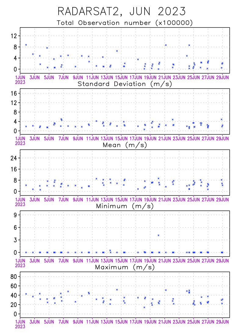
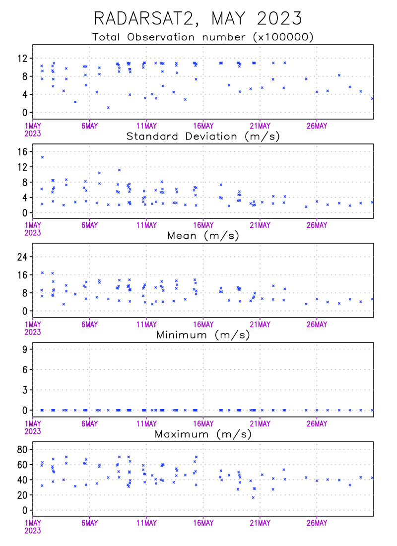
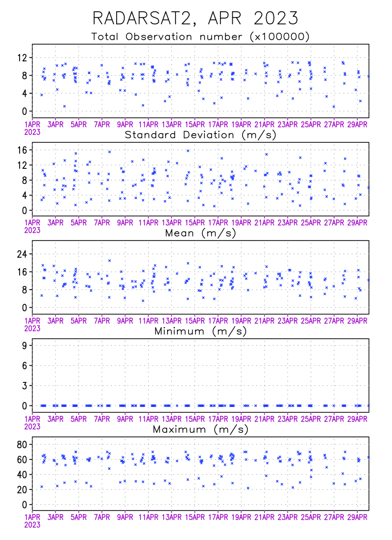
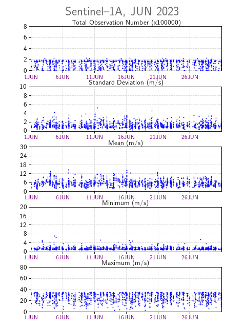
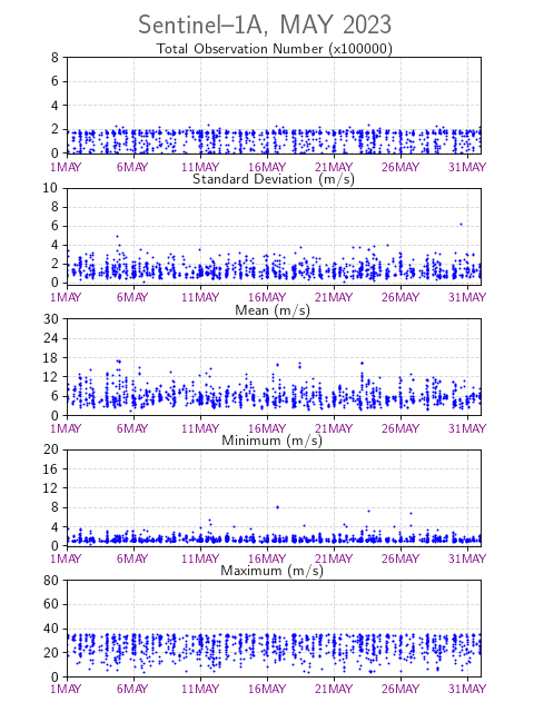
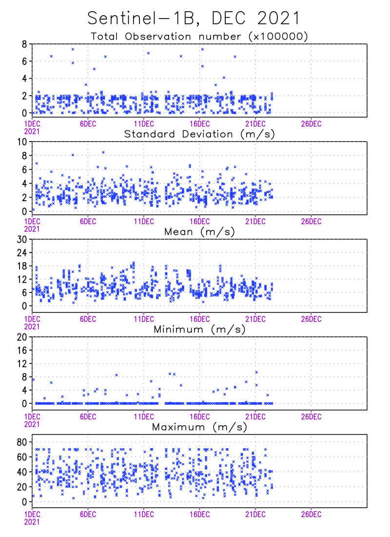
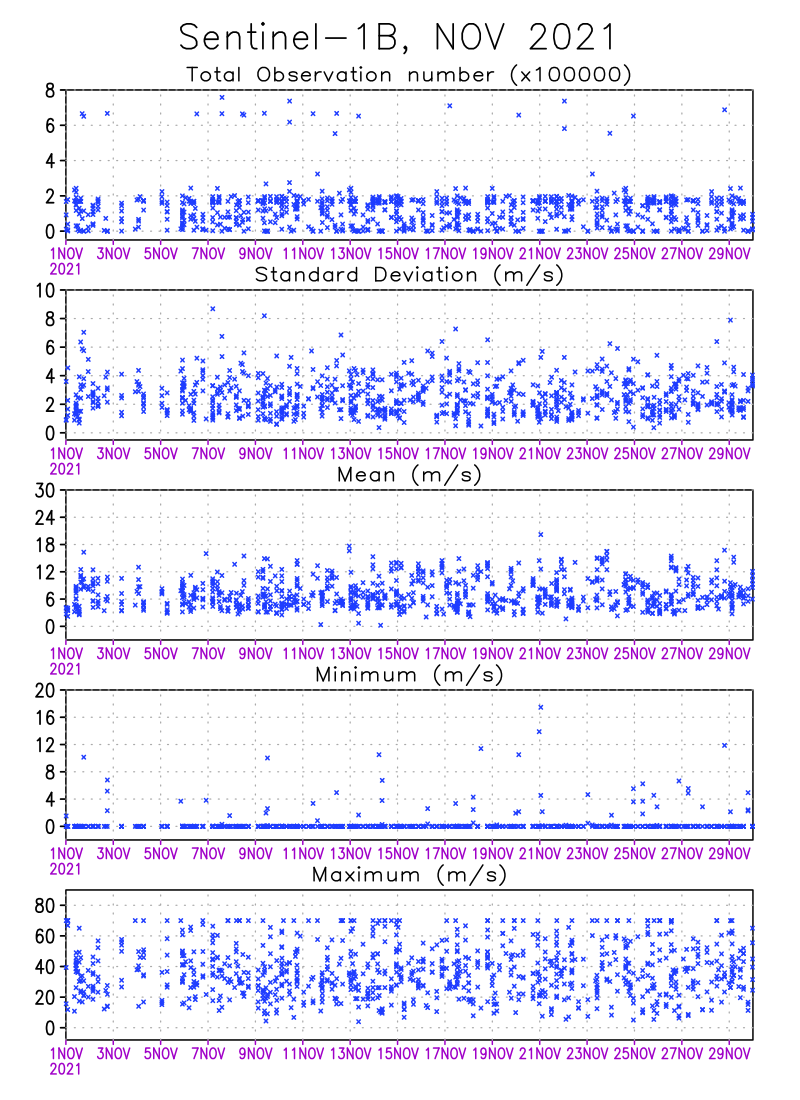
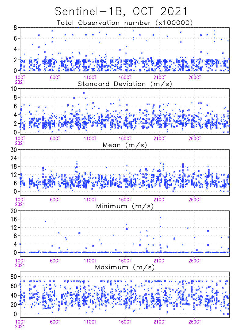
Data Quality Monitoring Statistics
The DQMS computes descriptive quality assurance statistics for: Instance, Observation Number, Standard Deviation, Mean, and Minimum/Maximum Wind Speed Field. New statistics are generated every month, and calculated for each level-2 granule (data file) after the land/ice mask and other quality flags have been applied.


